free to be able to rate and comment on reports (as well as access 1:25000 mapping).
Day 1 – Skye – Beinn Dearg Mhor
Day 2 – Skye – Marsco
Day 3 & 4 – Skye – Trotternish Ridge
Day 5 – Harris – Uisgebhal Mhor
Day 6 – Harris – Oirebhal and Tiogra Mor
Day 7 – Harris/Lewis – Rest Day
Day 8 – South Uist – Beinn Mhor & Thecla
Day 9 – Skye – Glas Bheinn Mhor and Belig
Day 10 – Skye – Skye – Sgurr a’Bhasteir, Sgurr a’Fionn Choire, Bruath Na FritheDay 11 – Raasay – Dun Caan
Day 12 – Skye – Kylerhea Hills
Day 13 – Skye – Sgurr Beag
Day 14 – Skye – Sgurr nan EagDay 15 – Skye – Beinn Dearg Mhor & Beinn na Caillich
Day 16 – Skye – Sgurr nan EachThe final section of my report on our Skye summer holiday covers our forays into the Black Cuillin. I had planned to do some of the summits on the ridge which count as Simms, 11 of which I had still to do. I didn't have any real preference - I knew some were way beyond what we could manage unassisted (eg Bidean na Druim Ramh, Sgurr Dubh Beag) but it's always an experience to go up on the ridge, so easier things like Sgurr a'Bhasteir, Sgurr Thuilm etc were up for grabs.
The Monday of our second week was the first venture out - we were back encamped at Sligachan and I'd been looking and looking at Gillean. Well how could you not. Settling beside that peak, Sgurr a'Bhasteir led up to the Tooth. I fancied making a circuit of Sgurr a'Bhasteir, over Sgurr a'Fionn Choire and down Bruathe na Frithe - looked a great day out with not too much scariness.
A cloudy start didn't seem too promising, but I checked yr.no and full sun was forecast from 10am. All day. In fact, all week

Great

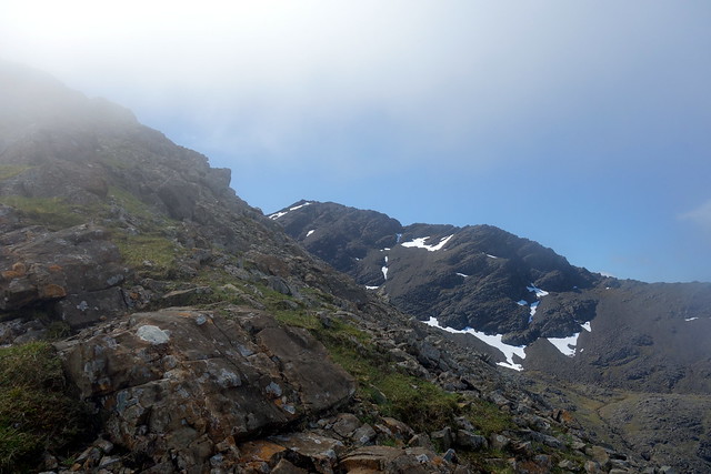
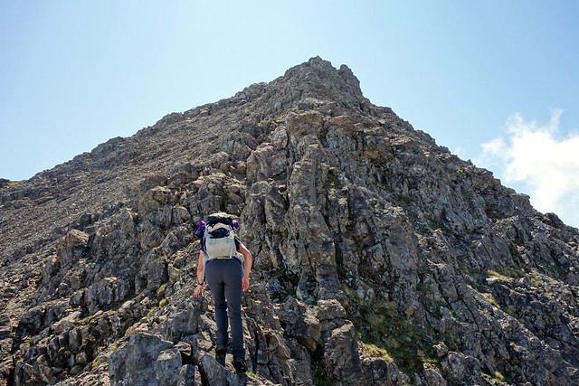
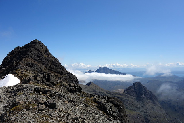
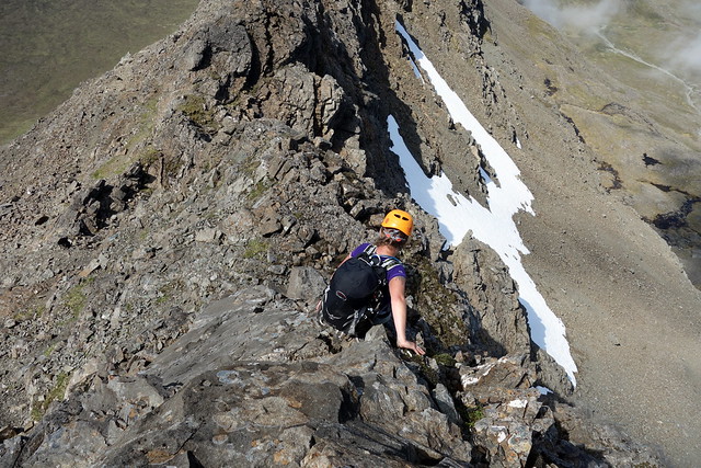
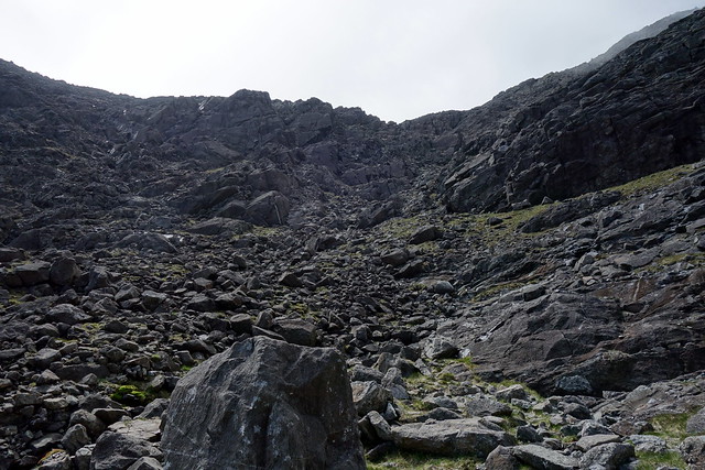
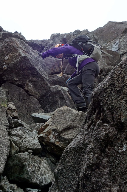
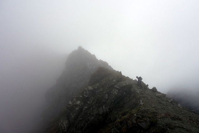
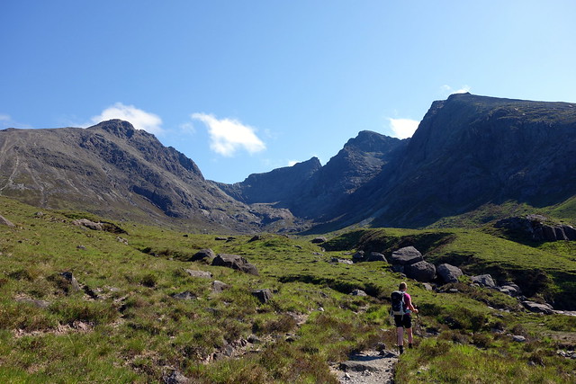
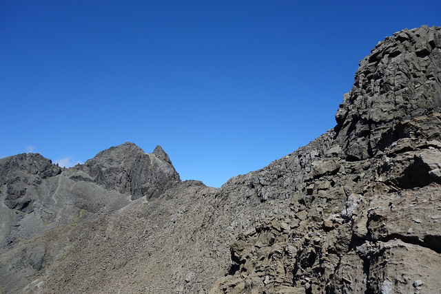
We packed up and set off up the path to Sgurr nan Gillean, following the Allt Dearg Beag. Clag blocked our views of the summits as we headed into Coire a'Bhasteir and made SW for Meall Odhar. Boulders and bits of scree underfoot, some wooly sheep poking out of the clouds. We reached the broad ridge top and started off onto the narrow NW ridge of Sgurr a'Bhasteir. This was enjoyable, bits of scrambling, a few exposed places, one section which reminded both of us of climbing up the In Pinn, just the feel of the rock, not the challenge. Everything was bypassable if you wished. As we git over 750m we suddenly broke through the clag into sunshine. Rejoice!
 DSC00724
 by
Al, on Flickr
Up to Meall Odhar
 DSC00725
 by
Al, on Flickr
There's daylight up ahead!
 DSC00726
 by
Al, on Flickr
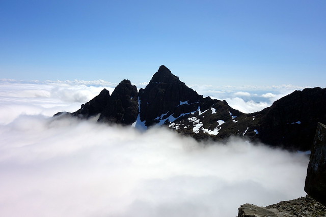
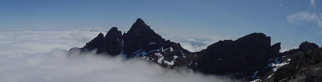
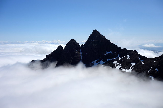
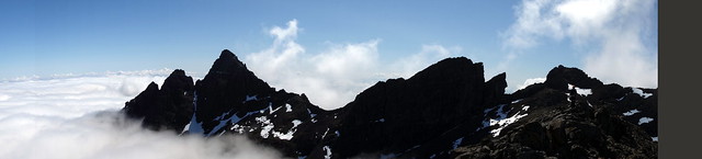
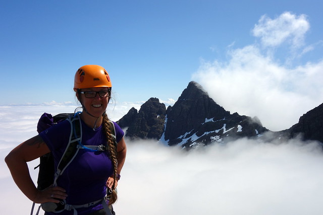
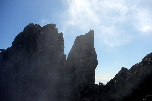
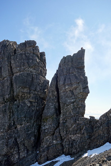
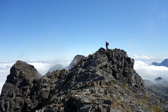
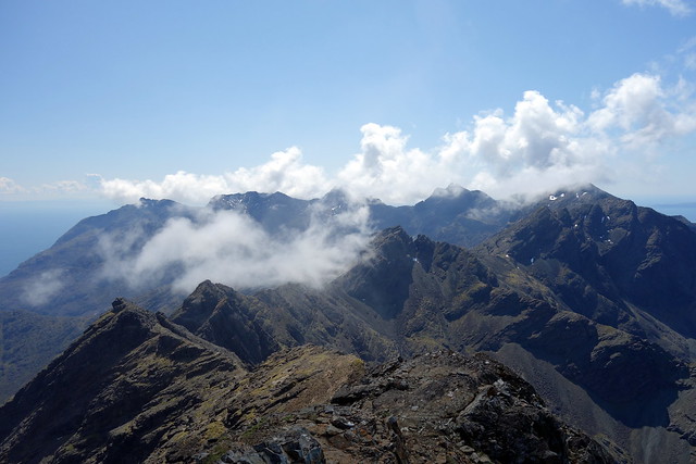
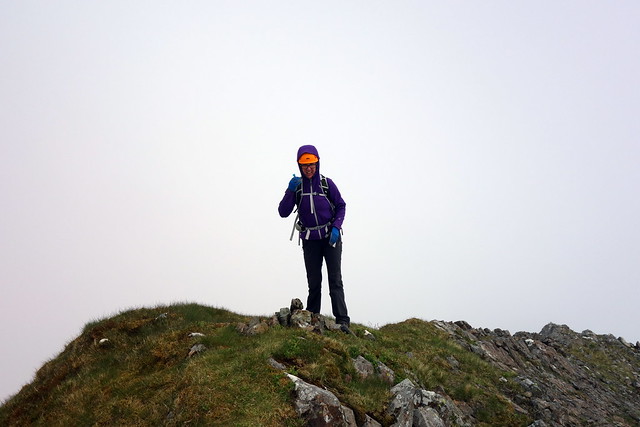
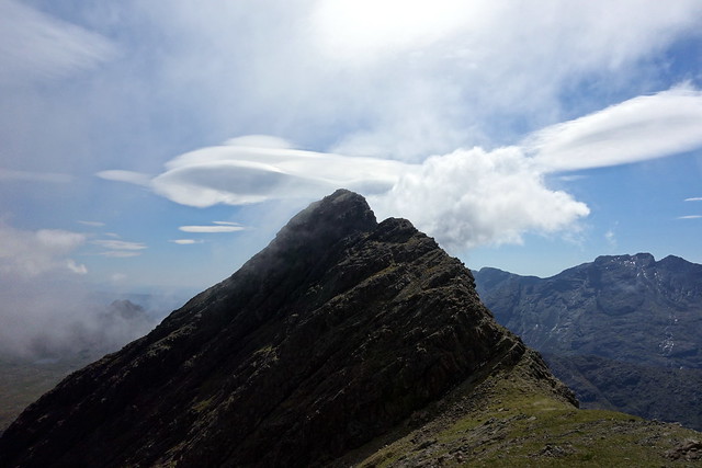
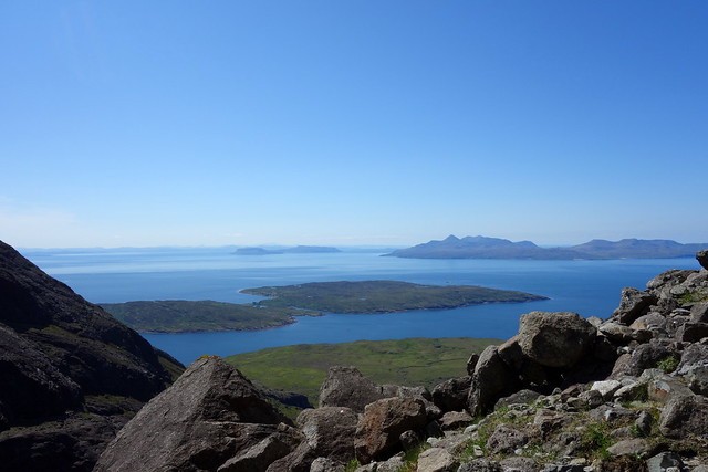
From this point on everything just got better and better. We reached the summit of SaB and were greeted by the most spectacular vision of Pinnacle Ridge on Gillean floating on a sea of cloud. An enchanted rocky island adrift in some alien landscape. Wow! Up ahead, the Bhasteir tooth jutted and we saw a couple of guys preparing to abseil. Another of the party was below - they'd just completed a three day ridge traverse and were signing off by doing a long abseil off the tooth. Problem was - only 50m of rope. Abseiling down the King's Cave Chimney, that would be fine, but not off the top of the tooth as they found out. A bit of dangling and a jump from the end of the rope was involved

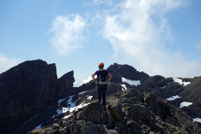
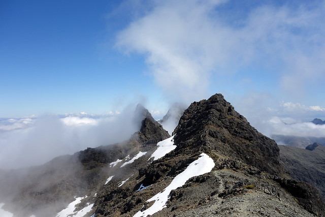
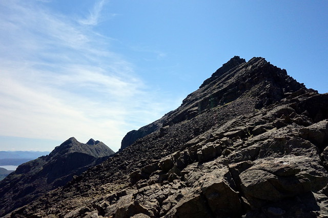
We continued on and had some fun finding different routes up Sgurr a'Fionn Choire. I had my reasons for wanting to do this one.

Afterwards we descended, found a place to sit in the sun and ate lunch, looking out at Bla Bheinn, Sgurr nan Uamha, Gillean, well - just all around
Sgurr a'Bhasteir
 DSC00730
 by
Al, on Flickr
Pinnacle ridge
 DSC00732
 by
Al, on Flickr
 DSC00734
 by
Al, on Flickr
 DSC00736
 by
Al, on Flickr
Heading towards Sgurr a'Fionn Choire
 DSC00740
 by
Al, on Flickr
 DSC00742
 by
Al, on Flickr
 DSC00744
 by
Al, on Flickr
Climbers preparing to abseil off the Tooth
 DSC00749
 by
Al, on Flickr
 DSC00751
 by
Al, on Flickr
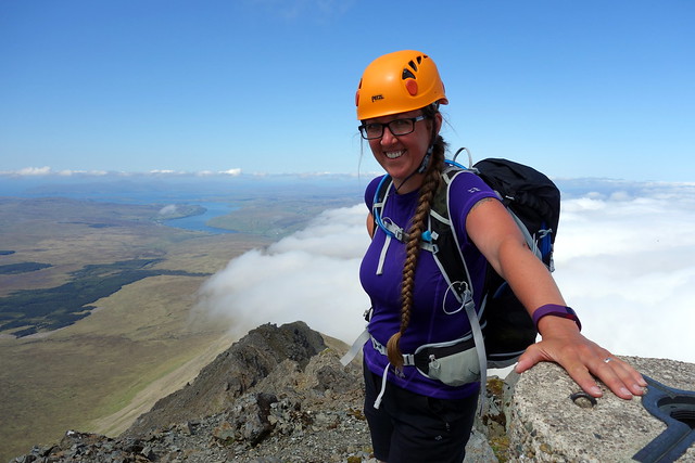
Summit Sgurr a'Fionn Choire
 DSC00752
 by
Al, on Flickr
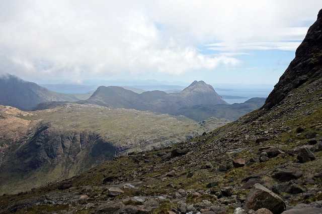
View to Bla Bheinn, Beag and Uamha in the foreground
 DSC00757
 by
Al, on Flickr
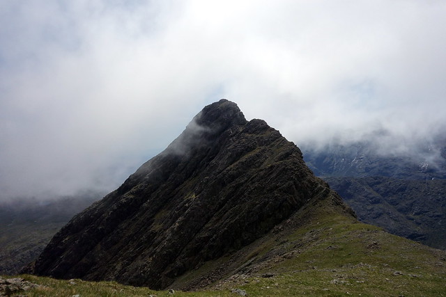
Sgurr a'Fionn Choire, Tooth & Am Bhasteir
 DSC00762
 by
Al, on Flickr
Afterwards we headed down the NW shoulder of Bruath na Frithe. To my surprise and shame I found myself freaking out a bit at anything exposed. Now this is a ridge that's great fun - I've done it twice before, once in full winter conditions. Why today? Who knows. Anyway, I didn't enjoy it much and mused about it walking back to the tent. We did stop off at the Slig for a pint which might have helped a bit.
Bruath na Frithe
 DSC00763
 by
Al, on Flickr
Bidean a Druim Ramh
 DSC00764
 by
Al, on Flickr
Heading down
 DSC00766
 by
Al, on Flickr
Day 13 - Sgurr Beag
I felt out of sorts today. Whether it was the heat on the Kylerhea Hills the previous day or something else, I don't know. Just vaguely anxious - like "one of us is going to die today" - nothing very specific
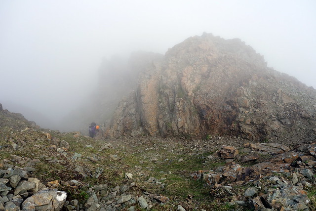
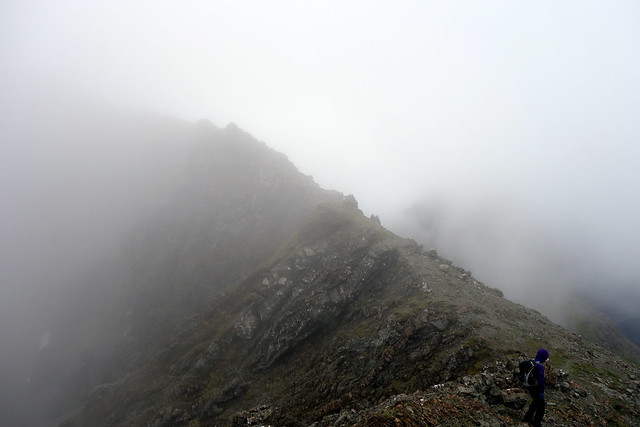
We had planned to head up towards Gillean, go over Sgurr Beag and have a look at Sgurr nan Uamha although I didn't feel it was likely we'd (or rather I'd) manage it with my current head on, then if there was time, check out the "tourist route" up Gillean - we'd come via the northern chimney route when we did it. So far so good. Clag was down at around 750m, but I hoped that it would clear away as the day progressed. Wrong...
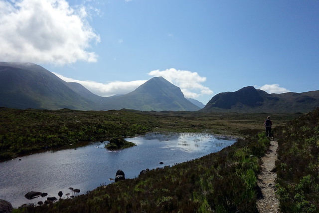
Again we walked in from the campsite, along the track into Coire Riabhach. enjoying views to Marsco etc on the way. we walked into the coire and found a cairned path upwards into the clag. We met the south east ridge and continued southwards towards Sgurr Beag. I was feeling a greater sense of foreboding now and having difficulty with simple stuff. The ridge was really quite straightforward to be honest and Allison was romping up it.
Starting out
 DSC00845
 by
Al, on Flickr
Irritating band of cloud
 DSC00847
 by
Al, on Flickr
 DSC00849
 by
Al, on Flickr
 DSC00851
 by
Al, on Flickr
 DSC00852
 by
Al, on Flickr
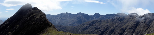
Ridge to Sgurr Beag
 DSC00854
 by
Al, on Flickr
 DSC00855
 by
Al, on Flickr
 DSC00858
 by
Al, on Flickr
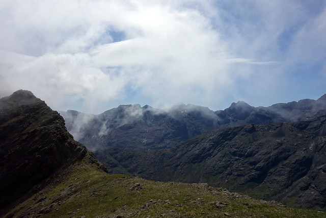
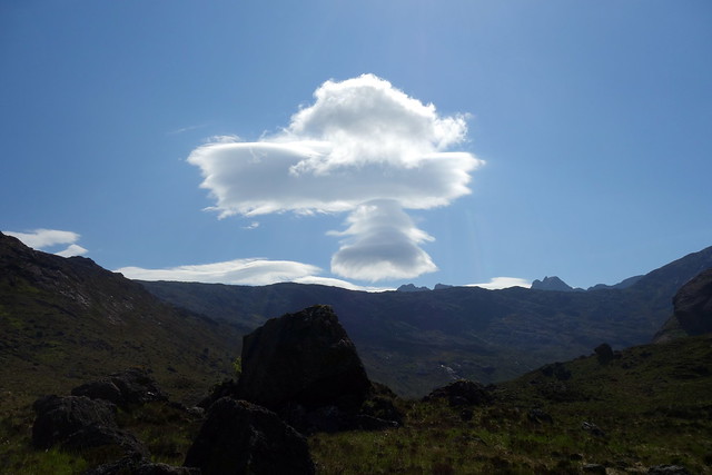
From the tiny summit we got some glimpses down to Sgurr nan Uamha. No way could i face clambering up that today. With the clag sitting in there was little point in heading back up to Gillean either. What to do? I decided we should drop down to Bealach a'Ghlas Coire and from there descend into Harta Coire. We could see Sgurr na Stri off in the distance and I did wonder about doing that, but it would have been a major undertaking from where we were - it had taken us 4 hours already to get not very far. We picked our way down, over slabs and boulders, enjoying some pretty views to the southern half of the main ridge as we did so - with some zany clouds in the sky.
View down to Sgurr nan Uamha
 DSC00861
 by
Al, on Flickr
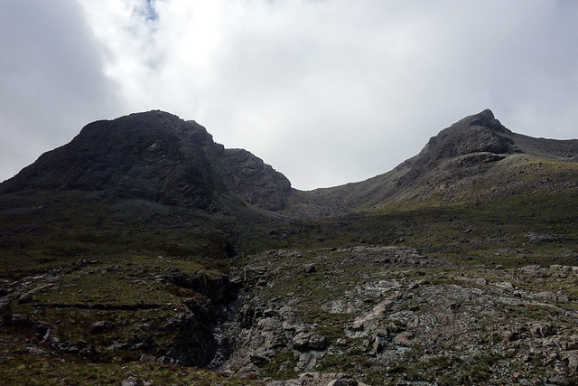
The southern section of the ridge is cloud free
 DSC00863
 by
Al, on Flickr
Uamha
 DSC00865
 by
Al, on Flickr
 DSC00866
 by
Al, on Flickr
Sgurr na Stri
 DSC00867
 by
Al, on Flickr
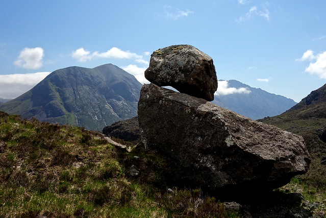
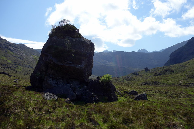
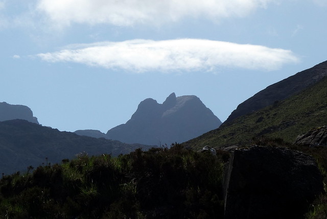
Once down into Harta Coire I thought we'd visit the Bloody Stone (Stone of the Flaying in Gaelic). It is a huge boulder that we wondered about scrambling up, but a little too challenging for me. To our right, Sgurr Dearg and the Pinn stood out against the blue sky. Dragonflies zipped around in the warm air. We returned to the track up Gleann Sligachan, called in at the Slig but it was very busy. An unsettled night followed - the Coastguard Helicopter had been out last thing at night and again at first light, circling over the campsite. Never good.
Uamha and Beag
 DSC00868
 by
Al, on Flickr
The Bloody Stone
 DSC00873
 by
Al, on Flickr
In Pinn
 DSC00872
 by
Al, on Flickr
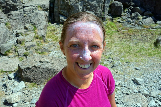
H Bomb on the Cuillin
 DSC00878
 by
Al, on Flickr
 DSC00883
 by
Al, on Flickr
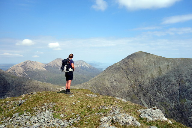
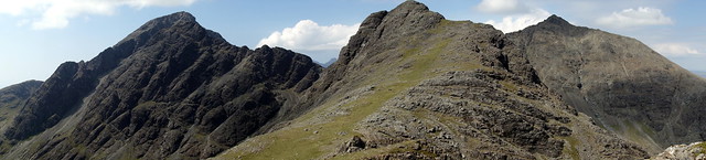
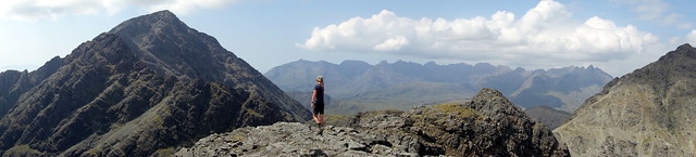
Day 14 - Sgurr nan Eag
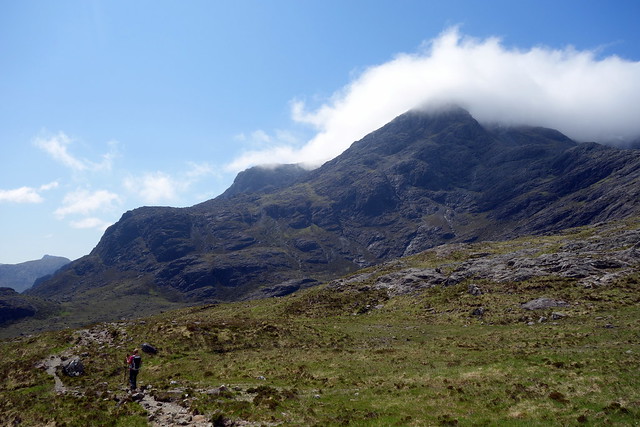
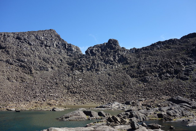
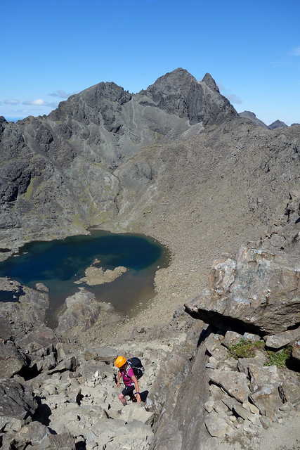
Since we'd had such a disturbed night it seemed reasonable to just get up early and face the day. It was also very hot in the tent as the morning sun beat down. Driving round to Glen Brittle I was surprised to see the campsite largely empty - I regretted we were not pitched here in such fine weather. We walked round into Coir a'Ghrunnda with the intention of ascending Sgurr nan Eag and continuing on the ridge over Sgurr a'Choire Bhig and onto Gars-Bheinn - with a rather unclear route after that - maybe back the way we'd come or heading off west into Coire nan Laogh. Rock was warm and dry, a few flies buzzed around and the air was clear - great views out to the islands. We followed the path up to the loch - water level really low, revealing sand at the western end. From here we enjoyed a playful scramble up to Bealach a Garbh-Choire, then onwards to Sgurr nan Eag. A pair of raven perched on the summit, talking away to each other.
Another fine day on Skye
 DSC00885
 by
Al, on Flickr
 DSC00888
 by
Al, on Flickr
 DSC00889
 by
Al, on Flickr
 DSC00892
 by
Al, on Flickr
 DSC00895
 by
Al, on Flickr
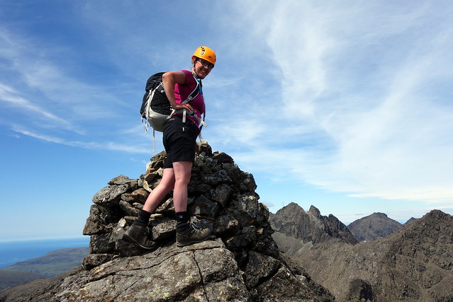
We looked along the ridge towards Sgurr a'Choire Brig. It seemed a fair distance away. We had taken quite a long time to get this far. Allison had noticed some twinges in her back too, with the scrambling. It seemed unlikely that continuing along the ridge would be good for that
So we made a decision just to return the way we'd come up, which - with a minor fumble for the right way going down the slabs from Coir a'Ghrunnda was uneventful. It was very warm indeed.
Sgurr nan Eag and the ridge continues
 DSC00896
 by
Al, on Flickr
 DSC00898
 by
Al, on Flickr
 DSC00902
 by
Al, on Flickr
We decide against it
 DSC00903
 by
Al, on Flickr
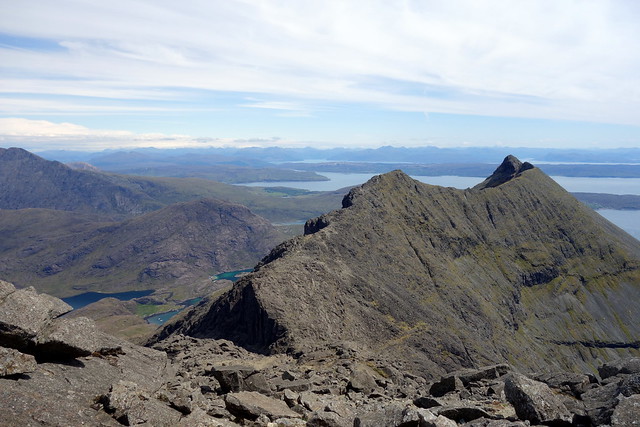
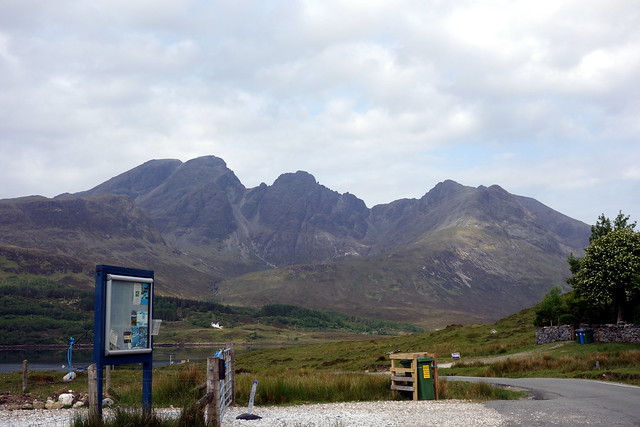
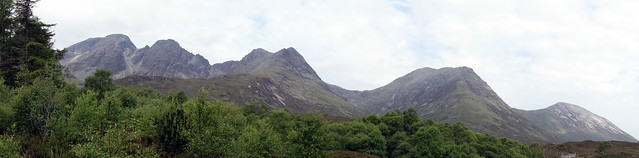
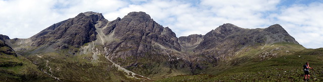
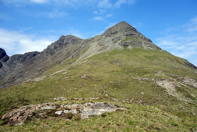
Day 16 - Sgurr nan Each
Our final day of holiday and another scorching day. We gathered up the tent, packed away our belongings and set off for the drive to Torrin. Sgurr nan Each would be our parting shot for this holiday, allowing a close up view of the Clach Glas traverse which we might like to have a try on one day. Bla Bheinn looked beautiful as we drove towards it and parked in the forest parking spot. Setting off up the path by the Allt Dunaiche we turned off to our right before Choire a Caise and began walking up the grassy shoulder of the hill. Above, we could see crags and a path of sorts wending through the scree. We kept towards the SE aspect of the mountain and clambered to the 623m summit before walking across to reach the main top. There wasn't a breath of air and the sun beat down relentlessly. We looked for any shade to have our lunch and found the opening of a cave some distance below the summit where we could find respite.
 DSC00923
 by
Al, on Flickr
 DSC00925
 by
Al, on Flickr
Sgurr nan Each to the far right
 DSC00928
 by
Al, on Flickr
Ascent route
 DSC00930
 by
Al, on Flickr
View NE
 DSC00933
 by
Al, on Flickr
Onwards to the main summit
 DSC00934
 by
Al, on Flickr
 DSC00935
 by
Al, on Flickr
 DSC00941
 by
Al, on Flickr
Descent was on scree - there are clefts that open up in the central part of the descent, so we required to traverse back towards the eastern side. Back on the grass we returned to the car - 27 degrees - too hot for the hills. A long drive back home followed, the air con getting a lot of use on the journey
