walkhighlands

Share your personal walking route experiences in Scotland, and comment on other peoples' reports.
Warning Please note that hillwalking when there is snow lying requires an ice-axe, crampons and the knowledge, experience and skill to use them correctly. Summer routes may not be viable or appropriate in winter. See winter information on our skills and safety pages for more information.

Ord Hill and the Moray Firth

Ord Hill and the Moray Firth


Postby malky_c » Sun Mar 24, 2013 9:17 pm

Route description: Ord Hill, near North Kessock

Date walked: 23/03/2013

Time taken: 2.75 hours

Distance: 12 km

Ascent: 450m

Register or Login
free to be able to rate and comment on reports (as well as access 1:25000 mapping).

Hills: Taindore Hill, Ord Hill
Date: 23/03/2013
Distance: 12km
Ascent: 450m
Time taken: 2 hours, 45 minutes
Weather: Cold, windy and overcast.

With uninspiring weather and a couple of potential weekends' camping coming up, I decided to save on petrol and explore some places closer to home. Ord Hill is the first thing I see out of the window every morning (unless the weather is really bad), and despite cycling and walking around it a few times, I've only ever been to the summit once. I decided to combine it with a bit of coastal walking and the hills around Loch Lundie.

Ord Hill.gpx Open full screen  NB: Walkhighlands is not responsible for the accuracy of gpx files in users posts


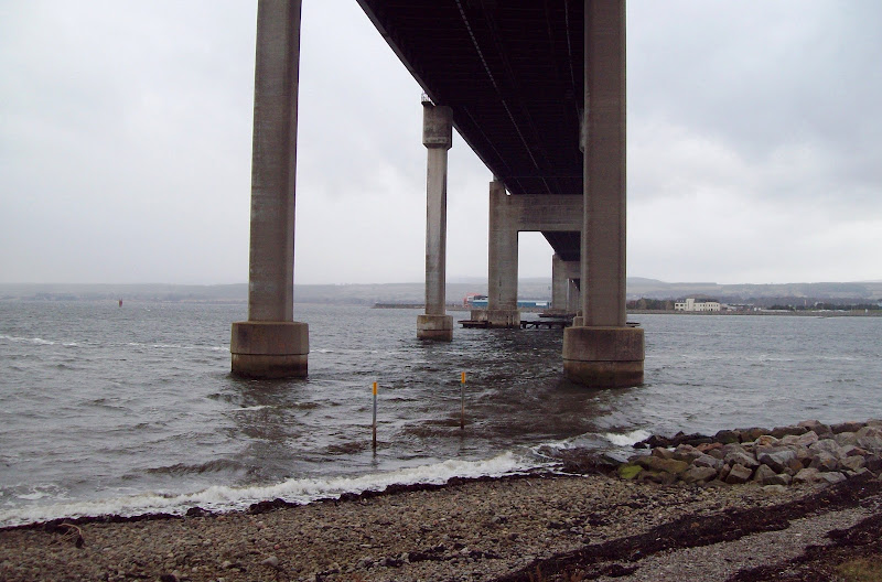
I parked up under the Kessock bridge next to the North Kessock lifeboat station, where the wind was howling. Once I'd persuaded myself out of the car, it was an easy walk along the tarmac drive to Croft Downie.

Parking underneath the Kessock bridge:
Image

Along the Moray coastline towards Croft Downie:
Image

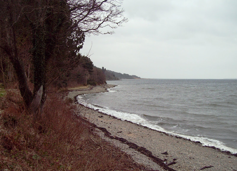
The right of way weaves through the woods a little to avoid a couple of houses, before dropping back down to the shore. The route from here to Kilmuir follows the beach, weaving between conglomerate boulders. I'd done this section on a few occasions, even dragging my bike along once.

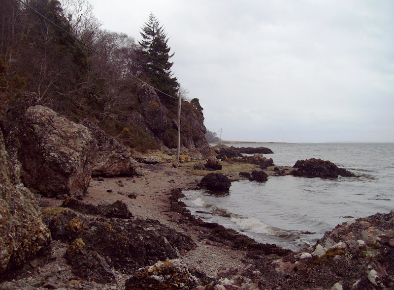
Pathless section along the beach just prior to Kilmuir:
Image

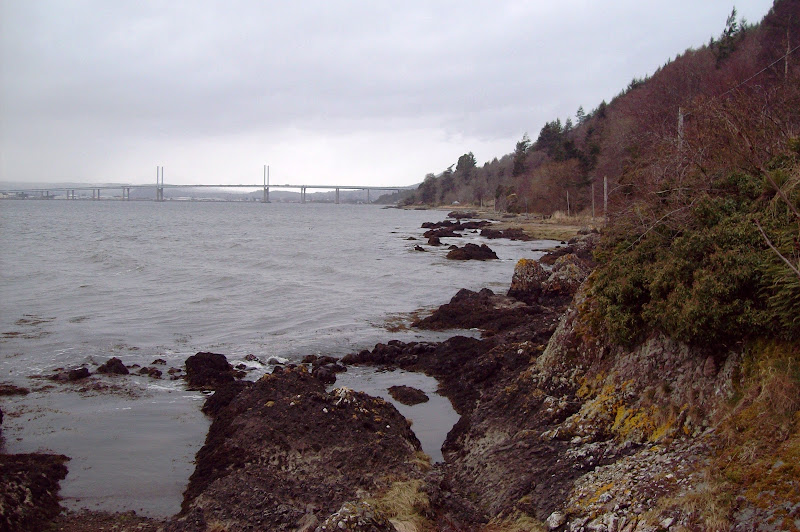
Looking back to the Kessock bridge:
Image

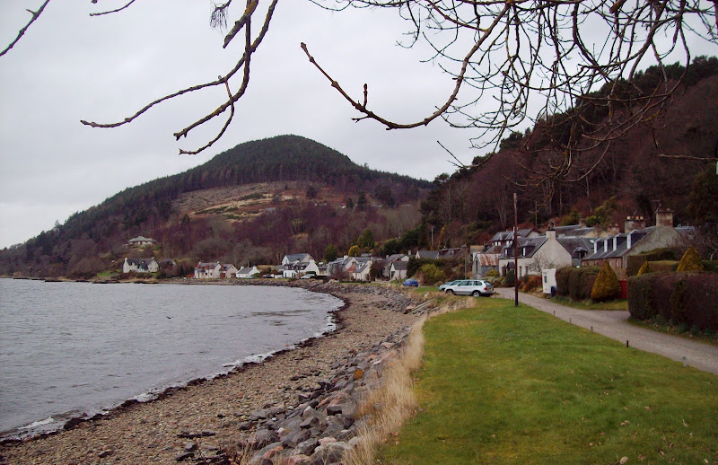
Approaching Kilmuir:
Image

Kilmuir is a secluded little row of houses, pretty exclusive by the looks of it. The route onwards passes across a grassy point, then it is a choice of climbing a fence into the adjacent field or sticking to the rocky shoreline (the slower option). I did a bit of each.

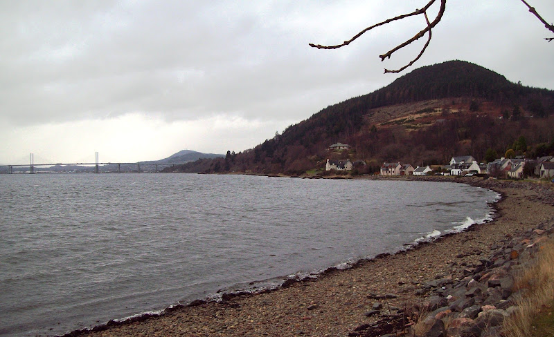
Kilmuir and Ord Hill:
Image

...with the Kessock bridge and Dunain Hill in the background:
Image

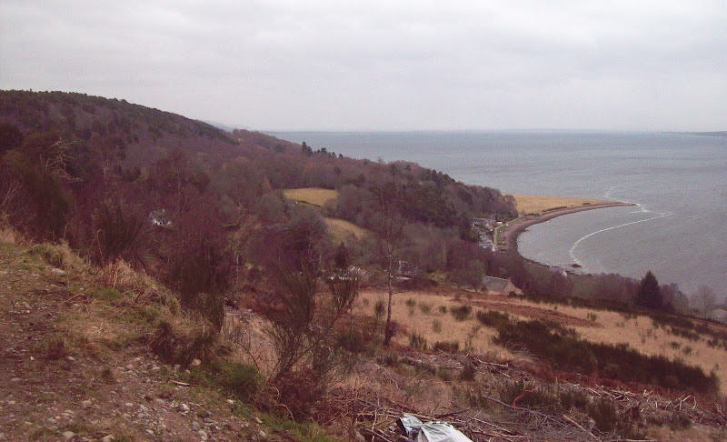
The next section of coast NE of Kilmuir:
Image

The views would have been better in less grey weather, but it was nice to be able to look back across the firth to Culloden and home. Eventually I crossed a grassy track which descended from Taindore down to the edge of the water.

Across the Firth to Alturlie Point and Culloden. Carn nan Tri-tighearnan in the background:
Image

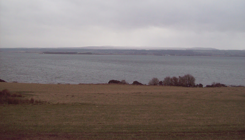
SW down the Moray Firth:
Image

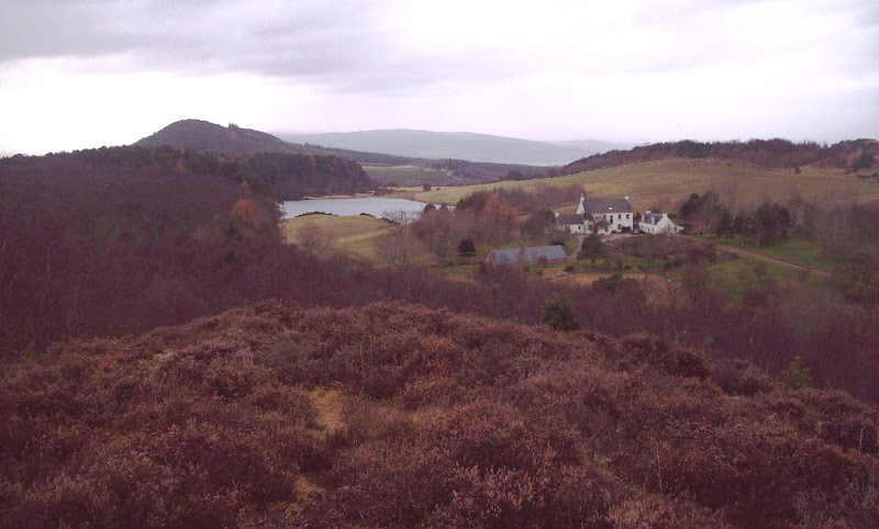
I would like to have carried on around Craigiehowe and into Munlochy Bay, but I didn't have time this morning, so I headed up the track towards Taindore. Arrie was a rather fancy house on the right with a £million view over the firth.

I followed the driveway out to the public road, then followed the road down a short distance to Pitlundie. In retrospect I should have stuck to the high ground on the left (which I have called Taindore Hill, although it is un-named on the map), as it had nice open woodland to stroll through. I ended up cllimbing up to the high point from Pitlundie, where there were a number of faint paths. A great spot for a picnic in the summer - I'll be back for that!

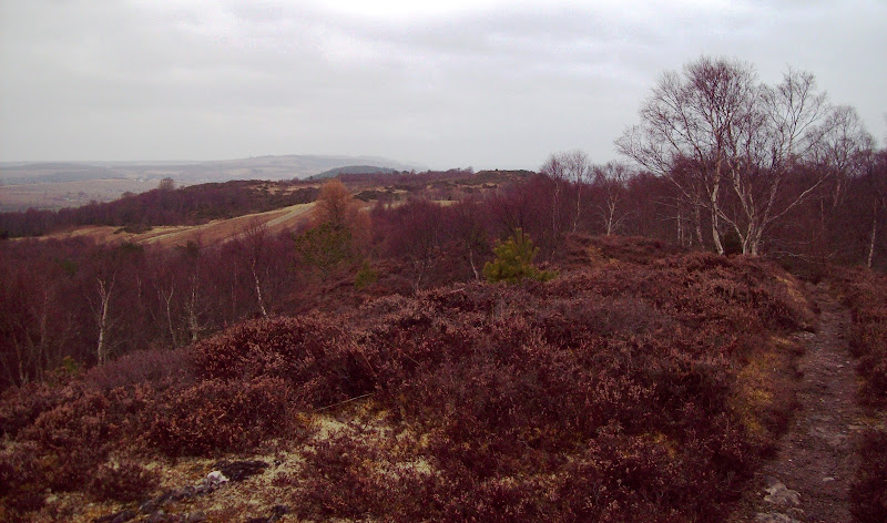
Looking SW from Taindore Hill:
Image

Munlochy Bay and Mount Eagle:
Image

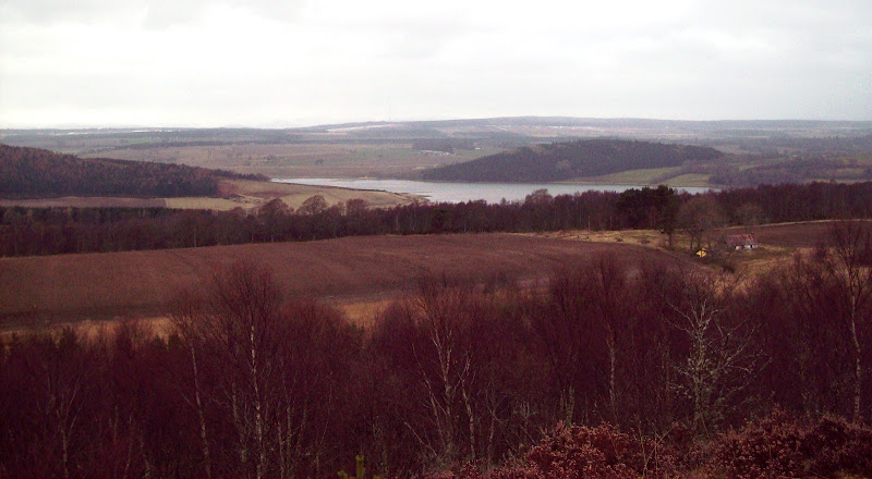
I carried on following faint paths through the woods in a south-westerly direction. My original plan had been to go over Creag a Chaisteil on the other side of Loch Lundie, but this route looked nicer.

Loch Lundie and Ord Hill from Taindore Hill:
Image

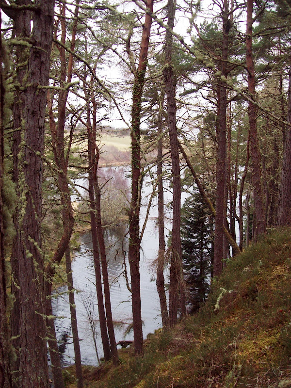
Woods above Loch Lundie:
Image

Loch Lundie:
Image

I crossed the Kilmuir road then headed down a driveway towards Culish, where there were a number of houses. Up past Culish itself, a stile led into an area of newly planted conifers, then another stile led onto the main forestry track which contours Ord Hill at about half-height.

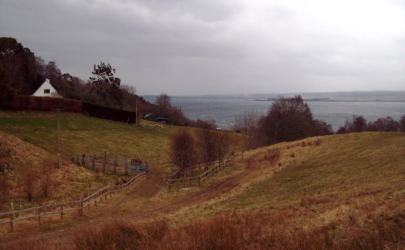
The Firth from Culish above Kilmuir:
Image

Image

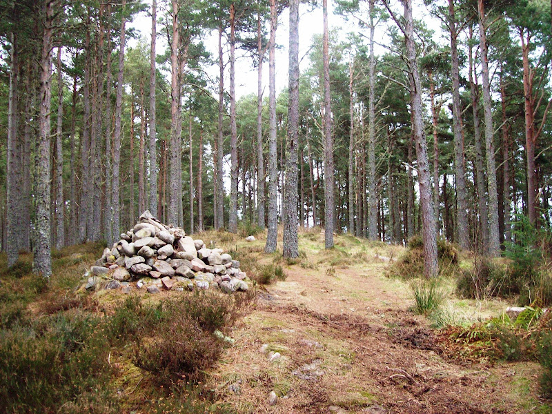
A couple of right turns and a short steep section let me to the summit cairn of Ord Hill. While it is one of the most interesting hills on the Black Isle, views from the summit are non-existent. Of more interest are the remains of a hill-fort circling the summit.

Summit of Ord Hill:
Image

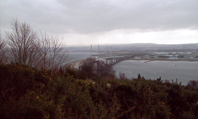
Following a waymarked trail led me down past the trig point (which I didn't bother visiting), then it looked like it was going to take me to a layby on the A9, so I took a left turn. A steep descent took me out onto the pavement just at the start of the Kessock bridge. It was easy to get off the A9 and follow a road back down to the lifeboat station.

Kessock bridge:
Image

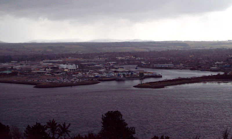
Inverness Port and Marina:
Image

Dunain Hill and the Beauly Firth:
Image

A nice walk, and one that I'd like to extend in nicer weather. Also one where I can trace pretty much the entire route from the lounge window.
Last edited by malky_c on Thu Mar 28, 2013 10:27 pm, edited 1 time in total.
User avatar
malky_c
 
Posts: 6347
Munros:282   Corbetts:222
Fionas:219   Donalds:80+37
Sub 2000:315   Hewitts:281
Wainwrights:140   Islands:39
Joined: Nov 22, 2009
Location: Glasgow/Inverness

Re: Ord Hill and the Moray Firth

Postby BlackPanther » Mon Mar 25, 2013 11:28 am

Nice one and close nearby :D I've been planning to visit Ord Hill for ages, but there was always something bigger or more ambitious on the horizon...
It was really windy on Sat, we did shopping in Inverness and running 50m to the supermarket from the car park was bad enough! :lol:
User avatar
BlackPanther
Mountain Walker
 
Posts: 3841
Munros:268   Corbetts:182
Fionas:136   
Sub 2000:76   
Joined: Nov 2, 2010
Location: Beauly, Inverness-shire

Re: Ord Hill and the Moray Firth

Postby Sarah86 » Mon Mar 25, 2013 2:32 pm

That looks a lovely walk. I enjoy walks like that, a bit different with nice scenery
User avatar
Sarah86
Mountaineer
 
Posts: 572
Munros:20   Corbetts:8
Fionas:3   Donalds:5
Sub 2000:20   Hewitts:1
Wainwrights:20   Islands:1
Joined: Aug 29, 2011

Re: Ord Hill and the Moray Firth

Postby heatheronthehills » Mon Mar 25, 2013 3:01 pm

Hoping to move up to this area later this year so will add this to the long list of new hills to do! We've been poring over maps and hill books and there is just so much to do up there! I live in Inverurie just now and our main local hill is Bennachie, but it's always really busy. It will be nice to find some new routes :) Nice walk and lovely photos, despite the weather.
User avatar
heatheronthehills
Walker
 
Posts: 166
Munros:208   Corbetts:88
Fionas:70   Donalds:4
Sub 2000:82   Hewitts:5
Wainwrights:2   
Joined: Mar 5, 2012

Re: Ord Hill and the Moray Firth

Postby tummelv » Tue Mar 26, 2013 11:22 am

Nice report. You get some good views over Inverness but I can't help but feel it would be better if they cut back some of the trees to open it up a little. In 20 or 30 years from now there'll be almost no views of Inverness and the bridge. :(
User avatar
tummelv
Mountain Walker
 
Posts: 33
Munros:24   Corbetts:25
Fionas:19   Donalds:1
Sub 2000:77   
Joined: Nov 9, 2012

Re: Ord Hill and the Moray Firth

Postby boabness » Tue Mar 26, 2013 1:13 pm

tummelv wrote:Nice report. You get some good views over Inverness but I can't help but feel it would be better if they cut back some of the trees to open it up a little. In 20 or 30 years from now there'll be almost no views of Inverness and the bridge. :(
a lot of the trees have been cut down from the area around nm 661 485
boabness
Hill Bagger
 
Posts: 33
Joined: Aug 12, 2009

Re: Ord Hill and the Moray Firth

Postby rockhopper » Thu Mar 28, 2013 2:06 pm

yup - a nice walk malky and even better in good weather as you say - good to have on your doorstep - cheers :)
User avatar
rockhopper
 
Posts: 7447
Munros:282   Corbetts:222
Fionas:136   Donalds:89+20
Sub 2000:16   Hewitts:2
Wainwrights:3   Islands:20
Joined: Jun 1, 2009
Location: Glasgow

Re: Ord Hill and the Moray Firth

Postby malky_c » Thu Mar 28, 2013 10:25 pm

Thanks everyone :)
User avatar
malky_c
 
Posts: 6347
Munros:282   Corbetts:222
Fionas:219   Donalds:80+37
Sub 2000:315   Hewitts:281
Wainwrights:140   Islands:39
Joined: Nov 22, 2009
Location: Glasgow/Inverness

Re: Ord Hill and the Moray Firth

Postby Gordie12 » Thu Mar 28, 2013 10:57 pm

That looked like a good wander.

From memory I think Kilmuir was the village that BT were planning to remove the public phone box from. The villagers found out and parked their cars round it to stop the engineers. I think your photo of the village looking back from the direction you came would be around the point where the phone box is.

God that's sad, why did I think of that :? :? :?
User avatar
Gordie12
Wanderer
 
Posts: 2158
Munros:114   Corbetts:65
Fionas:30   Donalds:38+0
Sub 2000:35   Hewitts:37
Wainwrights:32   
Joined: Sep 6, 2012
Location: Nr Forfar

Register or Login
free to be able to rate and comment on reports (as well as access 1:25000 mapping).


Can you help support Walkhighlands?


Our forum is free from adverts - your generosity keeps it running.
Can you help support Walkhighlands and this community by donating by direct debit?


Return to Walk reports - Scotland

Who is online

Users browsing this forum: No registered users and 94 guests