free to be able to rate and comment on reports (as well as access 1:25000 mapping).
Ben Reoch is one of those hills I keep tucked away in my mind for when I want a short day out. Not every day has to be an epic, even if that is how they are remembered by the time you have got to the pub afterwards. The last time I attempted this hill it certainly did fall in to the epic category, as I was beaten back back by 70mph winds and driving snow on the tops, followed by driving wind and rain back at the roadside, cancelled trains and hitch-hiking home. That was the day of “Hurricane Bawbag” as it was known. This time would be a more mellow affair.
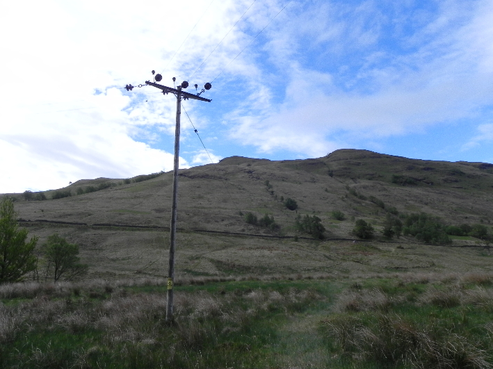 Ben Reoch from Tarbet
Arrochar and Tarbet railway station is one hour and twenty minutes from Glasgow by train, and I disembarked into the warm bright sunshine, a welcome change from the weather of late. The last time I was here I was in full winter regalia, in fact I still had the photo in my GPS of my previous trip, hood up and goggles on in the face of the storm. In contrast, this time my jacket was in my rucksack and my head was protected by a floppy desert hat.
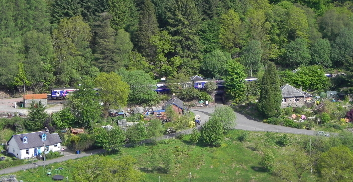 Arrochar and Tarbet Station from the lower slopes of Ben Reoch
I crossed the A82 and passed under a strip of oak trees, their leaves fresh, bright and green. I headed for a gap in the wall which runs alongside the path which contours round the hill. I avoided the large tent next to the wall and it's sleeping occupants, and began climbing up the northern slopes of the hill, to join the ridge which runs down towards Tarbet. I took it easy, not wanting to overdo it early on. The heat can be as draining as the cold. I paused often, taking in the distant views as well as the closer ones. This hill is a great viewpoint for The Cobbler and Beinn Narnain. Possibly. It was hard to tell with the cloud which seemed to wash over them.
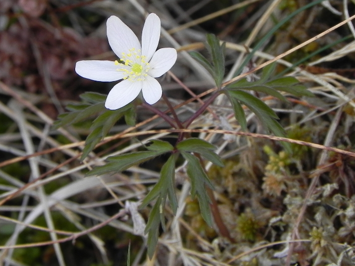 Wood Anemone
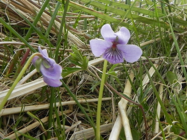
Wild Pansies
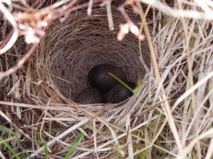 Mind how you go! Meadow Pipits nest and eggs.
At my feet were views of a different sort. Bright green bracken shoots mixed with bluebells. Butterfly shaped mountain pansies, carnivorous butterworts, and more which I still cannot identify. As I walked uphill, a small bird, later identified as a meadow pipit, flew out of the grass. Had it sat still I'd never have noticed it, but it's explosive flight drew my attention instead to a small grassy cup containing a clutch of dark green mottled eggs. Further uphill I had the same experience. The Meadow Pipits were too fast and active to get a decent picture of, darting away as soon as I managed to focus the camera, or hiding against a background where it was impossible to pick them out.
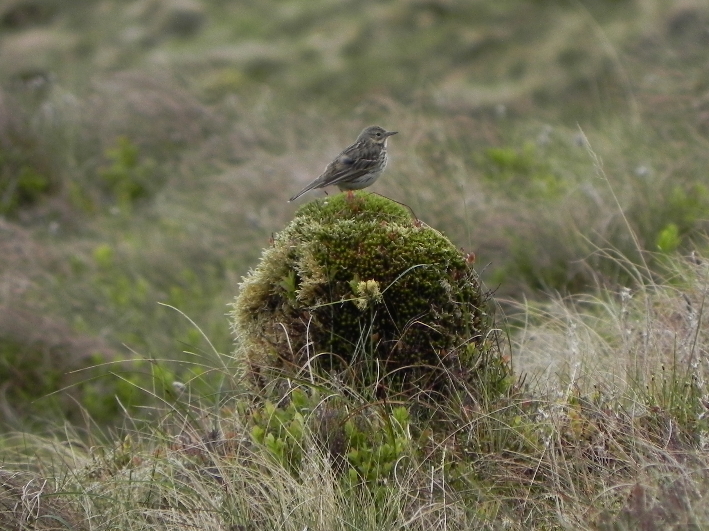 Meadow Pipit
I continued uphill, and the hill rises in a series of small crests, before reaching a very steep slope. Beyond this was my previous high point from my last visit. On breaching this crest the weather turned, and the remainder of the hill was swallowed in a sea of fast moving cloud which moved in an endless wave across the hillside, swallowing everything in it's path. I stopped and pulled on my jacket, the heat now replaced with biting cold.
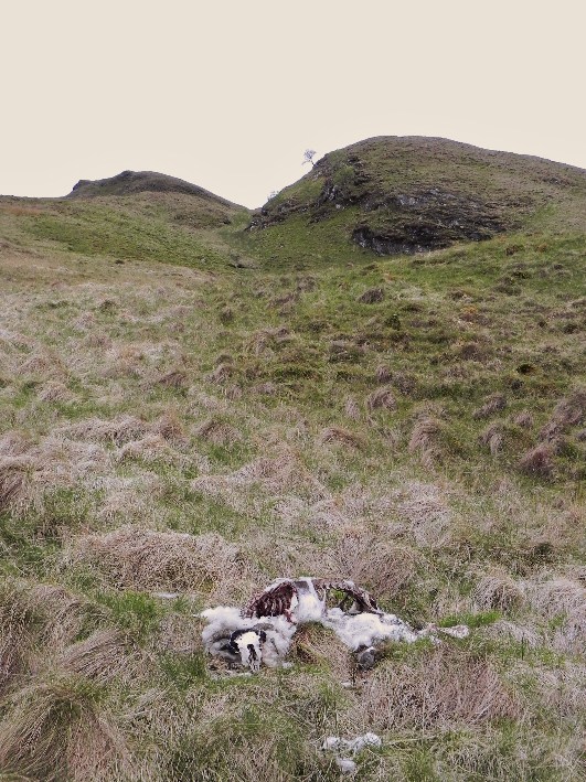 The remains of a sheep
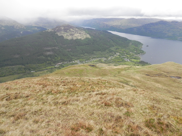
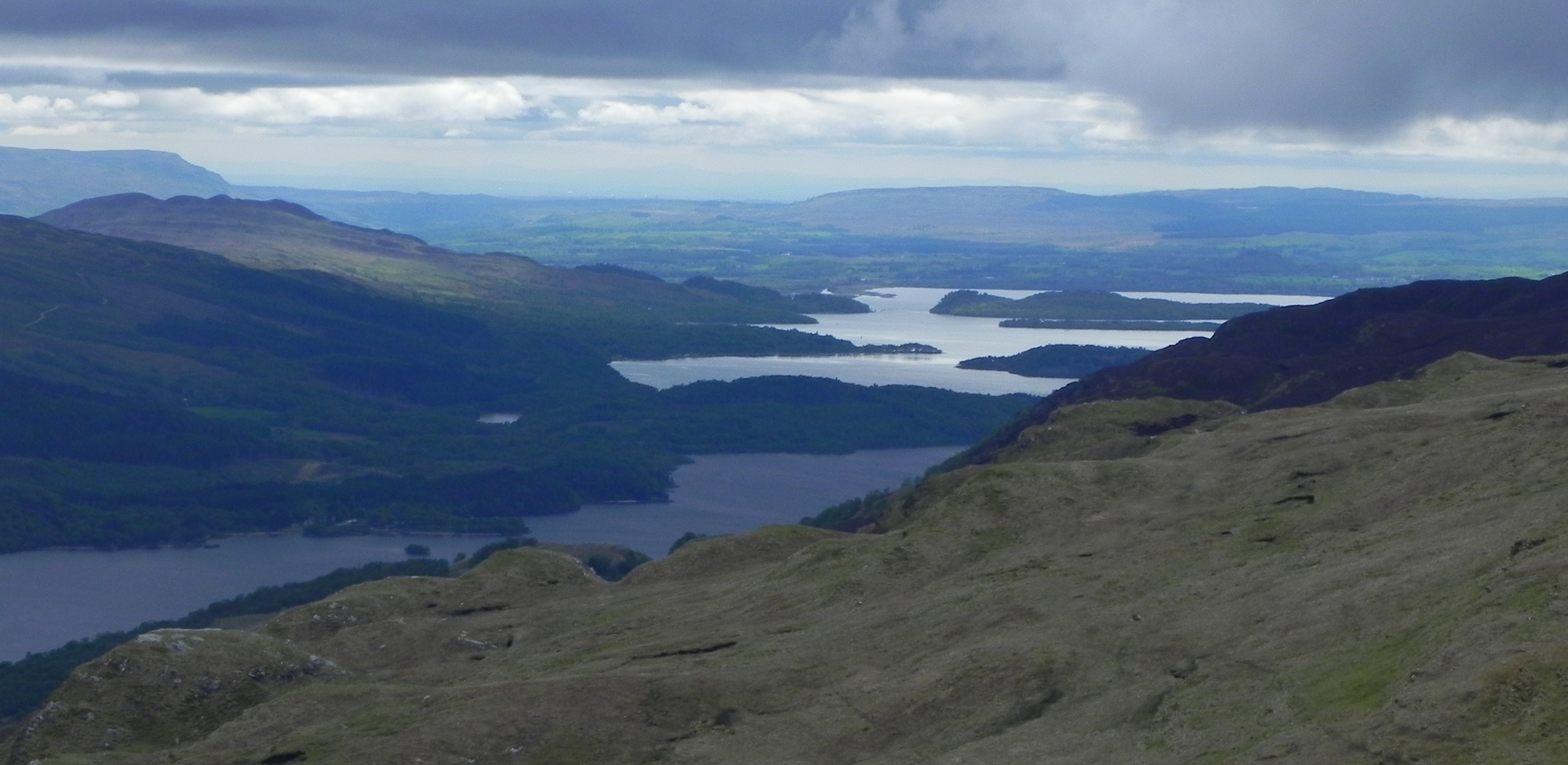 Loch Lomond from Ben Reoch
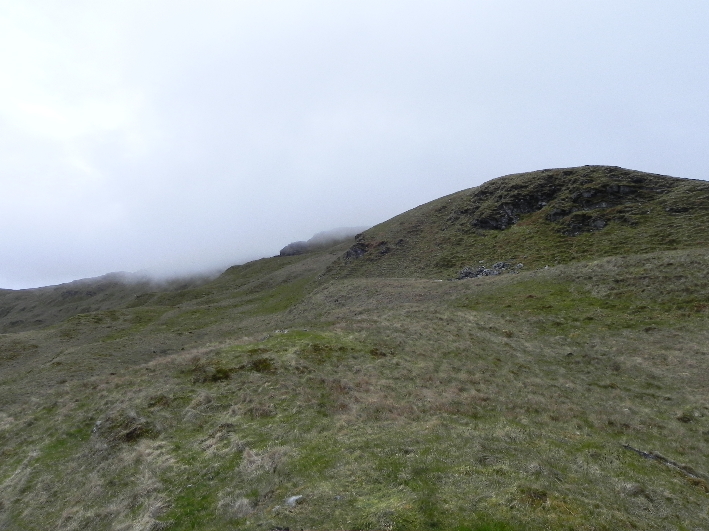
The mist swallows up the views...
I made my way up a steep slope which I could have easily avoided, but liked the look of. Strangely, at the top I found a piece of tape tied to a rock, the type that is usually used to cordon off an area. There was no sign of it's purpose, so I left it where it was. Soon I arrived at a small cairn, and the ground ahead sloped away. I sat at the summit and tried to stay low to avoid the wind while I had a quick lunch stop. Looking at the map I could see the ground dropped away before rising to a top of 632m in height, then there was a longer section down to a bealach, before climbing again to Beinn Bhreac. I decided to carry on and if time permitted I would take in this next hill as well.
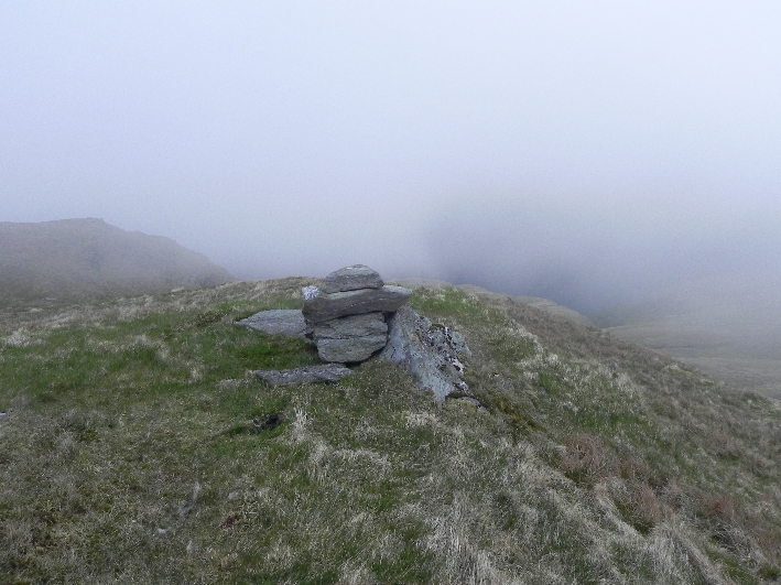 False summit
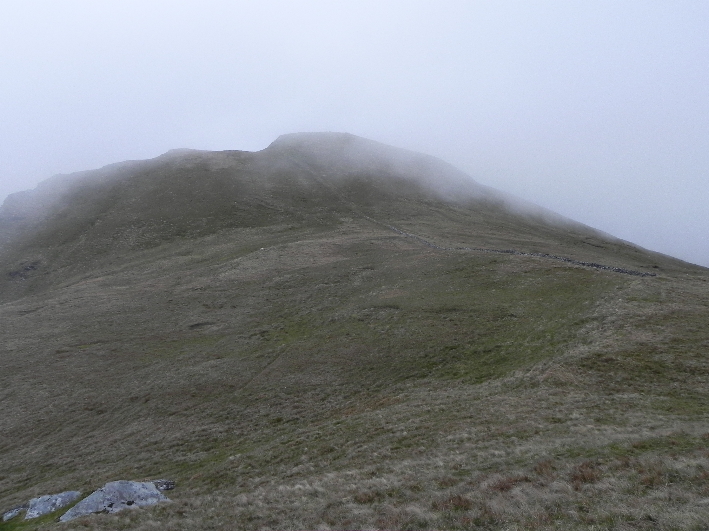 To the real summit
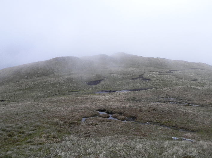
Within a few minutes of walking the mist cleared and I realised that I wasn't actually heading to the 632m summit, but was still heading Ben Reoch. The first cairn was placed on a false summit, and in the mist I had simply accepted that this was the summit. A minor error, but nonetheless one that niggled me. I dropped down hill again, into a sea of peat hags and mist. The mist really affects the ability to judge distance, and what I perceived to be something possibly as large as a deer turned out to be a foot or so high! The terrain from here on was confusing in the mist, rocky outcrops and bumps. It was becoming apparent that I wasn't going to manage to do the second hill and get back for the train. I managed a quick glimpse of the way ahead through the mist which then closed in again. I turned and made my way back the way I had come.
 Towards the 632m summit
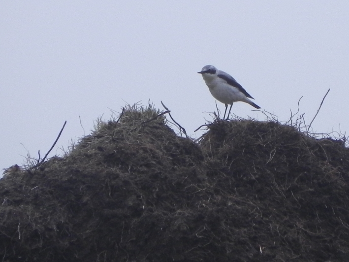 Wheatear
I now had one eye on the clock, and as I descended I decided as an alternative to follow the quicker, but steeper route, following a line of trees towards a cottage and the railway station. It was hard going on the knees, but far quicker. I was unsure whether the cottage was occupied, so I bypassed it, crossing the adjacent field. I was thankful that it had been fairly dry of late as this was a cunningly disguised bog, requiring a bit of dexterity before I could finally haul myself over the fence onto the road.
 The ridge down, a series of humps
When I had arrived earlier there had been two bus-loads of people milling around in a car park at an old church, converted into a licenced restaurant. I had about twenty minutes before the train, just enough to grab a quick beer, so I set off towards the pub. You can imagine my disappointment when I found it closed up, the mail box stuffed to bursting with never to be answered mail. Another business gone to the wall in troubled times.
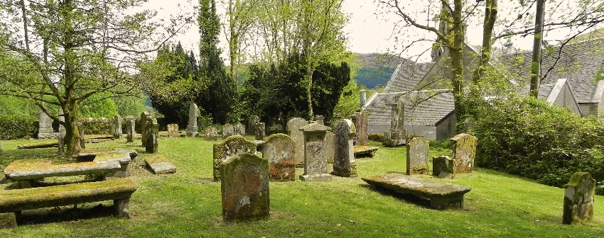 Graveyard
I had a quick wander round the adjacent graveyard, before dashing up the hill to the railway station. The beer could wait until Glasgow. For a small hill Ben Reoch certainly doesn't give up it's summit easily, but for now has now been well and truly ticked off. Perhaps Beinn Bhreac will too, but for now the summer is coming. Time for the big hills again!
Previous walk report on this hill:
http://www.walkhighlands.co.uk/Forum/viewtopic.php?f=9&t=17290