free to be able to rate and comment on reports (as well as access 1:25000 mapping).
Walking time: 3 hours
Stopped time: 1.5 hours
You can see from my track that I walked for a part up a stream. Well, in the conditions it was hard to tell the difference between deer paths and burns so it is perfectly possible. In fact there were small burns all the way up to the summit plateau so no hydration problems today.

Fortunately my boots passed the waterproof test as my feet didn't get wet but that was the least of my worries.
I don't know what's up with the weather this year but almost every weekend since June has been plagued by wind and rain at the weekends and the week-days have, on average, been glorious. I'm one of the unfortunate souls that can only climb hills at the weekend so the frustration level was high this weekend. I decided to go to Diabaig as I promised a climber I would go and search for his lost shoes and jacket under one of the Diabaig cliffs so I thought that at the same time I would pay a wee visit to An Ruadh-Mheallan - the Graham due west of Beinn Alligin. How bad could it be?
I left home early and drove in the dark through the rain, gales and pestilence (in the form of things unknown flying around - mostly leaves). I thought near Shieldaig I might have to turn back as the roads appeared to be flooded and the rain was coming down in sheets. I didn't see a single vehicle going in either direction all the way from Applecross to Diabaig - it was a bit spooky to say the least.

Of course Diabaig village is very sheltered and even there the wind was making its presence felt. It's a bit of a ghost village and, I thought, a bit sad. I didn't see a living soul, in fact, come to think of it, I didn't see a soul all day long until my return drive home in the afternoon.
Diabaig village from the Coastal Path.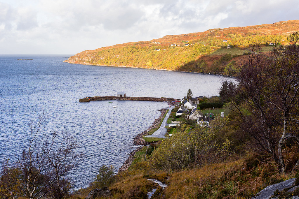 An Ruadh-Mheallan
 by
anniesmountains, on Flickr
After looking around the rocks for about an hour I didn't turn up any shoes or jackets so returned by the very slippery path to sea level and headed for the start of my walk. I parked at the view-point at the top of Bealach na Gaoithe which has parking for two cars. The altitude at this point is already 280m so it's a bit of an easy day really.
After climbing a few metres, the walk ahead comes into view. Beinn Alligin is to the east and is a looming presence - not its best side. I had considered maybe going up Tom na Gruagain via the east ridge but that was before I had assessed the weather! Never mind the wind, I would not have been able to cross the Abhainn Alligin burn and then I didn't know if the deer fences were negotiable.
An Ruadh-Mheallan from just above the road.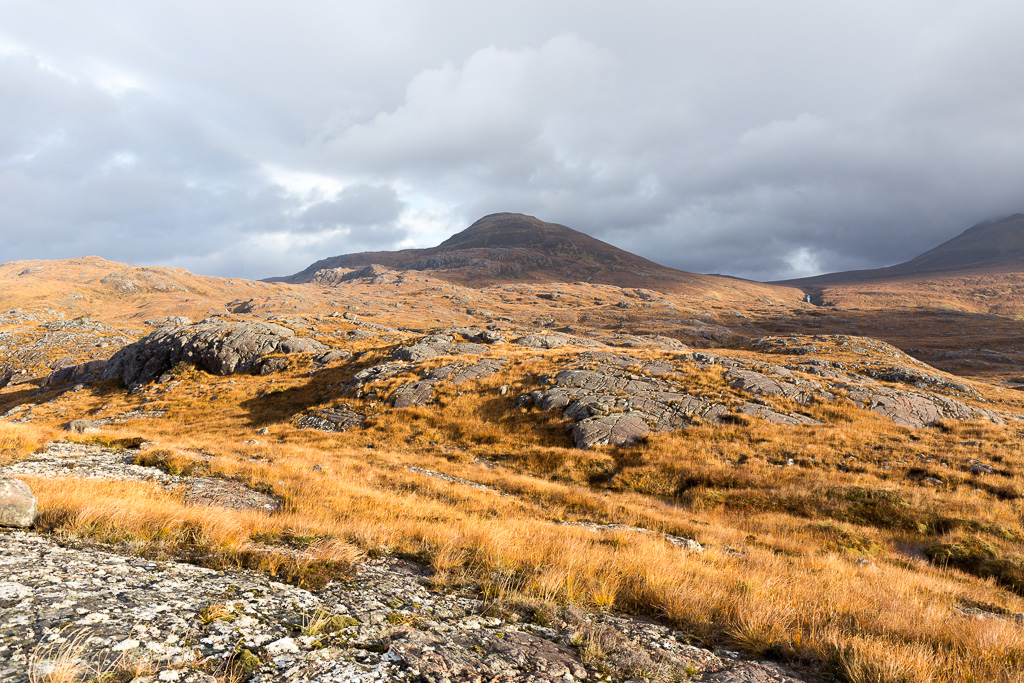 An Ruadh-Mheallan-2
 by
anniesmountains, on Flickr
The Diabaig road and Loch Diabaigas Airde.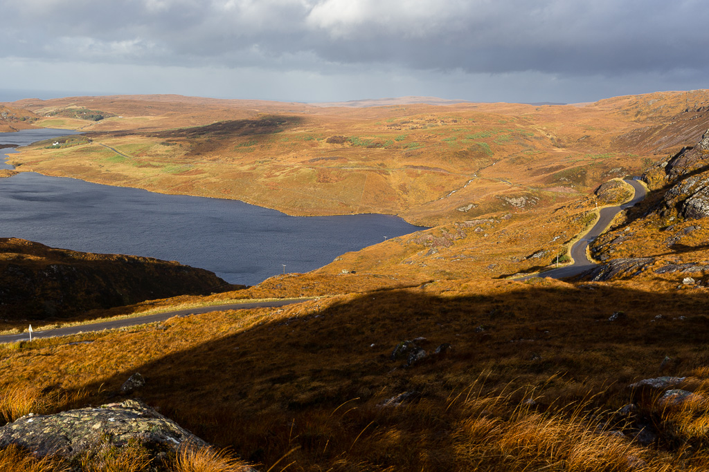 An Ruadh-Mheallan-3
 by
anniesmountains, on Flickr
West side of Beinn Alligin. Liathach is on the right.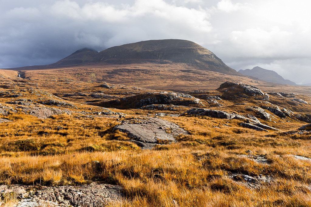 An Ruadh-Mheallan-4
 by
anniesmountains, on Flickr
I started off on a path but, as it's not on the map, I abandoned it as I wasn't sure where it was heading. I decided instead just to take a straight line up to the summit and took a bearing so that I could reverse it if the mists came down to envelop me on the way back. There are a few bumps to get over and some peat hags to negotiate but it's mostly a tale of water and bog and more of the same all the way up. The wind strengthened steadily as I gained altitude but it was pretty much behind me and made the walking easier if anything. There were some very heavy showers but the air was clear and the visibility was excellent. I stopped a lot to take photos - often the same one quite a few times!
Beinn na h-Eaglaise and Beinn Damh. The weather looked worse over there! Note the wet rocks which were quite slippery.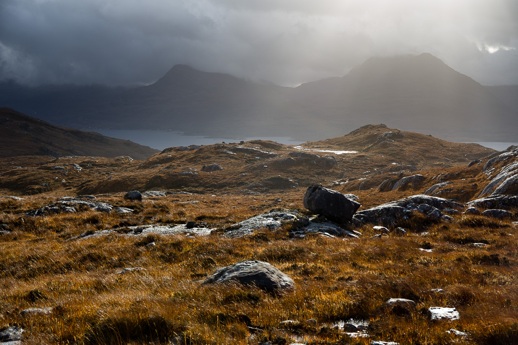 An Ruadh-Mheallan-5
 by
anniesmountains, on Flickr
Beinn Damh and Loch Damh to the right.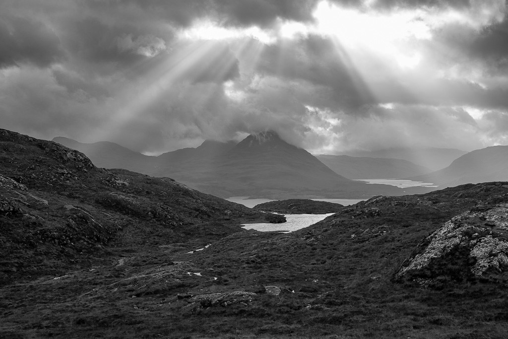 An Ruadh-Mheallan-6
 by
anniesmountains, on Flickr
Loch Damh and Upper Loch Torridon with another shower coming in.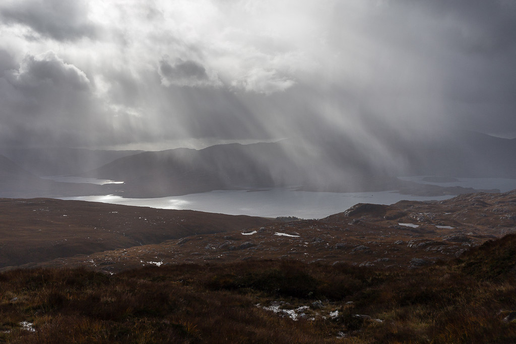 An Ruadh-Mheallan-7
 by
anniesmountains, on Flickr
From further up - Beinn Damh and Loch Damh.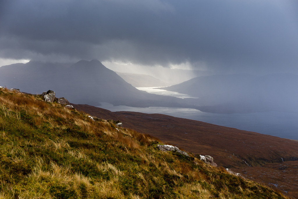 An Ruadh-Mheallan-8
 by
anniesmountains, on Flickr
I got to the wee bealach to the east of the summit plateau and that's when the wind really hit me - with a vengeance. I scooted round to the lee side of the hill where calm was restored and tied everything down - hood, gloves, walking poles, camera stuff.... I thought I would just see if I could stand on the top and use my walking poles to give me balance. The wind itself was OK, it was the gusts that worried me as they were so unpredictable and so much stronger. (I remembered reading Mountainlove's report where she crawled to the summit and thought I might have to do that too!) As it turned out I didn't fall over and I didn't have to crawl but there was a rock near the cairn which gave me a bit of shelter so I sat behind it to take a few photos. It was such a shame as it's a great-looking summit on a huge slab (this was fairly slippery so a bit dangerous in the circumstances) and the cairn has a wee shelter attached to it but was no help today! I touched the cairn, took a few photos and got down to the bealach as fast as I could. It didn't seem too bad at all down here after the ferocity up top!
Summit An Ruadh-Mheallan. 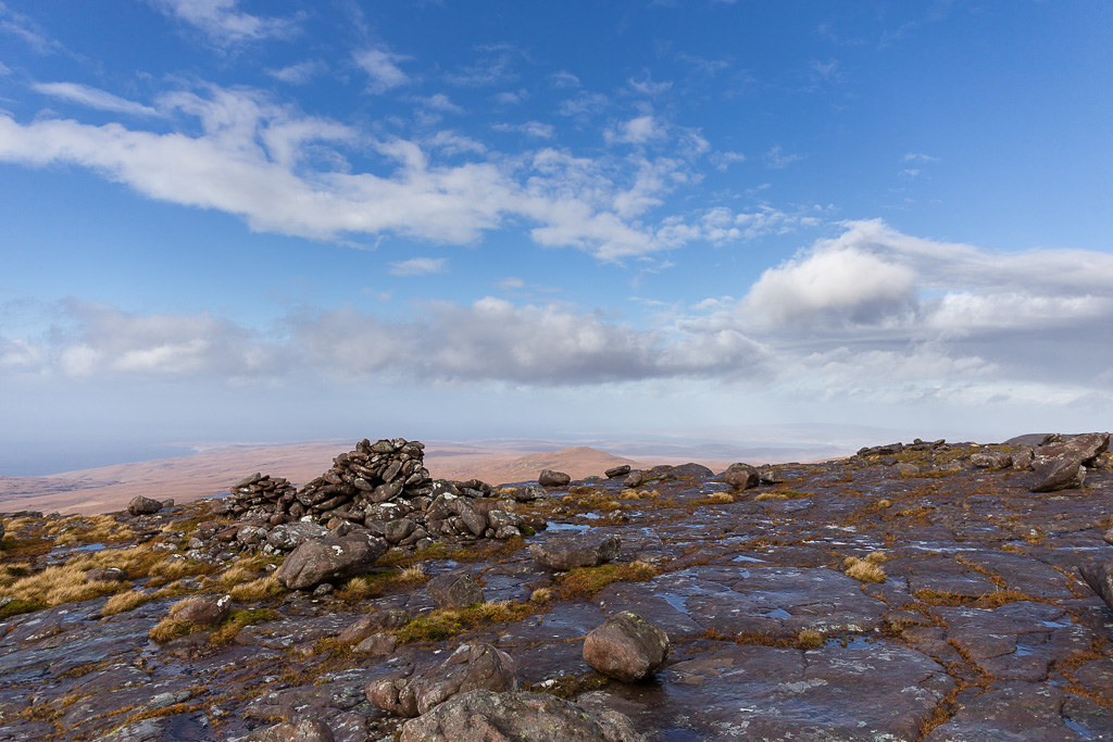 An Ruadh-Mheallan-14
 by
anniesmountains, on Flickr
Tom Gruagaich from the summit of An Ruadh-Mheallan. The clouds were moving at an alarming rate!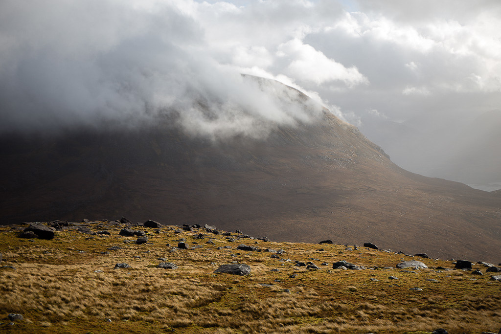 An Ruadh-Mheallan-9
 by
anniesmountains, on Flickr
Baosbheinn to the north.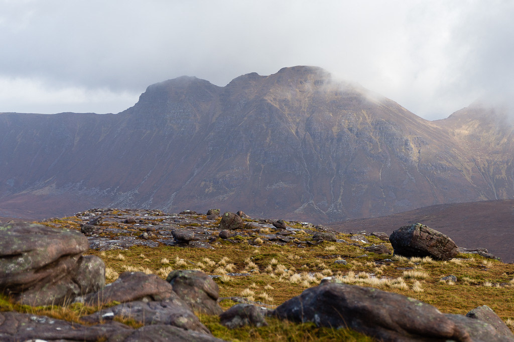 An Ruadh-Mheallan-10
 by
anniesmountains, on Flickr
I headed back down pretty much the way I had ascended but took a detour to see the Loch nan Tri-eileanan.
Rays over Loch Torridon.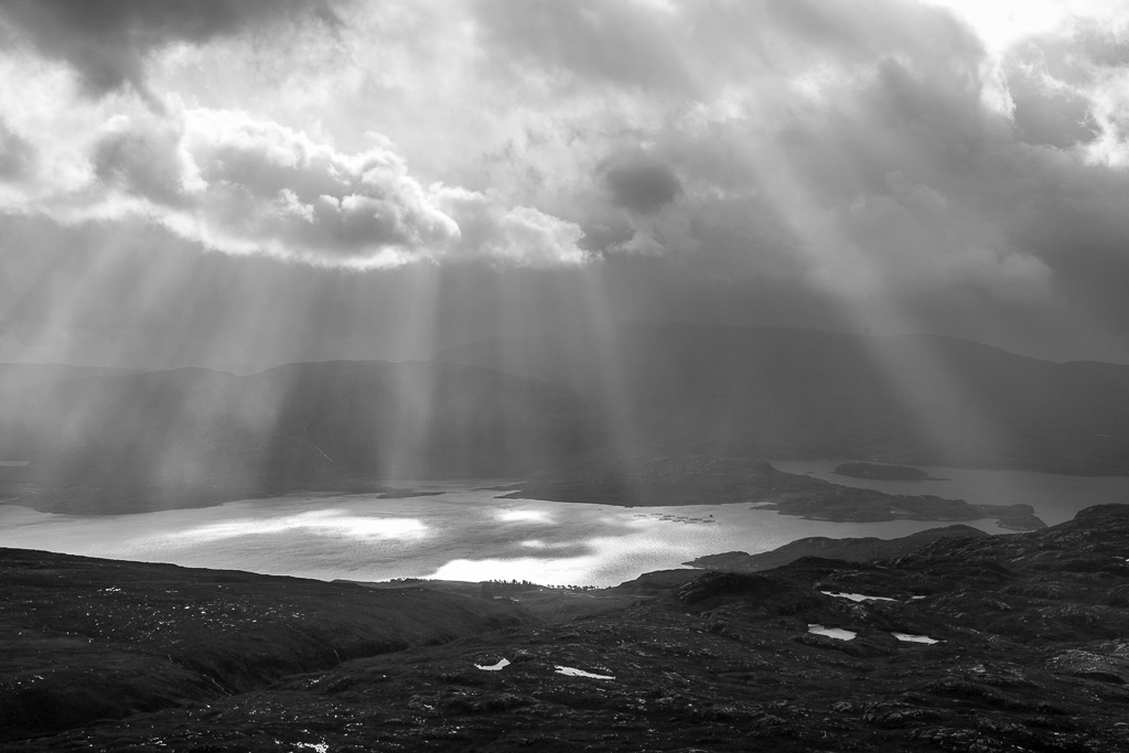 An Ruadh-Mheallan-11
 by
anniesmountains, on Flickr
Loch nan Tri-eileanan and An Ruadh-Meallan. 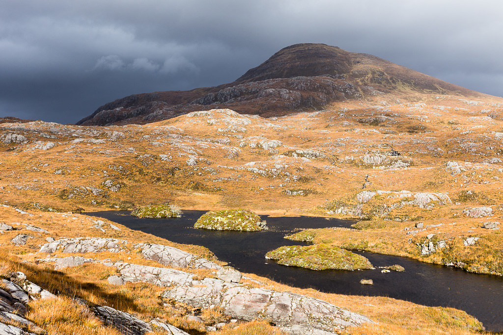 An Ruadh-Mheallan-12
 by
anniesmountains, on Flickr
West end of Liathach (Sgorr a'Chadail) on the way home.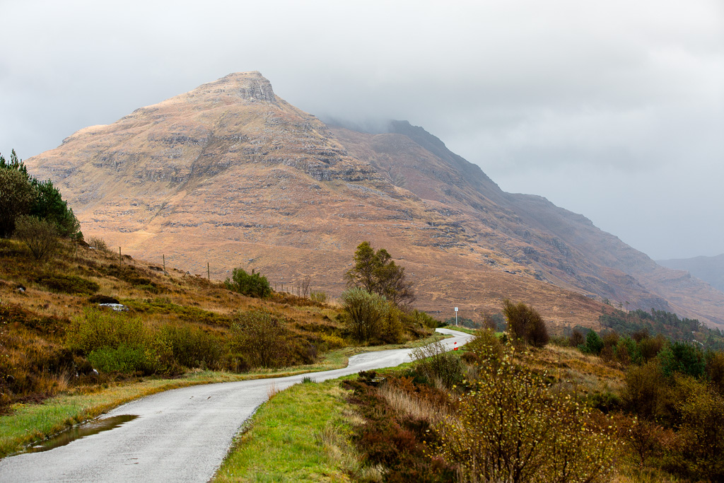 An Ruadh-Mheallan-13
 by
anniesmountains, on Flickr
I do believe I found my limit when it comes to wind. Wish I knew the speed of the gusts as I'm really none the wiser!
