free to be able to rate and comment on reports (as well as access 1:25000 mapping).
Munros: Ben Lomond.
Corbetts: Beinn a' Choin.
Grahams: Cruinn Bheinn.
Sub 2k Marilyns: Beinn Uamha.
Date: 30/05/2015.
Distance: 31km.
Ascent: 2750m.
Time taken: 11 hours, 50 minutes
Weather: Sunny with cold breeze. Becoming overcast.
I had a 2 day route planned across these hills starting at Inverarnan and finishing at Aberfoyle. However it looked a bit ambitious and I wasn't sure I'd ever get around to it, so I took this rather handy chance to drive into the Loch Arklet area. The alternative route I came up with looked a bit ridiculous too (and so it proved to be in a couple of places), but it took in lots of things I wanted to include in the area.
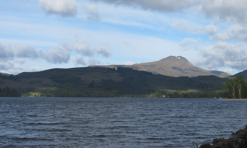
I'd never been up the long roads west of Aberfoyle before, and only looked out across the area for the first time from Stob a' Chroin a couple of years ago. Ben Lomond looked great from Loch Ard. I had long been planning another visit to Ben Lomond, but only wanted to do it if it included the remote NE spur. Looking through all the scores of reports on Walkhighlands and Scottishhills, I could only find a couple of reports that took in this side of the hill, and neither of them included this spur. That lack of coverage made it even more appealing

.
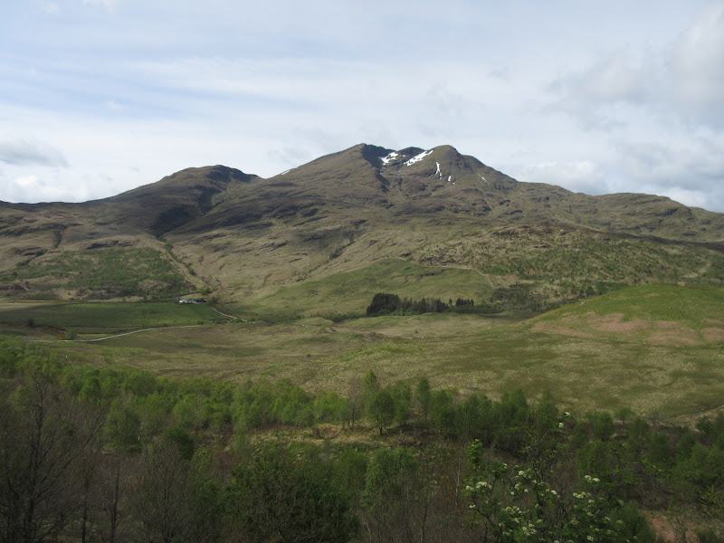
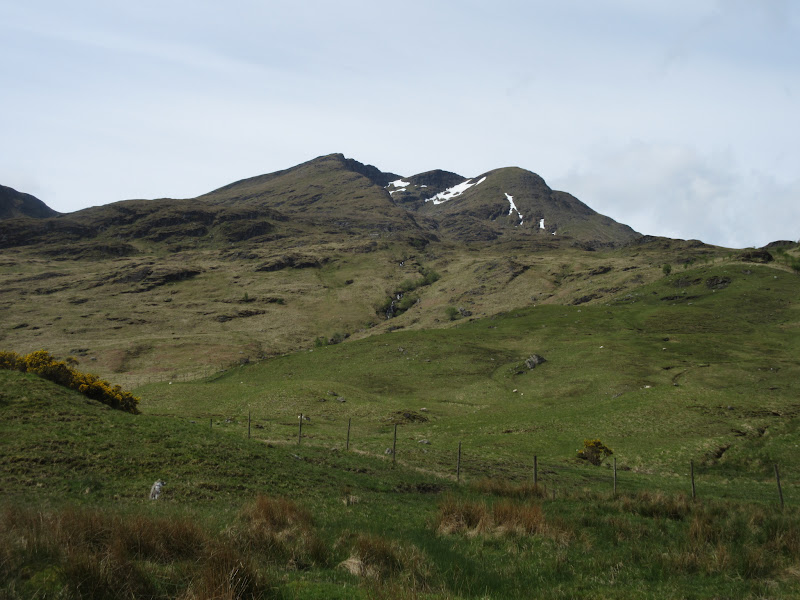
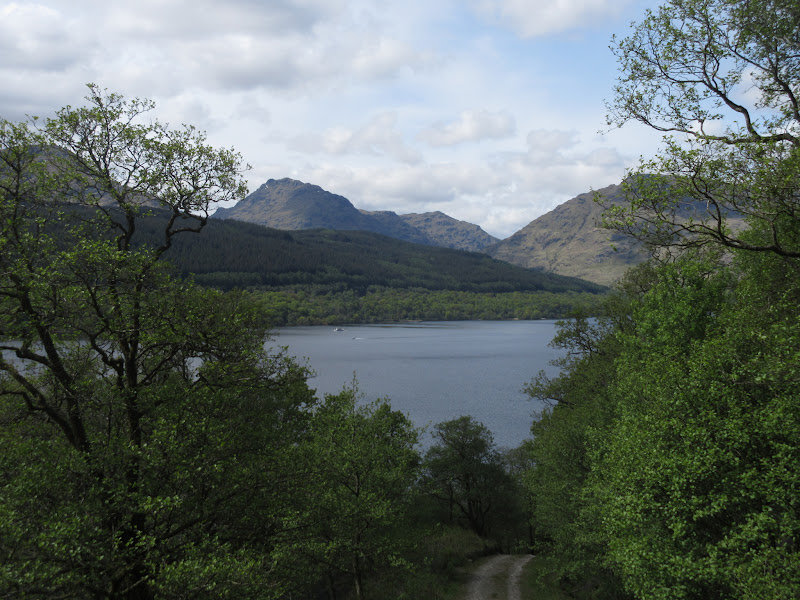
Ben Lomond from Loch Ard:
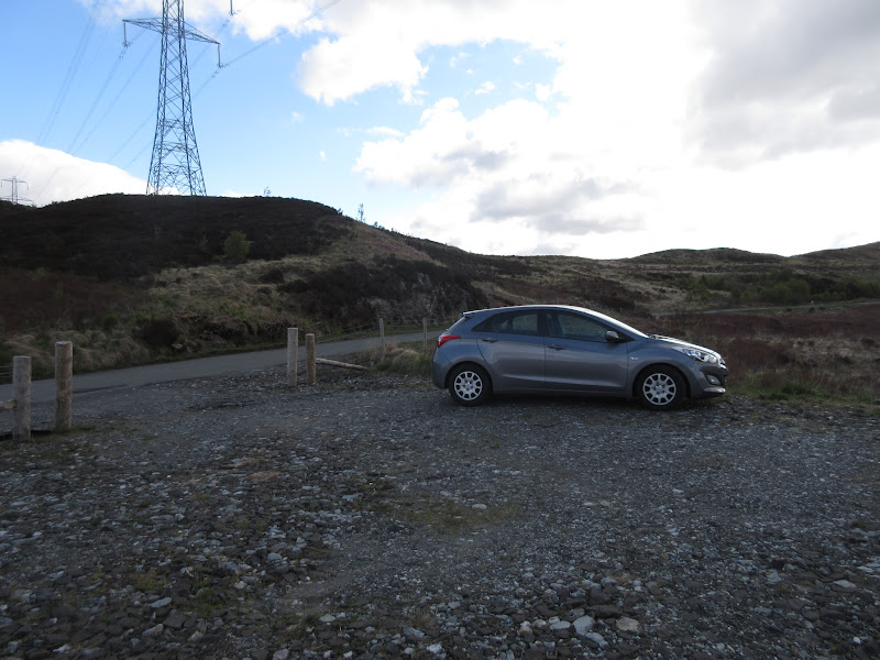
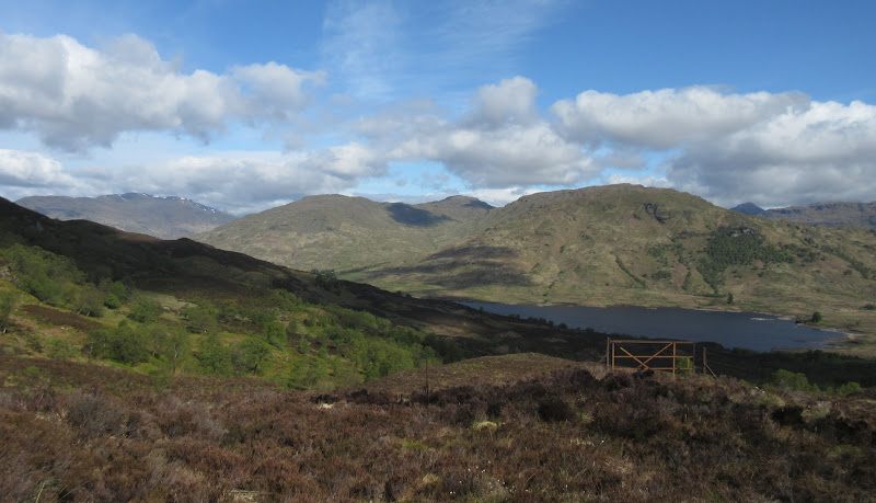
In order to fit all the other hills in, I chose a rather unconventional starting point beneath the pylons prior to Loch Arklet. I wasn't sure if there would be any convenient parking, but there was an area of hard standing off the road right where I needed it

. Probably used for pylon maintenance.
Car parking near Loch Arklet:
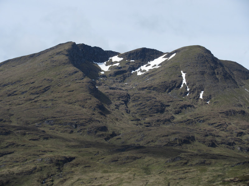
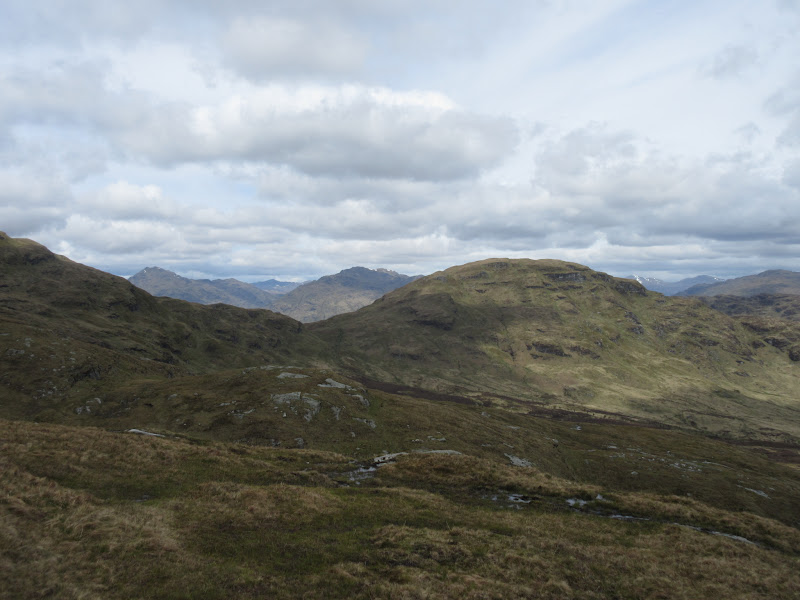
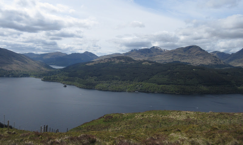
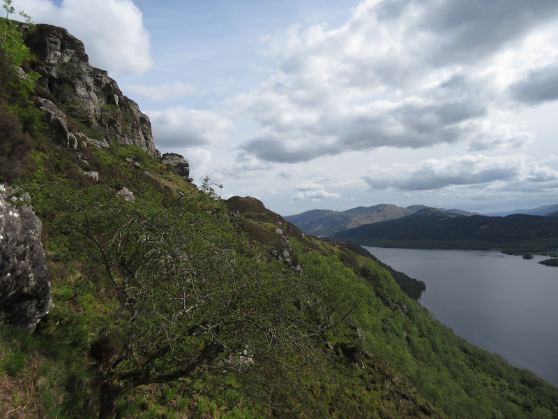
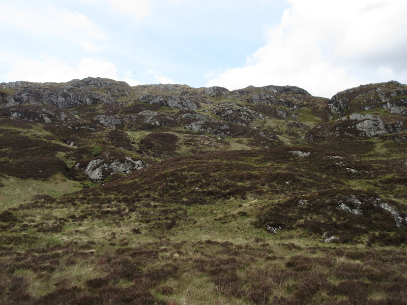
The ground on the way up to Beinn Uamha looked pretty rough. The way was eased a little by quad bike tracks to the pylons, then a gate through a new deer fence. I then vaguely followed the fence up to the summit of Beinn Uamha for the anticipated view of Ben Lomond. It was well worth the seriously rough walk-in.
Ben Ime and Ben Vorlich across Loch Arklet:
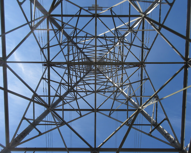
Always wanted to take one of these photos:
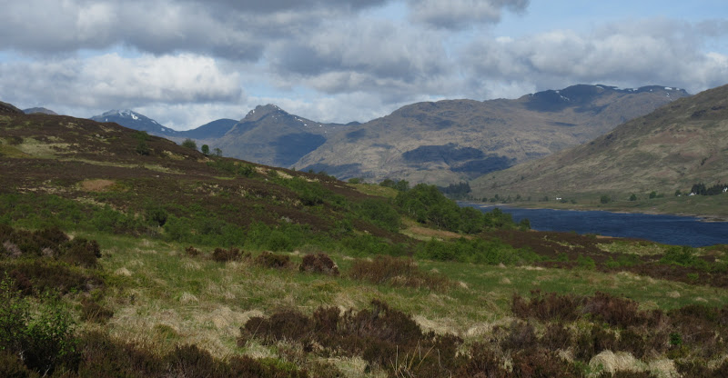
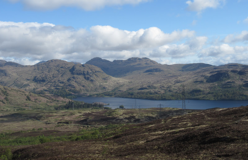
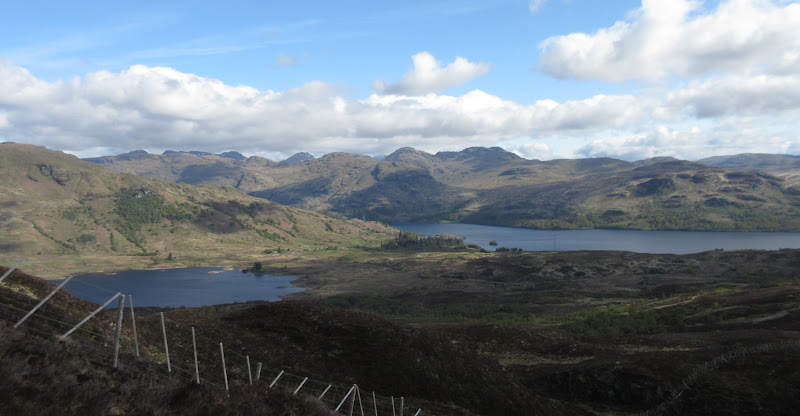
Beinn a’ Choin across Loch Arklet:
Stob a’ Choin across Loch Katrine:
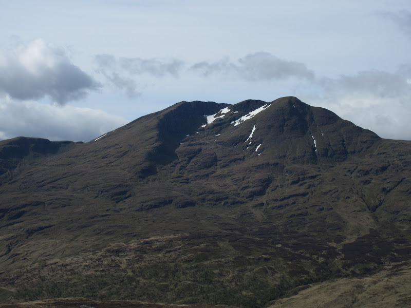
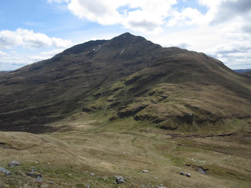
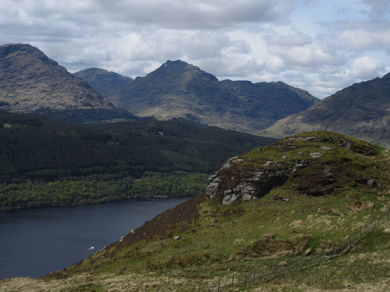
Ben Lomond from the summit of Beinn Uamha:
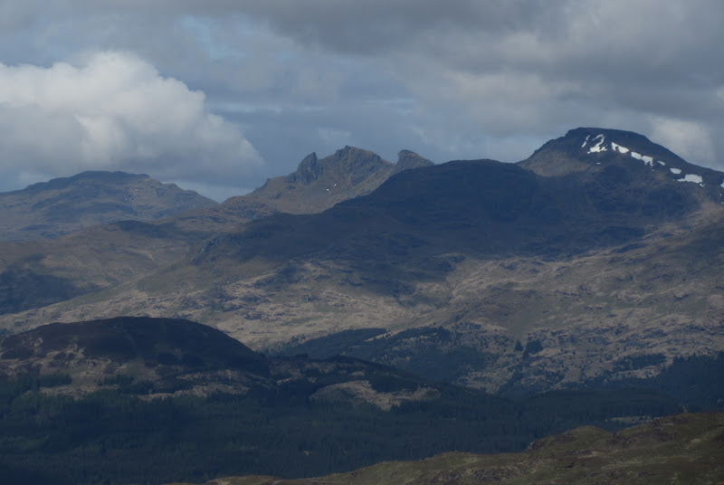
…and the Cobbler:
I decided not to bother with the adjacent Marilyn of Beinn Dubh as I would have plenty more rough ground to cross before the day was out. Instead I dropped down to the track in Gleann Dubh, having to re-ascend a couple of short sections to avoid crags.
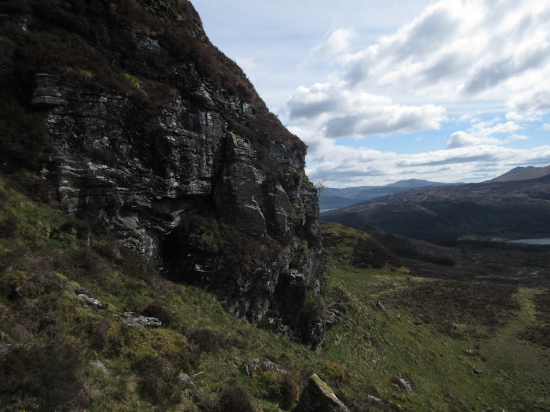
Crags on the descent of Beinn Uamha:
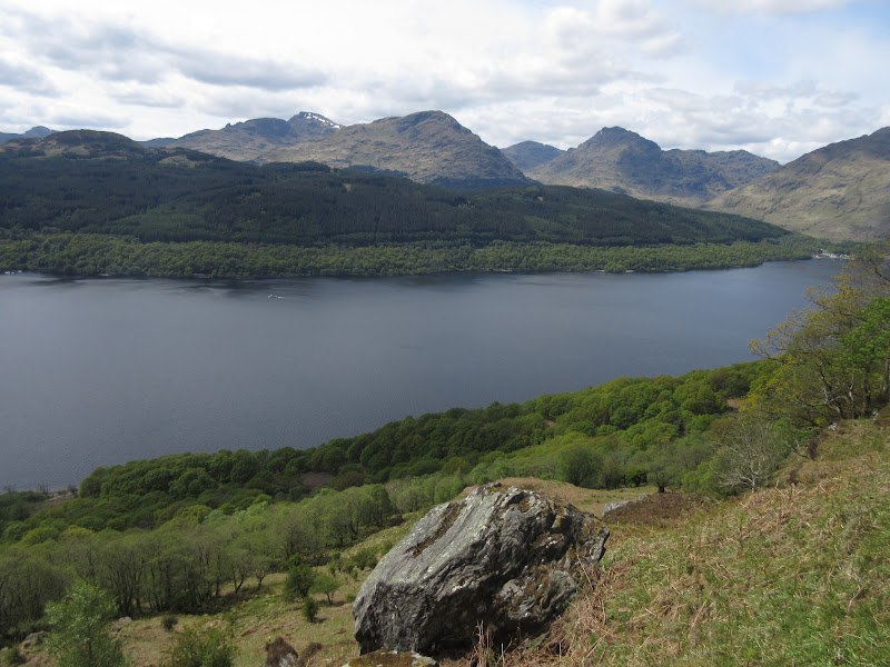
Ben Lomond across Gleann Dubh:
I cut a small corner on the final approach to Comer. There were a couple of notices advising that there was no approach to Ben Lomond through the farm. Based on the lack of paths later on, they seem to be pretty effective

. There seemed to be a more obvious path up Dubh Creag, but I was more interested in the spur which went right up to the summit ridge. I ascended grazing land just before getting to the farm and climbed a low fence into a newly planted area above. I had to climb a pretty high deer fence to get out of here and onto the quad bike track which went up towards Coire a' Bhathaich. This soon veered off to the north and I carried on over trackless grass and bog, soon crossing the burn onto the correct side of the corrie.
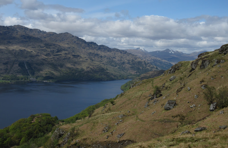
Ben Lomond from Comer:
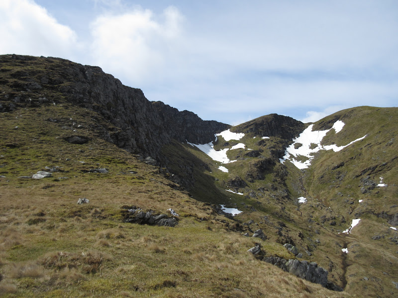
Ascending towards the NE ridge:
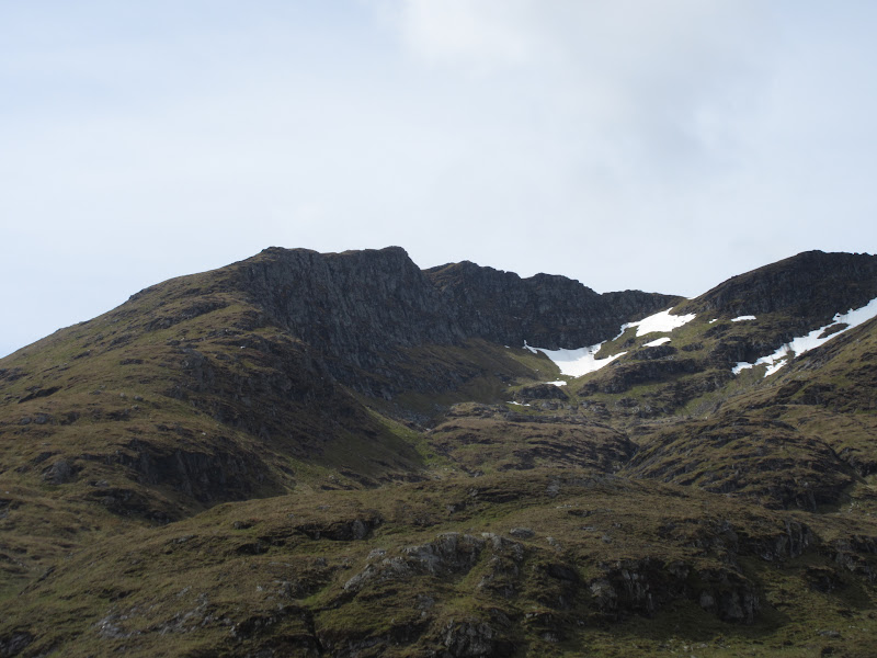
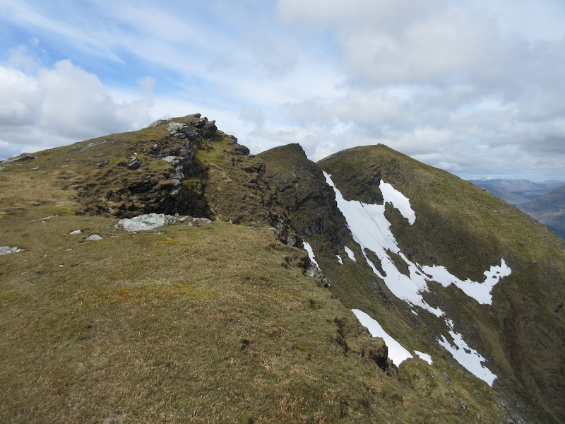
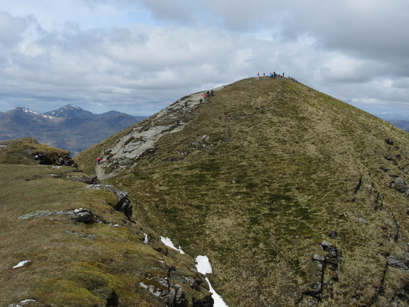
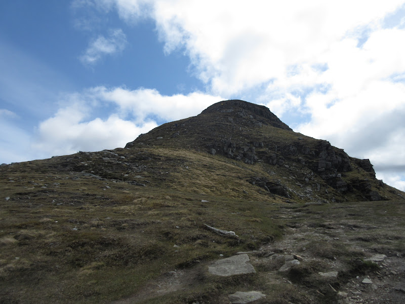
Approaching this was great - it looked more like something you'd find in Knoydart or Ardgour than the Southern Highlands. The ridge proper was very steep, although without any real scrambling. There was also no evidence of a path whatsoever until the final 30m or so. I found that astounding, on what is probably the most climbed mountain in Scotland. This route is even mentioned as an alternative in Irvine Butterfield's 'High Mountains' guidebook, although that is probably out of favour with most walkers nowadays.
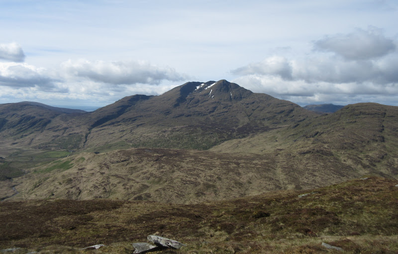
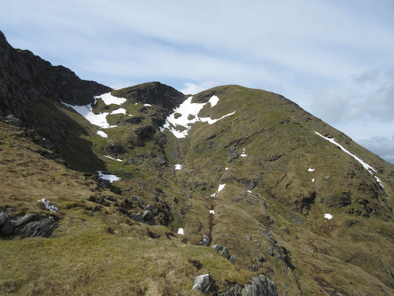
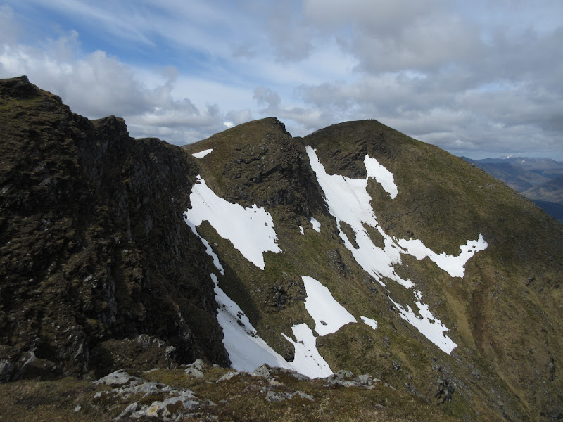
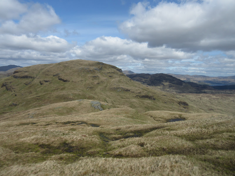
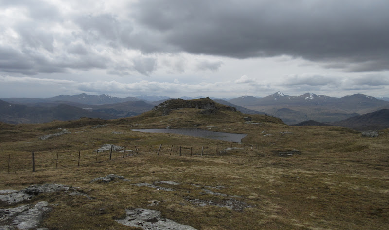
Cruinn Bheinn:
Getting closer to the summit:
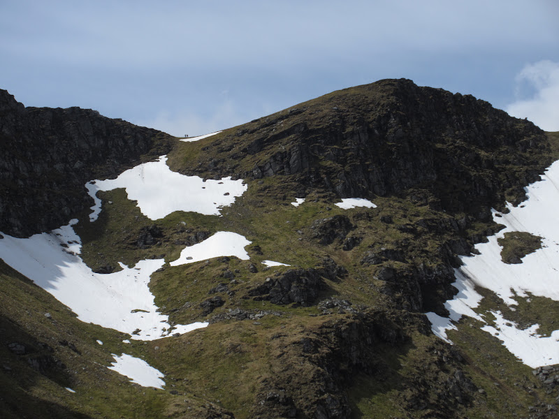
Of course unlike Knoydart, there were scores of people on top. I don't mind this at all, but it can come as a bit of a shock after only meeting a dozen or so other people on the hills in the last 6 months

. There is a bit of a lack of adventure here too - the main path runs below the crest for most of the approach to the summit, and I didn't see anyone make the small diversion to look over the edge in the few minutes that I was parallel to the main path.
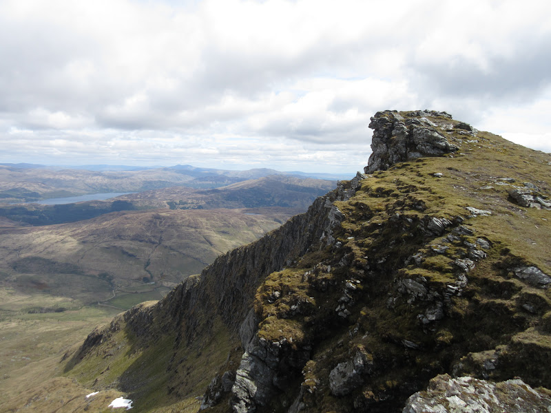
Summit crags:
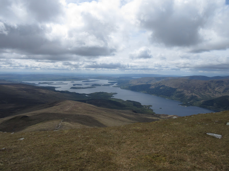
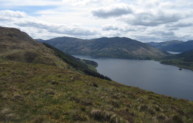
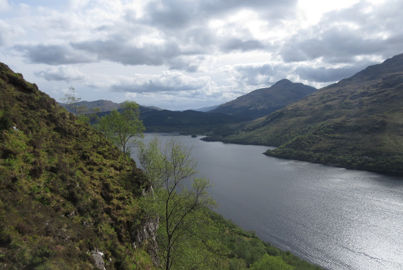
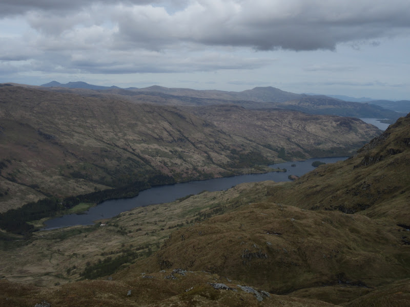
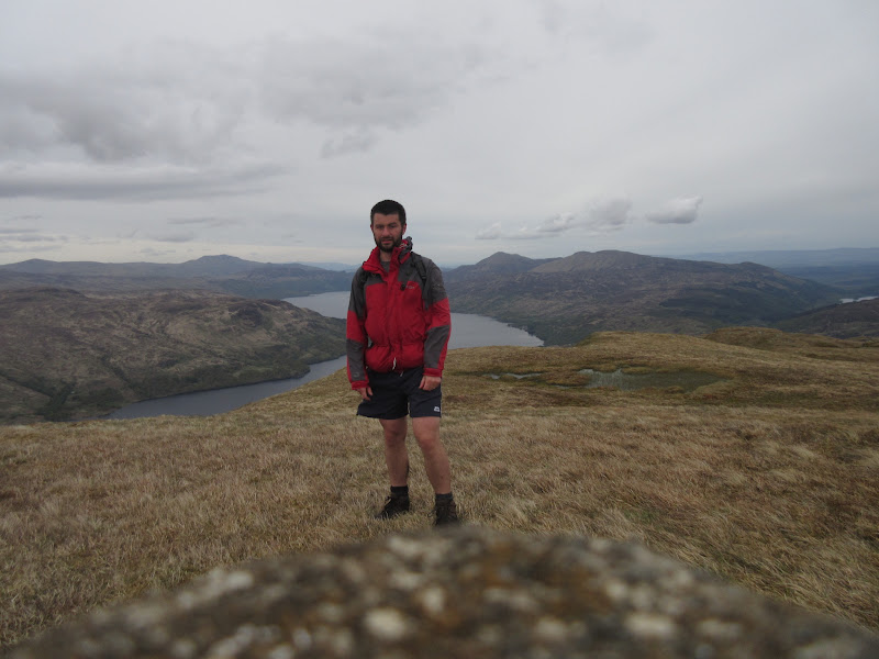
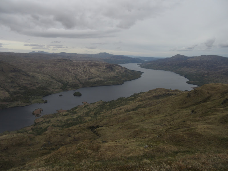
Loch Lomond:
Getting busy:
With all thoughts focused on my route up, I'd forgotten that Ben Lomond is a pretty spectacular viewpoint. I'd never seen it myself before, as on my only other visit in 1996, the top 100m had been in a miserable clag, and below that was hazy and overcast anyway.
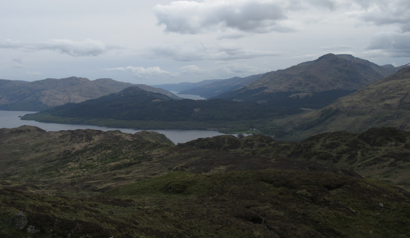
North across Ben Vorlich:
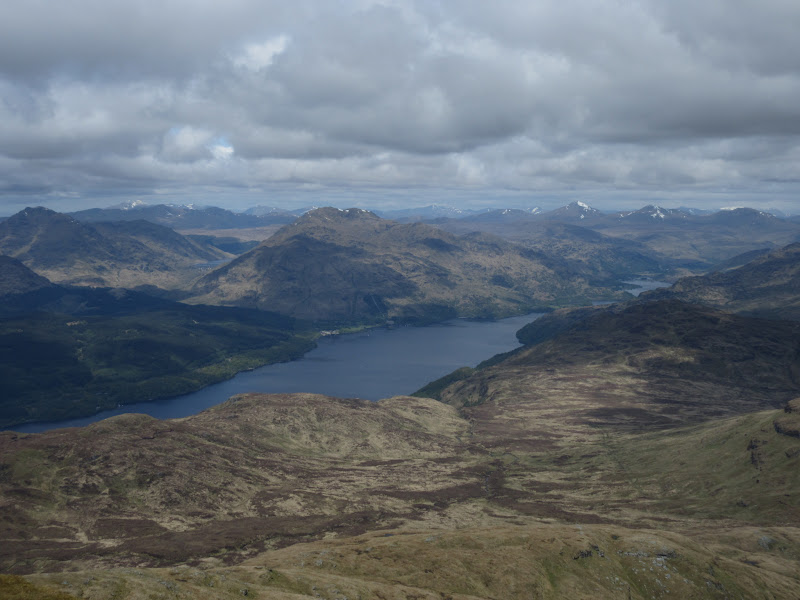
Ben Lui to Ben Oss:
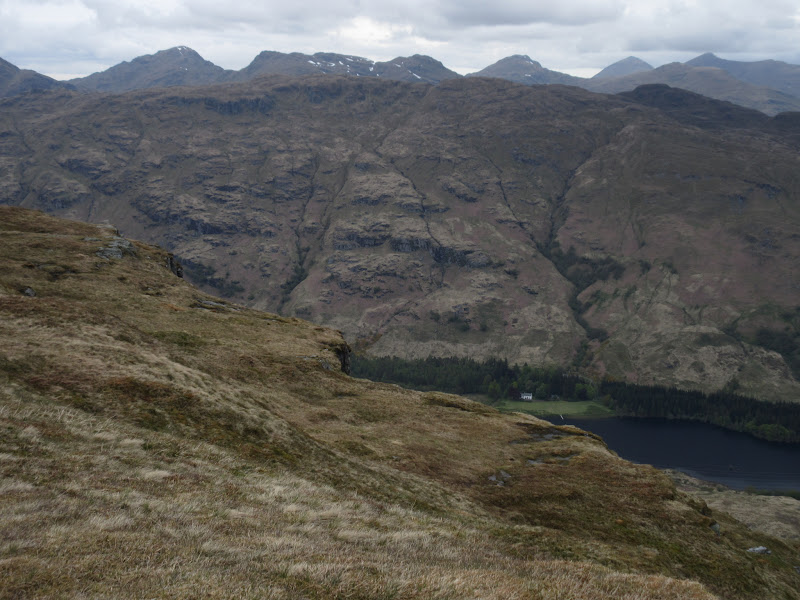
Across Arrochar to the Alps:
Wandering around the busy summit area, I saw a couple of faces I thought I recognised. I was right for once - it was (Scottishhills forum members) Greg and Mhairi
. After a few minutes chatting, I headed off down towards Ptarmigan before breaking off the main path and carrying on north.
Looking back up the NW ridge:
Loch Sloy dam:
Ben Vorlich:
Looking back:
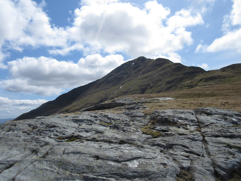
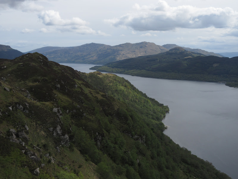
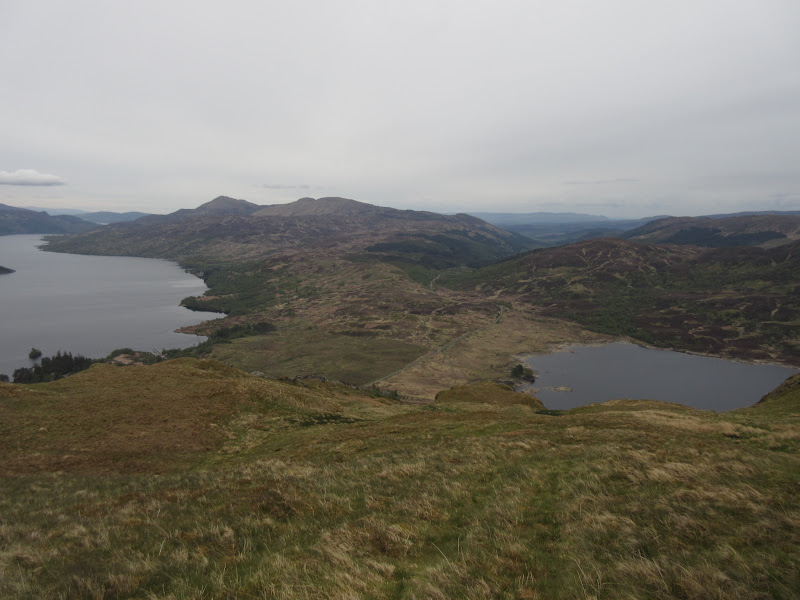
Luckily the ground is quite good down this way, and there isn't a massive amount of re-ascent to Cruinn Bheinn. It is an oddly obscure hill - not that prominent but quite hard to reach. You can't see much of Loch Lomond from it as the spur of Craig Royston obscures the view. There are some nice little craglets on it though and it looks rather like one of MacLeod's Tables on Skye.
Cruinn Bheinn:
Back to Ben Lomond:
Descent was grassy and followed an old fenceline before meeting up with an actual fence near the Cailness Burn. The flat floor of this corrie was rather wet in places.
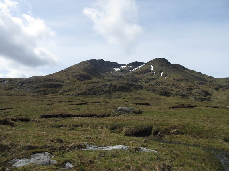
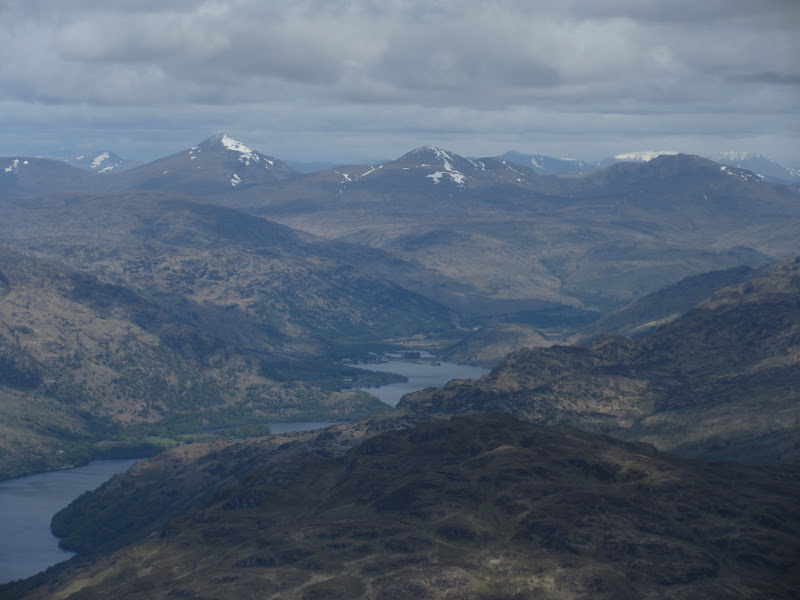
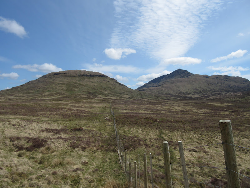
Cruinn Bheinn and Ben Lomond:
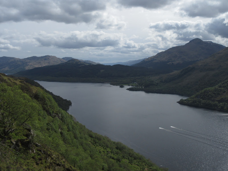
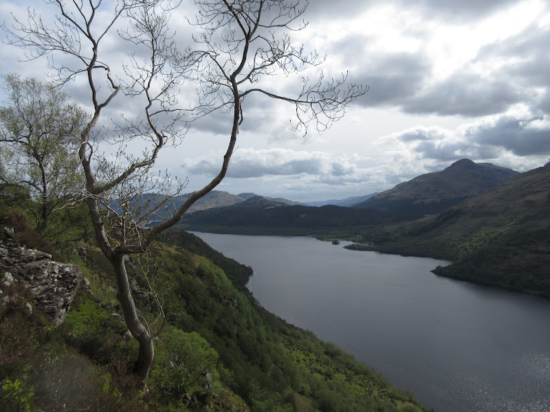
I had a choice here - crash over more rough ground on Cruachan to emerge at Garrison, then up Stob an Fhainne, or down to the West Highland Way with a view to getting onto Beinn a' Choin from the west. Knowing how rough the ground around Cruachain was likely to be, I chose the second option, despite the extra couple of miles it would add.
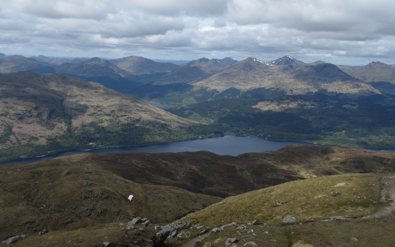
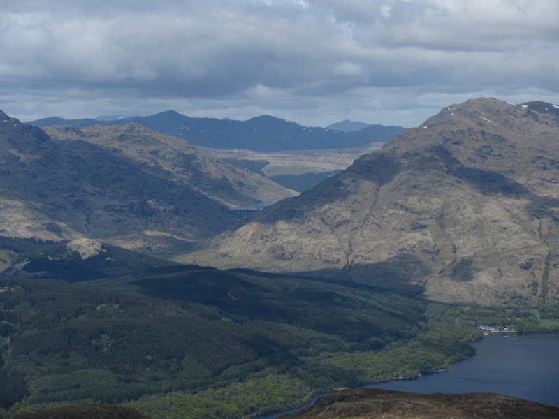
Just before joining the zigzag track down to Cailness, I got some of the best views of Loch Lomond of the day. Loch Maree is still my favourite large loch, but Loch Lomond can't be that far behind!
Beinn Bhreac and Beinn Reoch:
Across Cruach Tairbert to the Arrochar Alps:
Ben Vane:
…with A’ Chrois and Ben Narnain:

Inveruglas power station and the Little Hills of Ben Vorlich:
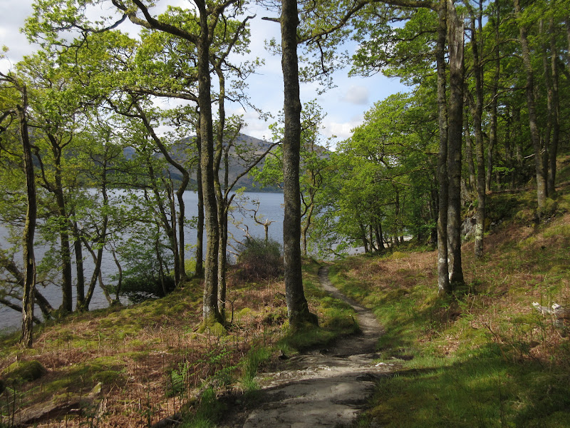
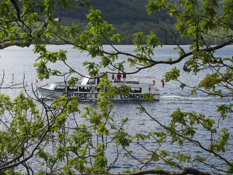
Down the zigzag track to the shores of the loch and the WHW. I have never had any great desire to walk the WHW, but this section up the east shores of the loch had always looked appealing. I'd imagine the majority of people start the WHW on Saturday, so most of them hadn't reached this point yet. I was also going in the same direction as nearly everybody else, so I didn't actually meet that many people at all.
Dropping down to Loch Lomond:
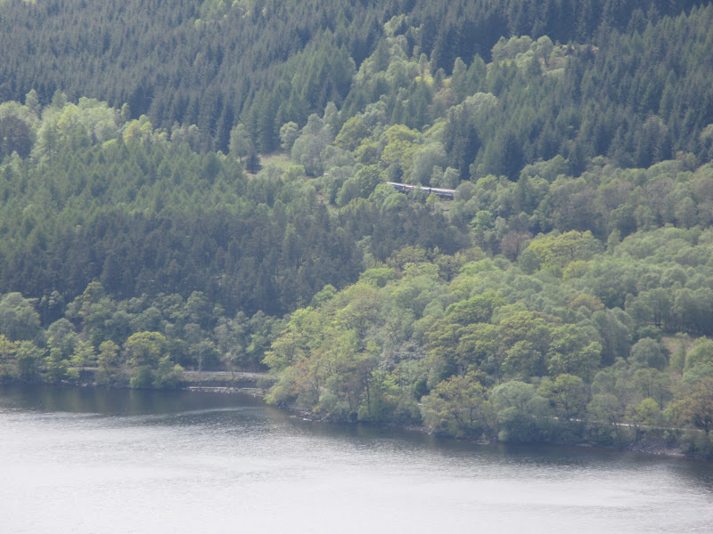
Train heading south:
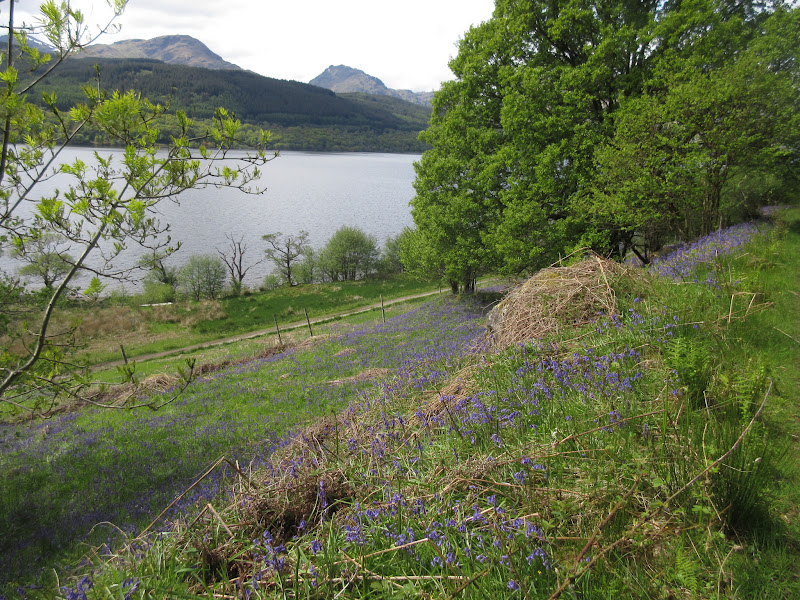
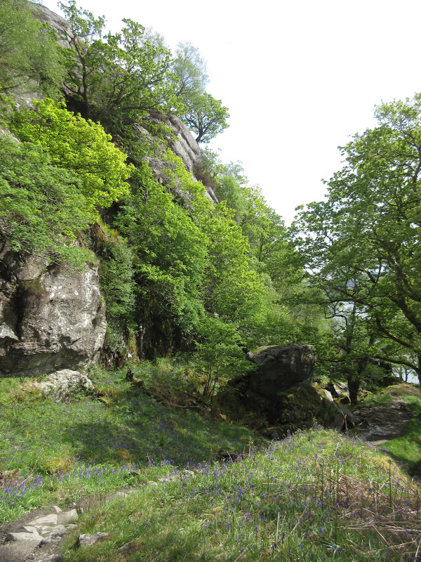
Bluebells:
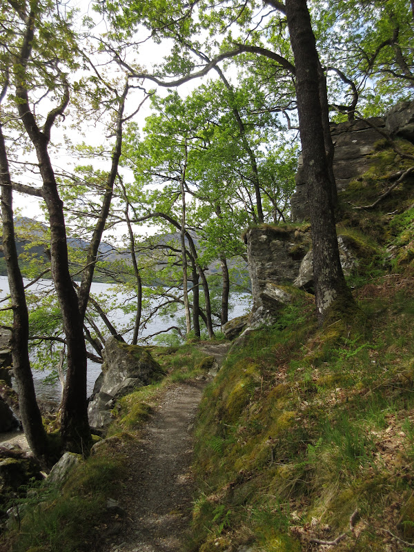
Some lovely relaxed walking (although a couple of steep ascents) to Inversnaid, then some more beyond. I passed a sign for Rob Roy's cave but wasn't in the mood to investigate - it was probably dark, smelly and full of litter anyway.
West Highland Way:
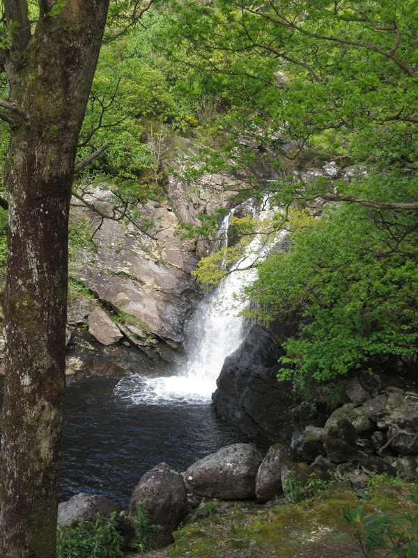
Waterfall at Inversnaid:
Near Rob Roy’s Cave:
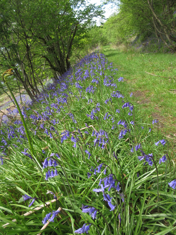
Near Pollochro, I knew it was time to go back uphill again. Perhaps I should have walked up the road to Garrison for an easy way back on the hill, but my usual masochistic streak pushed me to find a way up from the lochside. Just before a deer fence surrounding woodland at Pollochro, I headed up a steep, slippery slope of bluebells. I thought things might get easier after the first 50m but I was wrong. A pleasant mixture of spiky hawthorn bushes and slithery clay soil made the whole ascent a trial, and it took me about twice as much time and effort as expected to get onto Creag an Fhithich. At least there were more good views over the loch to compensate
Ascending Creag an Fhithich:
South down the loch:
Up top the going was still rough. Superficially it was the same heathery craggy hillside as lots of the highlands, bit the heather was particularly deep and boggy here. After some up and down and crossing a couple of burns and fences, the final ascent up to Beinn a' Choin was easier.
Ascending the side of Beinn a’ Choin:
Loch Long:
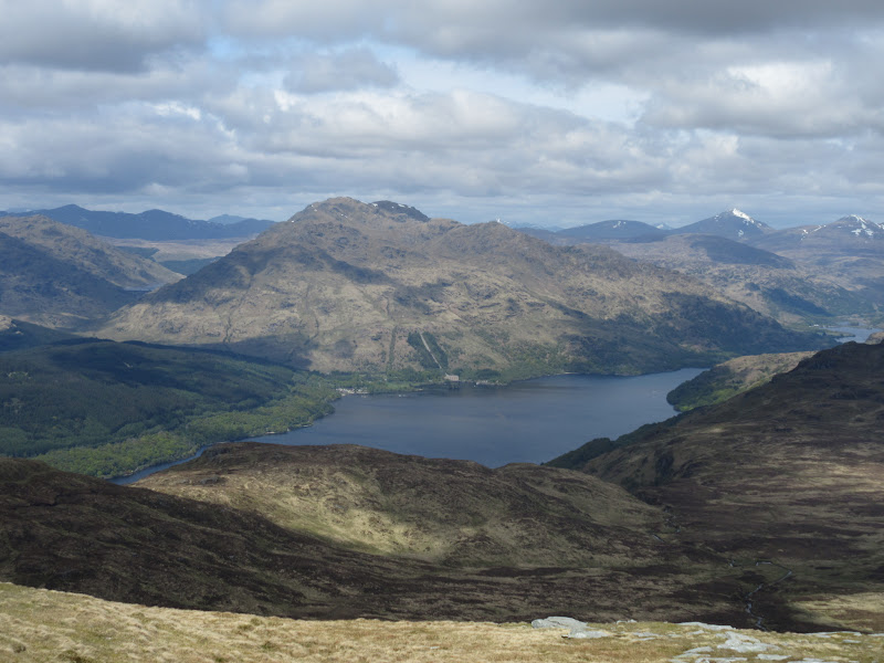
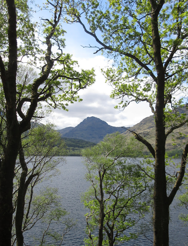
The weather had been much more consistently sunny than forecast, but that was now coming to an end, with the skies greying over. After the ascent onto Beinn a' Chroin, my energy levels were seriously decreasing as well. The views were great but the best of the day was now passed. Still, some interesting things observed - the jumble of ridge and summits connecting Beinn a' Choin to Meall Mor looked intricate, with the spiky summit of Beinn Ducteach looking particularly interesting. There could be some good (but energetic) exploring out that way.
Stob Binnein from Beinn a’ Choin:
Arrochar Alps:
North to the summit:
After a break, I dropped down to the SE to contend with the final ascent of the day - Maol Mor. I had been looking forward to this and its views of Loch Katrine, but ended up a bit hacked off at the endless ups and downs to the trig point.
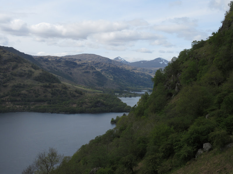
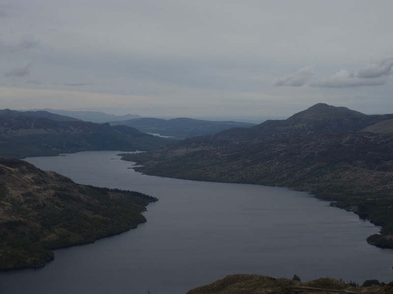
End of Loch Katrine:
On Maol Mhor:
Beyond the trig point, most of the walking was downhill at least, although my way was blocked by a monstrous deer fence at one point. The final descent from Garradh was through some very attractive glades of bluebells, but also decidedly steep and slippery for my tired legs. Finally I reached the new cycle path (not shown on my map) which led me back to the car at 8:45pm, just as the first drops of rain began to fall.
Loch Katrine and Ben Venue:
Across Meall Mor to An Caisteal and Beinn a’ Chroin:
Ben Venue:
As I had hoped, this was a pretty interesting route, and certainly the longest and hardest I've done this year. Have to say I felt more knackered by the end of it than on similar walks I have done in the past, and I also ended up trailing Naismith by a good hour. That didn't bother me massively, but did make me question a couple of other (possibly even longer) walks I have planned.
As the rain worsened, I drove round to Balloch for a chippy, then up to Glen Douglas to park up for the night. I couldn't be bothered pitching the tent, so slept in the car. If I had known how bad the weather would be in the morning, I might just have driven straight back to Glasgow

.
