free to be able to rate and comment on reports (as well as access 1:25000 mapping).
Day 1 – Skye – Beinn Dearg Mhor
Day 2 – Skye – Marsco
Day 3 & 4 – Skye – Trotternish Ridge
Day 5 – Harris – Uisgebhal Mhor
Day 6 – Harris – Oirebhal and Tiogra Mor
Day 7 – Harris/Lewis – Rest Day
Day 8 – South Uist – Beinn Mhor & Thecla
Day 9 – Skye – Glas Bheinn Mhor and Belig
Day 10 – Skye – Skye – Sgurr a’Bhasteir, Sgurr a’Fionn Choire, Bruath Na Frithe
Day 11 – Raasay – Dun Caan
Day 12 – Skye – Kylerhea HillsDay 13 – Skye – Sgurr Beag
Day 14 – Skye – Sgurr nan Eag
Day 15 – Skye – Beinn Dearg Mhor & Beinn na Caillich
Day 16 – Skye – Sgurr nan Each
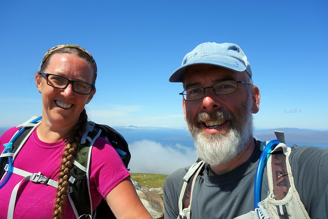
Day 12 - another fine sunny one. The Kylerhea hills had been scheduled for today - previously a circuit of three Grahams, before Beinn Aslak was demoted for failing to meet height criteria. Still a simm and Marilyn so i intended to include it in my circuit, though thought Allison - who is much more sane about ticking things and needed to avoid unneccessary stress on her back - should bale out before Aslak. It seemed a fair way from Sligachan to Kylerhea - especially the last 10 miles along what might be euphemistically termed an "entertaining" single track road to the ferry. We met enough cars coming the opposite way for any entertainment value to be stretched thin. Anyway, we turned up left before the ferry jetty to park in the nature reserve car park. The sky was clouldless and it was going to be a scorcher. We watched the tiny ferry beat its way across from the Glenelg side, turning into the current. Our hills lay right behind us from the car park - and the only way was up.
Car park area
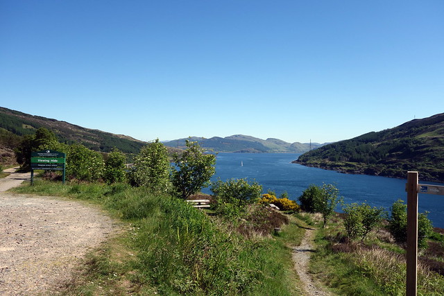 DSC00803
 by
Al, on Flickr
Glenelg ferry
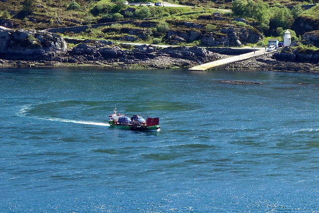 DSC00804
 by
Al, on Flickr
Bernera Beach
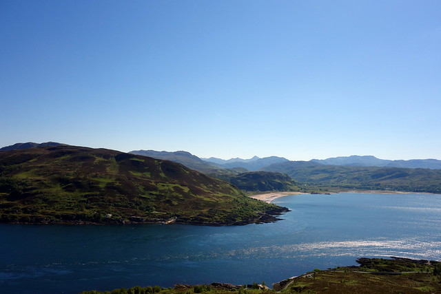 DSC00805
 by
Al, on Flickr
Up Beinn Bhuidhe
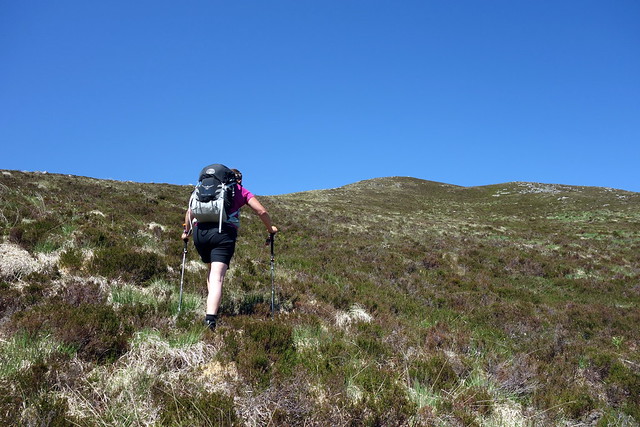 DSC00806
 by
Al, on Flickr
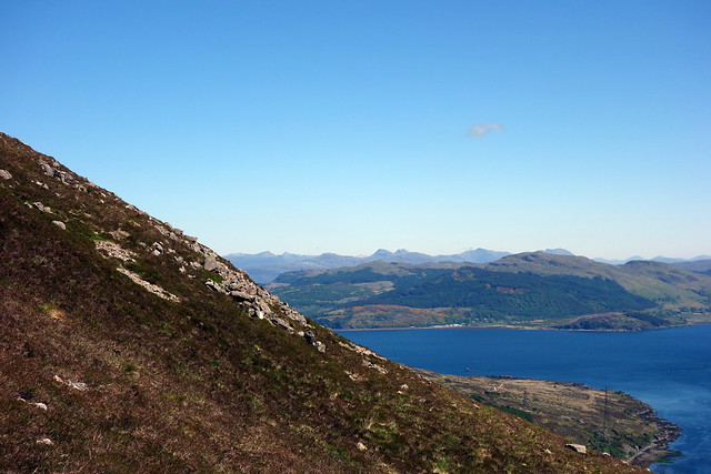
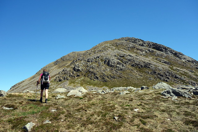
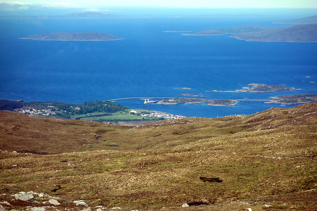
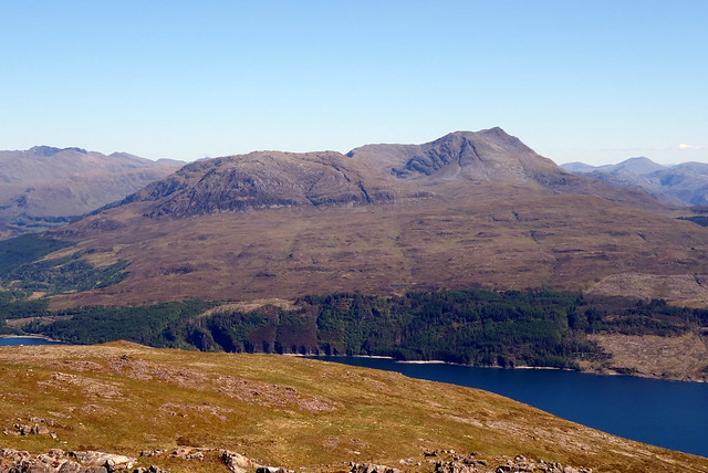
We climbed on steep grass/heather up the back of Beinn Bhuidhe, turning frequently to enjoy the vista of the Kintail hills. We had quite an animated discussion about what some of them were. The Saddle was one of the more easily recognised peaks, along with Sgritheal. We reached a bealach before ascending Beinn na Caillich where Allison dropped her pack. Steepish ascent, with a path through some scree took us up to a fine summit giving impressive views of Skye. In fact it was hard to think that we were still actually on Skye, not the mainland. The Skye bridge curved below us, the Red and Black hills gleamed - I noted that Glamaig still had its personal duvet in place. On the way up Allison had noticed a rock with many crane flies hanging perpendicularly out of the wind, like a minature collection of vampire bats.
Quite steep
 DSC00809
 by
Al, on Flickr
 DSC00811
 by
Al, on Flickr
Coinnich and Caillich
 DSC00812
 by
Al, on Flickr
"now, which one is that?"...
 DSC00813
 by
Al, on Flickr
Caillich
 DSC00814
 by
Al, on Flickr
Skye bridge
 DSC00816
 by
Al, on Flickr
It's them Cuillin Hills again
 DSC00819
 by
Al, on Flickr
 DSC00822
 by
Al, on Flickr
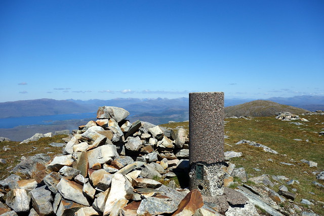
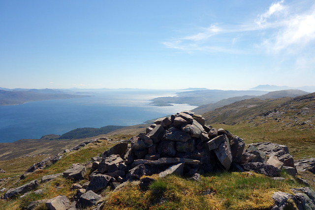
Summit, Caillich
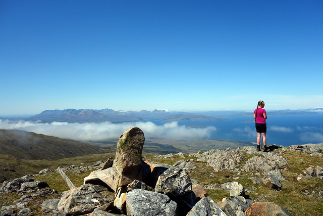 DSC00824
 by
Al, on Flickr
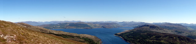
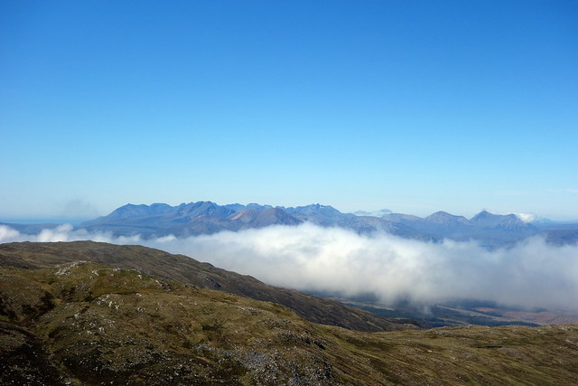
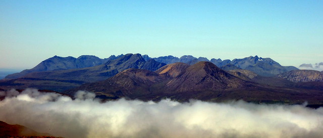
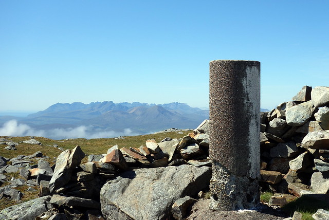
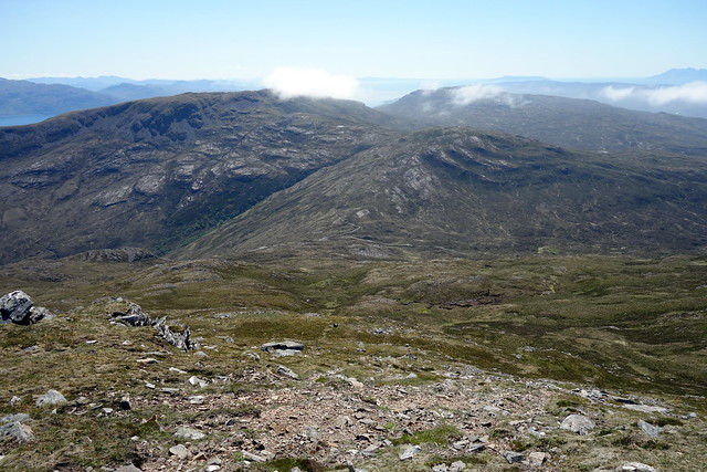
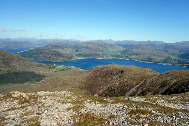
On our descent back to Bealach nam Mulachag we heard voices - on what the SMC book describes as hills you will never see another soul on, here were 2 walkers coming up. We chatted for a bit then picked up Allison's pack and climbed up to the summit of adjoining Sgurr na Coinnich. I'm surprised this pair are both Grahams, as the drop between them seemed small - must just make the 150m criterion. The views from the second hill were, if anything, even finer than from Beinn na Caillich - especially those to the Cuillin, where the Red hills sat grouped in front of the Black, like kids in a school group photo, the smaller ones nearest the camera, the gangly taller ones in the rear.
Summit Coinnich
 DSC00825
 by
Al, on Flickr
 DSC00827
 by
Al, on Flickr
 DSC00831
 by
Al, on Flickr
 DSC00832
 by
Al, on Flickr
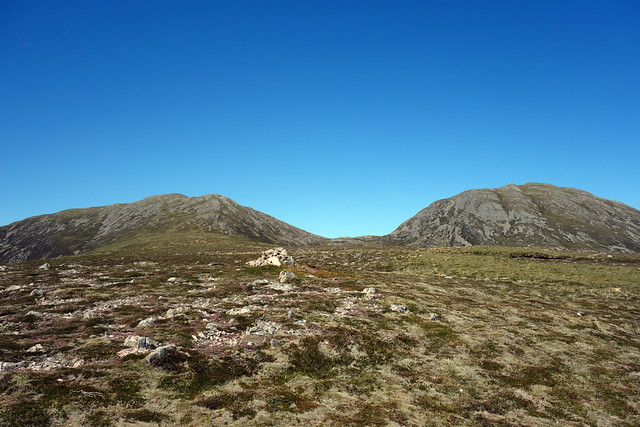
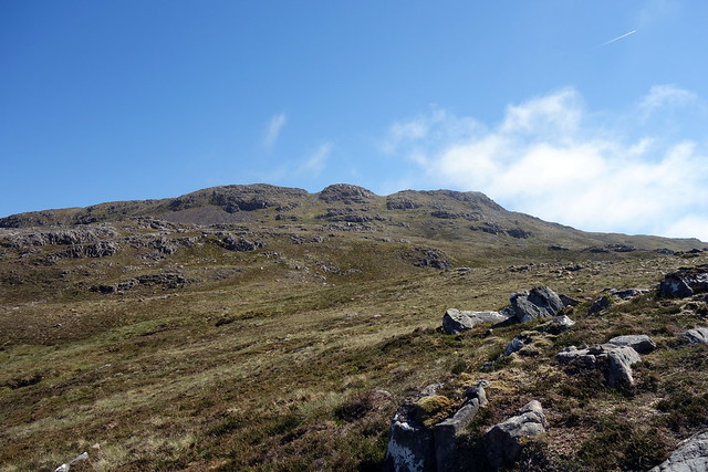
Still a fine day we dropped down the NW side of the hill, aiming for the transmitter mast on the road below - this marked the start of the route up Beinn Aslak and the return point for Allison to the car park. We saw another walker coming up to Coinnich - heavens, this place is like Sauchiehall Street. Once back at the road I went up the track to the transmitter mast and found a path leading to the top of Beinn Bheag. From here I headed south east for Beinn Aslak, enjoying rapid progress. The summit was reached and provided grand views once again, particularly to Beinn Sgritheal which sat just over the Kyle.
Descent route
 DSC00834
 by
Al, on Flickr
Beinn Aslak
 DSC00835
 by
Al, on Flickr
Sgritheal
 DSC00837
 by
Al, on Flickr
Summit Aslak
 DSC00839
 by
Al, on Flickr
Sgritheal
 DSC00840
 by
Al, on Flickr
I began to descend along the broad eastern shoulder of Aslak, deciding after a bit to cut north down into Kylerhea Glen and make for the road, which I could see over the river. This way was steep initially, with some slabs near the bottom section and quite boggy around the river - water level was very low so no problems with crossing. Bracken and bog myrtle on the other bank scratched my legs to ribbons - not the best place to be wearing shorts. I rejoined the road with relief and walked the couple of kilometres back to the car park. A splendid circuit of hills with views which really require it to be done on a clear day.
Descent route
 DSC00842
 by
Al, on Flickr
 DSC00843
 by
Al, on Flickr
