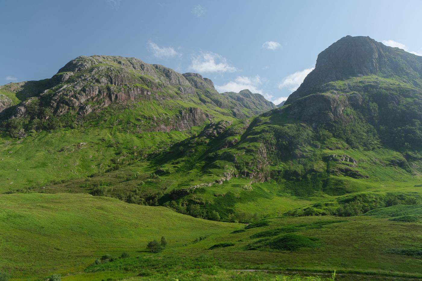
Lost Valley (Coire Gabhail), Glen Coe

 GLENCOE AND KINLOCHLEVEN

Coire Gabhail is the hidden valley where the MacDonalds of Glen Coe hid their rustled cattle. A visit involves a very rough but intensely dramatic and scenic walk.

Summary

Steep and rocky path with some mild scrambling; great care needed.

Terrain

NN170569

Grid ref

4km/2.5 miles

Distance

grade grade grade Key

Grade

Safety warning: Hillwalking when there is snow or ice lying requires ice-axe, crampons and the ability to use them. Some featured routes can become technical ice climbs. Check out our Winter Skills information provided by the Mountaineering Council of Scotland.

335m [Profile]

Ascent

2 - 3 hours

Time

Bog Factor

Start

Maps

  Download walk in GPX format
  For use with Memory Map, Anquet etc.

GPS Waypoints

View in 3D

Users'
rating

Read reports by: smirnie71   HighlandSC   johnkaysleftleg   joemunro   Jockstar  
Add your own report on this walk - there's £90 to win to spend at Webtogs each month

Users'
reports

Glasgow - Fort William and Skye buses passes along the A82(T)
Open Traveline Scotland

Public transport

Press play button to listen

  Tell me more

Pronunciation
and meaning


Click to enlarge

1. Park in the large car park half way up Glen Coe at NN170569; alternatively you can park in a smaller car park a couple of hundred metres further down the glen. The car park is often busy with coaches later in the day (and often has a bagpiper), so try to arrive fairly early. There is a fabulous view of the Three Sisters across the glen.


Click to enlarge

2. Follow the path downhill to the old track through the glen; turn left along this before following the well-worn path off to the right. This soon descends a wooden stairway to cross the River Coe, far below in its gorge. Once across the bridge the path becomes very rocky and rough, and care is needed as there have been fatalities where people have fallen into the gorge. Scramble easily up the next slope to continue on the path which heads through birch woods and pass through a gate in the deer fence before cutting round the base of Gear Aonach.


Click to enlarge

3. The path leads into the fine wooded gorge between Beinn Fhada and Gear Aonach. The scenery is tremendous with great rock walls on each side. After some distance watch out for the place where it crosses the stream on rough stepping stones, as this spot can be easily missed. A short distance beyond here the path scrambles up a rocky rake with a steep drop on the right. The scrambling is fairly straightforward but some may find the situation airy; the rake has been well-polished by the countless walkers who have descended it on their bottoms! On the return, it is possible to avoid the rake if preferred by descending over the boulders to the left, but it would be very difficult to climb up this way.


Click to enlarge

4. Once above the rake the path has been improved with boulders placed to form steps, and there are more open views to Glen Coe behind. Once beyond the most rugged section the path begins to descend into the 'Lost Valley'. This wide and flat expense of stones and grass is completely cut off and unsuspected from Glen Coe due to the great rock falls in the gorge below, and would have been the perfect hiding place for stolen cattle - though how they got them up here seems a mystery. Many of the Macdonalds who escaped from the massacre of Glen Coe fled here, but some perished in the winter snows.


Click to enlarge

5. It is worth exploring the flat area of the Lost Valley, which is littered with fallen rocks the size of houses. At the head of the Glen the Munro peak of Stob Coire Sgreamhach is visible, but it is the great rock walls of Gear Aonach and Beinn Fhada on either side that win most attention. The return walk is by the same route.


Have you found an error or is any information wrong or missing?

Please let us know by using the error report form.

Quick links:
Kinlochleven and Glencoe Hotels
Kinlochleven and Glencoe B&B
Kinlochleven and Glencoe cottages
Fort William hostels


Walking can be dangerous and is done entirely at your own risk. Information is provided free of charge; it is the walkers responsibility to check it and navigate using a map and compass.
See our Terms of use, Disclaimer, Privacy and Copyright Policies for more details. ©2006-2011 walkhighlands.co.uk