free to be able to rate and comment on reports (as well as access 1:25000 mapping).
It had been quite some time since I last did this walk, in fact it was 15th September 2017, almost 3 years to the day when we – Chris and I – approached Deepdale Hause following the course of Deepdale Beck along the dale that gave it it’s name, a long and quietly peaceful dale inhabited by nothing only the local wildlife and scattered sheep giving each other more than Covid-19 space as they vie for the best patch of edible vegetation. It’s quite narrow as it’s enclosed in by the long steep sided bulk of Hartsop above How on its south side and the larger one of St Sunday Crag on its north. On this occasion we had mixed weather with sun, rain and full cloud cover to contend with.
Today though on this walk I, with E and Martin, would approach Deepdale Hause by way of walking along Grisedale following the course of Grisedale Beck below the heights of St Sunday Crag and Birks on the southeast side with the craggier face of the Helvellyn fells towering over us to the northwest with this route being far busier than the previous one to the same destination, also with far better weather.
We arrived at NY390 159 that is the car park behind King George V Playing Field accessed by a short drive along the metalled lane to Grisedale and a suggested charge of £3 for all day parking. Although we wasn’t late in arriving there it was already quite full of cars and with a good forecast, a sunny start with a temperature of 10°c it boded well for the days walking ahead.
It was cool and the air was fairly clear with just a few wisps of cloud about as we set off with a fine view of Place Fell behind Patterdale Church.
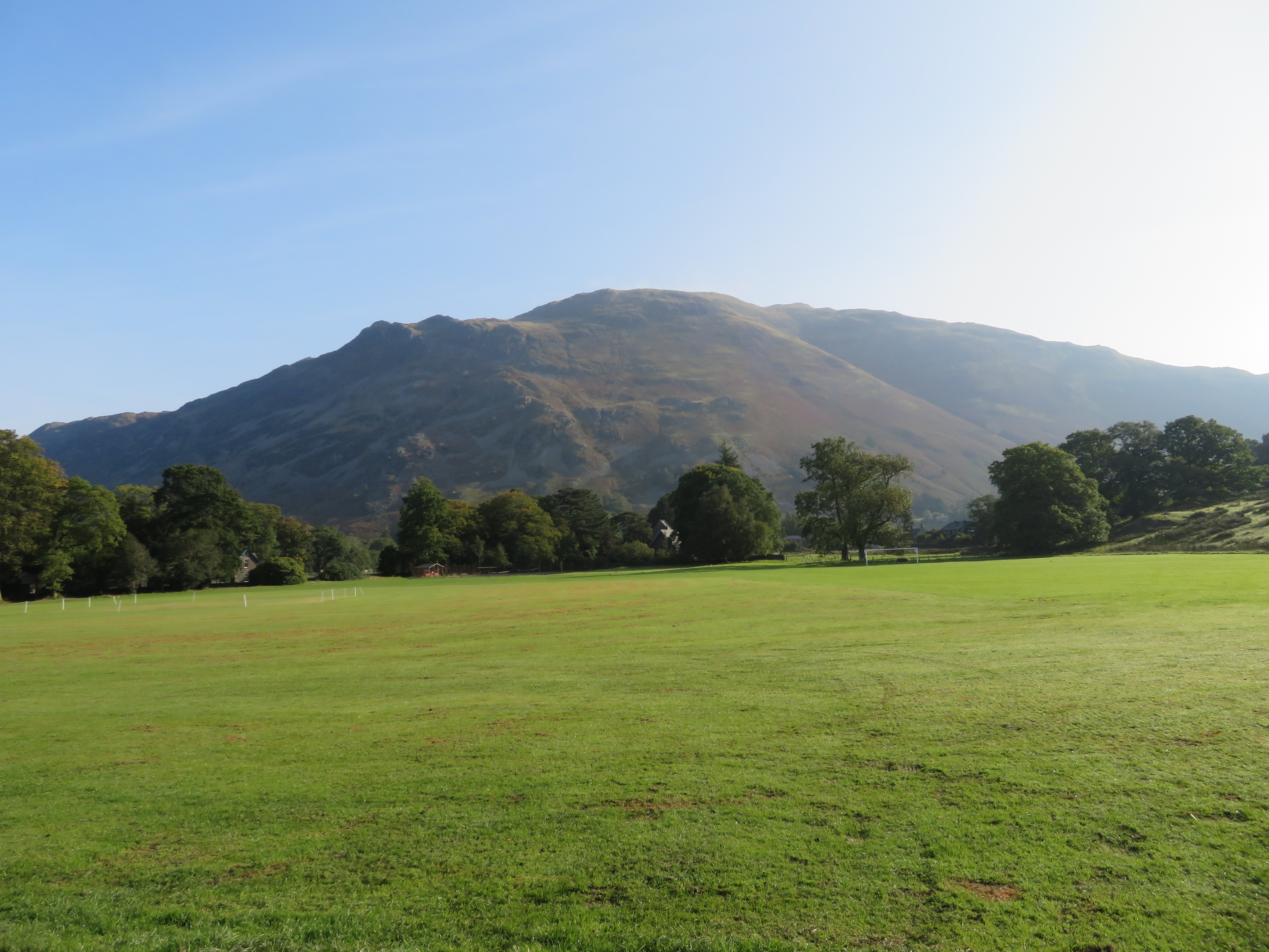 Place Fell from King George V Playing Field Patterdale
Turning left out of the car park saw us walking along the lane into Grisedale where we turned roughly north to walk over the bridge, past Waterfall Wood and climbed the short grassy bank to the sounds of the barking hounds from the nearby kennels over to our right. Passing through the wall we then took the regular path southwest to more or less follow the line of the beck right up to Grisedale Tarn. With green pastures below and high fells rising on either side there was no way it was going to be a boring walk as there is much to take in on the walk through this dale.
 A view along Grisedale
 Despite the blue sky a brisk cool breeze kept us going at a decent pace with the high crags getting increasingly larger as we closed in on Nethermostcove Beck and a glimpse into Nethermost Cove high up the fellside...
 Nethermost Pike behind Eagle Crag - High Crag and Dollywagon to the left
 with Ruthwaite Lodge now just about in sight where would have our first break in about 30 minutes time. After just a few more metres of gentle climbing a look back along Grisedale gave us a view of Place Fell blocking any further view in that direction. The coming of autumn is now obvious by the swathes of dead or dying bracken with just a hint of brown and gold on the leaves of the trees with some giving up their short lives for an early release as they flutter down to the ground to end up as nourishing mulch and so continue the circle of life in these beautiful dales and valleys of Lakeland.
 View along Grisedale towards Place Fell
 Arriving at the Lodge we had a welcome break chatting and enjoying the views although didn’t linger too long as the breeze was by this time quite cold, encouraging us to fuel up, drink in the views and continue on our way. It would be another 45 minutes of walking and photo taking before we arrived at the tarn where wisps of cloud were drifting over the summit of Seat Sandal. All was peaceful with one or two couples sat down relaxing as we were to do also. The water was a steely blue, a reflection of the sky mingled with the dark of the water with the breeze causing endless ripples across its surface.
Grisedale Tarn is the legendary resting place of the crown of the kingdom of Cumbria after the crown was conveyed there in 945AD by soldiers of the last king, Dunmail, after he was slain in battle by the combined forces of the English and Scottish kings. The tarn lies at an altitude of 538 metres – 1,765 feet – and has a maximum depth of about 33 metres – 108 feet. It has in its waters brown trout, perch and eels, although I have never seen anyone fishing there.
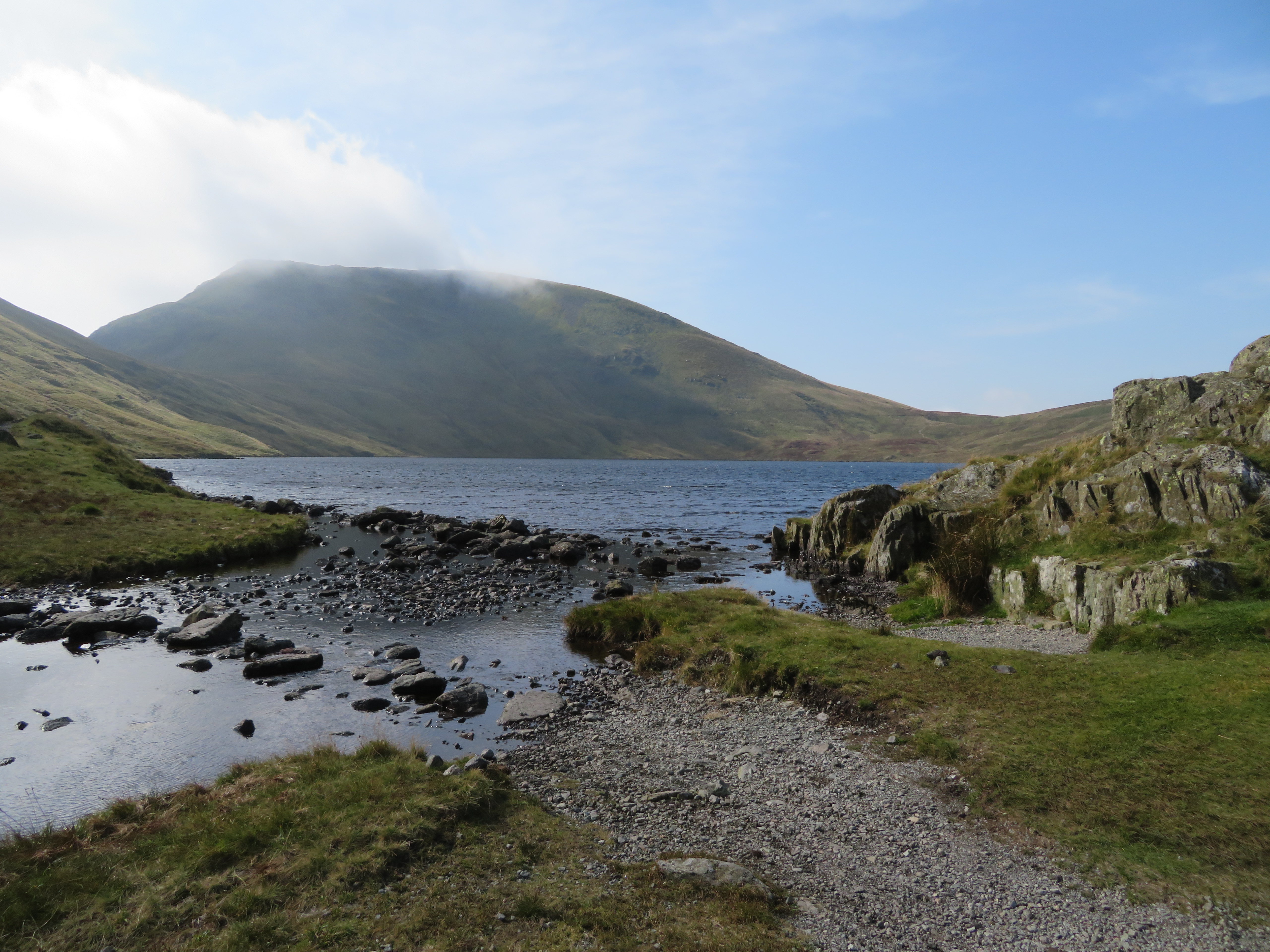 Grisedale Tarn and Seat Sandal
 All three of us have visited the tarn in the past, E has climbed the next three fells before, Martin hasn’t, and neither has left the tarn by the route up to Deepdale Hause before so we stopped for another break so that they could have a good look at the route to come. We tucked in behind some rocks that afforded some shelter from the strengthening wind, chatted to a few other likewise walkers and then set off for the gully that would lead us directly to Deepdale Hause.
 Setting off for St Sunday Crag
 The path is good, undulating and easy to follow apart from one short low wet area where it all but disappears into the soggy grass but a few long strides soon got us over this and back on more solid ground and a series of photo’s along the path may give an indication of what the route and some of the views are like.
 Grisedale view from below Cofa Pike
  A good path all the way
  Grisedale Tarn
  Tarn Crag and Falcon Crag below Dollywagon Pike
 We passed through a hollow full of shattered rock.
 St Sunday Crag ahead
 At about the 600 point and NY356 123 the path splits with the right hand one taking off to make a steeper climb up to a point just higher and south of the hause and nearer to Cofa Pike but we would stay on the lower one that would have us arrive at the lowest point of the hause. The alternative can be seen rising above ours as it climbs up through the crags.
 Alternative path junction just here
  Heading for the gully at Deepdale Hause
 The way along the gully is easy enough with some loose stuff and a bit of mild scrambling in a couple of places in the centre section but all in all a good way to go.
 Start of the climb up the gully
  Dollywagon Pike above Tarn and Falcon Crags
  A splendid view of the Helvellyn group of fells
  Getting near to the ridge
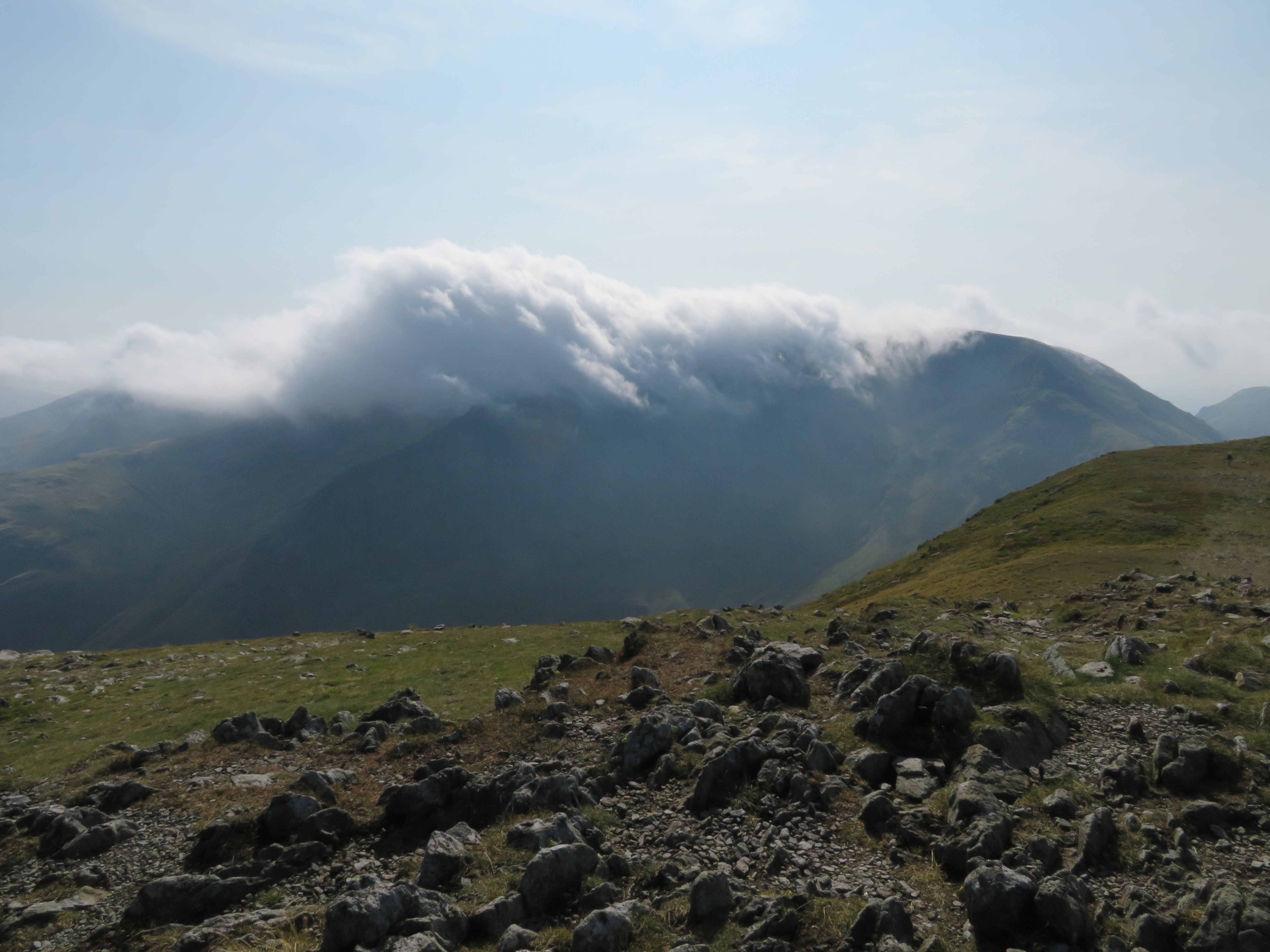
 We arrived at the ridge to open views all round apart from the Fairfield side where there is nothing to see but the steep and craggy faces of Fairfield and Hart Crag and a touch of Dove Crag, or we would have but for the ever moving cloud formation that dodged along their tops none stop for the duration of our sight of them. At least Cofa Pike was clear of clag.
 Cloud over Fairfield and Hart Crag
 So now began our long climb up to the summit of St Sunday Crag with its fairly easy slopes and three false tops giving the unwary dashed hopes of an early end to the climb to the summit cairn.
A fantastic view into Deepdale and the long ridge back of High Street and Hartsop above How can be picked out on the way up.
 Deepdale with Hartsop above How and High Street behind
 Grisedale Tarn below Seat Sandal and the long climbing path to it can be seen below Tarn and Falcon Crags of Dollywagon Pike fame.
 Grisedale Tarn between Seat Sandal and Dollywagon Pike
Helvellyn and Striding Edge was next on to be seen clearly enough and the main reason that I took this photo was to show the fantastic dry stone wall that climbs out of Grisedale bending and curving its way up the fellside to come to a conclusion at the famous ‘Hole–in–the-Wall’, well a conclusion if it is not to be related to the wall that then runs on to Striding Edge to the west and along and around Birkhouse Moor to the east. Now that’s a wall.
 Helvellyn and Striding Edge
 At 750 metres and halfway to the summit a glance back showed no real movement of cloud from off those other Eastern Fells.
 Cloud over Hart and Dove Crags
  Cloud drifting on and off Fairfield
 We arrived at the top to find a wind strong enough to hinder the taking of photos as it was with sturdy legs that I had to brace myself as much as possible to try and keep myself and camera still. But the views were still as magnificent as before and we could now see into Nethermost Cove - a place I have yet to visit - lying below Striding Edge.
 Nethermost Cove below Striding Edge
  Southwest towards Seat Sandal
 And that pesky cloud over Fairfield.
 Eastern Fells cloud magnet
 And of course the summit evidence photo.
 St Sunday Crag summit
 The view across to Hartsop and beyond was just amazing with another cloud bank over High Street that hasn’t made much movement all day.
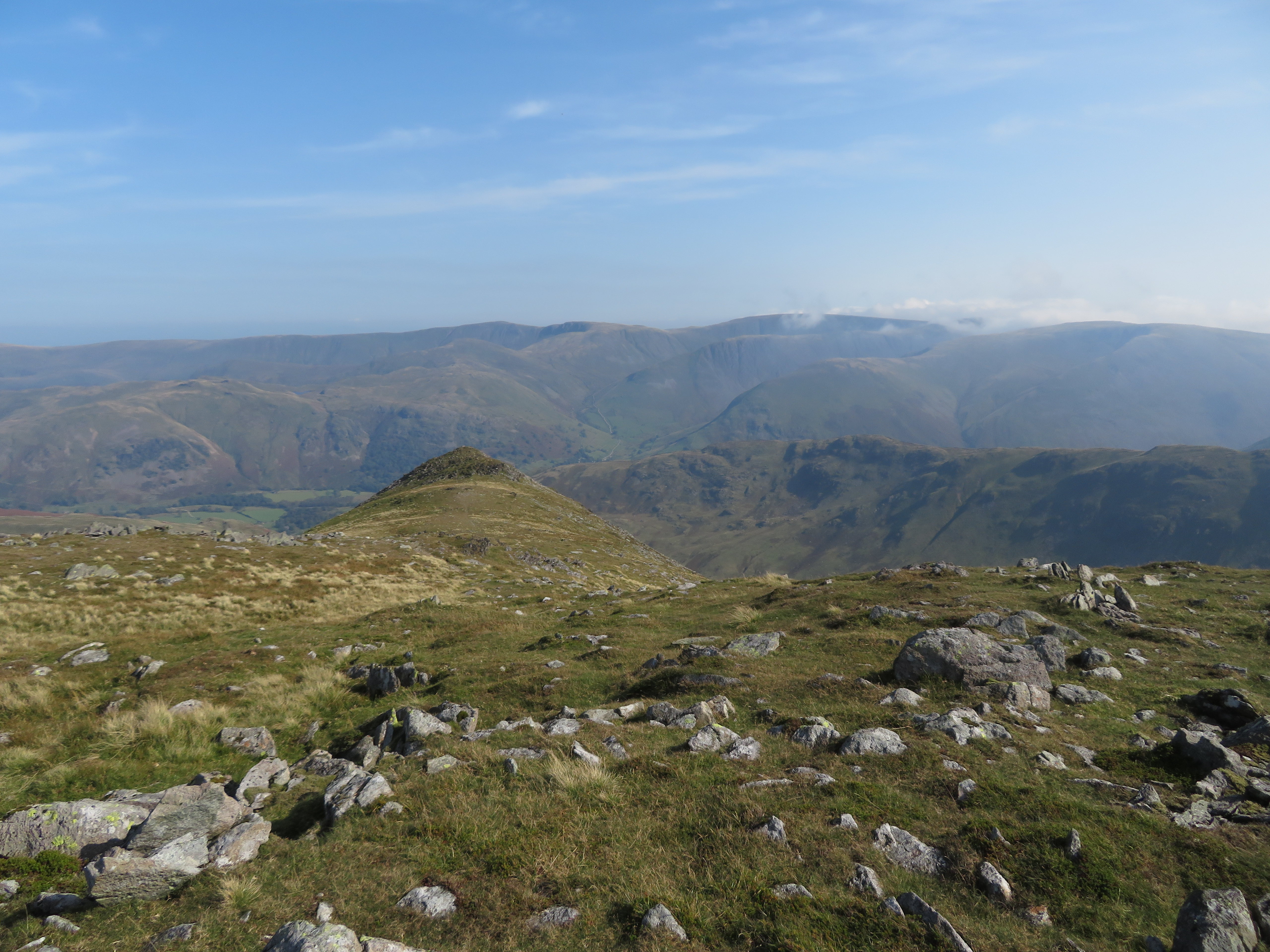 Some Eastern Fells behind Gavel Pike
 We could now see the large rounded bulk of Birks and the path to its summit and meagre cairn plain to see.
 A northern view from St Sunday Crag
 We left this top to now make our way down to Birks.
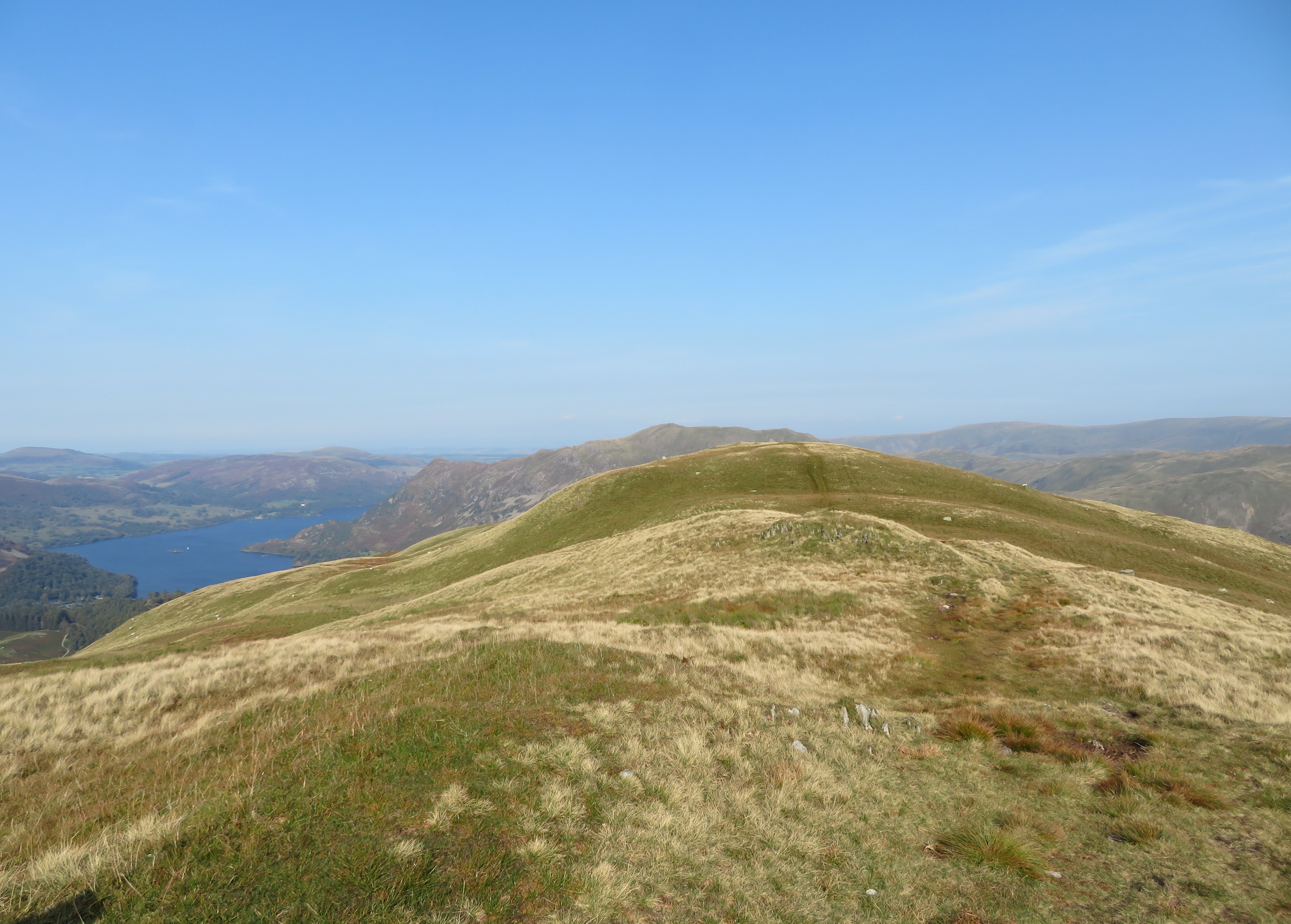
 A view across to Hartsop
  Grisedale greenery
 A good steady descent saw us taking the easy path to the summit of Birks where a few light coloured stones mark the spot.
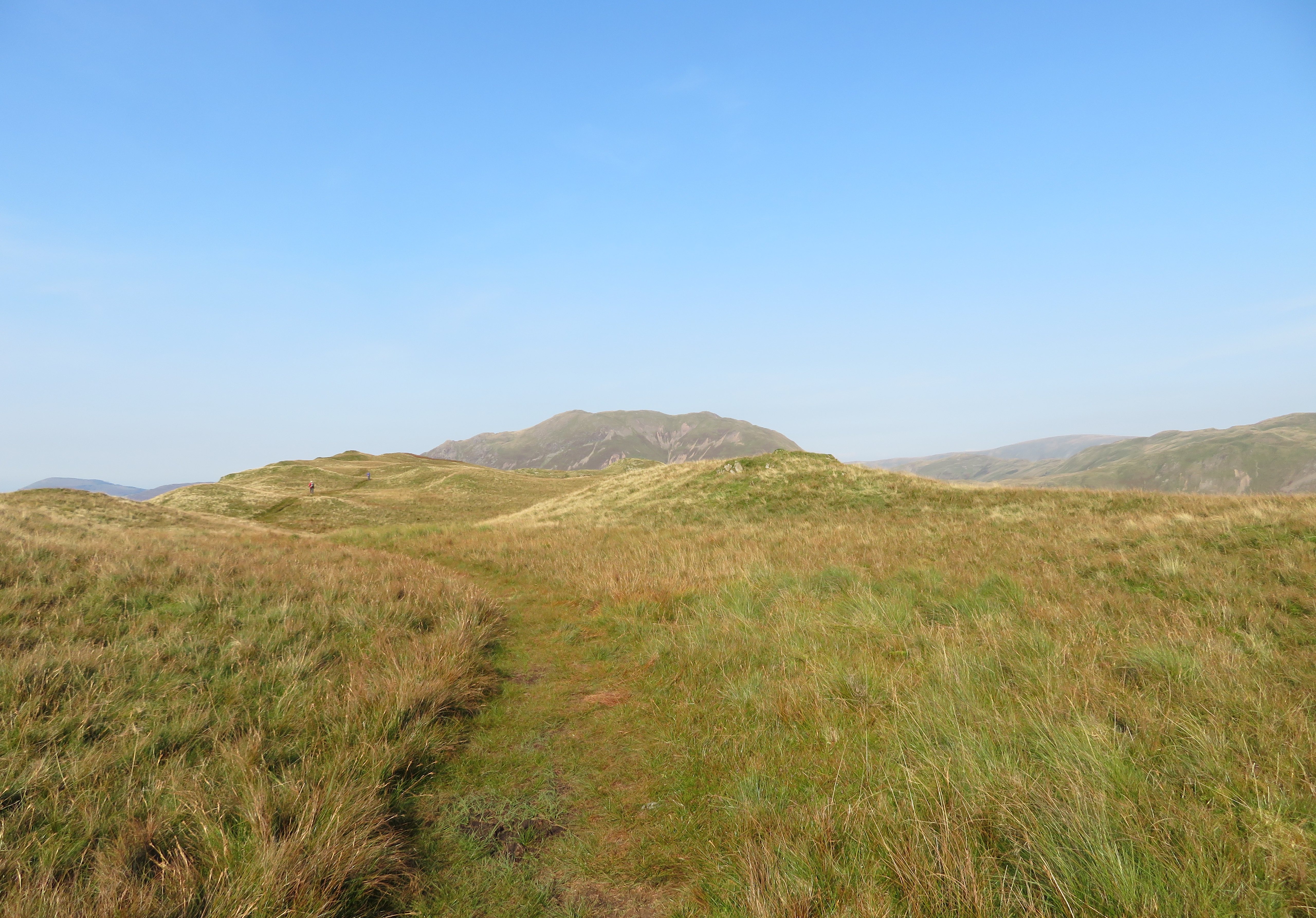
 Birks summit in view
 From this viewpoint we now had a great view of Ullswater, Patterdale and Glenridding and it’s hard to stop taking photos when faced with beauty such as this before us. Where to look, what to take, what a dilemma. Sod it, take it all and sort out later. We didn’t take either of the regular paths down as we were to take an unmarked - on the OS Map – path down the southeast face that would put us at Trough Head and a good position to walk to Arnison Crag our last hill of the day. We continued northeast for a short distance and then picked up the faint path at NY383 145 initially going south for a few metres where it splits with one going off to the left – E and Martin took this one – whilst I took the one going over to the southeast before swinging back northeast towards the wall that runs all the way down to Trough Head.
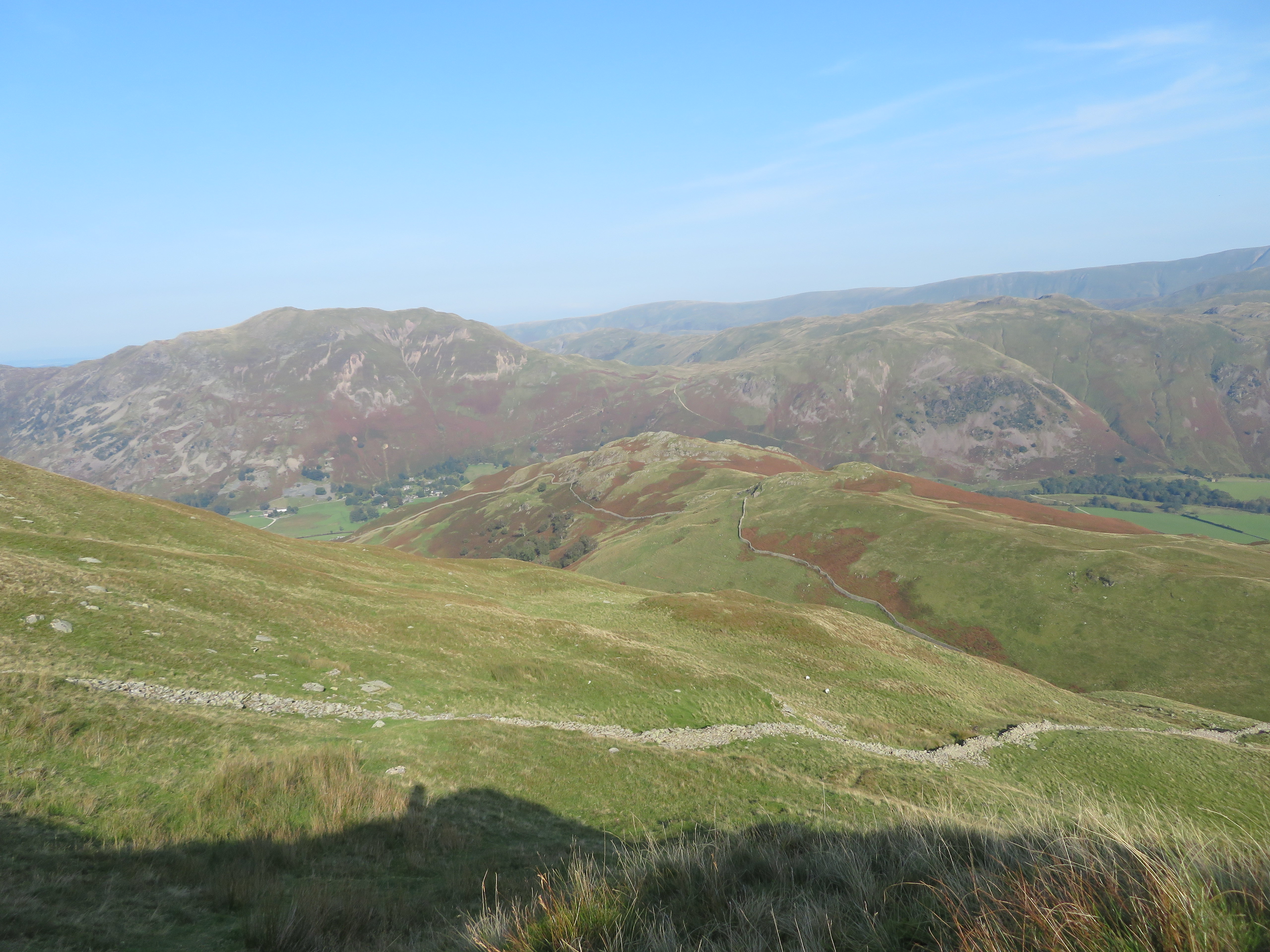 Place Fell and Angletarn Pikes behind Arnison Crag
 I met up with the others at the wall to follow the path to the head of Hag Beck, down into the Trough and climb out the other side to follow a well seen path towards Arnison Crag.
 On the way to Arnison Crag
 Fifteen minutes later and we were stood on the summit of Arnison with the most fantastic views all around. I’ve been here quite a few times in the past but I don’t think that I have had better views than I have today, what a bonus to an excellent near end to a walk.
 Hartsop view
 The views were absolutely brilliant and I’m afraid that I couldn’t give them justice with my camera but I’ll take what I’ve got and enjoy them anyway. I took many photos of Ullswater and surrounding district and two shots of them from different locations are shown below with the first one from the summit.
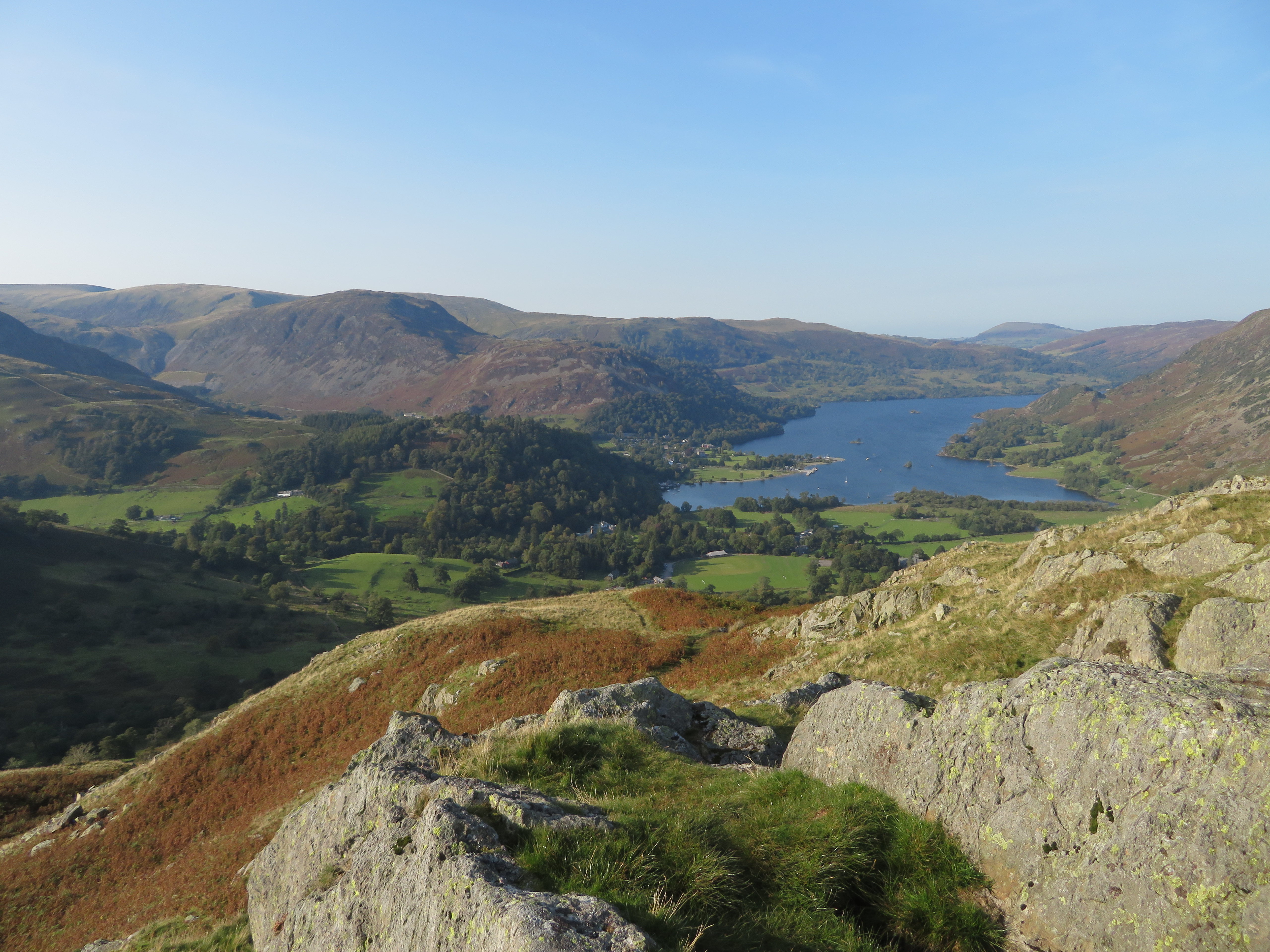 Glenridding
 This next one was taken from the rather steep path that drops down behind the Patterdale Hotel and in fact if following it to its termination would find you at the back door of it but at about the 180 point we turned off at NY393 157 to take a path through the trees and rough pasture to find ourselves back at the car park.
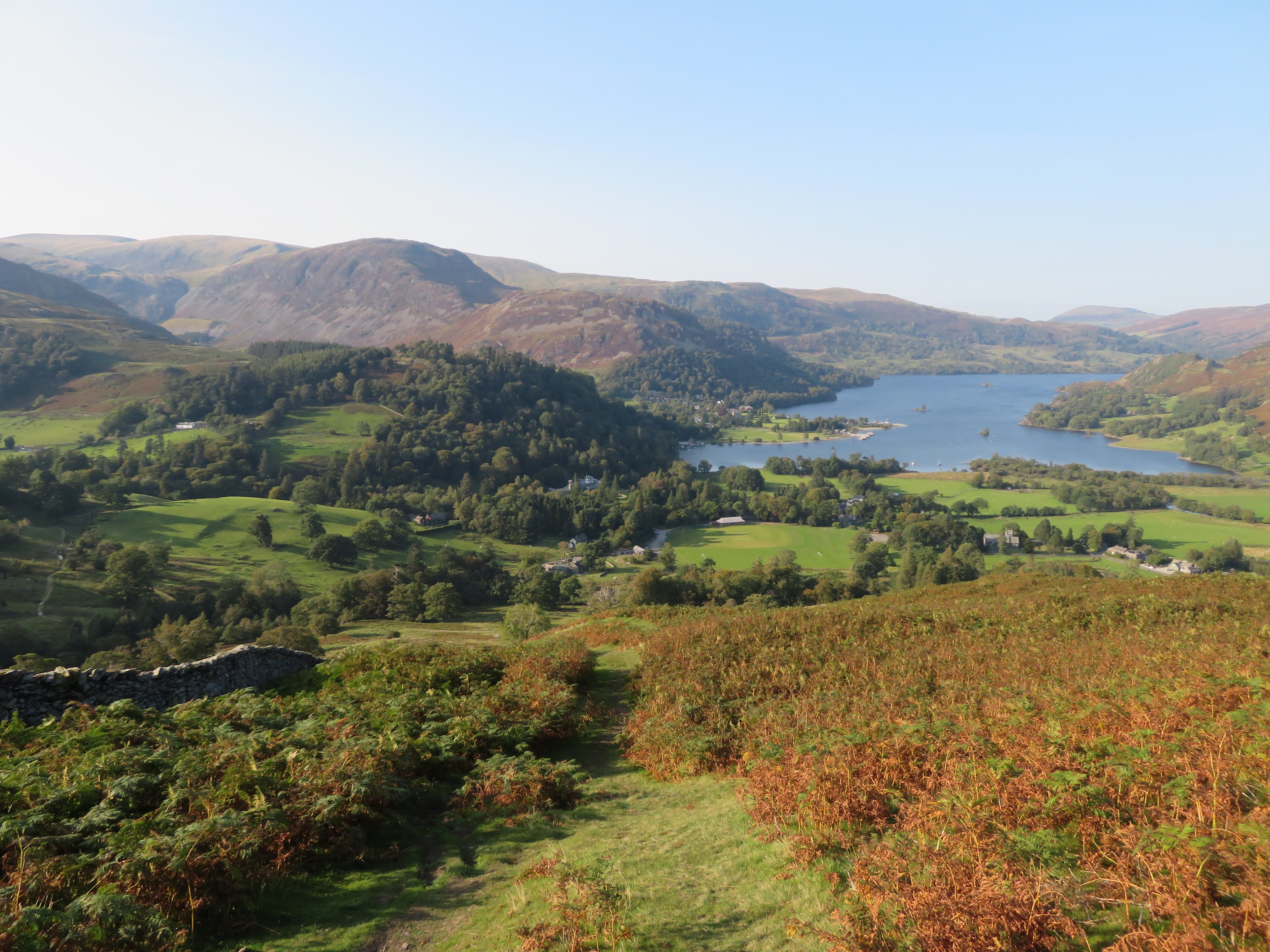 An early autumnal view across Glenridding
 All walks are good with some being better than others and this one is on the short list of those better ones especially with the weather and clear views that we had.
