free to be able to rate and comment on reports (as well as access 1:25000 mapping).
Well, we were in Borrowdale once again just 2 weeks after we had to change our plans for this walk due to the nature of the weather conditions on that day to the lower, though no less interesting wet autumn walk and one that was scenically productive in its autumnal beauty. The walk today would take us from Grange once again and steer us across the lower east side of Maiden Moor, onto High Spy and then return by the confines of Tongue Gill and Rigghead Quarries, again, a route that I haven’t done for quite some time.
The roads were quiet on our journey to Grange as was the small car parking area that is just on the right as the bridge is left behind and is set between the Village Hall and the River Derwent with just enough room for around 6 cars if parked sensibly. The skies were grey with low cloud as we set off but as we got nearer to Grange the sky began to show signs of blue so we could only hope that things would at least stay that way or preferably, improve, with only the hint of a cold wind that could only prove to be a nuisance at times.
Once parked up and wrapped up against the chill of the wind we were off through the village along the metalled lane that would take us to the Borrowdale Gates Hotel and the gate that would give us access onto the area of Swanesty How.
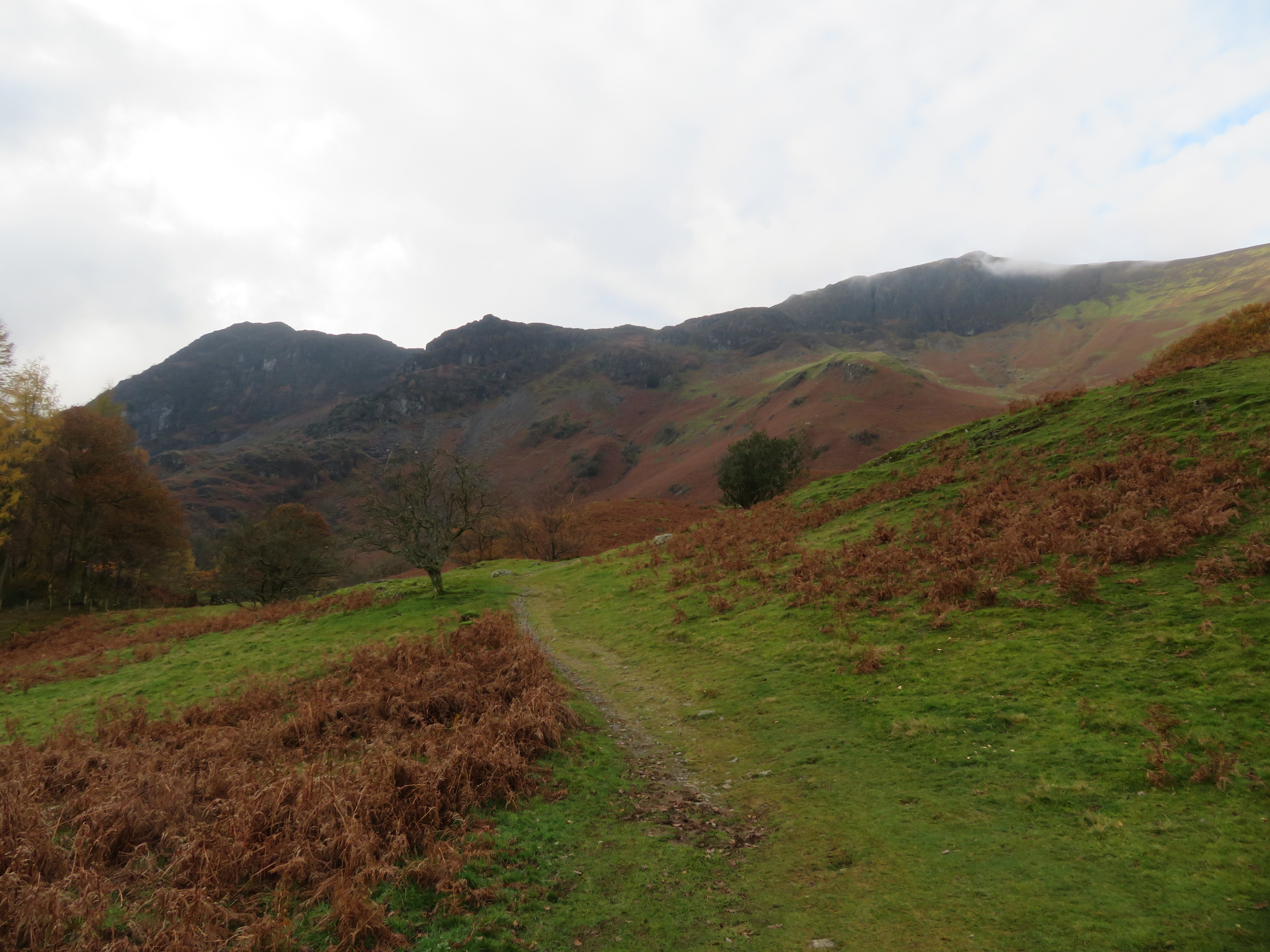
Facing us as we walked along the lane was the autumnal and multicoloured east flank of Maiden Moor with Cockley How and Nitting Haws stuck to its sides like limpets with the long line of Blea Crag on the skyline.
 Grange with Nitting Haws and Blea Crag background
 The hotel is a large sprawling affair, looking rather austere but comfortable as it sits there in the Jaws of Borrowdale.
 A view towards Borrowdale Gates Hotel
 Passing through the gate onto Swanesty How we made the short climb up the bank from where we had a decent view of our way forward and another across Grange...
 Blea Crag and Nitting Haws behind Cockley How
 King's How behind Grange
 and then across to the small Sewage Works from where we passed through another gate onto the fellside proper from where we walked along a path that passed across some fairly wet ground towards Greenup Sikes with its rocky cleft and waterfalls and from where the path begins its climb up to the green topped Cockley Hows.
 Greenup Sikes and Cockley How below Blea Crag
 From the foot of the sike I took a photo to the north, one that I took at various stages and heights of the walk up to Nitting Haws so I will take the opportunity and cast my apologies for repeat views to the north now.
 North and a hint of Derwent Water from 140 metres
 A few metres higher and I could see into its rocky confines with its little copse of trees trying their best to hide the small waterfalls away from prying eyes, just now that’s not possible but in summer it must be like a secret haven to small animals and birds alike and is just one of a few similar ones that are scattered hereabouts.
 Tree lined cleft of Greenup Sikes
 The sky was a beautiful shade of blue with a large scattering of clouds with bright sunshine that did nothing to alleviate the coolness of the strong breeze when not walking. The path up to Cockley How is green and plain to see as it makes its way through the lower areas of brown bracken, fairly well graded for the most part but with a couple of steeper sections as height is gained.
 North towards Derwent Water and Walla Crag from 160 metres
 A glance towards the upper reaches of Borrowdale from the same spot showed a lovely fan of light rays that aren’t shown to their best in this photo.
 Light rays in Borrowdale
 The path continues as described above and the next series of photos unfold the surrounding landscape as height is gained and Cockley How is reached.
 North towards Walla Crag and Bleaberry Fell from 210 metres
  A view across Grange
  Borrowdale comes into view
  Blea Crag
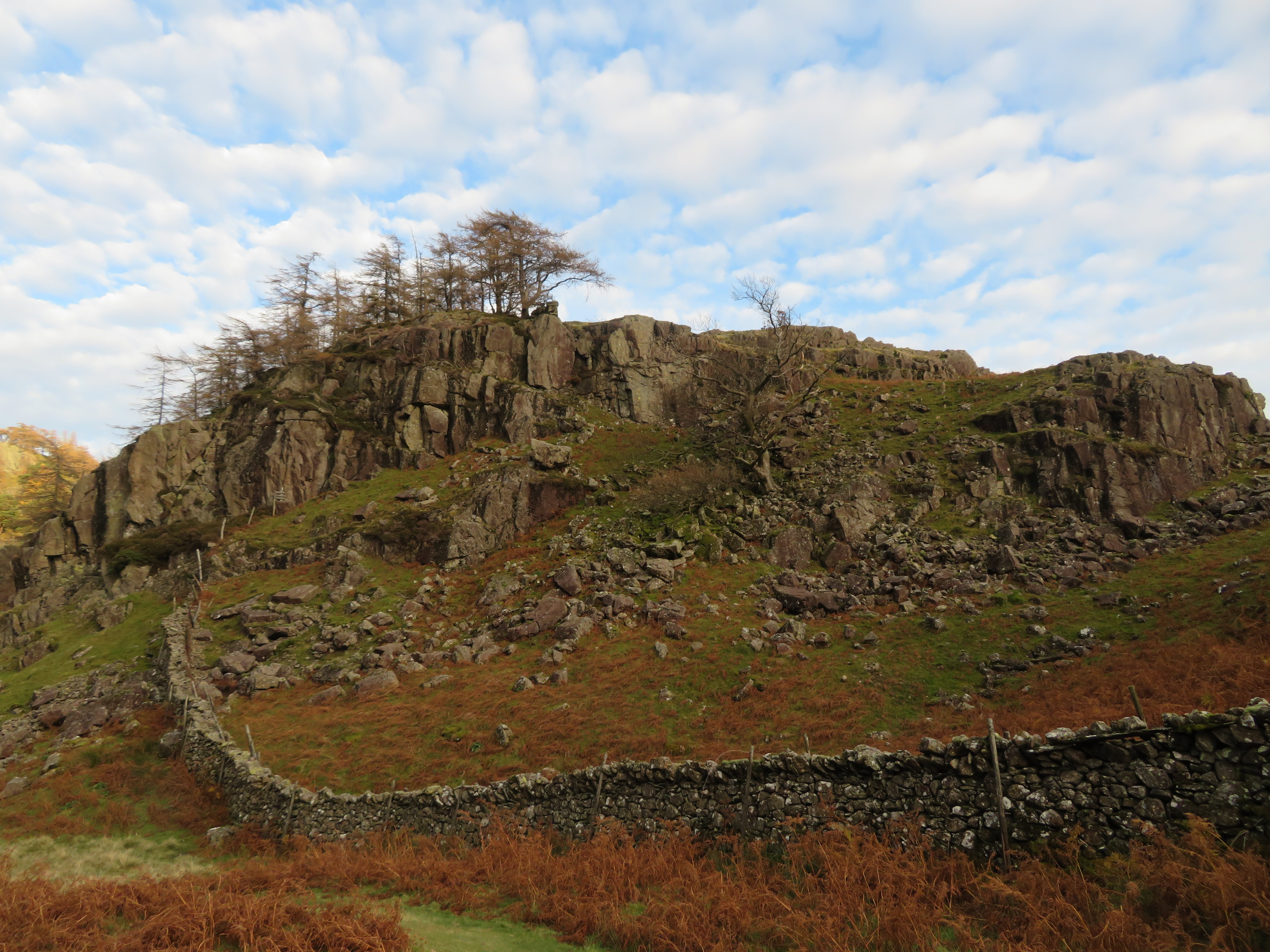
 There is a small area of scree just prior to reaching the top of Cockley How but poses no problems at all.
 Northern view from the top of Cockley How at 340 metres
 Cockley How is fairly flat on top and has a small pile of boulders on it that appear to form the shape of a square wheel but apart from that there are no other redeeming features apart from the remains of an old sheepfold sat further back below the crags.
 View south into Borrowdale from Cockley How
 From this spot we could now see our way towards Nitting Haw that is by way of a somewhat stony path that rises steadily below the crags of High White and Low White Rakes towards the top of Nitting Haws.
 Our path passes below the crags
  Blea Crag from Cockley How
 As we have gained height so the surrounding fells have opened up around us and although the views are rather similar in nature over to the north the eastern and southern fells are beginning to come nicely into view. The pile of square rocks can be seen in the next photo.
 Walla Crag and Bleaberry Fell from Cockley How
 It had been a nice steady climb up to this point keeping us nicely warmed up without breaking into a sweat even though we had been sheltered from the wind once behind Cockley How. After a few minutes of lingering for photos we set off along the path to Nitting Haws. This path is good though a bit rough underfoot in a couple of places with a bit of exposure whilst crossing above a short section of scree.
 Path to Nitting Haws
  Maiden Moor background
 About 15 minutes of careful walking had us nearing the top of Nitting Haws.
 Top of Nitting Haws
 And this is where we had a break and a look at the world around us.
 Time for a break on Nitting Haws
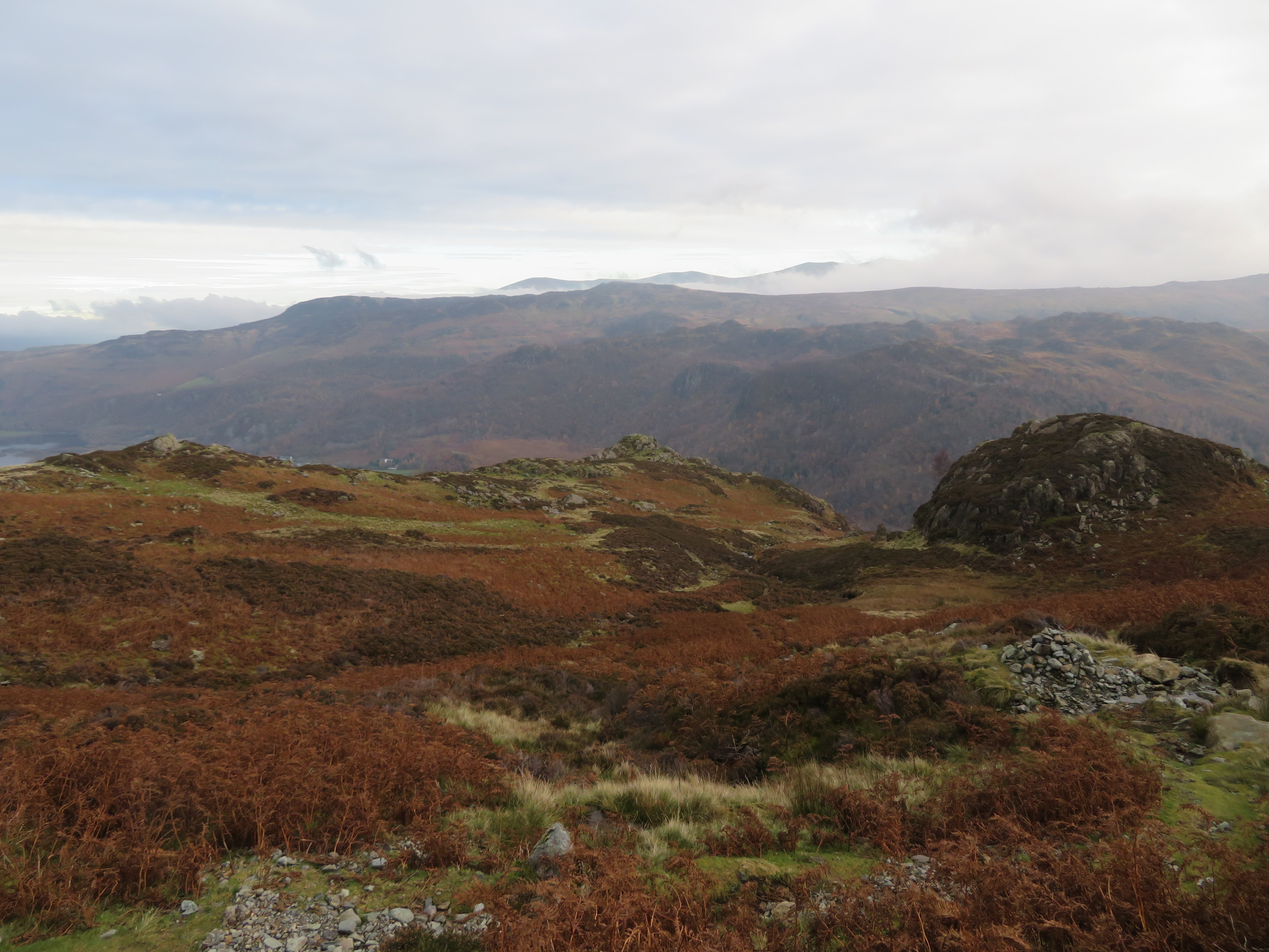
  Borrowdale behind High Steel Knott
 The clouds were down again just now but they would move away over the next half hour or so to give clearer views than what we had just now. It was cold and windy on top of the Haws but tucked away amongst the summit rocks we were warm enough as we surveyed and contemplated our next section of climb onto Maiden Moor.
 Our way is west towards Maiden Moor
 Again the path is right enough as it passes through heather in the lower reaches with lots of wet and sticky ground to contend with after the night’s rain, some stony areas and some where the heather pulls at the boot laces. This lower part of the path is by far the worst bit. We saw a couple near running down – no, not fell runners - and how they didn’t injure themselves must have been down to plenty of good luck on their part.
As we started the climb we spotted Joe Bank’s Fold over to the south tucked away amongst the rocks and heather and if not looked for can easily be missed. It is so well camouflaged that although we could see it was an old fold I can’t pick it out in the photos that I took from the path.
A few minutes after setting out again a look back gave us a view of the cloud covered eastern skyline that would reveal itself properly a short time later as the clouds lifted.
 Nitting Haws and a view east
 The climb along the path is steady enough but is variable in its nature.
 Quite a rough path
  Minum Crag to the left
 The path leaves the rough behind at about where we passed Minum Crag and is now on grass passing over easy ground with the steepest part of the path over and done with. The cloud had lifted over the eastern fells giving us a view of the complete skyline ridge from Clough Head to Fairfield and even the small hump of Calfhow Pike could be seen.
 Clough Head to Fairfield skyline
 We met the Maiden Moor ridge path at approx the 620 point from where a look to the north showed only a slight movement in the clouds over the northern fells.
 North towards Blencathra
 A short walk and gentle climb south and a fair lump of the north western fells was on show with the top of Grasmoor, Hopegill Head and Grisedale Pike showing behind the southern half of the Coledale Round walk that is behind the lesser heights of the Ard Crags to Knott Rigg ridge, a most delightful view.
 North Western Fells skyline
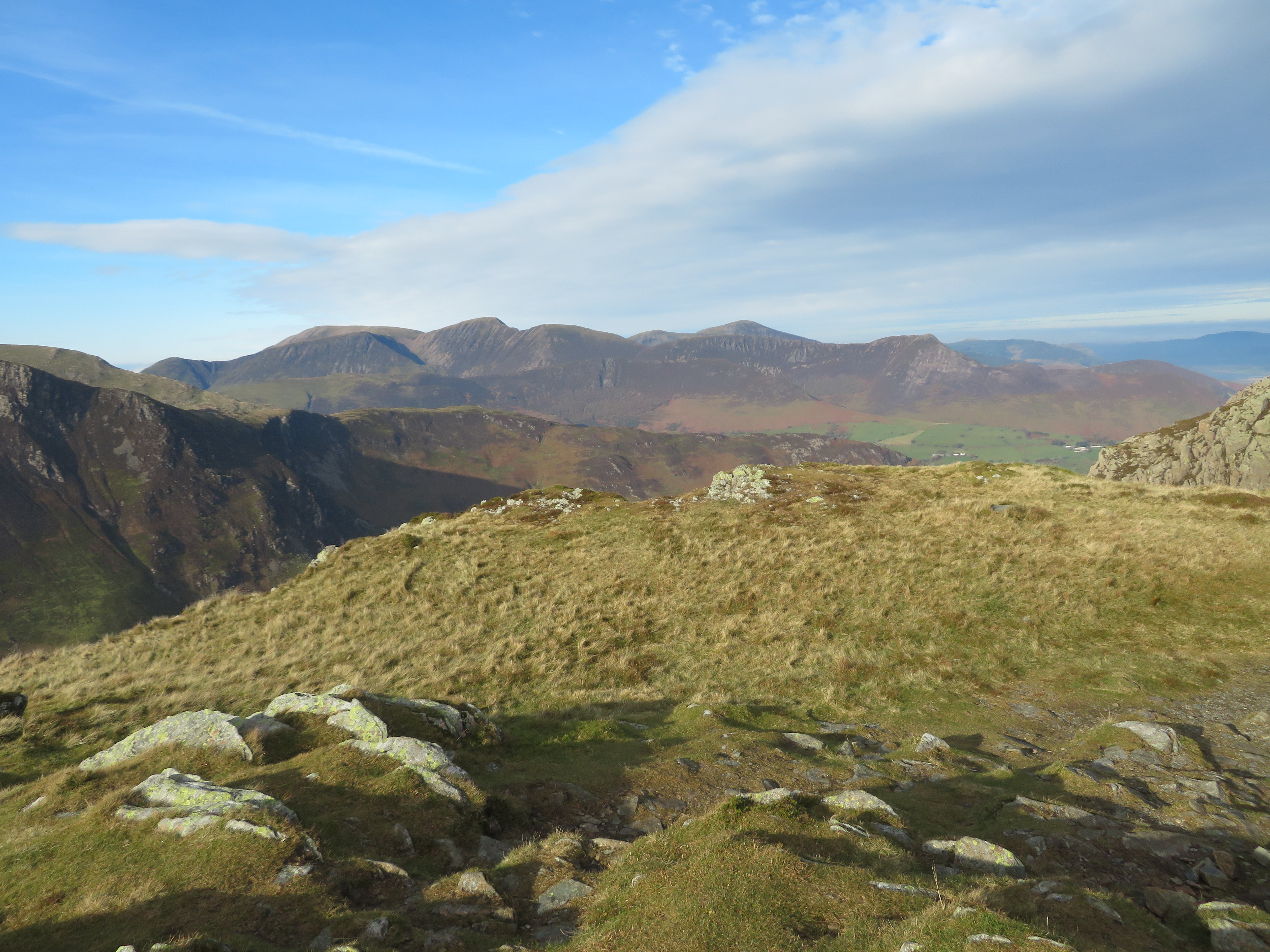
 On our short approach to High Spy where the sun was beaming out of a beautifully blue sky we had a great view of some of Lakelands finest of its southern and western fells with Great Gable and Dale Head having the most unusual cloud formations hovering over them. We were surrounded by a plethora of high fells.
 Great Gable and Dale Head cloud formations
  The Hindscarth ridge from High Spy
  High Spy with Skiddaw and Blencathra background
  Harrison Stickle behind Thornythwaite Fell
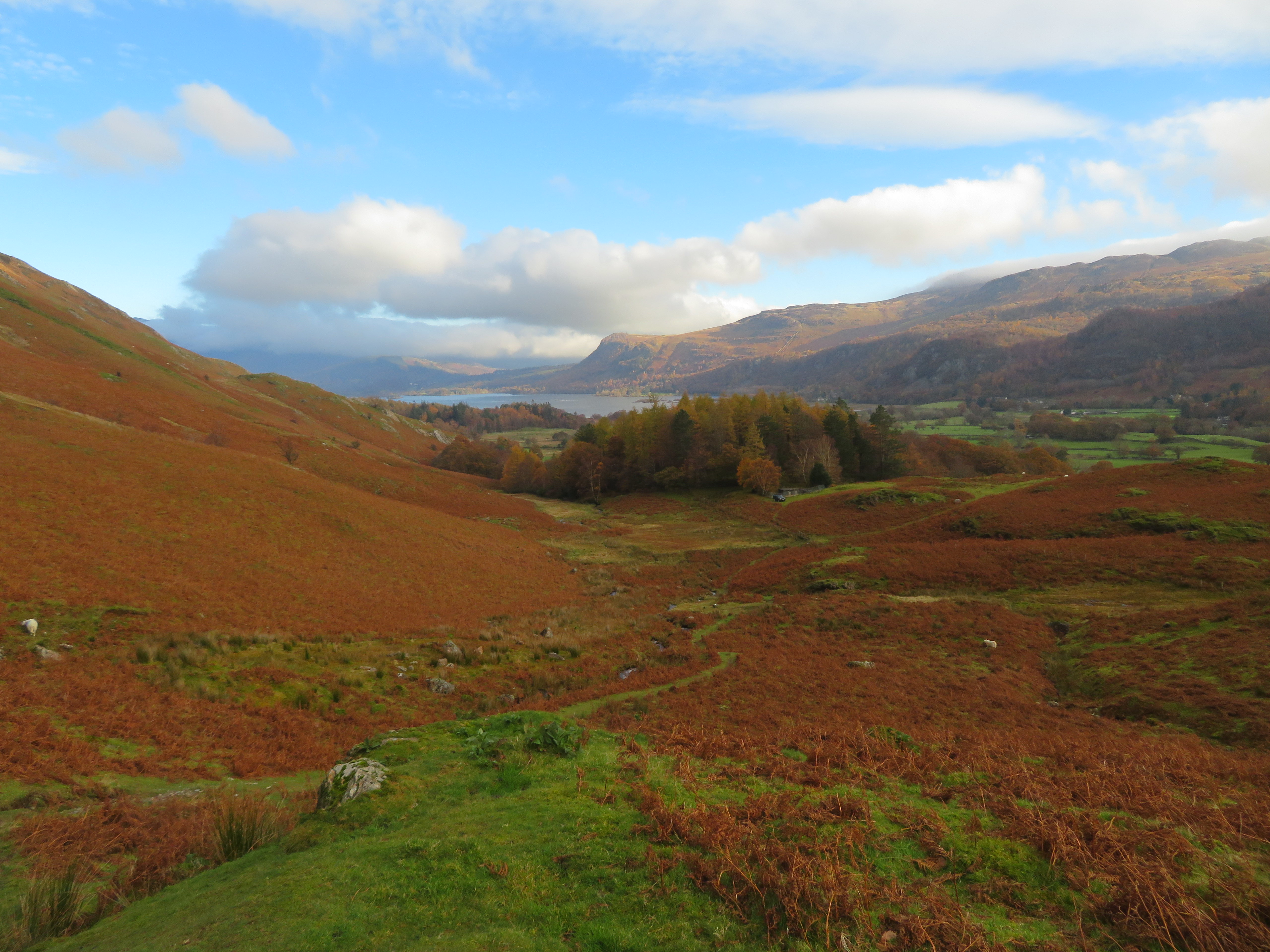
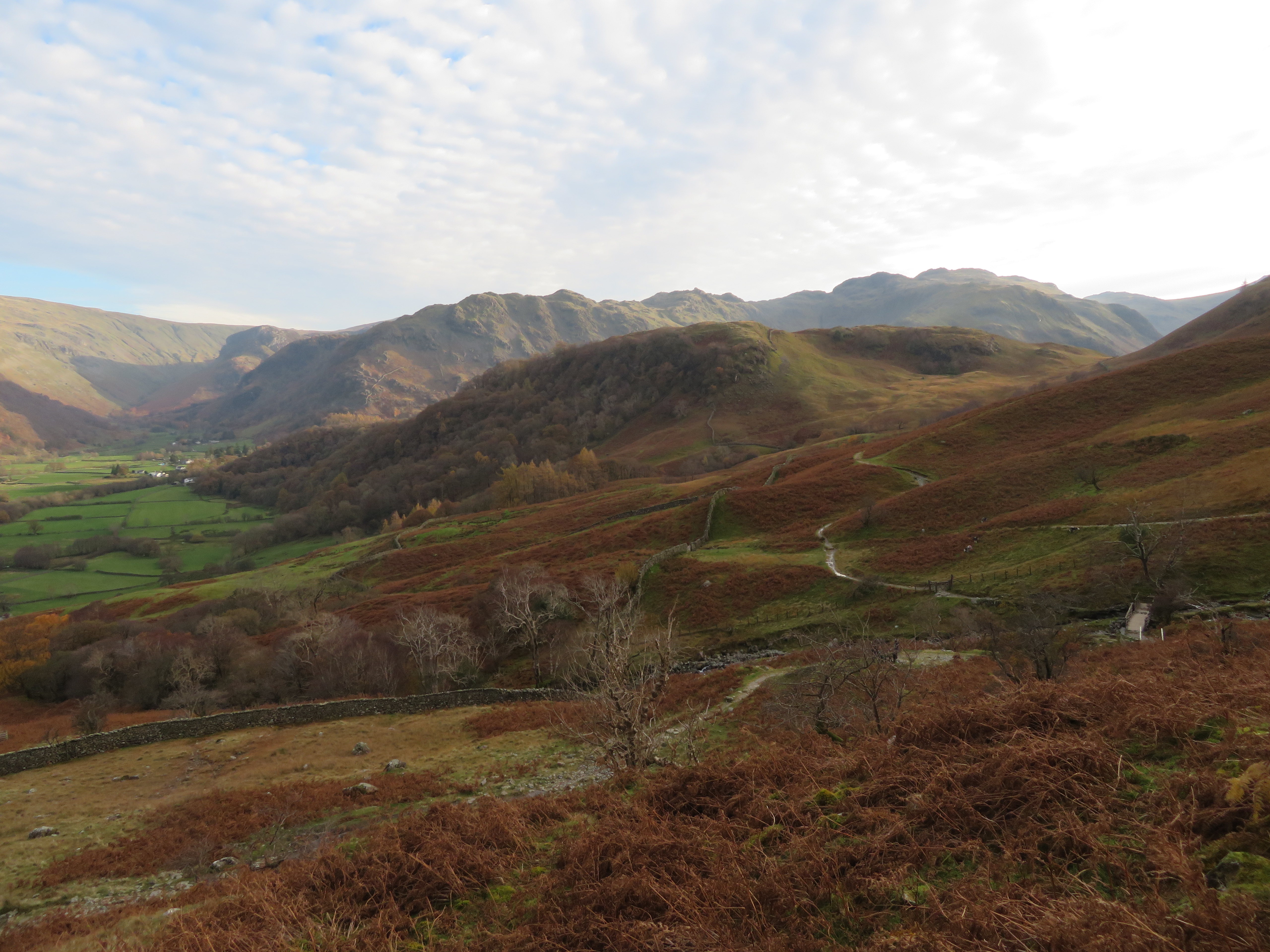
 We had another break sat on some rocks on the east side of the fell whilst enjoying the views across Borrowdale and surrounding fells before setting off to descend down the south end of High Spy to make our way to Wilson’s Bield and the head of Tongue Gill.
 High Scawdel and the head of Tongue Gill
 We was now due for a long drop off through Rigghead Quarries where there is much of interest to see and much loose material on the path in places. The path starts off more or less level before it starts to descend through the old workings passing through massive piles of spoil heaps, typical old mine openings, and much larger ones where the slate has been taken directly out of ground much the same way in Millican’s Caves behind Castle Crag.
The eastern skyline was still with us as was the fells and pastures of Borrowdale way below bathing in sunlight. A beautiful sight indeed.
 An eastern skyline from Rigghead Quarries
 It was a slow descent in places.
 Steep and slippery in places
 At one point there is a welcome set of pitched slate steps that give some respite from the loose stoned parts of the path to those with tired legs.
 A fine set of slate steps
  Borrowdale below Tongue Gill
 I just love mooching around these places of industrial antiquity, of wondering how things were back in the day when these places were full of people toiling away, having to climb up every day in all weathers to earn a few pennies eking out a living best they could. It took us about a half hour to get down to the old paved ford where we crossed over the gill...
 A view up Tongue Gill
 to follow the old track along to the gate and our way back to Grange.
 Great Crag in autumn
  Borrowdale
 This is a good track to walk along and we were soon on our way towards Castle Crag.
 Thornythwaite Fell and Glaramara behind High Doat
 Castle Crag was lit up by sunlight and the clouds were like balls of cotton wool as we also got a sight of a sunlit Skiddaw below clouds of a different type and I couldn’t help but think back to those two weeks ago looking at that same scene sat under a cloak of cloud and rain.
 Skiddaw beyond Derwent Water
 Just to the south of Castle Crag there is an interesting crag of shattered rocks and small trees that should be worthy of a name, but has no such honour as I suppose that it is classed as Castle Crag even though there is a fair drop and distance between the two.
 Unnamed crag
 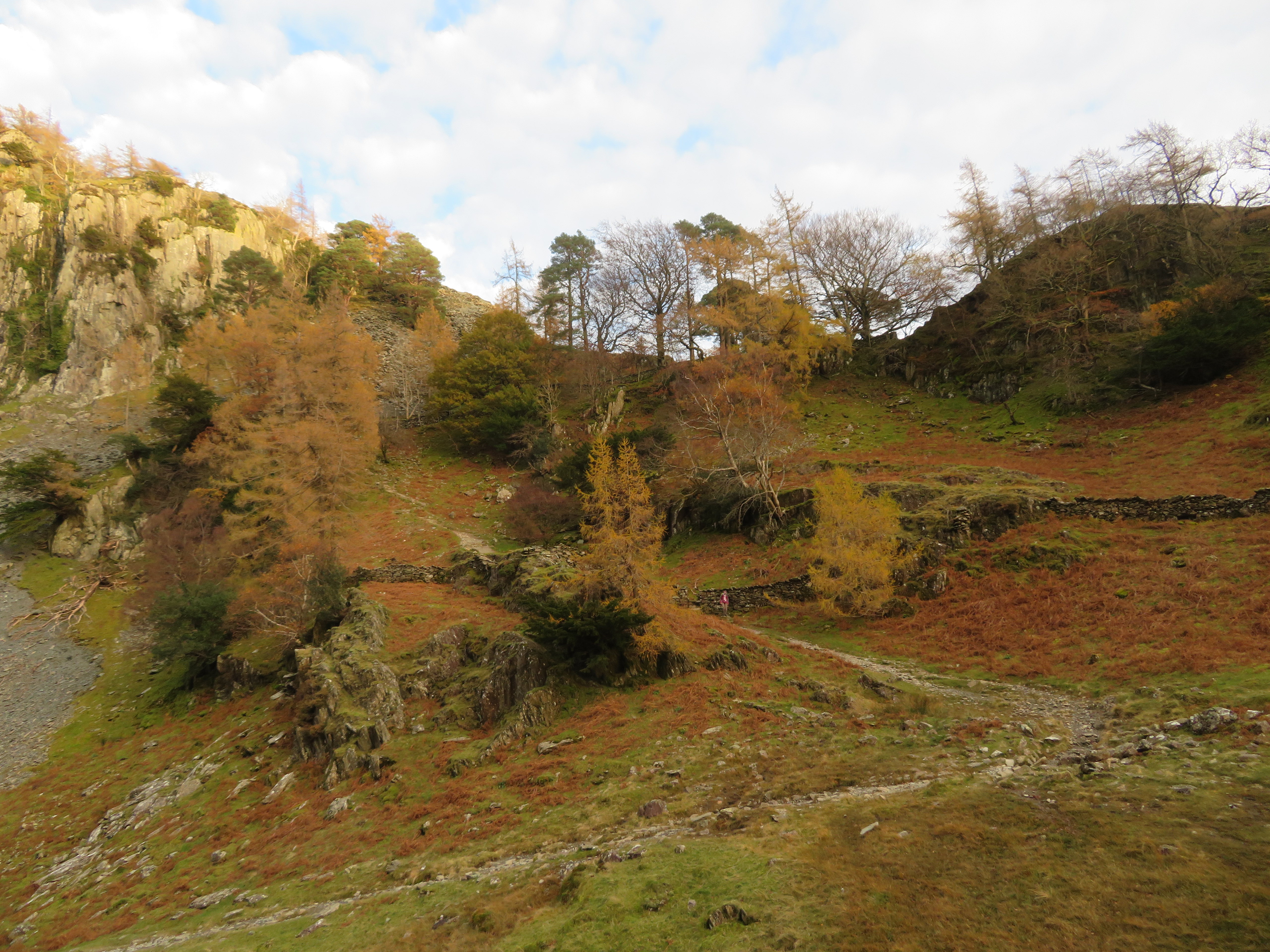 Autumn colours at Castle Crag
 All we had to do now was continue on our way back to Grange along the Allerdale Ramble, through High How Woods and Low How Woods passing below trees that have now lost the best of their autumn splendour. And then we passed under High Steel Knott, Goat Crag, and Nitting Haws with fronts that belied the gentle nature of their grass and heather covered backs.
 Nitting Haws and Goat Crag-High Steel Knott
 It’s always a pleasure to walk in or around Borrowdale be it low level or up in the high fells looking down on what must be one of Lakeland’s finest views. The views from the high fells around here include many fells on all points of the compass including some of the finest in the Lake District. Well, this has been another memory jogging walk and it’s been far too long since I last did it and I think that I may make it a bit of a mission to revisit some of the long neglected routes of mine of the past few years. And what a contrast to two weeks ago when the paths were running with water and we walked with hoods up and gloves on, low cloud, cold wind, and short on views with today being the complete opposite to that one.
