free to be able to rate and comment on reports (as well as access 1:25000 mapping).
Date: 14/09/2021.
Distance: 4km + 10km.
Ascent: 250m + 500m.
Time: 2 hours + 1 hour, 20 minutes.
Weather: Mostly overcast but dry and clear.
Saturday's walk up Red Screes and a short cycle on Sunday had worn Jackie out, so we decided that any walk we did today would need to be short. With that in mind we drove up to near the top of the Blea Tarn road to allow us an easy walk onto Side Pike. This was the only driving we did all week aside from getting in and out of Langdale at either end of the holiday. We were lucky and well placed not to need the car - handy as the Lakes is busier than ever and parking can be a nightmare.
It is a steep but straightforward walk up onto Side Pike from the road, and there is a decent path all the way. Hands are needed on a couple of occasions.
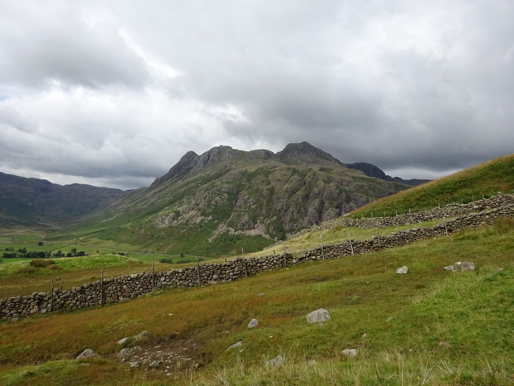 Langdale Pikes from above Blea Tarn
  Bowfell and the Band
 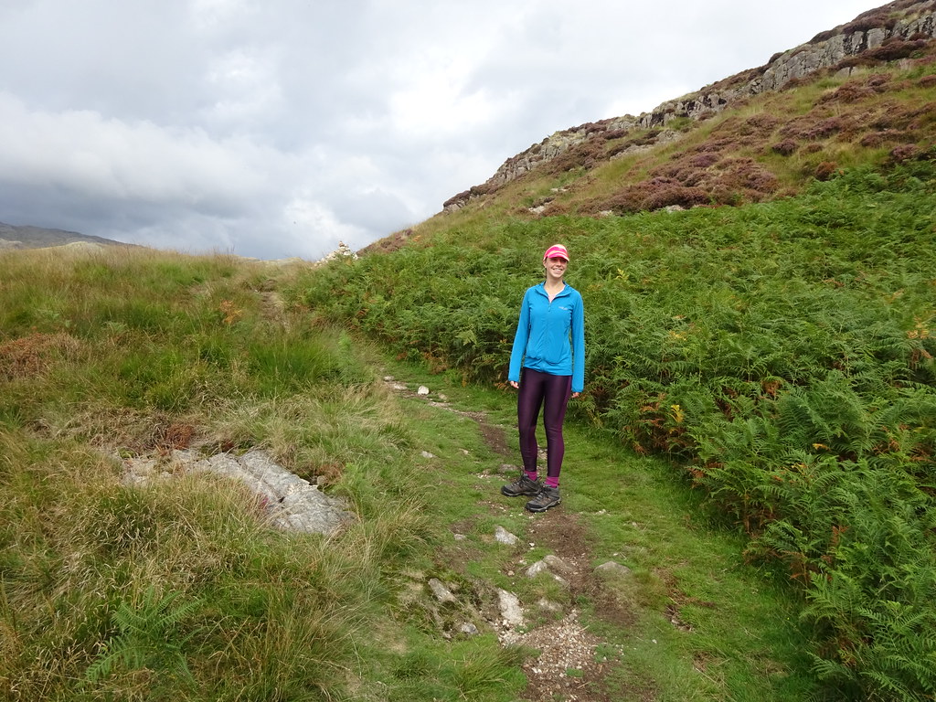 On the way up Side Pike
  Side Pike summit
 We had a bit of a break at the summit before taking the slightly contorted descent off towards Lingmoor Fell. You need to retrace your steps a short way for this before teetering around a corner on a ledge and squeezing round the back of a large spike. Jackie sauntered through but it was a bit more of a squash for me!
 The squeeze on the descent
  Looking back to the squeeze
 We didn't go up Lingmoor, instead descending to the road then walking along to Blea Tarn. Then it was a pleasant stroll back to the car on the path at the other side of the tarn - somewhere I haven't been in about 25 years.
 Langdale Pikes from Blea Tarn
  Side Pike from Blea Tarn
 We managed this without finishing Jackie off. She had some online teaching to do and we were back in good time for that. However I was getting itchy feet while she was working so decided to go out for a run from the lodge.
_______________________________________________
After initially considering a road run without too much ascent in it, I decided to do a loop which would take me up Silver How instead. I knew this would probably kill me but it seemed more appealing than plodding round some tarmac.
As it happened, I started by plodding along some tarmac round the back of the slate quarry and along to Baysbrown Farm. Then it was on gravel and softer tracks until I crossed the river and the Langdale road. I was already puffing but the painful bit was only just starting with a steep ascent up the back of Harry Place Farm. I had to remind myself here that even though I was out for a run I didn't need to run bits like this.
 Langdale from above Chapel Stile
 Good views from higher up as well as a fun path contouring above Chapel Stile around some old mine workings. Some more steep bits took me onto a grassy plateau where I joined a decent path for the last bit to the summit.
 Langdale slate quarry
  A glimpse of Blencathra between Steel Fell and Helvellyn
 Great views from up here, but none of it seemed familiar despite me marking the summit as previously visited. Maybe I never did

.
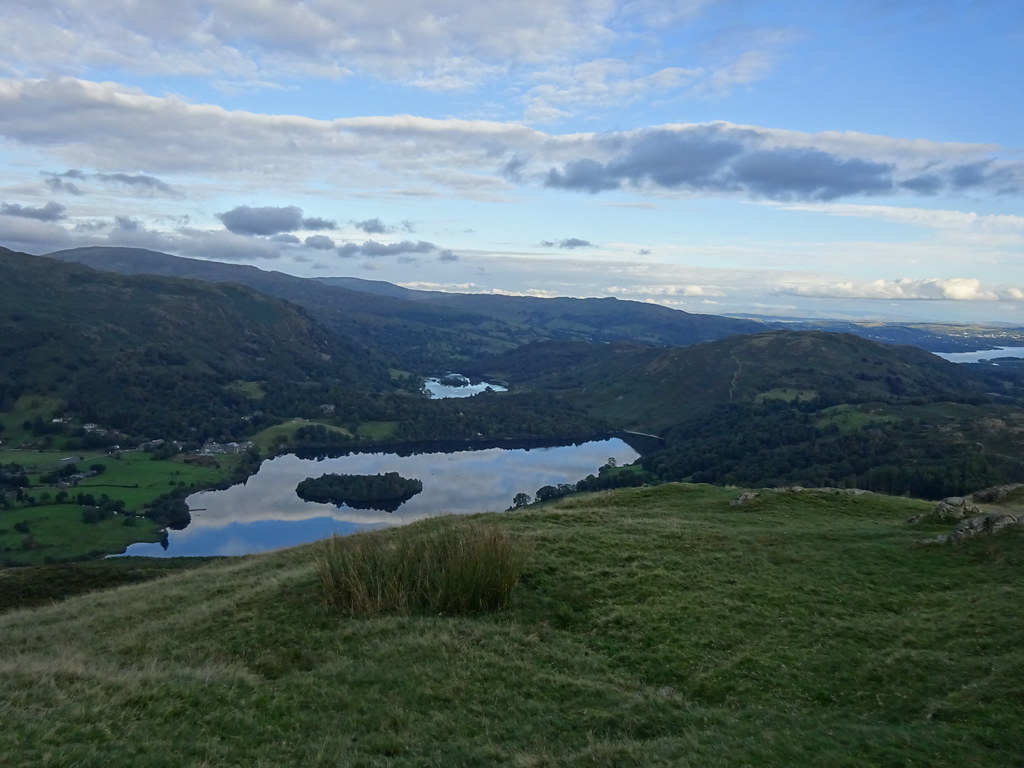 Grasmere and Rydal Water from Silver How
  Windermere from Silver How
  Crinkle Crags, Bowfell and the Pikes from Silver How
 There is a motorway of a path down to the SE of the summit - steep but well built, then an area of scrubby trees. Soon I was lined up for the final descent into Langdale. There were a couple of options here and I probably picked the wrong one. A path of sorts, but in scree and deep bracken with some lovely hawthorn to accompany the route. Ouch!
 Error of judgement on the descent...
 I was glad to reach the road and the last few minutes back to the lodge. As expected, I felt dead but it had also been fun.
