free to be able to rate and comment on reports (as well as access 1:25000 mapping).
The intention today was to climb Hart Side but as the clouds were low on the fells today a lower though slightly longer walk was done around the circumference of Grange Fell/Brund Fell’s base taking in a variety of roads, lanes, and paths with most of the ascent being from the foot of the Watendlath Road to the top of Puddingstone Bank, a distance of some 5.5 kilometres or 3.5 miles in old money.
This walk is by no means, design, or intention to be an epic, it’s just a substitute route to get us out for the day under the cloud base, away from the wind and intimated rain that together don’t go all that well when walking at height. It’s not as though I haven’t done plenty of that but sometimes a man wants to take it easy and there’s not much point climbing into the clouds with none of the familiar and beautiful views in sight that one has used up energy to see.
To walk around the perimeter of Grange Fell may seem a little odd and a ‘how can you do that without venturing onto the fell itself’ question may arise, but it is quite easy to follow the marked paths, lanes and roads that are visible on the OS Map therefore allowing a walk through a very mixed and picturesque landscape although some of the road walking is not necessarily a good part, though a requirement of the route.
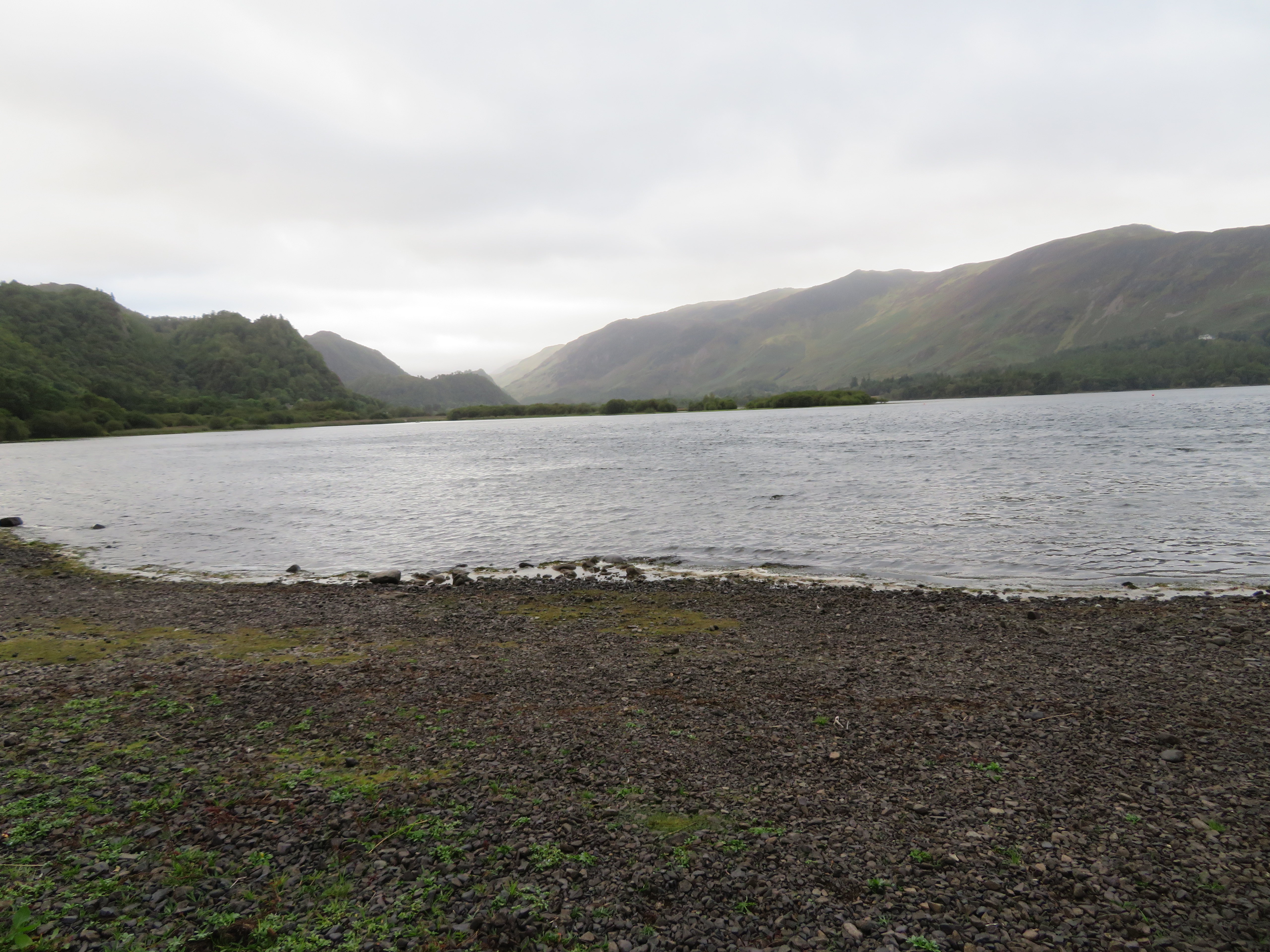
Due to the recent influx and subsequent lingering of staycation visitors to the LD we arrived at the Kettlewell NT Car Park adjacent to the east side shore of Derwent Water just off the side of the B5289 Borrowdale road to find it occupied by only 2 other cars that was a nice surprise indeed so quickly getting into boots and all we set off walking north along the shore line path on our way to the start of the Watendlath road with a fair expanse of water and cloud covered fells before us, the tree filled 244 metre high hill of Swinside sitting low in the centre of the photo.
 North along Derwent Water from the Kettlewell NT Car Park
 The path starts as a narrow but well made way running parallel to the road and Derwent Water sitting nicely between the two and below the road level.
 Shoreline path from the car park
 As we reached the shingle beach of Barrow Bay a look back south allowed a hazy peek into the Jaws of Borrowdale...
 South along Derwent Water
 with the long ridge of Maiden Moor to the right and the west side of Grange Fell just poking out from the left.
From the northern side of Barrow Bay we had a good sighting of the cloud covered Skiddaw massif.
 The Skiddaw massif from Barrow Bay
 The calm surface of Derwent Water imitates the leaden sky that shows no signs of clearing away for anything better and I suppose we should be grateful, are grateful, that it isn’t raining. The path to here has been people free and apart from the quiet buzz of traffic along the road all has been peaceful with just the rippling of the water to disturb the stillness.
A little further along from the Bay is where we abandoned the path and took the short flight of steps up to the road which we crossed to access the metalled lane to Watendlath, a lane that is bracken and tree lined with just a few cars and delivery vans coming or going along it. The walk along the road is not ideal but at least it’s quiet and well graded making walking up it easy enough. A few birds hidden in the trees made themselves obvious enough with their birdsong and we saw a red squirrel dash across the road ahead of us. Just above from where the next photo was taken...
 The Watendlath road above Strutta Wood
 we came across a memorial to Robert Graham the famous Lakeland fell runner at approx NY26989 19847. A lovely little monument built from local stone – cobbles from the beck – and pieces of local slate with a brass plate set into it and hard to see due to the bracken being up. It must have been passed many times and gone unnoticed by thousands of walkers, especially in the summer months.
 Bob Graham Memorial above Strutta Wood
 Steady walking soon had us at Ashness Bridge where a camera group were set up taking photos of the water running below the bridge whilst I took one of the thin flow of water upstream of the bridge.
 Barrow Beck upstream from Ashness Bridge
 It wasn’t too far to walk now before we could get off this damn tarmac, just past Ashness Farm and we can make our way through the trees and car park to Surprise View from where the views are fantastic although today they would be a poor showing of their usual self.
 Ashness Farm nestled below Dodd
  Northern view from Surprise View
 Looking towards the south the full ridge of Maiden Moor to High Spy is in view across the water with the huge complex of the Lodore Hotel sitting below Gowder Crag.
 Maiden Moor to High Spy ridge
 From this point we were walking through ancient woodland that was beginning to look autumnal with a scattering of golden leaves on the ground, bracken going brown, toadstools of varying shapes and colours with a few wild flowers just about hanging in there. So a lovely walk through the woods soon had us at the small clearing at Moss Mire where we decided to stop and have a few quiet moments enjoying the beauty of the place whilst having a drink.
Watenlath Beck is short on water and Reecastle Crag dominated the centre skyline.
 Watendlath Beck at Mossmire Coppice
 We were now to follow the beck all the way to Watendlath enjoying the delights of both water and woodland...
 Twisted trees by Watendlath Beck
 until we came to the clearing that runs for some length below Caffel Side below Ether Knott.
 A view south towards Watendlath
 Ullscarf dominates the centre skyline in the next photo...
 The gap between Reecastle Crag and Ether Knott
 and then it’s the turn of Reecastle Crag to take centre if not full stage. It’s a lovely crag with a scattering of trees and carpets of rough fell grass holding on where they can and the nuisance of bracken commanding the lower slopes.
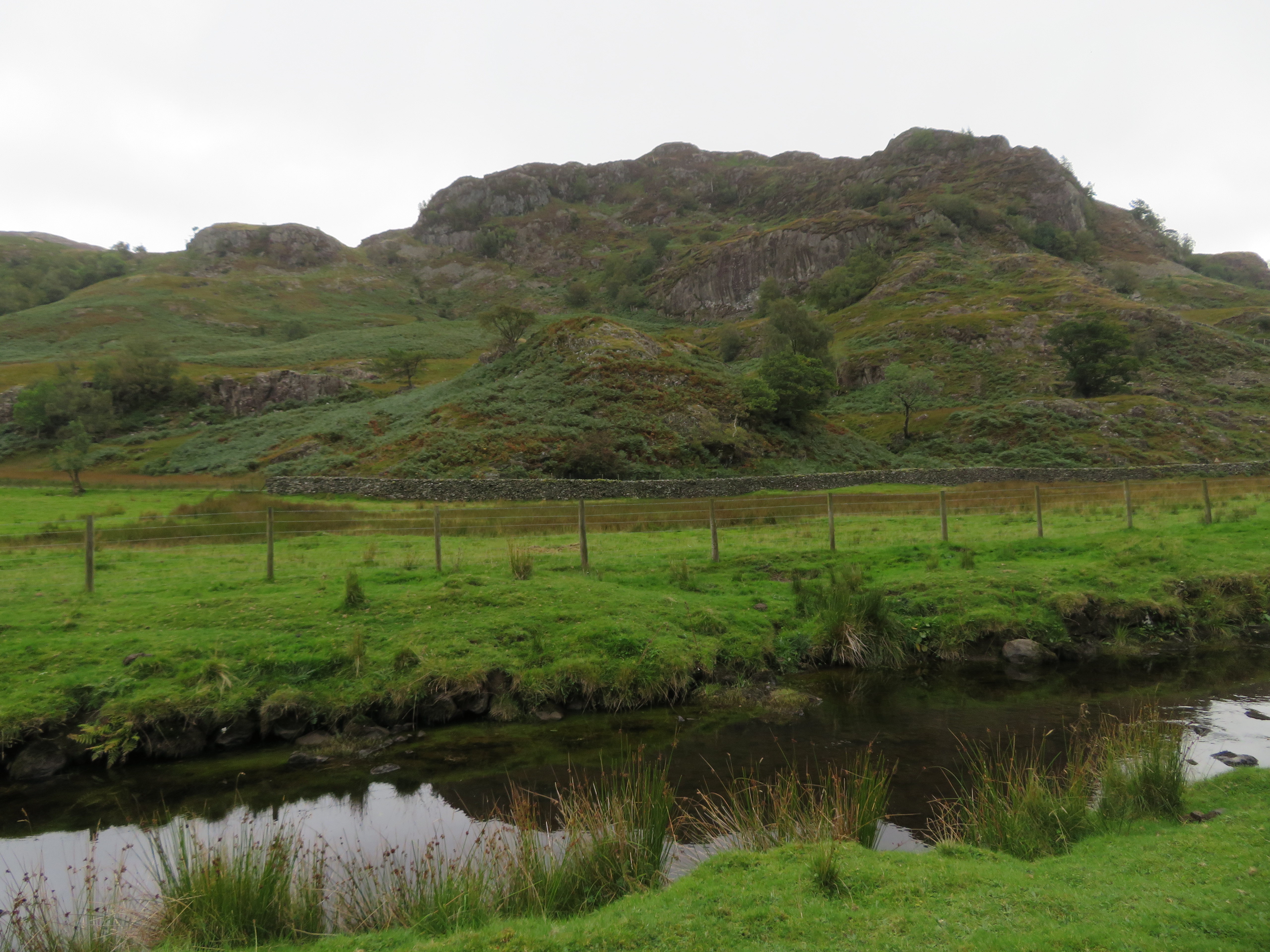 Reecastle Crag
 There were more people about now, most of them wanderers from Watendlath just taking a stroll from the NT car park and coffee shop and as we arrived below Black Waugh I took a shot of where we had just come from.
 The view north from the east side of Black Waugh
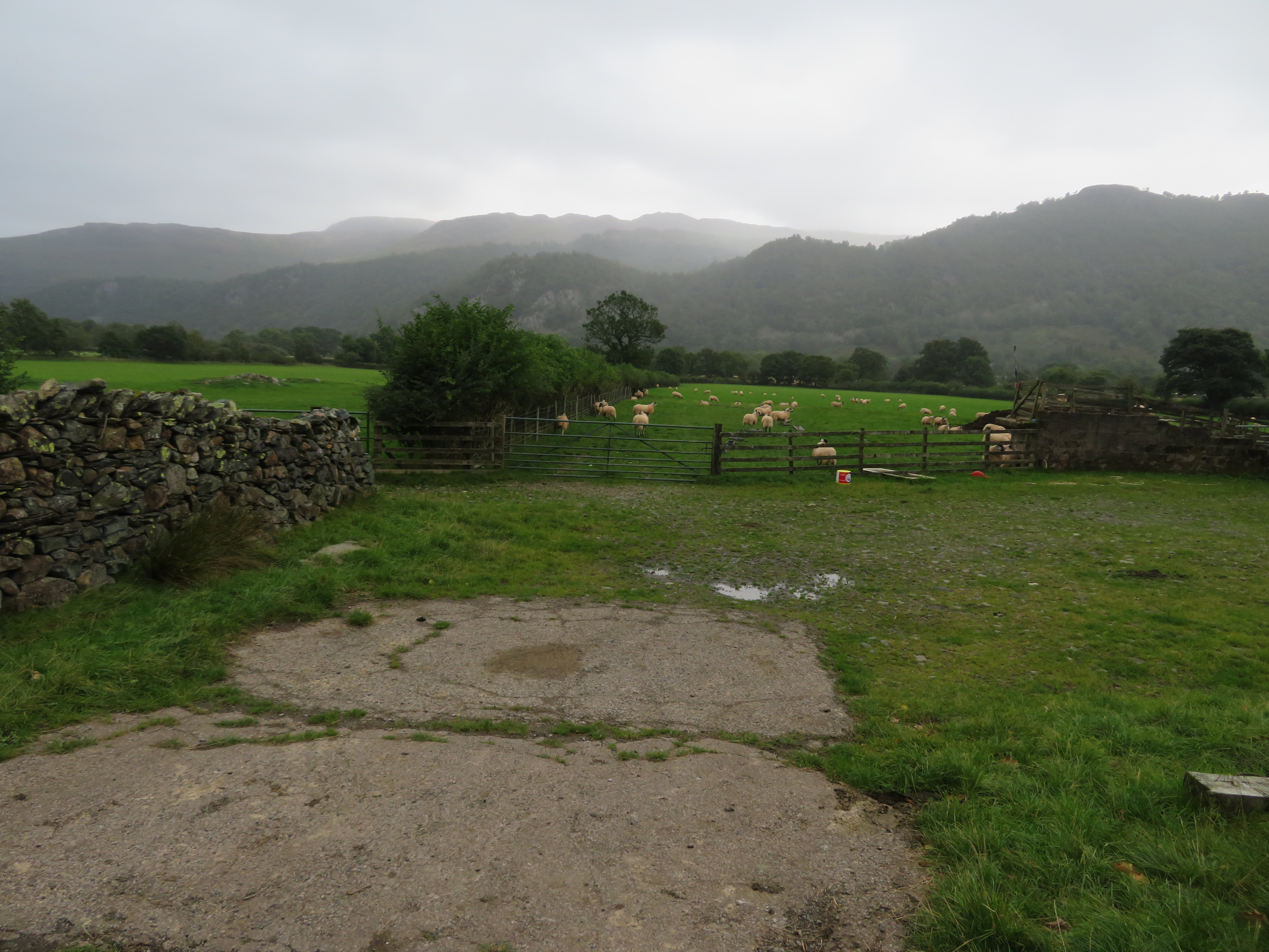
As we neared the hamlet we could hear the sounds of heavy machinery, predominately a ‘pecker’ that is a large breaker that fits onto the arm of an excavator and is used to break out solid rock or concrete and fifteen steady minutes later we were passing the source of the sound and site of the new hydro scheme on Watendlath Beck just north of the tarn. It looks a mess now but I’m sure it will be mostly concealed when it’s completed.
 New hydro scheme at Watendlath
 We tarried for a comfort break at the NT car park and passed the ‘Home of Judith Paris’ house. Judith Paris was the fictional heroine who lived in this real though fictional home featured in the Herries Novels set in the years 1720 to 1930 by Hugh Walpole. The novels are set partly in Watendlath and Paris during the French Revolution.
 Featured in the Herries Novels
 We walked back over the old packhorse bridge at the outflow from the beautiful Watendlath Tarn that just now is grey stretch of water sat amongst the green pastures of the surrounding farmland.
 Watendlath Tarn
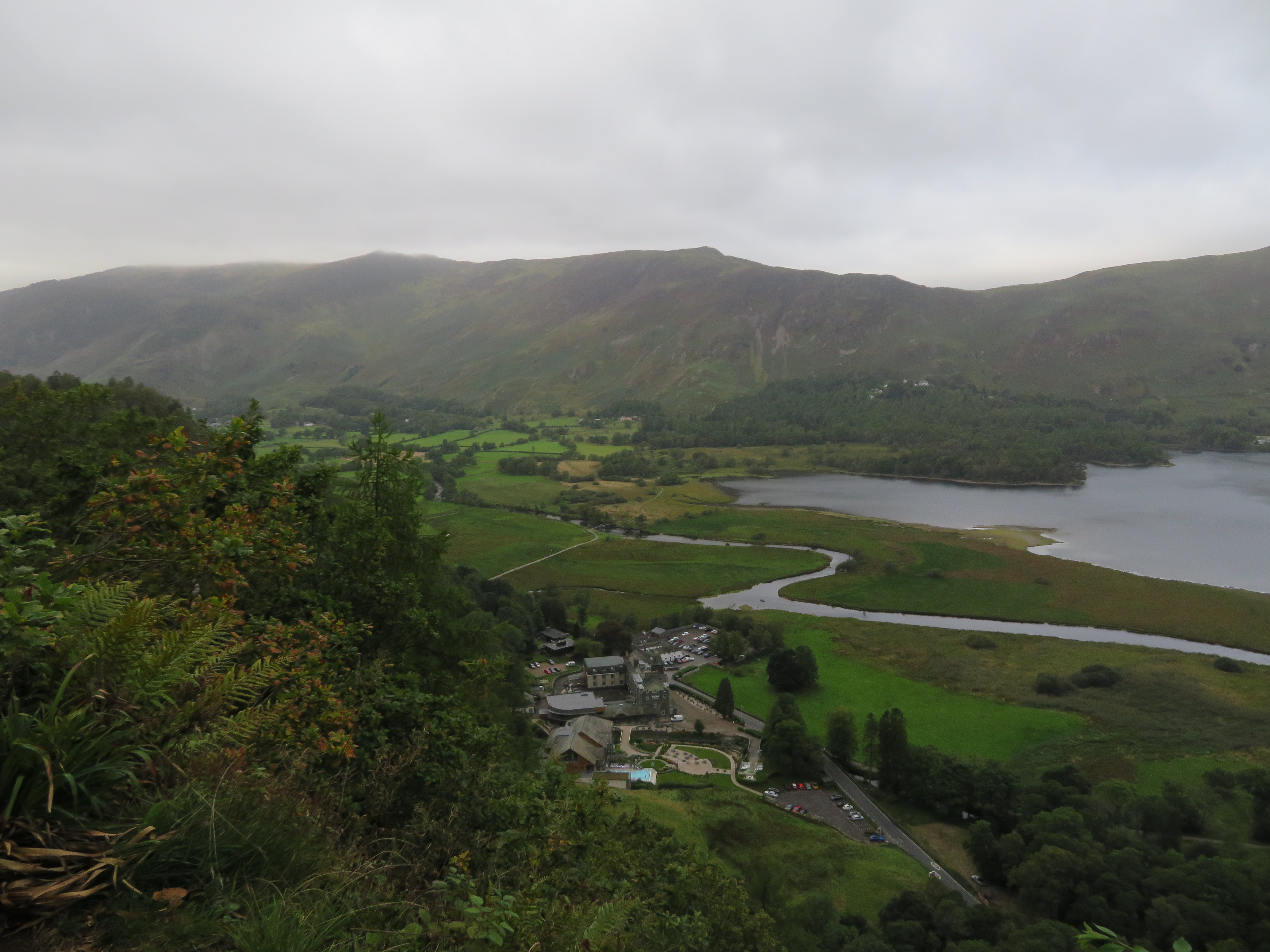
 From the bridge there is another section of climbing along a stony, sometimes paved, track that would put us at the top of Puddingstone Bank from where the views on a clear day are very extensive across Borrowdale and over to the Scafells and Great Gable. Today is not such a day.
 Borrowdale view from the top of Puddingstone Bank
 These views have been photographed many times by many people including myself but every time that I pass this way I hope to see something different, some change in the landscape, nothing too serious, damaging or ugly like the snaking scar that runs up the side of Thornthwaite Fell and into The Combe where another hydro plant was installed a couple of years ago. But I must be fair and say that the scar of the wide and stony track is now blending slowly back into the landscape and probably looks no worse than any of the many such like tracks in the Lake District.
The track is to be found at the centre of the photo running up from the far green pasture.
 Borrowdale from Belt Knott
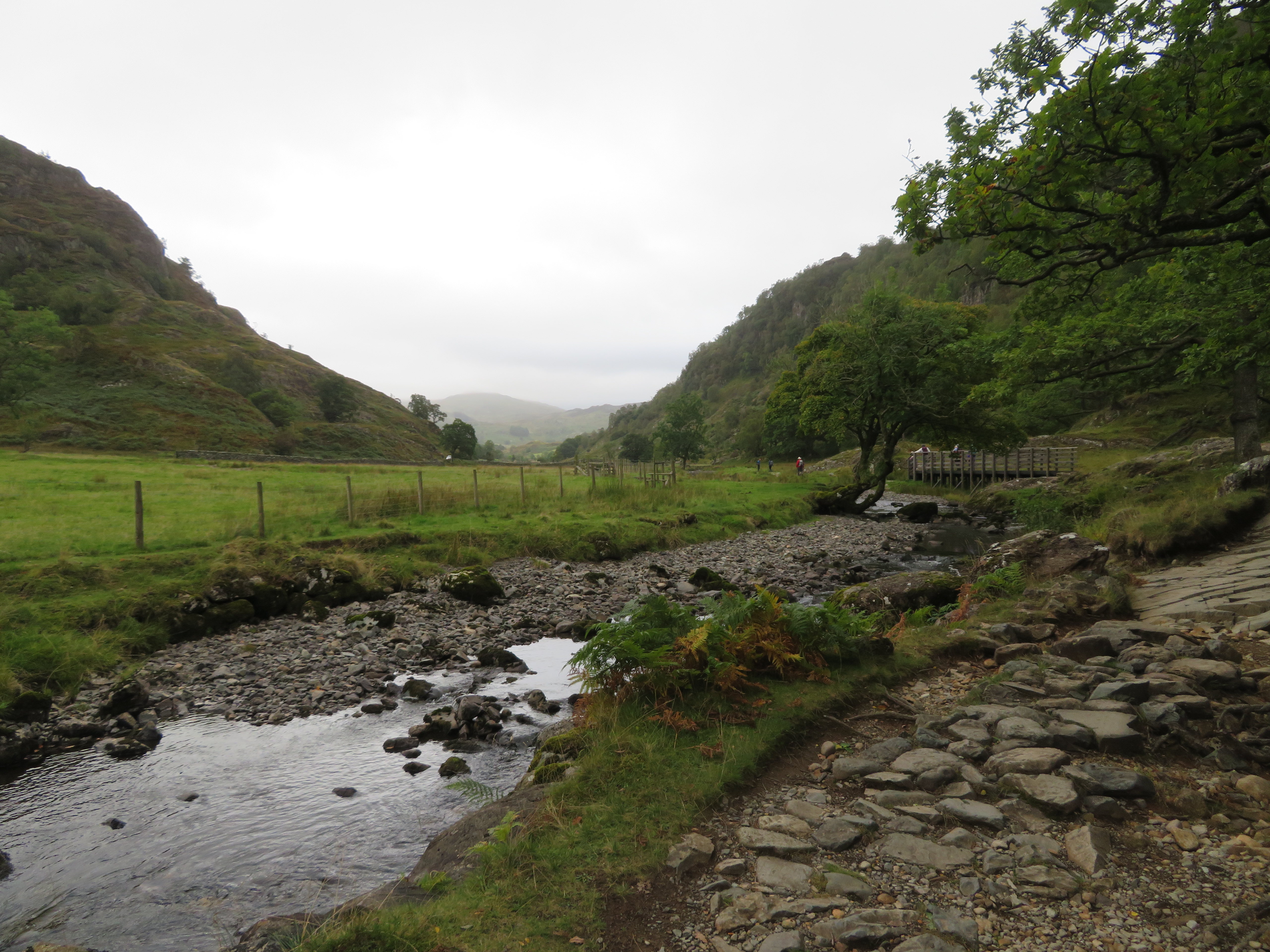
 We descended this now rough track down Puddingstone Bank, a track that has washed out in many places leaving slippery rock behind needing care when, as today, the rock is wet and slick and when reaching the gate just below Birkett’s Leap – near the Resting Stone – we turned off to the west following the path through bracken and trees...
 Path through Frith Wood
  Autumn's calling
 until arriving at the steep downhill bank through Frith Wood where many loose stones and tree roots await the unwary walker. After reaching the main road below Red Brow we now had another fair stretch of road walking to do before turning off to the Bowder Stone. Fortunately the Borrowdale Road was fairly quiet with not much traffic today and it wasn’t too long before we were going through the stile towards the famous Bowder Stone where today there was a few climbers practicing their holds and techniques under the overhang with crash mats at the ready. By this time we were having a few spots of rain falling with some quite bad mannerly landing on my camera lens.
 The Bowder Stone
 Another nice walk through the woods below King’s How and Cummacatta Wood saw us arrive at the road again just south of Grange which we would now walk through and follow the Allerdale Ramble and Cumbria Way route along the tarmac road and following Eller Beck towards Great Bay at the south end of Derwent Water taking note of the cloud hazed skyline of some eastern fells.
 Eastern skyline
 A good path soon had us at Great Bay where we opted to stop for a break even though we were quite near to the end of the walk by now. It was more to drink up what was left of our fluids than having to stop. But it is a great place to linger sat beneath the trees looking along the water.
 Derwent Water view from Great Bay
  Great Bay on Derwent Water
 Next on was the so called Chinese Bridge, so called due its design, that spans the River Derwent and for that to happen we had to use the elevated walkway that is made of re-cycled plastic that allows passage across this oft flooded low area of rough grass and sedges. There were a few cattle and sheep grazing and the ground was looking fairly dry just now due to the lack of rain over the past few weeks.
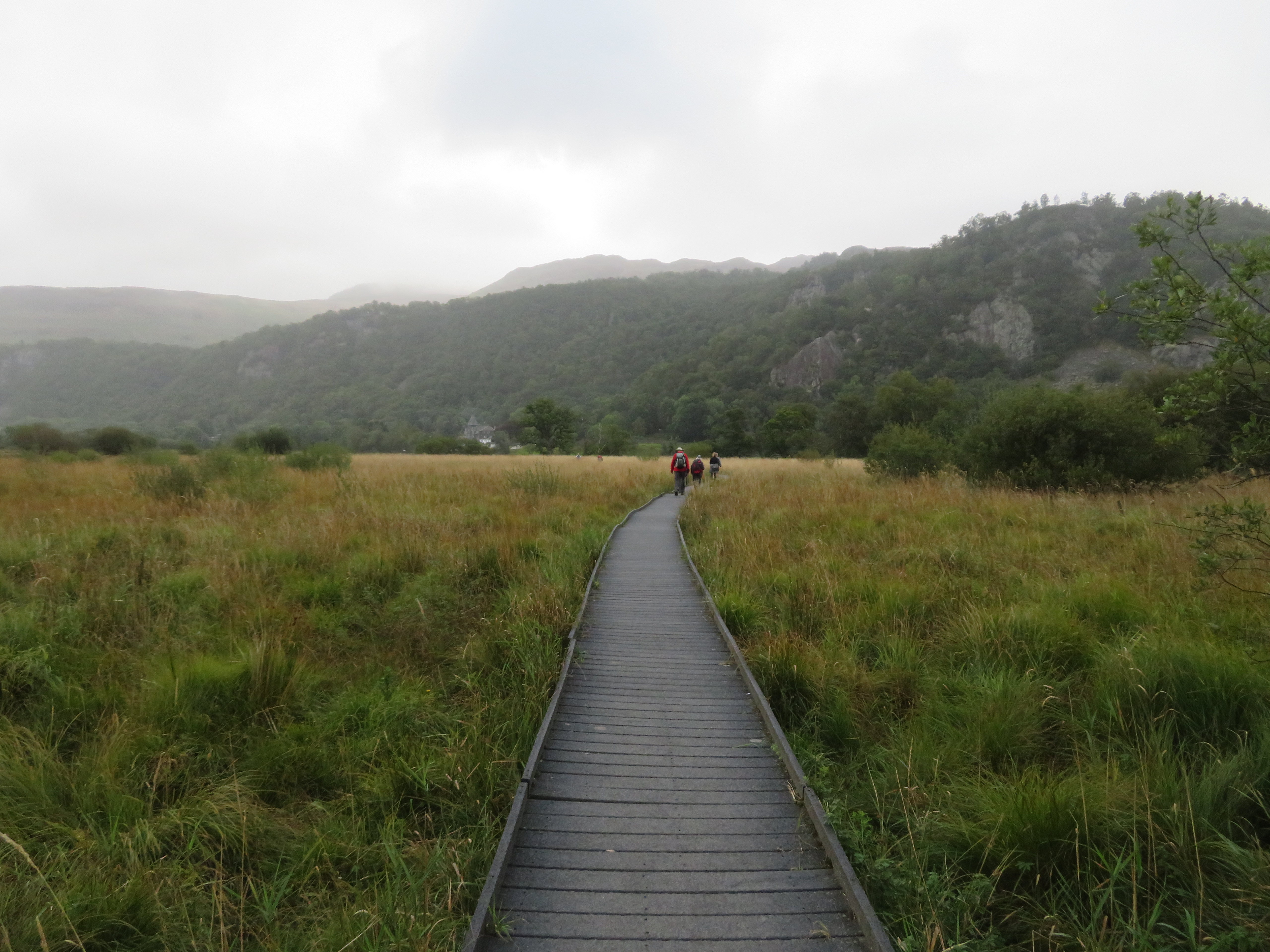 Walkway across the low lying land south of Derwent Water
 We arrived back at the car to find a few more parked up and saying how much we had enjoyed this simple low level walk noting that one doesn’t always have to get amongst the big fells and mountains to find pleasure in a simple but picturesque route. This route more or less encircles the base of Grange Fell therefore some road walking cannot be avoided but even these sections are through glorious areas of woodland and countryside.
