free to be able to rate and comment on reports (as well as access 1:25000 mapping).
Today’s plan was to get Ann up onto Rosthwaite Fell to cross another one off in the Southern Fells Book but with the weather once again dealing the cards and coming up with a so-so hand with strong winds a route was cobbled up, one that would take us on one or two paths – if indeed they were there as they’re not marked on the OS Map – that we hadn’t ventured onto in the past. The route was to start at the second car park at NY23462 29226 that is north of Mirehouse and the Old Sawmills Car Park where there is room for about six cars and where the paths will allow us to start and finish at the car cutting out any unnecessary road walking. This car park is also a good starting point for accessing Longside Edge as a decent circular taking in Carl Side that can also be made by finishing on the last part of our route today.
The day was grey and damp as we set off walking south on the path through the Old Plantation that runs alongside the A591 and followed it through the near full autumn coloured trees all the way to the Old Sawmills Car Park where work was being done on the tearoom. It was quite a pleasant and colourful journey through the trees as autumn takes hold with an ever stronger grip and though there was still plenty of green leaves on the trees there would have been as many of the brown and golden variety lying on the ground.
 Autumn debris in the Old Plantation
  Autumn reigns
 Apart from the exposed and greasy tree roots the path is good and clear all the way through to where it arrives at the old weir on Skill Beck at the car park. From the car park we took the regular path towards Dodd leading out at the back of the toilets to then make our way along the forestry track through a couple of U bends into Dodd Wood and the opening views over Bassenthwaite Lake and on which we would stop for a drink and vista viewing at the viewing point with its wooden picnic table and shuttered hut just further along the track. The track is in fact part of the Allerdale Ramble and one that we would follow for quite a way.
 Part of the Allerdale Ramble in Dodd Wood
 A couple of hazy shots northwest from the viewpoint caused by the misty atmosphere and rolling grey clouds didn’t show the landscape at its best...
 North Western Fells behind Braithwaite
 whilst the other way showed plenty of sunlight on the pastures below but left the summits in darkness.
 Barf and Lord's Seat
 We were now entering the area of Thornthwaite Forest and it’s a nice steady incline along the forestry track and the only thing delaying us was the views across to the mountains around Keswick and Braithwaite but to our left the Forestry Commission has done what it usually does when it completes a logging operation, they leave their debris behind, acres and acres of it left to nourish the ground ready for regeneration they would have us believe, it’ll soon rot down they say. Ha! They’re just saving money; it’ll still be there in a hundred years.
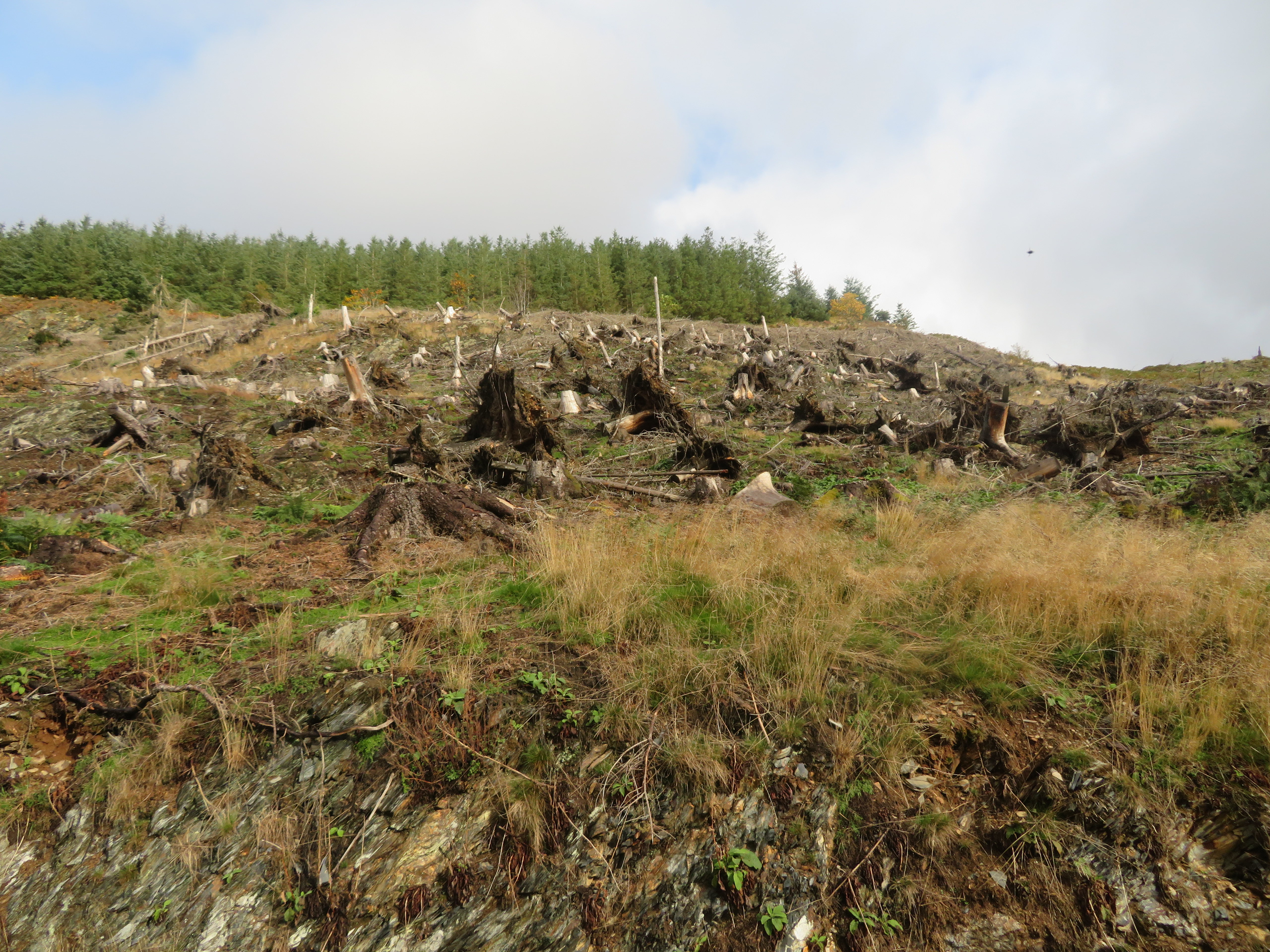 They always leave a mess behind
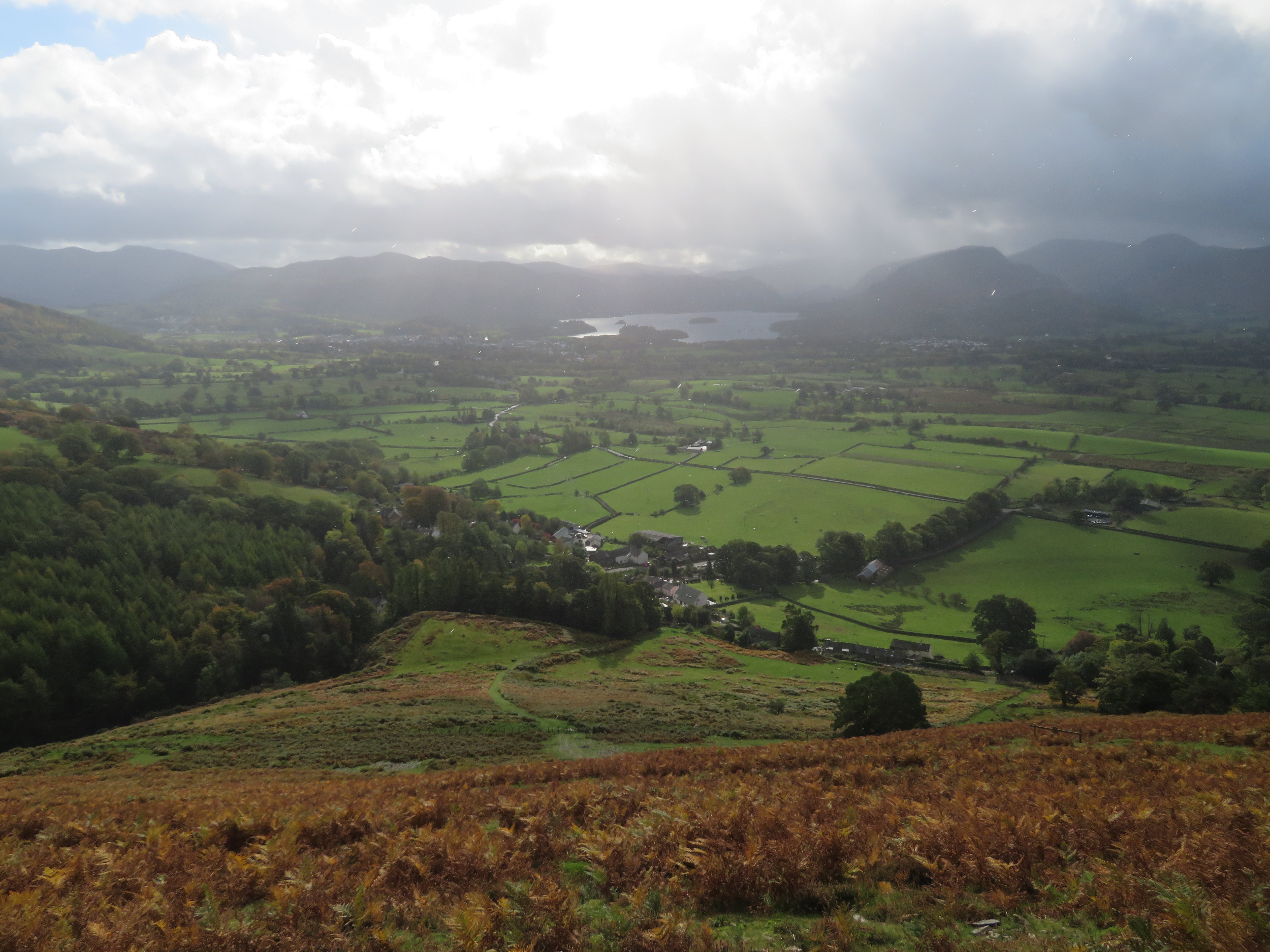
 A few metres further along we got a view of the Dodd’s skyline and Derwent Water through the trees. Latrigg, Bleaberry Fell, Walla Crag etc in the haze. There wasn’t any sunshine although there were plenty of light rays picked out amongst the darker clouds.
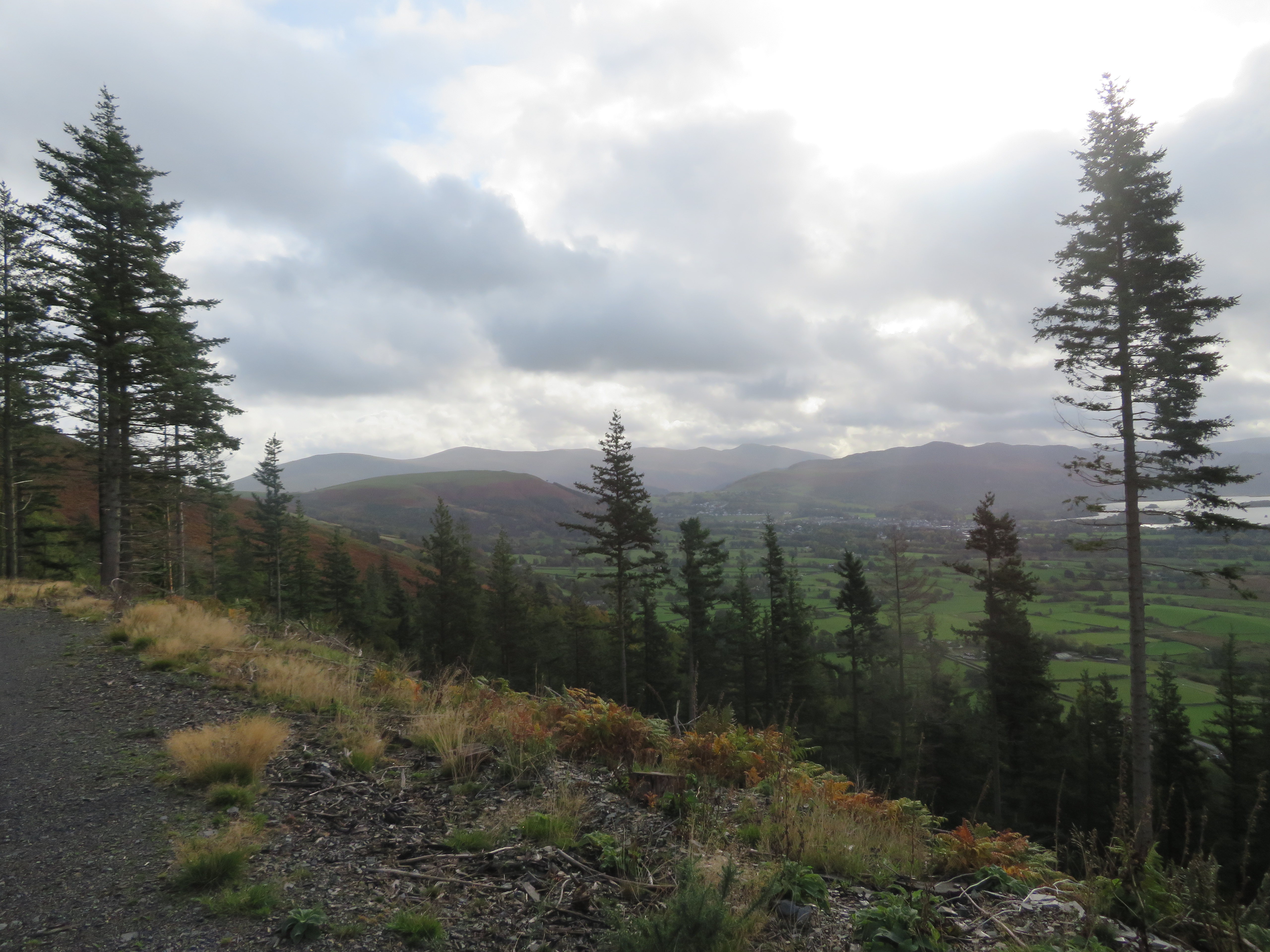 East towards the Dodd's et al
  Derwent Water and surrounding fells
 Very soon afterwards the slopes of Doups were before us, slopes that we would be climbing very shortly. The bend in the track is where we start the descent towards the main road at Millbeck.
 The slopes of Doups behind the trees
 We were now about to enter into the realms of a different wood, this one being Lyzzick Wood from where the track running southeast now swings over to the north from where we got a view of the bracken clad slopes of Longside Edge...
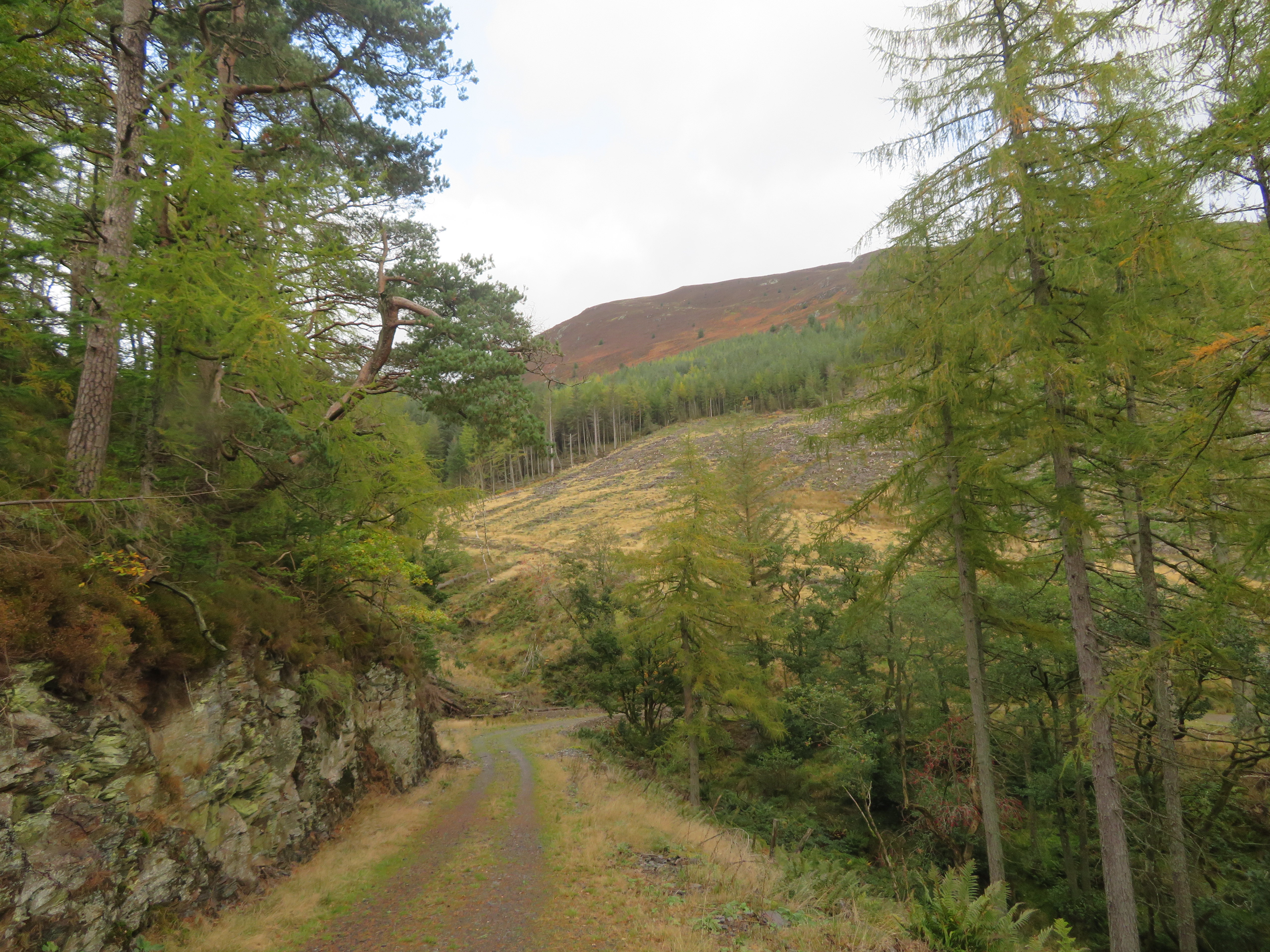 Looking up to Longside Edge
 and Scalebeck Gill that was completely choked up with logging left over’s, long grass and rushes.
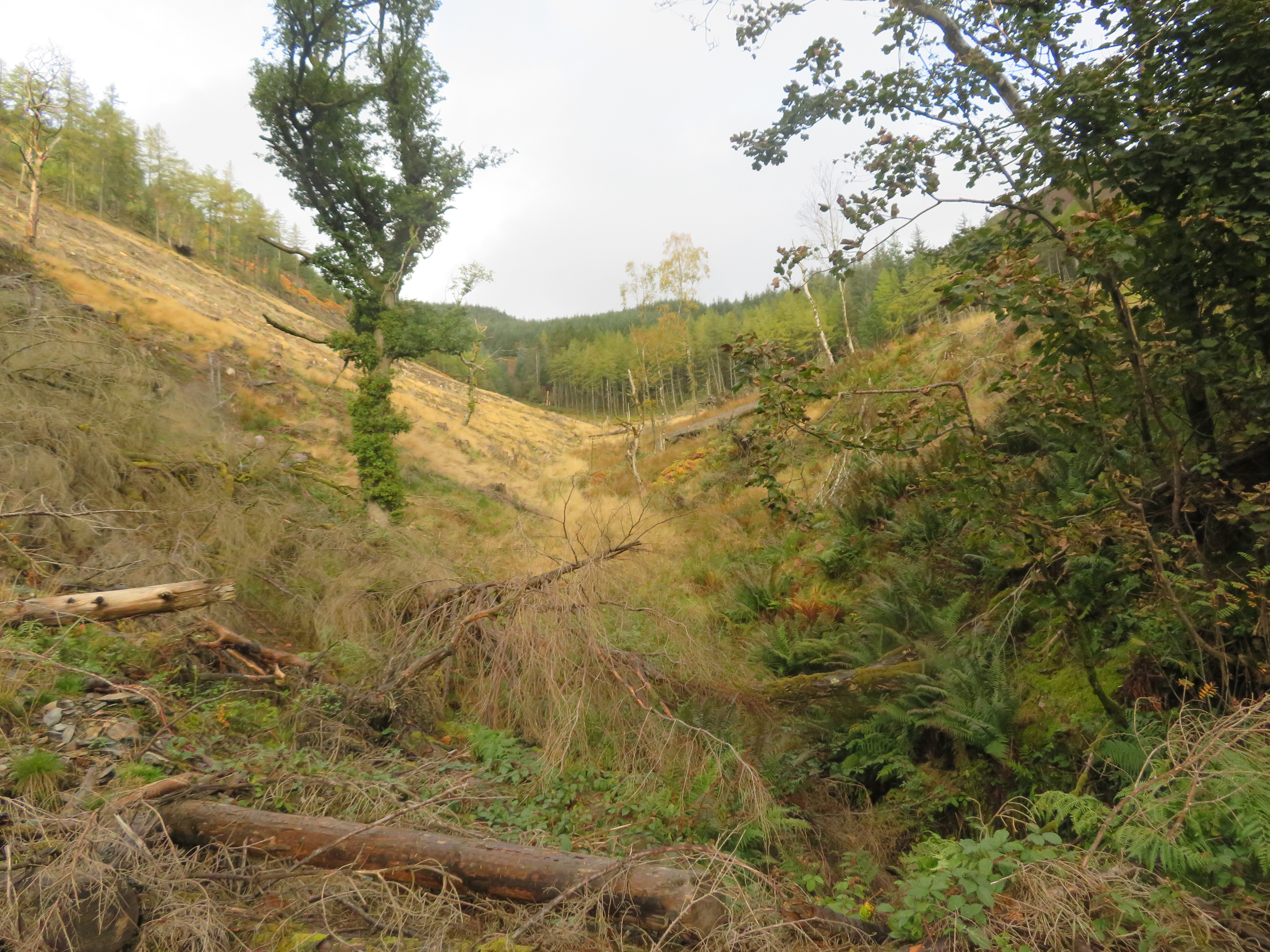 A choked up Scalebeck Gill
 From the gill the track does a U turn to the south and a vehicle turning circle that stands in good stead as a great viewpoint over Keswick and the surrounding fells.
 Keswick viewpoint in Lyzzick Wood
 The track now morphs into a footpath the short section of track being formed from the centre part of the path that begins beneath Dodd at NY24745 27322 and drops down to Hounslow Bank to another track and this part of the path is not too obvious in its lower regions as the last time that I was on it found it a bit of a struggle working my way through the tree branches but of course most of the trees have been cut down so should be much easier nowadays. It then continues down through what was Lyzzick Wood to join this short section of track to then continue down behind the Lyzzick Hotel and to Millbeck.
The path is good and clear from this point with a decent view of Derwent Water ahead of us.
 Rays on Derwent Water
 The day was a bit damp and windy although we haven’t really felt the wind as yet because we’ve been sheltered and not too high up, it was cool though warm enough when moving. Despite the full cloud cover the sun was giving us a good light show or bright rays over Keswick. Once that we had reached the trees we had to tread more carefully as there are lots of exposed and slippery tree roots and thousands of pine needles across the path...
 Greasy tree roots underfoot
 making for a bit slower passage than before.
Fifteen minutes or so later we were at the foot of Benny Crag that we would access by a stony lane sheltered by overhanging tree branches.
 Enclosed lane on Benny Crag
 Five minutes later and we had climbed the easy slopes of Benny Crag...
 Benny Crag to Doups
 and was standing at the foot of Doups from where we had a decent view of Skiddaw.
 Skiddaw and Little Man behind the slopes of Carsleddam
  Start of the climb up Doups
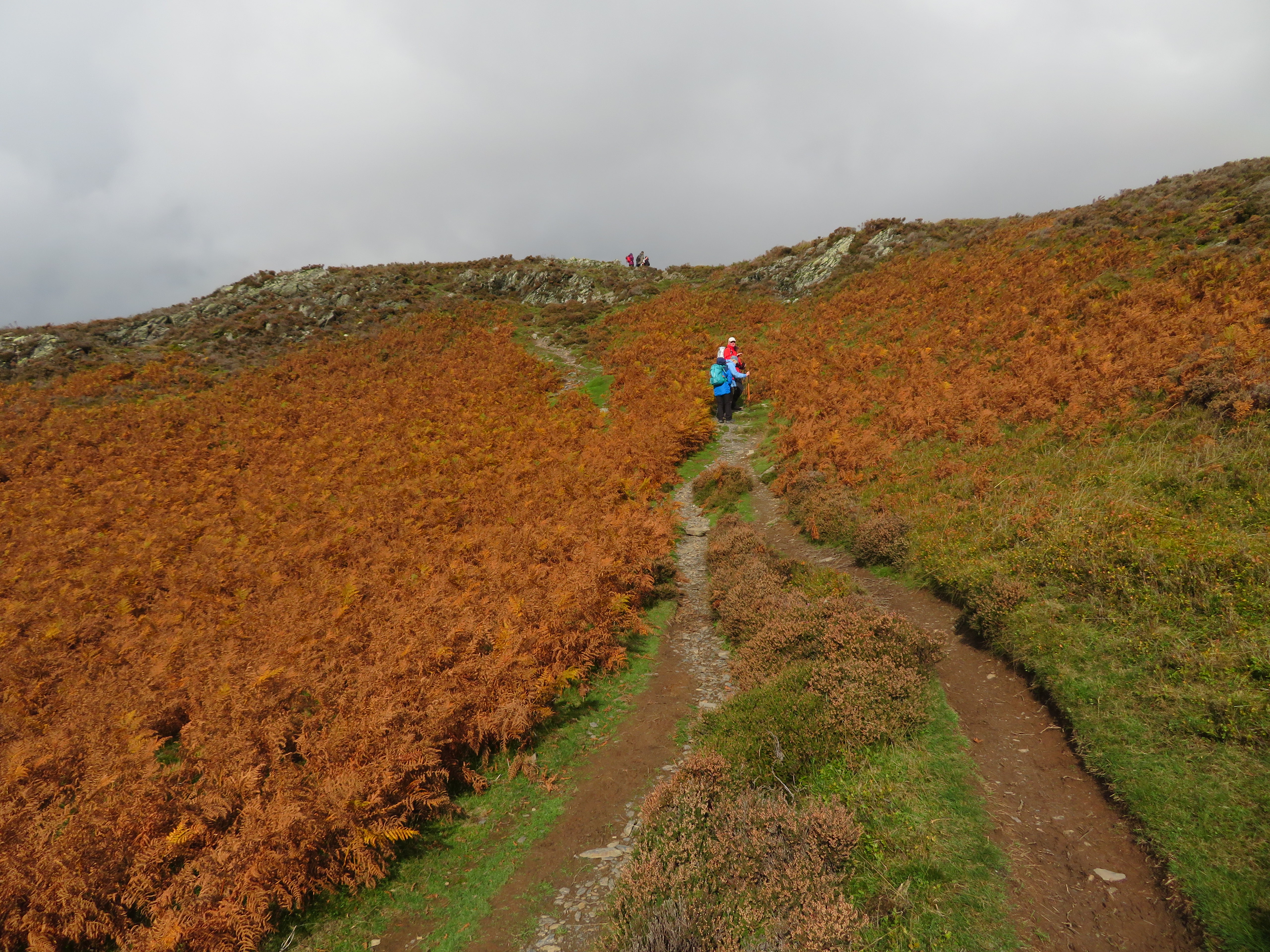
 Doups is a big grassy hill with small rocky outcrops poking up through the acres of dead and dying bracken, also a worn out path that has had path erosion barriers erected on one section of it to be replaced by zig-zags of which we were pleased as it it’s a lot harder climb up without them. There’s nothing to see in front of us only dead bracken and sloping ground so the climb was more tolerable when turning around to see the views opening up behind us. Or is that in front of us? A large patch of cloud has dissipated allowing the sun to throw its rays across the valley below and just skimming the nearer and lower fells as a bonus.
 The fells of the Coledale Round
 I’m afraid that some of the scenes will be repeated albeit from different height that do throw a somewhat different aspect to the photos so sorry for that as the slopes dominate the north as the views of Lakeland do similar to the southern vista.
 The zig zags start at the old path barrier
The next photo was from the 210 metre point.
 Sunlit pastures
 And from point 280.
 A southern view from the 280 point on Doups
 The zig-zags made for an easy and quick climb past the worst part of the erosion and we stopped at a fairly level area for yet another look back.
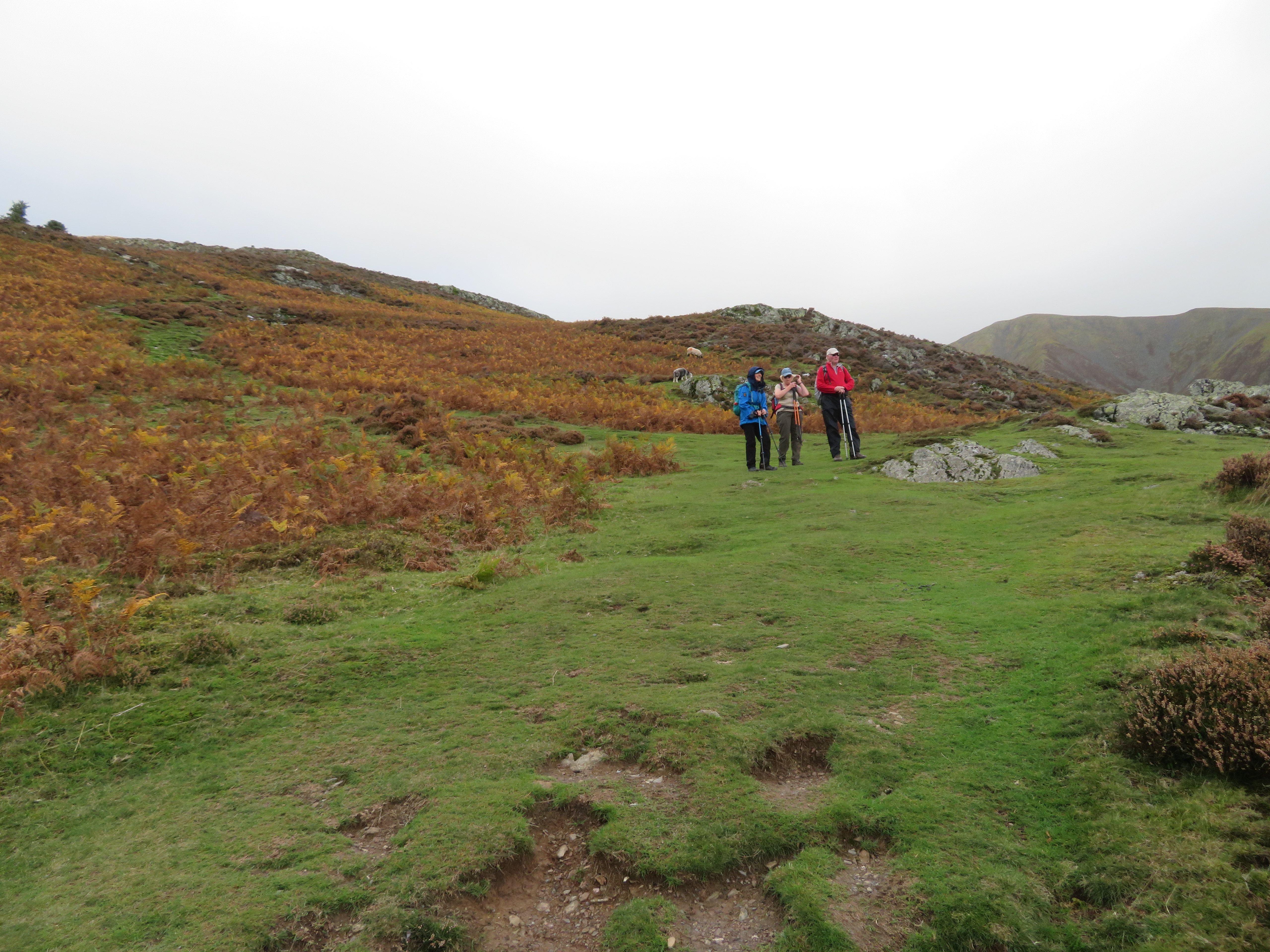 Taking in the views after the zig zags
 From here on we continued on a good path that would take us to the rocky outcrop of White Stones if we were going that far but we shall turn off just before reaching them.
 The houses of Millbeck bathed in sunlight
 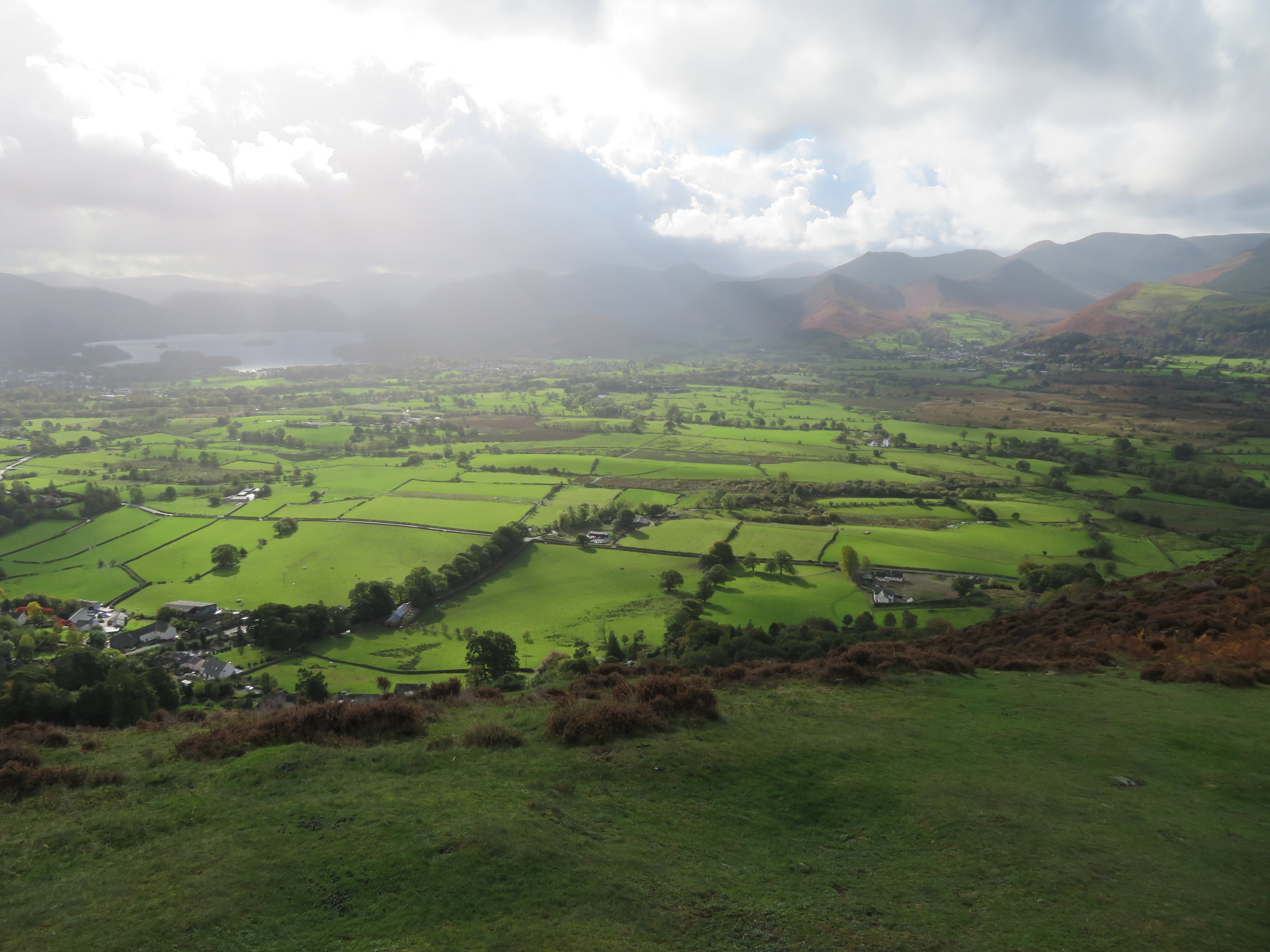 Rain over the fells and sunshine across the pastures
By this time we were feeling the effects of the wind that had now sprung up as we had gained altitude and though not much of a bother it did make one cool down fairly quickly when stopped. We met a couple on their way down from Skiddaw who told us that the wind was about 40 mph up there and the going was really hard. Happen as well we are staying low today then.
The climb above the zig-zags is continued on a good path that has clumps of still flowering heather alongside it and is well graded with interest in moving over the rocks instead of just a plod up a mundane path.
 A lovely climb through the rocks
  The Dodd's - Bleaberry Fell - Latrigg
 Despite the haze and clouds the views are spectacular and I couldn’t help, or stop myself, taking far too many photos of that scene below us.
 A well graded path at 360 metres
 We stopped for a break at about the 390 metre point and could see that the clouds had rolled in again behind us but with just enough small patches of clear to allow the light rays to shine through and scatter the sunlight over the fields below whilst after a few minutes they also lit up Derwent Water. E’s name for them reflects in the next photos title.
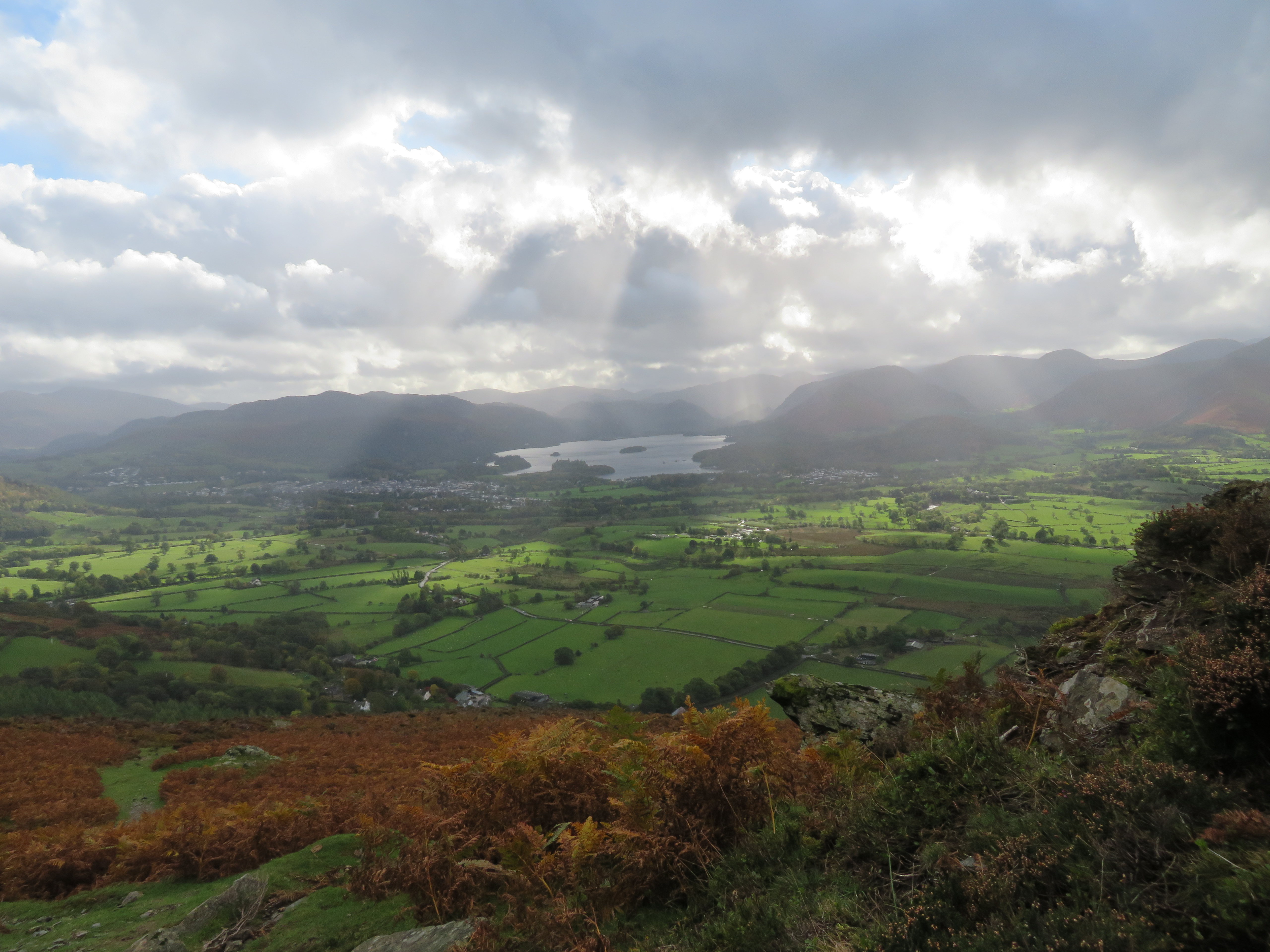 Angel's torch lights
  Torch light beams on Derwent Water
 Break over and few more metres on and we got a good view of Latrigg with the sunshine glinting off the roofs of the cars parked just below it...
 Latrigg and the Dodd's skyline
 and then a view forwards towards the top of Doups.
 Line of crags at the top of Doups
 The final few metres led us to the comparatively flat top of Doups with the crags of White Stones not too far above us and from where had a good view of Dodd with its bristly head starting to show its new but sparser growth of trees.
 Dodd with Barf to the left
 We were now at our highest point of the walk, just on the 410 metre contour and from here we were going to leave Doups behind and follow the old wall northwest all the way back to Long Doors below the eastern slopes of Dodd. This path is not marked on the map but is good and narrow with a few rocks to stride over and the ever present and offending bracken trying its best to push you over the wall that in part has been beefed up with a fence as a protection against it as it must have been an easier and cheaper option than climbing up here on a regular basis to keep repairing it. However, our path to this point now continues upwards to White Stones and Carl Side from where either Longside Edge or Skiddaw can be accessed.
 The path continues to White Stones
 A partly hidden Skiddaw and its minion can be seen behind the slopes of Carsleddam.
 Skiddaw and Little Man behind Carsleddam ridge
 Earlier we had felt a few drops of rain and suspect that they were blown in from this over at Portinscale.
 Rain over Portinscale and the hill of Swinside
 The path behind the wall undulates up and down but actually drops around 20 metres down to Long Doors but there are no issues to worry about on this path.
 Following the wall northwest to Dodd
 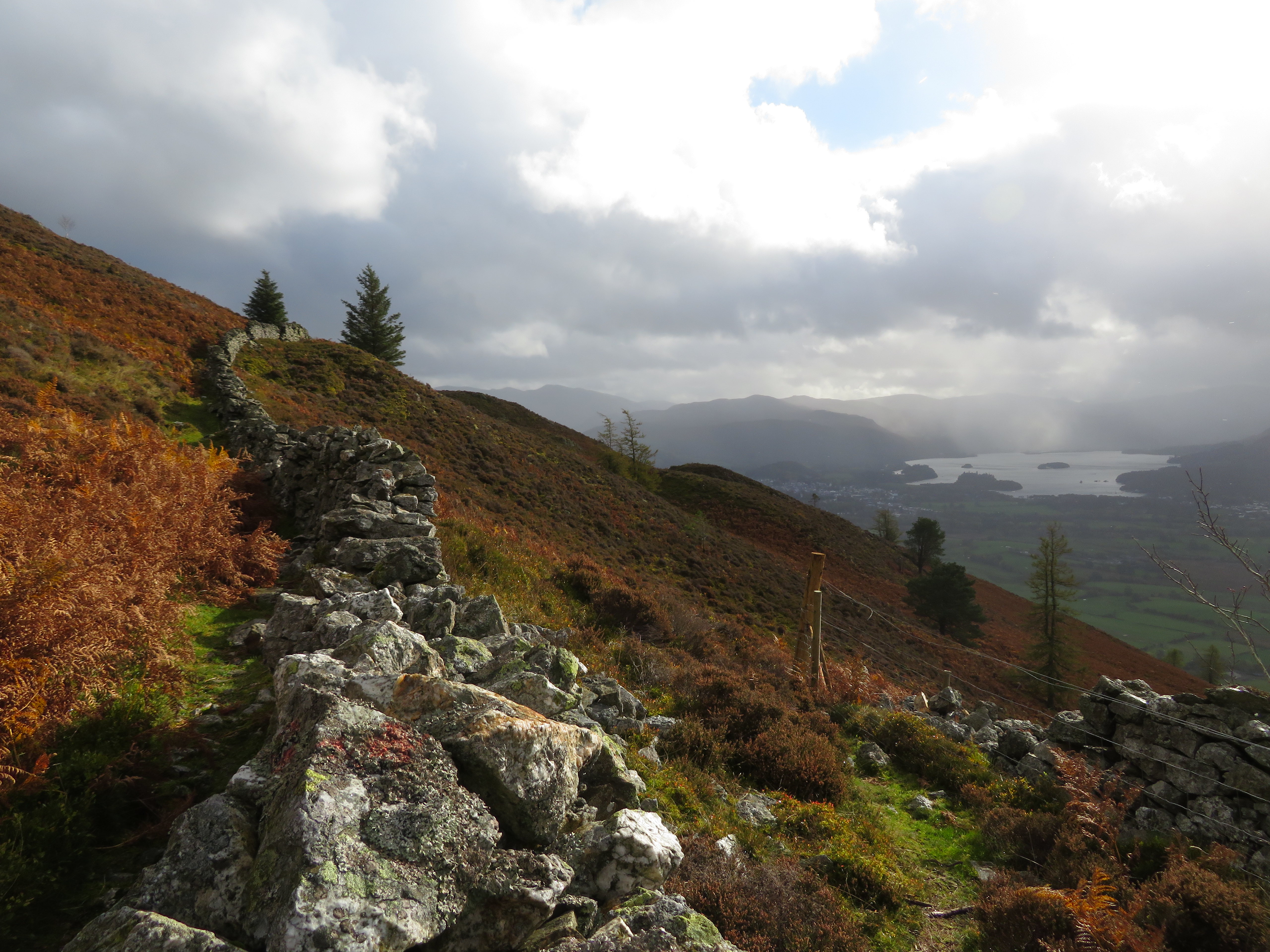 Path behind the wall
 We could quite clearly see people making their way up Dodd as we made our way along, now in a small burst of sunshine.
 Dodd
Dodd The path terminates at the fence stile at Long Doors – NY25018 27316 – from where we now accessed the forestry track into Long Doors where a large amount of new fencing was stacked up. Passing that and arriving at the junction of tracks we took the right one that is a metalled lane for most of its length down to the Sawmills Car Park following Skill Beck on its way. The sky was now grey again but the colours of the autumn leaves more than made up for the lack of them above us. The only thing to watch for on the way down the metalled lane is the layer of green algae lying in patches on the tarmac as it can be very slippery under unwary boots.
 Autumn leaves
  Autumn in Thornthwaite Forest
  Autumnal tunnel
 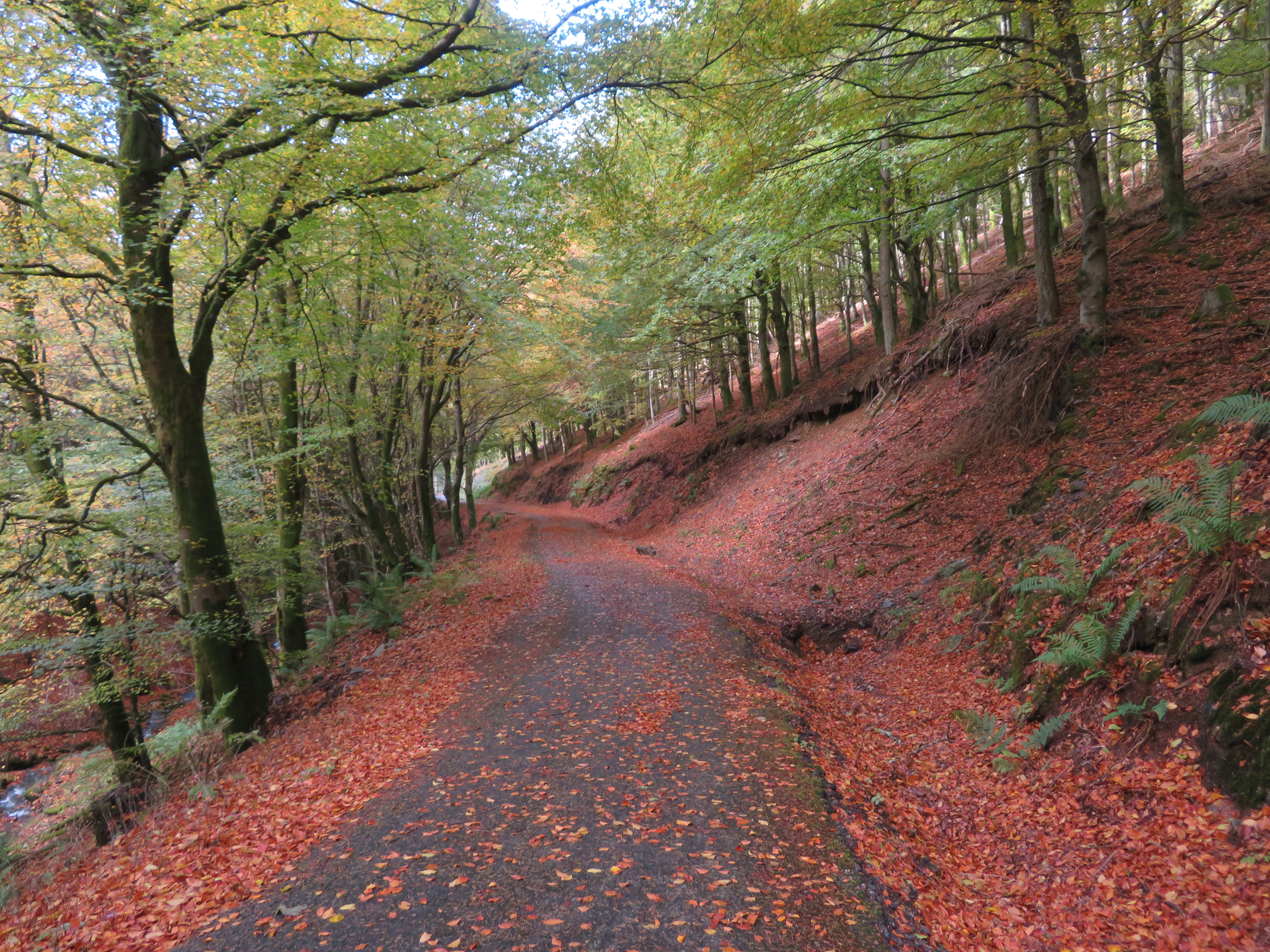 Autumn leaves
 Having walked a good stretch of the road we decided to take a walk along the footpath NY24315 27804 - that is on the right opposite the footbridge over Skill Beck. This footpath is good, firm and well graded as it passes through the trees that were bathed in sunlight as it filtered through the upper branches.
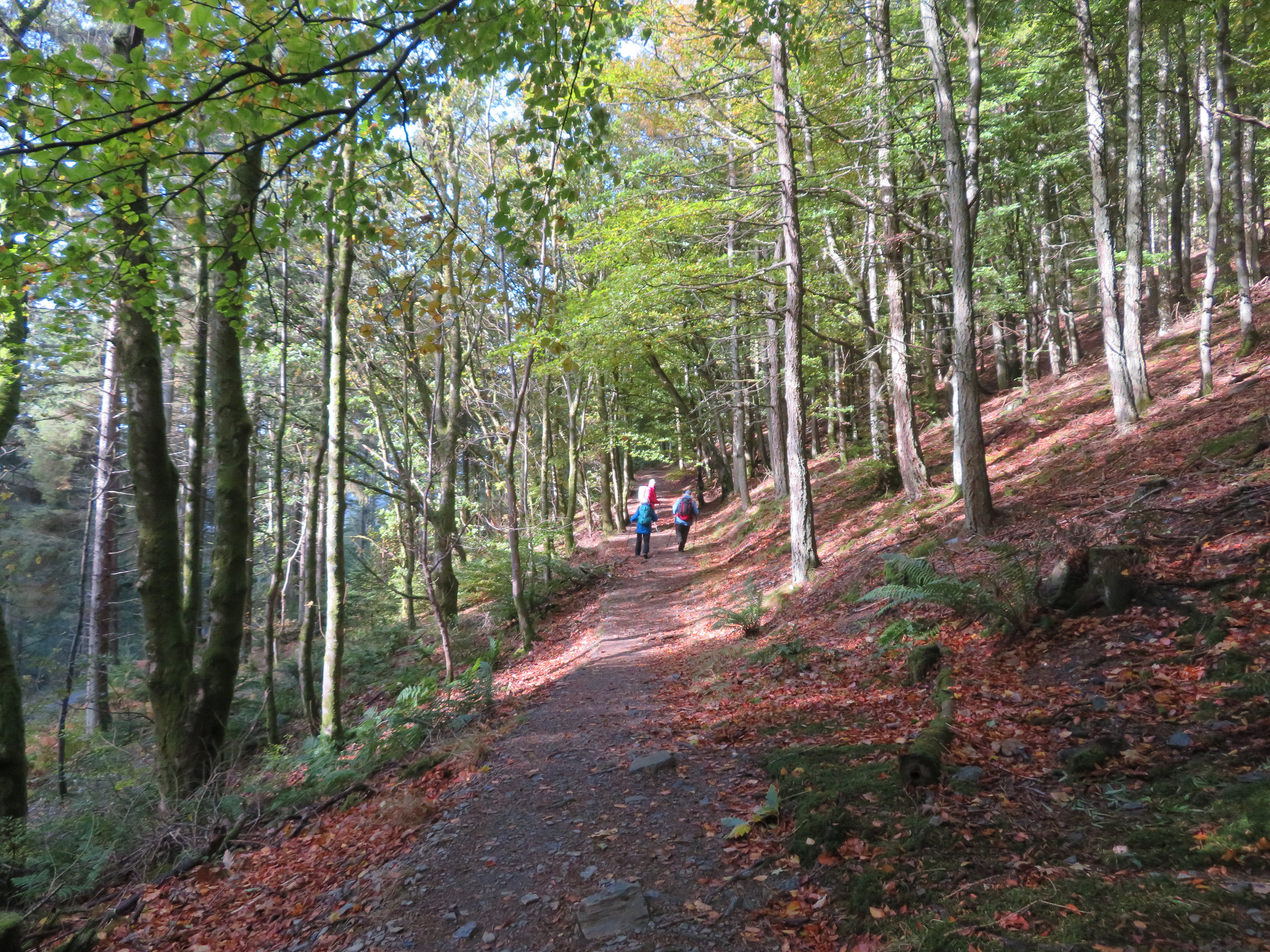 Autumn sunshine through the trees
 Somewhere along its length it widens out to track width and it was completely covered with brown pine needles.
 A carpet of pine needles in Longside Wood
 A couple of footbridges are crossed over unnamed feeders into Skill Beck and the only excitement was the pleasure of walking through these autumn cloaked woods with the filtered sunshine an added attraction.
This last photo was taken just before we arrived back at the car and apart from the green of the centre tree looks almost sepia in colour.
 Cascades of light in Old Plantation
 This was a decent walk to say that it was ‘thrown together’ at the last minute and there were a surprisingly good number of other walkers using the path on Doups going either up or down. A steady enough walk with easy going on good paths and tracks and a moderate height gain on which we caught some of the wind at height but more or less dodged the rain showers apart from the odd splatter blown in from afar. As aforementioned there are some repeat photo scenes taken but on this walk there isn’t much of an option really as all the views are towards the south and the sides of with the haze and cloud cover not helping at all. But you get what you can when you can. However it was an enjoyable one as ever and as long as I’m out I really don’t mind where I go for a walk.
