free to be able to rate and comment on reports (as well as access 1:25000 mapping).
Sub 2000's: The Wrekin
Other hills: The Ercall (265m)
Date walked: 13/11/2011
Time taken: 3 hours
Distance: 21km
Ascent: 650m
Weather: Sunny, warm and hazy
Surprisingly this is my first English trip report. Even more surprisingly, I've managed to spend 6 weeks down in Shropshire before climbing it. It seemed like a good Sunday walk, as public transport to more far flung places tends to be poor on a Sunday.
It is actually more of a walk/run combination report, as I hit upon the idea of getting the train to Wellington, climbing the Wrekin, then running back to my flat in Shifnal (I'll do anything to avoid paying for a return fare

). The train turned out to be a bus due to engineering works, and took half an hour instead of 10 minutes, but on the upside, no-one was selling tickets, so a free ride for me

.
Having lugged a load of crap over the Radnor hills the day before (goes against the grain, but I like having a full change of clothes with me when using the train), I went for the other extreme today. Running gear, with camera, house keys, a print out of the relevant bit of map (more for navigating the ghettoes of Telford later) and a bottle of water. No bag needed at all.
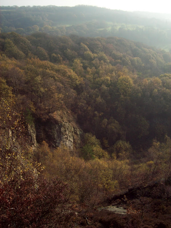
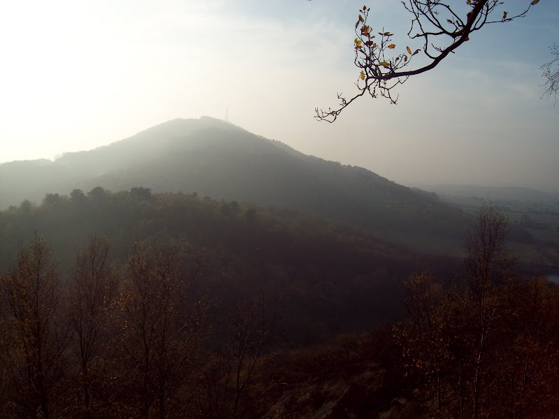
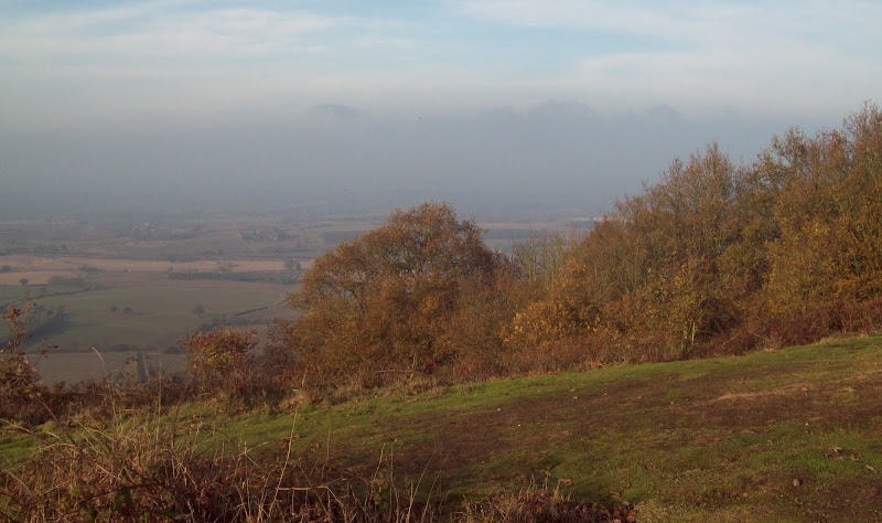
Leaving Wellington station at 12:45, there was a short section of suburbia to be navigated, before crossing the motorway and getting straight onto the Ercall. This is a smaller hill just to the NE of the Wrekin, which I decided was worthy of a visit as well. A fairly steep start led to more pleasant terrain, and near the summit, there were a couple of clearings in the trees allowing views out to the east. The area on the far side of the golf course looked as if it might have some nice walking too. At the summit, the path went to the edge of a quarried area, which fell steeply away. With the amount of rejuvenated tree growth, this made for an impressive looking cliff. There were also views of the next target, looking quite large in the haze.
Across the golf course from the Ercall:

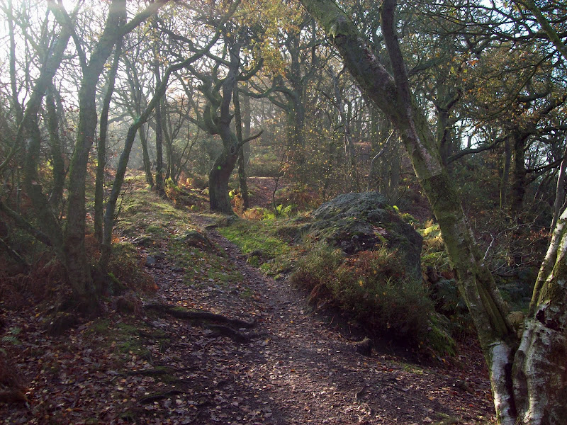
Woodland path:
Overgrown quarry. The crags almost look natural and quite impressive:
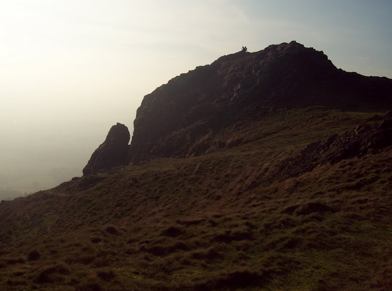
The Wrekin from the Ercall:
A short steep descent followed by a leg along a minor road led to the most common starting point for the Wrekin. It was heaving, with cars lining the sides of the road. I started on the main vehicle track, passing a mountain biker, then diverted up a steep, leaf covered slope as a shortcut. The leaves were as slippy as the worst scree!
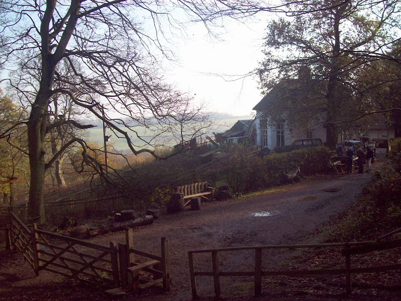
Popping back out on the main track, the route passed a strategically placed house, perched on the hillside with views east.
House perched halfway up the Wrekin:
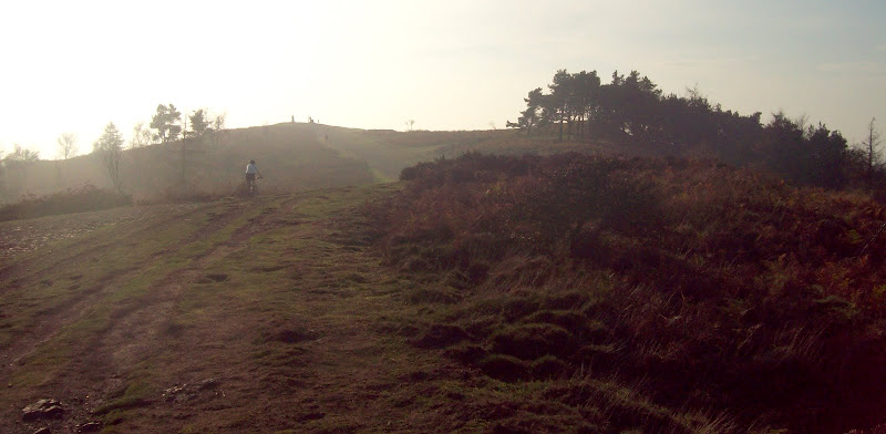
There is only one route from here onwards, as the NW ridge is quite narrow. There were dozens of people about, and the mountain biker caught me up again. However I kept getting ahead every time we hit a steep section (which there were a lot of)
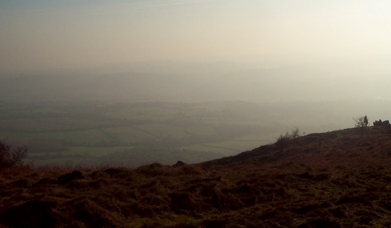
Where Wales would be if it wasn't so hazy:
Down the NE ridge to Wellington:
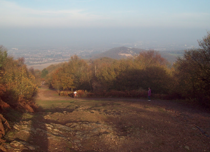
Approach to the summit (MTB guy finally got past me!):
The biker finally beat me to the summit, but only just. He went back down the same way at a rate of knots though - no way I'd keep up with him on the downhill! On the summit, the views were OK, but marred by the haze - it was hard to see further than about 10 miles. With the families sitting around in t-shirts enjoying picnics, it didn't feel like mid November at all. Wales was invisible, but some of southern Shropshire could just be discerned through the murk - probably Wenlock Edge. The warmth and sunshine more than made up for the haze though.
This finally confirmed my ascent of the Wrekin. I had come here for an orienteering event back in 1996, and was fairly sure I had crossed the summit, but have no recollection of it. The course organisers had been more interested in sending us on a tortuous zigzagging line up and down the NW face of the hill than taking us to any viewpoints.
NE across the summit:

South across the Severn Valley to the hillier parts of Shropshire:
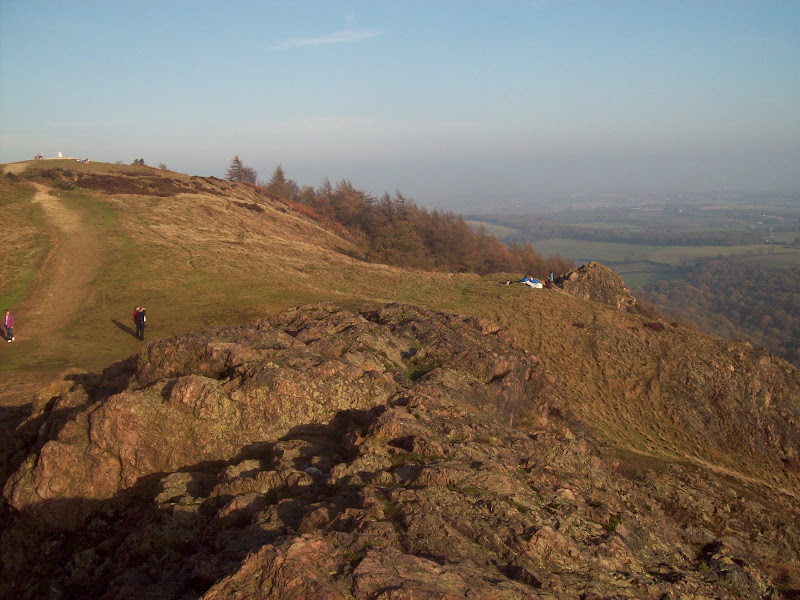
Beyond the trig point, there were some interesting rocky outcrops. Being quite a steep sided hill, these gave the impression of being much higher than a meagre 400m.
Some interesting rocky formations. Second one is probably Needle's Eye:

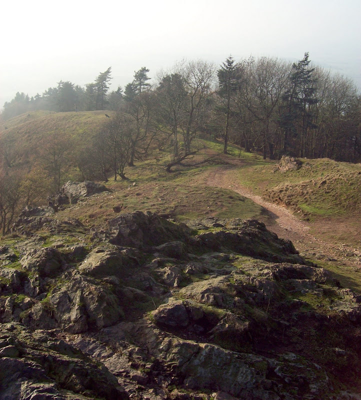
Next was the descent of the SW ridge, which was much quieter than the route of ascent, and before long I was plunged back into the trees. I saw lots of grey squirrels, but they were off before I could get the camera focussed on them. Probably my noisy gasping for air didn't help!
Along the SW ridge:
A bit of dodging and weaving took me past a scout camp and out onto the public road. I jogged up to Little Wenlock and on to the A5223, which was pleasant, and then onward through Telford. At one point I had planned to take a longer route via Ironbridge, but I decided this could wait for another visit.
Looking back to the Wrekin from near Little Wenlock:

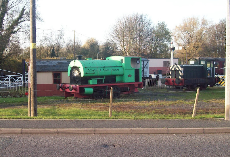
Parts of Telford were more pleasant than I had expected (being parts of the old villages that had pre-dated Telford, rather than the soulless concrete and roundabouts of the town centre), and I passed the railway museum. The OS 1:50,000 map wasn't the best for this kind of navigation, and I was nearly caught out a couple of times by new roads or junctions which worked differently to how the map suggested. Eventually I was on the east side of the town and back on familiar ground (due to runs I have being doing on weekday evenings). Back out in the country again, and there was a stiff pull up Nedge Hill, before a gentle drop back down to Shifnal. I confess to walking for half a mile or so here, as I was gubbed!
Thomas the tank (or is this one Percy?)
In the end I walked most of the Ercall and the Wrekin (to maximise the enjoyment, not to mention them being steep!) and ran nearly all of the rest. A good day out, but I definitely prefer doing this sort of thing on the bike!
