
Black Mountain: Garreg Las to Fan Brycheiniog
Hewitts: Garreg Las, Bannau Sir Gaer, Fan Brycheiniog, Fan Hir
Date walked: 21/04/2012
Time taken: 5 hours
Distance: 19km
Ascent: 1110m
Weather: Heavy showers, leading to sunshine and gusty wind
Here's something a little different to Fisherfield! The original plan was to head down to Llangadog on the train to do these hills over a weekend, but as my diary seems to be filling up with non-walking related stuff, I decided to consolidate it with another walk. This meant a bit of cheating…hiring a car! It isn’t like I’ve done all of my other Welsh hills without a car, but I did feel strangely guilty for using one to get to some that could be done by train. Silly really.
In order to make use of Enterprise’s rock bottom weekend rates, I had to collect the car at 9am on Saturday morning, so no early start on the hill. Indeed, it even meant I could have a bit of a lie-in. The back roads through Shropshire were a shortcut as far as Ludlow, after which it was slow going in the heavy traffic to Brecon. The weather was looking pretty good…until I got to the western Brecon Beacons, when I hit heavy showers.
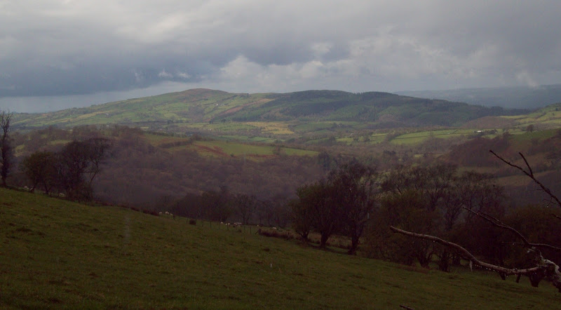
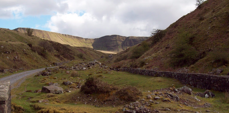
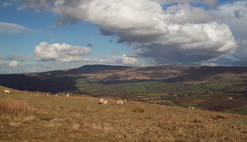
Llanddeusant is pretty tight for parking - in fact I later discovered that you’re best off driving to the Llyn y Fan Fach road head. I squeezed in onto an embankment near the middle of the village, and started walking steeply down the minor road towards Gelligron. This was soon steeply up, then a road no more. A track led to the edge of the rough grazing, then it was easy walking across short grass towards Carreg yr Ogof. It was still showery at this point, with no sign of the famous cliffs of Bannau Sir Gaer, but some sunshine was on the way.
Trichrug:
Back to Llanddeusant, with Mid Wales beyond:

Garreg Las from Carreg yr Ogof:
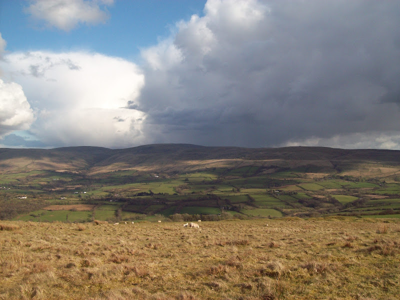
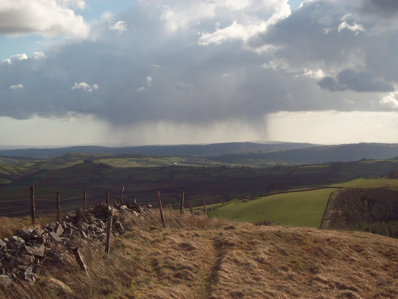
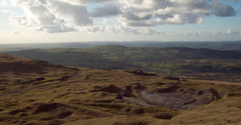
From the trig point of Carreg yr Ogof, there was more easy walking towards Garreg Las. This area is mostly limestone, so it drains really quickly. A couple of massive cairns marked the summit of Garreg Las. I stopped for a break, and waited for the cloud to clear gradually. The highest summits still weren’t in view, but I could see across the vast expanse of grassy moorland which makes up the southern slopes of the range. Also looking south, the weather over the valleys was beginning to clear. I was pretty surprised to be able to spot Swansea, the Gower Peninsula and the sea. It was hardly going to rival the views around Coigach and Inverpollaidh, but I’d never even associated any of the Brecon Beacons with being able to see the coast.
Summit cairns of Garreg Las:
Descending steeper and rougher gound, I picked up one of the bridleways that crosses the hills, and followed it for a short distance. Then I broke away onto the slopes of Waun Llefrith – very wet in places. I wasn’t sure what to expect at the summit, but suddenly the whole range was in front of me. The cloud had cleared extensively in the last 40 minutes, and the sun had come out. The only downside was the wind, which was strong along the edge where the vest views were.
Garreg Las from Waun Llefrith:
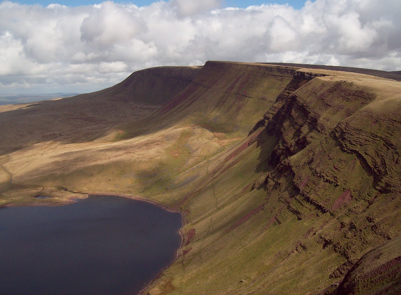
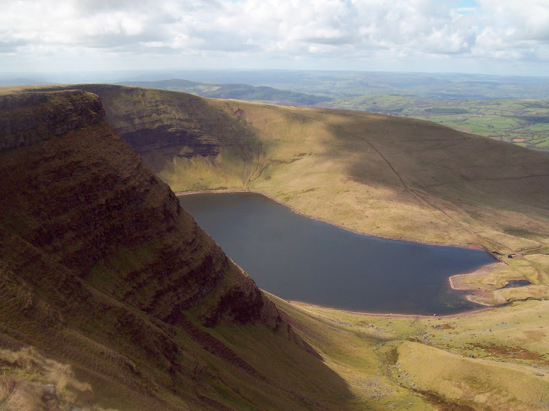
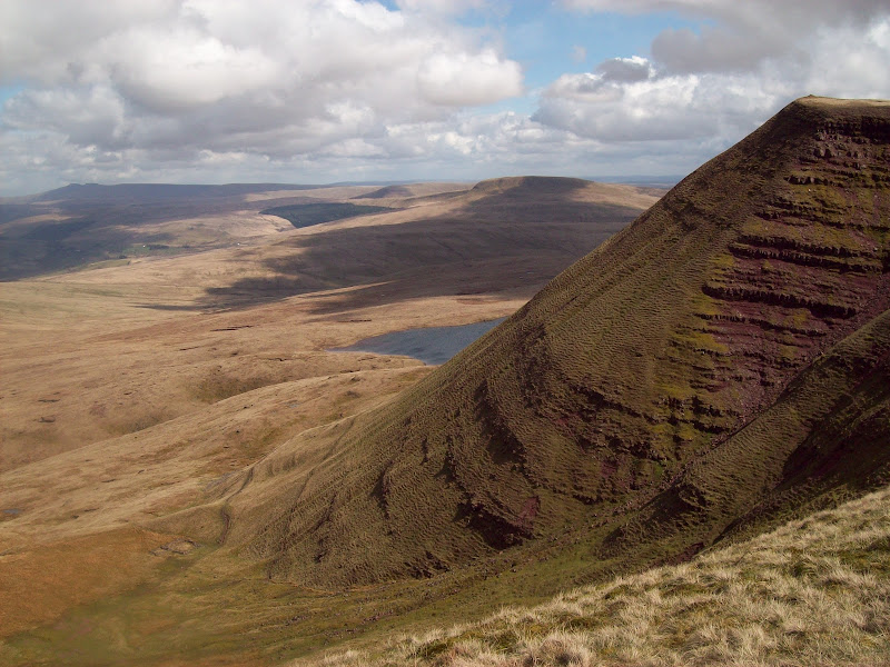
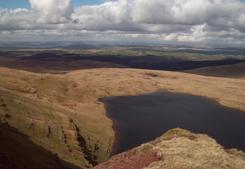
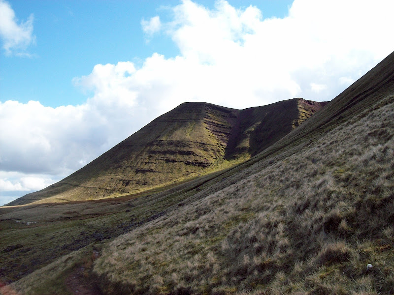
The classic view of Fan Brycheiniog and Bannau Sir Gaer:
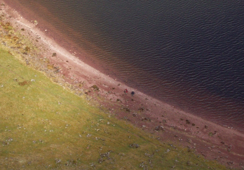
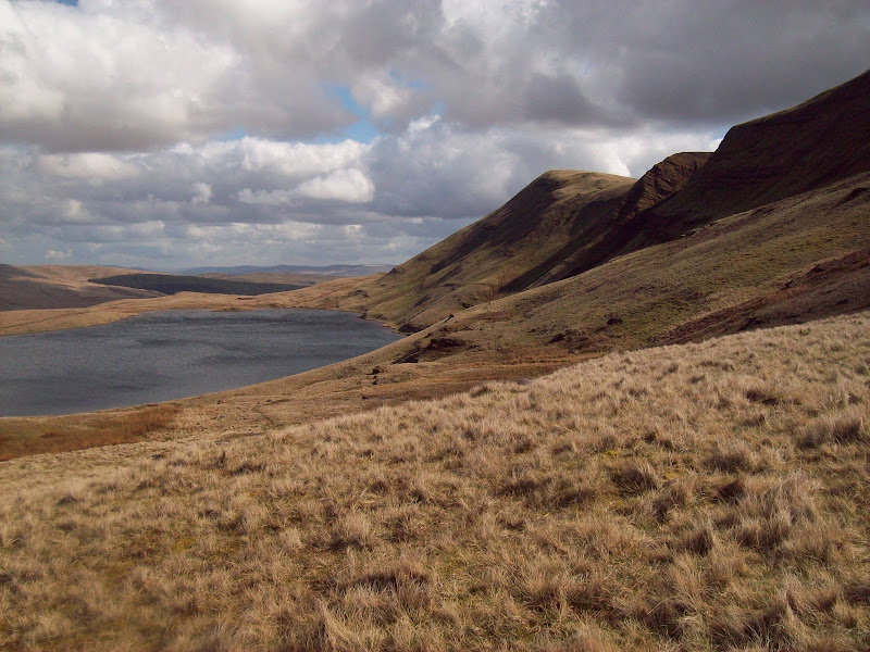
A couple of folk just about visible on the shores of Llyn y Fan Fach:
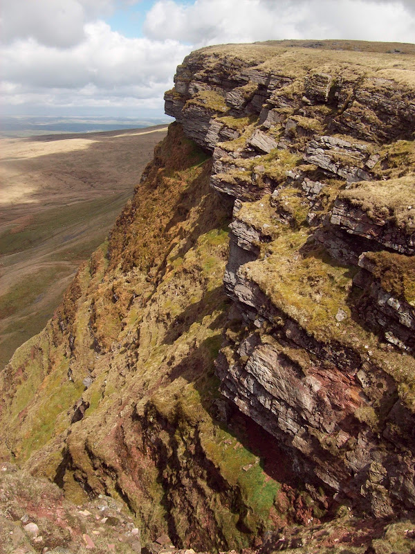
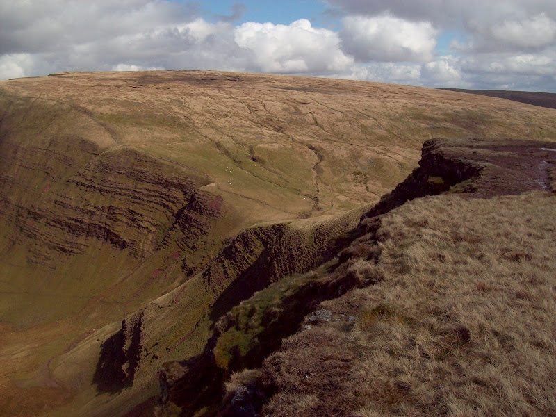
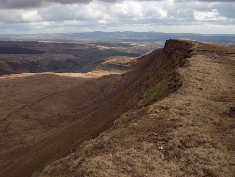
Cliff edge:
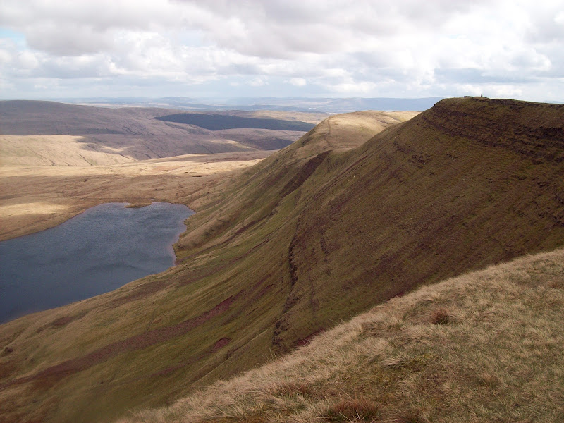
The slopes up to Bannau Sir Gaer were fairly gentle, and a great promenade above Llyn y Fan Fach, but descent on the other side was much steeper. I passed a group of three guys here, who were making pretty speedy progress up this.
Looking back. The white dots you see aren't snow patches...
...they are suicidal sheep!

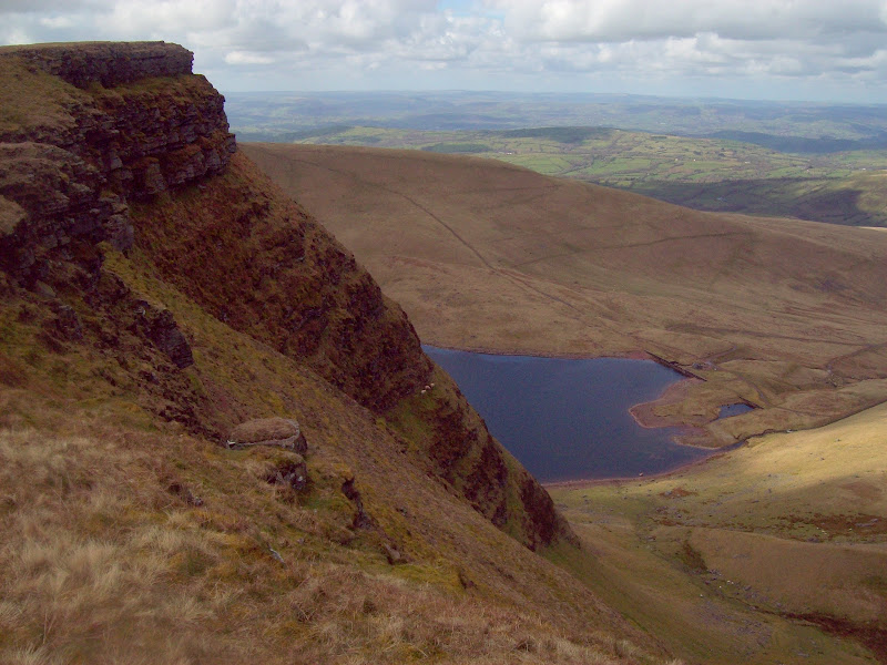
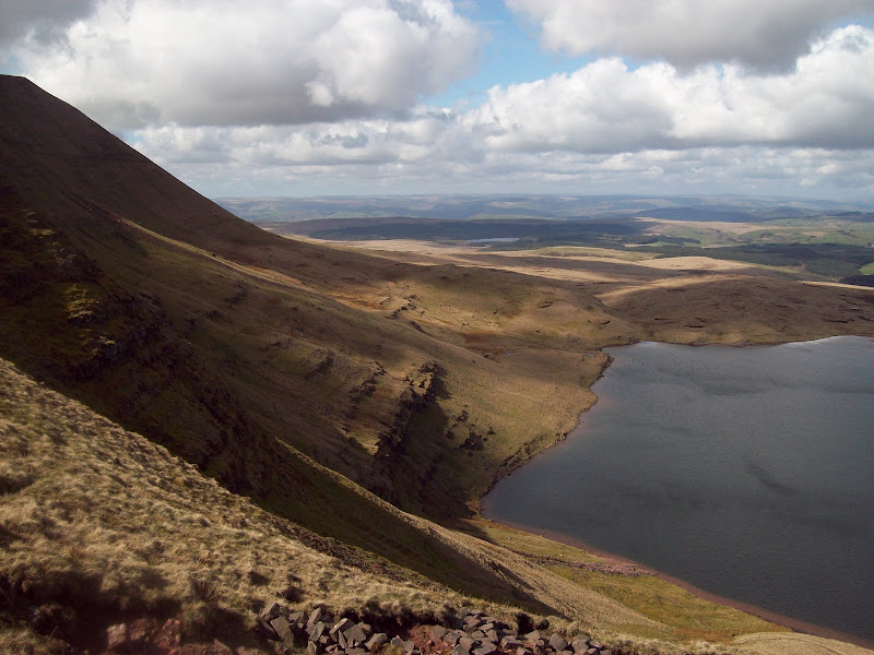
Llyn y Fan Fach:
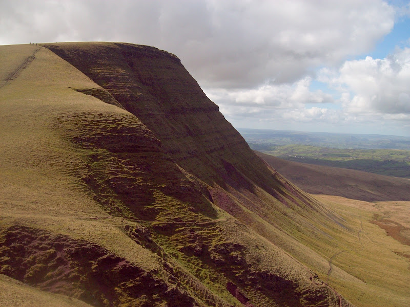
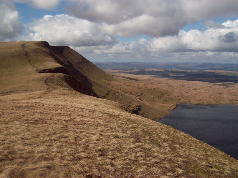
Fan Brycheiniog:
Back to Bannau Sir Gaer:
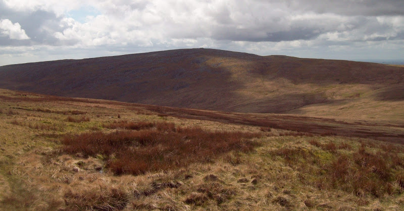
The original plan was to contour around to Fan Hir and return over Fan Brycheiniog, but I didn’t trust the weather to stay nice. Instead I stuck to the ridge, enjoying the views east as I reached the skyline. There was a whole new lake and line of crags to look at over here. A couple I passed just before the summit were the only other people I passed apart from the trio earlier. I had spotted other people in the distance, but they always seemed to be going elsewhere (a fair few fellrunners too).
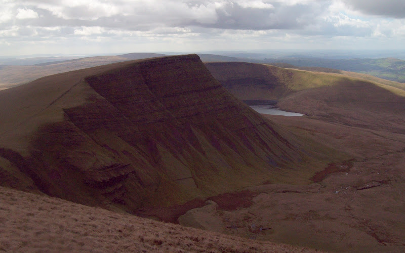
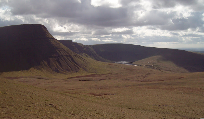
Fforest Fawr, Llyn y Fan Fawr and Fan Brycheiniog (with Pen y Fan in the far distance):
Llyn y Fan Fawr and along to Fan Hir:
Fan Hir:
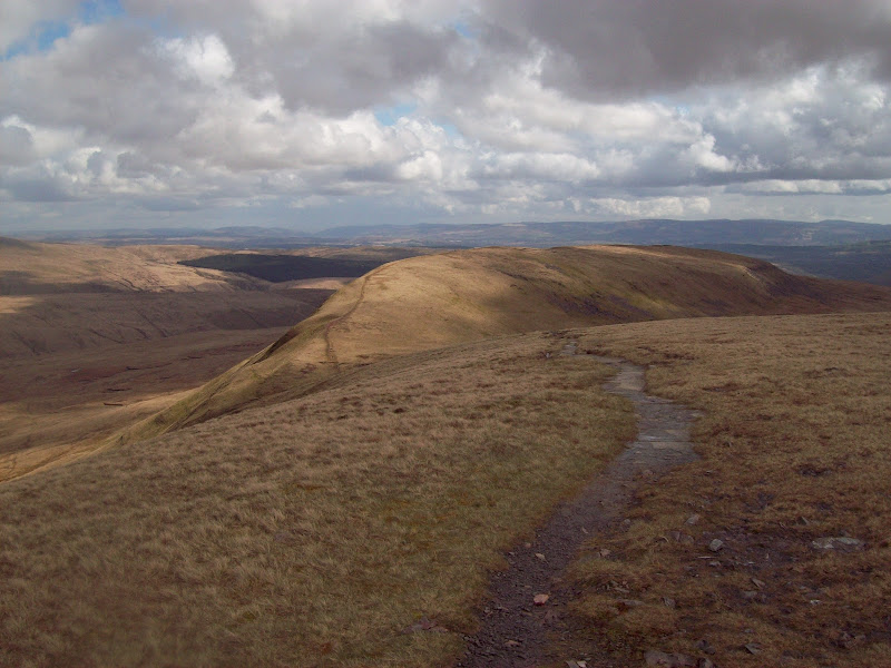
A flagged path led the way down towards Fan Hir, suggesting that this must be the most common ascent route. I had another break out of the wind then made the small ascent to Fan Hir. This ridge looked as if it would provide scenic walking all the way down to Tawe Valley, but I turned and retraced my steps to the col.
Swansea Valley from Fan Hir:
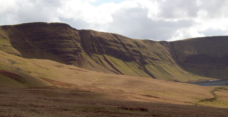
As I was heading back, I spotted a more interesting return route than re-ascending Fan Brycheiniog. I could see paths contouring around Llyn y Fan Fawr and onward round the corner, so I dropped down and followed one, traversing beneath some of the cliffs. This was a great move, giving me lovely views of Llyn y Fan Fawr, before taking me round the corner and suddenly facing me with the cliffs of Bannau Sir Gaer again.
North across Llyn y Fan Fawr:
South along Fan Hir:
Back to Fan Brycheiniog:
Fan Hir and Llyn y Fan Fawr:
Fan Brycheiniog:
Bannau Sir Gaer and Llyn y Fan Fach:
More easy grass led me down to the reservoir track, from where it was a short walk down to Blaenau. There was a decent amount of parking space here, but for me there was another mile back to Llanddeusant. As the road rose out of the valley, the views back were tremendous. I now had only the extreme western summit of Moel Gornach to climb, which was best done as a very short separate walk.
Back up the valley:
The view from the road near Llanddeusant:
~~~~~~~~~~~~~~~~~~~~~~~~~~~~~~~~~~~~~~~~~~~~
Sub 2000 Marilyns: Trichrug
Date walked: 21/04/2012
Time taken: 35 minutes
Distance: 3km
Ascent: 130m
Weather: Sunshine and gusty wind
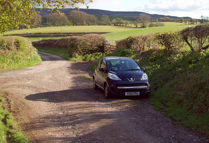
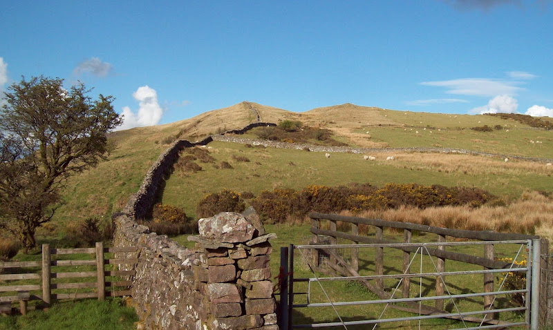
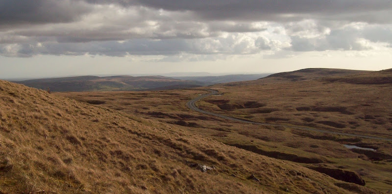
Before heading to Moel Gornach, I had another quick trip planned. When I had originally planned to do these hills over a weekend by train, I had identified Trichrug as a handy Marilyn to fill up some time before my train home. Having spent the early part of my walk looking over at it, I decided it looked very attractive, and worth a visit. I drove over to Blaen Llynant, where there was enough space for a couple of cars to park. A good vehicle track led to a col, where there were fine views onto the Tywi Valley and Mid Wales in general. It was a simple task of following a wall from here, dodging a couple of bits of old fence, and up to the trig point.
Space for a teeny tiny car at least:
Summit ridge from the col:
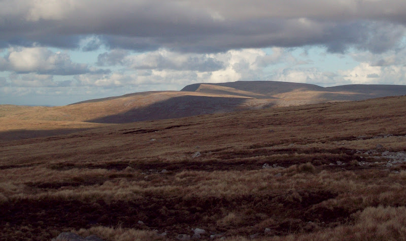
Eastern end of Black Mountain:
Western end:
The summit views were even nicer, extending almost from the border to the coast. The west end of Black Mountain glowed golden as the evening sun hit it, and I could see another shower hanging in the air to the west. There was also another large burial cairn on the summit – a standard feature of the hills in this area, it seems. Then it was back down the same way.
Shower coming in:
Western Black Mountain with golden tinge:
~~~~~~~~~~~~~~~~~~~~~~~~~~~~~~~~~~~~~~~~~~~~
Hewitts: Moel Gornach
Date walked: 21/04/2012
Time taken: 35 minutes
Distance: 3km
Ascent: 130m
Weather: Sunshine and gusty wind
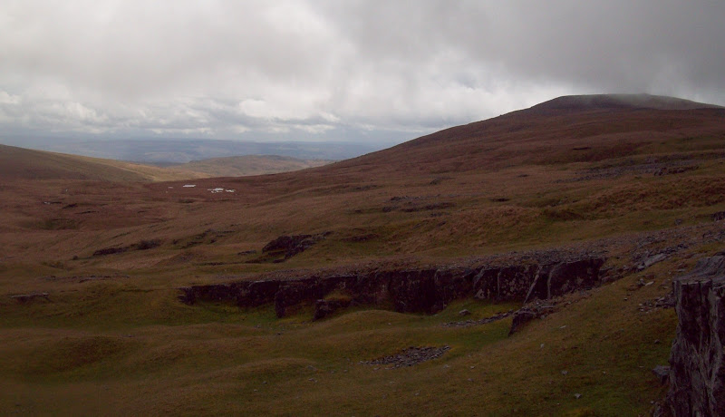
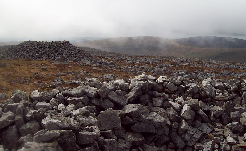
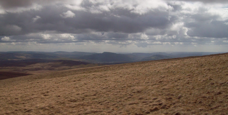
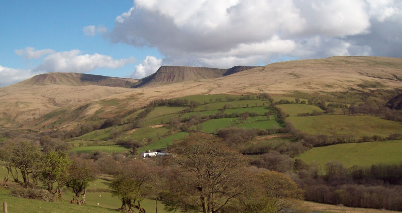
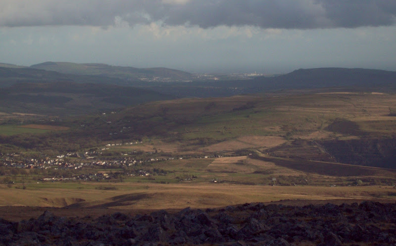
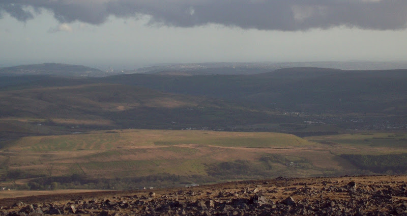
One last drive along winding lanes took me to the top of the high pass which crosses over the western end of Black Mountain. I parked up at an old quarry there and set off for the last hill of the day. Moel Gornach was an easy 15 minute ascent over dry ground. Once past the quarries, it wasn’t even steep. I’d noticed other folk suggesting that this is the easiest Welsh Hewitt, and I’d probably agree, even though it has a fair amount of competition from other summits adjacent to high passes (most notably Lord Hereford’s Knob, which has a similar amount of ascent, and steps and paving stones the whole way). The summit was another broad dome with a large cairn, but the evening light made the views spectacular. Swansea and Port Talbot were clearly in view again, and some of the hills in between were positively glowing. I hung around for a short while, before making a quick descent.
Trichrug from above the quarry:
High pass over to Brynamman:
Big clouds on the summit:
Zoom to Port Talbot:
...and Swansea:
West to Garreg Las and Fan Brycheiniog:
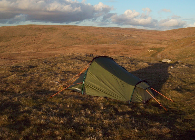
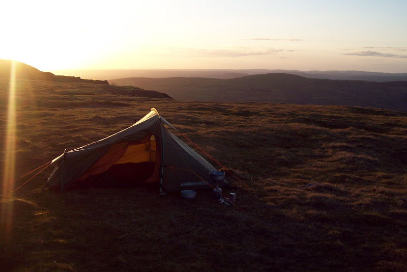
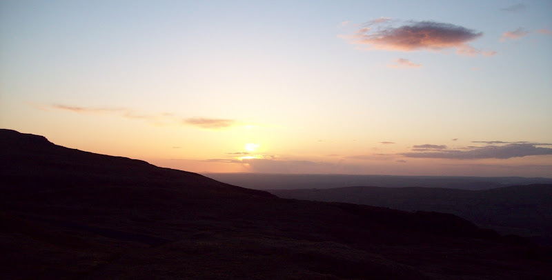
Next on the agenda was a test run of my new lightweight tent. This was more car camping than wild camping, but I packed up my bag with my stove and all of my overnight gear, and walked a few minutes around the corner as a compromise. I found a nice flat spot overlooking the Sawdde Valley and pitched there. It was a bit on the breezy side but I was sorted and cooking my dinner before long. I’m glad I did this before heading out properly into the wild, as I probably could have made a better job of pitching. Still, it was good enough, and I enjoyed the sunset for a short while before turning in for the night. It was a bit on the cold side for my usual shorts and t-shirt attire, but luckily my sleeping bag was warm. Note to self – take warmer clothes when on a proper wild camp!
Camping spot and sunset:
I don’t want to spoil Sunday’s report too much, but having now ascended all of the 2000 footers in the Brecon Beacons, the eastern part of Black Mountain was easily my favourite spot.
(Link to day 2 report.)
Date walked: 21/04/2012
Time taken: 5 hours
Distance: 19km
Ascent: 1110m
Weather: Heavy showers, leading to sunshine and gusty wind
Here's something a little different to Fisherfield! The original plan was to head down to Llangadog on the train to do these hills over a weekend, but as my diary seems to be filling up with non-walking related stuff, I decided to consolidate it with another walk. This meant a bit of cheating…hiring a car! It isn’t like I’ve done all of my other Welsh hills without a car, but I did feel strangely guilty for using one to get to some that could be done by train. Silly really.
In order to make use of Enterprise’s rock bottom weekend rates, I had to collect the car at 9am on Saturday morning, so no early start on the hill. Indeed, it even meant I could have a bit of a lie-in. The back roads through Shropshire were a shortcut as far as Ludlow, after which it was slow going in the heavy traffic to Brecon. The weather was looking pretty good…until I got to the western Brecon Beacons, when I hit heavy showers.
Llanddeusant is pretty tight for parking - in fact I later discovered that you’re best off driving to the Llyn y Fan Fach road head. I squeezed in onto an embankment near the middle of the village, and started walking steeply down the minor road towards Gelligron. This was soon steeply up, then a road no more. A track led to the edge of the rough grazing, then it was easy walking across short grass towards Carreg yr Ogof. It was still showery at this point, with no sign of the famous cliffs of Bannau Sir Gaer, but some sunshine was on the way.
Trichrug:
Back to Llanddeusant, with Mid Wales beyond:
Garreg Las from Carreg yr Ogof:
From the trig point of Carreg yr Ogof, there was more easy walking towards Garreg Las. This area is mostly limestone, so it drains really quickly. A couple of massive cairns marked the summit of Garreg Las. I stopped for a break, and waited for the cloud to clear gradually. The highest summits still weren’t in view, but I could see across the vast expanse of grassy moorland which makes up the southern slopes of the range. Also looking south, the weather over the valleys was beginning to clear. I was pretty surprised to be able to spot Swansea, the Gower Peninsula and the sea. It was hardly going to rival the views around Coigach and Inverpollaidh, but I’d never even associated any of the Brecon Beacons with being able to see the coast.
Summit cairns of Garreg Las:
Descending steeper and rougher gound, I picked up one of the bridleways that crosses the hills, and followed it for a short distance. Then I broke away onto the slopes of Waun Llefrith – very wet in places. I wasn’t sure what to expect at the summit, but suddenly the whole range was in front of me. The cloud had cleared extensively in the last 40 minutes, and the sun had come out. The only downside was the wind, which was strong along the edge where the vest views were.
Garreg Las from Waun Llefrith:
The classic view of Fan Brycheiniog and Bannau Sir Gaer:
A couple of folk just about visible on the shores of Llyn y Fan Fach:
Cliff edge:
The slopes up to Bannau Sir Gaer were fairly gentle, and a great promenade above Llyn y Fan Fach, but descent on the other side was much steeper. I passed a group of three guys here, who were making pretty speedy progress up this.
Looking back. The white dots you see aren't snow patches...
...they are suicidal sheep!
Llyn y Fan Fach:
Fan Brycheiniog:
Back to Bannau Sir Gaer:
The original plan was to contour around to Fan Hir and return over Fan Brycheiniog, but I didn’t trust the weather to stay nice. Instead I stuck to the ridge, enjoying the views east as I reached the skyline. There was a whole new lake and line of crags to look at over here. A couple I passed just before the summit were the only other people I passed apart from the trio earlier. I had spotted other people in the distance, but they always seemed to be going elsewhere (a fair few fellrunners too).
Fforest Fawr, Llyn y Fan Fawr and Fan Brycheiniog (with Pen y Fan in the far distance):
Llyn y Fan Fawr and along to Fan Hir:
Fan Hir:
A flagged path led the way down towards Fan Hir, suggesting that this must be the most common ascent route. I had another break out of the wind then made the small ascent to Fan Hir. This ridge looked as if it would provide scenic walking all the way down to Tawe Valley, but I turned and retraced my steps to the col.
Swansea Valley from Fan Hir:
As I was heading back, I spotted a more interesting return route than re-ascending Fan Brycheiniog. I could see paths contouring around Llyn y Fan Fawr and onward round the corner, so I dropped down and followed one, traversing beneath some of the cliffs. This was a great move, giving me lovely views of Llyn y Fan Fawr, before taking me round the corner and suddenly facing me with the cliffs of Bannau Sir Gaer again.
North across Llyn y Fan Fawr:
South along Fan Hir:
Back to Fan Brycheiniog:
Fan Hir and Llyn y Fan Fawr:
Fan Brycheiniog:
Bannau Sir Gaer and Llyn y Fan Fach:
More easy grass led me down to the reservoir track, from where it was a short walk down to Blaenau. There was a decent amount of parking space here, but for me there was another mile back to Llanddeusant. As the road rose out of the valley, the views back were tremendous. I now had only the extreme western summit of Moel Gornach to climb, which was best done as a very short separate walk.
Back up the valley:
The view from the road near Llanddeusant:
~~~~~~~~~~~~~~~~~~~~~~~~~~~~~~~~~~~~~~~~~~~~
Sub 2000 Marilyns: Trichrug
Date walked: 21/04/2012
Time taken: 35 minutes
Distance: 3km
Ascent: 130m
Weather: Sunshine and gusty wind
Before heading to Moel Gornach, I had another quick trip planned. When I had originally planned to do these hills over a weekend by train, I had identified Trichrug as a handy Marilyn to fill up some time before my train home. Having spent the early part of my walk looking over at it, I decided it looked very attractive, and worth a visit. I drove over to Blaen Llynant, where there was enough space for a couple of cars to park. A good vehicle track led to a col, where there were fine views onto the Tywi Valley and Mid Wales in general. It was a simple task of following a wall from here, dodging a couple of bits of old fence, and up to the trig point.
Space for a teeny tiny car at least:
Summit ridge from the col:
Eastern end of Black Mountain:
Western end:
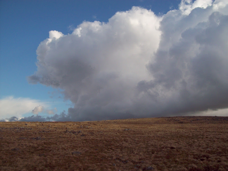
The summit views were even nicer, extending almost from the border to the coast. The west end of Black Mountain glowed golden as the evening sun hit it, and I could see another shower hanging in the air to the west. There was also another large burial cairn on the summit – a standard feature of the hills in this area, it seems. Then it was back down the same way.
Shower coming in:
Western Black Mountain with golden tinge:
~~~~~~~~~~~~~~~~~~~~~~~~~~~~~~~~~~~~~~~~~~~~
Hewitts: Moel Gornach
Date walked: 21/04/2012
Time taken: 35 minutes
Distance: 3km
Ascent: 130m
Weather: Sunshine and gusty wind
One last drive along winding lanes took me to the top of the high pass which crosses over the western end of Black Mountain. I parked up at an old quarry there and set off for the last hill of the day. Moel Gornach was an easy 15 minute ascent over dry ground. Once past the quarries, it wasn’t even steep. I’d noticed other folk suggesting that this is the easiest Welsh Hewitt, and I’d probably agree, even though it has a fair amount of competition from other summits adjacent to high passes (most notably Lord Hereford’s Knob, which has a similar amount of ascent, and steps and paving stones the whole way). The summit was another broad dome with a large cairn, but the evening light made the views spectacular. Swansea and Port Talbot were clearly in view again, and some of the hills in between were positively glowing. I hung around for a short while, before making a quick descent.
Trichrug from above the quarry:
High pass over to Brynamman:
Big clouds on the summit:
Zoom to Port Talbot:
...and Swansea:
West to Garreg Las and Fan Brycheiniog:
Next on the agenda was a test run of my new lightweight tent. This was more car camping than wild camping, but I packed up my bag with my stove and all of my overnight gear, and walked a few minutes around the corner as a compromise. I found a nice flat spot overlooking the Sawdde Valley and pitched there. It was a bit on the breezy side but I was sorted and cooking my dinner before long. I’m glad I did this before heading out properly into the wild, as I probably could have made a better job of pitching. Still, it was good enough, and I enjoyed the sunset for a short while before turning in for the night. It was a bit on the cold side for my usual shorts and t-shirt attire, but luckily my sleeping bag was warm. Note to self – take warmer clothes when on a proper wild camp!
Camping spot and sunset:
I don’t want to spoil Sunday’s report too much, but having now ascended all of the 2000 footers in the Brecon Beacons, the eastern part of Black Mountain was easily my favourite spot.
(Link to day 2 report.)