free to be able to rate and comment on reports (as well as access 1:25000 mapping).
Sub 2000 Marilyns: Worcestershire Beacon
Date: 28/07/2012
Distance: 20 km
Ascent: 780m
Time taken: 4 hours 50 minutes
Weather: Sunny and warm. Slight haze and breezy on ridge.
I was tempted by a visit to the Peak District this weekend, or maybe some wild camping in the Lake District. In the end, I settled for something shorter and closer to home - the Malvern Hills. Much is made of how this ridge tends to be a there-and-back walk due to the small amount of space it takes up, but I planned to start from the station at Ledbury and do a full traverse in one direction only.
Lazy start from Birmingham meant that I wasn't walking until 12. Ledbury is typical of this part of the country - sizeable and bustling, but I'd never heard of it prior to planning this trip. My knowledge of this part of the country is sketchy to say the least! I walked down the high street then took the Malvern road, picking up a public footpath shortly after. This passed through Coneygree Wood, which was thick and restricted the views. Passing through some fields after the high point of the path, I caught occasional glimpses of the Malvern Hills. These opened out as I descended to Eastnor.
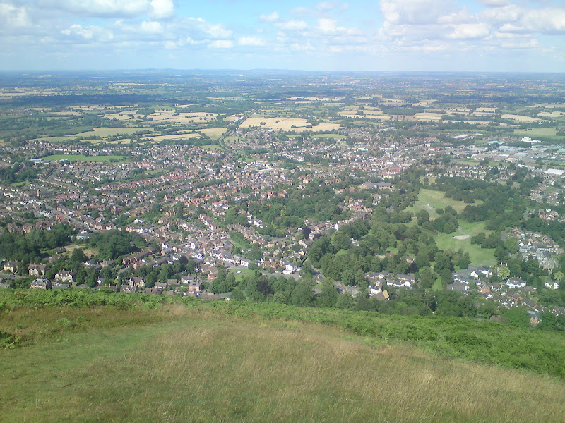
Malvern Hills from above Eastnor:

I had been told by many people how busy the Malvern Hills were, but this area just off the main ridge was practically deserted. The only people I passed were a couple of teenagers who were clearly about to get jiggy as I passed them. You'd think they might try somewhere a bit off the path!
Next was a section through Eastnor Deer Park, which had a stage set up in it by the campsite. I was wondering who was due to be playing here later. Was it worth sticking around for a look? Turned out it was Status Quo - time to move on swiftly!
Stage set up at Eastnor Park for some past-it crusties:

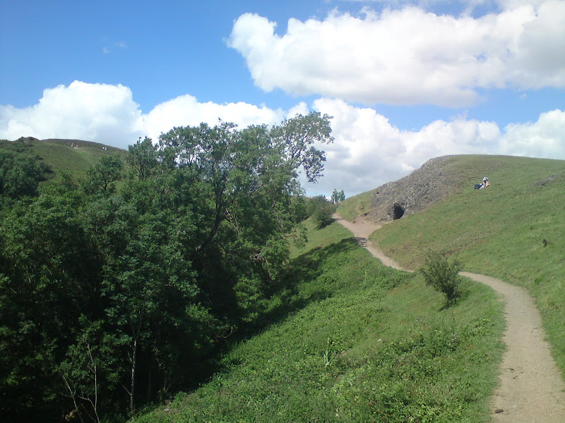
Climbing up towards the large obelisk in the centre of Eastnor Park, the paths were again deserted. I veered off into News Wood, where the vehicle track was submerged underwater, and I had to teeter around the edge on slithery clay soil. This was after a week of no rain - this bit must be horrible normally. Somehow I missed the path onto the ridge and ended up walking through the woods for longer than intended. Eventually I went off piste (more awkward than it sounds as the woodland is pretty dense), and climbed steeply, suddenly popping out on Hangman's Hill. The difference was startling - I was on short turf and there were literally dozens of people around.
Monument in Eastnor Park:

On the ridge at last - Hangman's Hill and Clutter's Cave:
I could see all the way into Wales with Ysgyryd Fawr, Sugar Loaf, the Black Mountains and Great Rhos all easily identifiable. Unfortunately I forgot my proper camera, so you will be lucky to make out that amount of detail from my cameraphone photos.
West across Herefordshire to the Black Mountains:

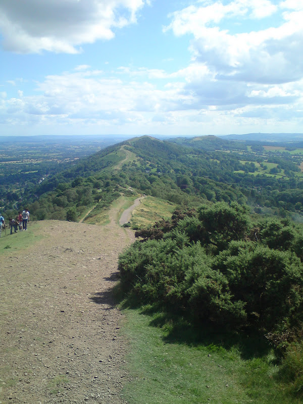
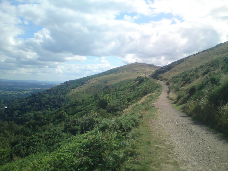
There were even steps and sections of tarmac path on the steeper bits, but the walking was easy and the views were good, so it didn't bother me. Herefordshire Beacon is the highest summit on this section of ridge. I stopped for a late lunch on its northern flanks before descending to a pass on the A449, which was cluttered with a hotel, carpark and cafe. A short section of the B4232 took me back onto the ridge, which was lower initially, but soon climbed up to Pinnacle Hill, another high point.
Millennium Hill sets the tone for the rest of the walk:


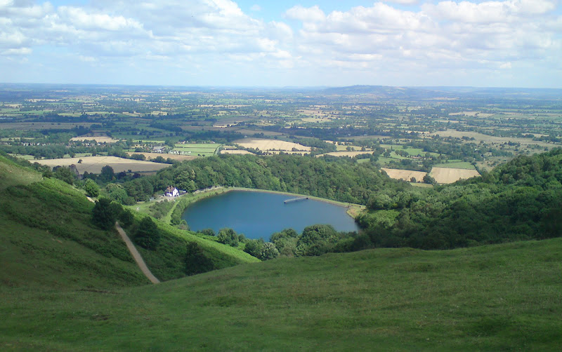
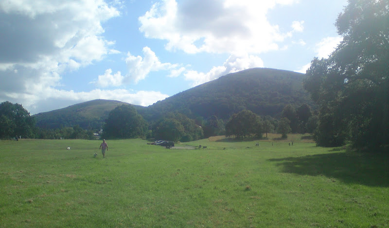
British Camp Reservoir:
Looking south from Pinnacle Hill:
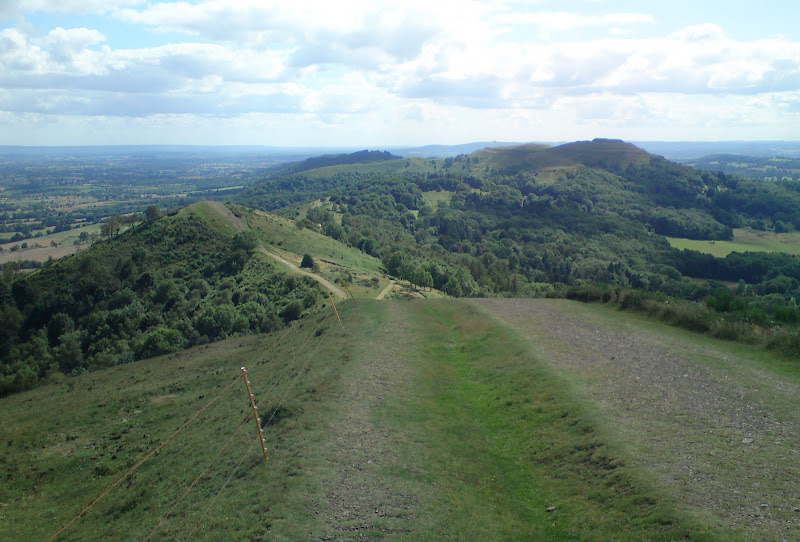
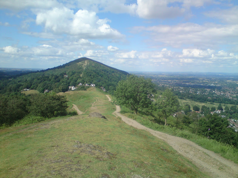
...and looking forward to Worcestershire Beacon:
again from Perserverance Hill:
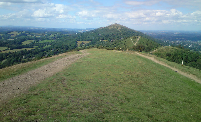
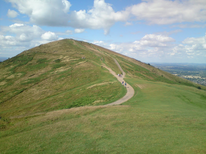
More down over assorted bumps in the ridge took me to the next road pass. There was a tarmac road (closed to traffic) all the way up Worcestershire Beacon, but this was easy to avoid, sticking to narrower paths. The top was pretty busy but the views were good, and it was an impressively steep sided summit for such a benign part of the country. In fact it reminded me a lot of Arthur's Seat.
South from the final ascent to Worcestershire Beacon. Nice to think I've walked along all this:
The last ascent:
The Marilyn was now in the bag but I wasn't going to descend without doing the northern end of the ridge - aptly named North Hill. This was a little quieter, particuarly on the steep north-eastern descent. Once in the woods, I picked up a zigzag path which took me down to a carpark in Great Malvern. From here it was a straightforward walk to Malvern Link station, where there was enough time to get changed, but not to search for a pint.
Last but not least - Table Hill and North Hill:

Fancy school (or hotel? I can't tell) in West Malvern:

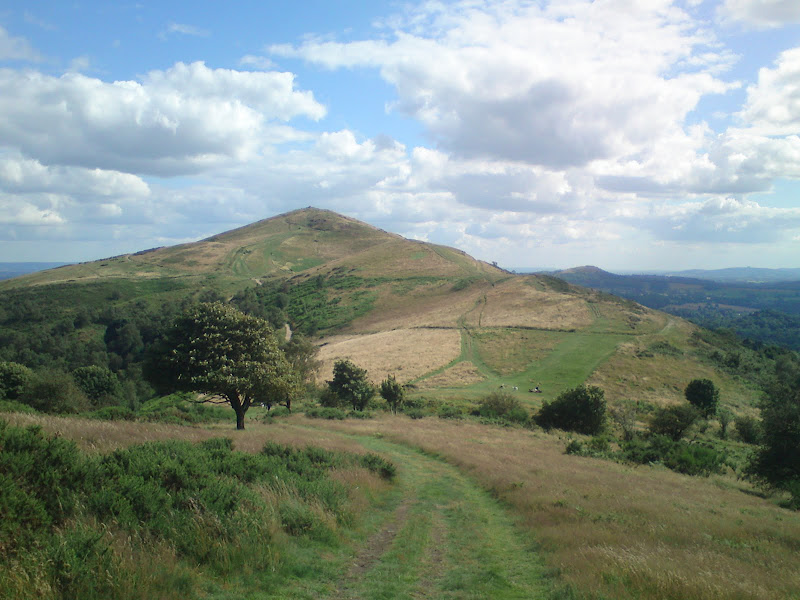
Back to Worcestershire Beacon:
Great Malvern:
Contouring North Hill:
Malvern Hills from Malvern Link:
The Malvern Hills don't really justify a long journey to get to them, but they are well worth a look if you are in the area. I'm glad I did the full traverse rather than just the highest point, and I was surprised how much ascent there was in the walk. It isn't that noticeable as it comes in small sections throughout the day.
