free to be able to rate and comment on reports (as well as access 1:25000 mapping).
Date: 25/08/2012
Distance walked: 8km
Ascent: 330m
Time taken: 3 hours 20 minutes.
Weather: Breezy with sunny spells.
This is a short coastal walk for a change. I always neglect the Moray coast when I'm at home, despite it having some good walking. Likewise, when growing up on Anglesey, I did very little coastal walking there either, tending to head for the hills in Snowdonia instead.
The weather was looking pretty hideous over the hills today, and mum suggested that she'd quite like to do the final section of the Anglesey Coastal Path that she'd not got around to. This started from Church Bay in the NW corner of the island. So that we weren't all retracing steps, dad and I dropped her off at Church bay and drove a couple of miles round to the National Trust Carpark near Hen-dy. We would meet her from the opposite direction, then we would all continue round to Carmel Head where some of the most impressive sea-cliffs were.
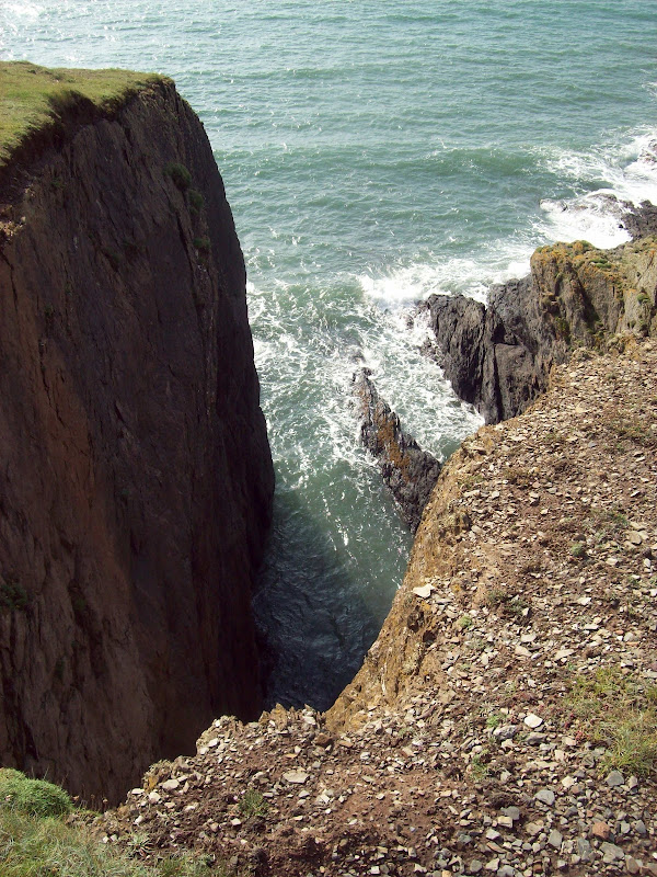
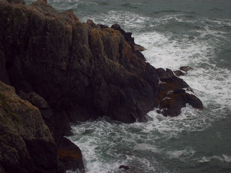
Dad and I strolled down to the coast from the carpark and headed towards Church Bay for a short while. Some impressively sheer drops off the path here, as well as great cliffs to look at. The air was still quite hazy at this point, but cleared as the day went on.
Porth y Dwfr:

Trwyn y Crewyn:

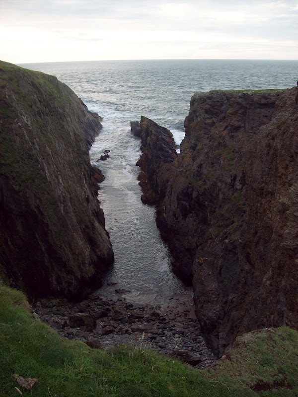
Big drops:
We reached a cairn on a small headland and spotted mum coming the other way from here. Then we all headed back north, including a couple of other small headlands as we went.
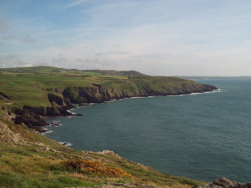
Porth y Dwfr and Pen y Foel:
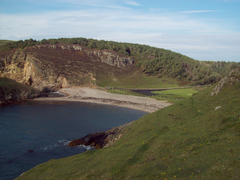
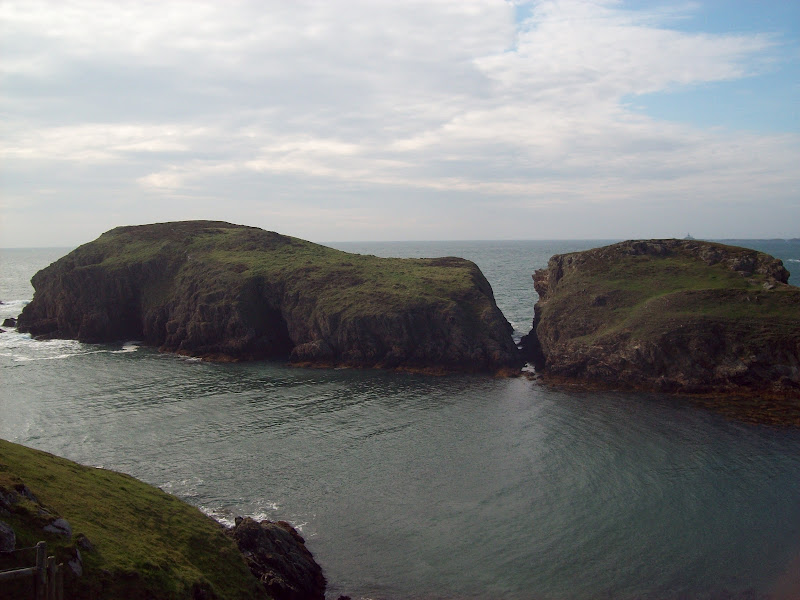
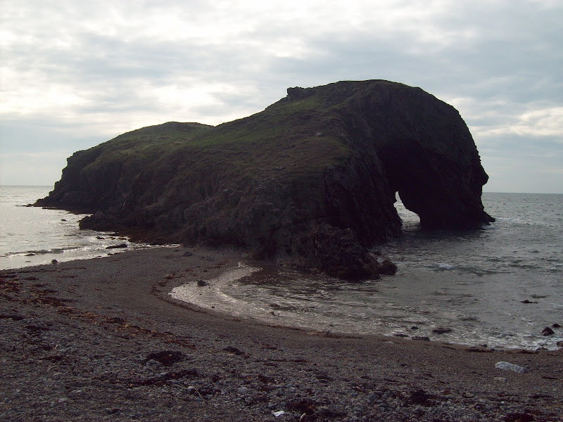
The most impressive part of the walk is where the route drops down to the bay next to the small island of Ynys y Fydlyn. At first this appears to be attached to the mainland, but then a gap appears on the island itself - a cave with a blowhole appears to have finally collapsed to create the island.
Down on the shore was where mum met up with the bit of the Anglesey Coastal path that she'd done before - this meant she had nowbeen round the whole island. At 126 miles, that's a fair amount of walking, and it took her 3 years of doing little bits here and there.
Ynys y Fydlyn and Trwyn Cerrigyreryr:

The land behind the bay here is used for pheasant rearing, and the path is shut for a couple of months a year to allow shooting. There were a good few pheasants on the beach.
Llyn y Fydlyn:
Pheasants:

Ynys y Fydlyn:

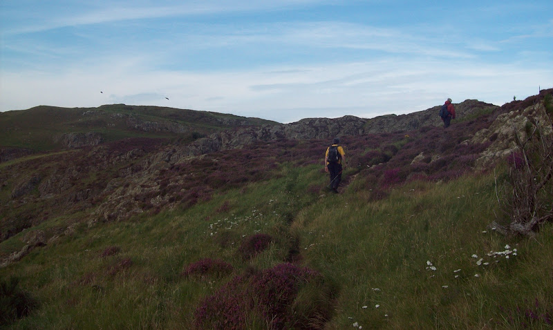
It was then a steep climb out of the bay and on towards the NW corner of Anglesey. Easy walking underfoot, but a fair amount of ascent and descent for a 'flat' walk. Soon the Skerries were in view.
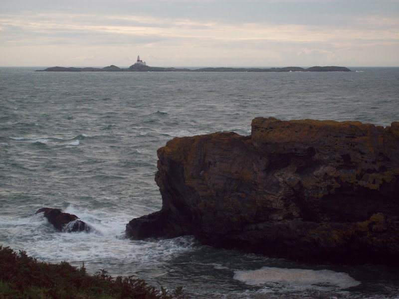
Trwyn Cerrigyreryr with the Skerries in the background:

Ascending from Llyn y Fydlyn:
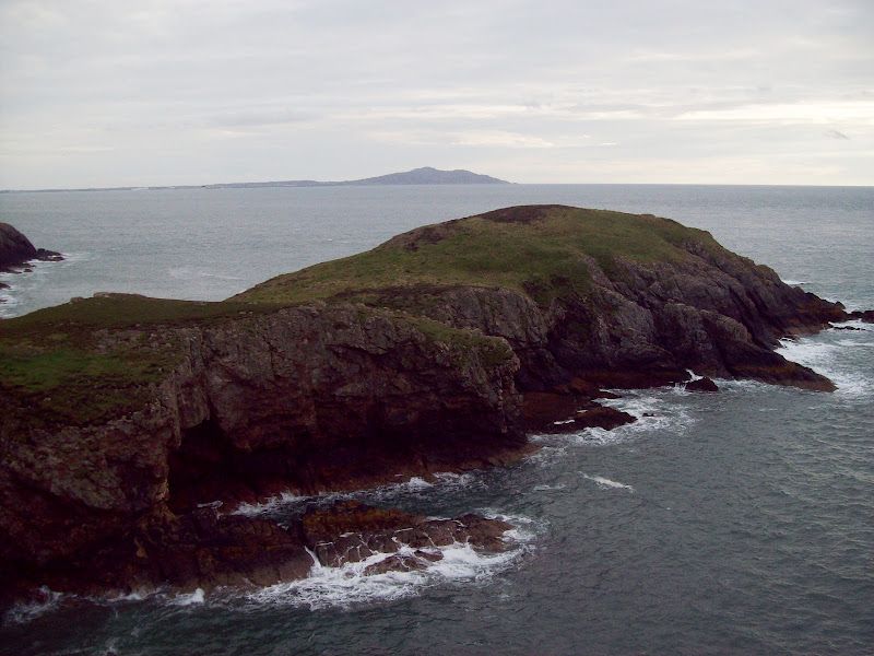
Ynys y Fydlyn with Holyhead Mountain in the background:

Bottom of the cliffs:
Mynydd y Garn:
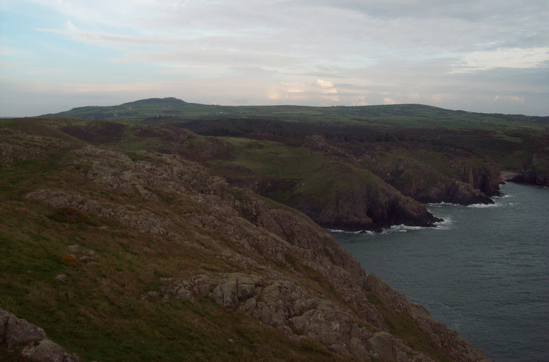
Once round the corner, the cliffs were lower and the inlets longer. We walked past a chimney and a couple of large brick markers (used for navigating into the coast here, although I have no idea why a boat would come ashore in this location). Wylfa Nuclear Power Station also came into view. As time was getting on (we hadn't started walking until after 4pm), we cut back over Penbrynyreglwys to the bay at Ynys Fydlyn.
Long inlet at Carmel Head:
The Skerries:
Trwyn Cemlyn and Wylfa Power Station:

With the haze clearing, Holyhead Mountain looked more impressive, and we were able to spot the Dublin ferry coming in. At the bay. we followed a track back up to the car. Given a bit more time, a visit to the summit of Mynydd y Garn might have been in order. Driving home, the hills of Snowdonia were still blanketed in clag - a good decision to avoid them today

.
Holyhead Mountain and a ferry from Ireland:

Trwyn y Crewyn across Ynys y Fydlyn:

Holyhead Mountain across Ynys y Fydlyn:
An enjoyable visit to one of the most impressive bits of coastline on Anglesey. Holyhead mountain is the only place which is more impressive, although there are also some nice beaches.
