free to be able to rate and comment on reports (as well as access 1:25000 mapping).
Having checked the weather forecast for the rest of the week, it was decided that our best shot at the High Street area was going to be today, with rain and low cloud predicted for Thursday and Friday. After much deliberation about where we could park, where we might be dropped off, where we might be picked up, etc etc, we decided that the best bet was to park at Kirkstone Pass, walk back home, and then get a lift back to the car. Starting at 1500ft was also appealing, though we would lose most of the benefit of it in the drop down to Threshthwaite Mouth.
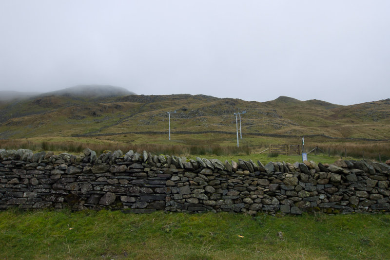
 Car park at the top of Kirkstone Pass
We set off a little later than we had hoped, after a diversion to Glenridding to buy knee supports, blister plasters, replacement gloves etc. The car park at Kirkstone was nearly empty, and we set off up the steep initial pull up to St Raven's Edge.
 Setting off towards St Raven's Edge
Before long we were on the ridge, and walking through shifting clouds that gave us occasional glimpses of where we might be heading. It's impossible to get lost though, as the path is good and closely follows a wall all the way to the summit of Caudale Moor (also known as Stony Cove Pike). By this time the cloud was constant, so we didn't linger but pressed on towards Threshthwaite Mouth.
The drop down to the hause was steep and rocky, and very frustrating knowing that every foot we descended meant a foot to be climbed the other side. At one point Sapphie came to a step down that was too large for her to be comfortable with, and we spent about 10 minutes trying to cajole her down before resorting to physical means to push, pull, lift and drop her. Next time I think I'll go back to the tried and true method of a good shove when she's not expecting it, but that would have required me to climb back up and I didn't feel like it.
The climb up the other side of the col was not quite so steep, but the path was fairly loose and none of us enjoyed it much, apart (bizarrely) from Thomas who said it was his favourite bit of any walk on the entire holiday. He seems to much prefer uphill to downhill, and prefers steep to gentle - I think its because being the lightest of us, he finds it relatively the easiest and can thus easily keep in his preferred position in the lead. We stopped half-way up for sandwiches as we were running low on energy.
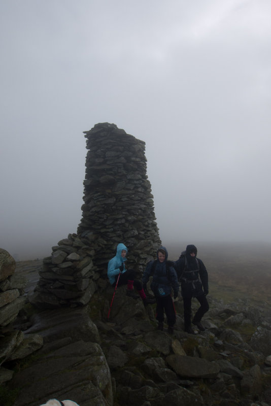 The top of Thornthwaite Crag
Eventually we reached the summit - another impressive cairn (they seem to be the fashion around here). We didn't hang around for long, as we were getting conscious that the walk to this point had taken rather longer than anticipated, and we might be in danger of running out of daylight. After the exertions to get up here, the easy walk along the old Roman road to the top of High Street was very welcome.
High Street summit itself was a bit of an anticlimax, especially with no view. The path was getting wetter as we headed towards the Straights of Riggindale (which sounds like somewhere out of the Lord of the Rings). We had wondered about a detour to bag the top of Rampsgill Head, but after realising we had missed the turning we decided it was probably just as well as time was not really on our side. The Knott, on the other hand, was a mere 2 minute detour from the path.
The path down to Angle Tarn was quite long - below the clouds by now, with nice views over Hartsop and Hayeswater. It seemed to take forever to cross the Satura Crag ridge and for Angle Tarn to finally come into view. Once round the corner Thomas set off on his customary sprint for the summit, only to be called back when we pointed out he was heading for the lower of the twin peaks.
There was no time for much of a pause on the top of Angletarn Pikes - the GPS was showing sunset in 45 minutes, and we were at least an hour from home. We had a torch, but that's only useful for following a good path, not for finding ill-defined ones. We set off for Boredale Hause while we could still see it.
Once at the hause, I could relax, knowing that the path down the flanks of Place Fell would not be any problem even if we did lose the light, and in fact we arrived at Side Farm with enough light to see us across the valley and home without having to resort to the torch.
