
High Stile Ridge
Buttermere Village - Buttermere Shore Path - Scarth Gap - High Crag - High Stile - Red Pike - Starling Dodd - Great Borne - Buttermere Village
2 weeks ago I went in search of snow up into the North Western Fells as we'd had a distinct shortage compared to the rest of the UK. This was immediately followed by a large downfall and long delays getting home... typical!
Last weekend was just as bad over the Friday afternoon ! This time I was down at the Gilpin Bridge outside Kendal when the snows fell and it took us over 2 hours to crawl home. This was then followed by a week of high winds which reached over 50 mph on Walney Island.
So when the forecast said the winds had dropped and the sun was going to show its face for the first time this year, Damson & I dropped other plans for the weekend and plotted a trip to Buttermere.
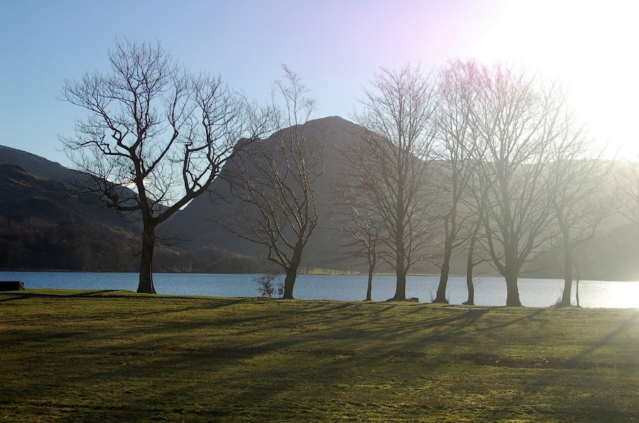
We parked above the church in Buttermere on a cold, bright and sunlit morning and headed down along the shoreline to the far end of Buttermere and headed up towards Scarth Gap.
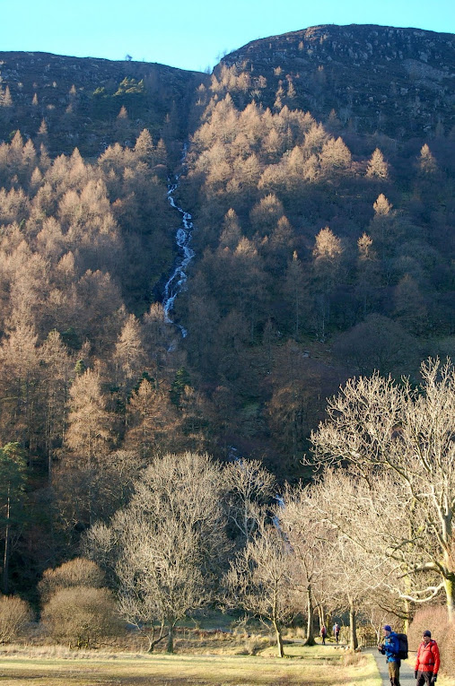
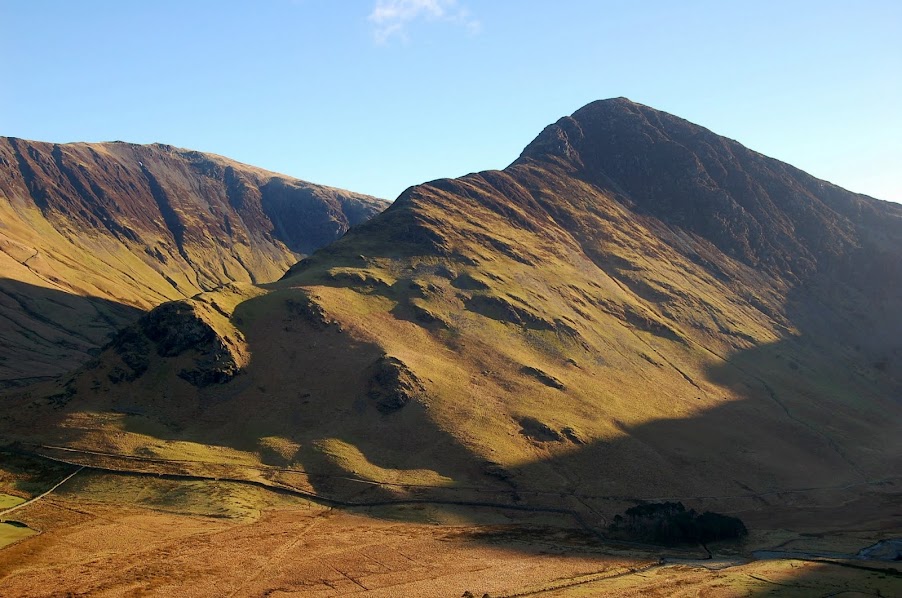
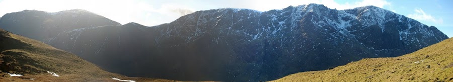
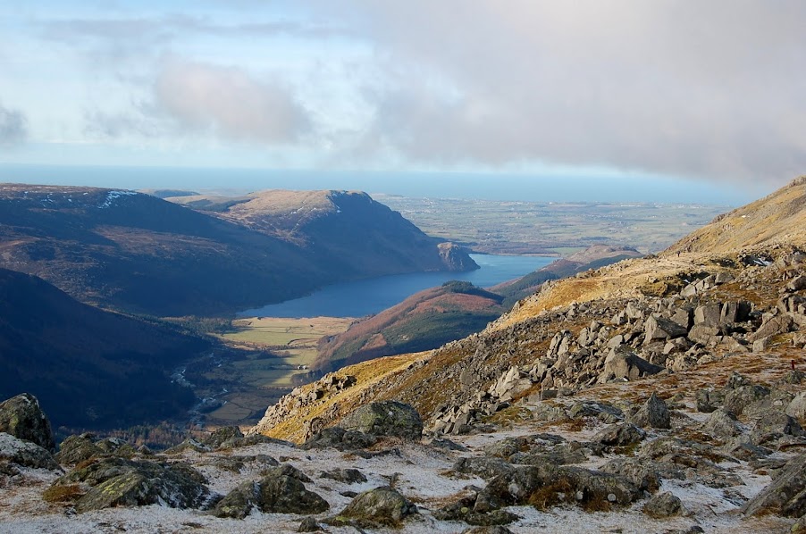
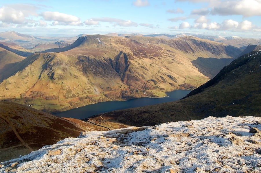
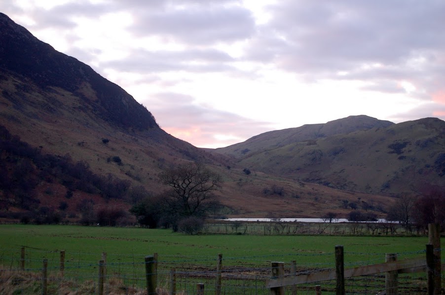
Sour Milk Ghyll from Buttermere shore
Fleetwith Pike from Buttermere Shore
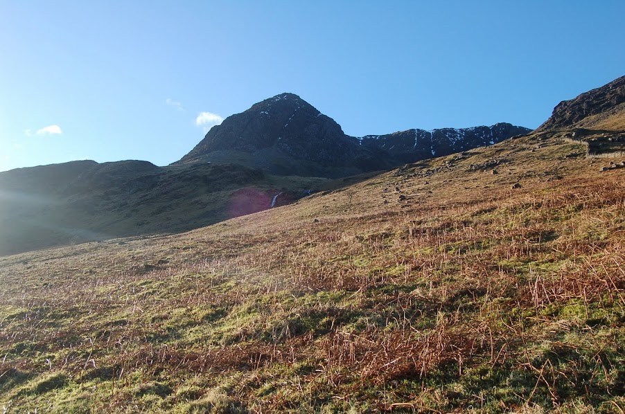
Looking up to High Crag and start of todays ridge walk
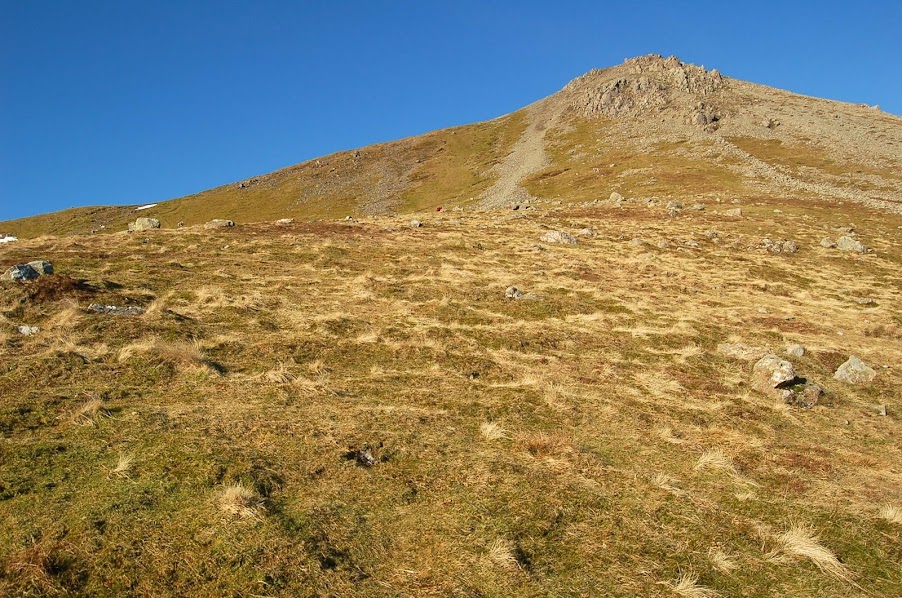
Starting ascent up Scarth Gap path
Fleetwith Pike from Scarth Gap ascent
I last came up this way in summer 2011 with my wife Ellie & granddaughter Charlie when we had a wild camp at Innominate Tarn on Haystacks. It was a considerably quicker ascent this time round and in no time at all we split away from the main path and onto the stepper section heading right on a bearing for High Crag.
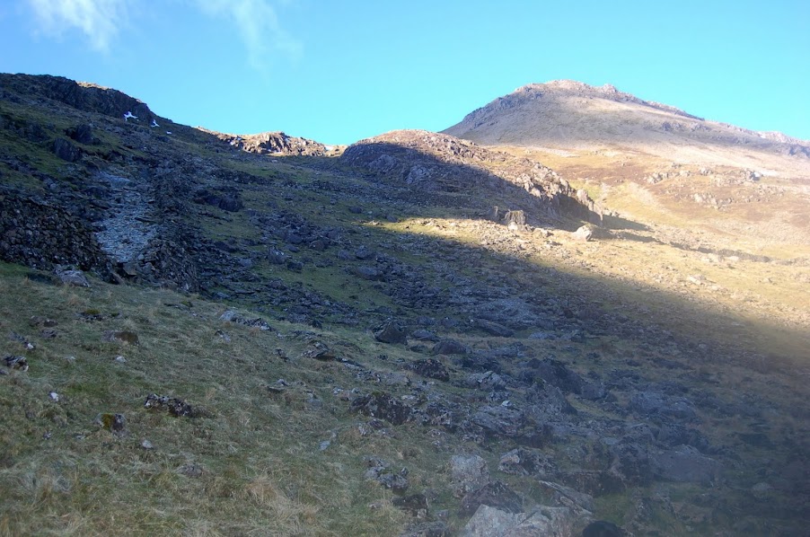
Steep path up to High Crag from Scarth Gap
As we reached the first plateau, giving us a brief respite from the climbing, Pillar came into view over the horizon, looking dark and menacing with its sheer black face spattered with snow clinging to its face.
From here the path got even steeper for the last haul up onto High Crags summit. In places it felt like a scramble but the views from the top and along the ridge are well worth the hard work.
Last steep section to High Crag
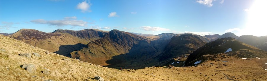
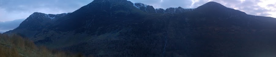
Fleetwith Pike & Haystacks panorama from High Crag ascent. 3D link below.
http://www.dermandar.com/p/cdfEDc/grizedale-pike-haystacks-panorama-from-high-pike
Pillar and Kirk Fell panorama from High Crag ascent. 3D link below.
http://www.dermandar.com/p/cQaZMl/pillar-and-kirk-fell-from-high-pike-ascent
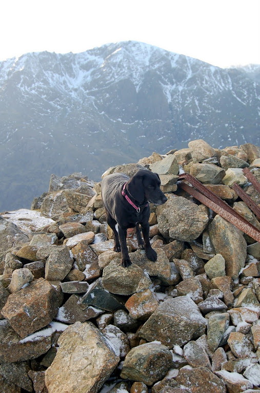
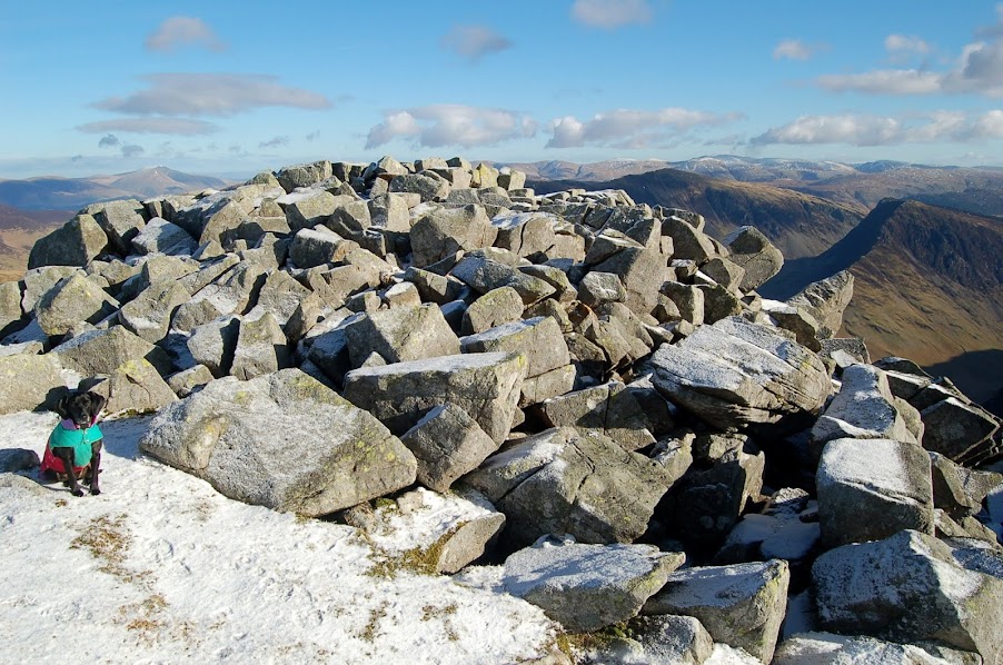
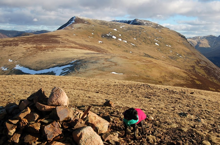
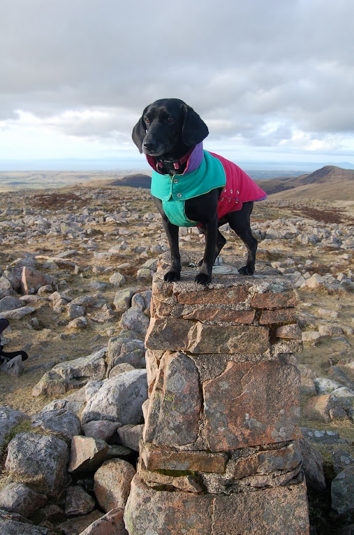
Damson on High Crag summit
Damson showing off as she's only 25 Wainwrights to go !
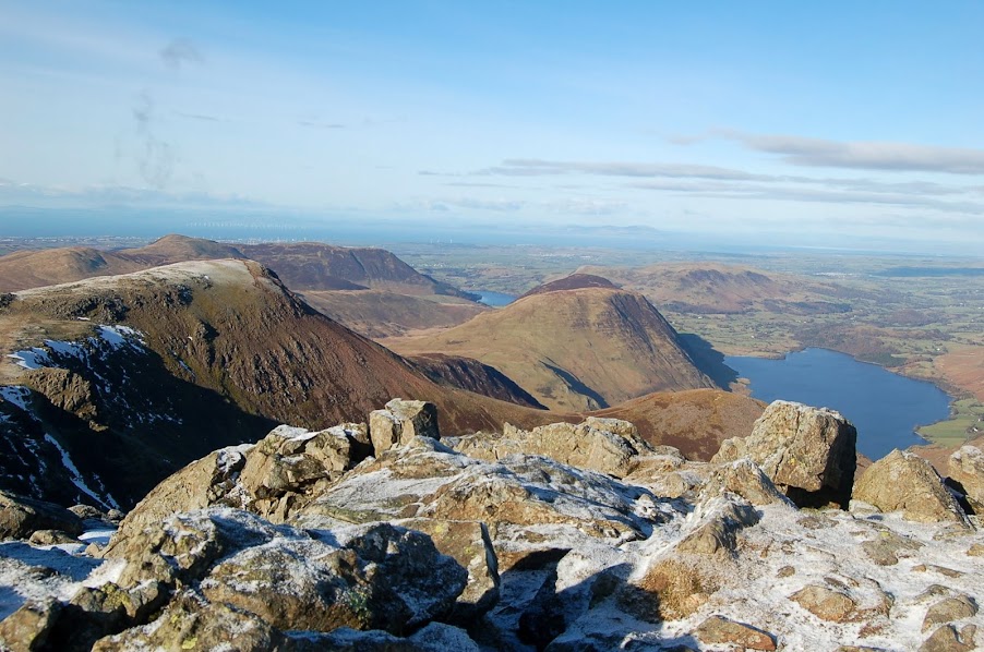
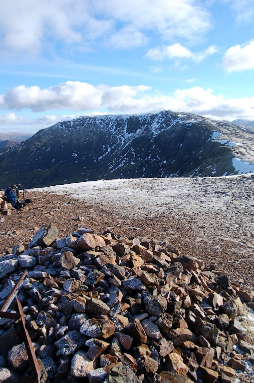
High Stile from High Crag
Ennerdale from High Crag
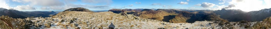
High Crag 360 Panorama. 3D link below.
http://www.dermandar.com/p/eOZNeI/high-pike-summit-360-panorama
From High Crag we made our way along the ridge heading towards todays highest point of High Stile.
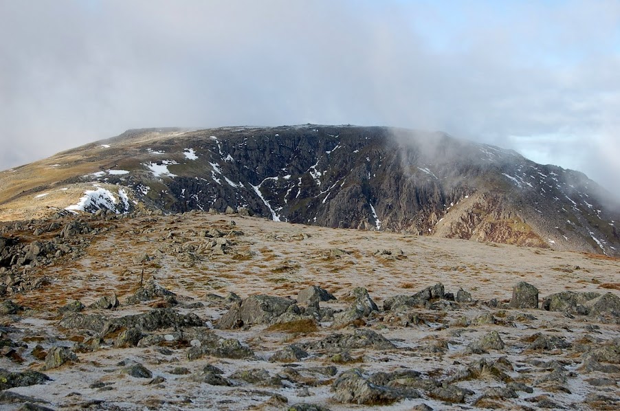
The ground was quite rough and rocky underfoot with several large panels of snow and a further dusting covering the ridge. We stayed well away from the ridge edge due to the snow build up that blurred the cliff edge. We first headed for the view point to the west of the summit overlooking Crummock Water. We were on the search for our second geocache of the day having gathered the first on the way up towards Scarth Gap but this one was to elude us due to the snow covering and the rocks in the area being frozen in position.
Damson near top of High Stile
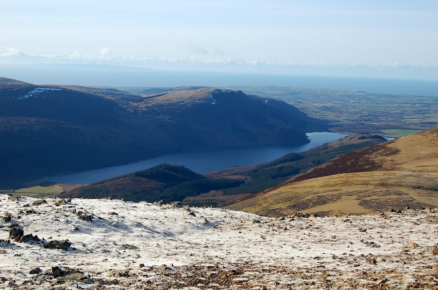
Crummock Water from High Stile View Point
View up Honister Pass from High Stile View Point
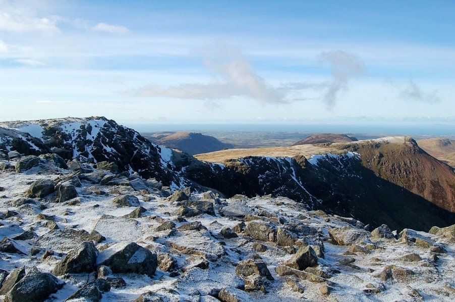
High Stile summit (left) and Red Pike (right) from View Point
Red Pike from High Stile View Point
We then headed for the summit itself for a quick bite to eat and some more stunning scenery.

Damson on High Stile summit
Damson on High Stile over Ennerdale
Crummock Water & Loweswater (behind Melbreak) from High Stile
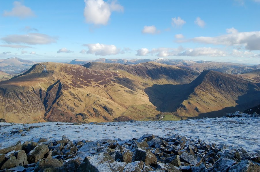
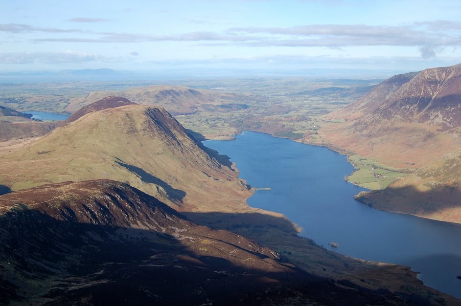
We followed the ridge round onto the red rock of Red Pike passing the views over Bleaberry Tarn sitting at the top of Sour Milk Ghyll as shown in todays first photo. Views opened up over the Loweswater Fells giving me a good idea what was ahead of me in the coming few weeks. (All 5 are still left to do to complete the 21 remaining after todays yomp).
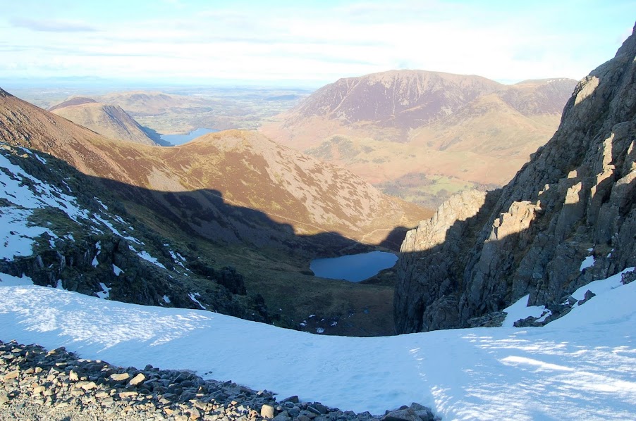
Bleaberry Tarn from below High Stile summit
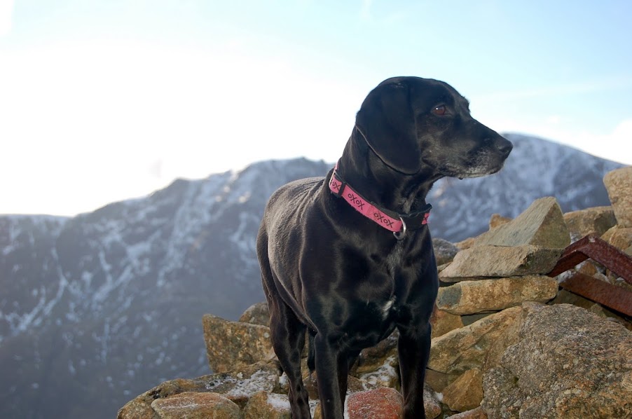
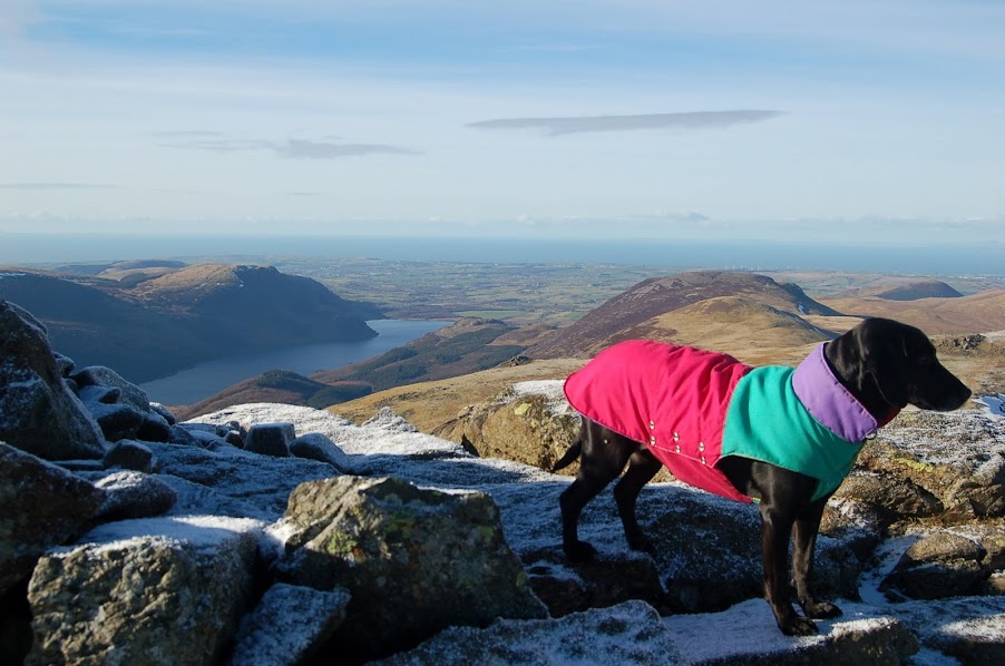
Damson on Red Pike summit
Looking back to High Stile from Red Pike
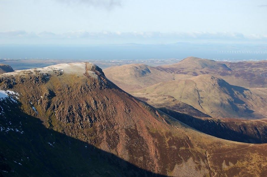
Loweswater, Melbreak & Crummock Water (left to right) from Red Pike
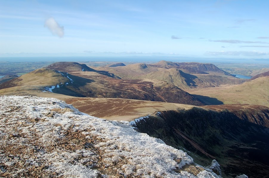
Starling Dodd (left) & Great Borne (behind) plus Loweswater Fells (middle to right) from Red Pike
Ennerdale from Red Pike

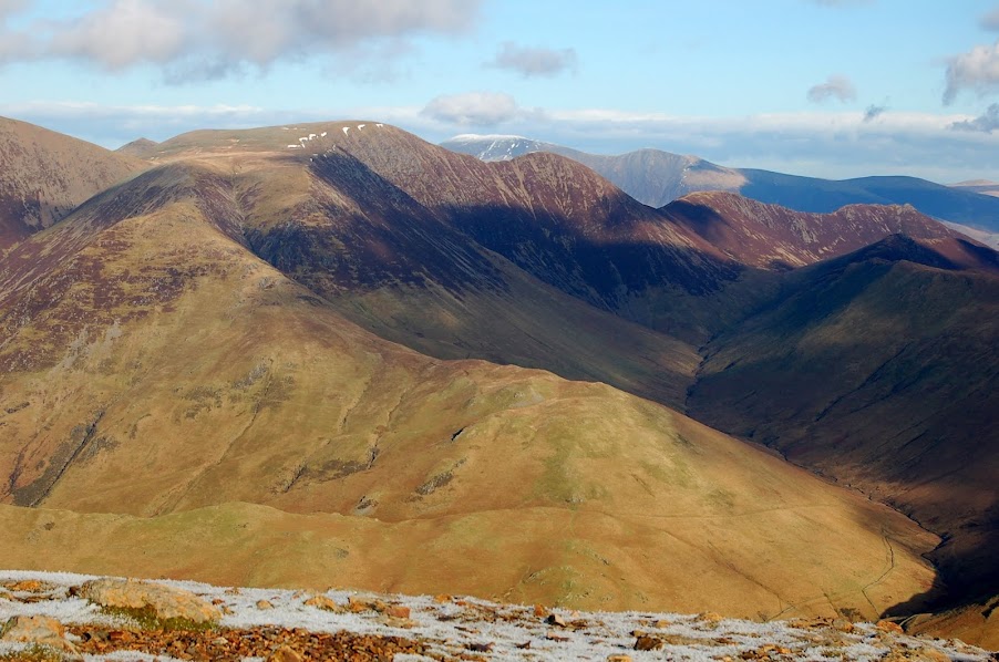
View back to Scafell Massif from Red Pike
View to Whiteless Pike, Crag Hill, Sail, Causey Pike ridge from Red Pike
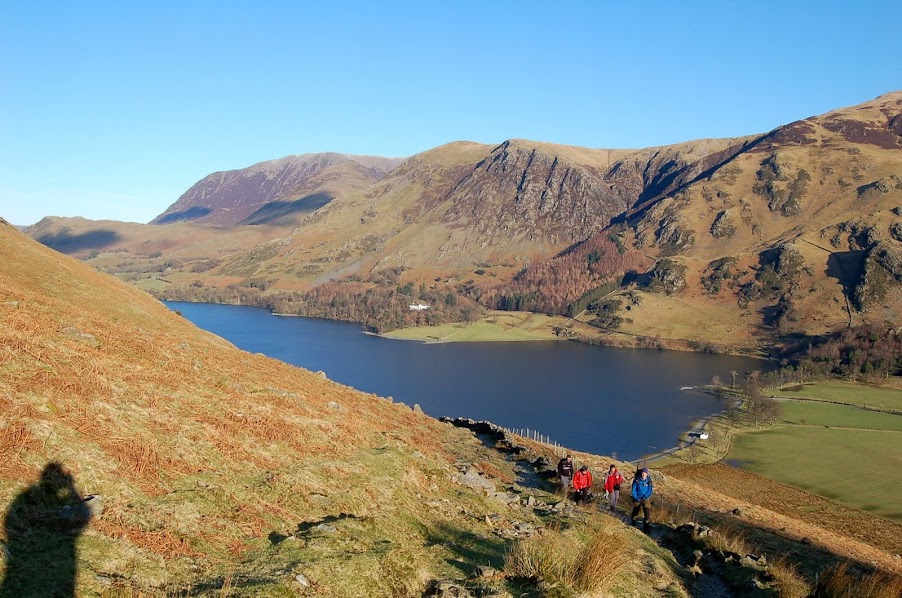
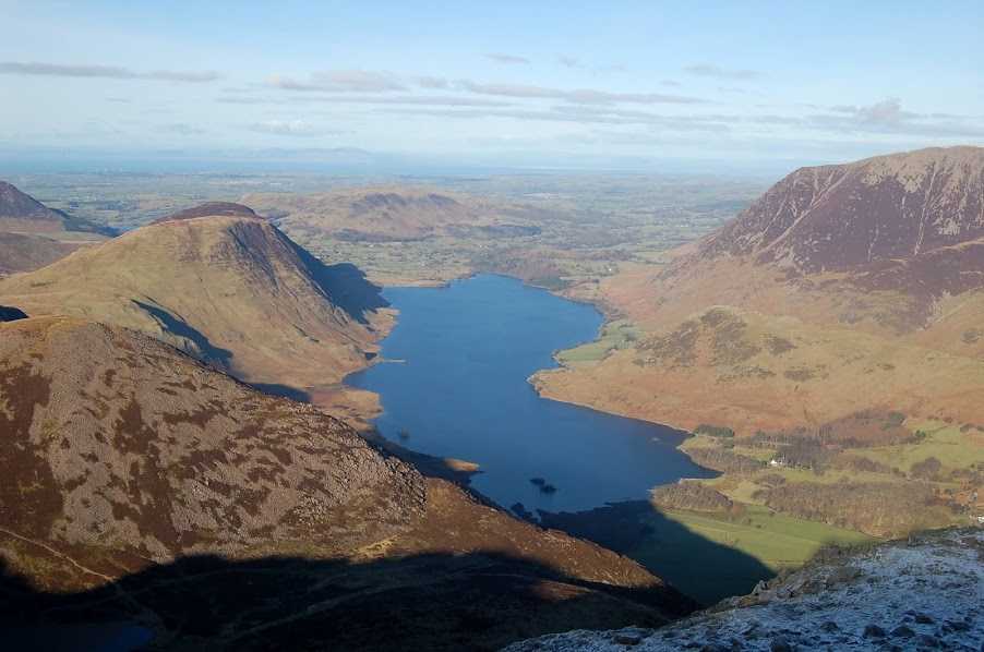
Over Buttermere from Red Pike summit
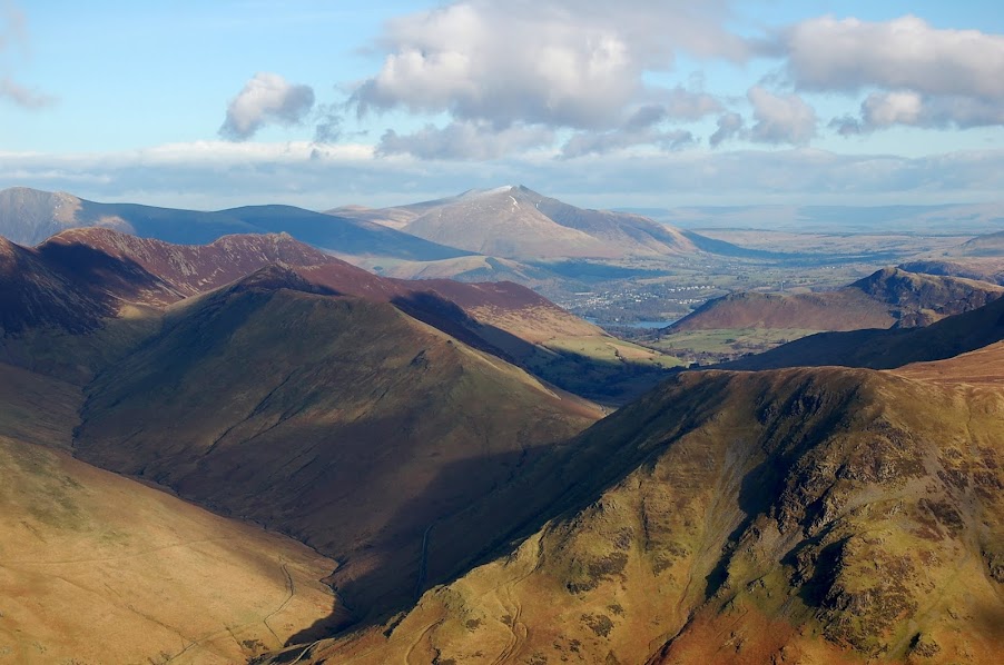
View to Keswick and Skiddaw from Red Pike
Next came the long slog to Starling Dodd. The ground was somewhat softer here but holding together and the climb up to Starling Dodd started to sap the energy from my legs.
Damson on Starling Dodd looking back over long plod from Red Pike
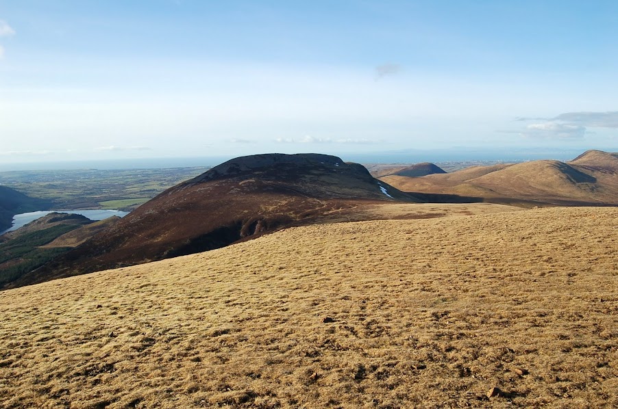
Starling Dodd was surprisingly the only section of the walk that felt windy so we took a few photos and headed immediately over to Great Borne. For all geocachers, this one is a great find, especially because of its remoteness and great views.
Great Borne from Starling Dodd
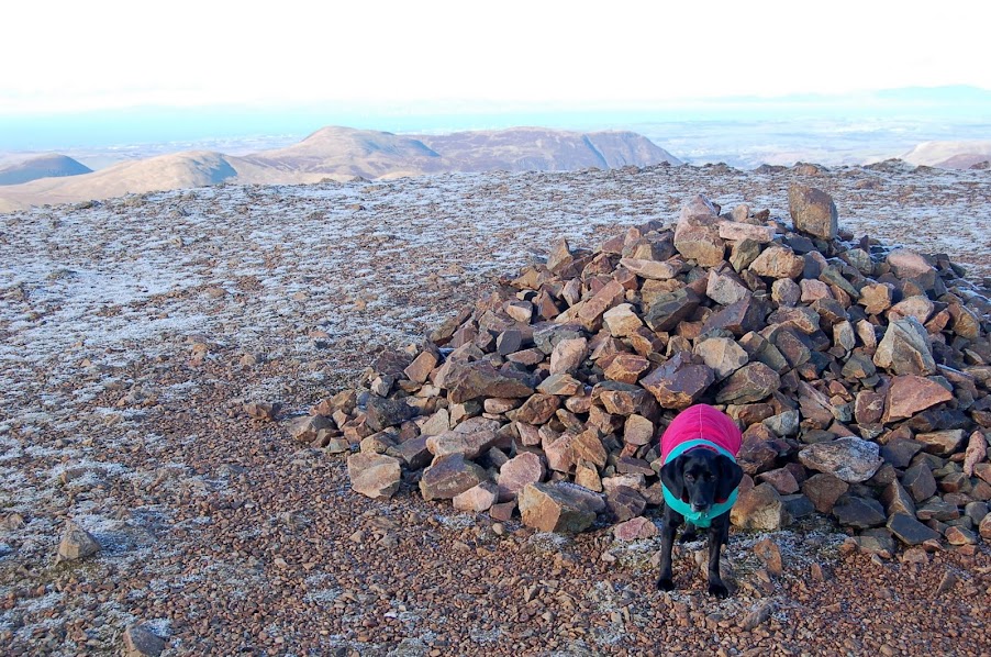
Damson on Great Borne trig point
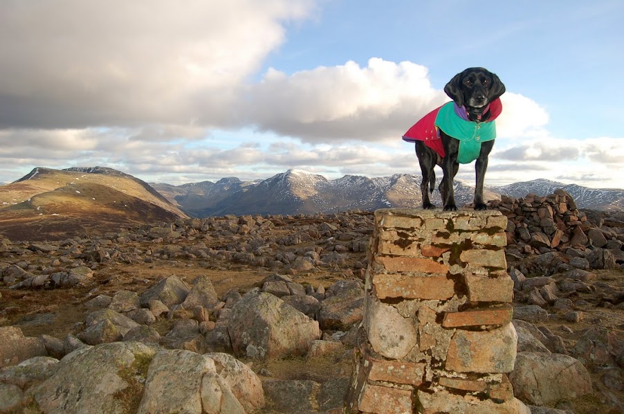
Damson on Great Borne trig point
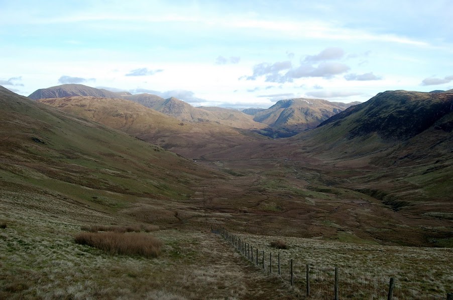
The descent off the far side off Great Borne was very steep following the fence line down to a small style.
From here the path became extremely wet and boggy as we made our way right and down towards Buttermere Village for approx 4 km through swamp and beck.
Wet, boggy descent back to Buttermere
We passed Scale Force, a waterfall dropping down into Scale Beck that rolled away to our left and down into Crummock Water. Over this last section I was getting more and more concerned that I hadn't left enough time to complete the walk before it got dark. I knew that the sun would set sometime around 4:45 to 5:00 and so slogged on (when I really could have done with a nice sit down for 10 mins) and tried to ensure I was on the shore line path before the light had gone and the head torch was required.
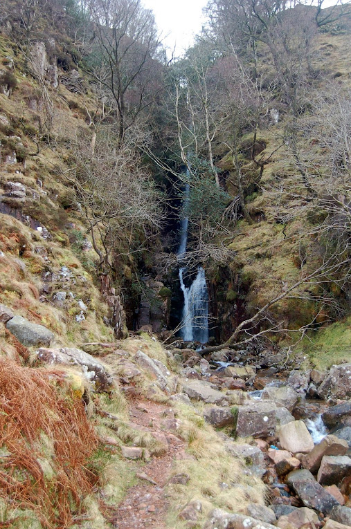
Scale Force waterfall falling into Scale Beck
Looking back to descent path in decreasing light
We got back to the car in twilight and quickly got changed out of wringing wet footwear. As we headed back over the pass to Braithwaite, within 10 minutes, the light had disappeared completely and I was almost glad that the Fish Inn was currently closed and I hadn't been persuaded to go for a pint.
Buttermere Ridge in twilight from above Buttermere Village. 3D link below.
http://www.dermandar.com/p/eaqIyA/buttermere-ridge-in-near-darkness
I grabbed a beer when I got home and a lovely sausage casserole to top off a great day.
Our Damson still hasn't recovered properly ... I think she is having a pyjama day today

2 weeks ago I went in search of snow up into the North Western Fells as we'd had a distinct shortage compared to the rest of the UK. This was immediately followed by a large downfall and long delays getting home... typical!
Last weekend was just as bad over the Friday afternoon ! This time I was down at the Gilpin Bridge outside Kendal when the snows fell and it took us over 2 hours to crawl home. This was then followed by a week of high winds which reached over 50 mph on Walney Island.
So when the forecast said the winds had dropped and the sun was going to show its face for the first time this year, Damson & I dropped other plans for the weekend and plotted a trip to Buttermere.
We parked above the church in Buttermere on a cold, bright and sunlit morning and headed down along the shoreline to the far end of Buttermere and headed up towards Scarth Gap.
Sour Milk Ghyll from Buttermere shore
Fleetwith Pike from Buttermere Shore
Looking up to High Crag and start of todays ridge walk
Starting ascent up Scarth Gap path
Fleetwith Pike from Scarth Gap ascent
I last came up this way in summer 2011 with my wife Ellie & granddaughter Charlie when we had a wild camp at Innominate Tarn on Haystacks. It was a considerably quicker ascent this time round and in no time at all we split away from the main path and onto the stepper section heading right on a bearing for High Crag.
Steep path up to High Crag from Scarth Gap
As we reached the first plateau, giving us a brief respite from the climbing, Pillar came into view over the horizon, looking dark and menacing with its sheer black face spattered with snow clinging to its face.
From here the path got even steeper for the last haul up onto High Crags summit. In places it felt like a scramble but the views from the top and along the ridge are well worth the hard work.
Last steep section to High Crag
Fleetwith Pike & Haystacks panorama from High Crag ascent. 3D link below.
http://www.dermandar.com/p/cdfEDc/grizedale-pike-haystacks-panorama-from-high-pike
Pillar and Kirk Fell panorama from High Crag ascent. 3D link below.
http://www.dermandar.com/p/cQaZMl/pillar-and-kirk-fell-from-high-pike-ascent
Damson on High Crag summit
Damson showing off as she's only 25 Wainwrights to go !
High Stile from High Crag
Ennerdale from High Crag
High Crag 360 Panorama. 3D link below.
http://www.dermandar.com/p/eOZNeI/high-pike-summit-360-panorama
From High Crag we made our way along the ridge heading towards todays highest point of High Stile.
The ground was quite rough and rocky underfoot with several large panels of snow and a further dusting covering the ridge. We stayed well away from the ridge edge due to the snow build up that blurred the cliff edge. We first headed for the view point to the west of the summit overlooking Crummock Water. We were on the search for our second geocache of the day having gathered the first on the way up towards Scarth Gap but this one was to elude us due to the snow covering and the rocks in the area being frozen in position.
Damson near top of High Stile
Crummock Water from High Stile View Point
View up Honister Pass from High Stile View Point
High Stile summit (left) and Red Pike (right) from View Point
Red Pike from High Stile View Point
We then headed for the summit itself for a quick bite to eat and some more stunning scenery.
Damson on High Stile summit
Damson on High Stile over Ennerdale
Crummock Water & Loweswater (behind Melbreak) from High Stile
We followed the ridge round onto the red rock of Red Pike passing the views over Bleaberry Tarn sitting at the top of Sour Milk Ghyll as shown in todays first photo. Views opened up over the Loweswater Fells giving me a good idea what was ahead of me in the coming few weeks. (All 5 are still left to do to complete the 21 remaining after todays yomp).
Bleaberry Tarn from below High Stile summit
Damson on Red Pike summit
Looking back to High Stile from Red Pike
Loweswater, Melbreak & Crummock Water (left to right) from Red Pike
Starling Dodd (left) & Great Borne (behind) plus Loweswater Fells (middle to right) from Red Pike
Ennerdale from Red Pike
View back to Scafell Massif from Red Pike
View to Whiteless Pike, Crag Hill, Sail, Causey Pike ridge from Red Pike
Over Buttermere from Red Pike summit
View to Keswick and Skiddaw from Red Pike
Next came the long slog to Starling Dodd. The ground was somewhat softer here but holding together and the climb up to Starling Dodd started to sap the energy from my legs.
Damson on Starling Dodd looking back over long plod from Red Pike
Starling Dodd was surprisingly the only section of the walk that felt windy so we took a few photos and headed immediately over to Great Borne. For all geocachers, this one is a great find, especially because of its remoteness and great views.
Great Borne from Starling Dodd
Damson on Great Borne trig point
Damson on Great Borne trig point
The descent off the far side off Great Borne was very steep following the fence line down to a small style.
From here the path became extremely wet and boggy as we made our way right and down towards Buttermere Village for approx 4 km through swamp and beck.
Wet, boggy descent back to Buttermere
We passed Scale Force, a waterfall dropping down into Scale Beck that rolled away to our left and down into Crummock Water. Over this last section I was getting more and more concerned that I hadn't left enough time to complete the walk before it got dark. I knew that the sun would set sometime around 4:45 to 5:00 and so slogged on (when I really could have done with a nice sit down for 10 mins) and tried to ensure I was on the shore line path before the light had gone and the head torch was required.
Scale Force waterfall falling into Scale Beck
Looking back to descent path in decreasing light
We got back to the car in twilight and quickly got changed out of wringing wet footwear. As we headed back over the pass to Braithwaite, within 10 minutes, the light had disappeared completely and I was almost glad that the Fish Inn was currently closed and I hadn't been persuaded to go for a pint.
Buttermere Ridge in twilight from above Buttermere Village. 3D link below.
http://www.dermandar.com/p/eaqIyA/buttermere-ridge-in-near-darkness
I grabbed a beer when I got home and a lovely sausage casserole to top off a great day.
Our Damson still hasn't recovered properly ... I think she is having a pyjama day today