free to be able to rate and comment on reports (as well as access 1:25000 mapping).
very spontaneous trip to lake district.
I really wanted to go up north to cairngorms (lochnagar, yummyyyy) but as the weather was same fantastic in both areas, we chose my partner's idea and drove south to Keswick. it was less than 2.5hrs drive, our first time in lake district and we had 1.5 day to enjoy.
we were busy, I can assure you, we arrived to Keswick about 5pm and still managed to see on the same day: prehistoric ring of stones in castlerigg, climb catbell, have a wee wonder in Keswick and have a bbq!
for sunday we planned something more serious, actually the most serious mountain in the area - blencathra via sharp edge (sharp edge meaning a sharp narrow ridge and almost vertical climb later on)
and this is where the story begins.
first of all I have to mention that we didn't have a proper map, just cicerone guide to lake district, which by the way was ok, but will never be the same as handling a proper ordnance survey map, which I missed very much. maybe I am old fashioned but ordnance survey maps ruleeeeee! (but we didn't have one as the trip was truly spontaneous!)
anyway, the guide suggested to make a circular walk starting in mungrisdale, up bowscale fell, blencathra, then way back via souther fell. they said it was a route for 6.5hrs... yeah maybe for a hill runner, we would need additional 1.5 to 2hrs to complete.
the thing was that we could not find the beginning of this route therefore decided to make it the opposite direction and start via souther fell. here we struggled to find a path too. now we know where we should have started: past mill inn and just after the first gate turn right along the fence. yes, there is a path apparently, which goes up along the fence and then 'comes back' towards the village and finally climbs up along the ridge of souther fell.
we didn't bother, decided to walk along the cycle path and start our ascent near scales (from mungrisdale ~1 hr walk)
path up starts along the fence at the car park, goes up and then runs across the slope to reach a saddle between souther fell and scales fell.
as we were eager to try the sharp edge, we walked towards the lochan (
just used Scottish name for an English paddle!!!) then to the right, up towards the ridge.
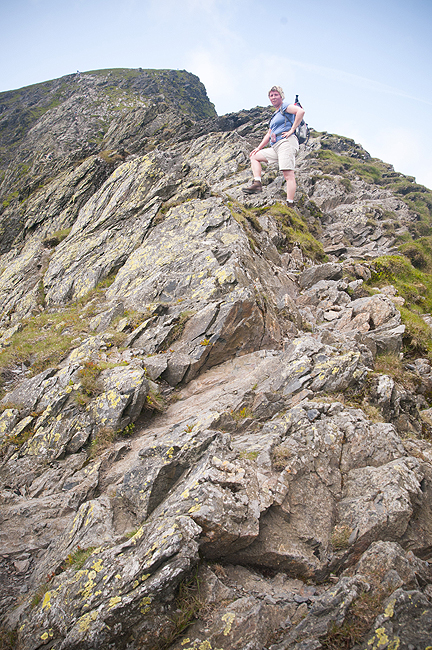
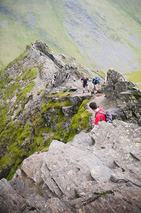
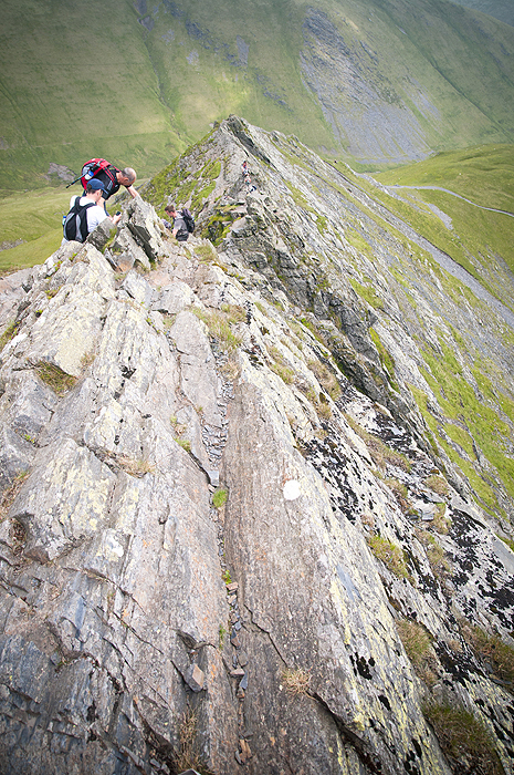
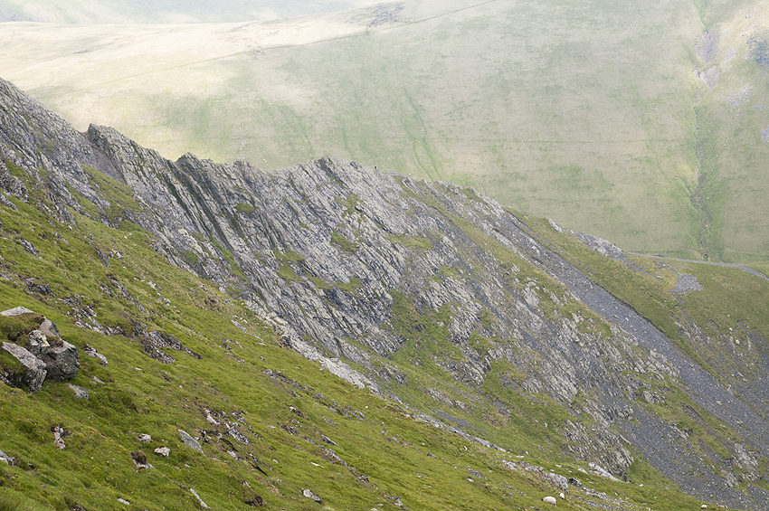
in my own private opinion the edge was easy. I had no problem with it at any point. it is not too narrow, not too exposed and not too high/steep. but I am aware that perception of the ridge would be conditioned on person's own experience and ability to deal with open space /height. I also remember that I read online that people die falling from the ridge, I believe that in wet conditions the traverse could be more challenging and dangerous.
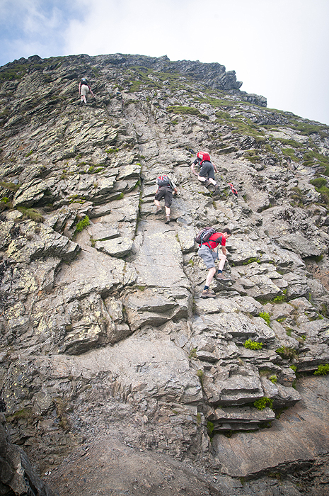
the ridge ends at the almost vertical rocky wall which you'll have to climb, but this was easier that the ridge itself, plenty of handles and if you're uncomfortable with the exposure, climb up the gully (to the right).
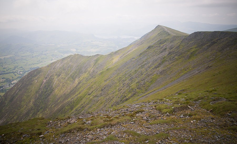
from the top of rocky wall (Atkinson pike) walk 10 mins to blencathra summit. I can imagine that views are amazing... our day was very hazy so all we saw in the distance was just a 'big white'.
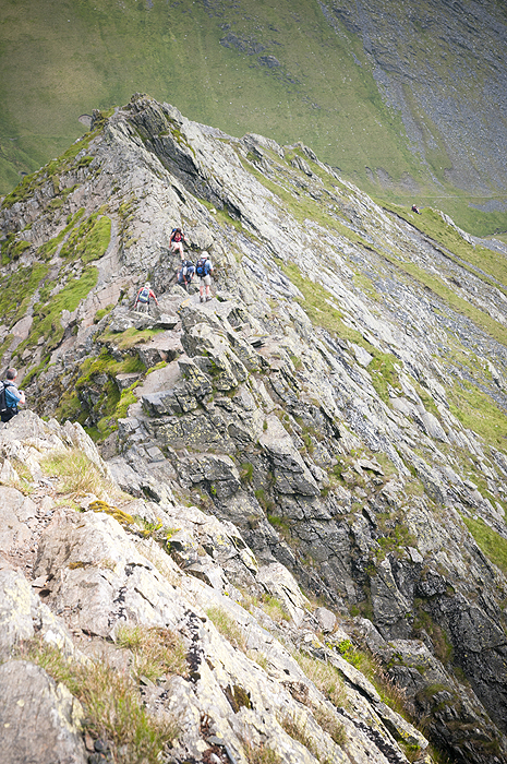
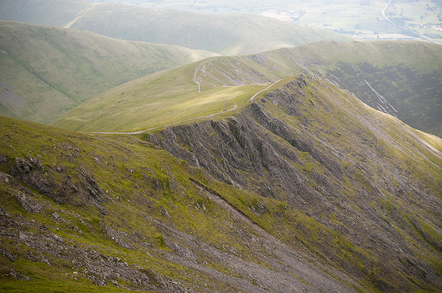
good paths throught, easy to follow, maybe a little bit annoying as most of the way paths are covered in tiny scree-like stones... can make you loose control over your feet easily.
finish the trip with a meal and a pint at mill in

I thought that starting the walk in mungrisdale and walking back to scales was a 'transport mis-management' as we could have driven to scales and leave the car there. but there were other people (many, actually) who walked the same way, so.. no, we are not insane.... and if we ARE insane, at least we're not alone
and here are some pics:
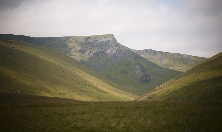
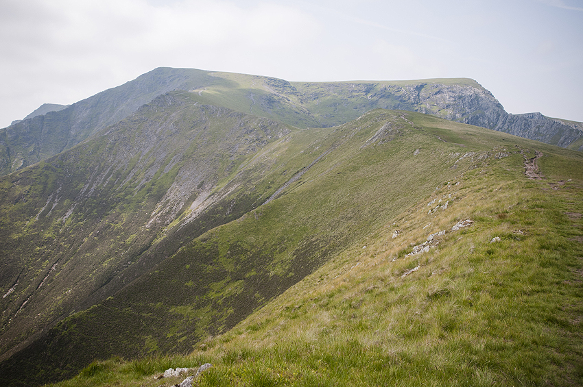
our destination
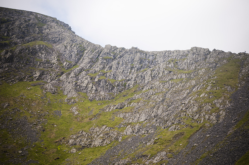
sharp edge comes into view
along the sharp edge
the magnificent one
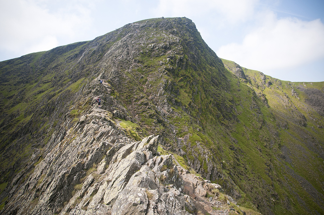
the ridge
up the Atkinson pike
sharp edge again
views from blencathra
the way back
looking back towards blencathra
more pictures herehttp://www.around-scotland.blogspot.co.uk/2013/07/blencathra-via-sharp-edge.htmlenjoy!
