free to be able to rate and comment on reports (as well as access 1:25000 mapping).
Over Christmas and New Year I took a month off work and headed off to the other side of the world to tick off a country that had been top of my to-do list for years: New Zealand. I spent the time travelling around both the North and South Islands, visiting as much of the country as I could.
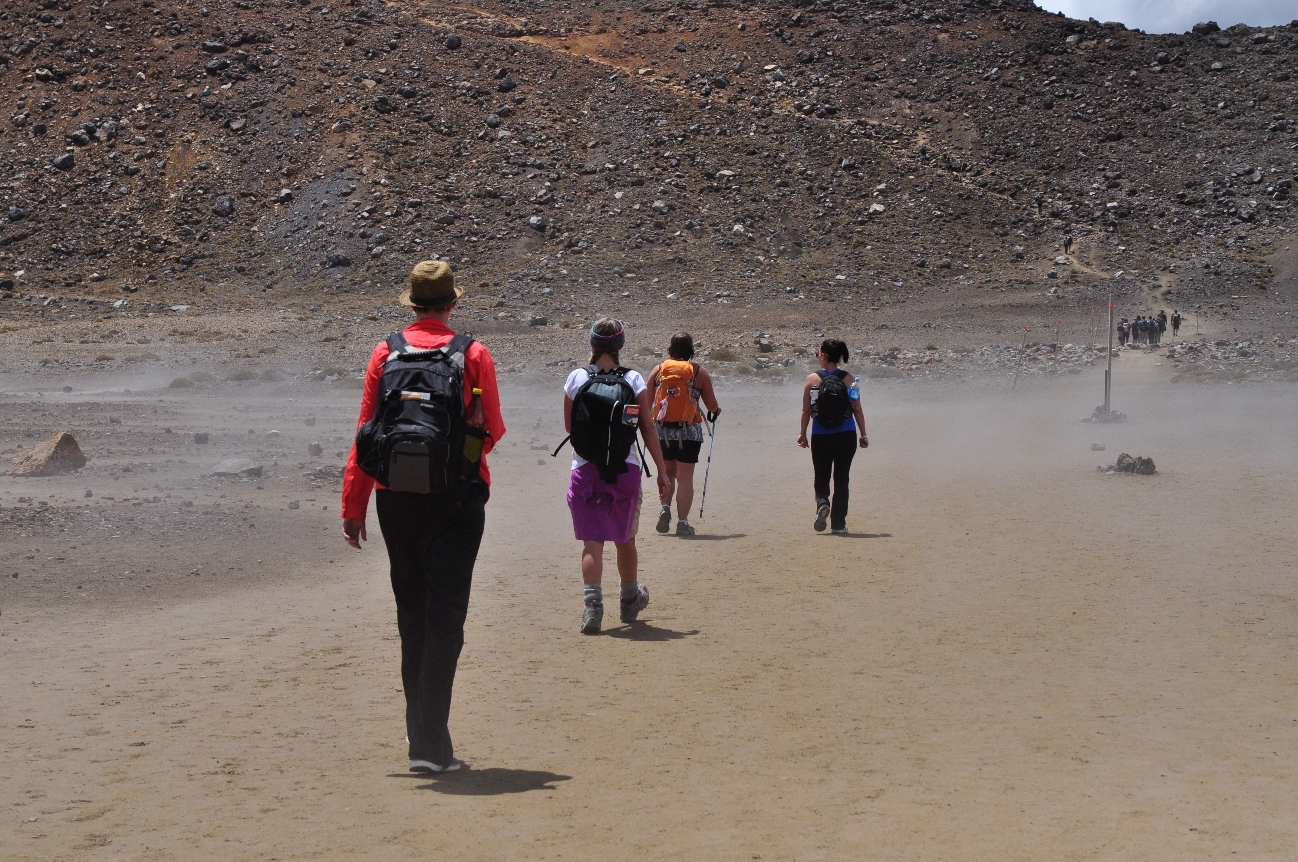
As part of my North Island tour I visited the Tongariro National Park and did the Tongariro Alpine Crossing. There's nothing particularly challenging about the route (especially in nice weather) provided you aren't unlucky enough to be in the middle of a volcanic eruption during your visit (!), but the changing landscape makes for a brilliant day out. Be prepared to not be the only person out on the trail though!
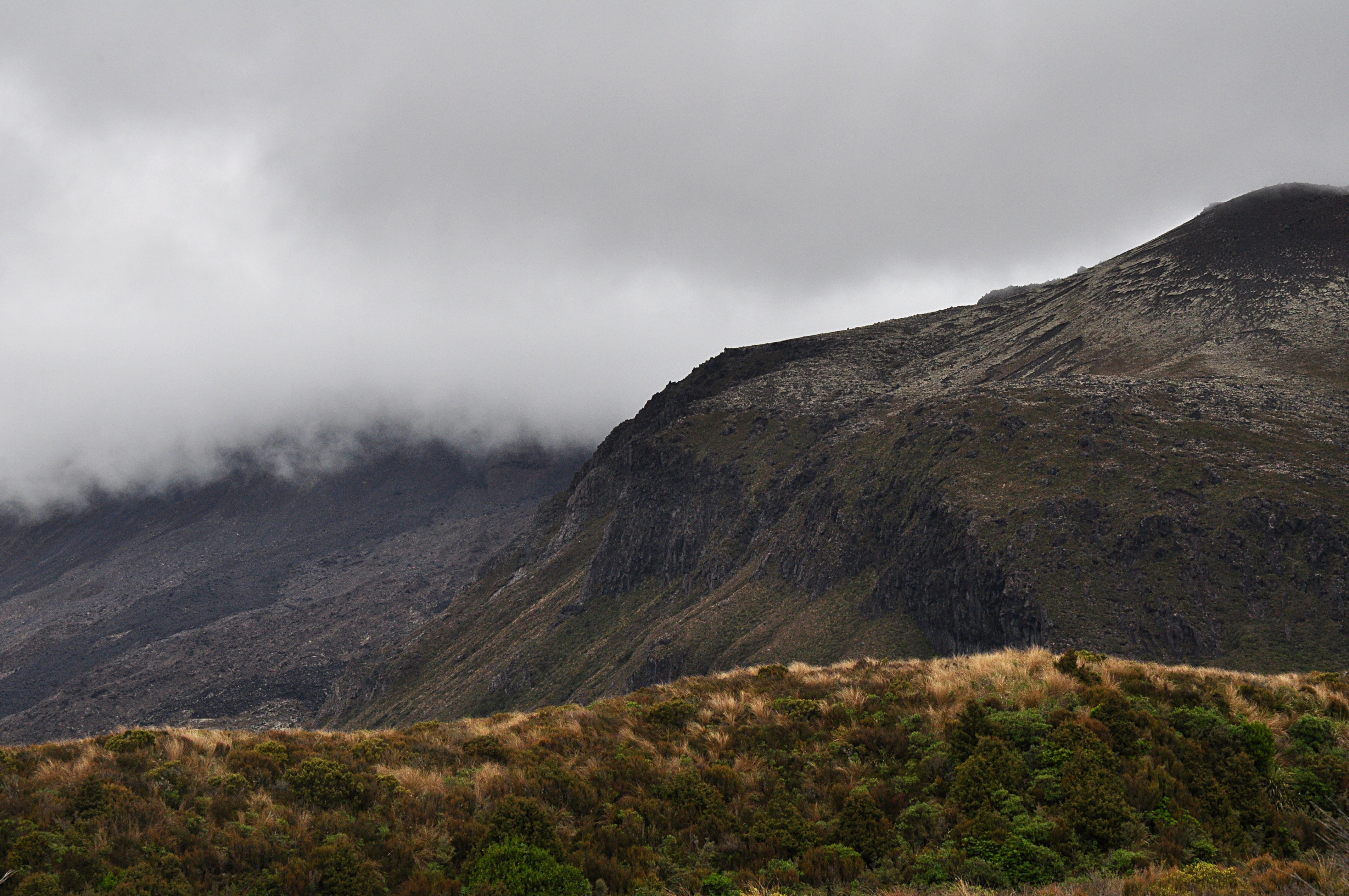
We were time limited due to a pre-arranged pick-up, so I couldn't explore as much as I'd have liked. We set off from the Mangatepopo car park just after 10am. The start of the walk goes through landscapes that wouldn't look out of place in Scotland:
 20131218_1_Tongariro
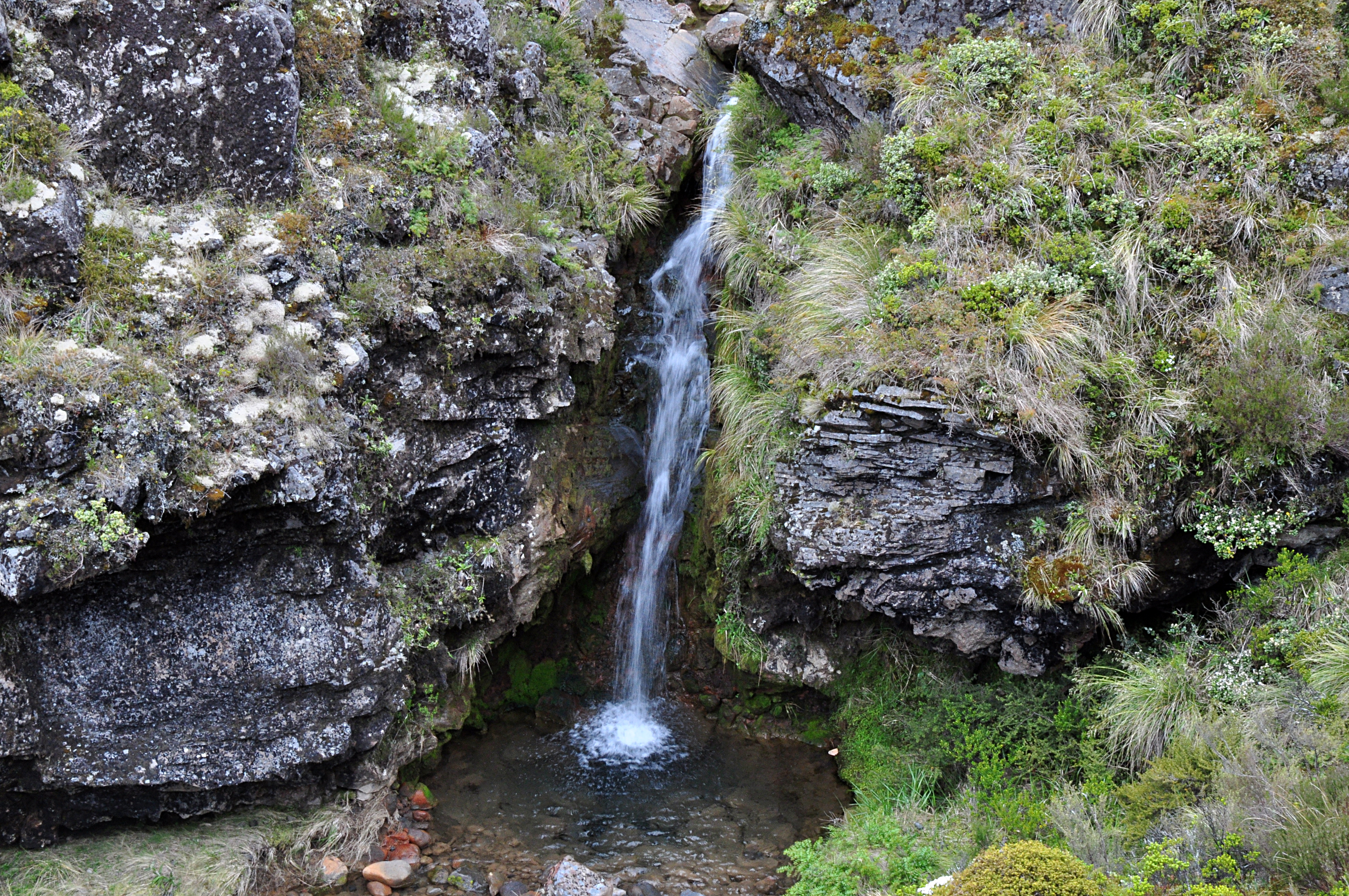 20131218_2_Tongariro
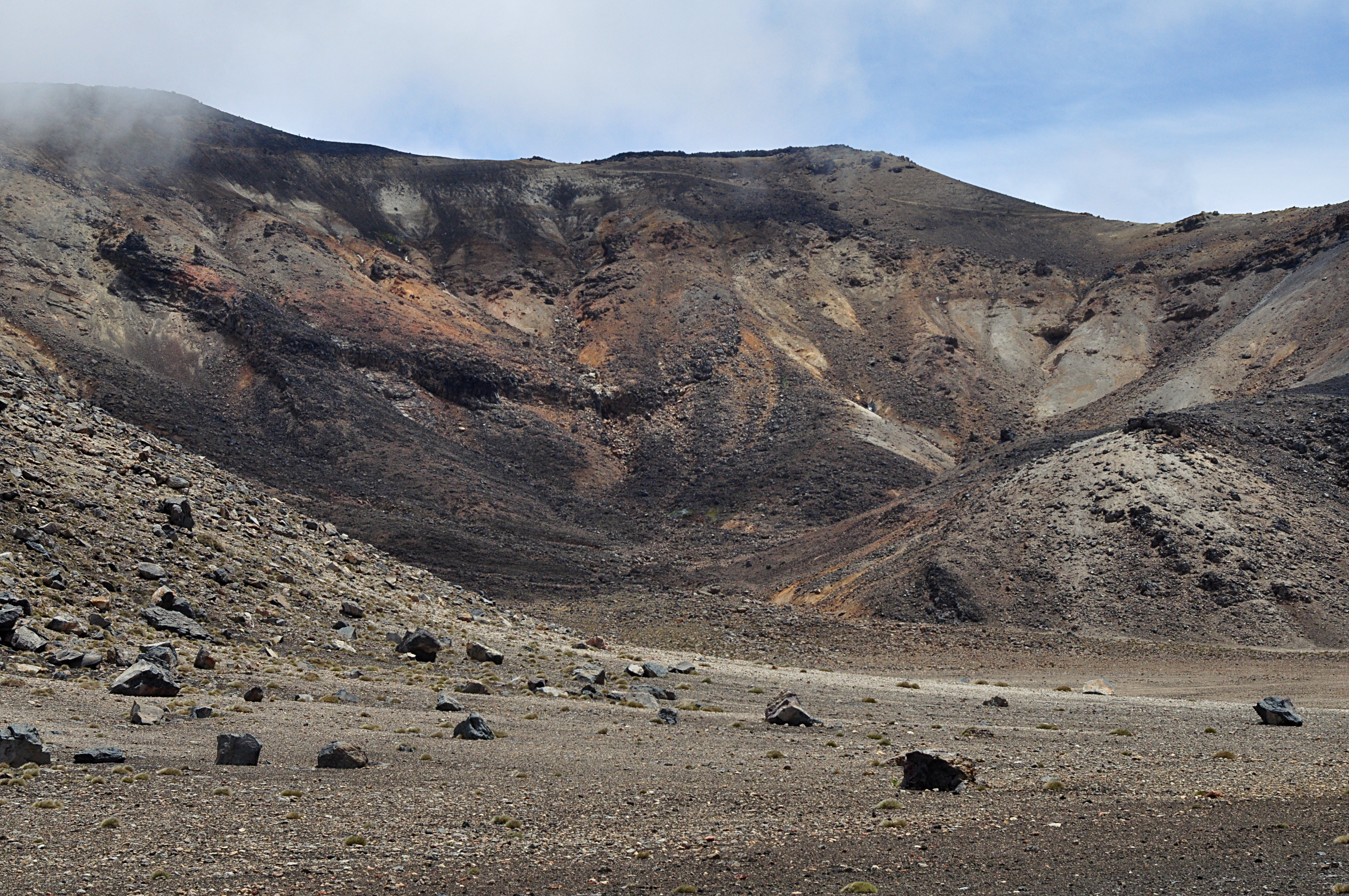
5km and 1 hour later, and we were at Soda Springs. At this point, the landscape becomes noticeably more volcanic, with exposed black basalt and brilliantly-coloured mineral streaks. The climb proper starts with a well-made path up the Devil's Staircase.
 Devil's Staircase
 As you climb, the first proper peak on the trail comes into view. There is a there-and-back trail to the peak itself, but we didn't have time. Definitely requires good footwear!
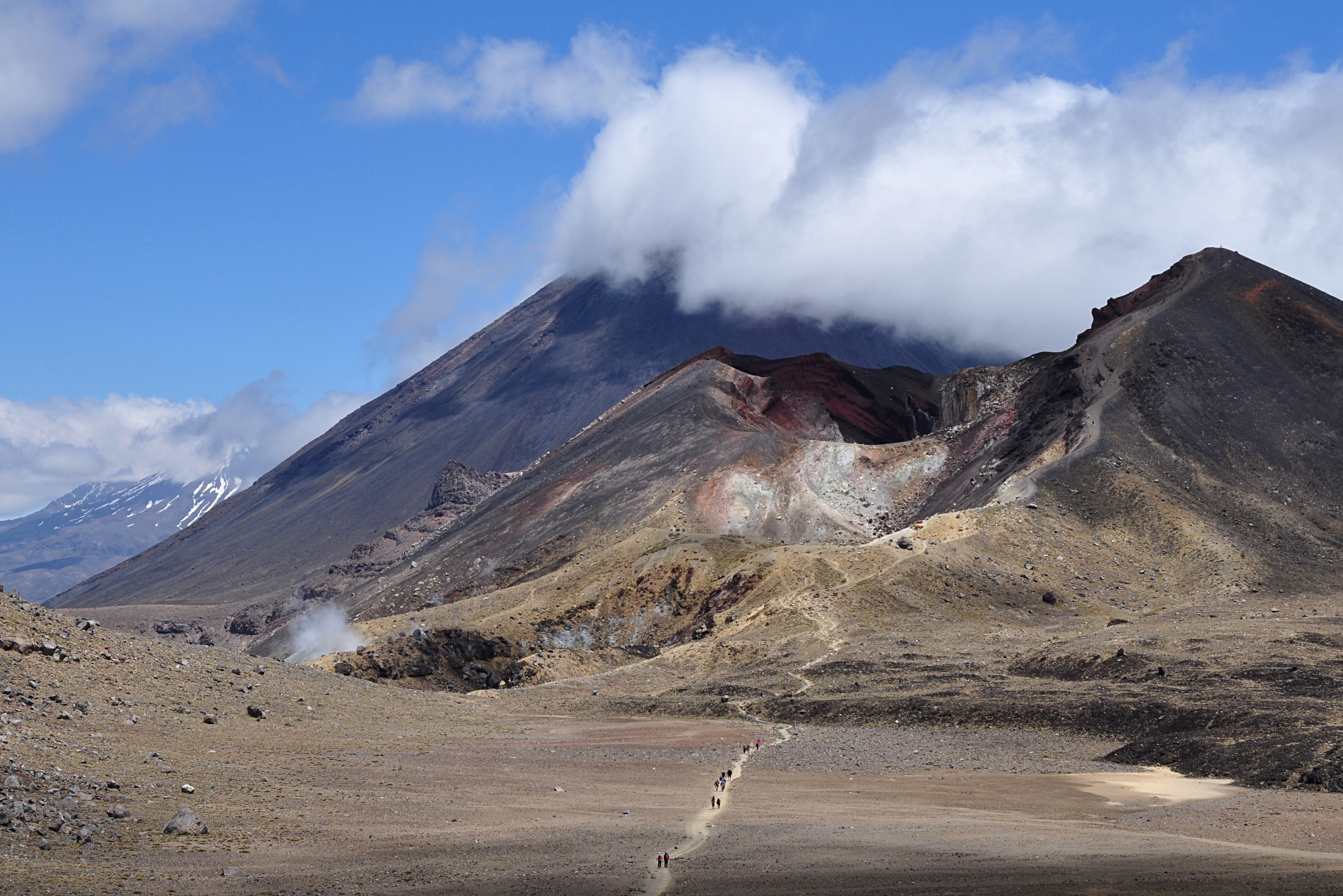
Mt Ngauruhoe is a beautiful perfect cone - snow covered in winter, which makes it one of the most-photographed landmarks on the North Island. In the summer, the top is a startling deep red colour.
 Mt Ngauruhoe
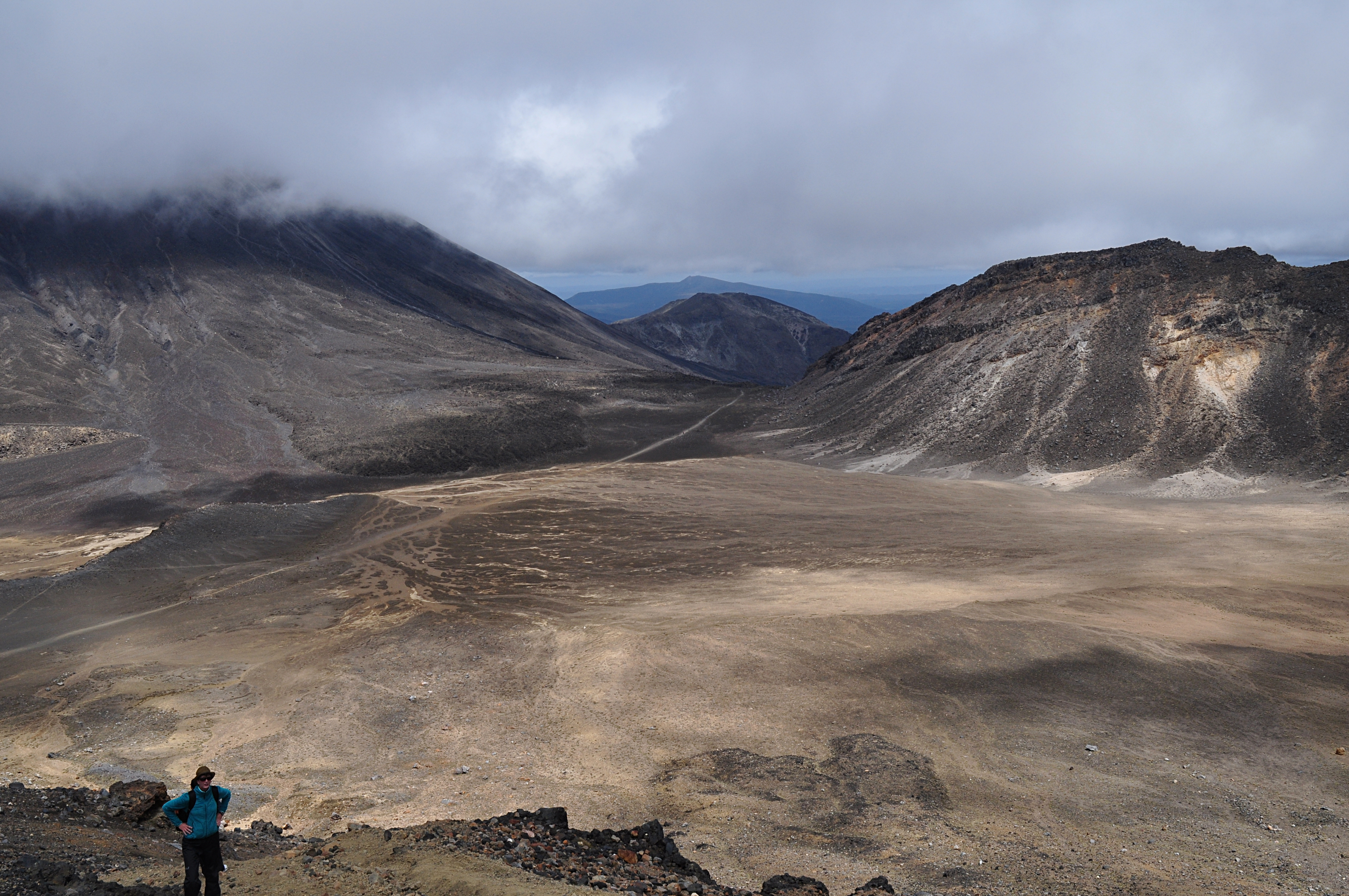
Looking back from the first climb gives a good feeling for how far you've come so far.
 View from the top of the first climb
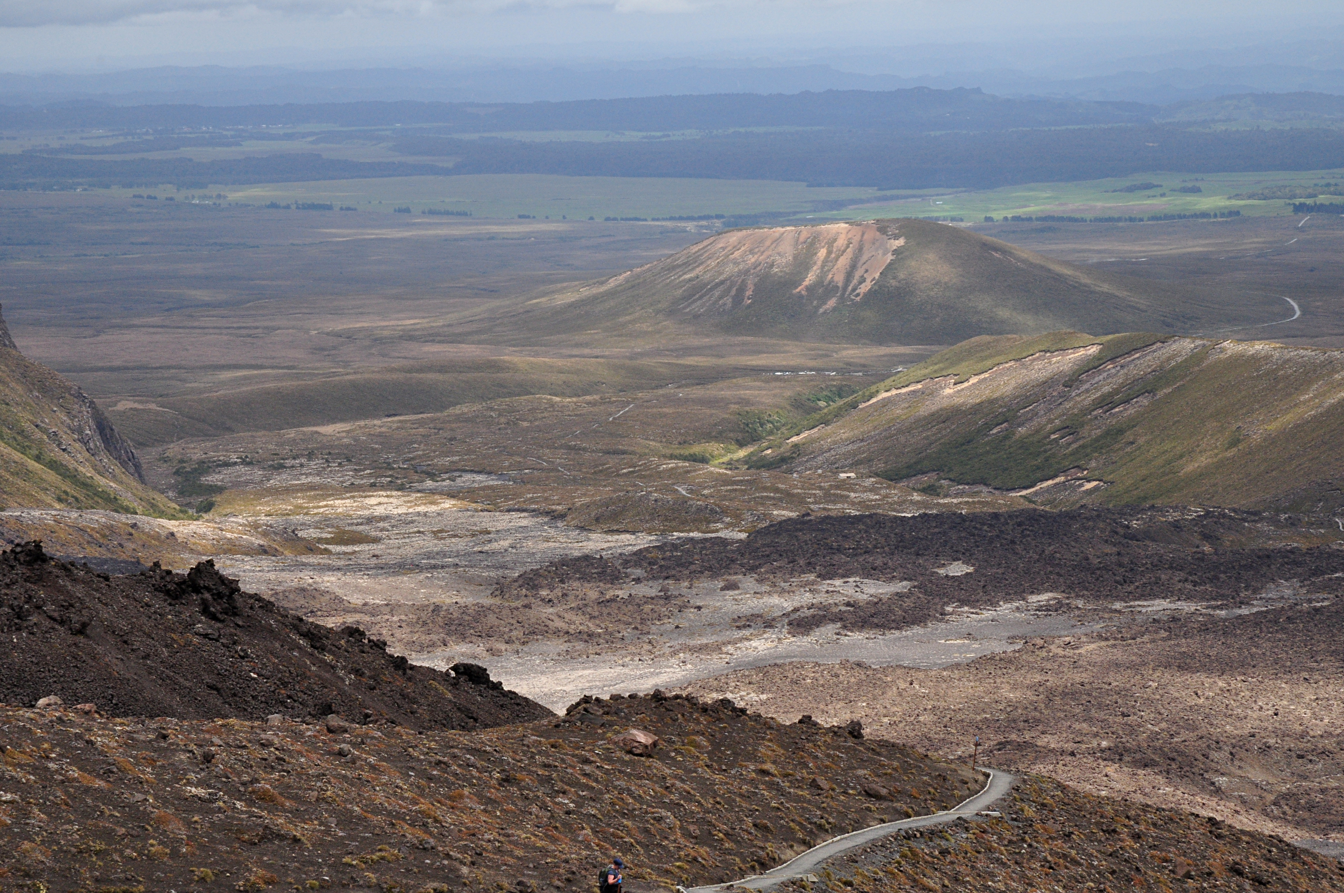
The next section is the extensive South Crater, where (for fellow geeks) they filmed a lot of the Mordor scenes in the Lord of the Rings.
 South Crater
 It has handy undersoil heating, which we didn't need on this occasion

.
 South Crater 2
The next climb takes you up to the saddle between the red crater and the track of to Mt Tongariro. Great views from the top:
 Tongariro summit track
The red crater really is red!
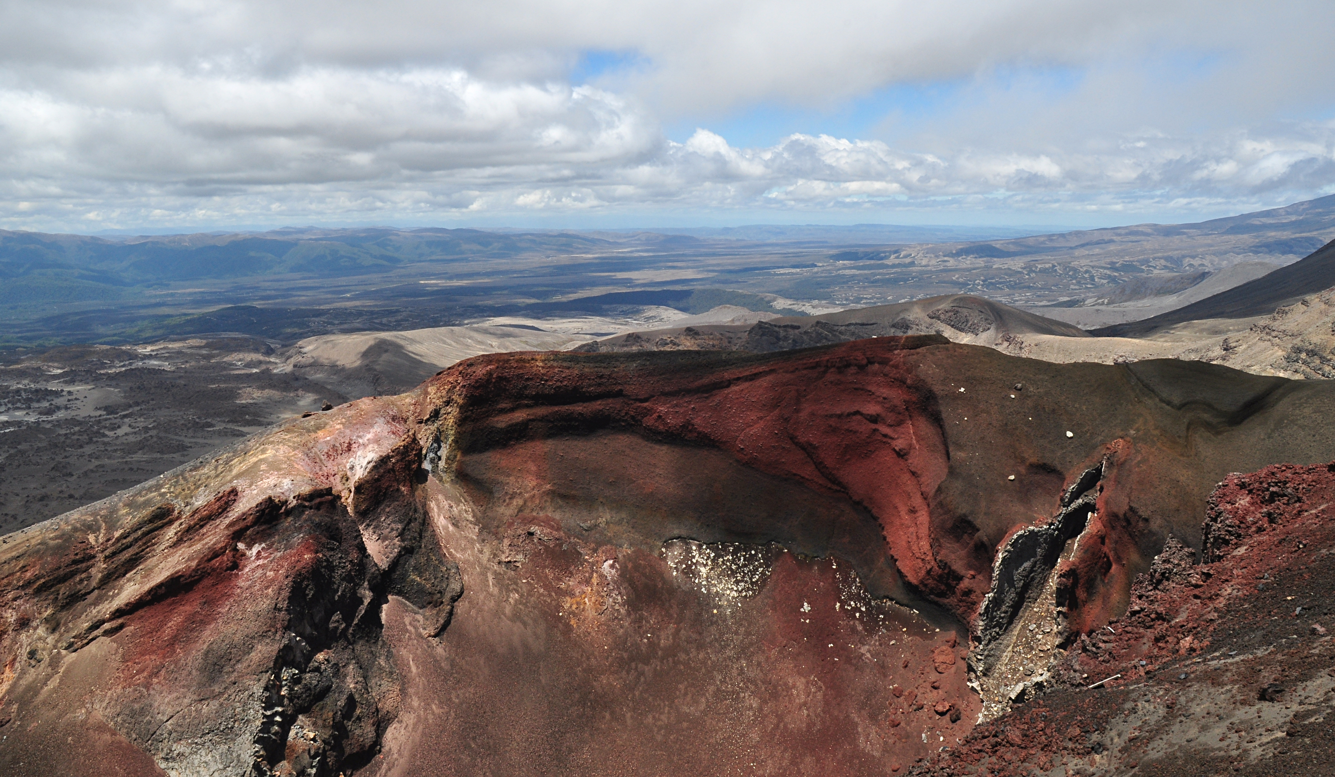 Red crater
We stopped just down from the Mt Tongariro summit for a bite of lunch at this point - the track down from here is covered in loose scoria, which sent several people tumbling as we watched. Experience walking in snowy Scottish conditions definitely helped here - the texture and grip were very much like soft spring snow. Not a very nice landing if you came a cropper though

.
Next stop - the Emerald Lakes. No photoshopping was done to this picture - the green colour comes from sulphur and copper sulphate deposits.
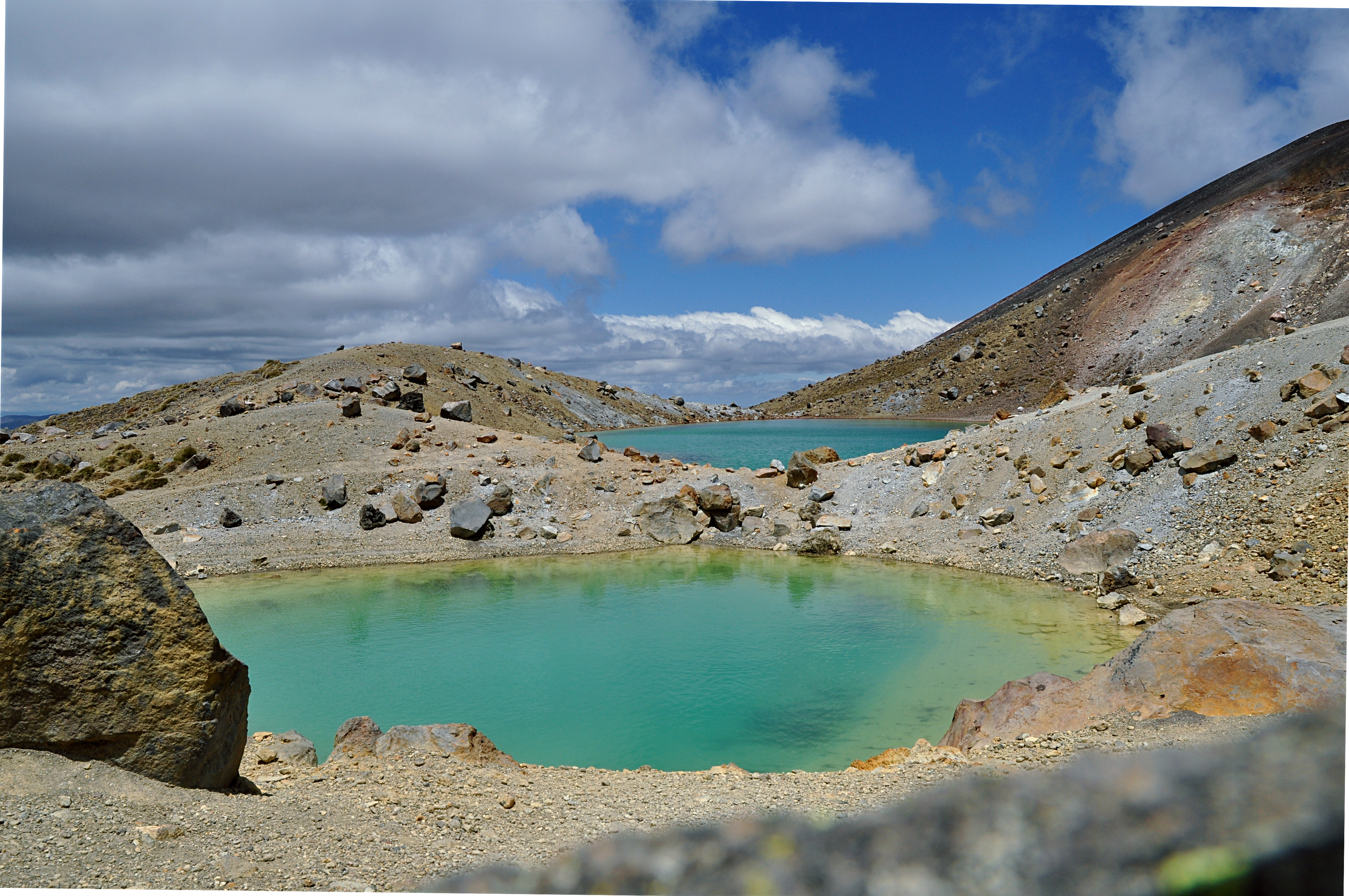 Emerald Lakes
Another flat section - this time across the Central Crater, gives you great views of the 3 peaks in the Tongariro NP: Tongariro, Ngaurahoe, Ruapehu. Ruapehu is the highest peak on the North Island, and is snow-covered year around. Very popular skiing area in the winter.
 20131218_37_Tongariro_Ruapehu
 On the map, the next lake was called the 'Sapphire Lake' - on the website, it's called the more prosaic 'Blue Lake'. It's very pretty - but Tapu (taboo, or sacred) in Maori culture, so looking only.
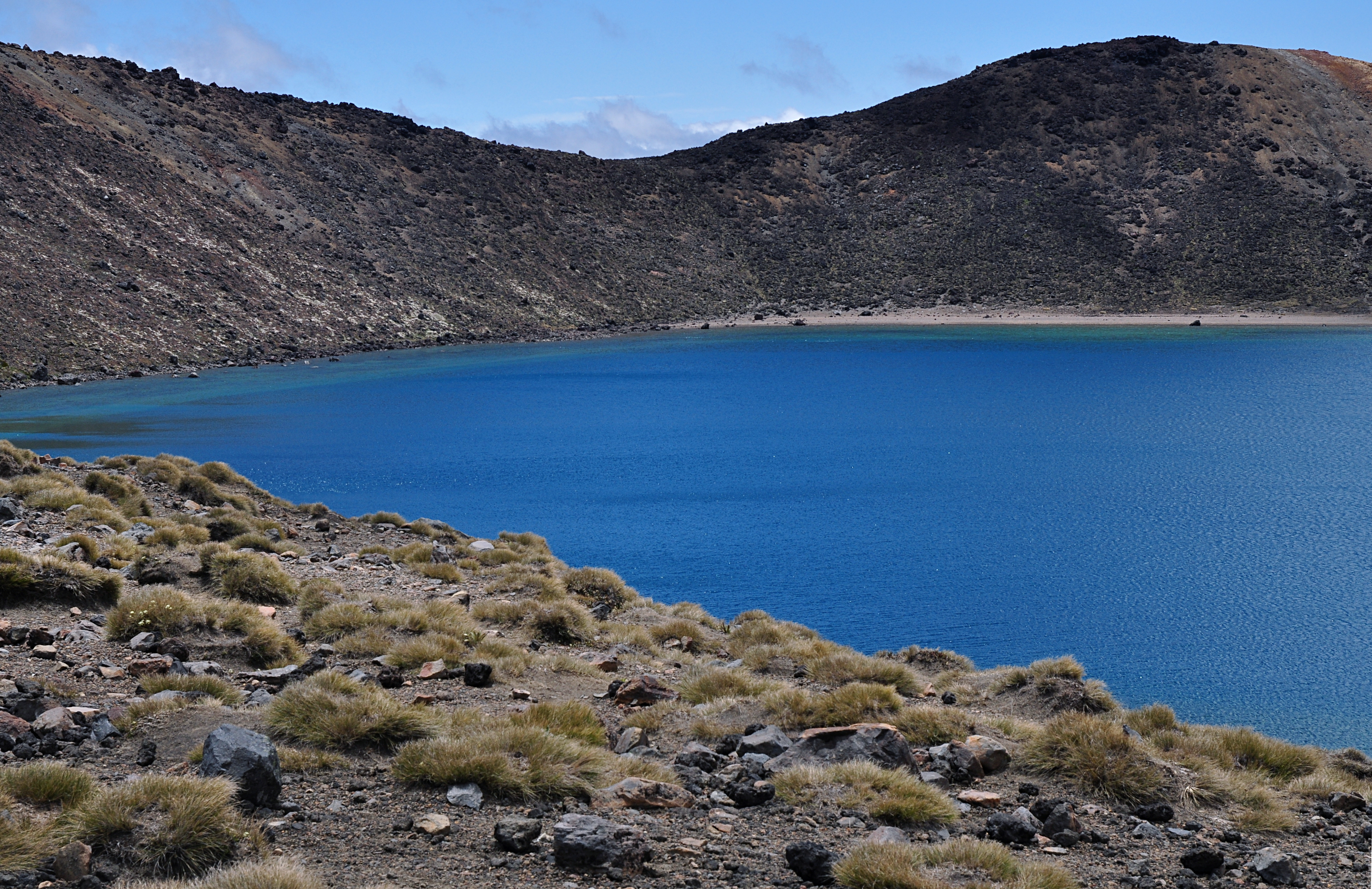 Blue Lake
 The descent takes you past the active volcanic area, complete with 'if you hear explosions, we suggest running' signs

. Fortunately for us, everything was quiet on this occasion, with just a steam plume to show the heat below the surface.
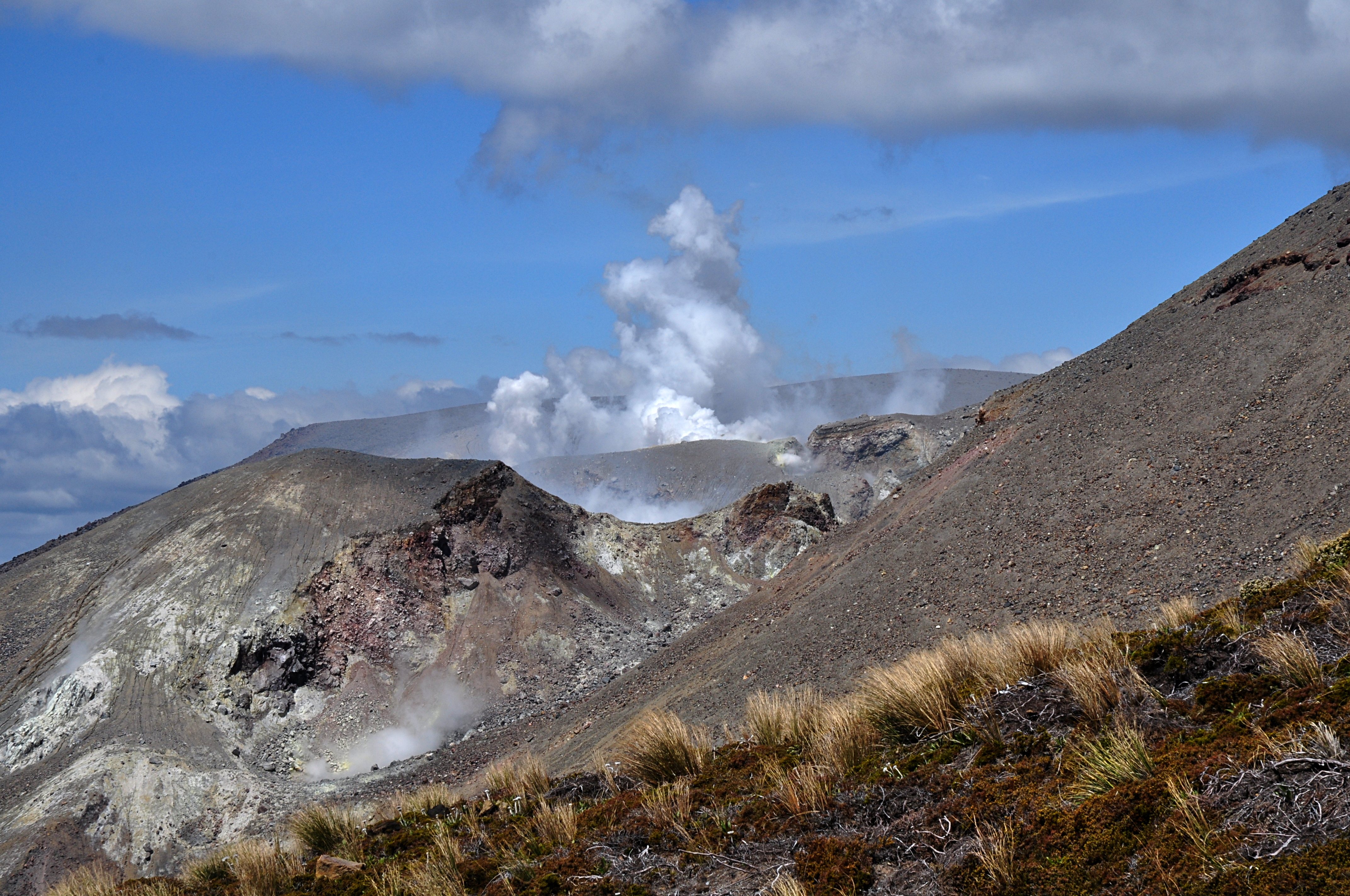 Restricted area
 Great views over Lake Taupo on the way down:
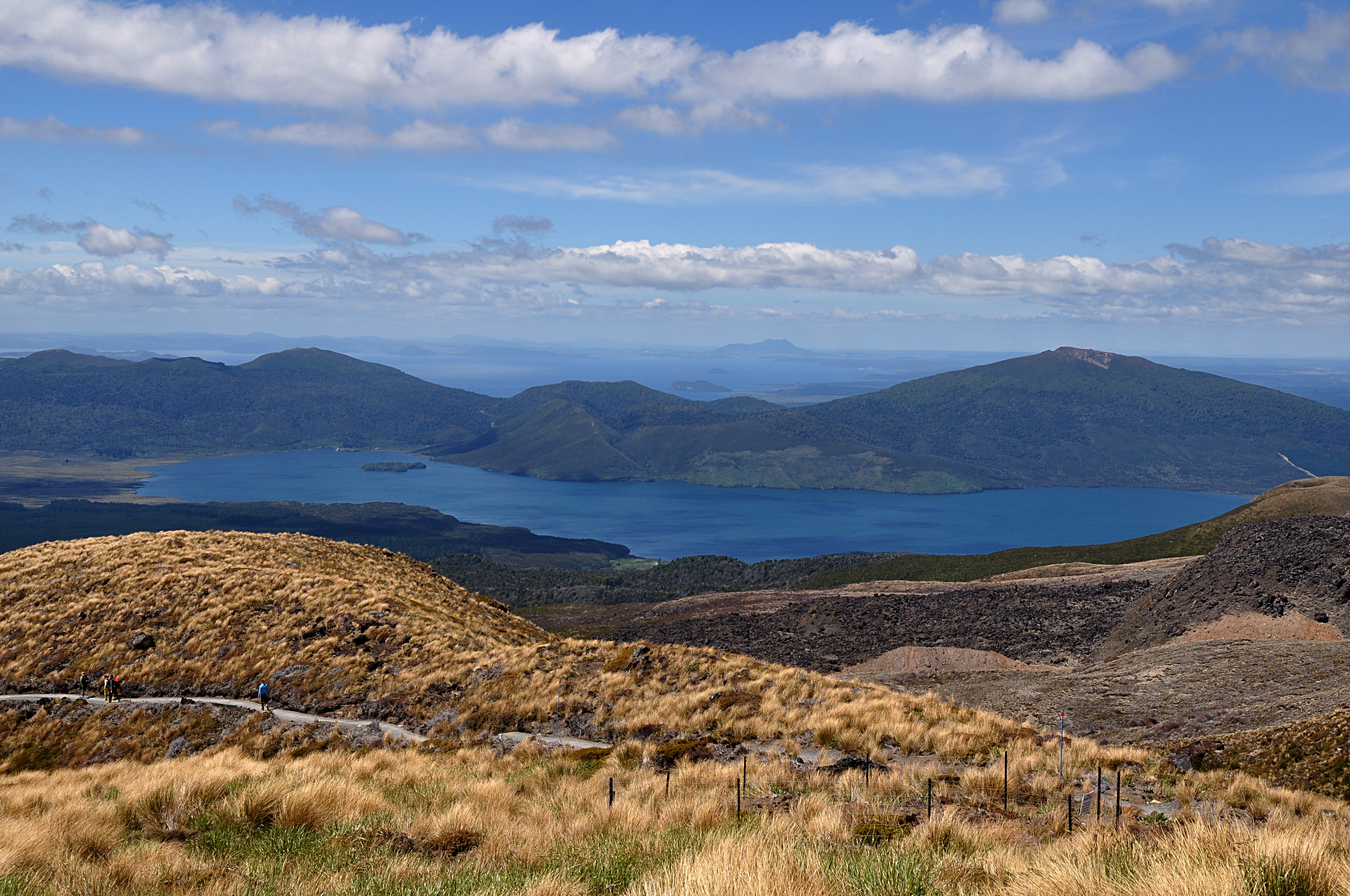 Lake Taupo
 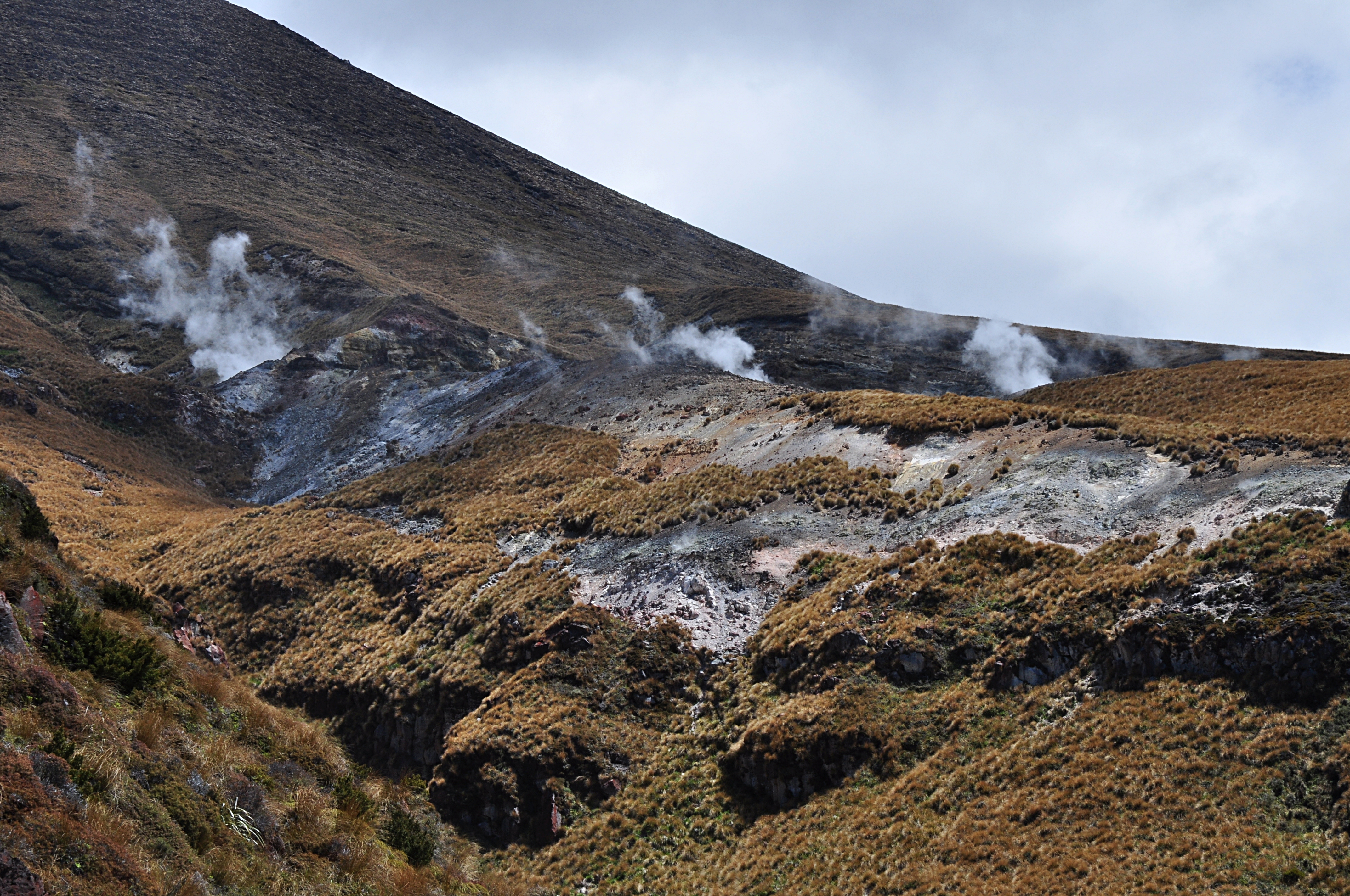 Ketetahi springs
The descent to Ketetahi is more thickly forested than the Mangatepopo side, complete with lots of characteristic silver ferns.
The last stop on the trail was the Ketetahi hut - which you can't currently stay at after part of it was destroyed by falling boulders during the last eruption. There's a tap with clean drinking water though, which was very handy as the temperature by this point was approaching 30deg - about the warmest it ever gets in this region.
The final section is through the woods and across a small stream - with yet more signs suggesting running away during volcanic activity. In this particular case, the danger is of lahar (mud flows) caused by rapidly-melting ice and snow
.
A couple more kilometers and we were back to the car park - more than an hour ahead of schedule. We were wondering whether we could have made that summit trek after all...
