
Way out West (part two)
Green Crag, 5th August 2014, 8.5km 500m
Following yesterdays exertions in Ennerdale (see part one) we could have done with a rest day but with a weather front heading in on Tuesday afternoon/Wednesday morning we decided to squeeze in another fell. The pay off for the short walk to Green Crag was parking at the Woolpack Inn so we could enjoy a feed afterwards
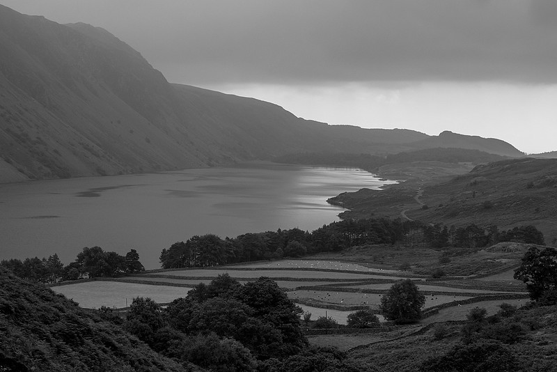
Tuesday was a lovely morning and it was very warm heading up the idyllic peat road out of Eskdale.
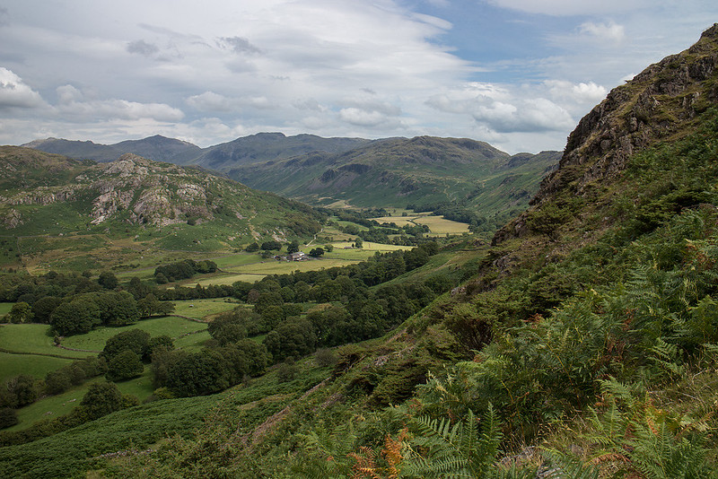 Looking back to Eskdale by johnkaysleftleg, on Flickr
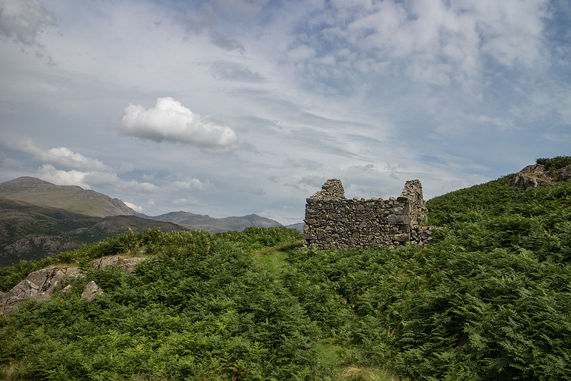 Old Peat store house by johnkaysleftleg, on Flickr
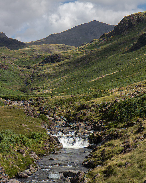
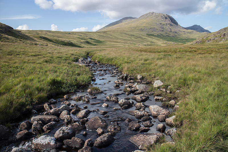
After the initial climb we went a bit astray attempting to avoid some bog and made the ascent far harder then it should have been, as we ended crossing some rough pathless terrain.
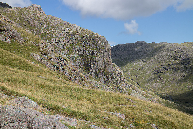
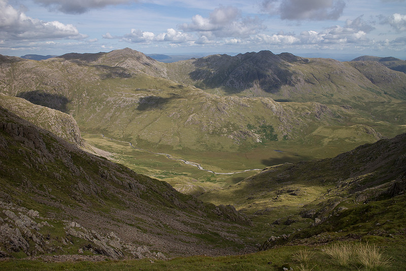
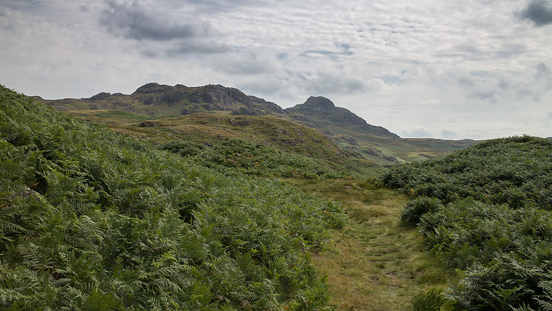 Green Crag comes into view by johnkaysleftleg, on Flickr
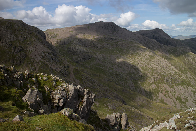
 Harter Fell by johnkaysleftleg, on Flickr
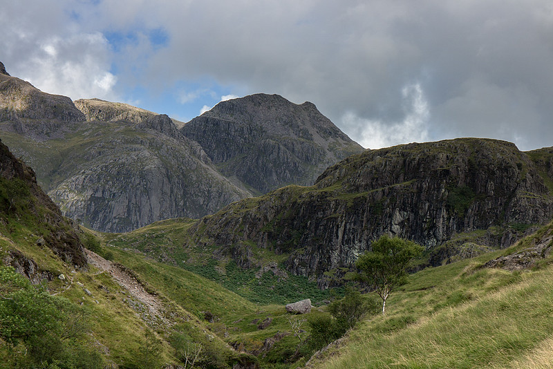
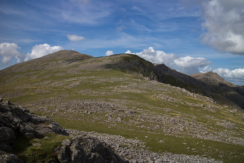
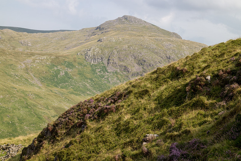
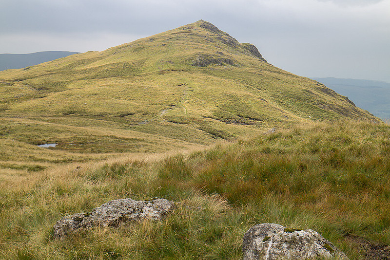
 Looking towards the heights of the Eskdale Horseshoe by johnkaysleftleg, on Flickr
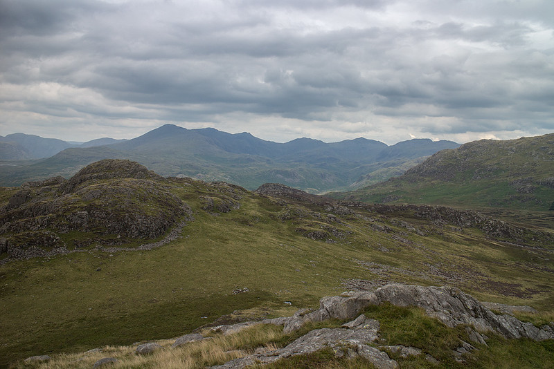
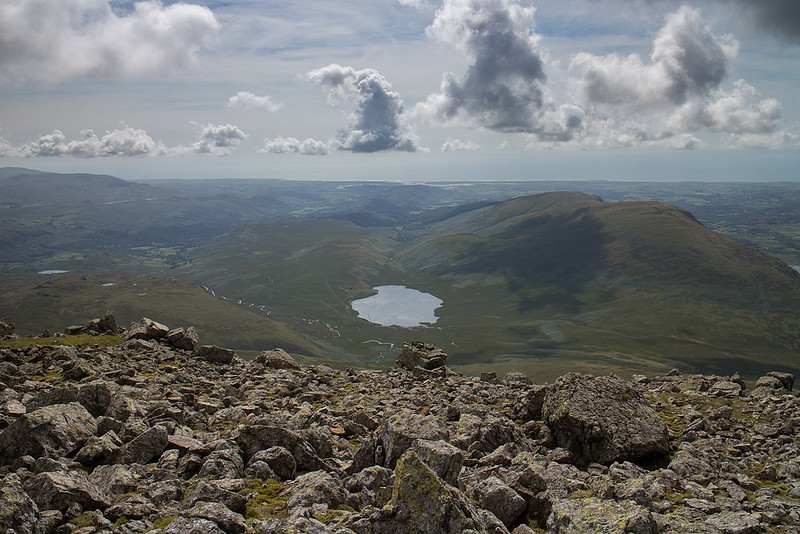
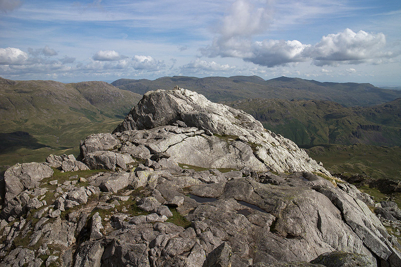
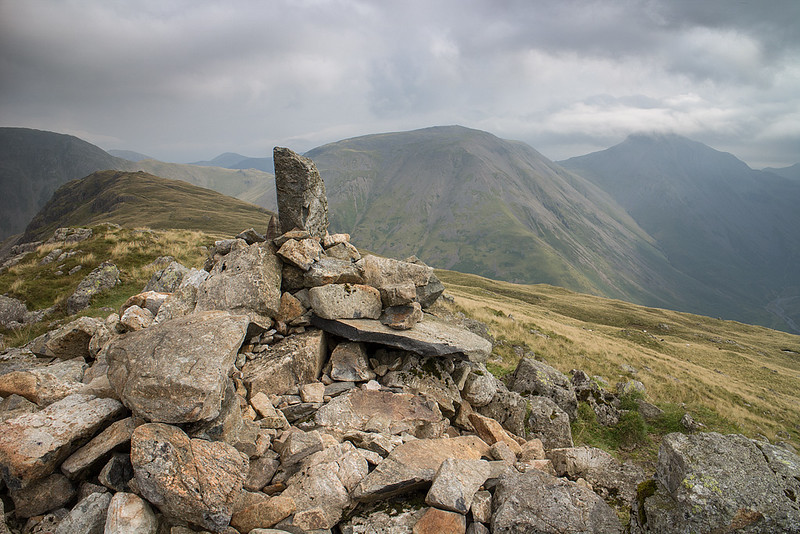
 Green Crag by johnkaysleftleg, on Flickr
By the time we reached the summit the cloud was increasing from the South so we had a short break before heading back in mildly moist conditions sticking to the path this time. The bog we avoided before turned out to be OK and we got back to the Woolpack before the rain started in earnest to enjoy some grub.
Rest day, 6th August 2014
Day spent wandering around Ambleside.
Scafell from Eskdale, 7th August 2014, 15km 1050m
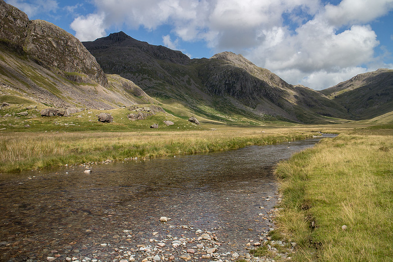
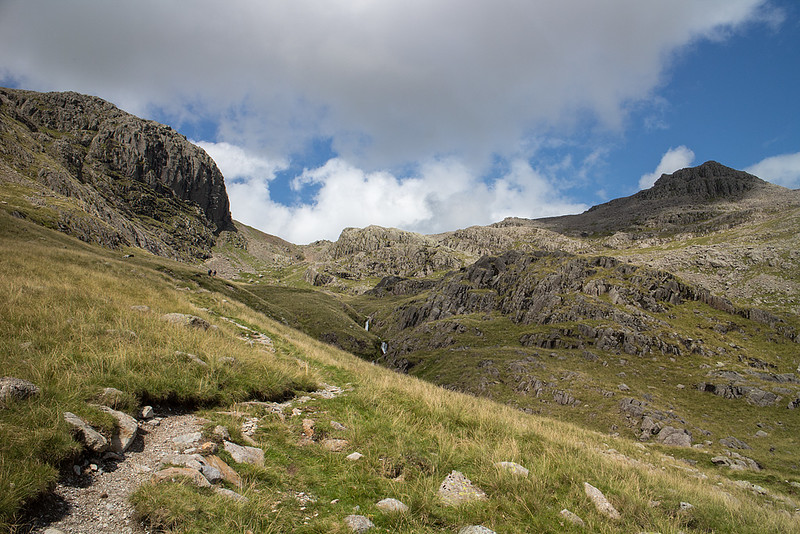
We parked at Jubilee Bridge and set off past Brotherkield farm on a perfect morning. The initial walk up the dale is very pleasant following the river Esk while attempting to spot the Eskdale needle. Once Lingcove bridge is reached a short climb begins and the full delights of the Scafell range come into view with Ill Crag looking truly awesome and impregnable.
 Bow Fell and the River Esk by johnkaysleftleg, on Flickr
 Lingcove Bridge by johnkaysleftleg, on Flickr
 Ill Crag by johnkaysleftleg, on Flickr
Once past the gorge that runs below Green Crag we arrived at the aptly named Great Moss and the search for a crossing point of the Esk was started. Strangely enough the driest part of Great Moss was right next to the river and after a bit of searching we splodged across a very shallow section opposite Sampsons Stones.
 Green Crag by johnkaysleftleg, on Flickr
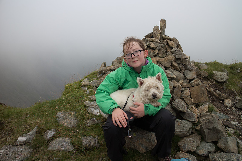
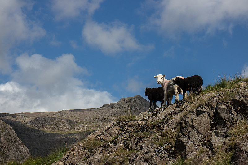 Some of the locals by johnkaysleftleg, on Flickr
 Scafell Pike and the River Esk by johnkaysleftleg, on Flickr
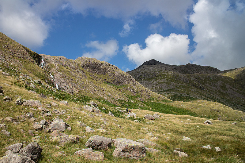
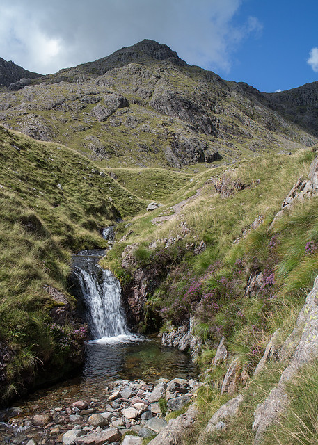
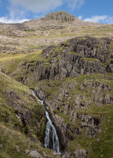
Once across the river we made our way to Cam Spout and took on the entertaining scramble to the right of the falls. There is a path further over but why miss out on the fun? We had a snack at the top of the falls before proceeding towards Mickledoor on the excellent path.
 Cam Spout and the Pike by johnkaysleftleg, on Flickr
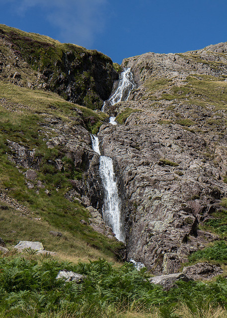 Cam Spout by johnkaysleftleg, on Flickr
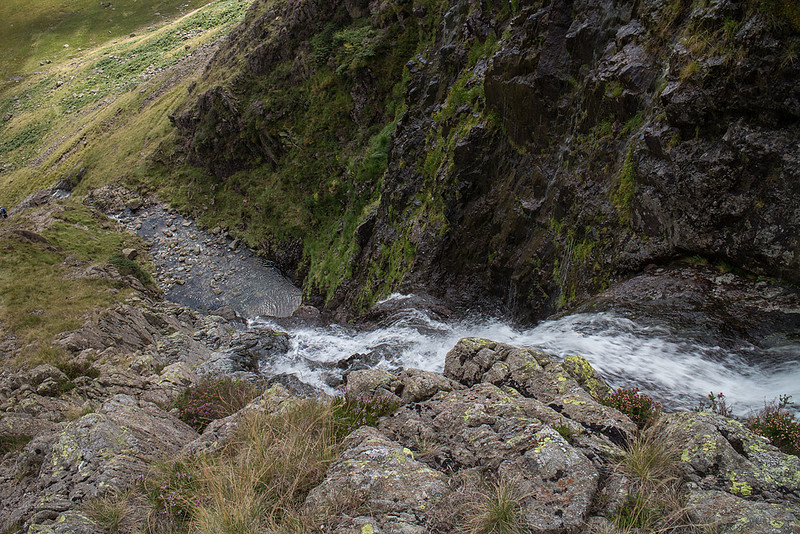 Looking down the falls by johnkaysleftleg, on Flickr
 The Esk Buttress by johnkaysleftleg, on Flickr
 How Beck by johnkaysleftleg, on Flickr
 Broad Stand and Scafell Pike by johnkaysleftleg, on Flickr
 Scafell Pike's south summit by johnkaysleftleg, on Flickr
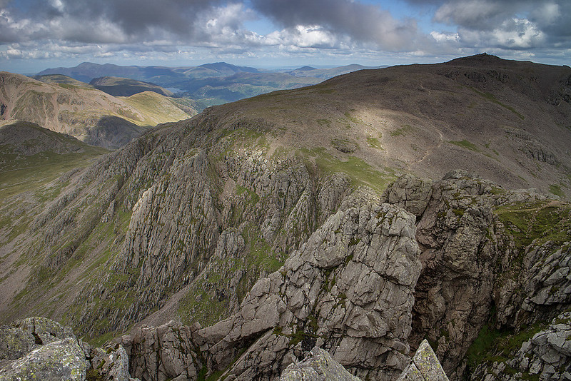
Thankfully the slog up the screes is not required on this route as you turn off up the obvious gully to the left to scramble simply up to the overgrown puddle that is known as Foxes Tarn. Another sharp pull up to col between Scafell and Symonds Knott and the hard work is just about done. Grace, Nicola and Hughie headed up to the main summit while I checked out the lower top to see the jumble of crags and pinnacles between England's two highest fells.
 Flying High! by johnkaysleftleg, on Flickr
 View from Symonds Knott by johnkaysleftleg, on Flickr
 Great Gable over Lingmell by johnkaysleftleg, on Flickr
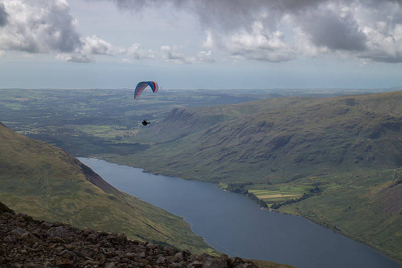
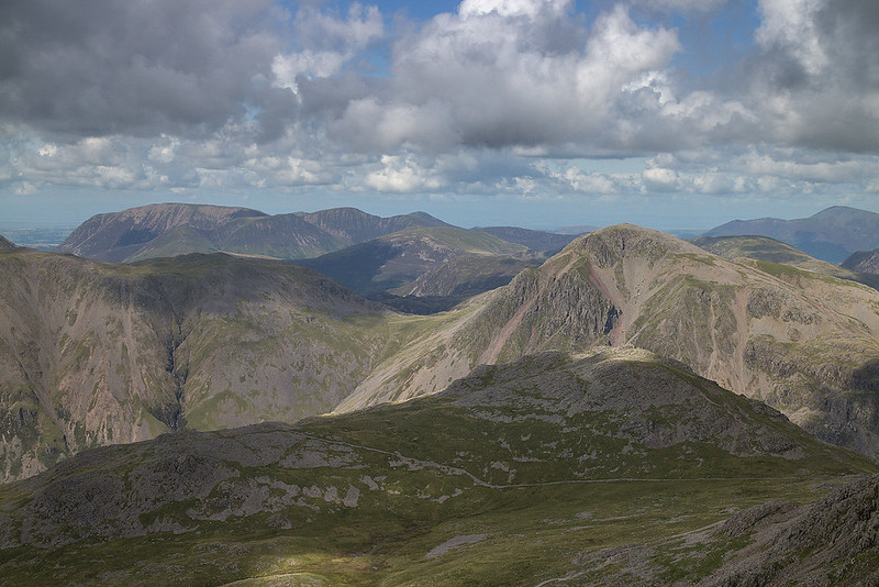
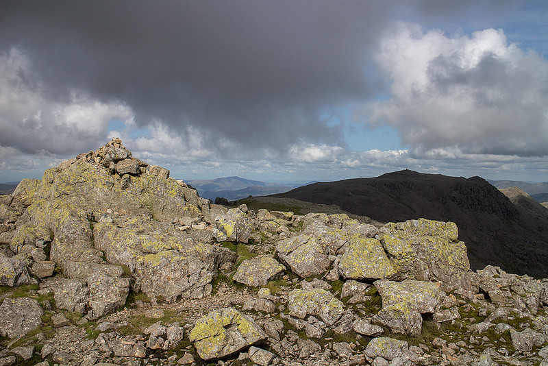
I joined the others on Scafell summit and we spent a while totally alone on the summit enjoying the views on this fine Lakeland day. In fact the closest other person we saw was the paraglyder who photobombed our family summit shot.
 Scafell Summit by johnkaysleftleg, on Flickr
 Burnmoor Tarn by johnkaysleftleg, on Flickr
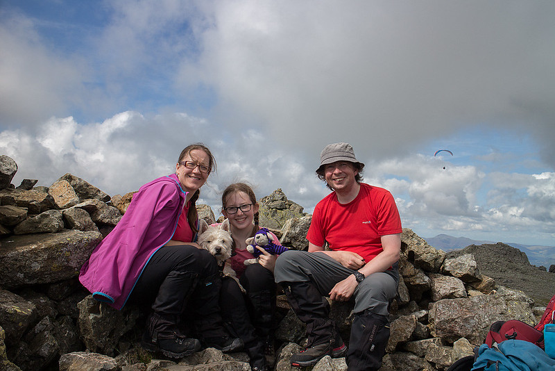 Family Summit Shot by johnkaysleftleg, on Flickr
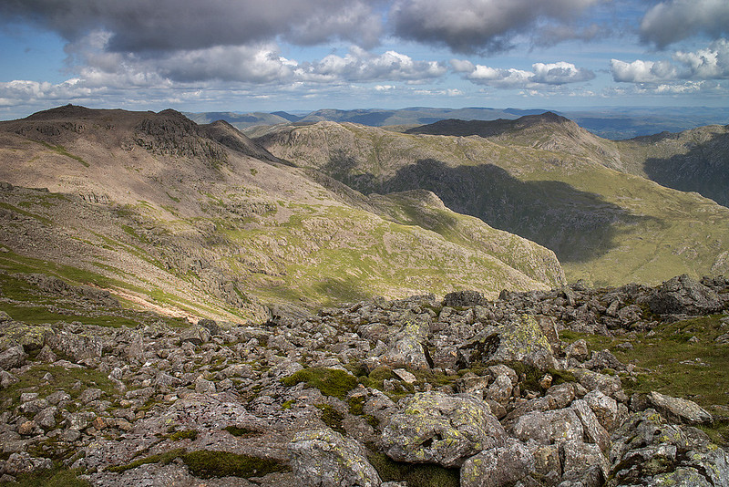 Scafell View by johnkaysleftleg, on Flickr
The walk along Long Green to Slight Side is a delight, easy going with superb views of Eskdale and it's magnificent mountains. Slight Side itself is a lovely top that looked silver plated in the afternoon sunshine.
 Looking towards Slight Side by johnkaysleftleg, on Flickr
 Looking down to upper Eskdale by johnkaysleftleg, on Flickr
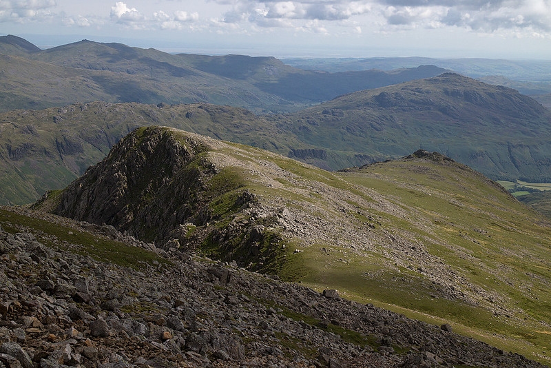
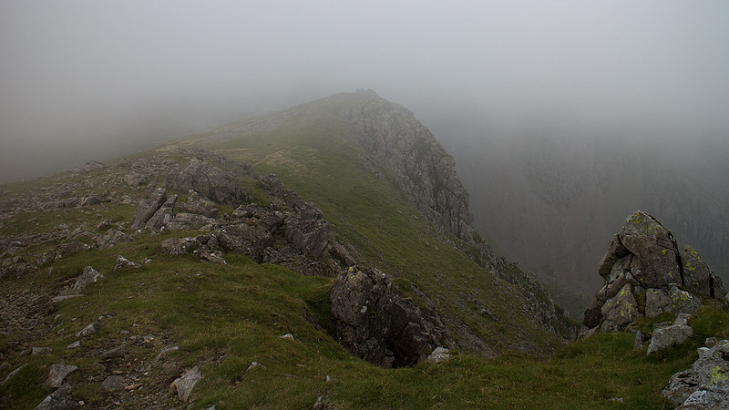
 The Pikes of Scafell by johnkaysleftleg, on Flickr
 Slight Side Summit by johnkaysleftleg, on Flickr
 Looking back up Long Green by johnkaysleftleg, on Flickr
This walk had been a delight up to this point but the last section back to the car was a little wearisome. A rough descent from Slight Side was followed by a boggy dreary trudge towards Cat Crag. The OS map shows a path heading down the south side of Cat Crag gorge but it appeared to have disappeared due to lack of use. Given the sea of bracken I knew was on the lower slopes this was a concern but to our great relief we found a feint trail making it's way through.
 Sight Side and Catcove Beck by johnkaysleftleg, on Flickr
Once back down in Eskdale it was a simple walk back to the car to finish off what was an overwhelmingly great day. I'm so glad we climbed Scafell from Eskdale as visiting this wonderful valley should surely be part of every walkers Lake district list.
Yewbarrow and Red Pike, 8th August 2014, 9km 942m
One fell that got away on our Ennerdale adventure was Red Pike. We were less than a mile from the summit but another mile and a half added on to what was, by our standards, a very long day would have been pushing it just too far. The good side of this was we got to re-visit a past favourite in the dramatic shape of Yewbarrow. With bad weather due by mid afternoon it was an early start from Overbeck bridge.
 Looking back to the Screes by johnkaysleftleg, on Flickr
 Red Pike by johnkaysleftleg, on Flickr
 High on Yewbarrow's South west ridge by johnkaysleftleg, on Flickr
 Yewbarrow Summit by johnkaysleftleg, on Flickr
The ascent of Yewbarrow certainly involves a degree of scrambling making it very entertaining. There has been a small amount of stone pitching but this just enables the bypassing of some tiresome scree and doesn't effect the fun bits at all. By the time we reached the summit the Scafells had disappeared under low cloud so we pushed on quickly to the North top and Stirrup Crag.
 Yewbarrow's South top from the North by johnkaysleftleg, on Flickr
The scramble down Stirrup Crag is very precipitous and requires care and concentration but in truth it's still easier than it looks from below. By the time we reached the top of the Dore head screes the cloud was massing and we had some drizzle on the climb to a clag covered Red Pike.
 Hughie and Grace on Red Pike by johnkaysleftleg, on Flickr
 Gloomy on Red Pike by johnkaysleftleg, on Flickr
We managed lunch on Red Pike summit without too much dampness before heading across the open fellside towards Low tarn. The going past the tarn was really quite rough through rocks and bracken but the main path was soon reached.
 Low Tarn by johnkaysleftleg, on Flickr
 Falls of Over Beck by johnkaysleftleg, on Flickr
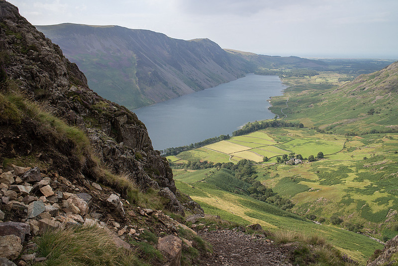
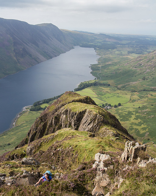
 Wastwater by johnkaysleftleg, on Flickr
We stuck to the lower path to avoid any re-ascent and made it back to the car just as the heavens opened with a torrential downpour.
All in all a very successful weeks bagging with some truly memorable walks to round off a great two weeks holiday.
Following yesterdays exertions in Ennerdale (see part one) we could have done with a rest day but with a weather front heading in on Tuesday afternoon/Wednesday morning we decided to squeeze in another fell. The pay off for the short walk to Green Crag was parking at the Woolpack Inn so we could enjoy a feed afterwards
Tuesday was a lovely morning and it was very warm heading up the idyllic peat road out of Eskdale.
Looking back to Eskdale by johnkaysleftleg, on FlickrOld Peat store house by johnkaysleftleg, on FlickrAfter the initial climb we went a bit astray attempting to avoid some bog and made the ascent far harder then it should have been, as we ended crossing some rough pathless terrain.
Green Crag comes into view by johnkaysleftleg, on FlickrHarter Fell by johnkaysleftleg, on FlickrLooking towards the heights of the Eskdale Horseshoe by johnkaysleftleg, on FlickrGreen Crag by johnkaysleftleg, on FlickrBy the time we reached the summit the cloud was increasing from the South so we had a short break before heading back in mildly moist conditions sticking to the path this time. The bog we avoided before turned out to be OK and we got back to the Woolpack before the rain started in earnest to enjoy some grub.
Rest day, 6th August 2014
Day spent wandering around Ambleside.
Scafell from Eskdale, 7th August 2014, 15km 1050m
We parked at Jubilee Bridge and set off past Brotherkield farm on a perfect morning. The initial walk up the dale is very pleasant following the river Esk while attempting to spot the Eskdale needle. Once Lingcove bridge is reached a short climb begins and the full delights of the Scafell range come into view with Ill Crag looking truly awesome and impregnable.
Bow Fell and the River Esk by johnkaysleftleg, on FlickrLingcove Bridge by johnkaysleftleg, on FlickrIll Crag by johnkaysleftleg, on FlickrOnce past the gorge that runs below Green Crag we arrived at the aptly named Great Moss and the search for a crossing point of the Esk was started. Strangely enough the driest part of Great Moss was right next to the river and after a bit of searching we splodged across a very shallow section opposite Sampsons Stones.
Green Crag by johnkaysleftleg, on FlickrSome of the locals by johnkaysleftleg, on FlickrScafell Pike and the River Esk by johnkaysleftleg, on FlickrOnce across the river we made our way to Cam Spout and took on the entertaining scramble to the right of the falls. There is a path further over but why miss out on the fun? We had a snack at the top of the falls before proceeding towards Mickledoor on the excellent path.
Cam Spout and the Pike by johnkaysleftleg, on FlickrCam Spout by johnkaysleftleg, on FlickrLooking down the falls by johnkaysleftleg, on FlickrThe Esk Buttress by johnkaysleftleg, on FlickrHow Beck by johnkaysleftleg, on FlickrBroad Stand and Scafell Pike by johnkaysleftleg, on FlickrScafell Pike's south summit by johnkaysleftleg, on FlickrThankfully the slog up the screes is not required on this route as you turn off up the obvious gully to the left to scramble simply up to the overgrown puddle that is known as Foxes Tarn. Another sharp pull up to col between Scafell and Symonds Knott and the hard work is just about done. Grace, Nicola and Hughie headed up to the main summit while I checked out the lower top to see the jumble of crags and pinnacles between England's two highest fells.
Flying High! by johnkaysleftleg, on FlickrView from Symonds Knott by johnkaysleftleg, on FlickrGreat Gable over Lingmell by johnkaysleftleg, on FlickrI joined the others on Scafell summit and we spent a while totally alone on the summit enjoying the views on this fine Lakeland day. In fact the closest other person we saw was the paraglyder who photobombed our family summit shot.
Scafell Summit by johnkaysleftleg, on FlickrBurnmoor Tarn by johnkaysleftleg, on FlickrFamily Summit Shot by johnkaysleftleg, on FlickrScafell View by johnkaysleftleg, on FlickrThe walk along Long Green to Slight Side is a delight, easy going with superb views of Eskdale and it's magnificent mountains. Slight Side itself is a lovely top that looked silver plated in the afternoon sunshine.
Looking towards Slight Side by johnkaysleftleg, on FlickrLooking down to upper Eskdale by johnkaysleftleg, on FlickrThe Pikes of Scafell by johnkaysleftleg, on FlickrSlight Side Summit by johnkaysleftleg, on FlickrLooking back up Long Green by johnkaysleftleg, on FlickrThis walk had been a delight up to this point but the last section back to the car was a little wearisome. A rough descent from Slight Side was followed by a boggy dreary trudge towards Cat Crag. The OS map shows a path heading down the south side of Cat Crag gorge but it appeared to have disappeared due to lack of use. Given the sea of bracken I knew was on the lower slopes this was a concern but to our great relief we found a feint trail making it's way through.
Sight Side and Catcove Beck by johnkaysleftleg, on FlickrOnce back down in Eskdale it was a simple walk back to the car to finish off what was an overwhelmingly great day. I'm so glad we climbed Scafell from Eskdale as visiting this wonderful valley should surely be part of every walkers Lake district list.
Yewbarrow and Red Pike, 8th August 2014, 9km 942m
One fell that got away on our Ennerdale adventure was Red Pike. We were less than a mile from the summit but another mile and a half added on to what was, by our standards, a very long day would have been pushing it just too far. The good side of this was we got to re-visit a past favourite in the dramatic shape of Yewbarrow. With bad weather due by mid afternoon it was an early start from Overbeck bridge.
Looking back to the Screes by johnkaysleftleg, on FlickrRed Pike by johnkaysleftleg, on FlickrHigh on Yewbarrow's South west ridge by johnkaysleftleg, on FlickrYewbarrow Summit by johnkaysleftleg, on FlickrThe ascent of Yewbarrow certainly involves a degree of scrambling making it very entertaining. There has been a small amount of stone pitching but this just enables the bypassing of some tiresome scree and doesn't effect the fun bits at all. By the time we reached the summit the Scafells had disappeared under low cloud so we pushed on quickly to the North top and Stirrup Crag.
Yewbarrow's South top from the North by johnkaysleftleg, on FlickrThe scramble down Stirrup Crag is very precipitous and requires care and concentration but in truth it's still easier than it looks from below. By the time we reached the top of the Dore head screes the cloud was massing and we had some drizzle on the climb to a clag covered Red Pike.
Hughie and Grace on Red Pike by johnkaysleftleg, on FlickrGloomy on Red Pike by johnkaysleftleg, on FlickrWe managed lunch on Red Pike summit without too much dampness before heading across the open fellside towards Low tarn. The going past the tarn was really quite rough through rocks and bracken but the main path was soon reached.
Low Tarn by johnkaysleftleg, on FlickrFalls of Over Beck by johnkaysleftleg, on FlickrWastwater by johnkaysleftleg, on FlickrWe stuck to the lower path to avoid any re-ascent and made it back to the car just as the heavens opened with a torrential downpour.
All in all a very successful weeks bagging with some truly memorable walks to round off a great two weeks holiday.