free to be able to rate and comment on reports (as well as access 1:25000 mapping).
A rare totally free day off in July saw me and my faithful canine companion, Hughie the westie head for the Howgills once again. One place in these hills my wanderings had not taken me was Carling Gill, the home to the
other major waterfalls in these hills, Black Force and The Spout. This is not really a regularly visited place, at least the grass growing on the road would suggest so

Unsurprisingly I parked up near Carlin Bridge alone on a lovely morning.
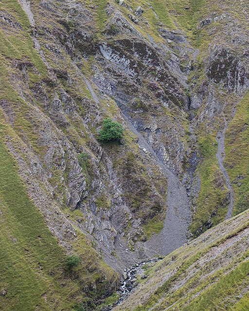
The initial walk in along the wide lower reaches of the Gill is an easy stroll but it's worth noting the rare geology that has given rise to several different levels of flood plain over the last 10,000 years or so..
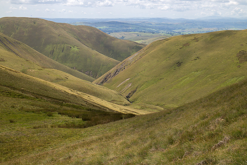
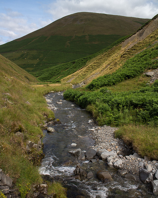 Carlin Beck
 by
johnkaysleftleg, on Flickr
Now Alfred Wainwright wrote some of the finest guide books about the hills of Northern Britain that have ever been committed to paper including one detailing the Howgills. His walk description of a journey up Carlin Gill is somewhat flawed however as he suggests entering the wooded gorge and continuing along the bed of the beck. This would be a mistake however as several online reports tell stories of desperate struggles ending with a very unpleasant scramble up lose slopes to escape from the gorge. This can be avoided by simply crossing to the North bank
before the gorge and finding a grassy path that rises gently and traverses easily above all the difficulties.
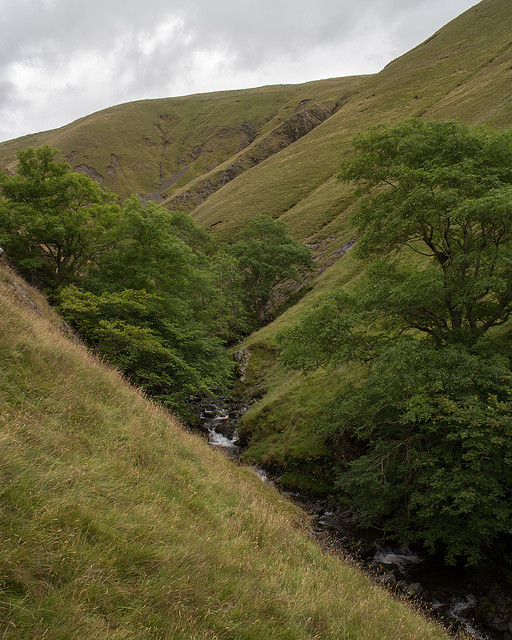 The start of the wooded ravine
 by
johnkaysleftleg, on Flickr
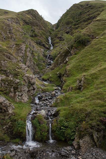
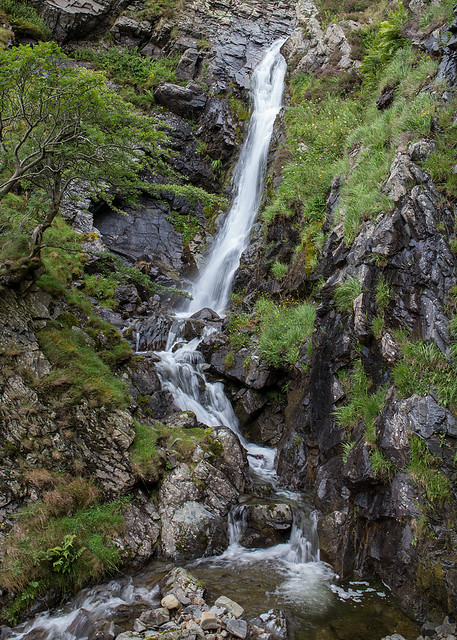
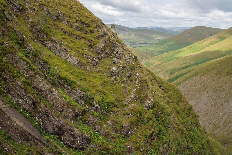
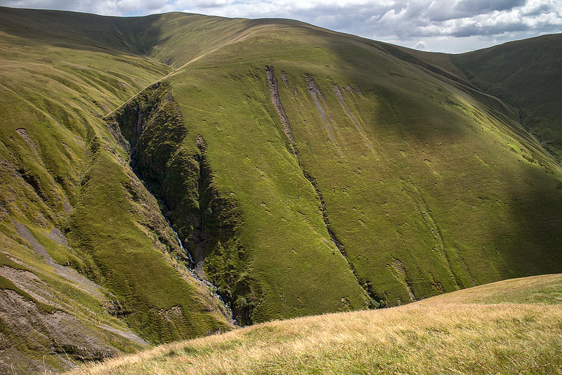
Black Force comes into view far sooner than you expect as it looms up to your right in impressive fashion. I decided to continue to the head of the gill to have a look at The Spout which necessitated re-crossing the beck and a bit of occasional clambering but was simple enough. The scrambling route up the left of the falls was quite obvious but as it looked steep and not at all dog friendly me and Hughie retreated back to Black Force.
The route up the side of Black Force has been described as a scramble but I fail to see why as it offers no difficulties other than extreme steepness. So steep in fact that around half way up when I looked across to the even steeper Black Force screes the effect was very disorientating

Eventually the route becomes a narrow exposed arete above the gorge but with a great view of the fantastic folded bedrock that makes up these hills.
 Black Force
 by
johnkaysleftleg, on Flickr
 The Spout
 by
johnkaysleftleg, on Flickr
 Black Force Screes
 by
johnkaysleftleg, on Flickr
 Folded Rocks
 by
johnkaysleftleg, on Flickr
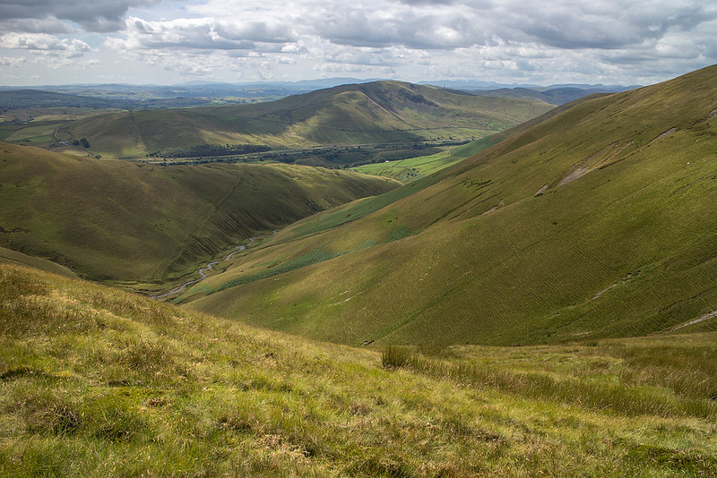
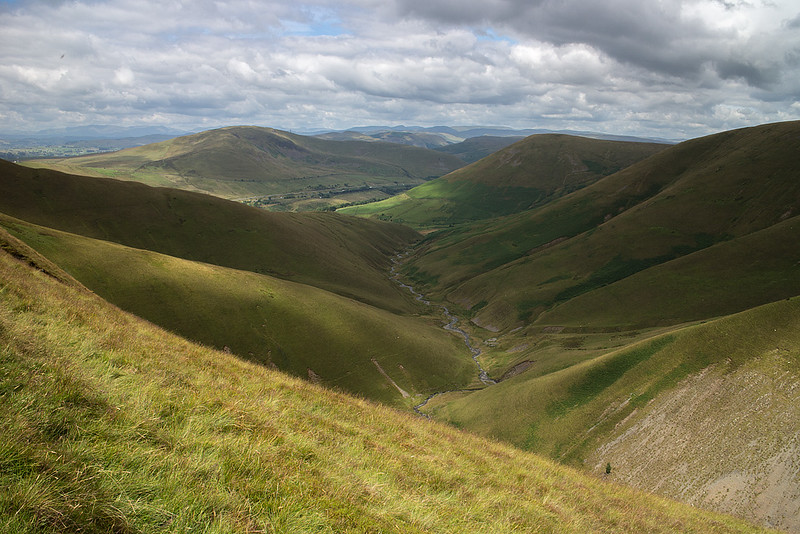 Carlin Gill from the top of Black Force
 by
johnkaysleftleg, on Flickr
Following a rest to get my breath back I found the traverse path around Blake Ridge to the minor top of Linghaw which gives a great view of the M6 winding away Southwards. I'm not a fan of looking at motorways but when you are on top of a hill watching the rat race below it's a great feeling

From here it was a fair upward trudge to get to the high point of the day, the Hewitt of Fell Head. It was on this section that I saw the only other walker of the day and the first other walker I've seen on mid-week visits to the Howgills. Me and Hughie had a bit of lunch and set off on the long and easy decent towards Simon's Seat.
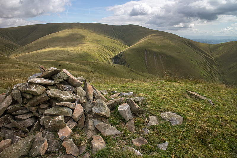
The climb to the top of Simon's Seat is a typical steep grassy pull to a tiny cairn on a wide flat top. There was a nice breeze so I sat for quite a while watching the dappled sunshine bring out the contours of the velvety hills around me.
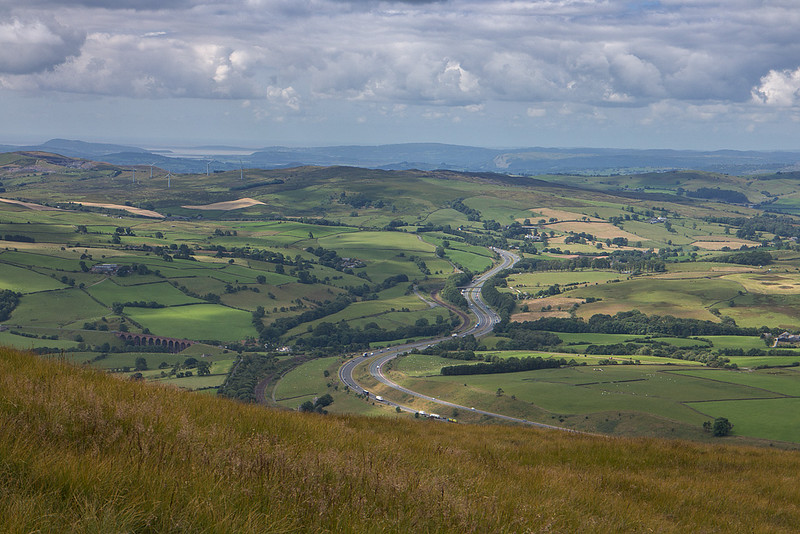 The M6 from Linghaw
 by
johnkaysleftleg, on Flickr
 Fell End
 by
johnkaysleftleg, on Flickr
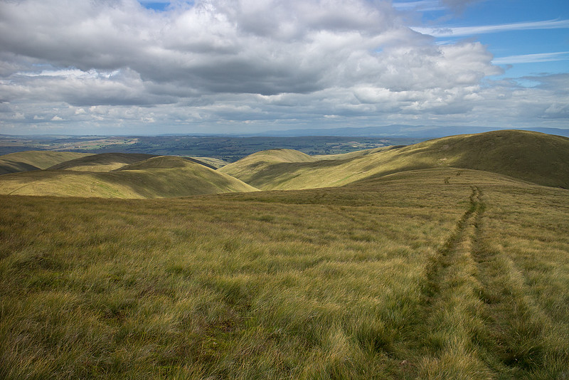 On the way to Simon's Seat
 by
johnkaysleftleg, on Flickr
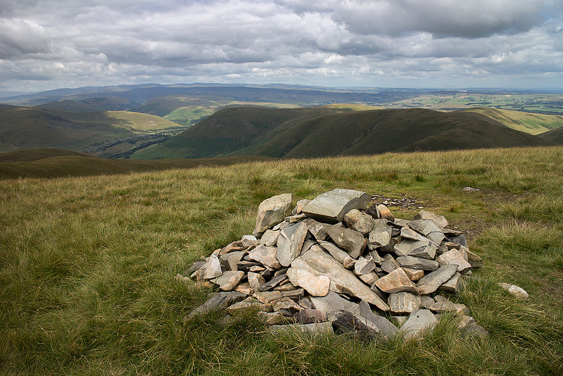
 Churn Gill
 by
johnkaysleftleg, on Flickr
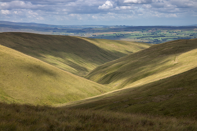
 West Grain
 by
johnkaysleftleg, on Flickr
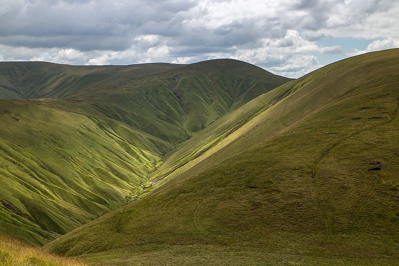
 The Calf from Simon's Seat
 by
johnkaysleftleg, on Flickr
Following a consultation with the map I decided to descend to the col and traverse around Wethercalf Moss and climb up to Docker Knott. This was fine in theory but for once the Howgills firm smooth grassy slopes let me down and I found myself wading through long grass masking uneven ground. Following some swearing and slipping down holes I made it to the minor top of Docker Kott to be confronted with a longer than expected descent to Blakethwaite Bottom.
 Blakethwaite Bottom from Docker Knott
 by
johnkaysleftleg, on Flickr
A long easy descent followed to the remarkable isolated pasture of Blakethwaite Bottom, Standing here you are totally surrounded by hills on all sides and feel cut off from the world almost totally. I began the final climb of the day up Uldale head which was slow and hot going. Once I was close to the top I took a detour off to view Black Force from the top of the Screes before making my way to the summit.
 Black Force from the Top of the Screes
 by
johnkaysleftleg, on Flickr
 Carlin Gill from Uldale Head
 by
johnkaysleftleg, on Flickr
 Uldale Head
 by
johnkaysleftleg, on Flickr
I was fairly worn out by the time I reached the summit so it was a relief that the way down was easy, helped greatly by finding a trod though the worrying sea of bracken. This was another memorable day in the Howgill Fells visiting some places I would highly recommend, but don't all rush at once or you'll spoil it.
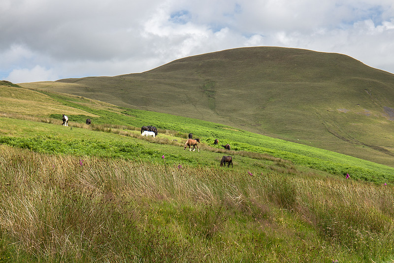 Fell Ponys
 by
johnkaysleftleg, on Flickr
