free to be able to rate and comment on reports (as well as access 1:25000 mapping).
We had the week off, and we had planned to go to Rum, but after being hailed off a scramble in Glen Nevis last Saturday, a mega-soaking in Kintail on Sunday, and the weather forecast looking grim, grim, grim, we decided to cut our losses, and return home to look on the internet for somewhere dry to go..
A search saw us booking some flights to Mallorca and quickly packing for the off - isn't t'interweb great

After awe had had enough wandering through the alleys of Palma, we managed to get our hands on a guide book written in English, with a 60K map which combined seemed to have enough info to do a route..

We set off the following morning, early, but with the bus into town taking 45 minutes instead of the usual 20, we missed our connecting bus to Gallalea

But then we saw a bus that was bound for Estellencs - where our walk was due to end, so we decided to just reverse our route, and off we went.

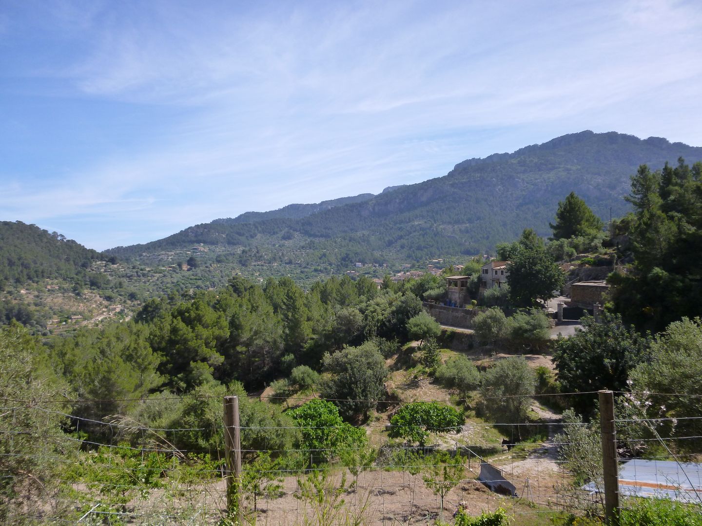
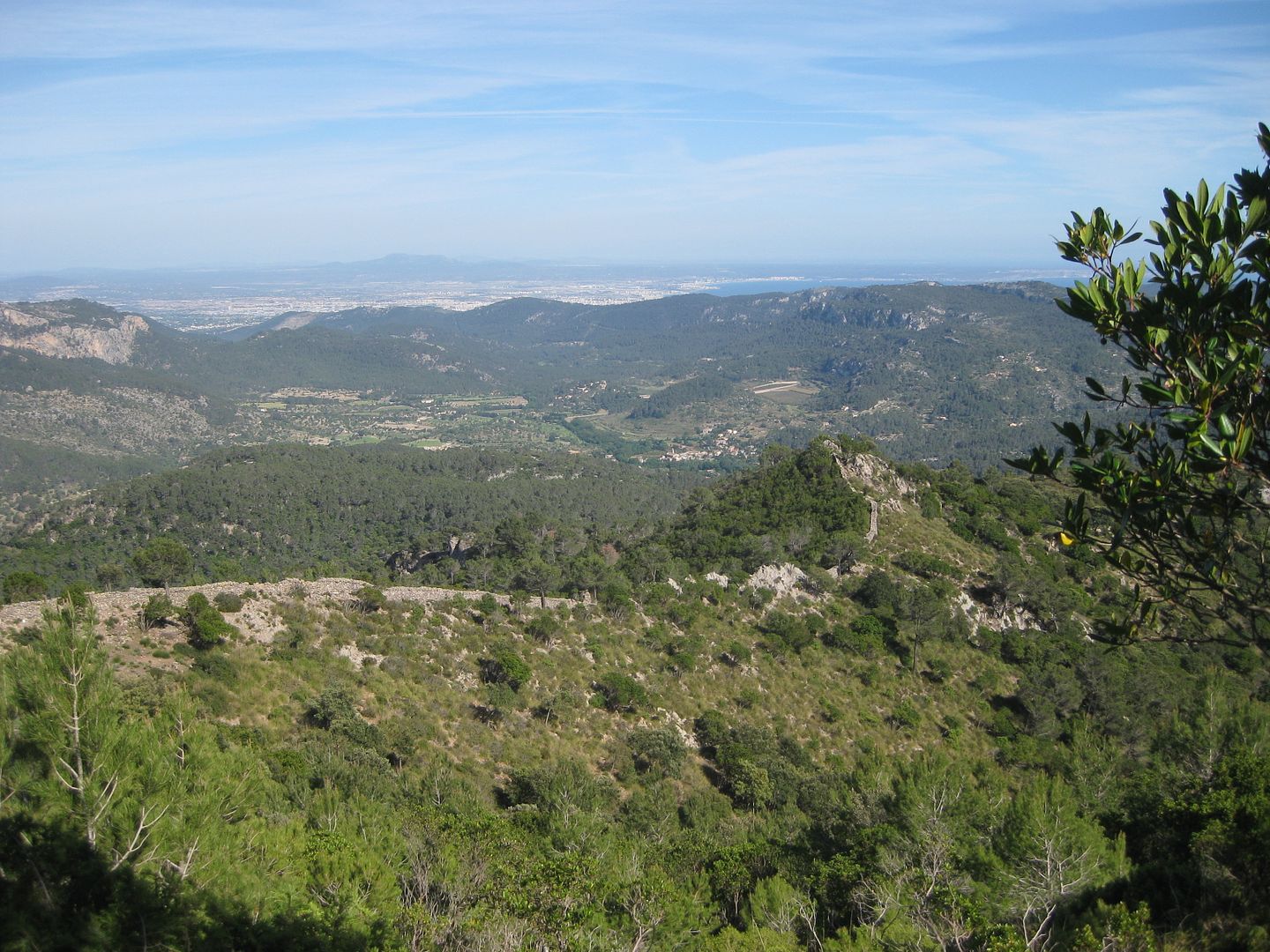
The bus took us through the retail parks and factories on the outskirts of the city, then past orange groves and into the foothills. The ambiance immediately changed, and we were glad we came already, such beautiful countryside.
There was a change of bus, before we hit the north coast - A dramatic setting with steep hillsides dropping right down to the sea, and tiny villages seemingly perched precariously. The ride became a bit scary as the big bus struggled with the alpine bends, swinging wildly from one side of the road to the other, barely managing to avoid the hundreds of cyclists that seemed a fixture of this part of the island.
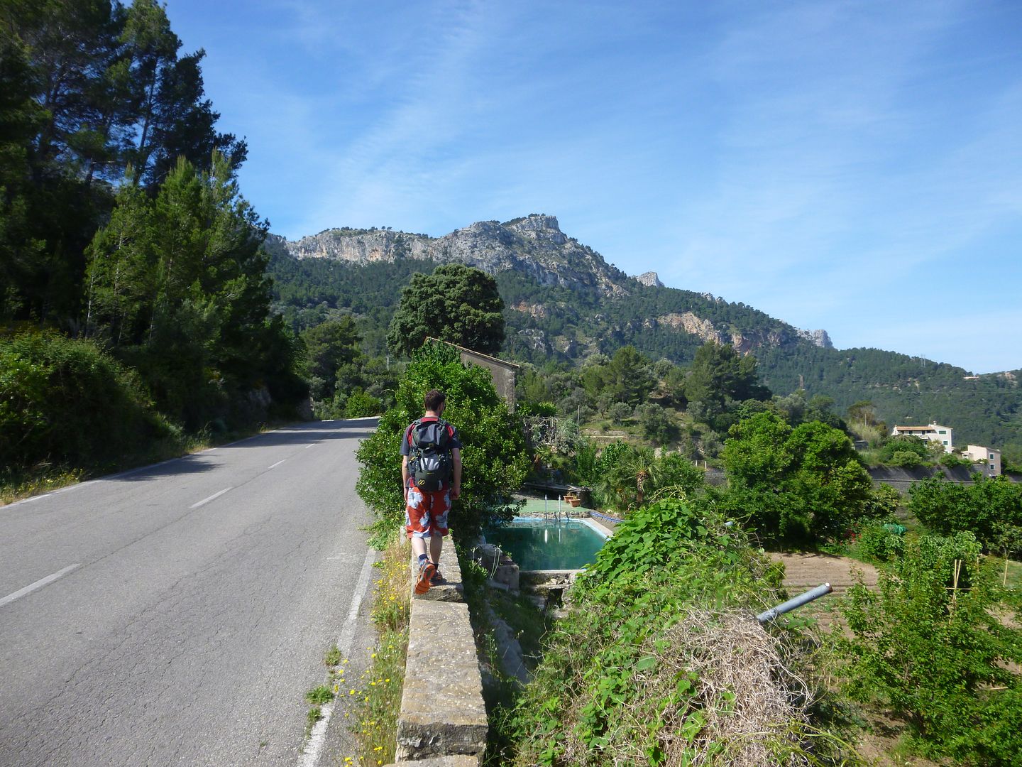
We got to Estellencs, and had some trouble locating the start of the path marked on our map. We thought we had found it, but we ended up in someones garden, and eventually onto a wee track that took us back where we had started.
At least now we had worked out that we had actually got off the bus in the wrong place..

So we followed the road along - only a few hundred yards out.
Even though we were now certain of where we were, we still couldn't locate the paths marked on our map. We went along one path, which ended at a wee water works, so that couldn't of been it, and we tried a track, but locked gates and some unfriendly looking signs deterred us from exploring further. I spose we learned that just because a track is on the map, doesn't mean that you can go that way

Too used to the Scottish freedom of access by far
So we decided to follow the GR221 long distance route to the path that was described in the guide book, as we knew we could definitely go that way. It followed along an old tarmac road, that was very pleasant.
The GR221, wound its way back to the main road for a spell, and we followed the road until the path up the hill started, scaring the odd cyclist who were careering round blind bends at high speed with seemingly no thought to their own safety.
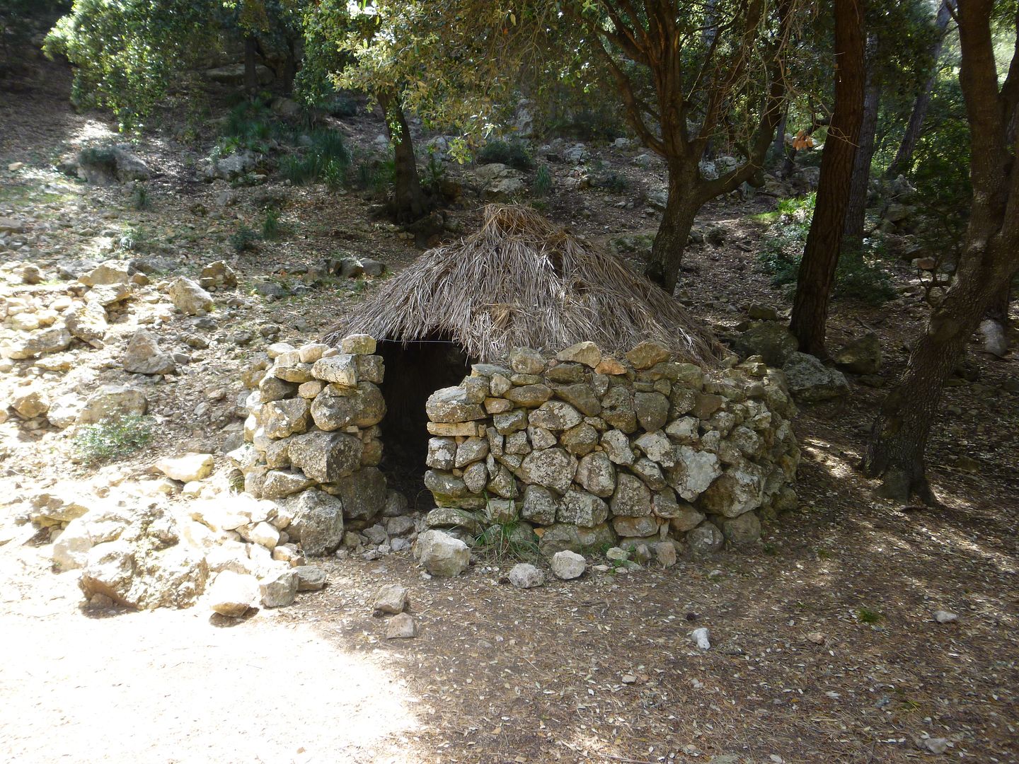
We were aware that with all the faffing about looking for the path, and the now longer route, we were running rather behind schedule, and I tried to set a fair pace, but was foiled by the heat, and we weren't even on the climbing part yet! Once off the road though, the described track, zigzagged uphill the GR221 heading off right, but we were following the signs to Puig De Gelatzo - the objective of the day. We reached a picnic area, with barbecues and an old charcoal makers hut.
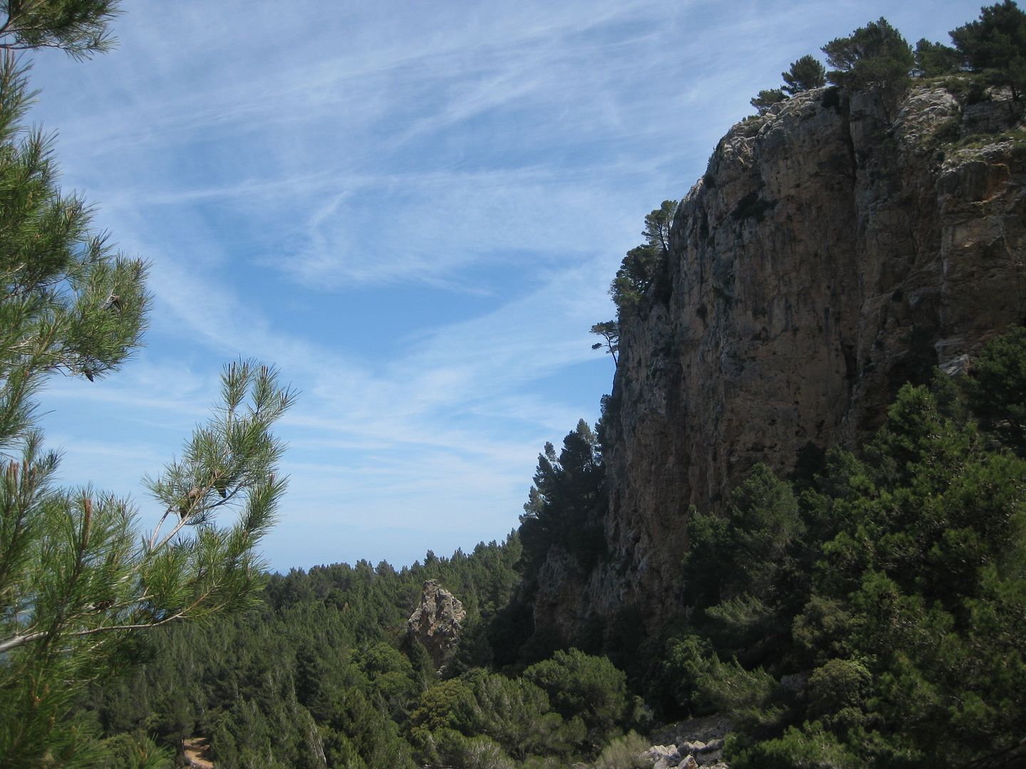
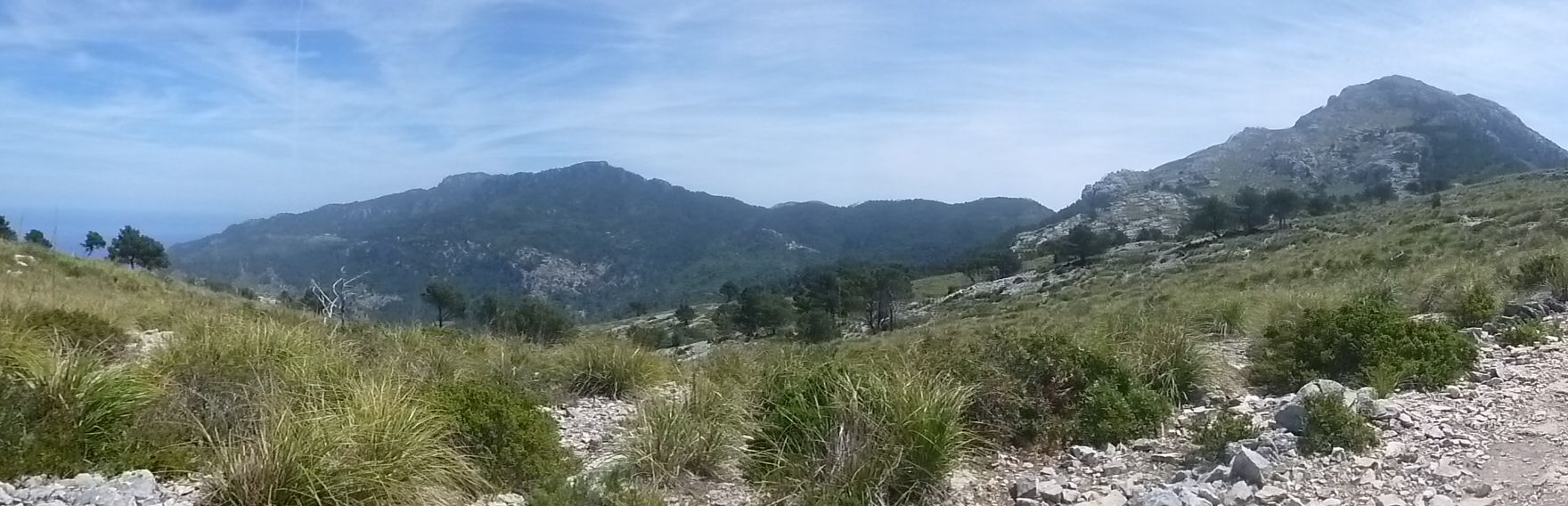
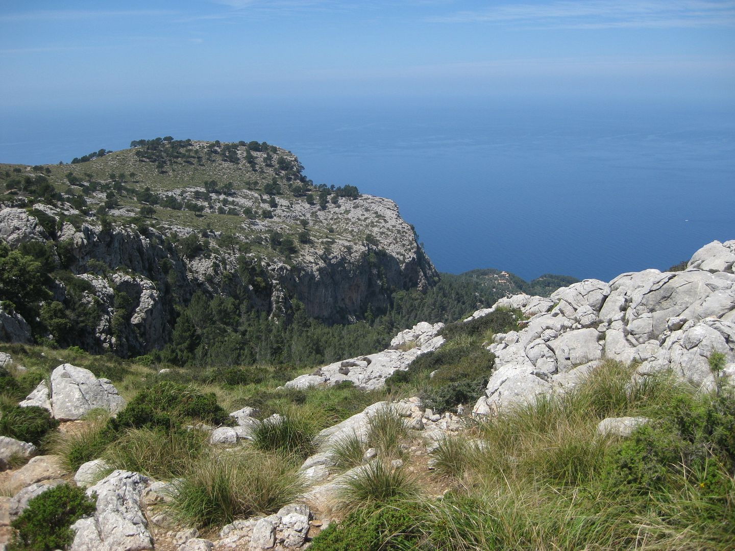
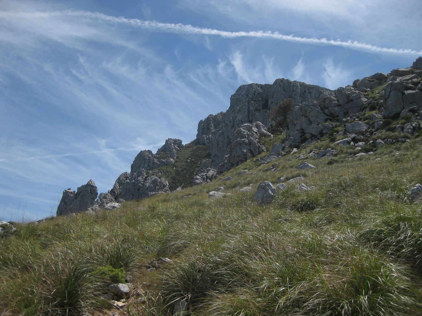
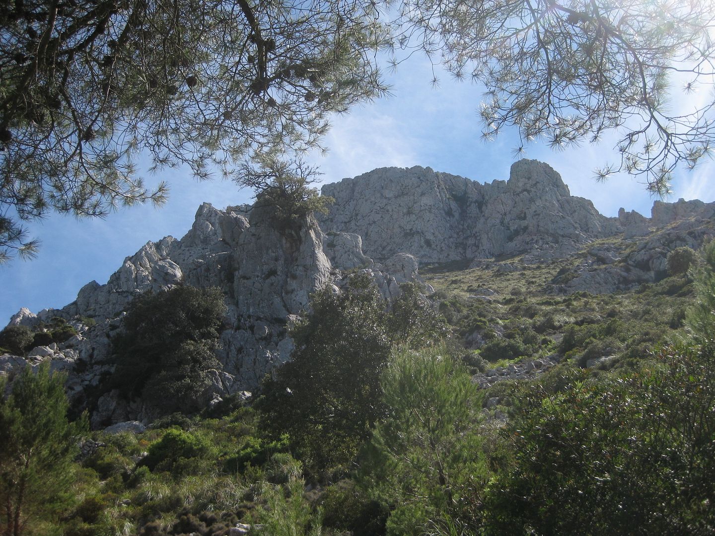
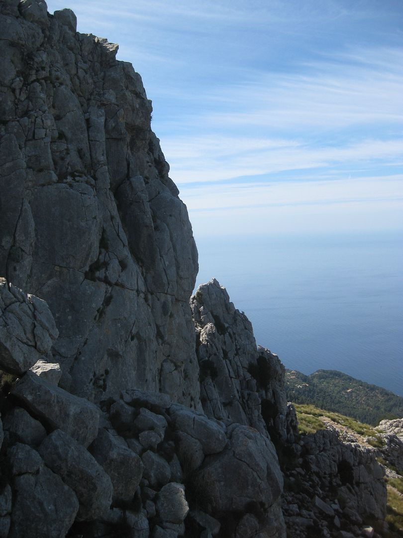
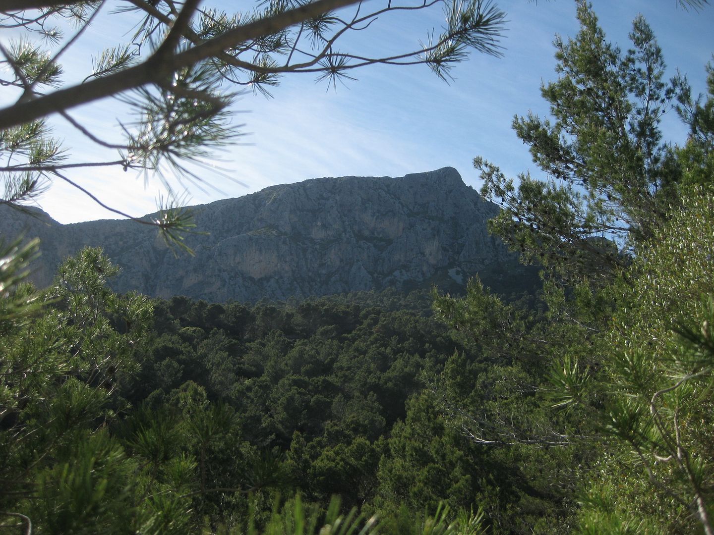
There were two paths waymarked from there, we took the one to the right, the path getting narrower and a bit rockier underfoot. We had been in the shade of the trees so far, but their cover got ever more sparse and the sun beat down hard. The path was well thought out, and not steep, but it felt like a lot of effort to weave up to the plateau. The big red cliffs of Penyal des Morro nearby were impressive.
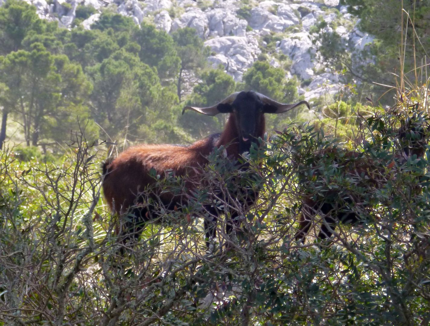
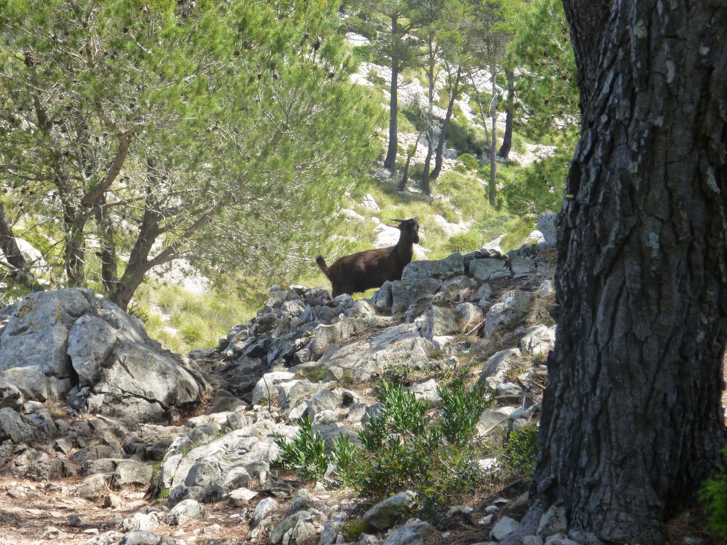
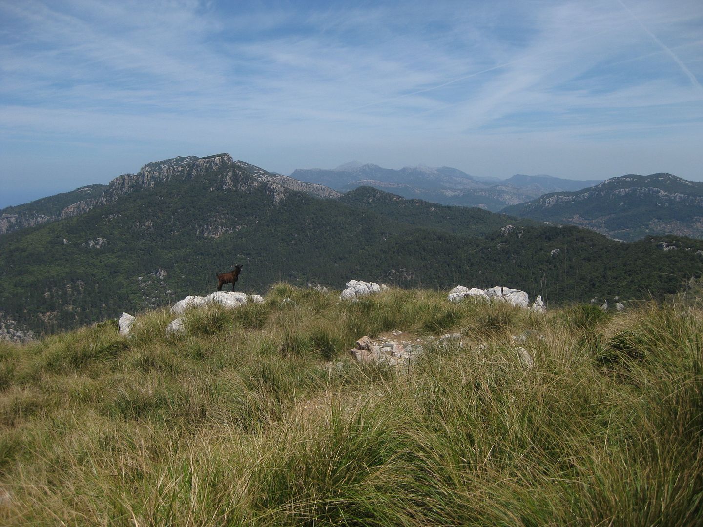
Up at the plateau, a long traversing path took us round to the Coll de sa moleta Rasa where we stopped for a snack under a lone tree. Goats nearby rustled in the undergrowth.
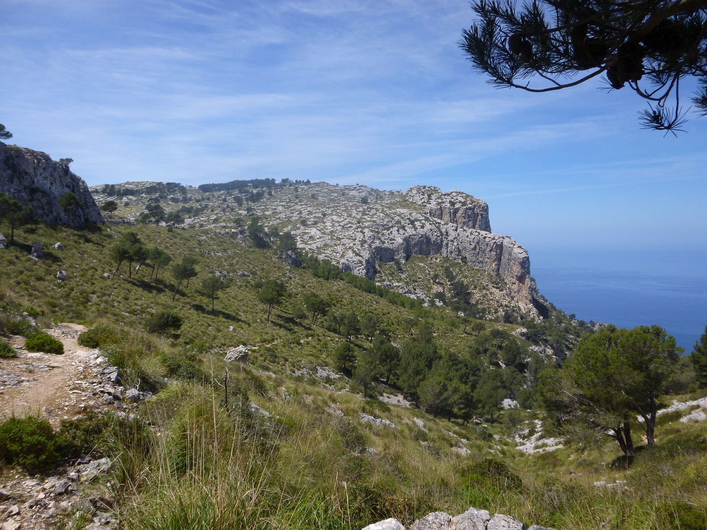
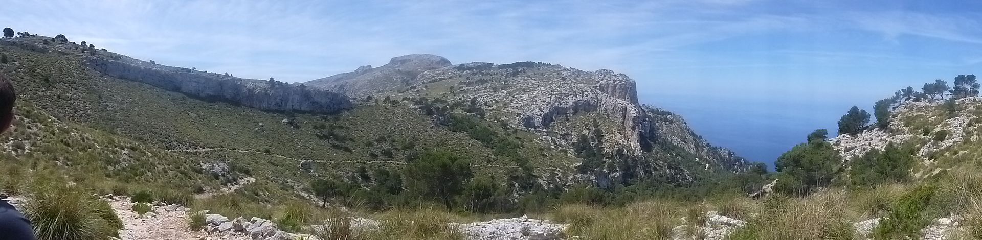
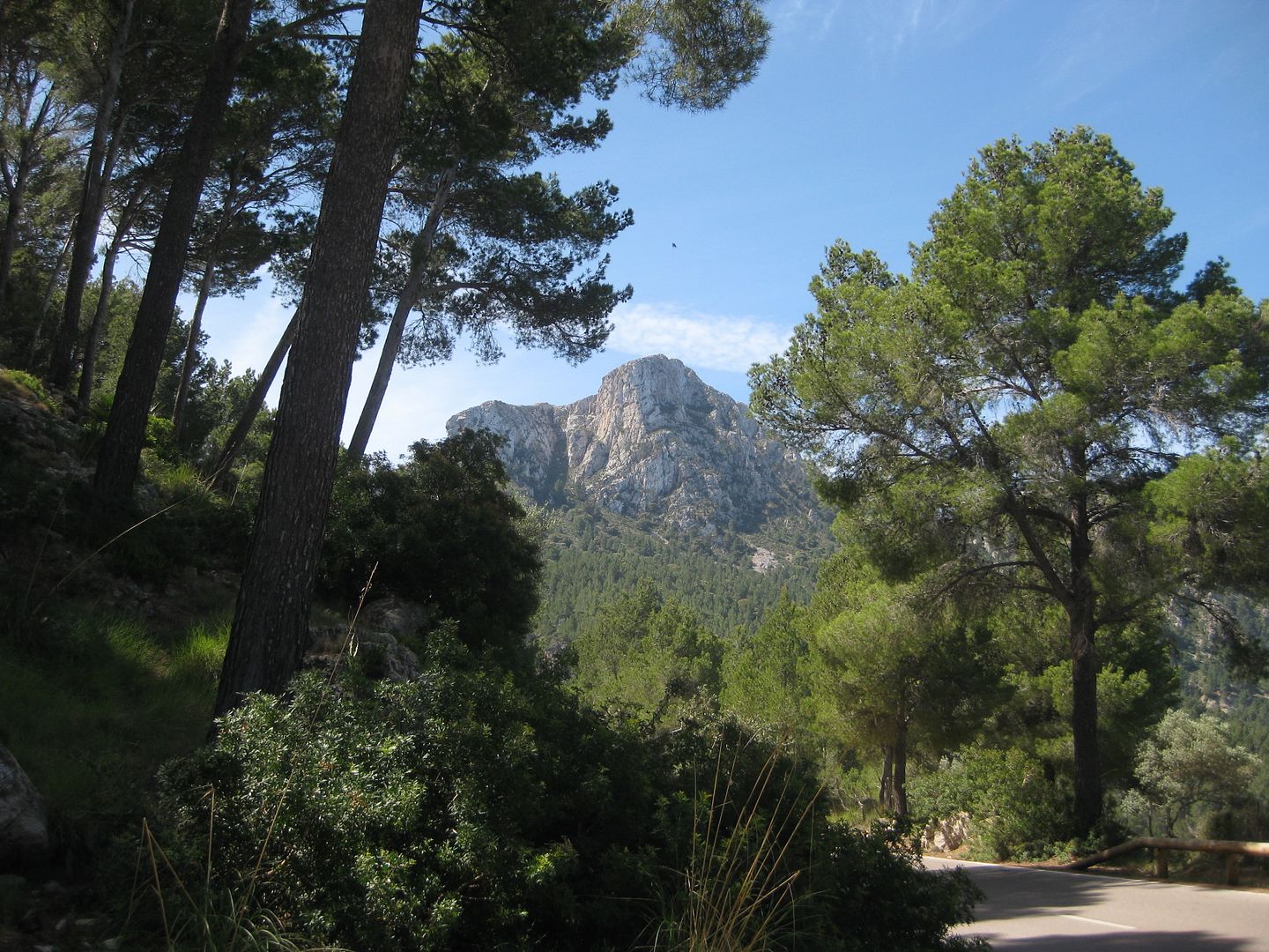
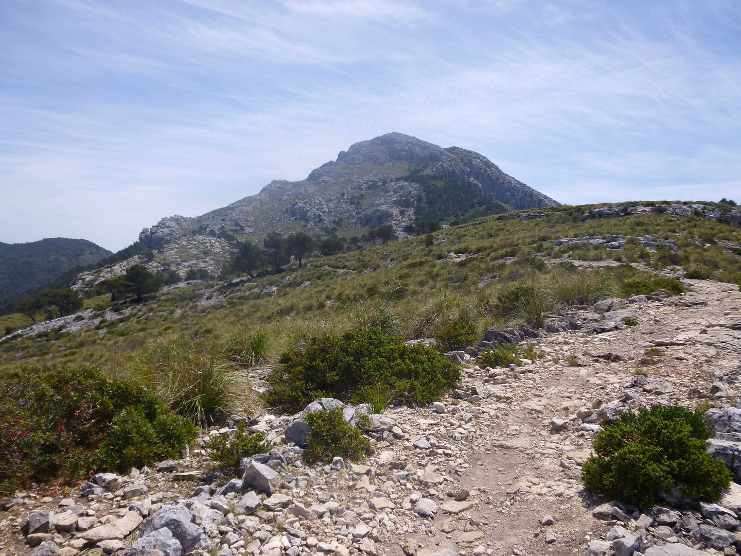
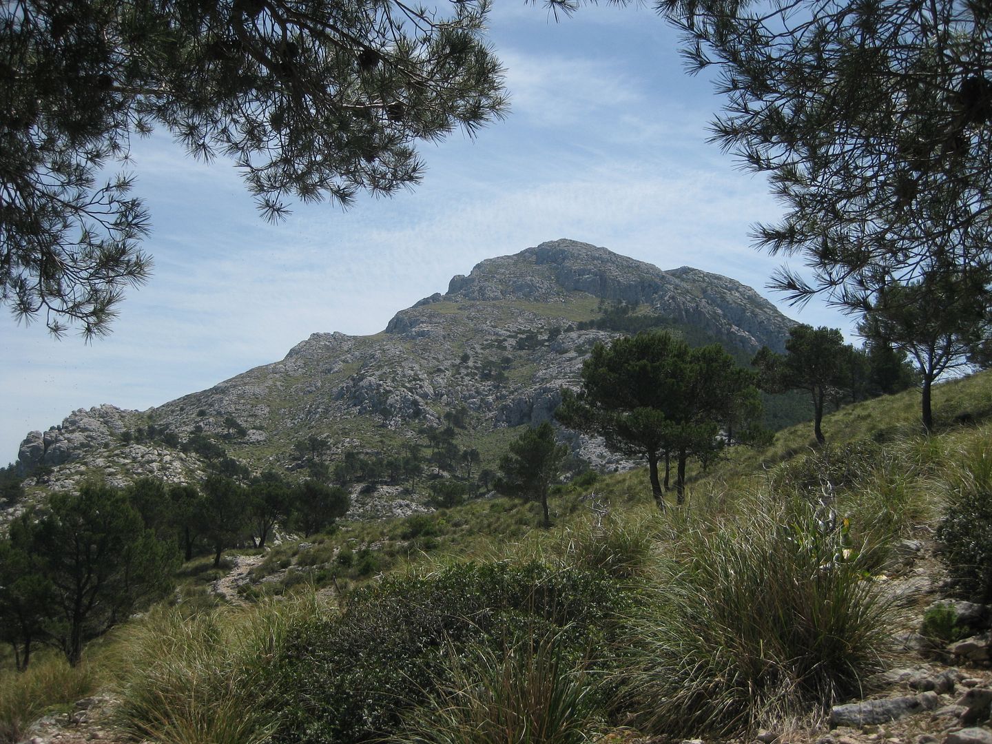
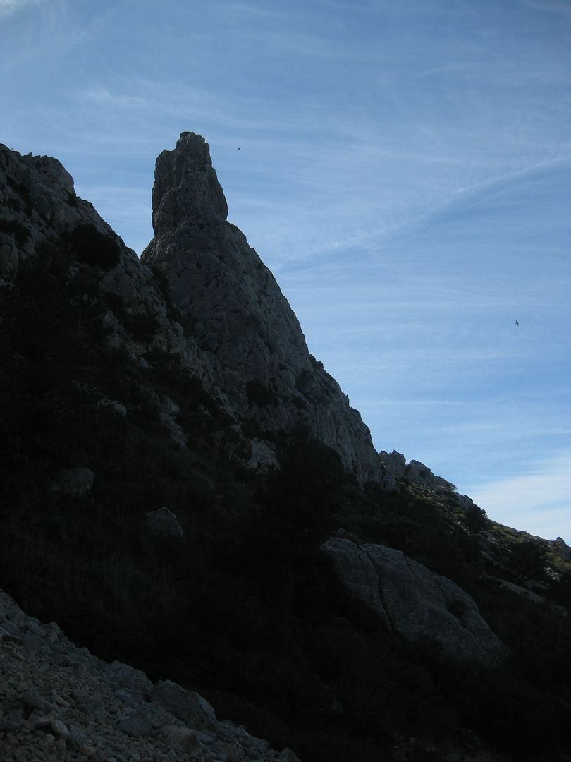
We got our first views of Gelatzo itself as well - it looked just brilliant
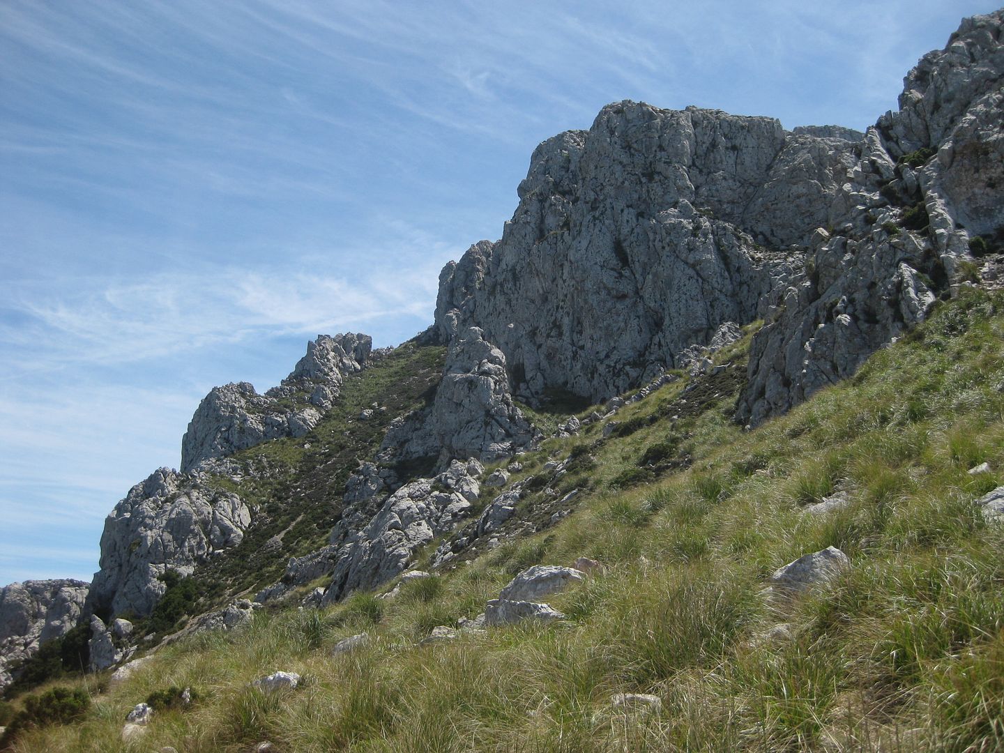
Some descent and re-ascent through some patchy pine forest took us up to the Pas De Na Sabatera. we were quickly realising how useless the map we had acquired was - didn't seem to have any information which fitted in with what was on the ground, and the 'shading system' for the contours was absolutely useless (especially when wearing sunglasses
). The way was well signposted so there didn't seem much chance of getting lost anyway
Some noises from the grass made me wary, as it sounded awful like the noises that I was familiar with snakes making from my times in Australia

I had seen a few lizards running for cover, but hadn't really thought about what other reptiles might be about!
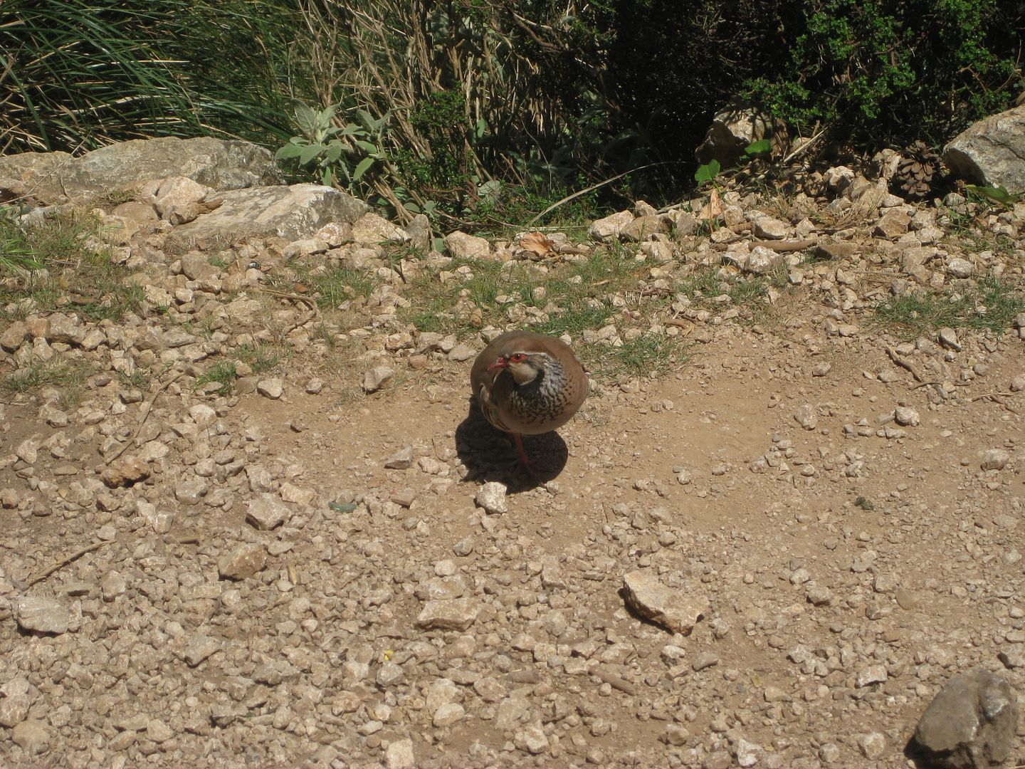
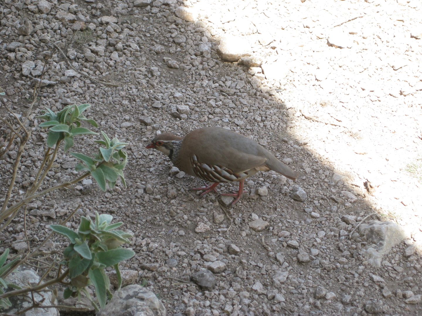
Not far on, at the next path intersection, we found a wee spot with a home made bench under an overhanging cliff which afforded some shade
so it seemed rude not to stop. As soon as we did, a wee partridge came out of the undergrowth, obviously used to being thrown a few crumbs. Looks like it would of been tasty, but the heat killed all appetite and all thoughts of expending any extra energy
A couple passed us at the start of the steep, rocky slog up the hill. It was just after 2, so the hottest part of the day, with no shade, and lots of exertion. I didn't cope with it well

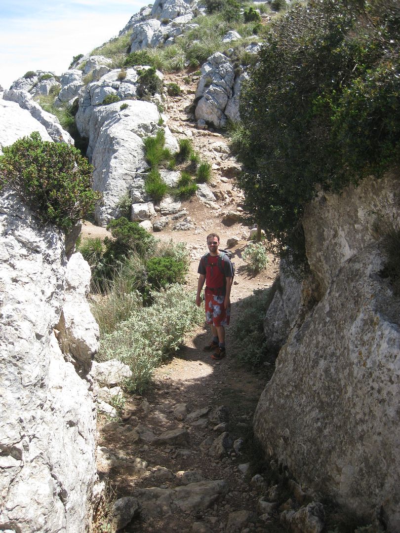
Its a rocky hill, with miles of slabs and cliffs to ogle at and scramble on. We just stuck to the path, but even then there were plenty of sections you needed to take your hands out of your pockets for a few cliffy bits.
The rock was so polished, it was worse than walking on ice in places, but still we managed to keep a slow, upward pace by me frantically fanning myself constantly. We stopped to let a large group of germans descend past us. They pointed and laughed at my melting demeanor
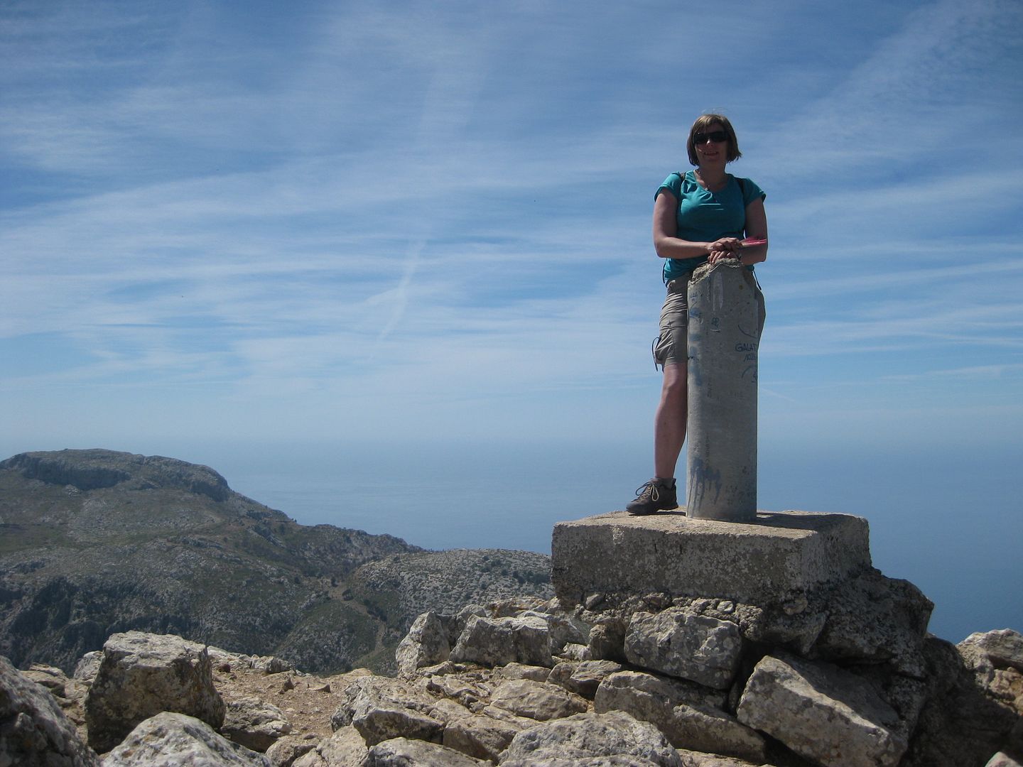
Things got so hot, I really didn't think I was going to make it, but I was able to stagger a few steps every few minutes and made it to the final scramble, the rocks there shaded and cool gave me a boost up to the summit.. Dougie looked frustratingly fresh and energetic

Such a challenge for me, doing a 1026m peak in that heat - I felt better than I have about a hill for a very long time

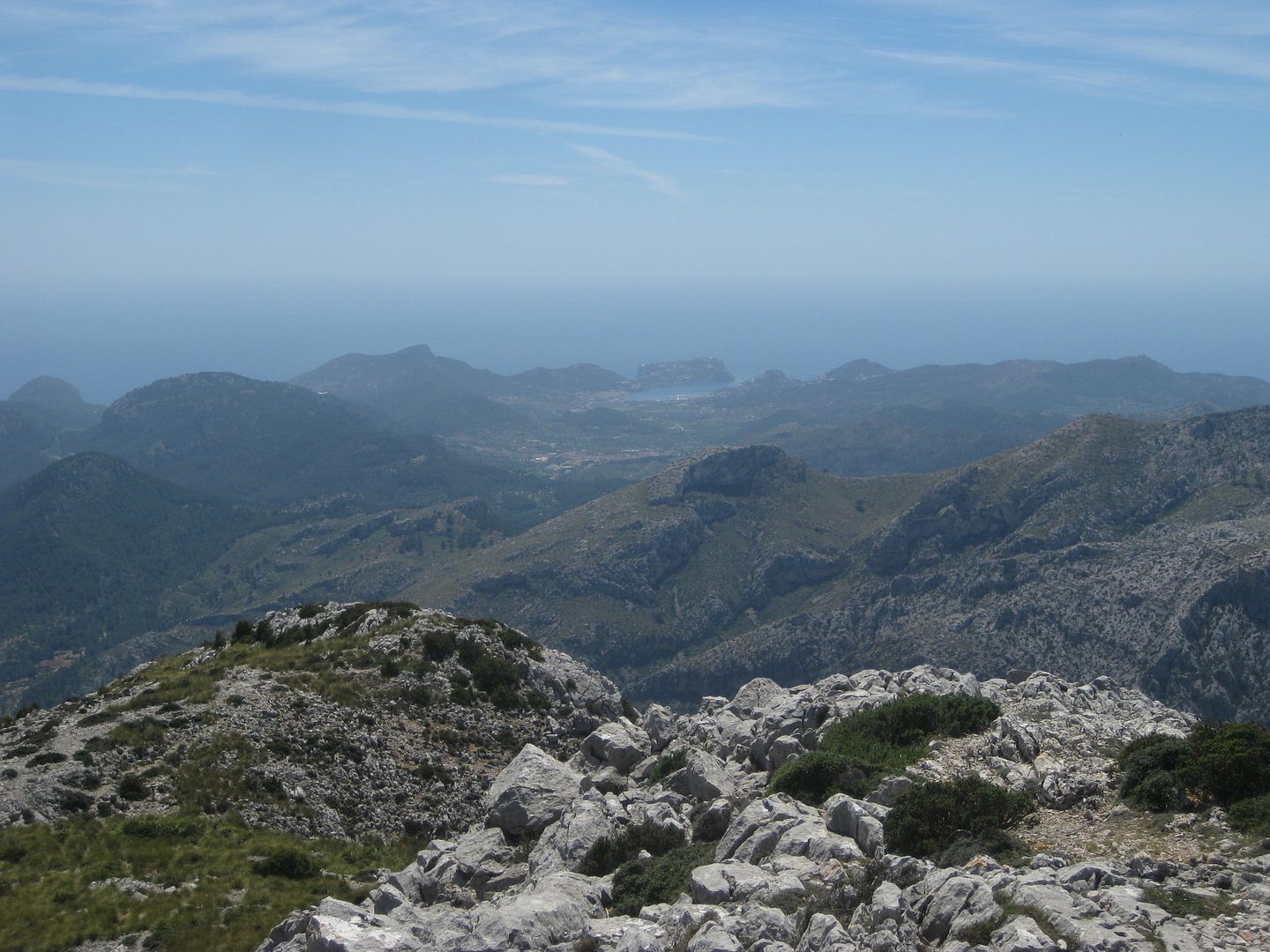
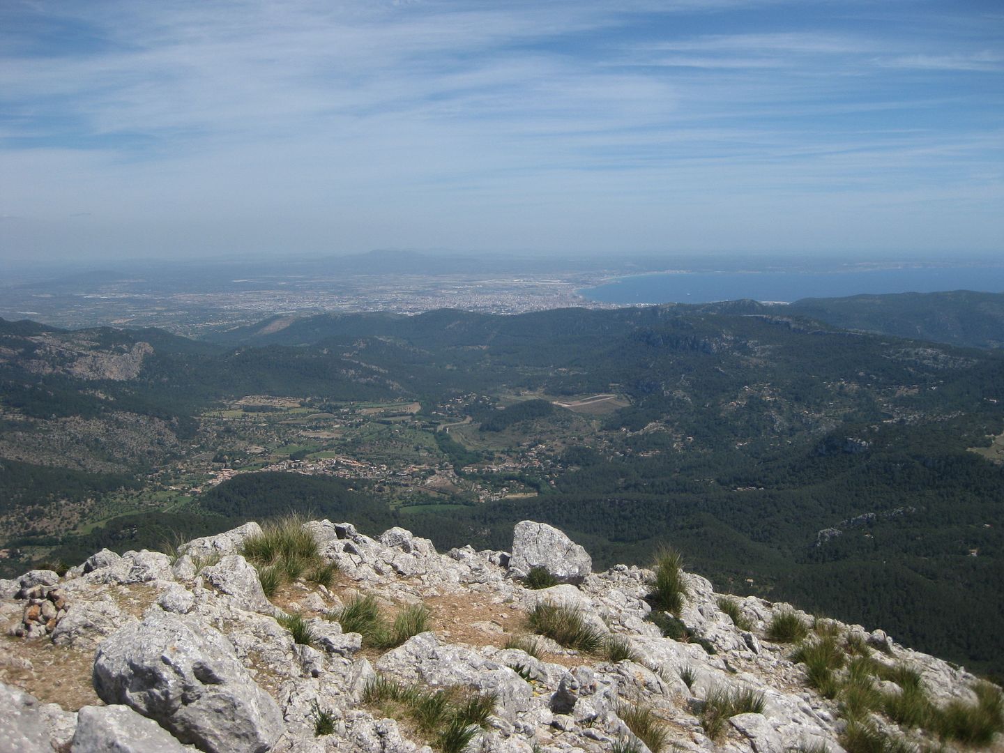
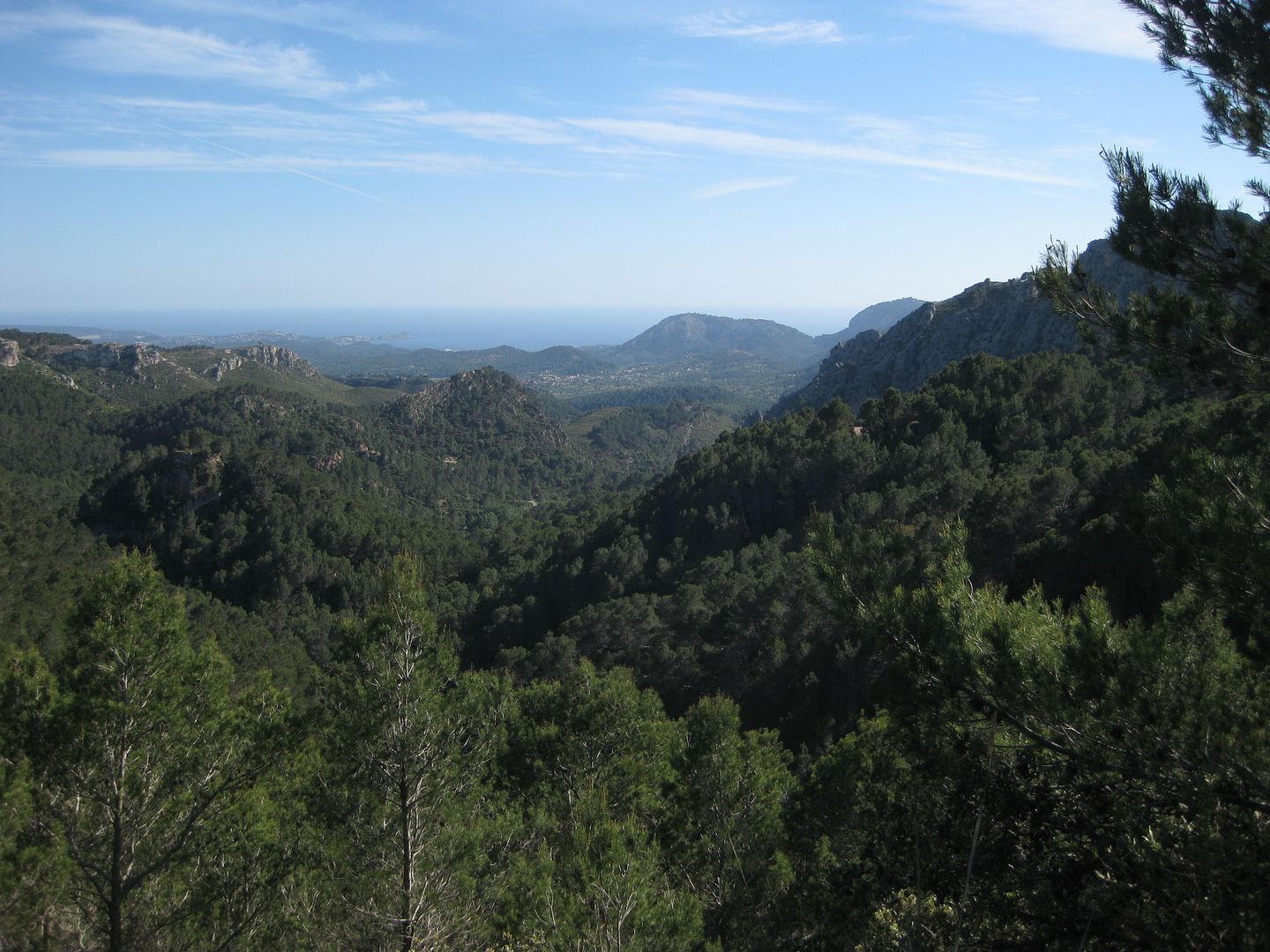
The views from the top were absolutely splendid - the SW tip of the island, SE up to Palma, and NE through the rest of the Tramuntana range. Shame about the haze, but always brilliant to be on a peak looking right down into the sea

We roasted ourselves at the top, and ate the tapas we had brought along, but we knew we were still running behind time, so we were retracing our steps before long, back down to the overhang with the partridge, and onto the rightward path, which wove its way inbetween the craggy bits in a very pleasing manner.
Pretty soon my alarm bells were ringing though, we were dropping down way too far to be going over the Coll des Corniceret? Dougie reassured me that the path would climb back up soon, but a couple of hundred yards further on, even he was looking less certain. Not far after that we came to a sign that confirmed that we had indeed taken a very wrong turn somewhere
Stupid crappy map and pigeon English guidebook

So we turned about, and reascended the path - at least it was mostly shady for a bit. We reached the partridge overhang, and continued upward - no sign of it cooling down any yet..
After the initial zigzags, we cut off the path to hopefully traverse round our own route to the right path.. Not sure it was that good an idea, as the plants were thorny, and the grass sharp. Dougie voiced his snakes concerns too
We hit some steep loose ground that would of been suicide, so nothing for it but to clamber up the cliffs above, which turned out to be a lot of fun, despite useable cracks being also inhabited by plants that tore into my bare shins
Above the cliff, was the path we had been on an hour or more before
but we finally managed to locate the right path

The sign for it had been removed, and the start of it covered up so it was less than obvious.. A steep drop down slippery eroded ground provided the reason why, but it wasn't any worse than say, the steep side of An Stuc, so perfectly passable.
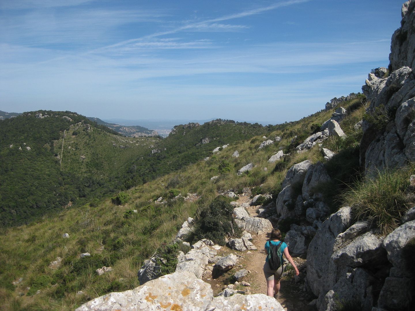
The path then traversed pleasantly below cliffs and across scree slopes, the way well marked by both cairns and splodges of red paint.
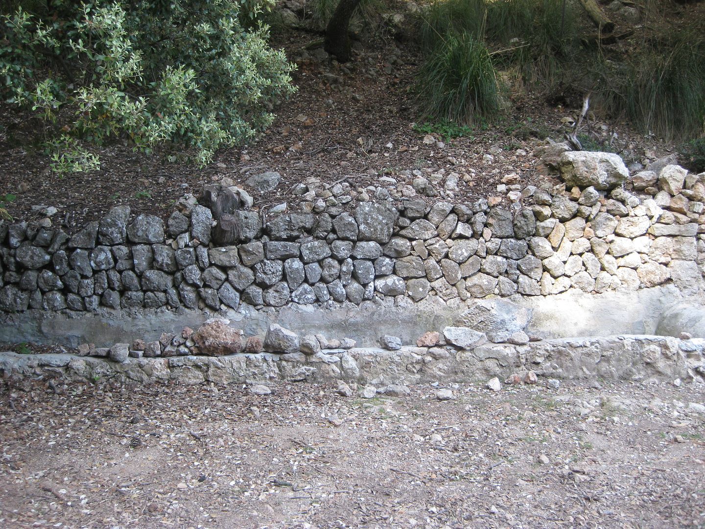
We soon made the coll, a fire tower coming into view and a crazily built wall running along the ridge. We were heading down though, through the maze of paths that werent on the map or in the description in the book. If you do this walk just keep heading on the path that descends most steeply and you'll be fine. We were running a bit low on water and there was a place 'Font De Pi' marked on our map which we thought could be our salvation, but no sign in the place it was marked on the map. The path ended at a track ( which was more like a long pile of rocks) and we followed it down a couple of hundred yards before turning left onto a better track. A short distance on, we found the Font De Pi, but were disapointed when we realised that it was just a muddy puddle inhabited by mosquito squirmers - well we weren't drinking that!
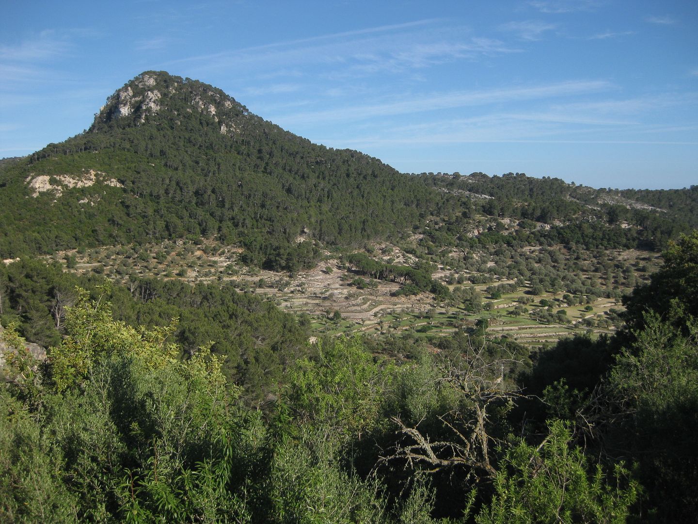
We took the left fork, onto the tarmac there, and passed abandoned quarries as we wound our way downward through the forest. The odd view back to Galatzo was brilliant.
We passed some hidden away houses, with guard dogs barking at us loudly through fences, and wound steeply down to a crossroads. The road to the right had a nature reserve sign, and the guide book said that the road to the left went down to Puigpunyent, but we were heading to Galalea, as it was a bit closer. We took the smallest looking road straight ahead, and soon realised that we had another climb on our hands. This was the point where my body gave up - my head was pounding, I had no energy, and was really dizzy. Despite litres of water, it obviously had not been enough. Dougie patiently waited for me, while I tried to take on the last of the water, but it was too little too late. It wasnt far though, and at the end of the road, a footpath took us through woods to the top of Galalea village
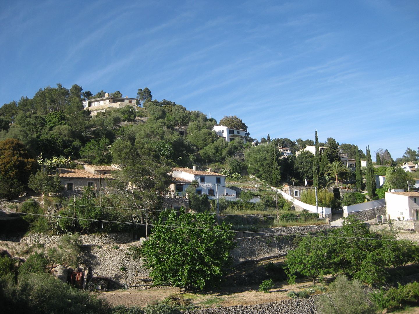
It was a lovely little place, but rather smaller than expected. The road took us down to the bus stop, where we were dismayed to find that even though it was only 6.35, we had missed the last bus of the day by only 15 minutes
Nothing for it but to walk the 3 or 4 miles or so to Puigpunyent to catch the bus there at 8.05. The mood was gloomy as we set out along the road. I really wasn't well at all..
Fortunately our luck was in, and a bit of cheeky thumb showing had us a lift from the second car that came along
It was french couple, who we worked out pretty quickly, were one of the couples we had met on the hill earlier on
We tried to talk, with nobody's French or English being that good, I was glad it was a short journey.
The village was lovely, especially the supermarket where we bought ice tea, juice, and water which we guzzled down sitting on the bridge, watching the locals go about their business and enjoying the birdsong. The bus arrived on time, the driver being even more of a maniac than the first, overtaking on blind bends and generally having a razz. Massive heat stroke attack for me getting off the bus, and I don't have much memory of getting back to the hotel or the rest of the night, so grateful to Dougie for looking after me
Despite this, and the many other problems encountered, it was the highlight of the whole holiday, and I'd go back in a heartbeat, but maybe in winter when I can actually function
 Added the track - I know you canny see it but handy download if you are off to Mallorca yourself..