free to be able to rate and comment on reports (as well as access 1:25000 mapping).
I have read reports of the wedge in scrambling guides and seen some brief reports online when trying to research further. Every single report I read the person had difficulty finding the trailhead for the scramble, so those thinking of heading to this risky venture should take note, even though everyone says "head toward the Wedge Pond"....don't take the signed trail.
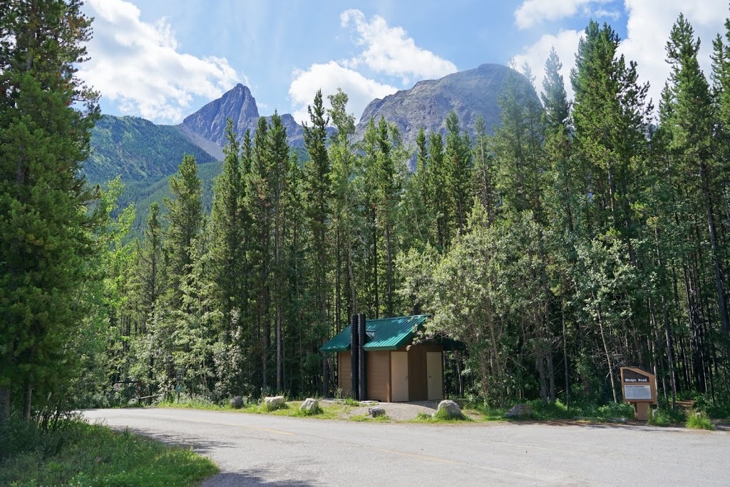
To find the trailhead take highway 40 (Kananaskis Trail) 30 km south from its junction with the TransCanada Highway where you will see the car park signed 'Wedge Pond'. From the car park do not take the trailhead for (Wedge Pond) clearly marked with the usual signage, walk left of the toilet block to the corner where a barriered gravel road continues, take this road to the right as if heading to the pond but keep your eye out after a very short distance for a tiny cairn and a left turn into the trees , had I done this I would have saved almost 1km of thrashing about in the forest.
From the car park the long point of 'The Wedge' can be seen above the trees, if you are looking for a hike this is not it. This is a serious scramble with some very exposed areas so if you aren't comfortable with that don't go...it is a very demanding lump.
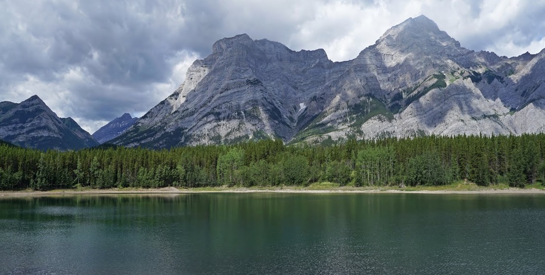
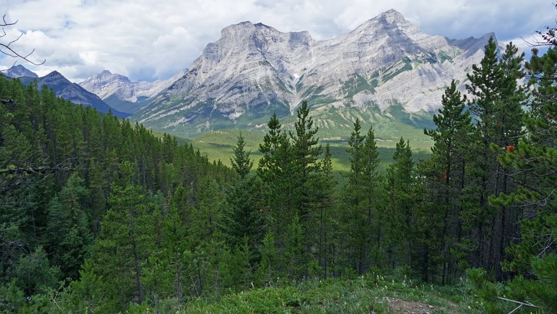
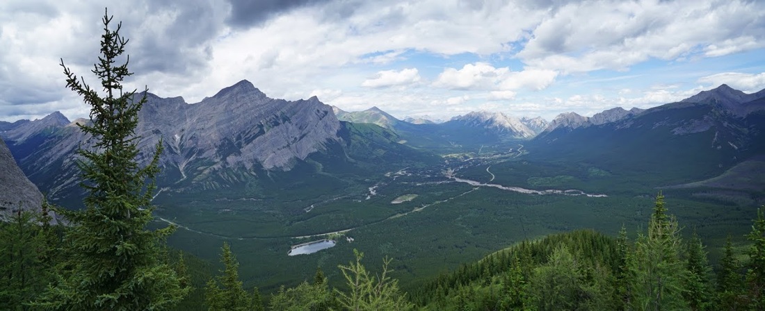
So, after setting off (in the wrong direction) I enjoy a stroll by the wedge pond with Mt Kidd beyond and dark clouds looming to the south and west, I expected showers today but did not want lightning so I kept my eye on the skies as much as possible. The Wedge Pond has tons of fish and is stocked annually by Parks Canada, there are often several small boats out here with the occupants fishing but surprisingly not today.
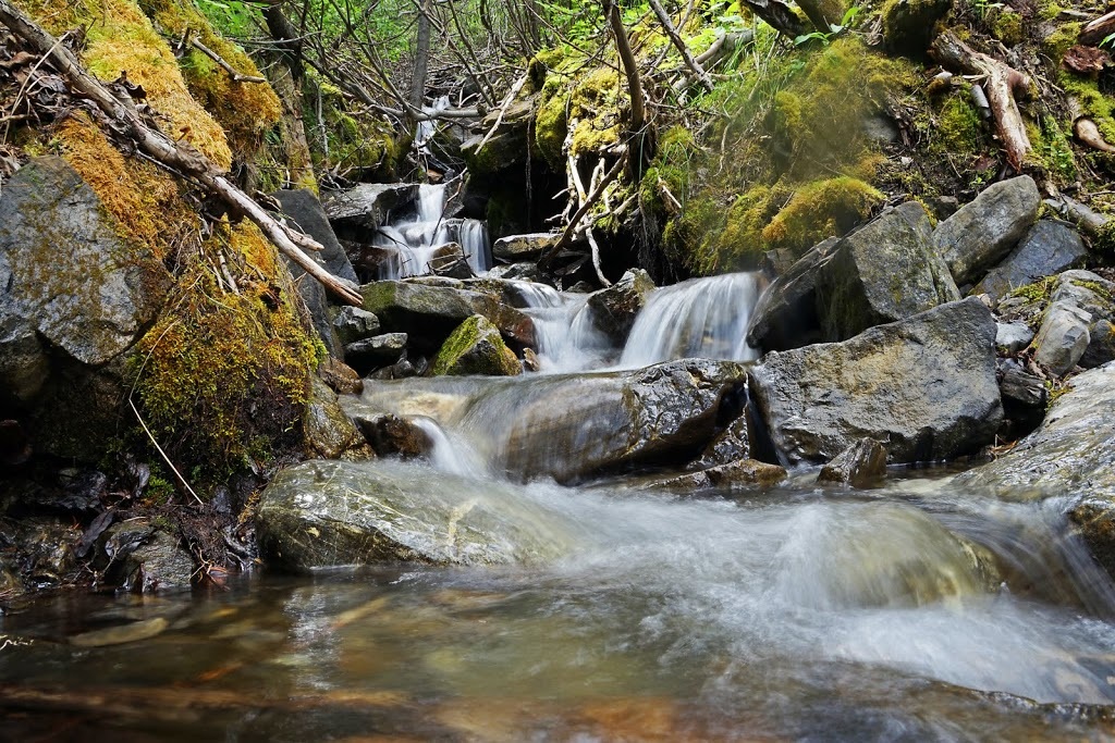
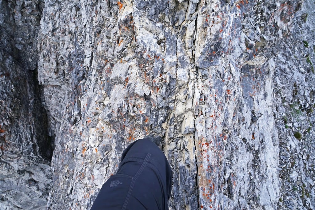
Perhaps my late start today had me too keen to get going, though all reports did say to head toward the lake, anyway after walking the entire east bank of the lake it was pretty obvious that I'd missed the trailhead just like my predecessors (I wondered if the "head down toward the lake" was actually some sort of local 'joke') but I think not. Anyway, I decided the trail must run up the obvious ridge so I blundered about in the forest bushwhacking in the general direction of the ridge until I came across this narrow little beauty in a clearing.
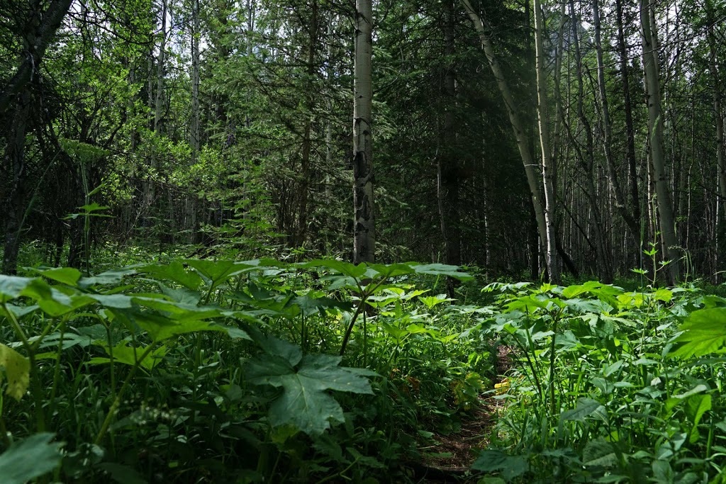
It's a great little trail (once you find it) and it follows a small creek for some distance, often actually becoming the creek when you have to pick your way around the splashing water to continue. There are a number of small waterfalls along the way to keep me entertained.
There are few openings in the forest for any kind of view and the trail climbs relentlessly almost from the start (and certainly from where I picked it up) at one of the very few clearings I was glad to see the dark clouds staying mostly west of Mt Kidd and moving north very slowly.
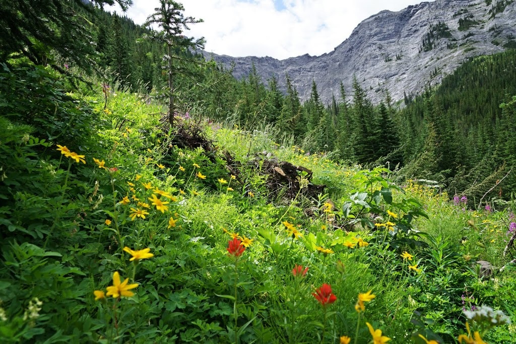
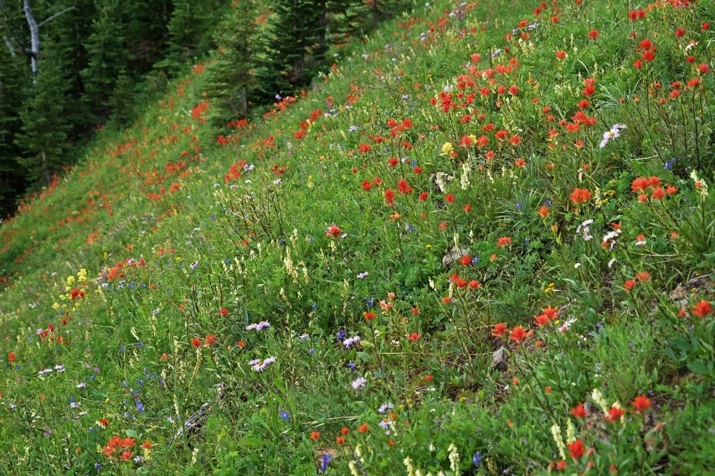
Every slope and every single open space was littered with wildflowers of all kinds jostling for space and sunshine in what little non shaded area they could find.
The route continues to be a real grunt, in fact it remains so from start to finish of this hike (which would be about 1km shorter had I not gone bushwhacking in the early stages)
After some considerable steep muddy slopes I find myself popping out onto a nice grassy ridge with trees dotted around, the wedge pond now looks quite distant but Mt Kidd still dominates the skyline.
Part way along the grassy ridge I see this huge bloom of Indian Paintbrushes with other wonderful colours dotted around them, the high meadows really have been beautiful this year thanks to the short winter and hot spring, it should be a real boom season for the smaller wildlife and their predators too.
Some nice little ledges cut across the grassy ridge giving me some scrambling practice as I near the base of the steep climb to the summit. The storms have cleared out for now and I'm just looking for a place to rest a little after the grunt up here.
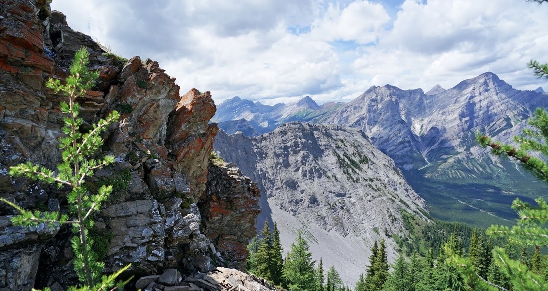
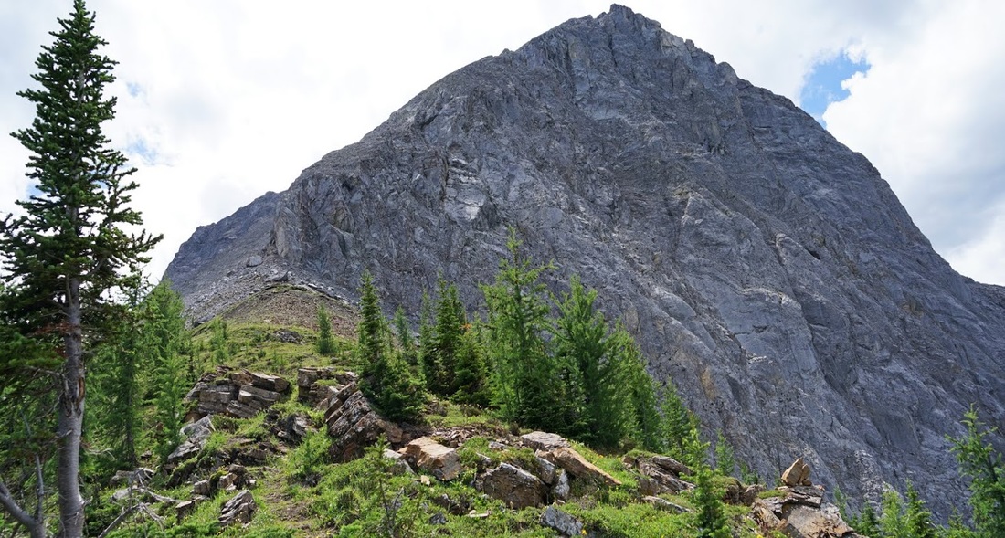
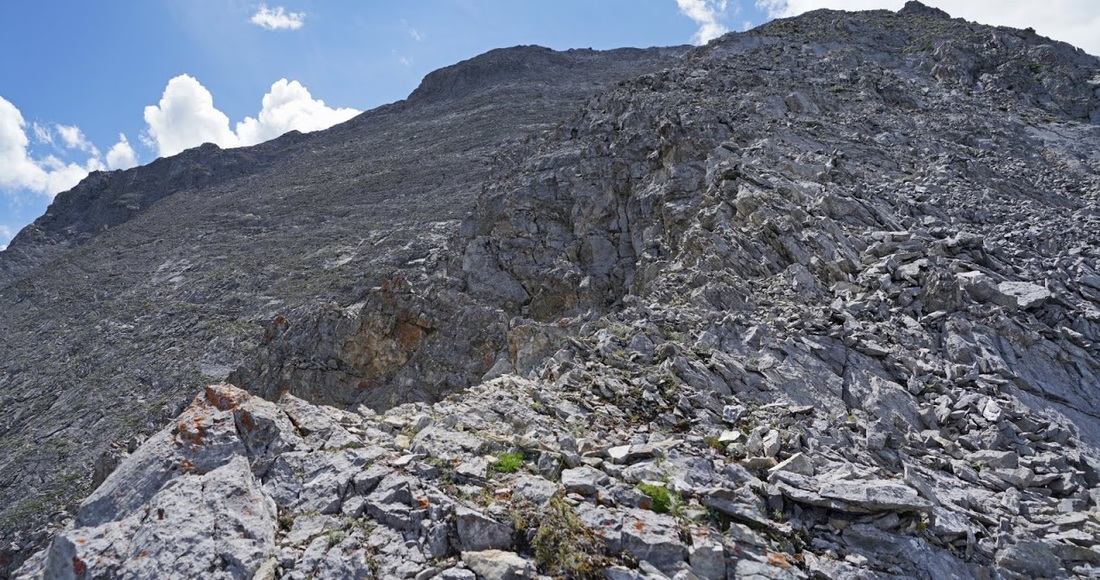
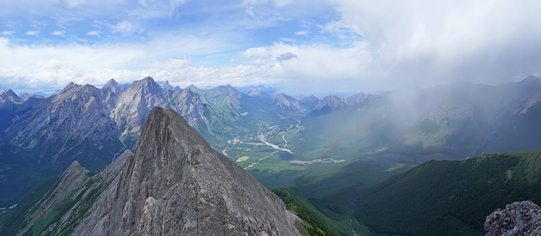
Over the last of the rock ledges on the ridge I am greeted by the suddenly barren mountain ahead, the slope heading up is the ascent route though there is an incredibly steep vertical of about 50 feet in order to reach the sloped edge of the rock.
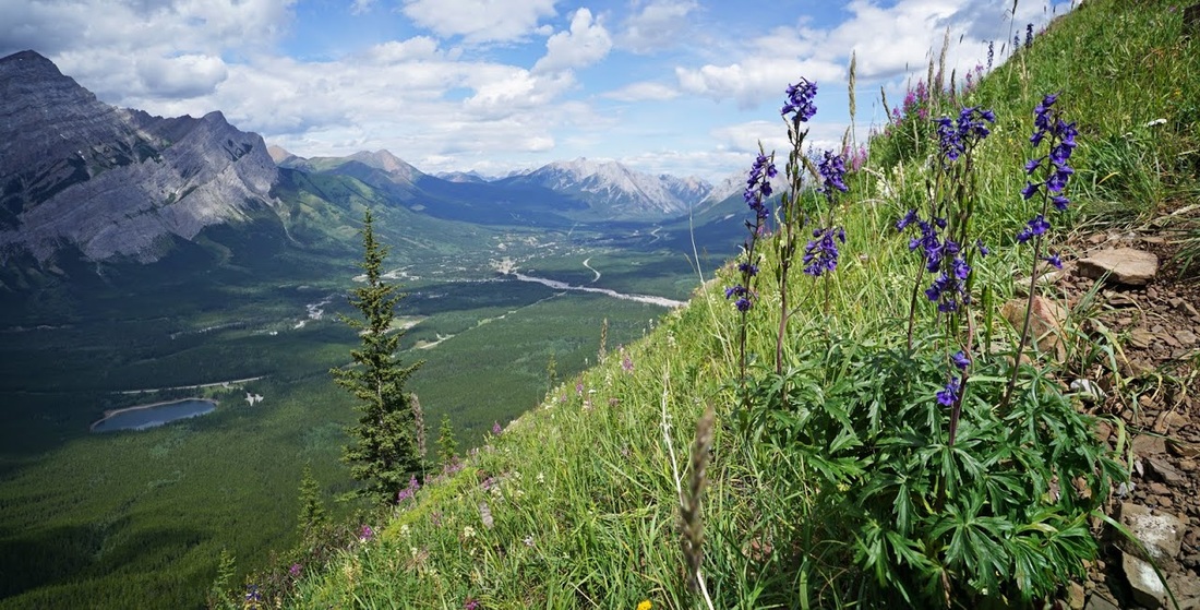
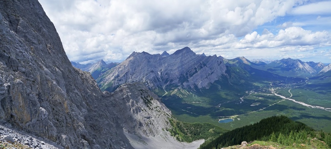
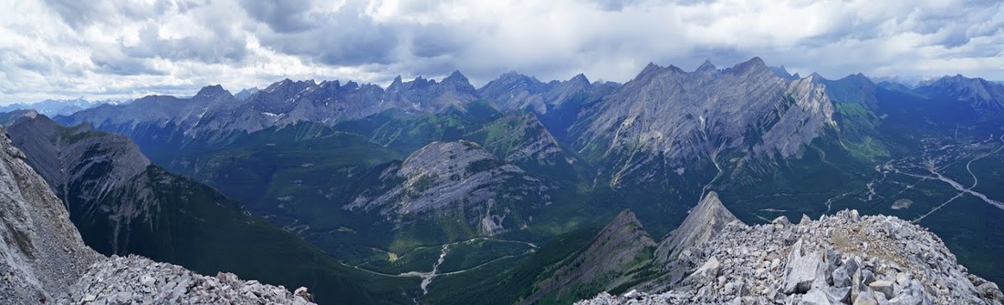
I decide that I'm going to rest a little while before taking on the vertical. Dark clouds are bubbling up again and I really don't want to be up a dodgy rock face with lightning about, I also really do need a rest and refuel session. I pull up a rock and take a seat looking down on the thin ribbon of highway 40 cutting its way through the forested valley below. The wedge pond looks tiny but the flood damage to Evan Thomas Creek coming in from the lower right of shot still stands out as a massive swathe cut through the forest.
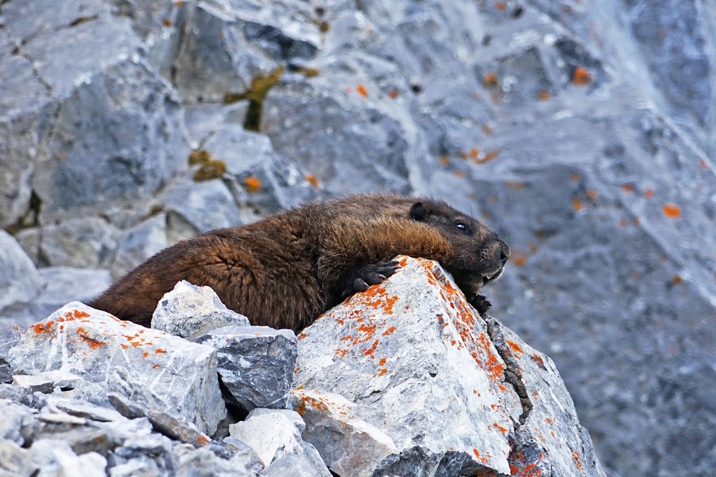
After resting for a good 10 minutes and watching the cloud still moving north I decided to crack on, I couldn't see what was coming from the south due to the massive lump of rock between me and it, so I would just have to hope for the best. As I started out a Hoary Marmot scooted away up the rock, I was disappointed that I didn't get a shot of him...until he reappeared a little further up.
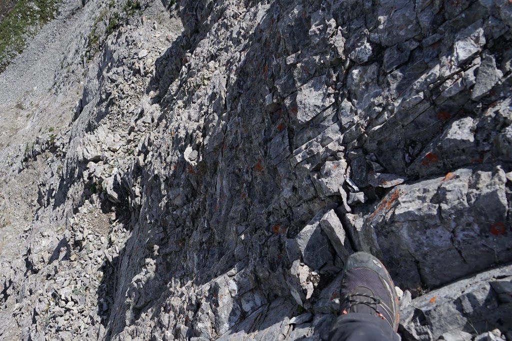
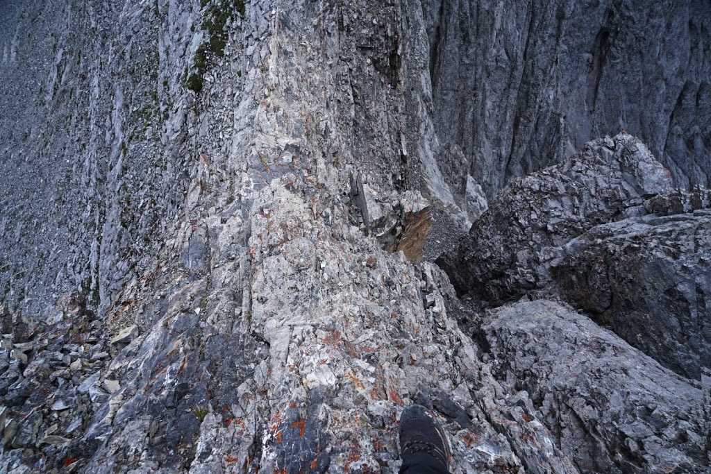
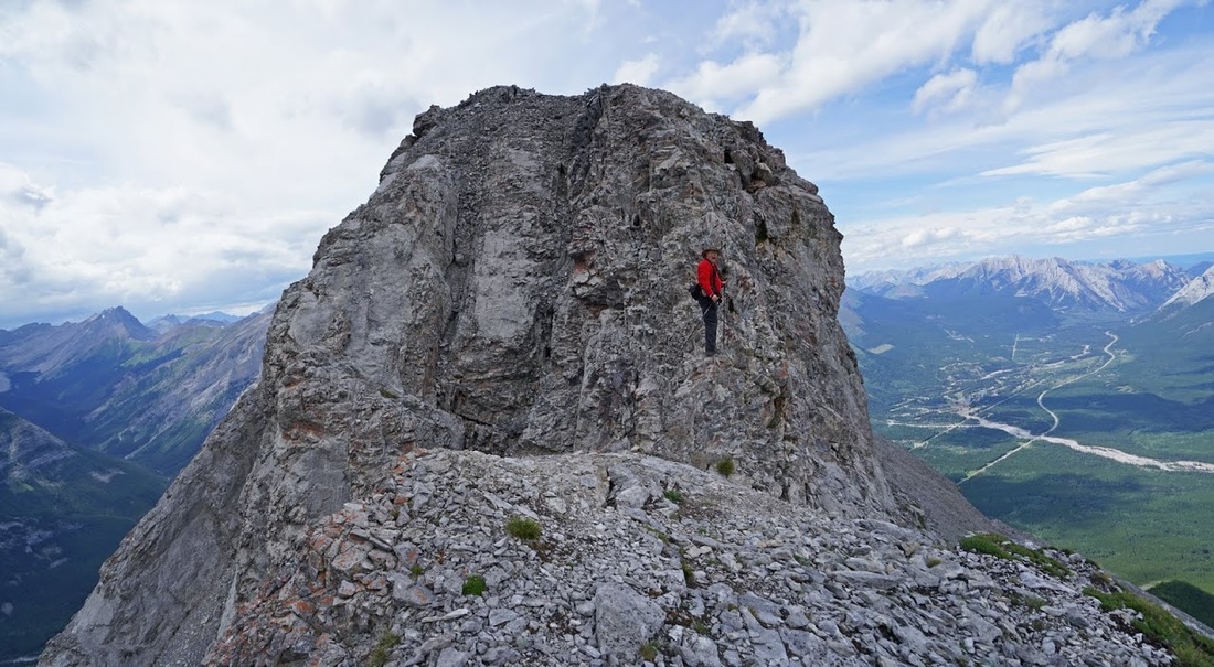
After an initial grovel up and around the corner of the lower rock wall I looked up at the 50 foot vertical with just a little trepidation, but I tried out the lower stages and they were surprisingly firm with very little loose rock and lots of hand and foot holds, so I went for it.
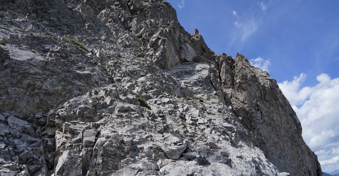
The early stages were easily conquered bringing me to a wide ledge where I could regroup and pick a slot that took me almost straight up, looking back down to the wide ledge it sure looks easy now!!
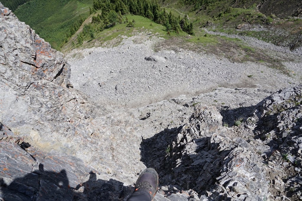
After the initial success I found myself having to traverse sideways along a rock wall for about 25 feet to reach another section to elevate me further, this was the last shot of the scrambling here as I really did need to focus.
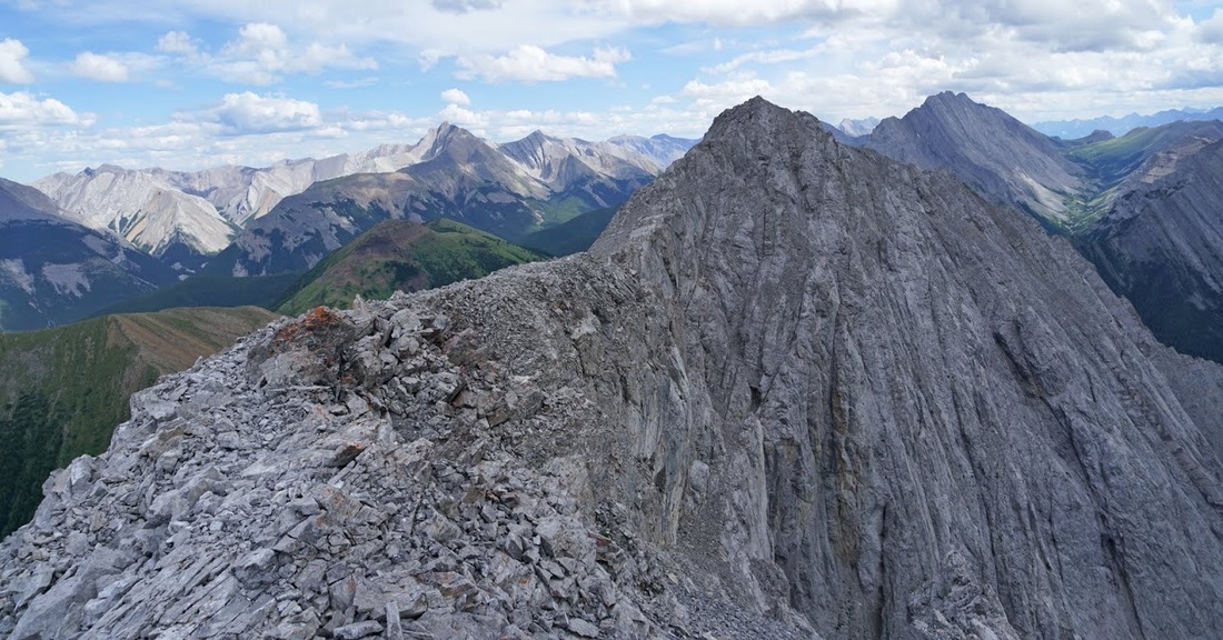
I have to say it was something of a relief to break out onto the ridge where only feet were needed for a while, the scramble was great but really difficult...then I got a hundred metres or so along the ridge and found a cairn at the top of a much more sensible scramble, turns out I'd got my scramble on a bit too soon; oh well, I'm where I need to be now, so onward and upward.
To the east there were fantastic blue skies and the usual fluffy white clouds, as I stopped to take a shot the strangest thing happened, a little bird (sparrow like) came flying right toward me tipping and tumbling on the wind that was whistling around the ridge, and suddenly plop...it landed right on my hat, the brim of which is very floppy and I could see the brim bouncing as I tried to get my camera out for a 'selfie' type shot of the bird but before I could it fell/was blown off and set off again careering down the hill. I guess learning to fly is tough, never really thought about it before.
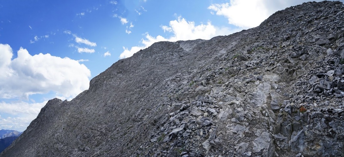
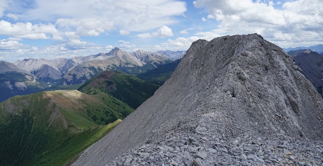
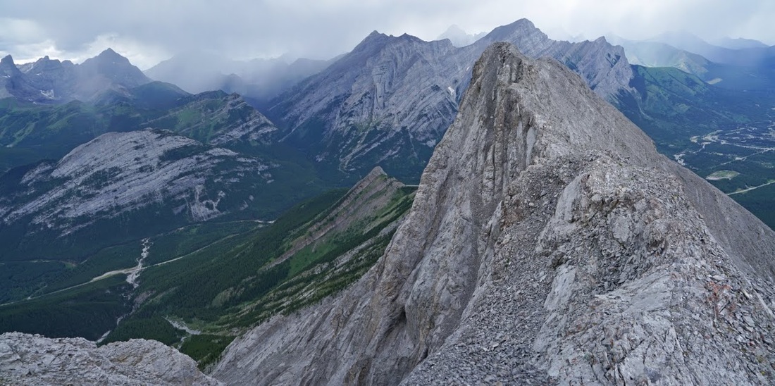
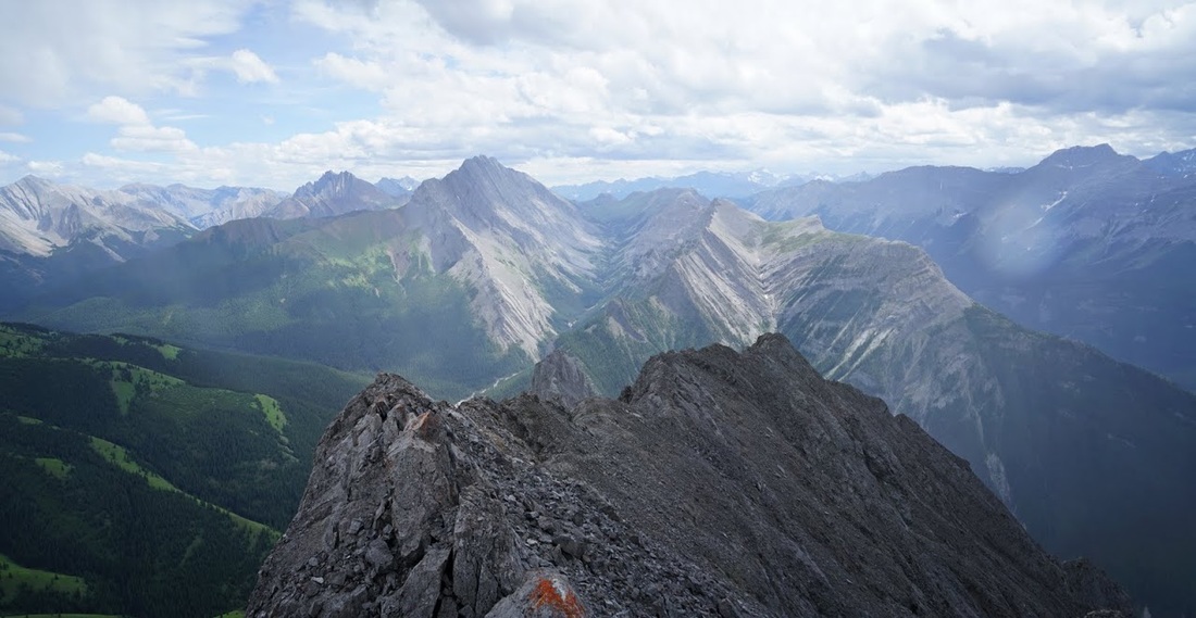
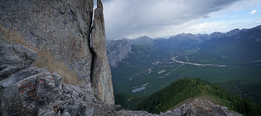
Almost at the western summit now and I can look along the whole ridge from here, the distance from here to the true summit on the east side is about 800 metres but between here and there is the crux, a nasty 25 foot downclimb onto a razor thin edge (and I really mean razor thin) that you then have to traverse, any slip on that traverse is a death sentence, there's no slope to speak of on this side and an straight vertical on the other, it's rated a class 3 (difficult) scramble largely due to the likelihood of death as a result of a fall.
Arriving at the western summit I was disappointed to see dark clouds all the way across the horizon, many of which were heading right for me.
To the east and the true summit is a lovely looking ridge and though every report says don't do the crux in the wet I decided if I get a move on over the ridge I can get down before any rain comes, as we all know going up is always a damn sight easier.
The ridge is a real stunner, a narrow band of broken rock with a sheer wall on one side and a very steep slope on the other, it is delicious. Without further rest I am soon heading east along it with a look back at the rain now starting to fall in several places behind me.
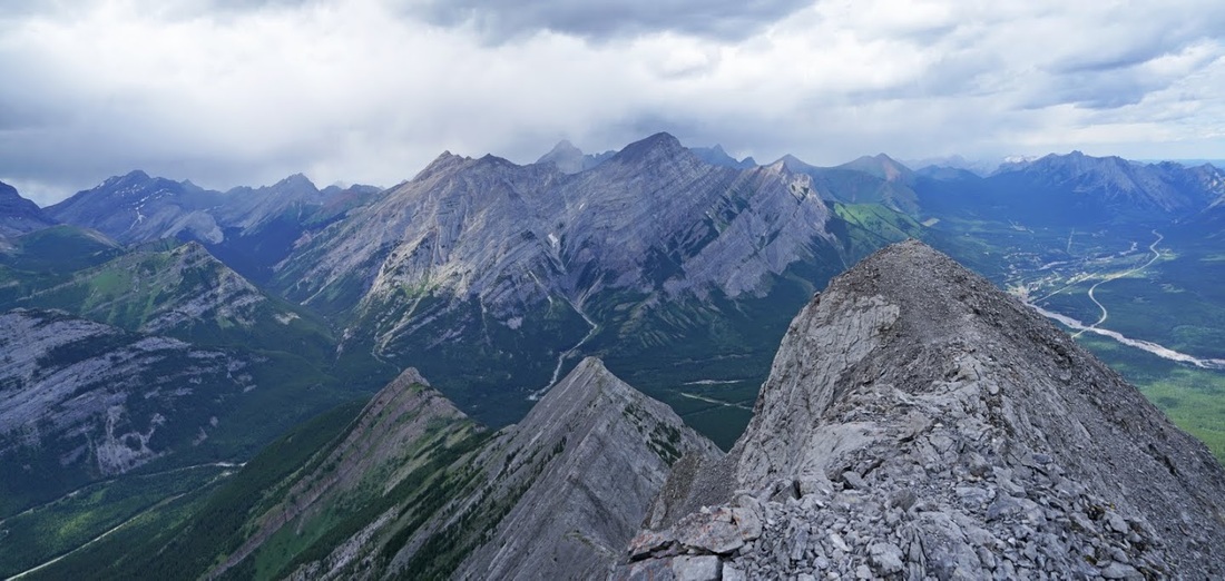
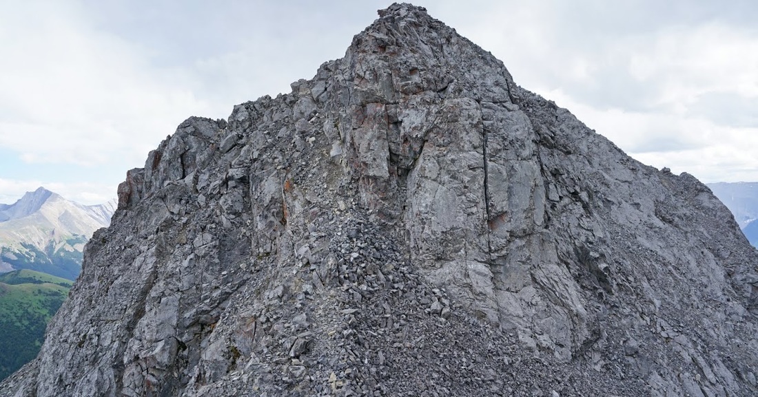
I am right on the line of blue sky and dark rainclouds as I hurry along the ridge toward the middle where another cairn stands on a high point, the valleys reaching away in front of me are stunning but there's little time to admire them as I still need to make the crux.
Standing on the edge looking down it doesn't look that bad to me (maybe due to my initial ascent up the sheer rock face earlier) The camera had to go away at this point but suffice to say I'm here writing up my story so I made it across.
Soon I'm across and have reascended the other side, now looking back across the void I can see the rain teaming down all around Mt Kidd and also to the south and heading right for me.
but nothing is stopping me reaching the true summit now, it's a last short scramble up the narrowing peak as a few raindrops splash down on me, big drops but few of them.
Finally at the summit and buzzing with adrenalin, there's a large cairn and a really poor effort at a summit shelter to its left, the rain is really firing up across the way but I'm still on the line with just a few drops landing. My summit shot is me leaning into the strong wind that's preceding the rain showers before deciding to tuck into what remains of the shelter and wait it out.
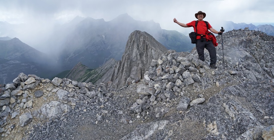
I'm still right on the edge of the showers and escaping all but a few drops of rain but I put on the fleece anyway as the wind is cool up here today. The summit is at 8743 feet and the wind and rain up here really cools the air. Beyond the summit the ridge appears to go on a little further and narrows even more....maybe that's for another day.
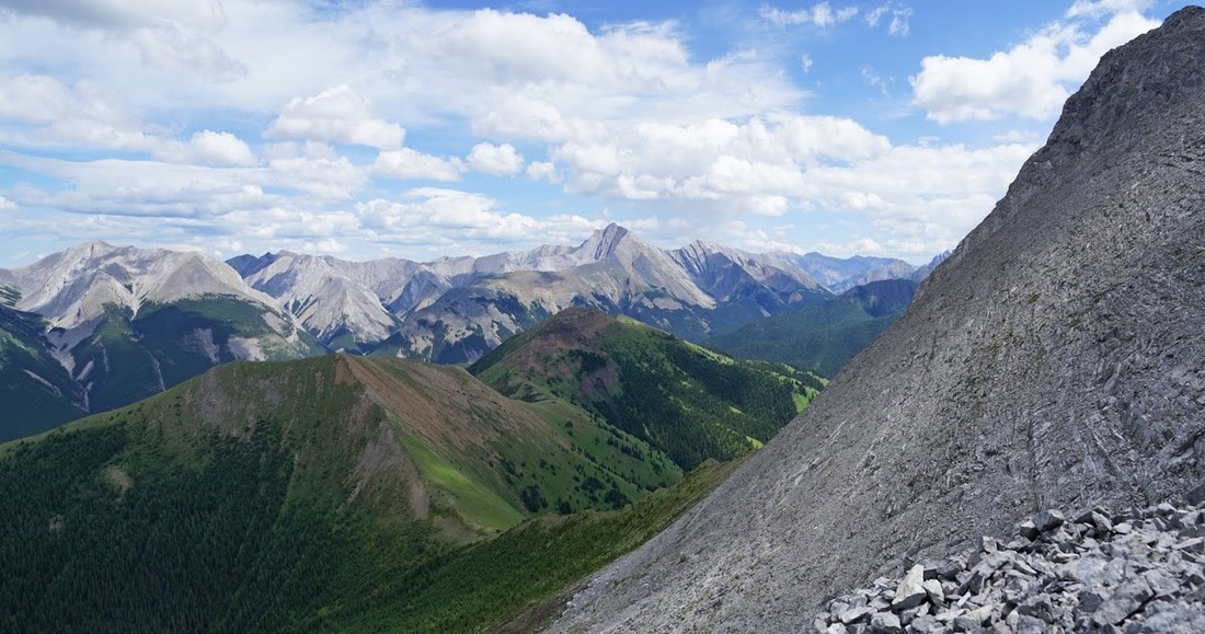
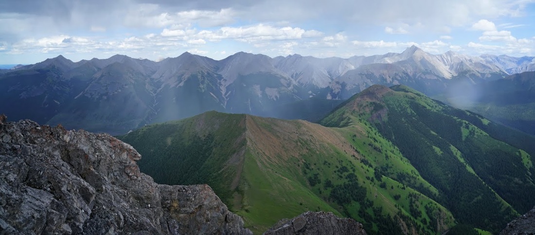
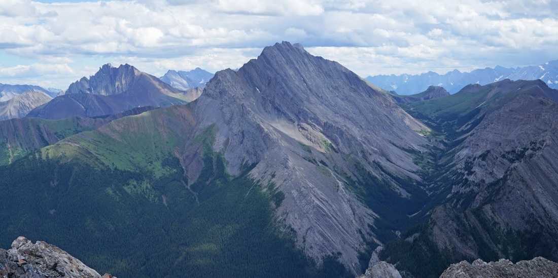
The grassy lump heading out toward the east is McKay Mountain, it looks like a nice hike itself, not very demanding but surrounded by mountains on all sides I'll bet it has some spectacular views. Beyond that are the front ranges that push up to the prairies and I can even see Moose Mountain away to the far right of shot on the distant horizon line.
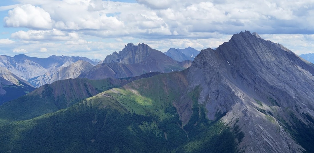
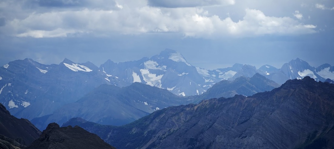
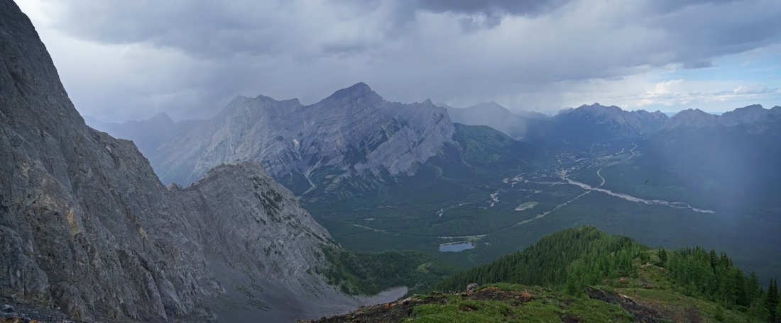
At last the rain blows through and I manage to stay dry once again and pull myself out of my resting place to make a few more shots of the surroundings, this time with a little zoom toward the vertical walls of Mt Potts, Denny and Evan Thoms on the right of frame and the wicked sharp tongues of Fisher Peak in the centre of the frame.
To the north is the long stretch of Mt McDougall and it's numerous summits and even a view to 'Old Baldy' which was one of my early conquests in Kananaskis, from up here I see so many more I'd like to reach.
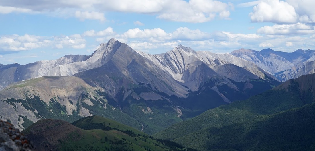
Far away on the continental divide I can see the 11.5 thousand feet, glaciated frame of Mt Joffre standing out from the array of peaks that run along the divide, all of which are shrouded in dark clouds once more.
The valley in the right of the shot below leads to the lush meadows behind the opal ridge and grizzly peak at the far end of the ridge separate from the rest (both of these are recent hikes of mine)
Turning to make my way back along the ridge, over the crux and down to the safety of terra firma I am treated to a very light rainbow as the storms drift away across the valley and east toward Calgary.
Back at the crux I found a spot for the camera, then set the timer and darted across the narrow ledge to the far side, only to find when I returned that I couldn't see down to the actual knife edge area which is several feet below the visible edge here....I decided not to do it again though.
I tried to get a shot as I made it across onto the wider section so I could let go and get the camera out and shoot straight down, that didn't really work either but at least it gives some idea of the edge....and it shows I didn't 'cowboy' the ridge which is apparently common.
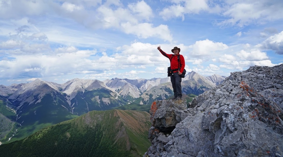
Once I'd scrambled back up the crux I took a little more time exploring the ridge and enjoying the views. The rain had blown through, I'd done the crux (more times than required) and the blue skies were back, so I found a suitable spot for another shot of yours truly.
After seeing more dark clouds coming and still having the steep ridge edge and that 50 foot vertical to do I stopped messing around and set out again to get off the dodgy stuff before the rain returned. The descent was made easier by taking the spot marked by the cairn I'd seen on the way up though it was still a very steep scramble until I was finally back in marmot territory.
The rains came as I started down the grassy ridge, there was rain to the left, to the right and in front but absolutely nothing on my little bit. Better still there were two eagles fighting in mid air over the valley which provided entertainment as I descended (you can just see the black dots in the shot below, by the time I'd got close enough for a decent shot they were over it and had moved on)
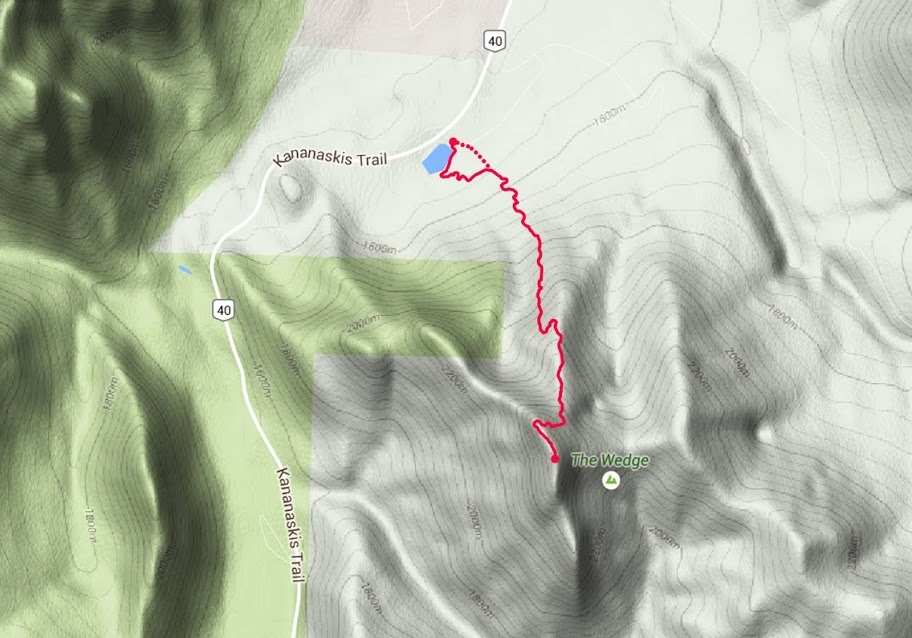
I escaped the rain entirely again on the descent and was back at the truck taking my boots of when it finally rained on me, for 5 seconds before I got in the truck and headed home. The map shows my route in via the solid line and my route out (staying on the trail) via the dotted line. All in all this was a really demanding day with plenty of work in it but as always, it was worth every step.
This will be my last post for a couple of weeks as Sarah and I set out today for a road trip south to San Francisco then after a few days there heading back up the pacific coast highway to Vancouver then through the rockies and home.....leaving in 3 hours time