free to be able to rate and comment on reports (as well as access 1:25000 mapping).
With the nights 'drawing in', a late start today meant I wouldn't have too much time but 5 hours in Kananaskis can get you to some pretty nice locations. Whilst climbing Mt Tyrwhitt last month I had seen this area from the summit and realised I'd never visited it at all.
When I hiked Buller Pass soon after Mt Tyrwhitt I discussed this with a ranger I'd met on the trail and he said "I wouldn't bother hiking all the way to Elk Lakes, Upper Elk Lake is really nice but it's a long way for one lake view" He went on to describe the hike as very dull, almost permanently in forest with few views to be had.
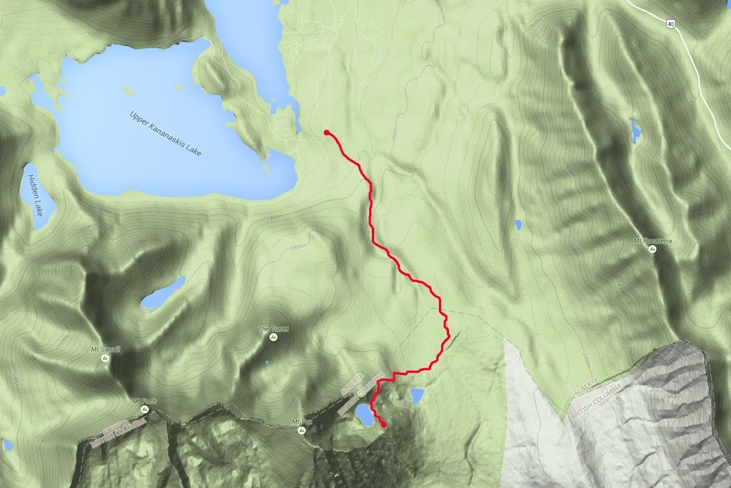
I took a look on my maps and saw Frozen Lake about half way along that forest covered valley and decided a hike to it would let me see for myself without undertaking a 28km round trip to Elk Lakes. That is what brought me to Elk Pass car park between Upper and Lower Kananaskis lakes. The trailhead is very easy to find, simply follow highway 40 to it's junction with the 'Kananaskis lakes trail' and then follow that toward Kananaskis lakes for 12km where you will see the car park signed 'Elk Pass'
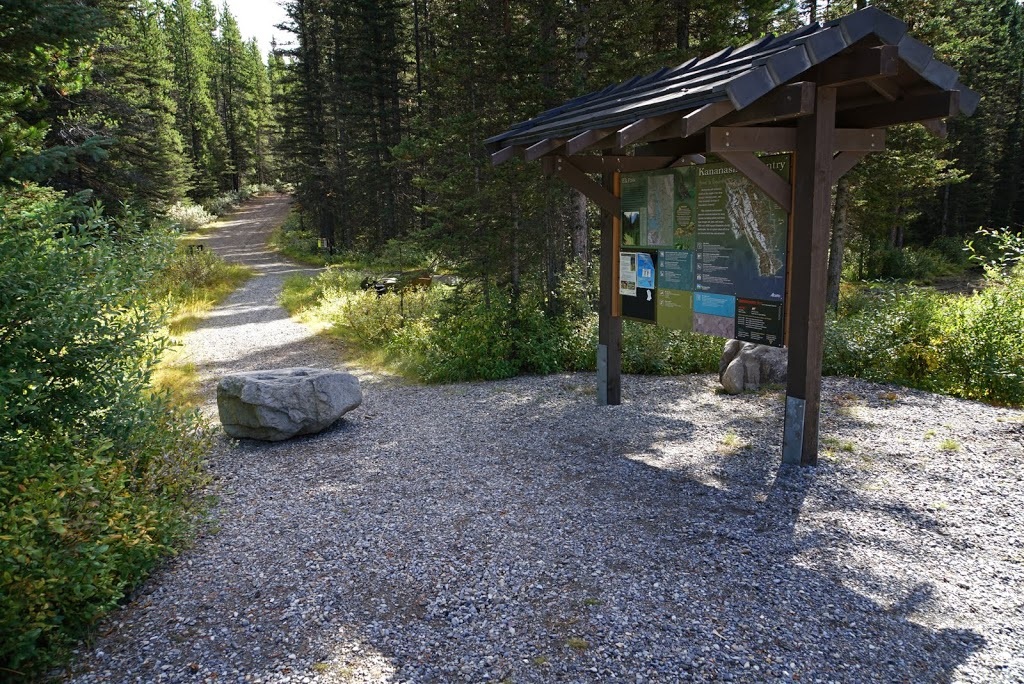
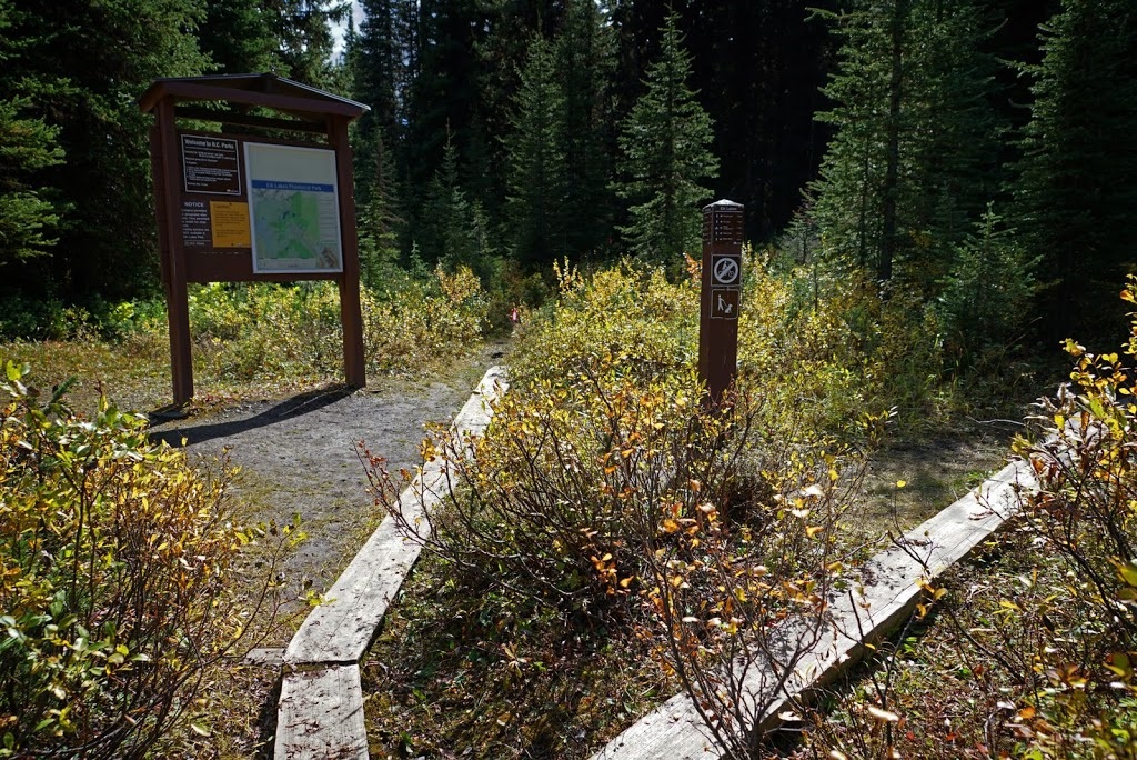
The trailhead is marked by an unmissable large kiosk with information and area maps, so, suited and booted I set out on the wide trail around 1pm.
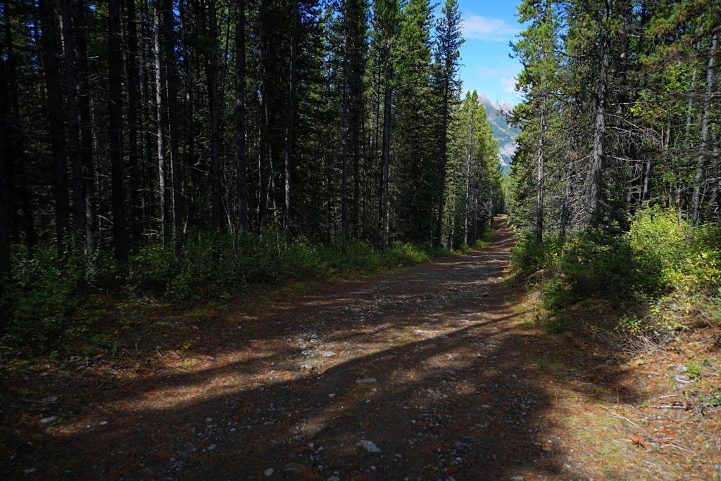
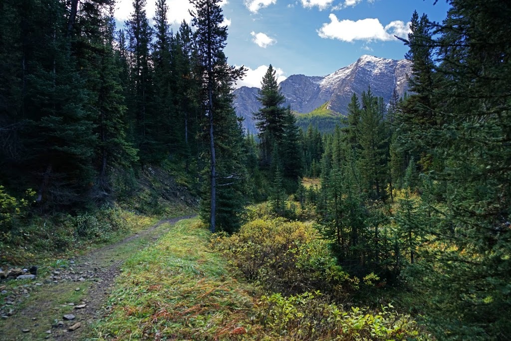
The trail is wide enough for a car for the first 4km or so and is permanently forested with few views to be found. The shade does keep a nice cool temperature in a warm autumnal afternoon and the quality of the trail means ground is covered quickly.
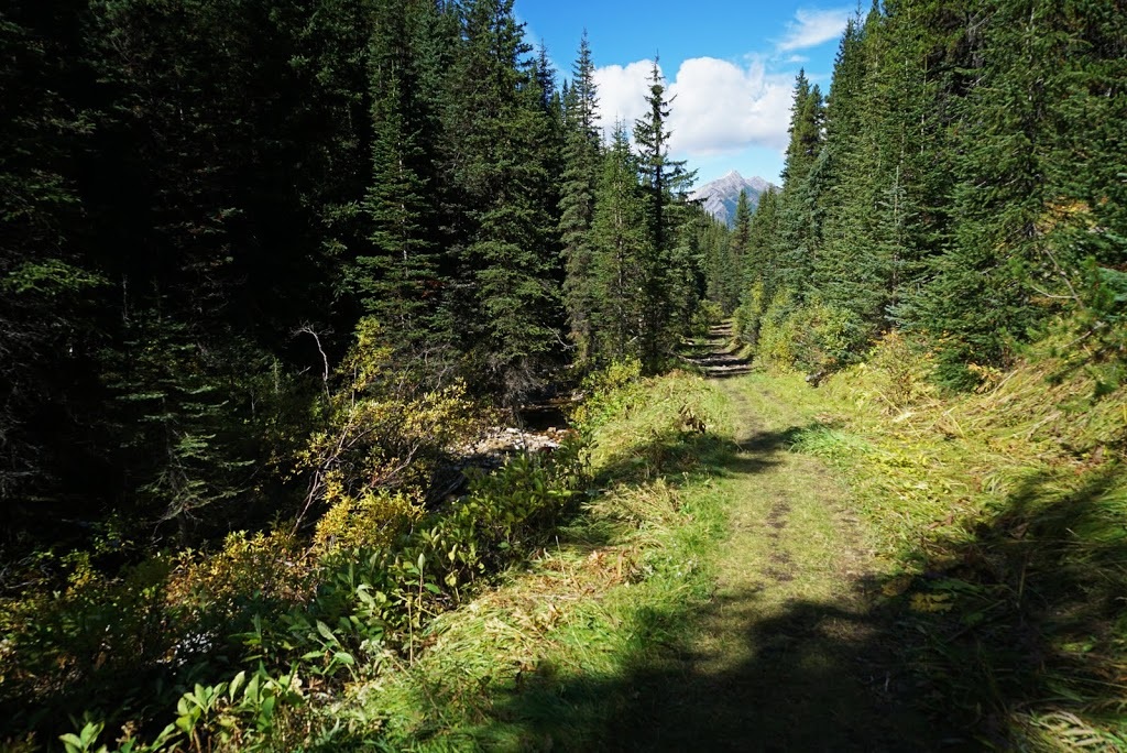
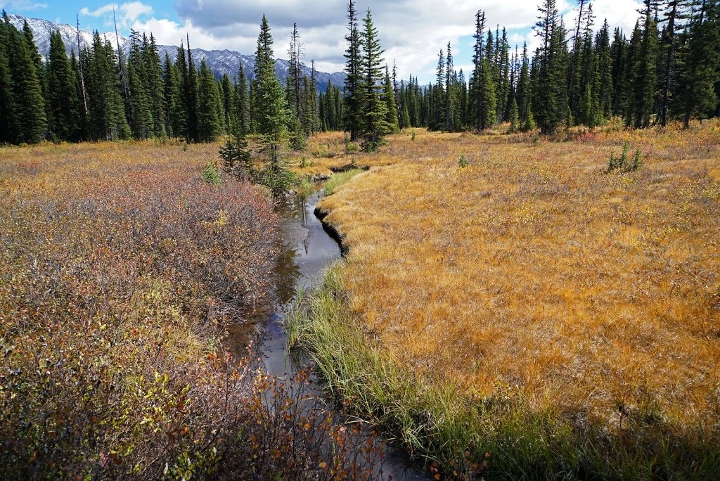
Some areas are more overgrown and provide a more natural feel as a result, the grasses and smaller shrubs at the trailside are yellowing now as we move ever closer to autumn.
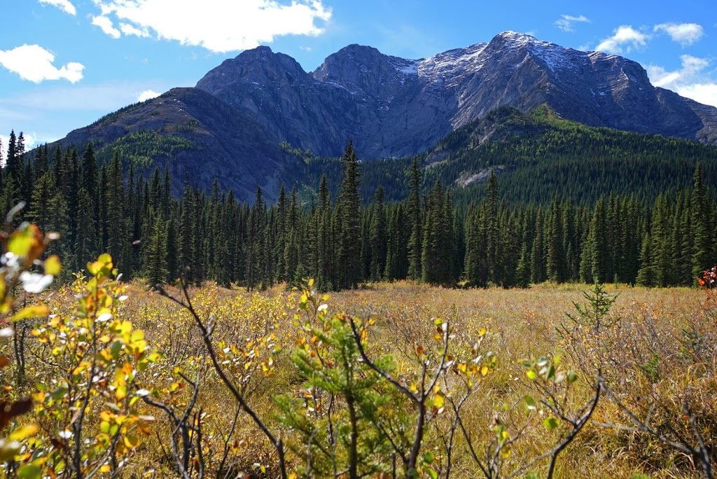
In what seems like no time at all I can see Mt Fox towering above the forest ahead, there is only a very small coating of snow remaining from the heavy fall over the past weekend and even that will be gone soon enough.
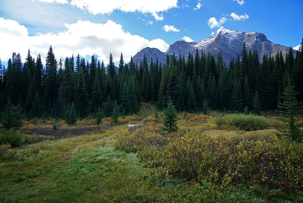
I am soon level with Mt Fox in an open meadow and see this well worn trail and small bridge heading west toward it, I make the incorrect assumption that this is my route and turn off the main trail here back into the forest.
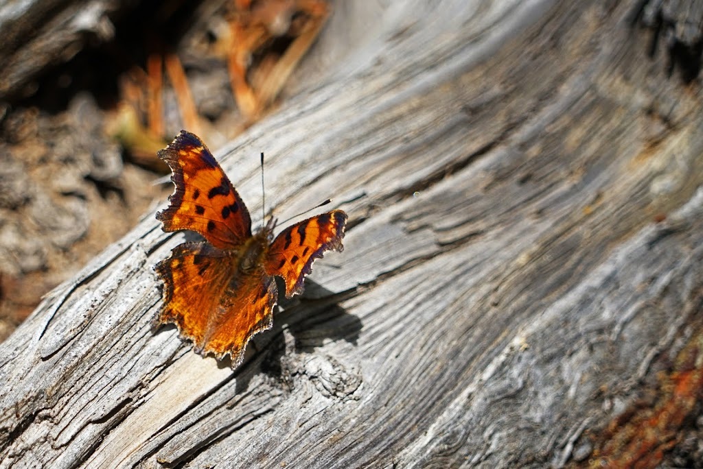
After walking about 2km and slowly curving away from the mountain I decided to check my position....oooops, it seemed I had turned off the main trail about 200m too early, I turned around and headed back to the trail with only a shot of a butterfly for my additional 4km
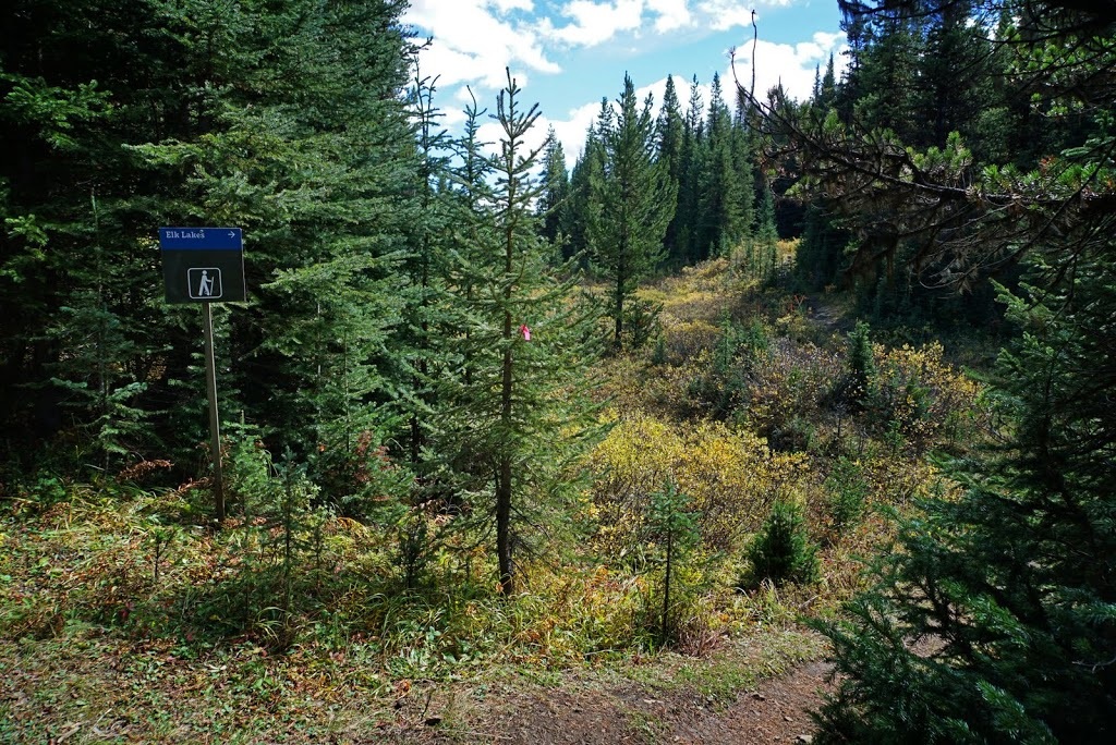
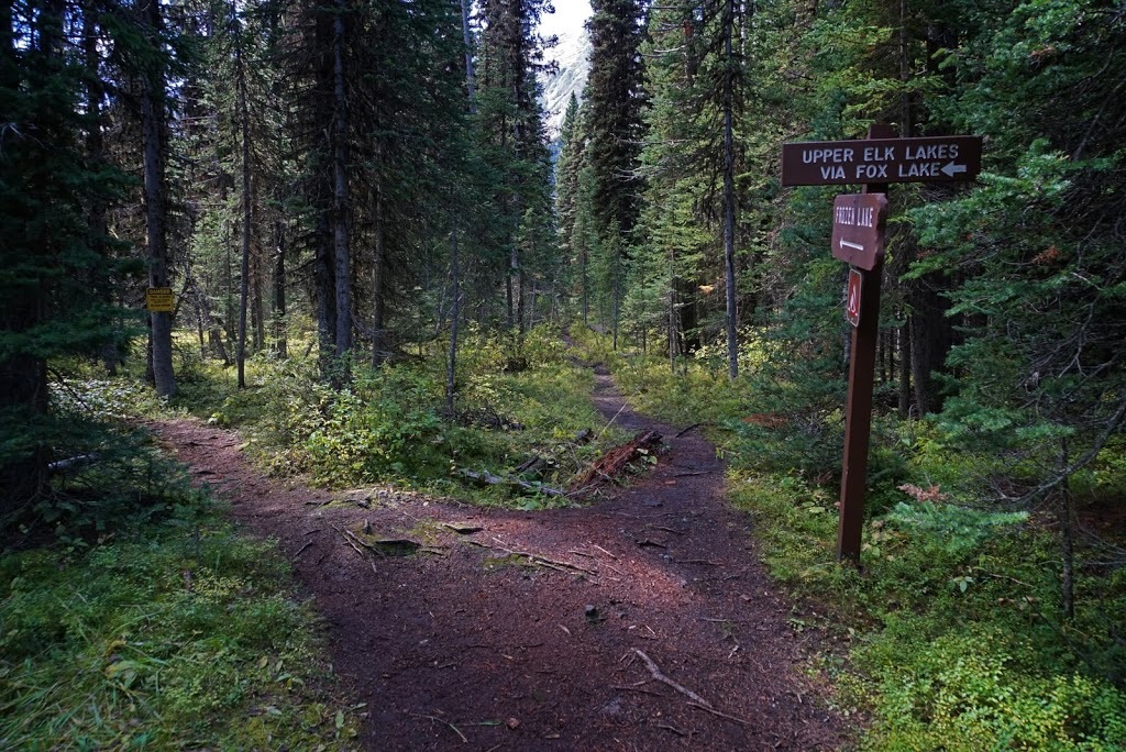
Sure enough, I hiked around 200m further along the main trail and saw this sign for 'Elk Lakes' which splits off the main wide trail. It is possible to continue on the main trail all the way to Lower Elk lake and the Alpine Club hut situated there ($25 per night) for anyone interested.
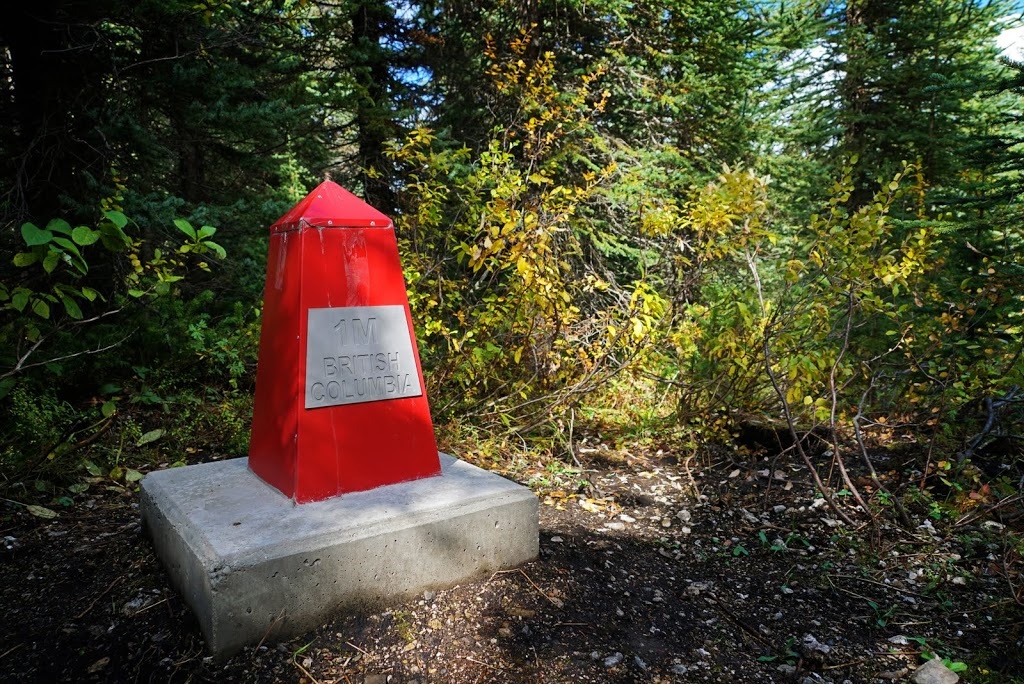
The trail climbs through forest until falling again to a marshy area with boarding provided that brings me to the Alberta/British Columbia border and another kiosk welcoming me to 'BC Parks' The right hand trail is needed here to head to both Fox and Frozen lakes.
The provincial border is marked by some impressive boundary markers some of which look pretty new, they are a strange thing to find in the middle of the forest seemingly out of place.
Further along the narrow forest trail is a fork for those seeking Fox lake or Upper Elk Lake, however the yellow sign on that trail states it is closed due to flood related damage, I can't help but think that information might have been better posted at the kiosk a way back. Fortunately for me my trail (straight ahead) remains open
After a length of forest trail that slowly turned to a mud slog I emerged into an open meadow with a wonderful view of Mt Fox directly ahead though at this point it appears much closer than it actually is.
What I thought was a meadow turns out to be a marsh and I find myself bog-hopping for a few hundred metres, most likely caused by the meltwater from the previous snow.
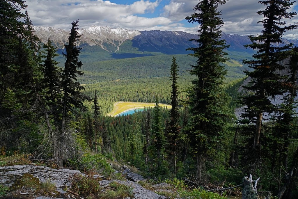
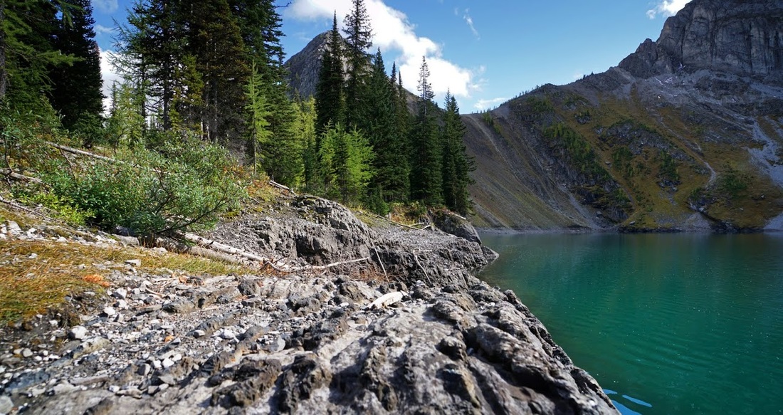
After crossing the marsh there follows a significant ascent on a narrow, steep, wet and muddy trail that leads up the front of the cirque that holds Frozen Lake. There are few views to be had but I did manage to get a shot of Fox Lake below me and the Elk Range beyond.
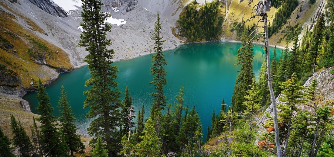
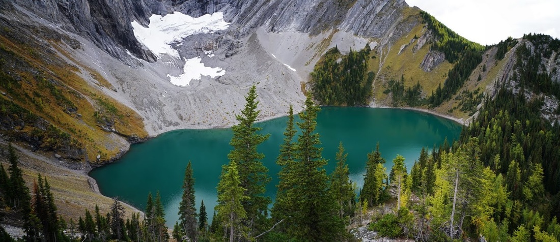
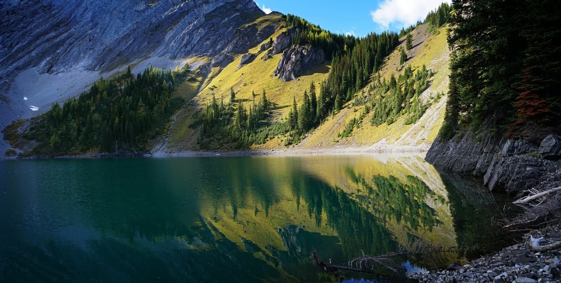
At last I arrive at the lake, the beautiful green water reflecting the glacial remnant that still lingers on the far side shaded by the towering eastern wall of Mt Fox
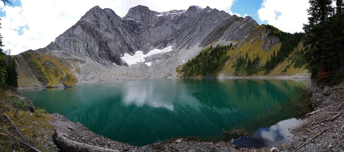
It really is a beautiful sight and I quickly find myself a log to sit on and take in the view. There are fish topping all over the lake as I scoff down a couple of oranges and rest my old bones, it's a tough slog up here and the mud just made it worse.
Having rested a little while I decided to have a look around the area and before I know it I'm climbing the side wall to the south, all of the walls fall steeply into the lake and while scrambling up I send copious amounts of rockfall splashing down into the water breaking the tranquillity.
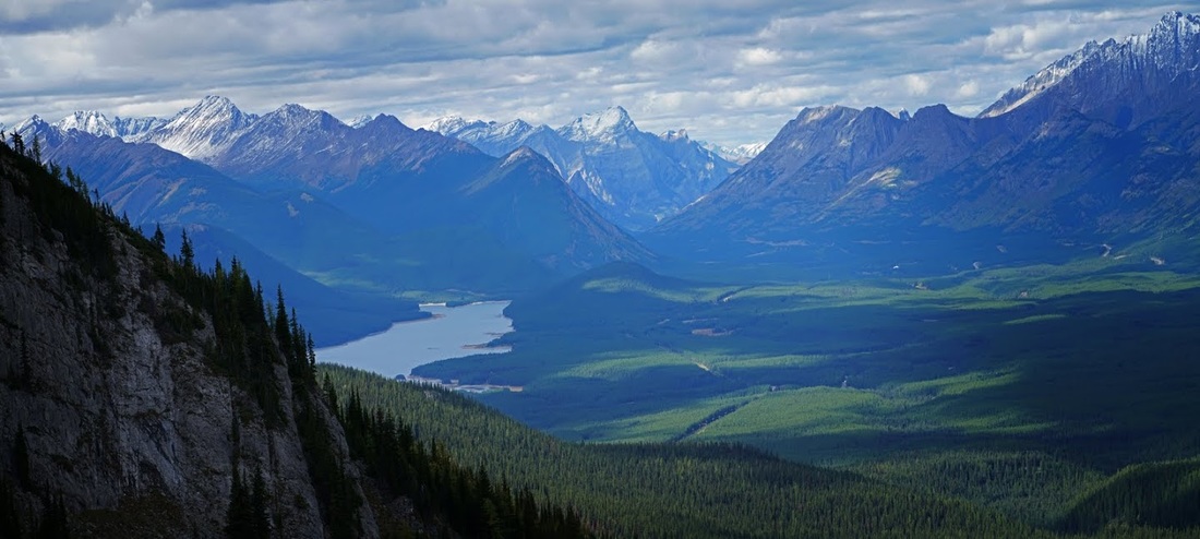
A zoomed shot from my lofty perch shows Lower Kananaskis Lake and the Kananaskis Range from which it takes it's name as well as the Opal and Elk ranges and the long valley reaching back up toward the TransCanada highway.
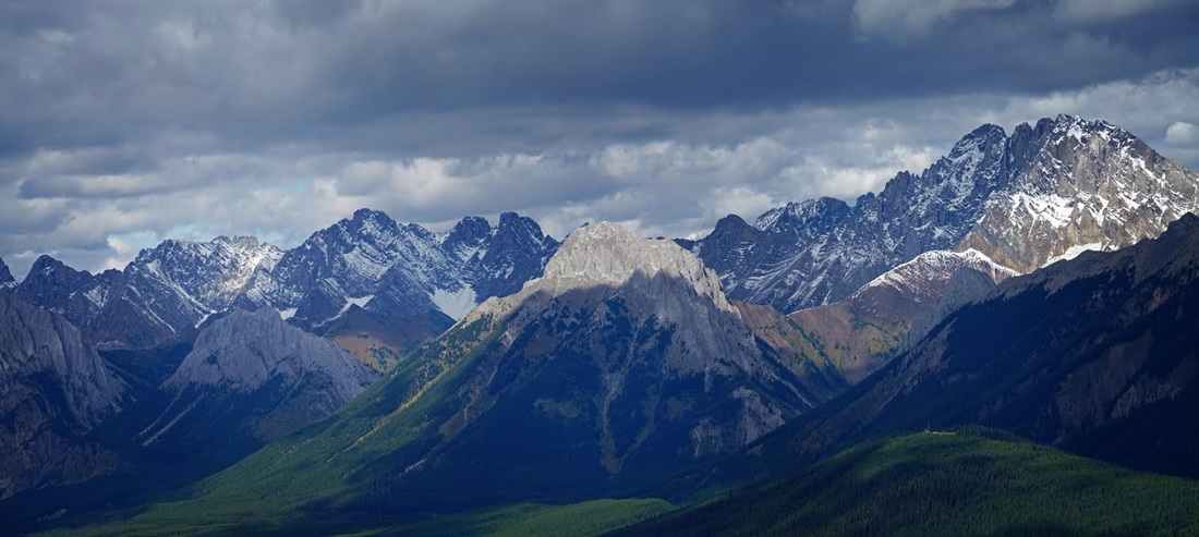
Another zoom across the valley to the east shows the huge frame of Elpoca Mountain on the far right of shot and the low ridge running toward me stopping abruptly at Gap Mountain (a tough little scramble I've yet to take on) further left is more of the Opal Range leading north
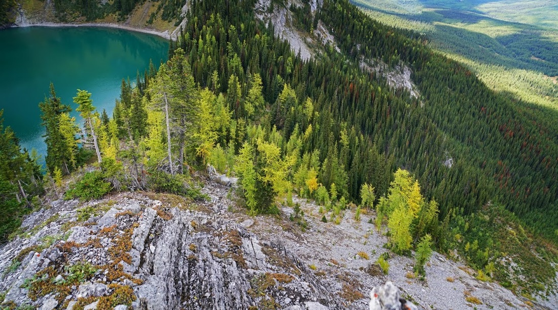
Scrambling around trying to find a better descent route than the incredibly steep ascent from the lake brings me to a great overlook that provides a view over almost all of the route from from Lower Kananaskis Lake to Fox Lake and then up the flank now facing me.
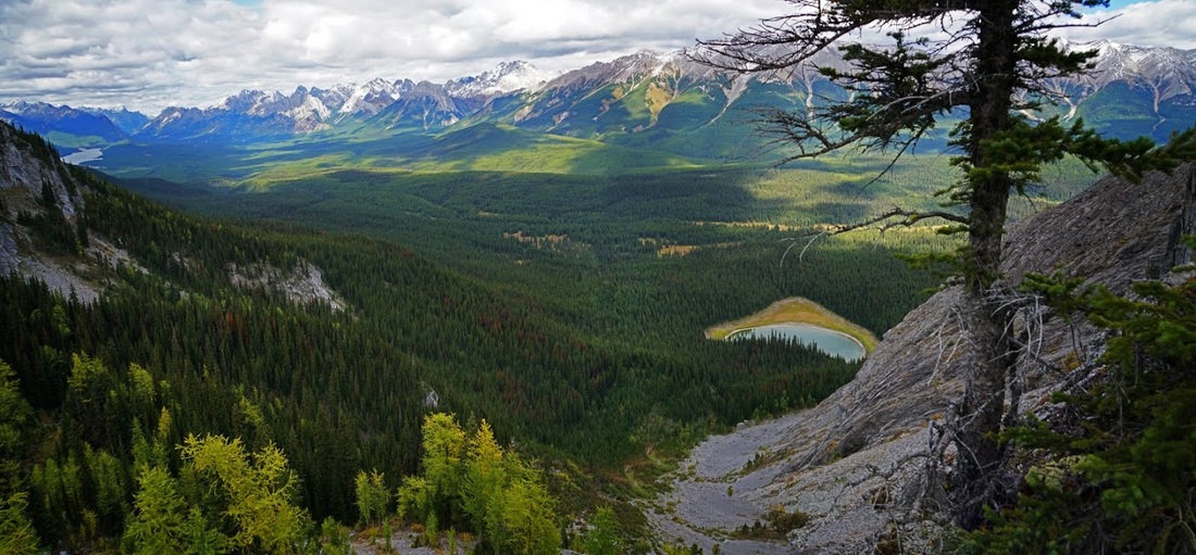
From up here the lake looks beautiful, it's much bigger than I expected when I set out to find it. The name comes from the fact that it remains frozen for 9 months of the year due to it's location, at 2200m (7217 feet) and being almost permanently shaded by Mt Fox.
I found a less challenging descent route after scrambling around for a short time and stopped as I made my way down to grab a shot of the larch trees beginning to turn for autumn. I love to see the larch as they are something of an oddity (as a deciduous conifer) and they bring a riot of colour to the Canadian forests in late September and October.
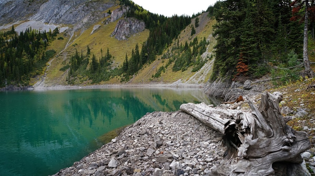
Back down on the lakeshore I milled around a while watching the fish jumping and skimming a few stones whilst contemplating a quick 'skinny dip' the water was really deep right off the rocky shore and jumping in would have been awesome....but a quick test of the water temperature put me off that idea pretty quickly.
I returned to my log seat by the lake and enjoyed a few minutes rest and another snack or two whilst watching the shade descend on the water until only a small section of wall remained lit, then I got to thinking about that long walk out and decided it was time to get going.
All in all this is a worthwhile hike, (4 k shorter if you don't wander off en route....and with 200m less ascent if you only go to the lake) it does lack the usual stunning scenery for most of the route but the secluded and tranquil setting is worth making the hike for. I think we are so spoiled out here that if we don't have a breathtaking view around every corner we think it's somehow lacking....maybe I'll get my bike out and make the longer journey to Upper Elk Lake at some point.
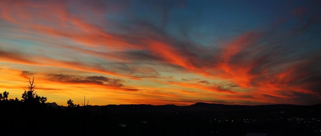
As an added bonus to the day, I got home, showered and had dinner in time to watch this lovely sunset with Sarah...a perfect end to the day.