free to be able to rate and comment on reports (as well as access 1:25000 mapping).
I'll begin my tale with a quick visit to Shark Lake just to share a few shots and get the distance/ascent into my diary.
I'd actually set out on Wednesday last week to hike the Old Goat Glacier trail but when I got close I saw dozens of vehicles and a huge group of people preparing to set out that way, not my thing at all on such a 'closed' trail so I quickly decided to go elsewhere, somewhere very close was shark lake which I'd seen from a distant ridge top years ago so I opted for that.
Date Walked: 14th October 2015
Distance: 9.5km
Actual Ascent: 240m
Time Taken: 2 hours
The trail begins from Mt Shark road where the twisting gravel surface makes a turn toward Mt Nestor you go left onto a grassy embankment.

Along the easy flat trail are lovely views north toward Mt Nestor and Goat Mountain (the one with a dusting of snow) where I'd intended going today.

Windows appear through the forested trail at various points along the way including this nice view out to Cone Mountain

The first view of Shark Lake is surprising as it has a thin layer of ice across most of the surface


The sun over the top of Mt Shark brings a welcome warmth to the afternoon even if it does make photography more challenging

A quick walk around the lake gets me out of the direct glare and allows some differing views

I scrambled up a rock wall at the back of the lake to try and gain an overview but the forest blocked all attempts

Ultimately I gave up and set out to return to the truck finding a nice clearing along the way to capture Cone Mountain, Mt Turbulent, Mt Nestor and Goat Mountain in one shot

The frost never left the ground all day in spite of the sunshine

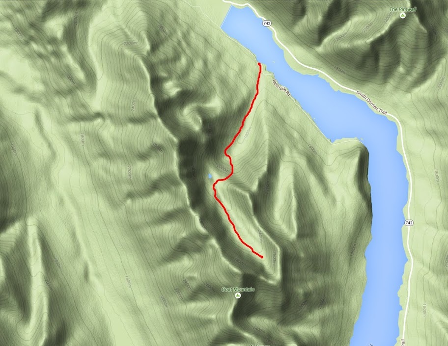
The broken line was my self made trail in to the lake, the solid red is an actual trail I found to exit on (very lightly used trail but better than bushwhacking.

En route home I came across a lovely calm surface on Spillway Lake and stopped for a few shots there


I returned to Old Goat the very next day....
Date Walked: 15th October 2015
Distance: 6.9 miles (11.2km)
Actual Ascent: 2372ft (723m)
Time Taken: 4 hours
Old Goat Glacier has been in my sights for quite some time but being a popular tourist route with associated campground it is a very busy location. Regular readers of my posts will know I enjoy the solitude of the mountains more than anything so as always I waited until the tourists had headed home for winter before taking highway 742 south from Canmore for 16 km to the turning for Spray Lakes West campground.
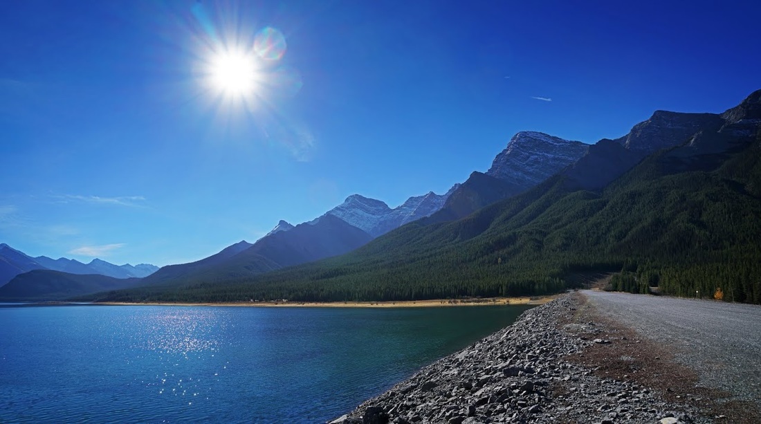
Turning here to cross the dam to the western side of Spray Lakes Reservoir provides a nice view over Goat Mountain and the snow sprinkled peaks that surround Old Goat Glacier.
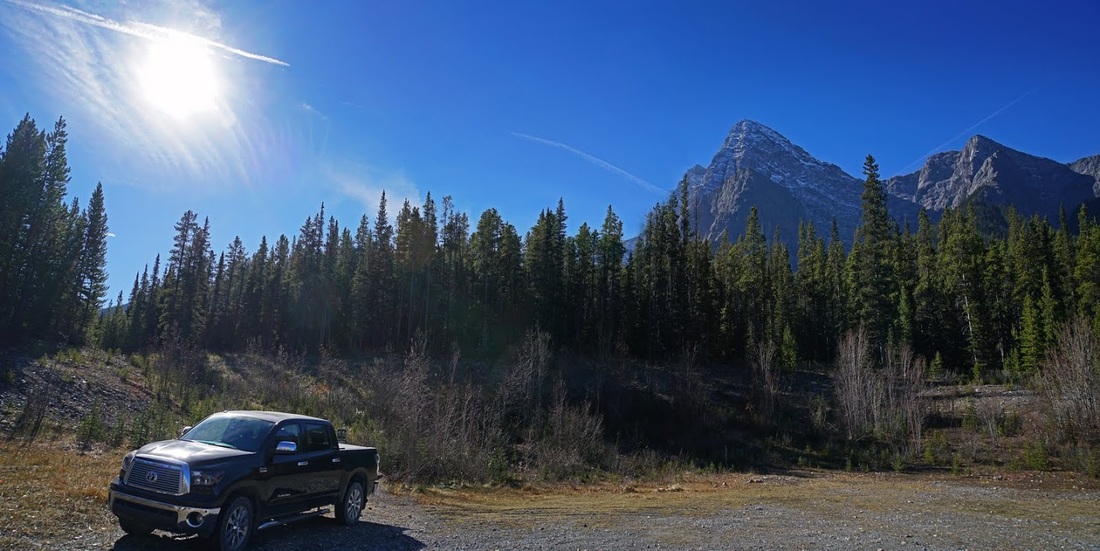
After crossing the dam a left turn on the gravel road leading alongside the lake for around 1.5km brings me to the large cleared car park signed 'Trailhead Parking'. It's worth noting that there is a winter gate after crossing the dam which will prevent access to this car park, you can still make the hike after the gate is closed as there is a car park provided close to the winter gate but it requires and additional 3km on the round trip. The trail itself begins from a well signed access leading out of the car park seen directly over the roof of my truck in this shot.
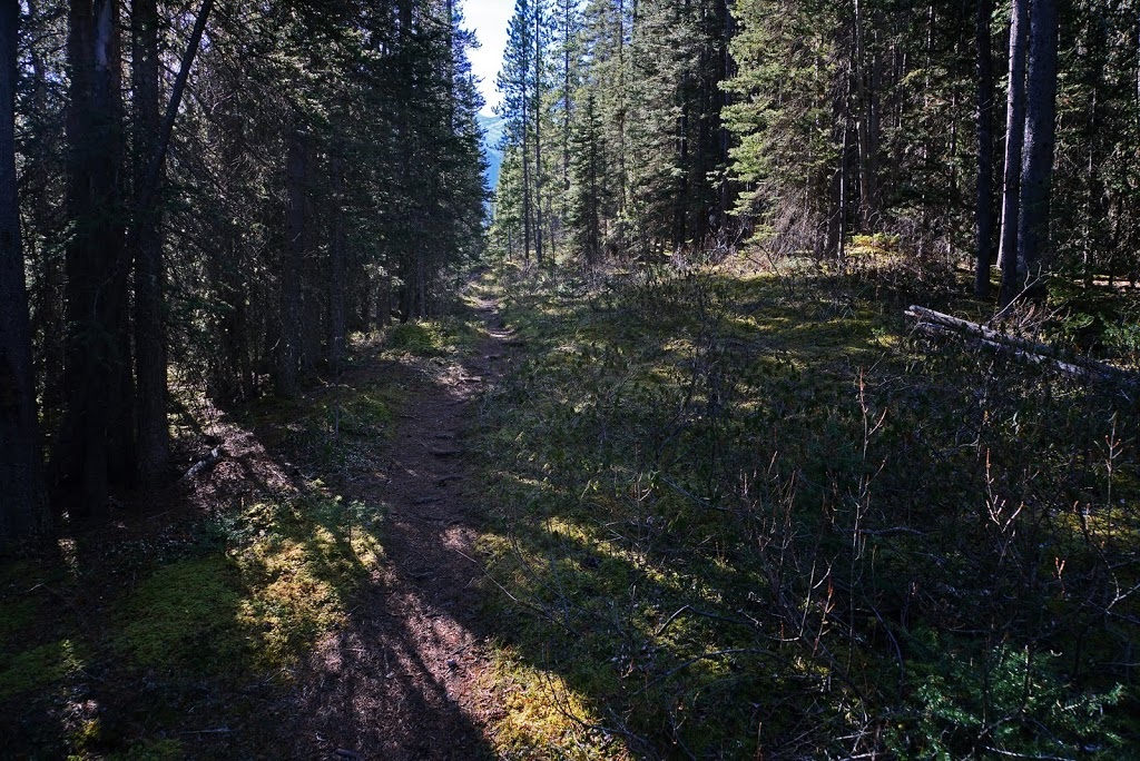
There follows a short stint that parallels the access road with some minor undulations before a right turn on well trodden ground turns me toward the mountain. In the cutting the air is much cooler than the 15 degree temperatures shown in the truck back at the car park.
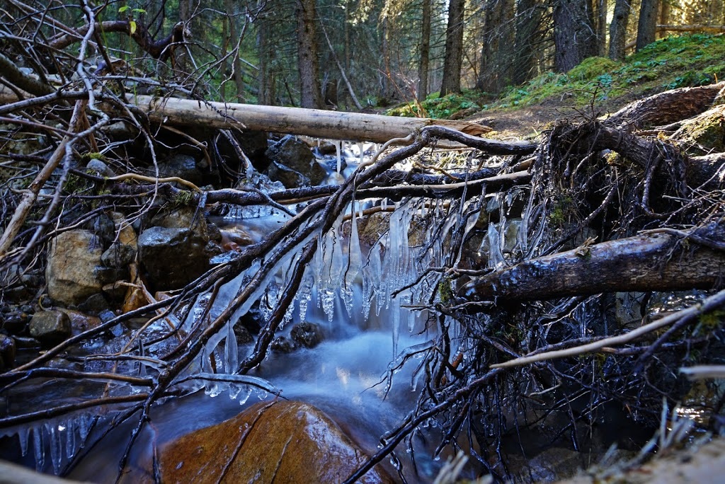
The trail rises over an embankment before dropping down to a small creek where the cold air from the glacier races down the mountain through the pass and out over Spray Lakes West, en route it maintains icicles in spite of the late autumnal sunshine.
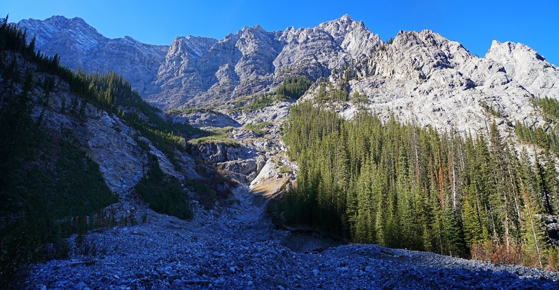
The hike follows the creek for a couple of km's always shaded by the forest, the trail has been washed out here and there but diversions have already been trodden down by those who went before. Eventually I appear into a wide open washout below a huge dry waterfall and the sheer north ridge of Goat Mountain.
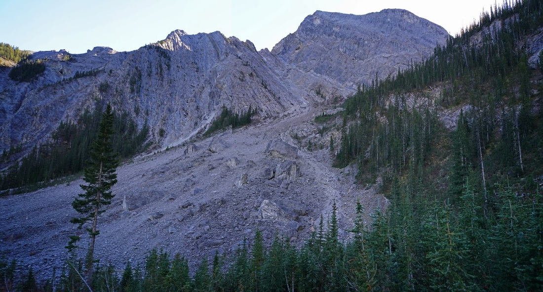
Directly across the washout from where I'd entered is the route up the south slope of the terminal moraine, it comprises a scree bank that is not steep and is easily scaled for the 350m of ascent needed to reach the initial turn.
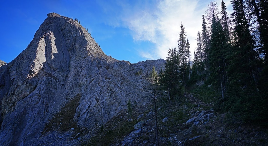
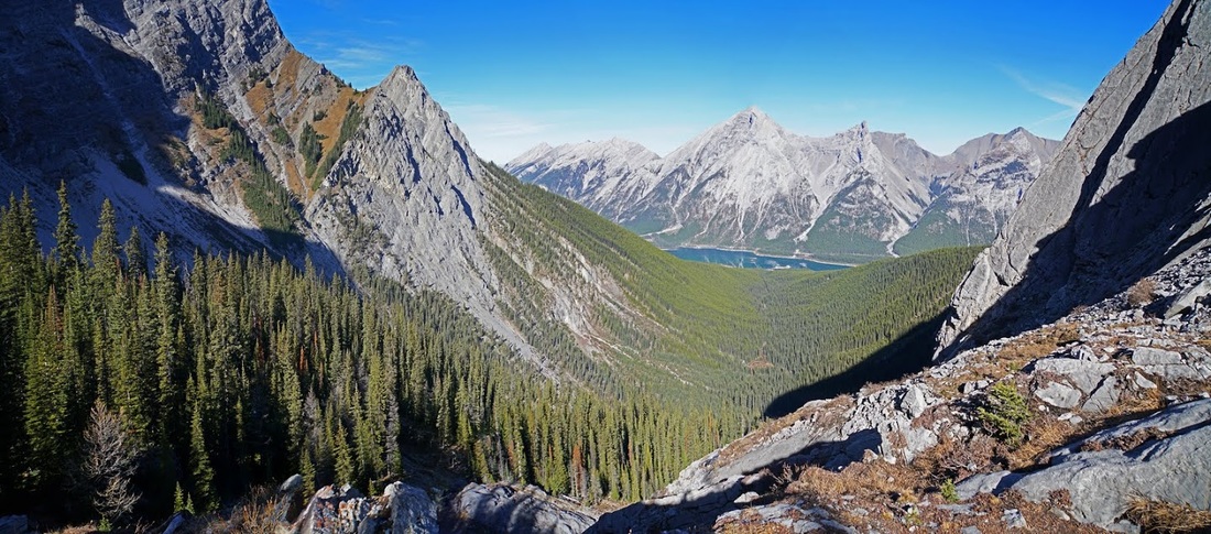
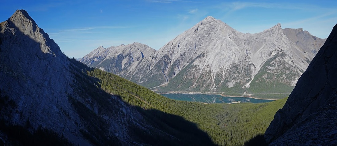
From the initial turn the route rises another 200m and athough the ascent isn't steep there's plenty of reason to stop for photos looking back over the forest covered entrance valley. Spray Lakes reservoir is just visible at the foot of 'The Three Sisters' and to the right of that is 'The Rimwall'

The trail continues to rise turning back towards the north-eastern outlier of Old Goat Mountain. I can really feel the cold air from the glacier now as it pours down over the lip of the terminal moraine and through the trees toward me.
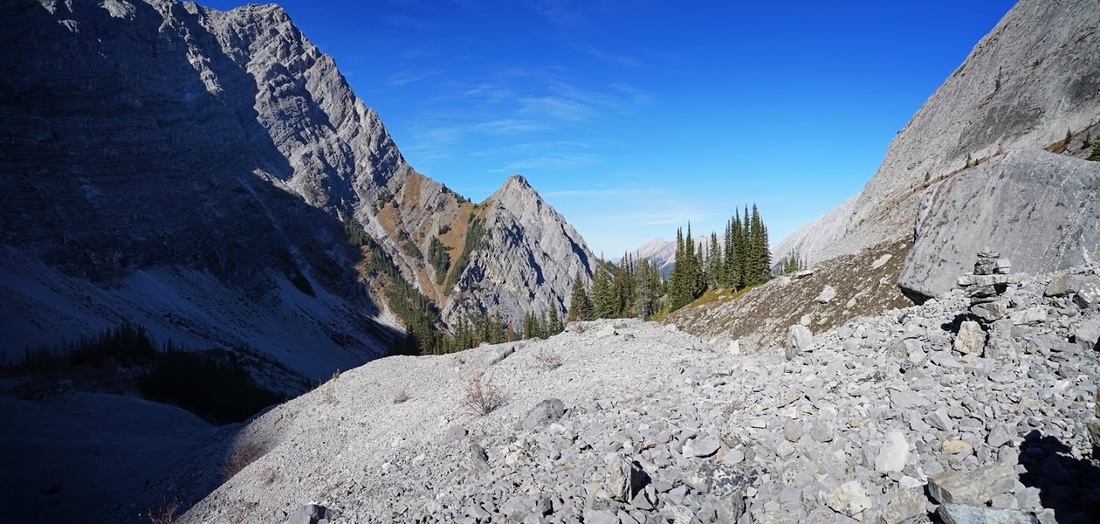
At the top of the terminal moraine I finally get to sample some of that lovely autumnal sunshine, looking back along the valley over a beautiful restricted view that focuses on the perfectly still waters of Spray Lakes Reservoir below.
I sat around on top of the terminal moraine for 5 minutes to get my breath back, I was making good time and the shortening of the days was not going to be a problem today. After my break I set out onto a lateral moraine that reaches the full length of the valley in which the glacier sits.
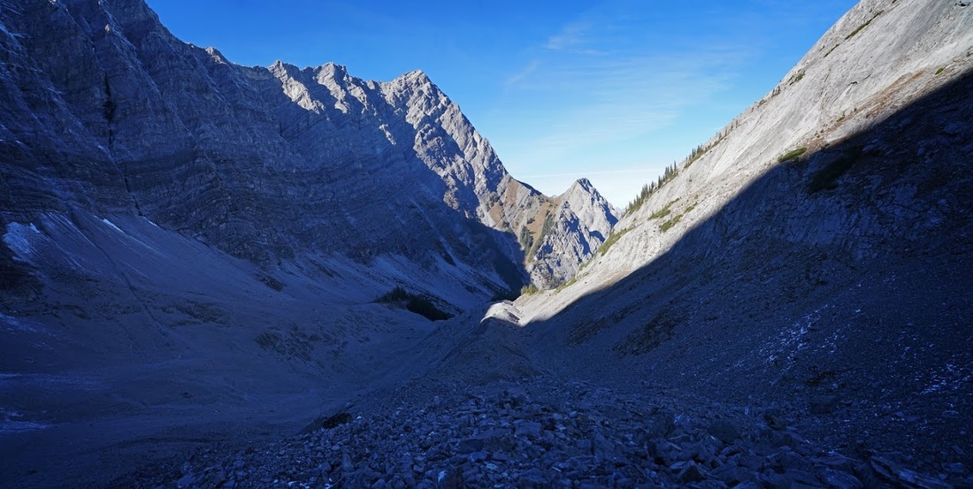
Rounding the final corner into the cool shaded valley brings the first view of the glacier, or should I say what remains of it. The lateral moraine leads away ahead of me and I opt for the additional 1.5 km and 150m of ascent to go to the end of it.
I'm back to walking in the shade though my fleece remains hanging by my side as the continual movement is enough to keep me warm. Looking back along the glacial valley toward the terminal moraine the blue skies and sunshine are soon left behind.
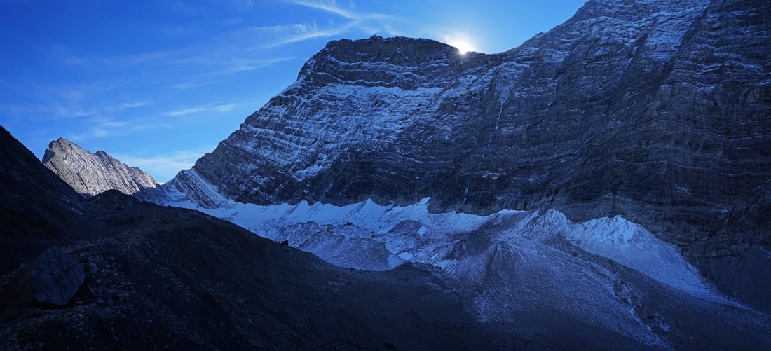
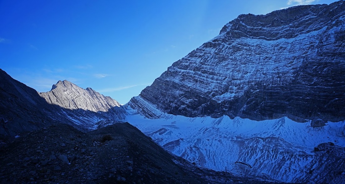
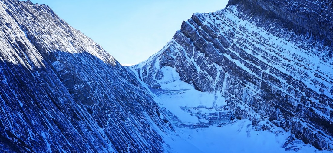
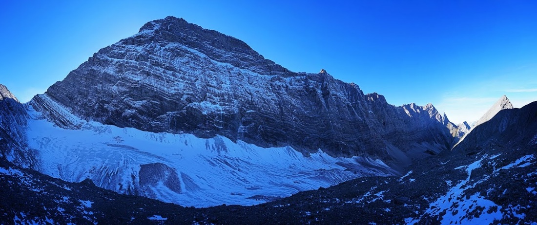
The lateral moraine climbs in steps toward the cirque where a huge sheer rock wall angles down to the glacier preventing any watershed to the south. There are some large cracks in the ice and some nice visible sections beneath the dusting of snow and rocks but the lack of light prevents any colour being captured.
Almost at the end of the lateral moraine where that sheer wall of rock meets the mountains of rubble and ice deposited over centuries along the valley, I inserted myself to bring some scale to the image.
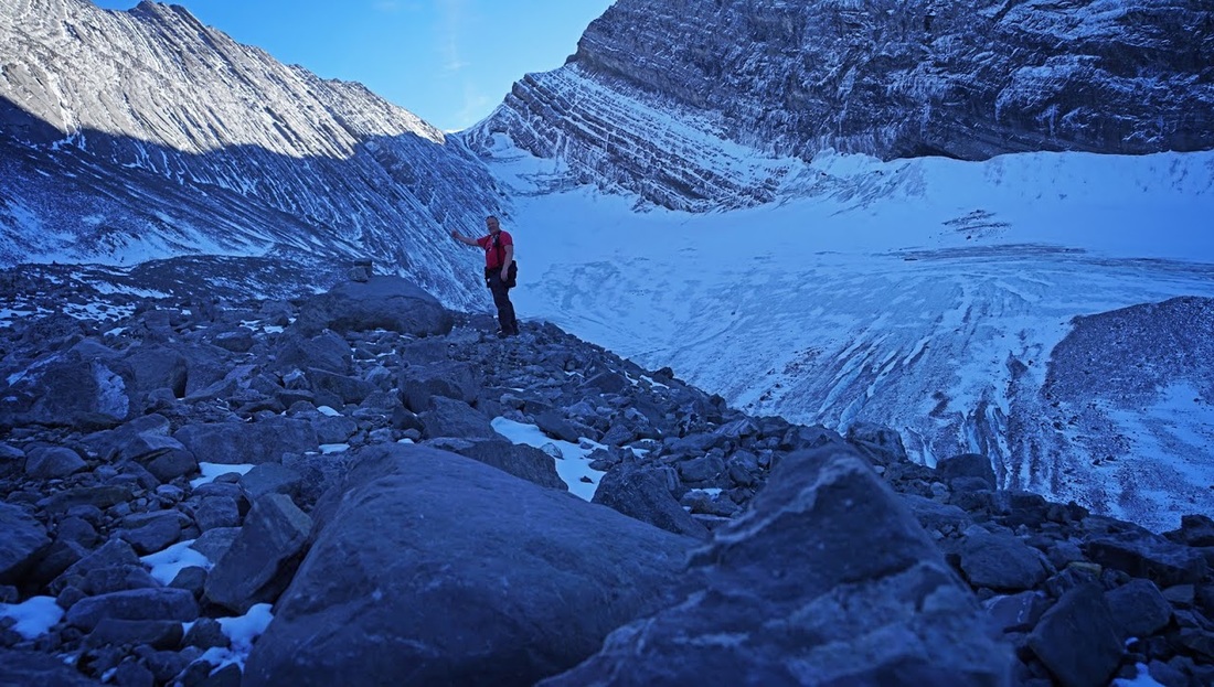
How nice that at the end of the lateral moraine is a 'summit rock' on which to perch and look over the last of this huge remnant. The t-shirt was still just enough to maintain temperature but soon after this shot when I'd stopped for a few minutes I needed the fleece.
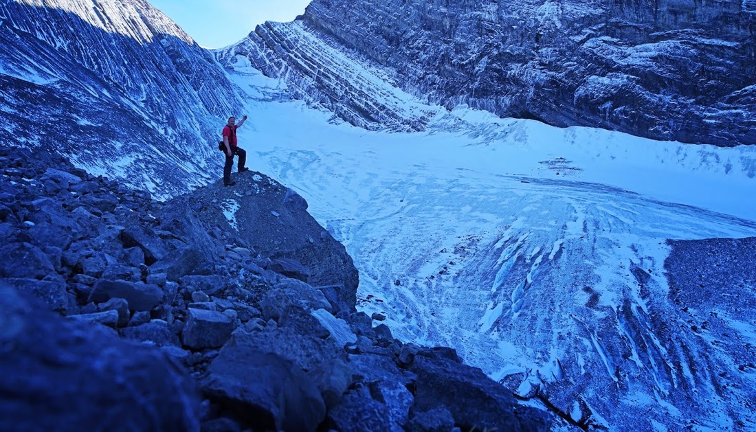
Above my raised hand in the previous shot is a long series of ice steps that looked fantastic and I found myself wishing I'd brought my crampons to make a little addition to the hike. Again the lack of light prevents capture of the true colours of the quite beautiful scene.
I had a wander around exploring the area picking up little fossils and looking for potential future scrambling opportunities until a random falling rock caused a great echo. I spent the next 5 minutes messing around with triple echos which could be made with little more than a raised speaking voice. This shot shows the full 1.2 km of the glacier and the massive wall of rock that is the northern ridge of Goat Mountain.
After a very short rest in the cirque (where I spent most of the time turning over rocks in search of a new dinosaur species) I set out to make the journey back which is unfortunately just a reversal of the way in and made one last shot of that beautiful view from the top of the terminal moraine.
So, that's the old goat hiking up the 'Old Goat' a really enjoyable hike and one that you might well get all to yourself, if you just wait until tourist season ends