free to be able to rate and comment on reports (as well as access 1:25000 mapping).
Part 1
As part of a "trip of a lifetime" arranged by Pura Aventura that included Patagonia, South Georgia and Antarctica we decide to start in the Atacama desert in Northern Chile - one of the driest places on earth. We flew to Santiago and then North to Calama in the copper mining Antofaogasta province. Our tour guide Camillo met us and drove us to St. Pedro de Atacama where we stayed for five nights in very pleasant hotel on the outskirts - individual adobe cabins with thatched reeds roofs
It is a bit more expensive having your own tour guide - there are various organsed trips - but
YOU arrange your holiday to do the things
YOU want to do. It's a long way to go to follow someone else's ideas.
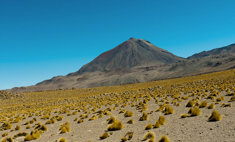
St. Pedro is a small town about 2600m altitude in the shadow of a classical cone shaped Volcano - Licancabur - mountain of the people - 5920m (19,400ft) high

. The border with Bolivia is just beyond.
From the hotel garden Licancabur dominates St. Pedro I was immediately reminded of Sergio Leone (fistful of dollars etc.)

It seemed to have an amazing population of dogs that just lay sleeping on the pavements, never barked and were completely unaggressive either to people or to each other - I guess it's to do with the heat

Although there is almost no rain, water does come down from the mountains - snow melt maybe - and a narrow canal runs through the village. The water is rationed - each house having a specific day on which it can irrigate its garden
The heat in the middle of the day is extreme, so our daily "itinerary" often involved two outings - one in the early morning and another about 4.00pm
DAY 1In the morning we bicycled a few km along a sandy track to a hot salt lake with soda crystals floating on the surface and also red-necked phalaropes (see later picture). Donna went swimming but I gave that a miss.
Halt-on-bike-ride.jpg[/img]
halt on the bike rideSalt LakeIn the late afternoon we went for a couple of walks in the Valee de la Luna a - few Km south West of St. Pedro. We had a driver - Rodrigo - who dropped us off and collected us at our finishing points. It is thought there has been no rain for at least 100 years here, and the surface is covered in salt, soda and gypsum crystals - there are also wind formed "statues". The photos say it all
DAY 2North and East of St. Pedro the land rises to over 4000m. This is part of the Altiplano - see Wikipedia for more info.
We headed up to a small village Machuka at nearly 4500m and walked for 4 hours down the valley of a stream - the Rio Grande -to the village of Rio Grande where Rodrigo collected us . What constitutes a "big river" depends upon where you are
. The altitude is quite high, but because it is so close to the equator, the effect on breathing is much less than in (say) the Alps
more detailed map of the walkAgain the photos say it all, though there were interesting plants and animals and Camillo found us several bits of Obsidian - a black volcanic glass
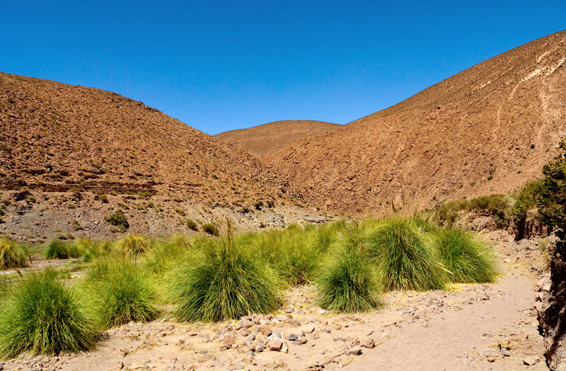
Lamas are domesticated animals and unusually, use specific common toilet areas so that they don't poo on their food - grass is quite precious VIEWS OF THE WALK - the vegatation beside the stream is quite lush, but changes to desert only a short distance away.
Continued in Part 2
 Viscachas live in the rocks and are related to the Chinchilla
 Cactus
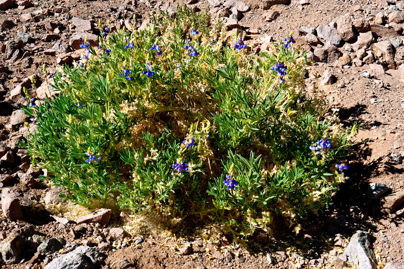
 Mutisia Subulata a climbing plant - or so a kindly man at Kew advised me
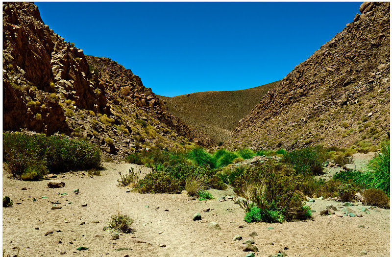
 The valley ahead becomes quite narrow - a side gully on the R
 Beyond these habitations the valley becomes too narrow to navigate and we follow a track on the Left.
  We start to climb above the valley
 Could be John Wayne country
  It was pretty hot at the top
 The track descends to rejoin the stream
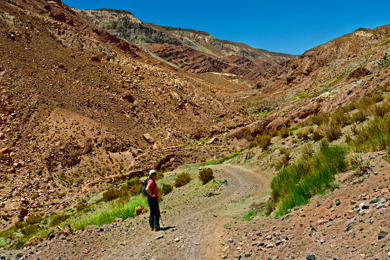 Looking back up
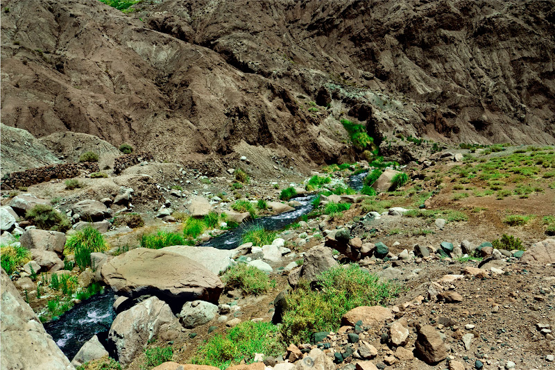

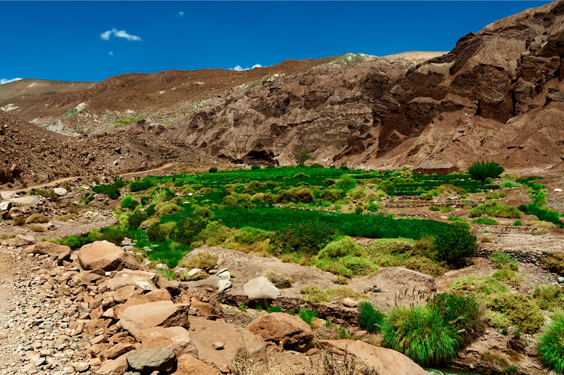 The vegetation down here is stunningly green
 In the village of Rio GrandeDAY 3
This was the day I would climb a volcano - Donna opted out and took it easy You can walk up Licancabur - it has a lake in the crater
Wikipedia says "The summit and the crater are located entirely in Chile, slightly over 1 km (3,281 ft) to the southwest of the international borders. It is about 400 m (1,312 ft) wide and contains Licancabur Lake, a 70 m (230 ft) by 90 m (295 ft) crater lake which is ice-covered most of the year. This is one of the highest lakes in the world, and despite air temperatures which can drop to -30 °C, it harbors planktonic fauna.- but it takes two days, so we settled for the 5600m Cerro Toco further to the South - still 1000m higher than I've ever been

You can drive to just over 5000m as there is an old sulpur mine there - Chile's copper used to be smelted using sulphuric acid made by burning sulphur, but a less polluting technique is used now, so the sulphur mines have closed down. We started about dawn
 The road to the old mine runs round to the South of the summit but doesn't appera in this google map
 A more detailed view we started from the 5050m plateau
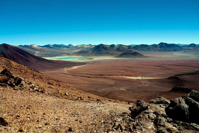
 LIcancabur in the early morning: It is a very old volcano and is thought not to have erupted for maybe 1000 years, Juriques (5720m) is much younger: the Laguna Verdes are in Bolivia
 On the road to the mine: There are two telescopes on the West face of the mountain - centre Right
 There is reasonable path for most of the ascent, and I didn't find it too exhausting: it was only when I sat by the summit and leaned forward to open my rucksack that I fell flat on my face
. It was like being very drunk.
The view looks like something transmitted by the Mars rover - A landscape of various shades of red with more volcanos in every direction - most of them dormant or extinct - I only noticed steam rising from one far to the South. There isn't really much of a crater. Here are the photos
 Licancabur, Juriques and the Laguna Verdes from the ridge
 Views from the summit go roughly anticlockwise from the South

 Looking South East: the distant snow capped mountains are in Argentina
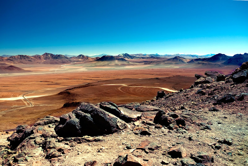

 Sitting at the summit - it was pretty cold and I wore hat and gloves
 On the way home - another view of Licancanbur and JuriquesDAY 4
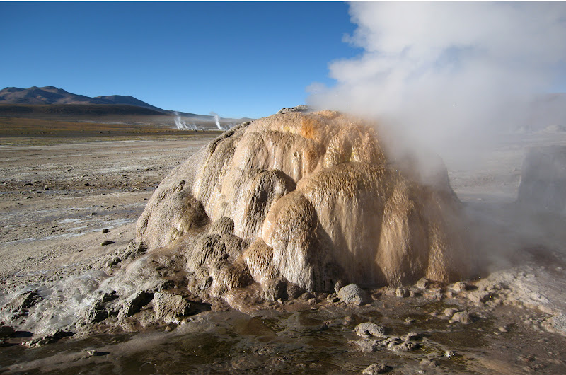
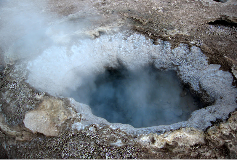
further North East beyond Machuka the road leads to the El Tatio geiser fields - still at around 4300m - where there are numerous steam vents, hot pools etc. You set off in the dark and arrive just before dawn so that the visual effect of the steam is maximised. It's all quite fun, but after seeing Yellowstone in my youth everything else is a pale imitation - including Rotorua in New Zealand..
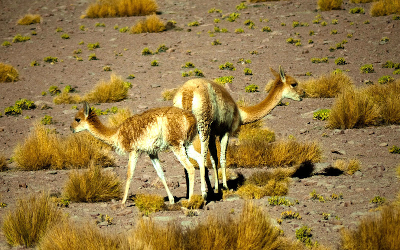
On the way back we saw a number of Vicunas -famed for their extremely fine fibered wool which allows them to survive at these altitudes. Unlike Lamas and Alpacas, Vicunas cannot be farmed. If they are enclosed they simply fade away and die. Every year the herdsmen round them up, shear them and then release them.

 Looking back at the Geiser fields
On the way home we visited a spring where there were a number of spectacular water birds
 A spring in the Altiplano
 TThe Phalarope was at the salt lake
 A final view of Licancabur on the way home
So that was it - a lightning tour of the area - just a taste but there must be so much more to see
