free to be able to rate and comment on reports (as well as access 1:25000 mapping).
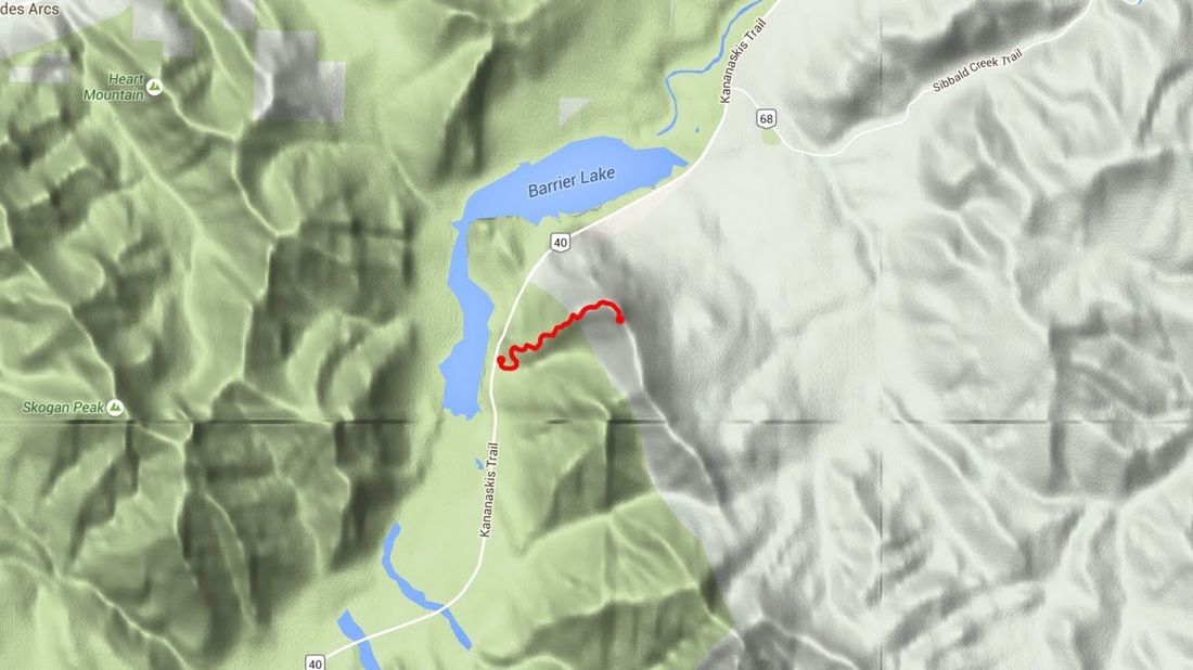
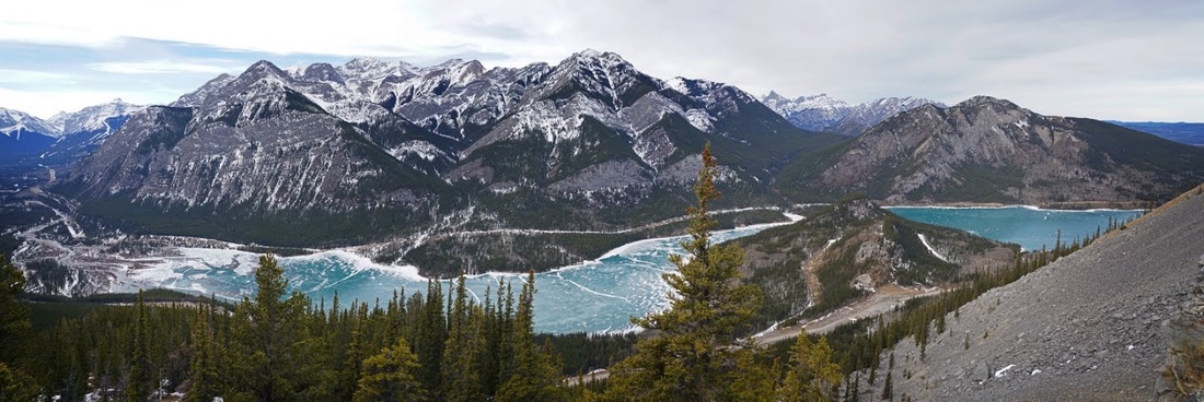
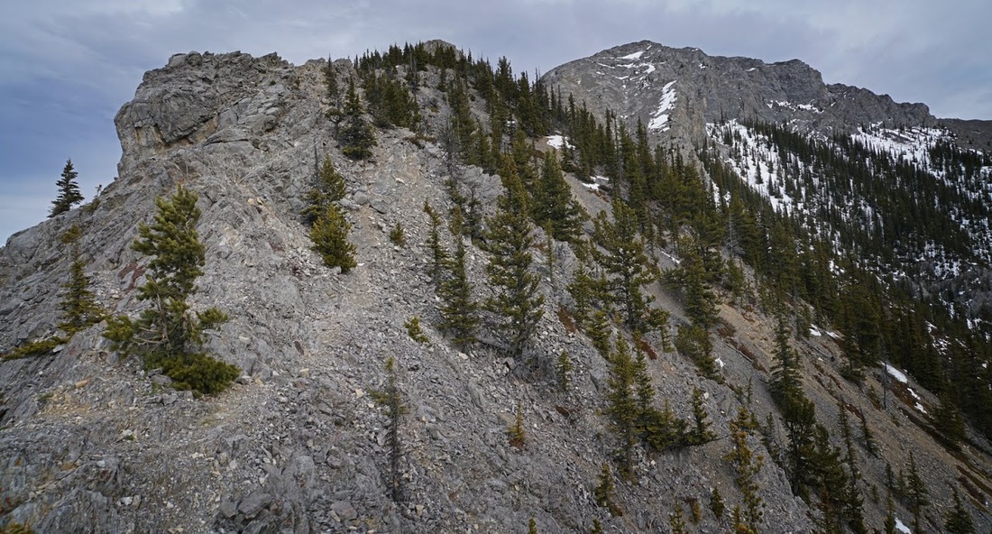
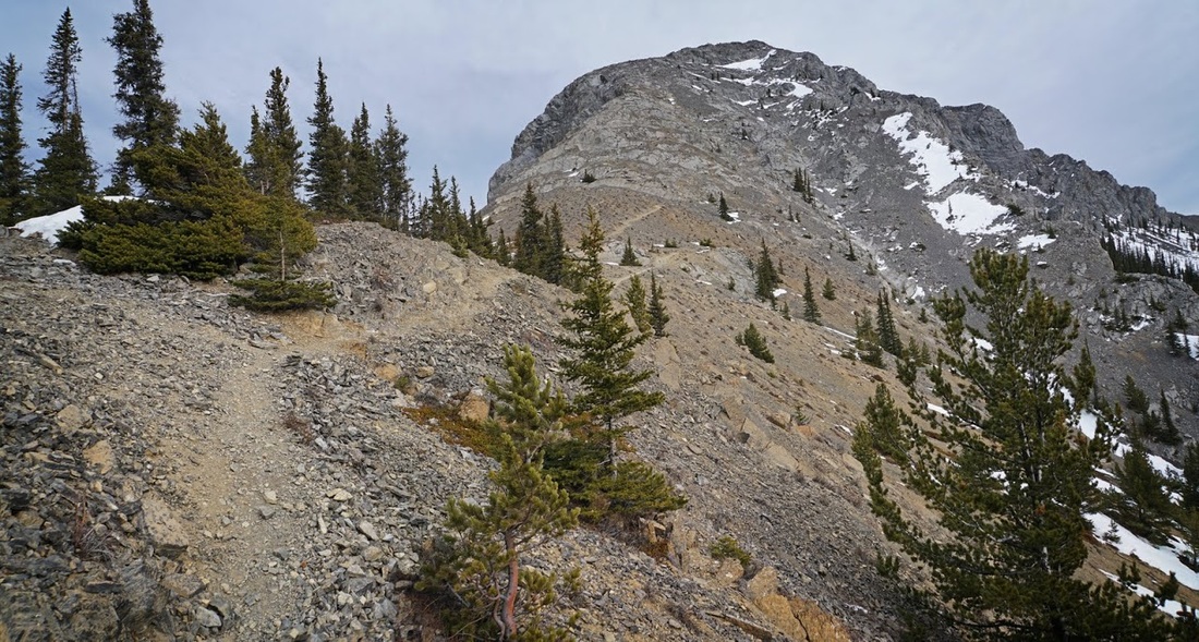
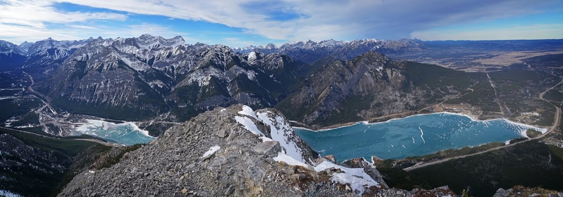
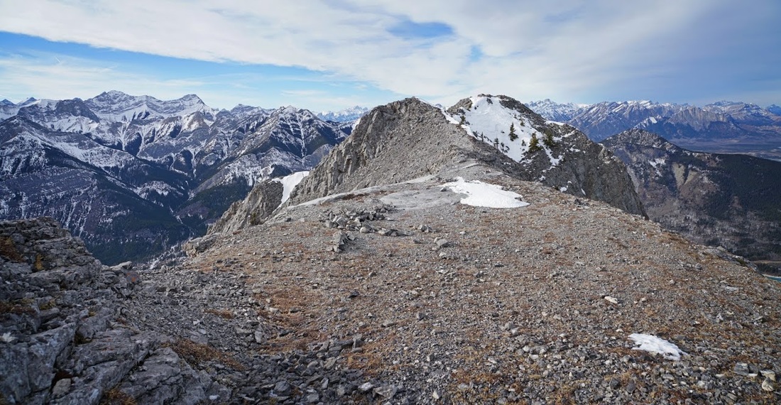
With another week of Chinook winds bringing unseasonally high temperatures to southern Alberta the snow was all but melted entirely from the lower peaks, and to be honest it was very sparse on the higher peaks too. I decided it was time to have a go at the north summit of Mt Baldy. At 2192m (7191 feet) it made a perfect target for the day. The shot below shows the north summit and most of the route up beginning from the rockwall visible at the bend in highway 40.
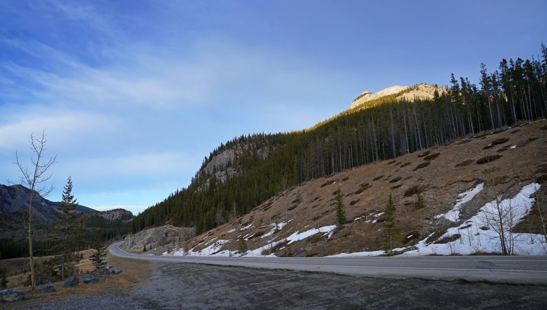
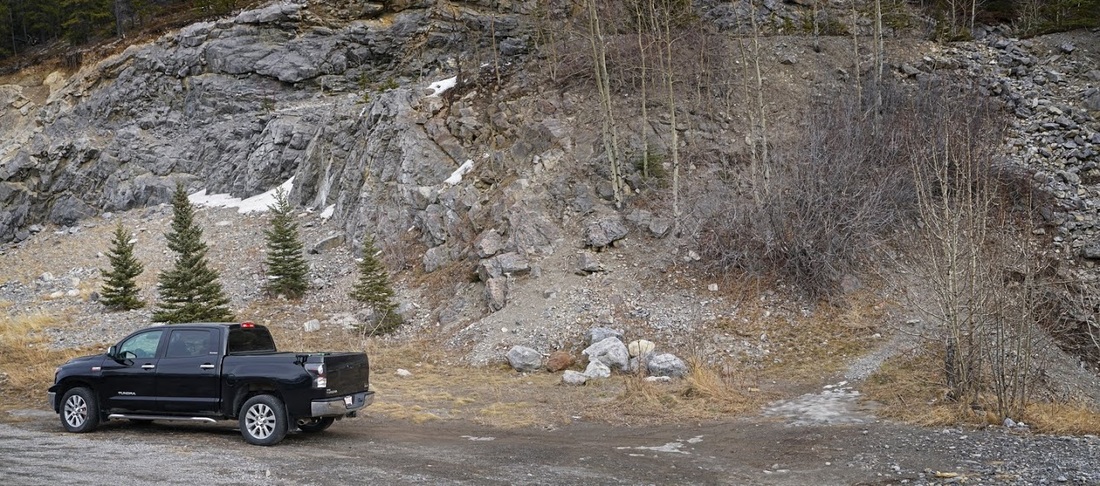
The parking area is is beside that rockwall 12.5km south on highway 40 from its junction with the Transcanada Highway at exit 118. From the parking area a clear trail sets out into the steep forested section that restricts views in the early stages. If you are looking for a hike, this isn't it, this is a scramble with some very exposed sections at times and definitely one where a head for heights is required.
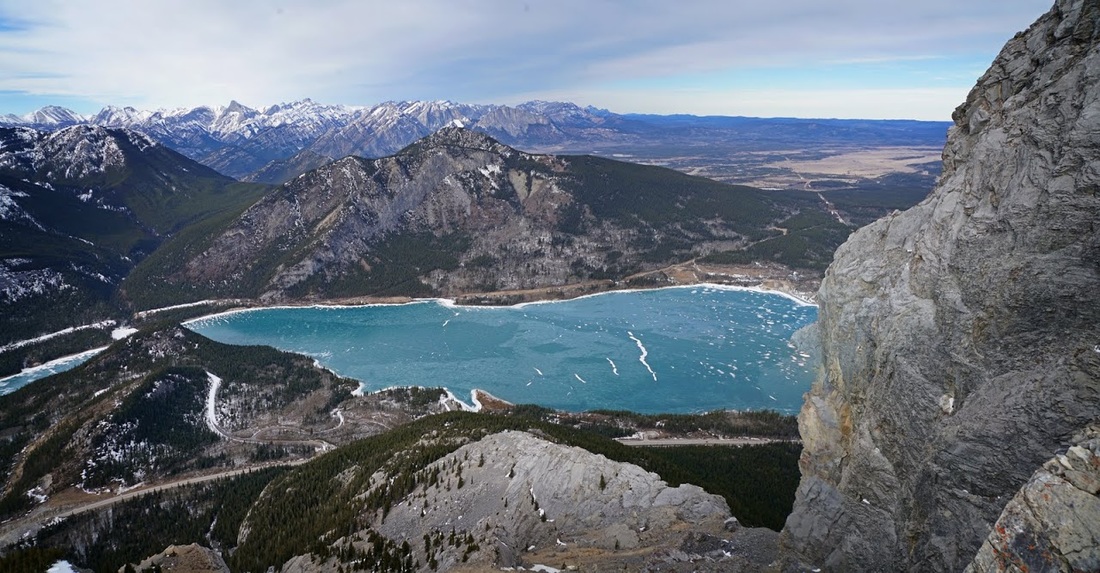
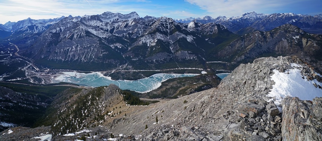
I'm wearing the summer gear again but with a winter jacket as I pick my way through the forest. Micros are needed to deal with the ice patches along the way and ultimately remained on for the whole hike. The usual benefit of a steep start applies and I am soon lifted to an open viewpoint where the blue ice of Barrie Lake can be seen thanks to the warm winds sweeping off the snow covering.
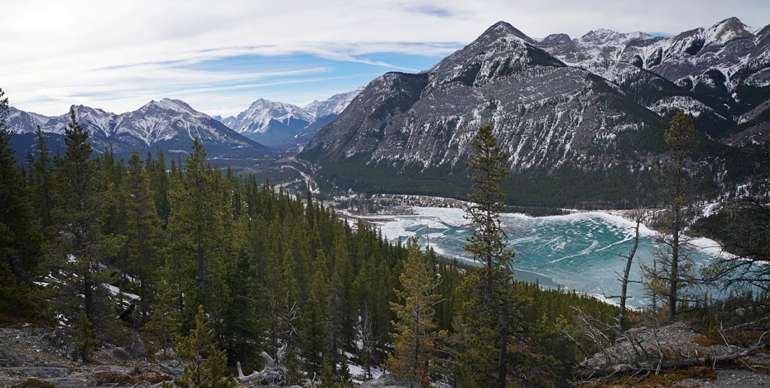
Higher still and the view opens out further showing the main part of Barrier Lake on the right which is where you'll find me kayaking in the summer months. The lake also has some beaches and picnic areas making it a favourite for locals as the tourist season fills the more prominent areas.
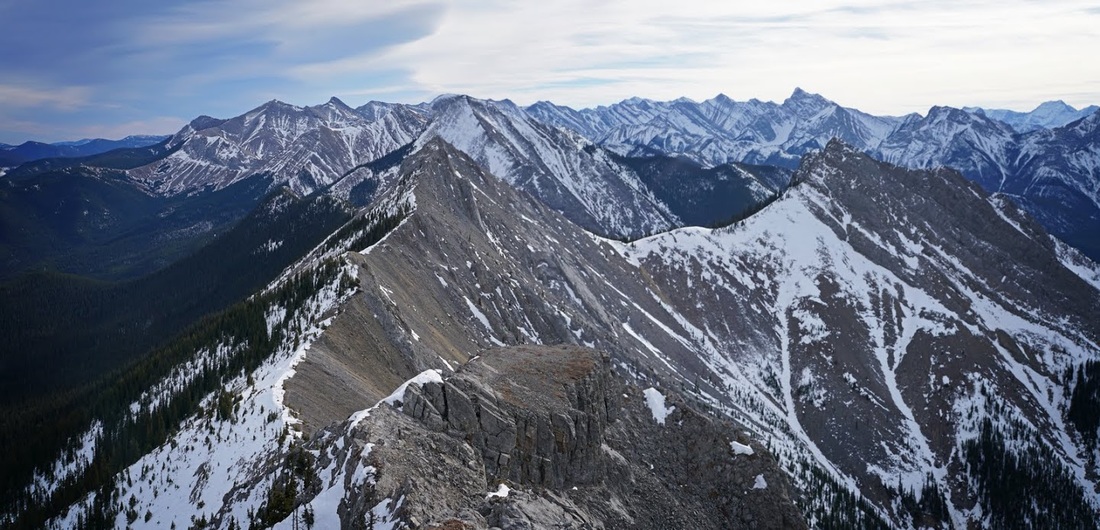
It's easy to get lulled into a false sense of security as you exit the forest and take on the straightforward ridges that follow, that is until you make you way to the top of a large buttress with the south and west summits of Baldy to your right.
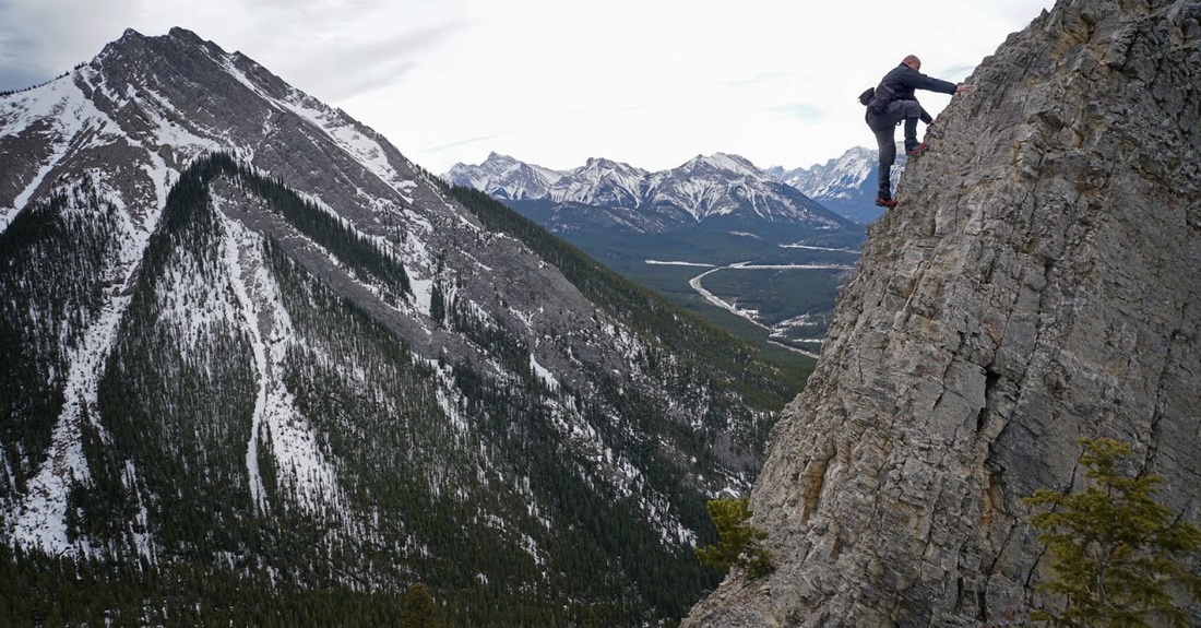
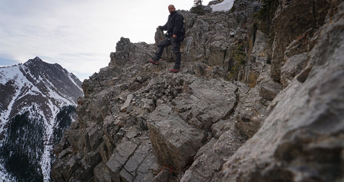
You suddenly find yourself at a crux that requires downclimbing and has a vertical fall to look forward to should you let go. In fairness it is an easy downclimb with plenty of foot and handholds (as you might be able to tell by the fact that I climbed down, set the camera and climbed back up again to get a shot) I cannot stress this part enough, if you fall here there is no coming back so even though it is easy enough, make sure you maintain your focus for this short section.
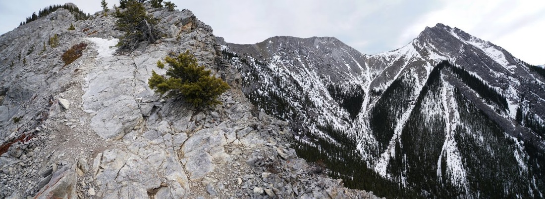
I'm soon leaving the crux behind and heading up the narrowing ridge with my views restricted to the south only, I actually found this part a little trickier than the crux to get onto but it's good going once there.
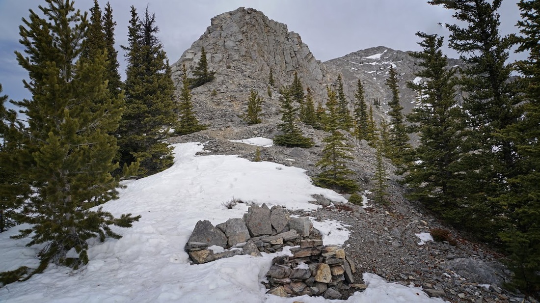
The ridge opens out a little and a scattering of trees try to reinforce the fragile slopes. I can now see the north summit above and between here and there is the top of a huge gendarme just visible over the treeline.
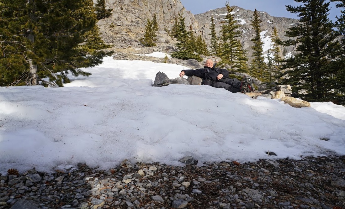
Approaching the gendarme I come across a great stone couch and fireplace and tempting though it is I decided to press on, a small trail leads up to the base of the gendarme so onward and upward it is.
About half way up the gendarme a broken trail leads to the right as far as a lone tree where a left turn directly up the rockface is easily undertaken with an abundance of holds.
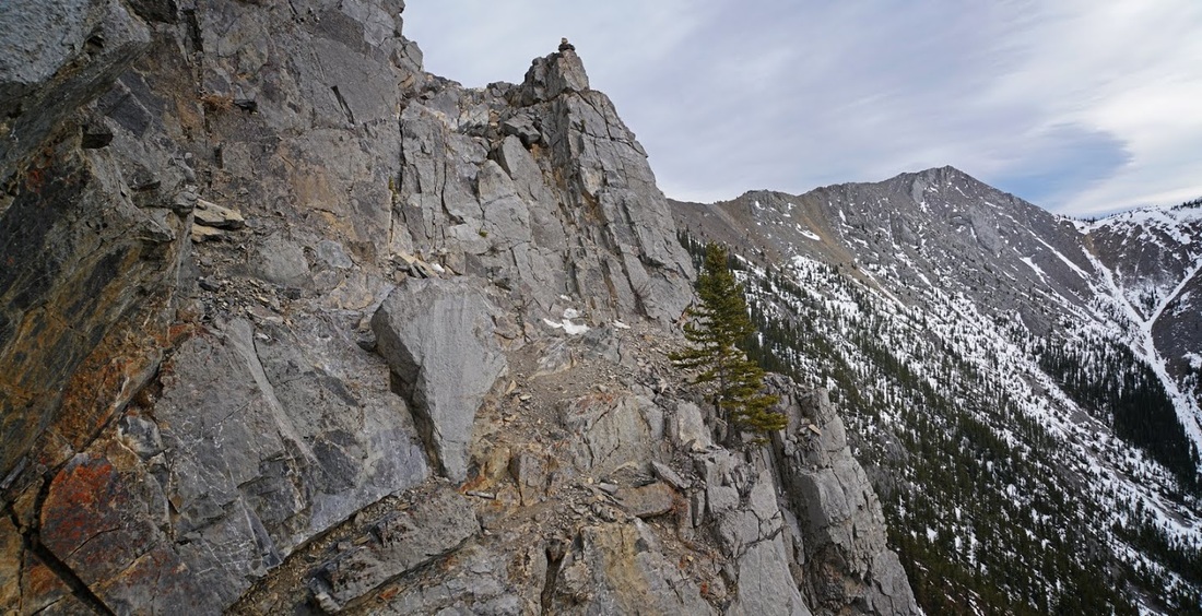
At the top of the short scramble a trail leads off around the southern edge of the gendarme, initially it looks innocuous enough until you realise the gray pathway seems to stop quite abruptly, what actually happens is that it drops suddenly and turns left.

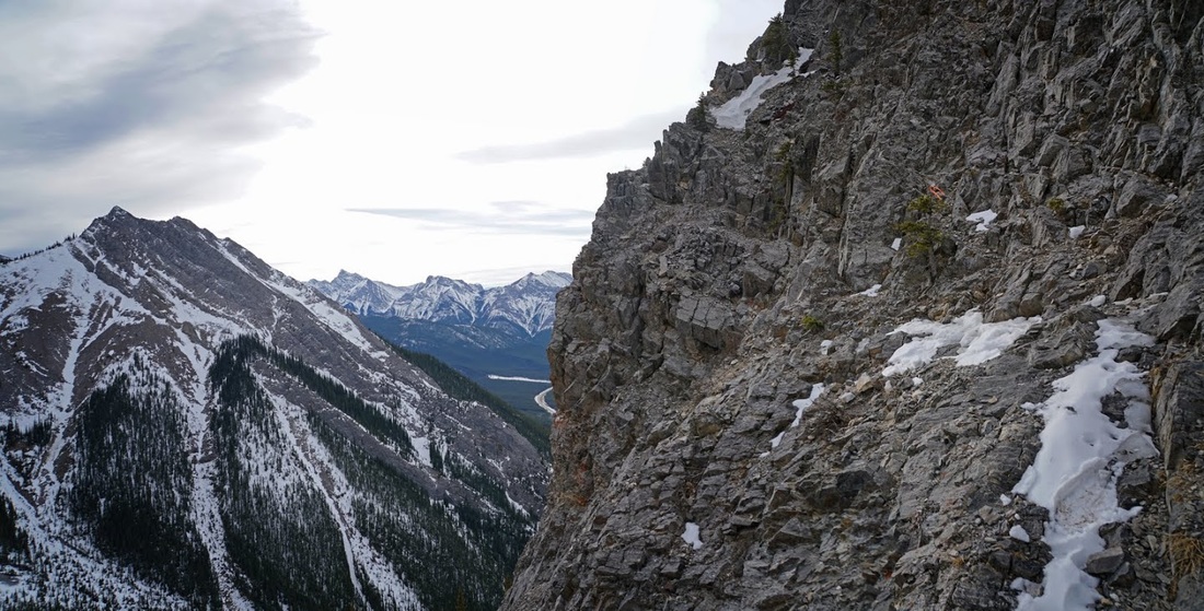
The point where the path disappears leads to this, the path that you see in the previous picture stops at the small flat area seen on the slope in the image below, it is then a matter of traversing the loose rock to the small tree with faded orange flagging and then across the last remaining snow patch.
With the excitement of the central ridge over and done with I can now settle into a long plod on orange scree toward the summit ridge which finally reveals itself ahead.
After the easy scree plod the trail once again turns to a steep climb through rock bands interspersed with loose scree shelves, there are a number of trails leading all over the place here but keeping predominantly left seems to be the right choice.

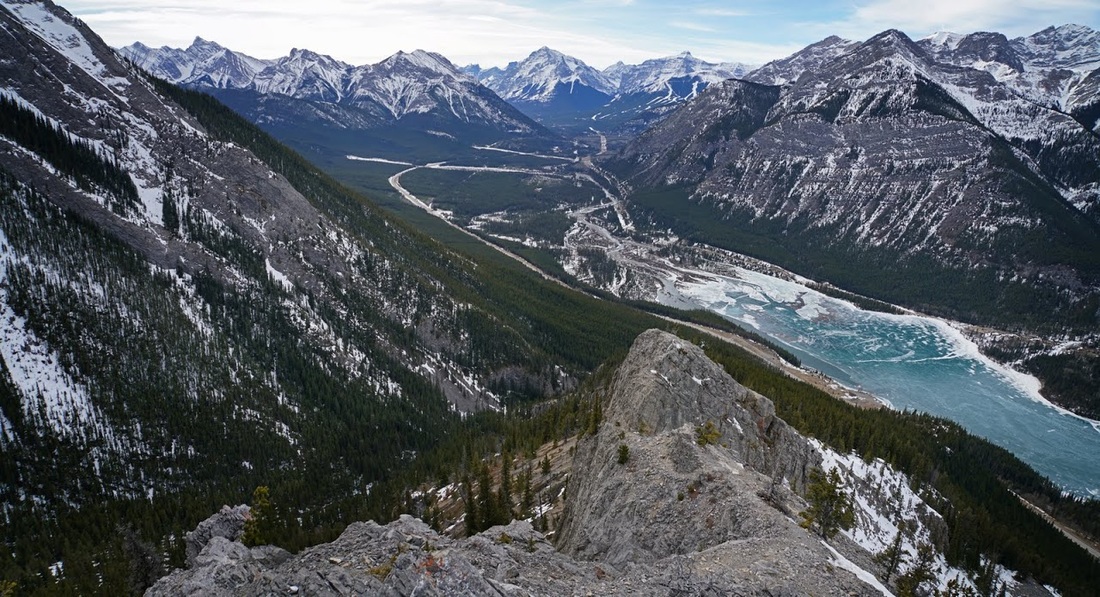
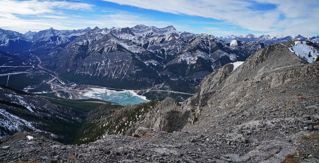
The meandering final ascent is made with some care as the rock steepens and the scree loosens, it's not difficult just one of those areas that needs negotiating rather than just plodding through. Views from here show the edge of the rockies melting into the prairie as if an invisible wall exists between the two.
At last I make the summit ridge and can see over the top toward the east and (though the camera doesn't show it) I can see the skyscrapers of Calgary in the distance.
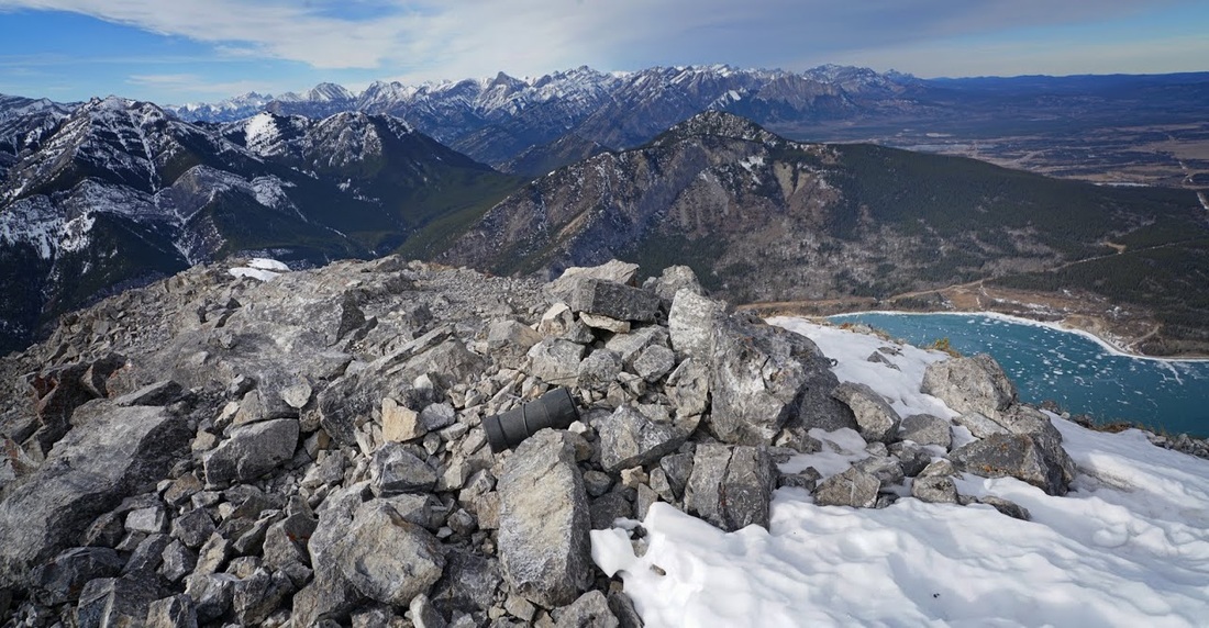
Arriving at the summit I see the usual hard plastic cannister tied down to the cairn bearing the summit register. I open it up and add my usual entry among the hundreds already entered, this appears to be a very popular summit.
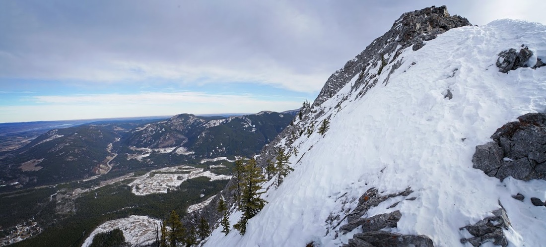
Looking north west along the ascent ridge gives a spectacular view of the front ranges hardly bearing any snow at all, it's hard to believe that is is only early february, these are the levels of snow cover we would normally see in april.
The ridge has a nice long reach so I took myself for a wander along to the top until I reached yet another crux that drops you down to the south ridge leading to the south and west summits visible along that lovely sharp ridge.
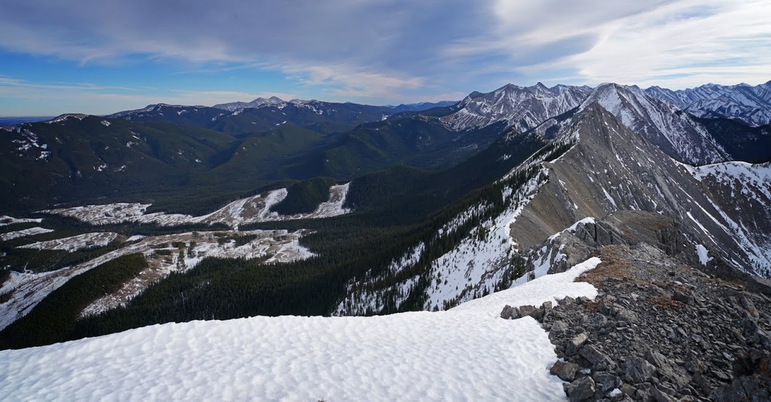
Directly west from here is Mary Barclays Mountain behind the south end of Barrier Lake and to the left of shot is Nakiska ski area which is struggling to maintain snow even on those low north facing slopes. To the right of shot is the ridge back to the main summit and downward is almost all of the ascent route.
To the south east is the south summit of Baldy followed by Midnight Peak (the one that almost got me a couple of years ago) to the left (east) are signs of logging activity in the foothills leading toward Calgary and away on the horizon is the familiar grey of Moose Mountain standing tall.
On my way back to the main summit I found a nice flat area behind a rock mass that provided shelter from the wind which whipped up and over the ridge, this was the lunch spot and time for a 10 minute rest.
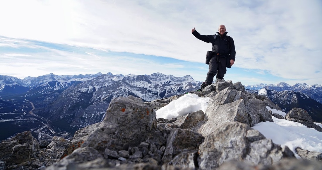
After a few oranges and snack bars I returned to the main summit and fortunately remembered to make a summit 'evidence' shot before starting out on the descent.
Looking down the descent route I found myself just a little concerned about circling that gendarme and reascending the crux with tired legs but ascending is easier than descending so I quickly put the negative thoughts away and got on with it.
Back on the broken trail around the gendarme I managed to set the timer and grab a shot of yours truly at the point where the trial becomes a half decent route once more....then I had to go back for the damn camera again, sometimes being a lone wolf is a pain in the butt.
Credit due to the person/people who built the stone sofa, it's genuinely comfortable. The back slopes away at just the right angle to allow me to put my feet up on the fireplace. After another snack break I found it hard to drag myself away and get down to the crux for the final real scramble of the day.
I stopped for one last shot of the Kananaskis valley beyond that evil looking crux before making the descent and reascent, I have to say the ascent of the crux was really easy and it was over in no time at all...but it sure makes you think when you look down.

So that was another look at Mt Baldy, this time from the north. I really enjoyed this one even though it is short, it has some great scrambling and some nice little adrenalin triggers along the way. Maybe I'll come back in summer and make the north south traverse and if this weather continues it will be summer by march.