
Canada - Feeling the heat on Porcupine Ridge
Where does the time go? It's hard to believe my last posted hike was 2 months ago. A lovely family visit from my son, daughter in law and grandson accounts for a couple of weeks, then there is the usual melancholy period that follows when they go home, a period where it's difficult to get interested in much at all. I did a lot of mountain biking and made a few local hikes that failed to lift the mood so decided on a short road trip to blow off the cobwebs. After a week roaming our neighbouring province of British Columbia and getting some great shots of my first bear of the year I began this week with the spirits lifted.
As the temperatures soared again to a record setting 27C I made my way out to Porcupine Ridge just off highway 40 in Kananaskis Country. To locate the off road parking, take highway 40 south for 25km from junction 118 of the Trans-Canada highway, at the 25km mark a small dirt trail leads off the east side of the road a short distance to a parking area.
After calling my brother to wish him happy birthday I meandered off, finally arriving at the trailhead around lunchtime (there's no need to hurry now as sunset is well past 9pm) The downside of the late start is the heat of the sun which, on exiting the truck, was already hot enough for me and still a few hours from it's peak.
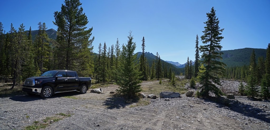
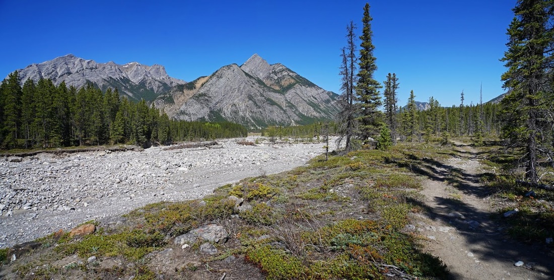
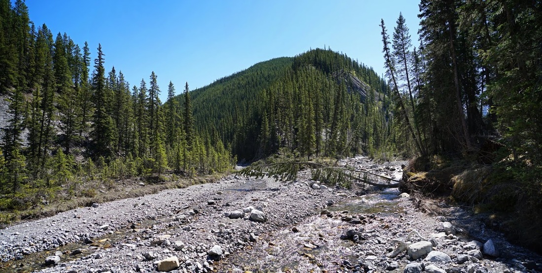
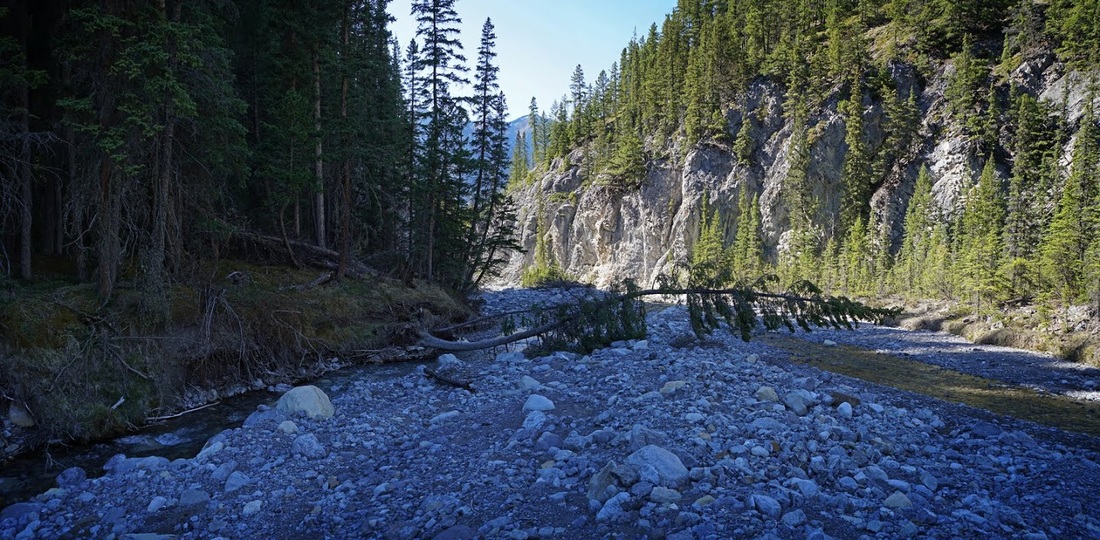
Even with the oppressive heat it felt good to be back in the mountains and I took my time 'booting up' as I sat on the tailgate soaking in the scenery. The early part of the hike is made alongside Porcupine Creek which is a tiny little body of water running along in the void created by the floods of 2013. It's good going on hard flat ground and I'm soon looking back at the sandstone bars of Mt Lorette guarding the parking area.
The creek gradually narrows and squeezes into a canyon where a slight breeze picks up a little of the cool air from the creek and brushes it across exposed areas bringing some relief from the heat of the day.
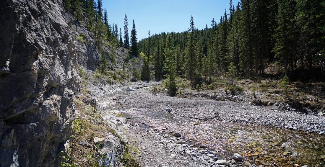
The creek meanders along swinging left and right and requiring numerous crossings along the way as the walls close in beside the water. It's no problem to cross as the creek is narrow and bears plenty of boulders at midway points, the shade on the east side is so wonderfully cool it becomes a chore to leave it and cross back to the west when required.
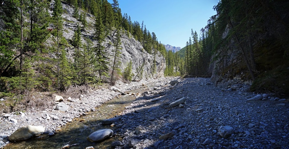
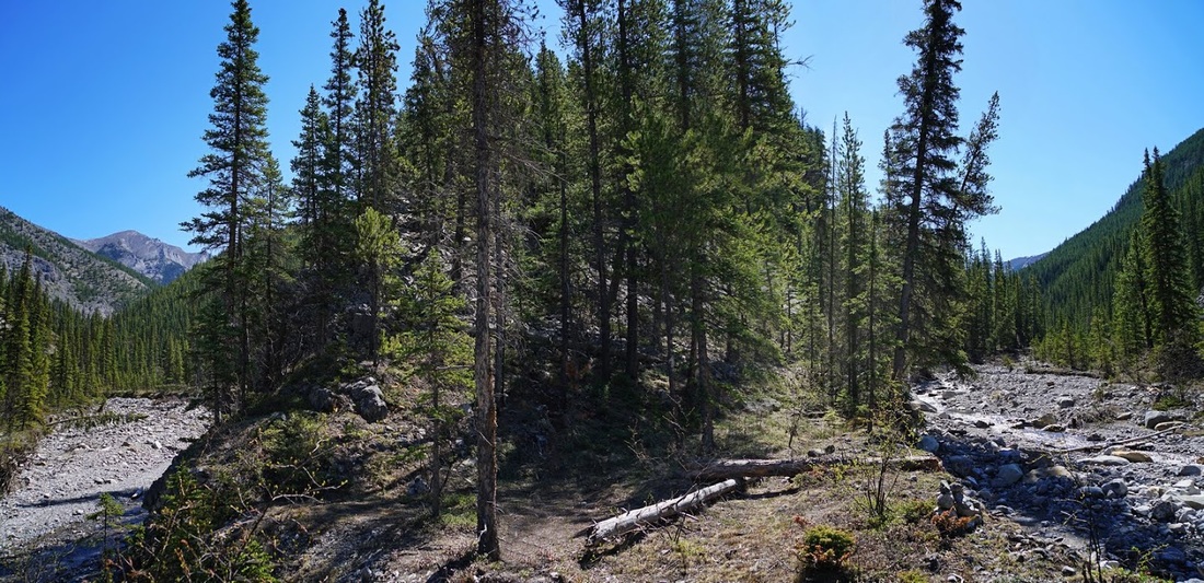
Eventually I reach the split in the creek where the north and south forks meet as they round the ridge I'm seeking today. I first came here in winter and with no trail to follow couldn't find the 'obvious path' referred to in my guide book (though the scene is now much changed due to the floods of 2013) I walked too far on the south fork that day and left myself a really hard scramble as a result.
With the trees and surrounding vegetation washed away by the floods the route is now easy to find and though not 'well trodden' it remains obvious and very direct as it rises up the end of the ridge without a single switchback to ease the burden.
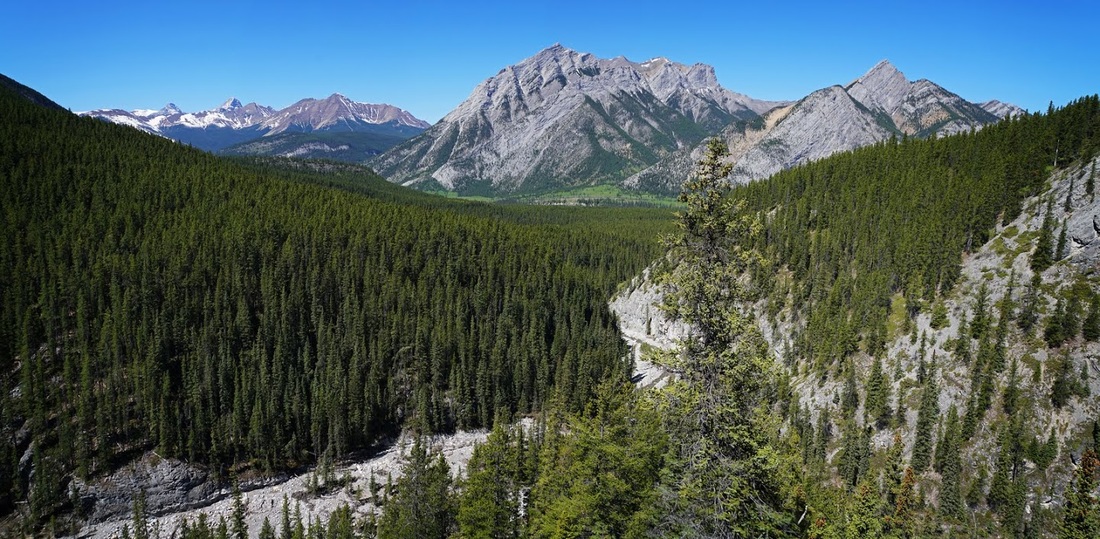
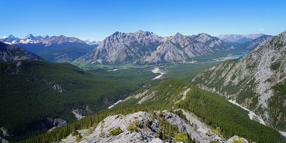
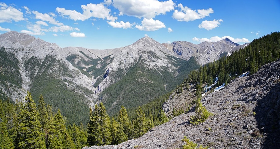
The only upside of that wicked direct ascent is the fact that I am very quickly high enough to look down on the creek below and across the canyon to Mt Lorette and Skogan Peak
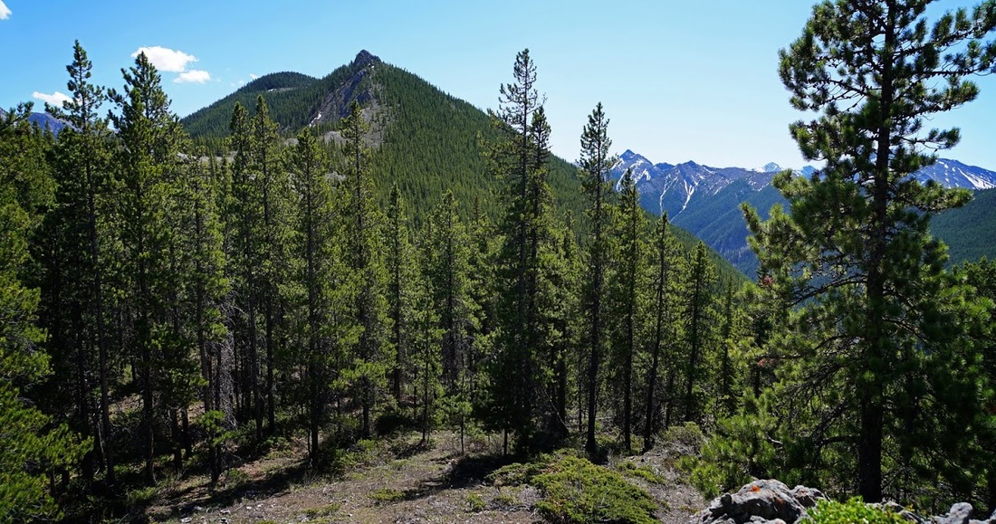
After that steep initial ascent it's nice to hit a more gentle undulating ridge with forested tops that provide some welcome shade as the mercury rises still further. The early part of the route ahead is now obvious, a short hop through forest to the exposed rocky ridge then an open section to the pinnacle rising above the forest.
It is not as gentle an ascent to the top of the pinnacle as it first appears and the heat of the day really starts to sap my energy. I'm not a sun worshipper, don't get me wrong I like a bright clear day but if it stayed at 5C permanently it would suit me just fine.
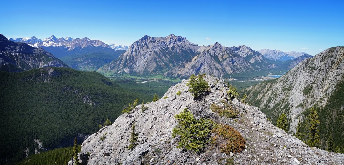
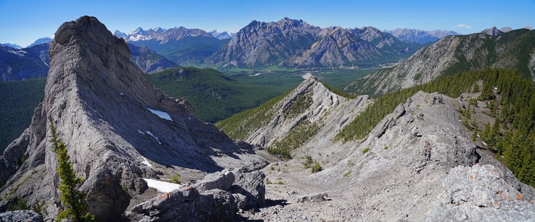
at the top of the pinnacle is a narrow flat pathway beside a steep rockwall that affords views forward to the east and to the right (south) to Wasootch Ridge and beyond. The final pinnacles are now visible ahead though a descent back into forest is required to reach them.
I seriously considered calling it a day at this point, the thought of that descent and reascent to reach the final pinnacles didn't do much for me I must confess. I even took a 'final' summit shot looking over Wasootch Ridge and the multiple tops of Mt McDougall beyond.

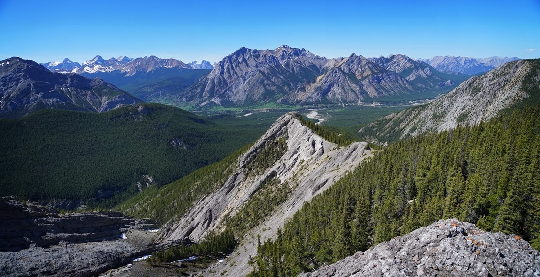
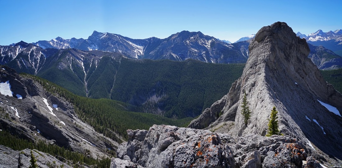
I took a few minutes rest for the first time today and soaked up those wonderful views. The light green spring growth in the valley below punctured by those towering grey summits one after another is something quite extraordinary. The blue waters of Barrier Lake peeking around the corner on the right and the last remnants of snow clinging to the tallest peaks on the left complete the scene perfectly.
The rest must have done me some good as I made the easy scramble down to the col, crossed back into forest and reascended to the ridge beyond and soon found myself looking back over the open ridge and now distant little summit.
To the north I think I can see a route along the north fork of Porcupine Creek and up through a long run-off to Mt Bryant 4, this is very interesting for me as I've not yet climbed any of the widely spread summits of Mt Bryant, this is another one to add to my list.
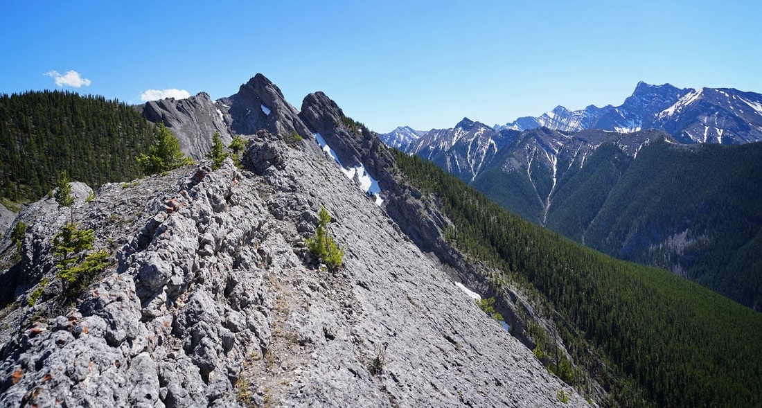
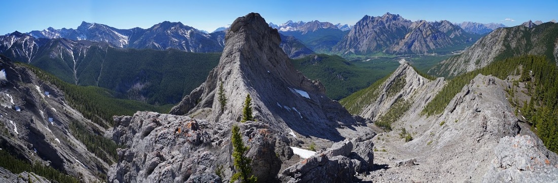
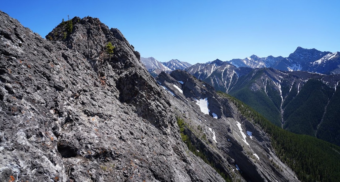
As I make the final ridge it is a really enjoyable gnarly rock hike that requires repeated easy scrambles to make the steps along the way. The first large pinnacle is not accessible without climbing gear, there is a tasty little ridge leading across to it which I went over to check for access but (though this image doesn't show it well) the vertical at the end of the ridge holds too much risk for unsecured scrambling.
To the left of the pinnacle (east side) is a long drop off that appears to prevent a sneak round the back approach so from my perspective that's it for this one.
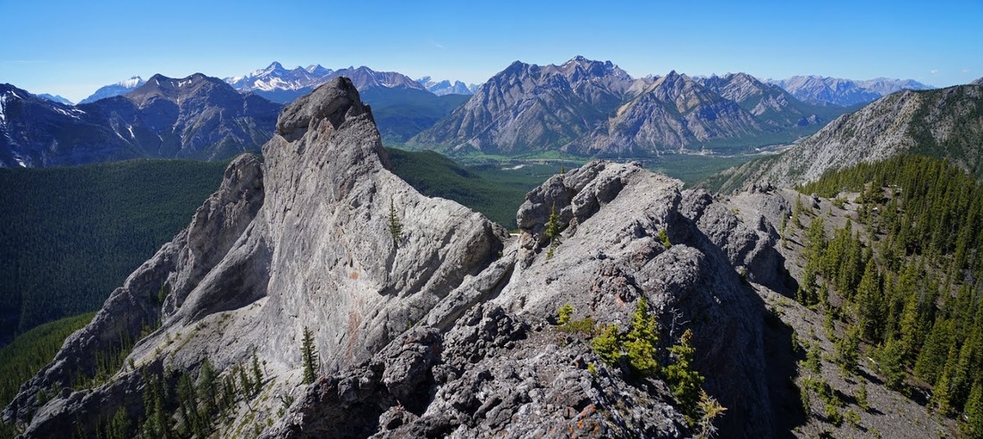
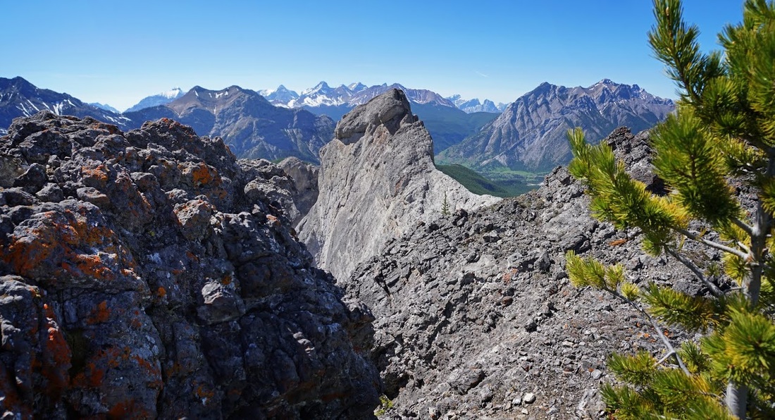
The previous 2 images stitched together give a nice indication of the wonderful view I had from this point.
The ridge does continue on a little further so I decide to keep going on to the high point there. The decision was made mainly because it involves some more easy scrambling with a little exposure thrown in.
After enjoying the scramble I am now at the end of the line looking back over to that first pinnacle where you can clearly see the overhang and vertical climb that makes it unwise to attempt without ropes.
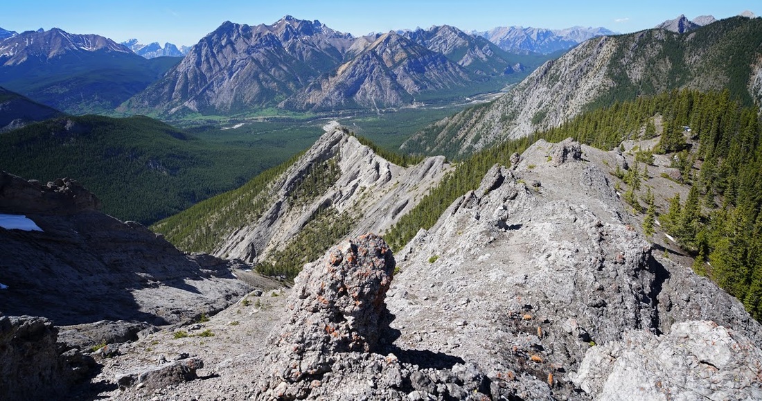
I found myself a nice 'tuck in' spot with a bit of shade where I could take a long rest out of the sunshine. When I got up to leave I was struck again by just how beautiful it is in Kananaskis. The seemingly endless mountains disappearing over the horizon are a spectacle I will never grow tired of seeing.
Eventually I have to call it a day and head back down, from here I can see the route back to the trailhead. I confess I'm absolutely drained, probably a combination of heat and lack of hill fitness but whatever it is the route home looks a long way today.
It really did feel like a very long walk to the cool air in the canyon holding the south fork of Porcupine Creek and once there I found myself slumping down on a cold rock and taking another long break even though I am now close to the trailhead.
Back at the truck I sat on the tailgate and removed the boots and socks, dangling my bare feet off the back of the tailgate never felt so good. This really did feel like hard work today but enjoyable all the same, and I have to say it felt good to be back out there.
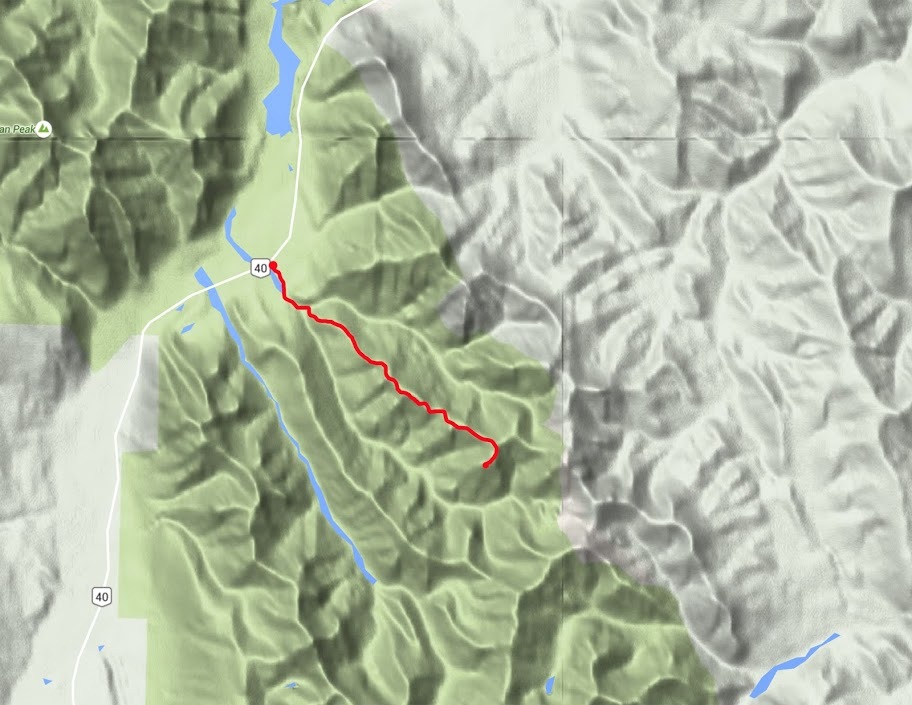
As the temperatures soared again to a record setting 27C I made my way out to Porcupine Ridge just off highway 40 in Kananaskis Country. To locate the off road parking, take highway 40 south for 25km from junction 118 of the Trans-Canada highway, at the 25km mark a small dirt trail leads off the east side of the road a short distance to a parking area.
After calling my brother to wish him happy birthday I meandered off, finally arriving at the trailhead around lunchtime (there's no need to hurry now as sunset is well past 9pm) The downside of the late start is the heat of the sun which, on exiting the truck, was already hot enough for me and still a few hours from it's peak.
Even with the oppressive heat it felt good to be back in the mountains and I took my time 'booting up' as I sat on the tailgate soaking in the scenery. The early part of the hike is made alongside Porcupine Creek which is a tiny little body of water running along in the void created by the floods of 2013. It's good going on hard flat ground and I'm soon looking back at the sandstone bars of Mt Lorette guarding the parking area.
The creek gradually narrows and squeezes into a canyon where a slight breeze picks up a little of the cool air from the creek and brushes it across exposed areas bringing some relief from the heat of the day.
The creek meanders along swinging left and right and requiring numerous crossings along the way as the walls close in beside the water. It's no problem to cross as the creek is narrow and bears plenty of boulders at midway points, the shade on the east side is so wonderfully cool it becomes a chore to leave it and cross back to the west when required.
Eventually I reach the split in the creek where the north and south forks meet as they round the ridge I'm seeking today. I first came here in winter and with no trail to follow couldn't find the 'obvious path' referred to in my guide book (though the scene is now much changed due to the floods of 2013) I walked too far on the south fork that day and left myself a really hard scramble as a result.
With the trees and surrounding vegetation washed away by the floods the route is now easy to find and though not 'well trodden' it remains obvious and very direct as it rises up the end of the ridge without a single switchback to ease the burden.
The only upside of that wicked direct ascent is the fact that I am very quickly high enough to look down on the creek below and across the canyon to Mt Lorette and Skogan Peak
After that steep initial ascent it's nice to hit a more gentle undulating ridge with forested tops that provide some welcome shade as the mercury rises still further. The early part of the route ahead is now obvious, a short hop through forest to the exposed rocky ridge then an open section to the pinnacle rising above the forest.
It is not as gentle an ascent to the top of the pinnacle as it first appears and the heat of the day really starts to sap my energy. I'm not a sun worshipper, don't get me wrong I like a bright clear day but if it stayed at 5C permanently it would suit me just fine.
at the top of the pinnacle is a narrow flat pathway beside a steep rockwall that affords views forward to the east and to the right (south) to Wasootch Ridge and beyond. The final pinnacles are now visible ahead though a descent back into forest is required to reach them.
I seriously considered calling it a day at this point, the thought of that descent and reascent to reach the final pinnacles didn't do much for me I must confess. I even took a 'final' summit shot looking over Wasootch Ridge and the multiple tops of Mt McDougall beyond.
I took a few minutes rest for the first time today and soaked up those wonderful views. The light green spring growth in the valley below punctured by those towering grey summits one after another is something quite extraordinary. The blue waters of Barrier Lake peeking around the corner on the right and the last remnants of snow clinging to the tallest peaks on the left complete the scene perfectly.
The rest must have done me some good as I made the easy scramble down to the col, crossed back into forest and reascended to the ridge beyond and soon found myself looking back over the open ridge and now distant little summit.
To the north I think I can see a route along the north fork of Porcupine Creek and up through a long run-off to Mt Bryant 4, this is very interesting for me as I've not yet climbed any of the widely spread summits of Mt Bryant, this is another one to add to my list.
As I make the final ridge it is a really enjoyable gnarly rock hike that requires repeated easy scrambles to make the steps along the way. The first large pinnacle is not accessible without climbing gear, there is a tasty little ridge leading across to it which I went over to check for access but (though this image doesn't show it well) the vertical at the end of the ridge holds too much risk for unsecured scrambling.
To the left of the pinnacle (east side) is a long drop off that appears to prevent a sneak round the back approach so from my perspective that's it for this one.
The previous 2 images stitched together give a nice indication of the wonderful view I had from this point.
The ridge does continue on a little further so I decide to keep going on to the high point there. The decision was made mainly because it involves some more easy scrambling with a little exposure thrown in.
After enjoying the scramble I am now at the end of the line looking back over to that first pinnacle where you can clearly see the overhang and vertical climb that makes it unwise to attempt without ropes.
I found myself a nice 'tuck in' spot with a bit of shade where I could take a long rest out of the sunshine. When I got up to leave I was struck again by just how beautiful it is in Kananaskis. The seemingly endless mountains disappearing over the horizon are a spectacle I will never grow tired of seeing.
Eventually I have to call it a day and head back down, from here I can see the route back to the trailhead. I confess I'm absolutely drained, probably a combination of heat and lack of hill fitness but whatever it is the route home looks a long way today.
It really did feel like a very long walk to the cool air in the canyon holding the south fork of Porcupine Creek and once there I found myself slumping down on a cold rock and taking another long break even though I am now close to the trailhead.
Back at the truck I sat on the tailgate and removed the boots and socks, dangling my bare feet off the back of the tailgate never felt so good. This really did feel like hard work today but enjoyable all the same, and I have to say it felt good to be back out there.