free to be able to rate and comment on reports (as well as access 1:25000 mapping).
For those familiar with hiking, the West Coast Trail needs little introduction. Repeatedly rated by hiking guides as one of the world's top trails it is a 'bucket list' item for many. The trail was constructed in 1907 to facilitate the rescue of shipwreck survivors from the 'graveyard of the pacific' and at that time was called the Dominion Lifesaving Trail. It is only 75km long so in terms of long distance hiking routes it would be very low on the list, but has a reputation that far exceeds numbers alone. The hike is usually undertaken in 6 to 8 days with overnight camping on pristine beaches along the way. Wildlife viewing includes the usual Canadian staples of bear, cougar, wolves and eagles but also has the additional attraction of orcas, whales, sea lions and sea otters. There's also the bonus of 5 human powered cable cars at certain river crossings, it's easy to see why so many people would want to make this spectacular journey.
As an avid hiker visiting Vancouver Island for a week long holiday with Sarah I was not going to miss the opportunity to walk a section of this legendary trail, so I buffered in an additional day at the start of the holiday to achieve that goal. As I was driving from home to the island it was easy enough to take an extra day before Sarah flew in.
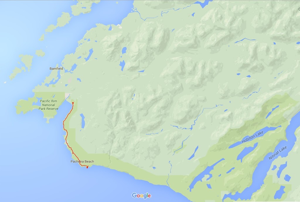
Access to my chosen trailhead was at the northern end of the trail in Pachena Bay which is one of only 3 access points to the WCT, permits are required to make the hike I chose Pachena Bay because it can be accessed by personal vehicle. It was my hope to leave the truck there and take a hikers bus 25 km down the trail and walk back. I booked a hotel in Port Alberni (2 hours north east of the trailhead) and set out early in the morning to make the journey to the trailhead. The route to Pachena Bay is a long, narrow, winding logging trail strewn with debris and potholes which is a bit of a nightmare of a journey to be honest though it does add to the 'wilderness feel'.
Unfortunately I was only 20 minutes along the gruelling logging road that leads west when I got a tyre pressure warning, I hoped it was one of those 2 psi difference things that sometimes causes an indication but a quick look showed I had a puncture. I contemplated changing to the spare and continuing but that would leave me a huge distance there and back without a spare should another puncture occur (the road suggested this was a very real possibility) I decided to make a dash back to Port Alberni where I reached 'Kal Tire' with about 10 psi remaining. It was a miserable start to the day to say the least but the guys at 'Kal Tire' rectified that by repairing the puncture in good time and then saying it was completely free and that they hoped I had a good time on the island. Imagine that, they knew I was from out of the province and would not be a regular customer so there was no win in it for them, they didn't try to sell me a new tyre or spin any bull or simply gouge me as one might expect in such circumstances, they just carried out a repair, sealed the tyre and sent me on my way free of charge, it really got the day back on track.
Unfortunately the delay meant I wouldn't be making the hikers bus so an 'out and back' was now all I had. I got back on the dire Franklin River Rd and made up as much time as possible between logging trucks and landslides but to no avail. I finally arrived at Pacific Rim National Park just south of Bamfield and parked in the heavily wooded parking area. Beside me a German guy was just about to set off and I had a quick chat with him and took a couple of photo's for him (with his camera) before he headed out.
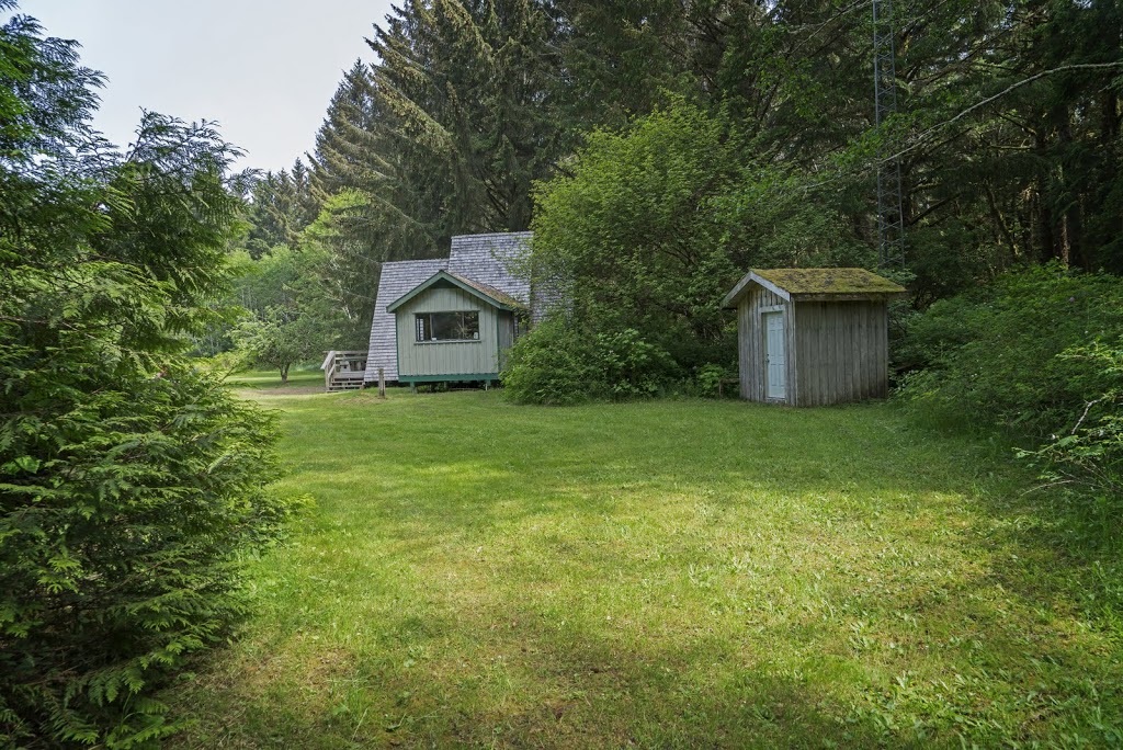
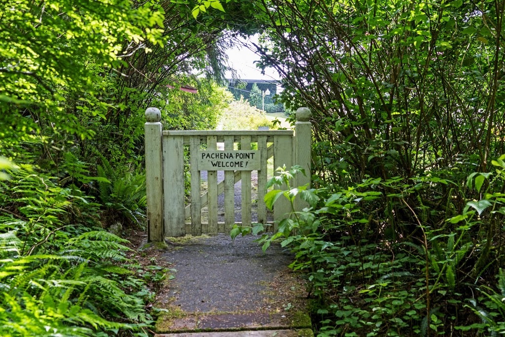
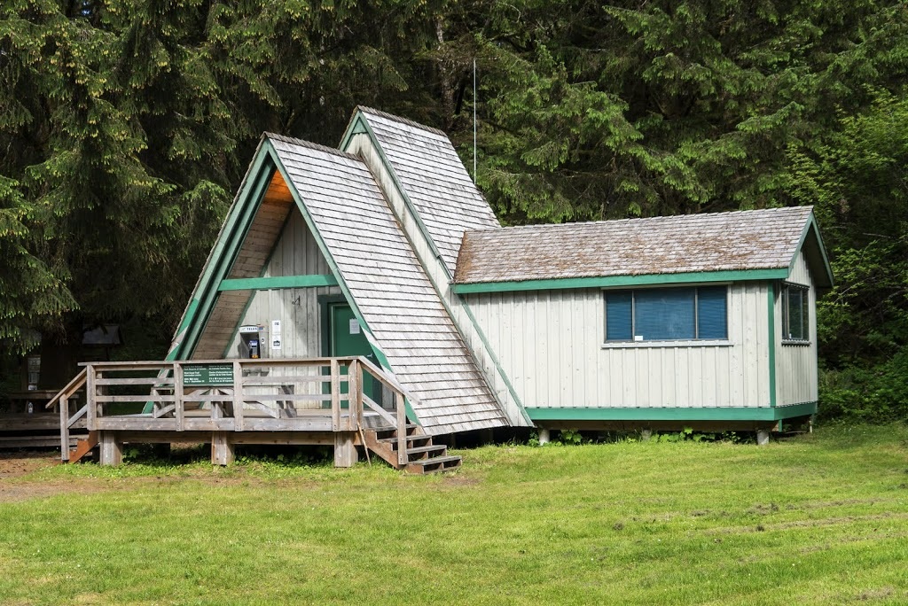
Finally suited and booted I selected a place on the map as my target, Pachena Point Lighthouse was about 10 km away, perfect for a day hike so that was that. Leaving the car park a trail leads to a ranger cabin where registration is required, once that was all done I finally got away around 10 am, not great from a 6 am start but at least I'm here and starting out looking and back at the ranger cabin.
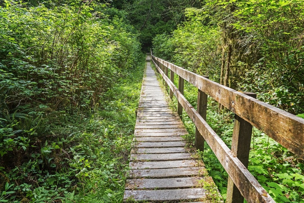
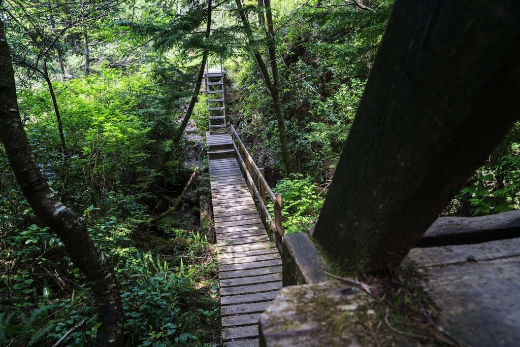
The trail is very easy going at the start and all creek crossings are made on well constructed boardwalks, many of which bear small metal plates with 'British Army Royal Engineers' insignia and mention of the training exercises in with the structures were constructed.
The early part of the hike can be varied if the tide conditions are right allowing a saving of some ascent but not distance, today however the tide was too far in, which effectively closed out that opportunity. The ranger explained that on the way out I should detour onto the beach to avoid doing 'the ladders' again.
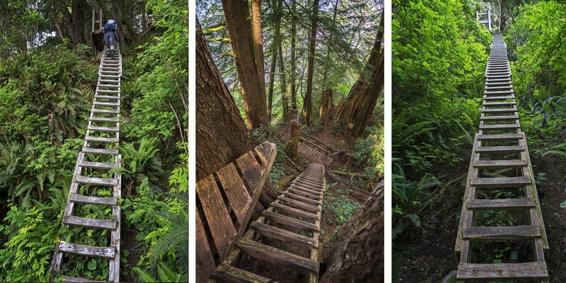
'The Ladders' are a series of steep cedar ladders that allow access to the trail when the tide is in, the ascent is easy enough though the construction is somewhat haphazard in places. They are quite long and steep so when a group of weary people are descending after 6 days on the trail it can be a bit of a wait at the bottom but does help show scale. There are a few ladders, some with a small landing followed immediately by another ladder, and some single ones.
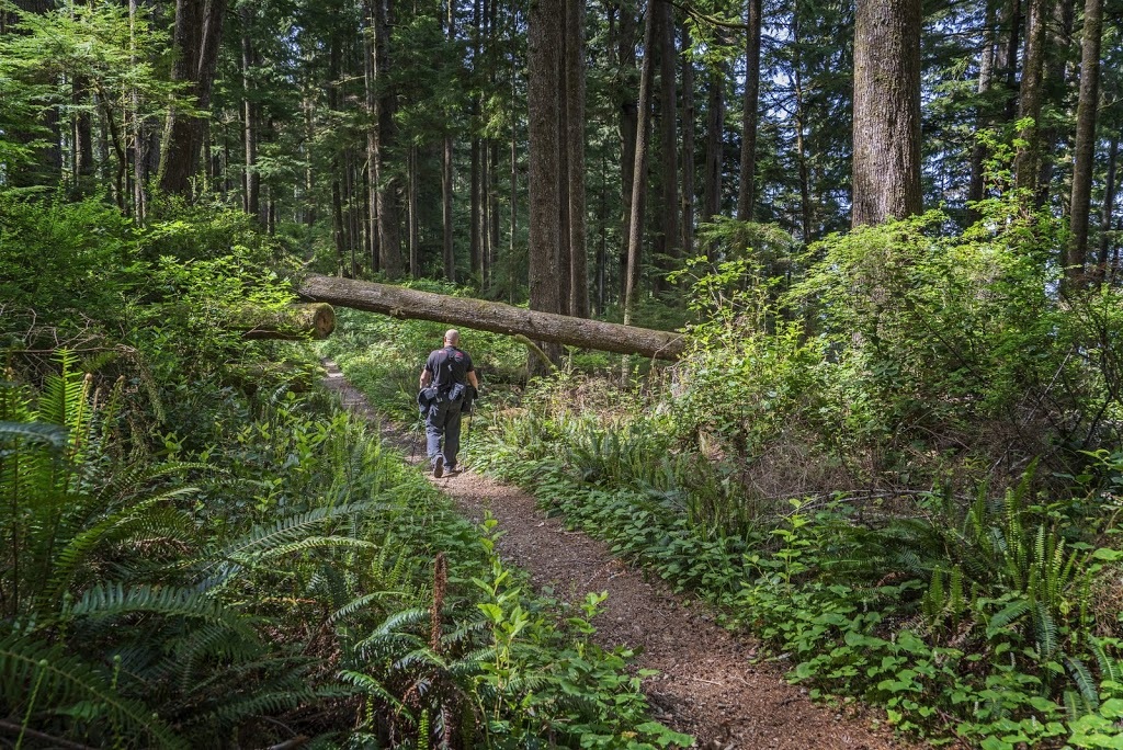
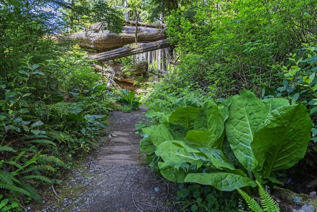
After the ladders comes a short roam through dense forest on a trail that winds it's way around various fallen trees and their huge stumps with root systems still attached.
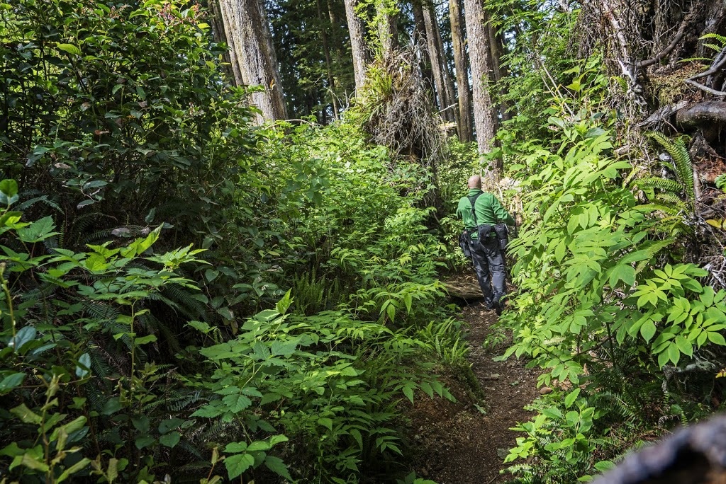
The heavily obstructed section soon ends and I reach a very well trodden route which stays like this virtually all the way to the lighthouse, where obstructions have fallen across the trail they have been cleared so hardly a bend in the back is needed to pass.
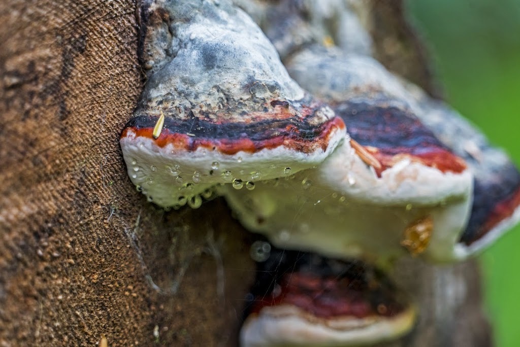
The going feels incredibly easy for me, the wonderful humid air is so welcome after the parched prairies and the availability of oxygen means I feel like I could run this entire route, but instead I find myself stopping to admire the dew covered tree fungus along the way.
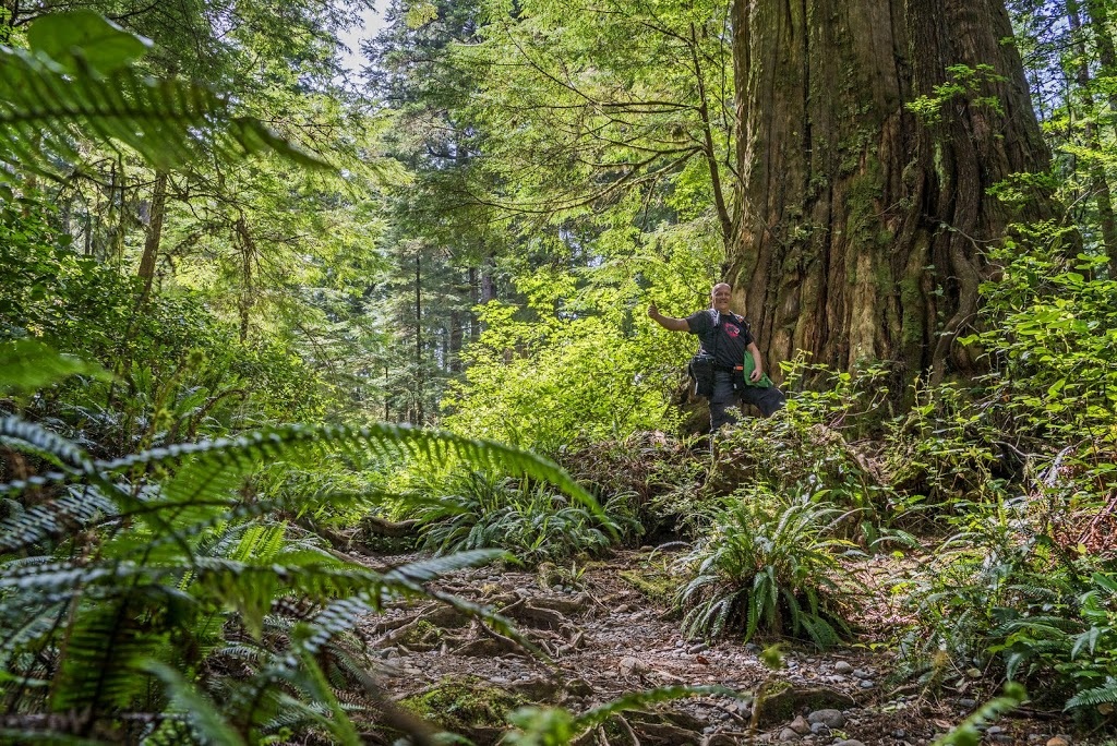
There are some similarities with this hike and the giant redwoods hike I undertook close to Crescent City California, though these cedars don't reach the circumference of the redwoods on the California coast they are still impressively huge and allow other trees to flourish around them which makes for a spectacular forest overall.
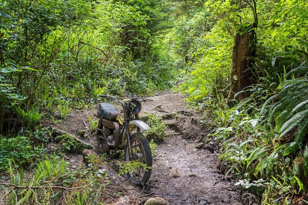
After a few km's I came across my German friend who was already sat resting with some of the contents of his pack strewn around him. We talked a little more and he said how this was a dream come true for him but he didn't realise just how much the extra weight in the pack would slow him. After a brief chat I said goodbye again and wandered on, when I found this bike on the trail I mulled for a moment if his german ingenuity would come to the fore and I'd see him whizz past me on it shortly.
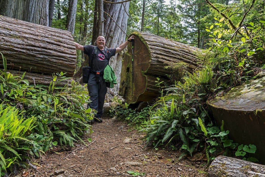
All along the trail are huge trees flattened by a storm in the winter of 2006/7 which saw 3000 trees felled and many of the bridges and cable cars destroyed, fortunately that's all repaired now and the remnants make for nice posing spots.
There is an abundance of foliage all across the forest and everything seems so lush and green, coming here directly from a winter in Kananaskis really shows the difference between our fir forests and the old growth beauty of the west coast.

A good number of the creek crossings incorporate a bridge/ladder combination some of which seem downright unnecessary, perhaps there was a feeling of repetition and someone thought variety might help.
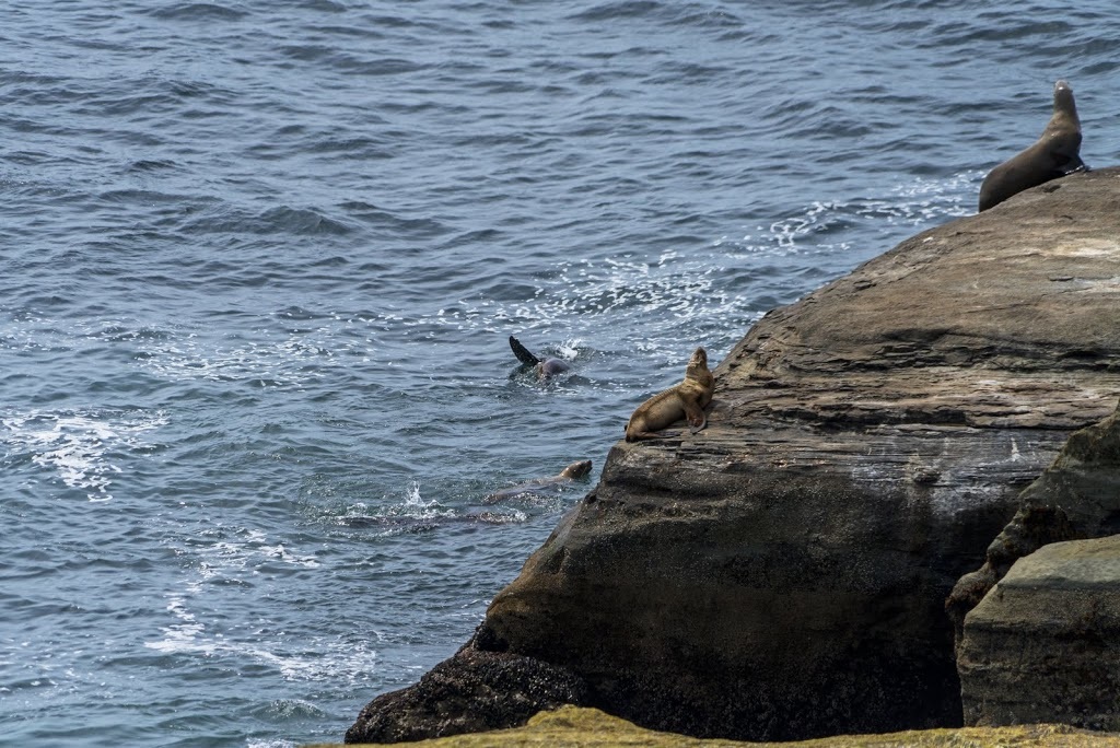
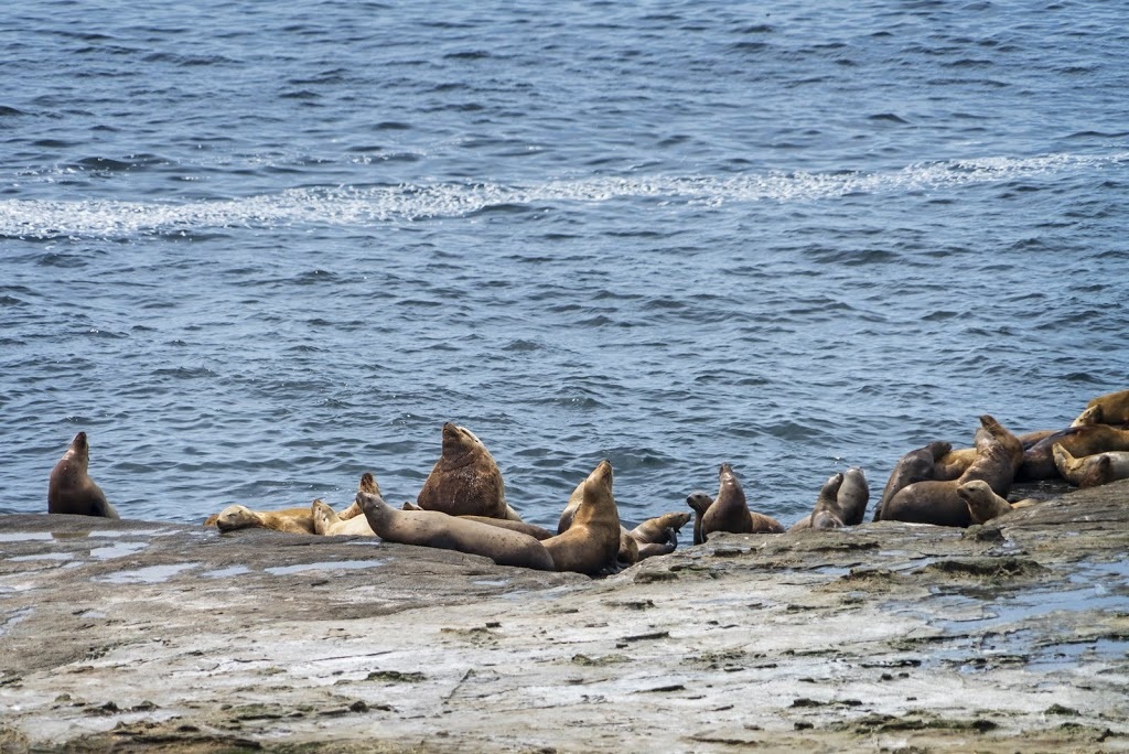
Around the 9km mark I could hear sea lions barking away on the coast so a small detour on a trail clearly made by others who heard the same, led me to an opening where a colony was basking on the rocky shore, I confess the steepness of the ascent they would make out of the ocean surprised me.
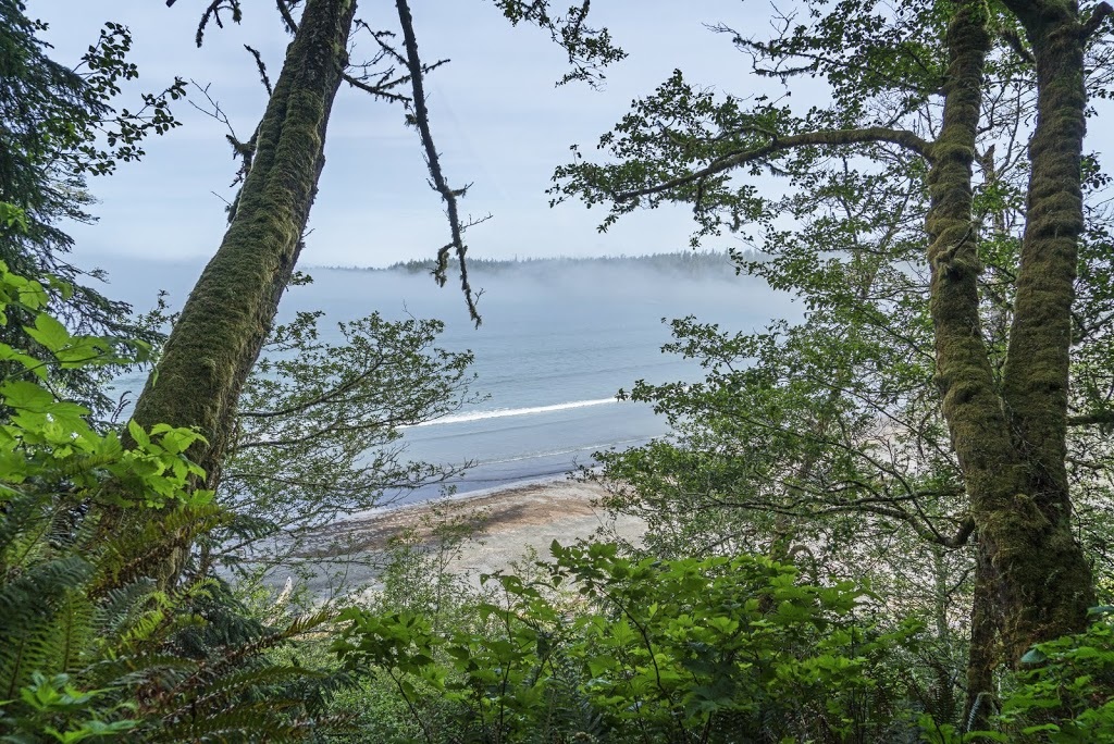
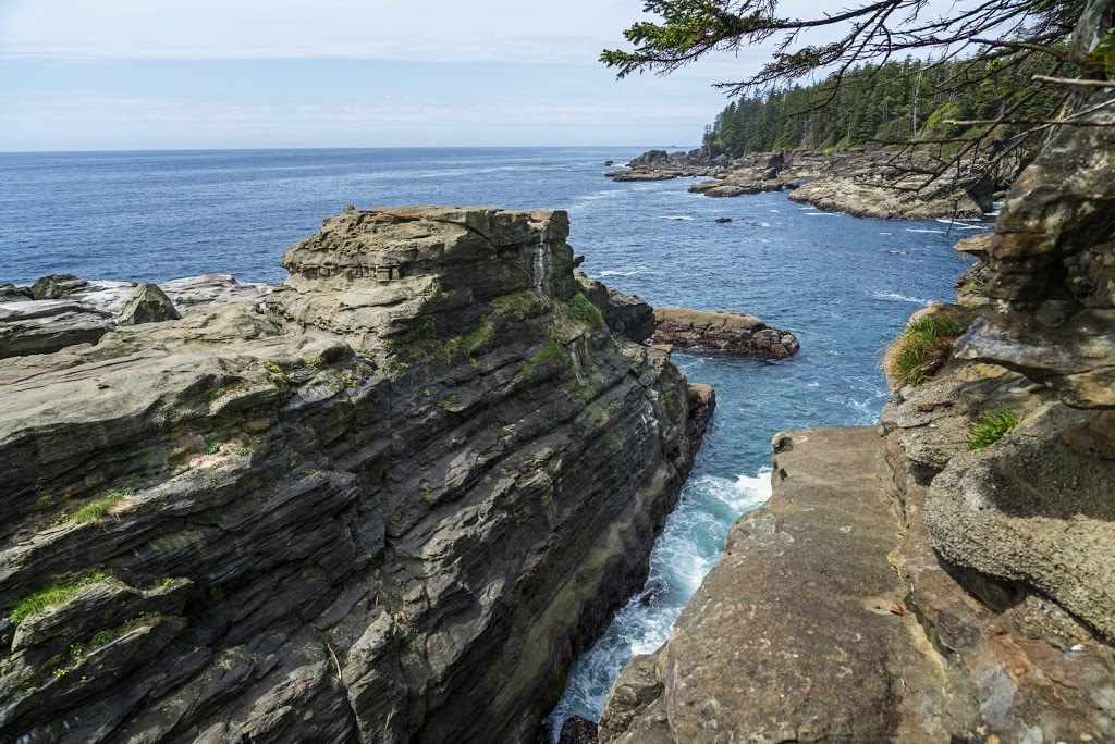
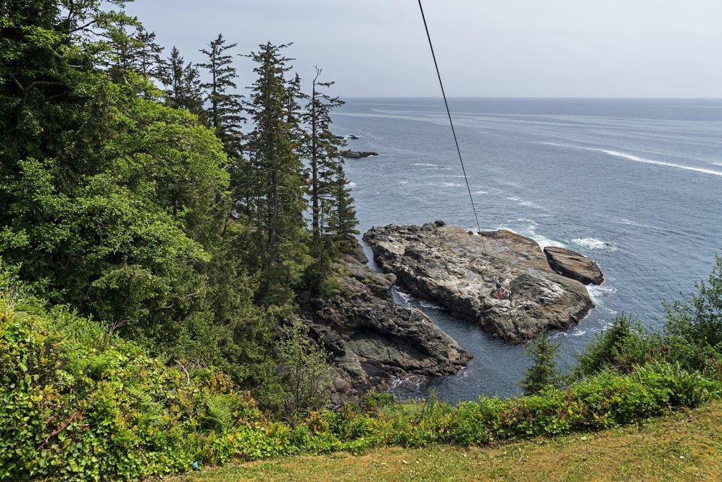
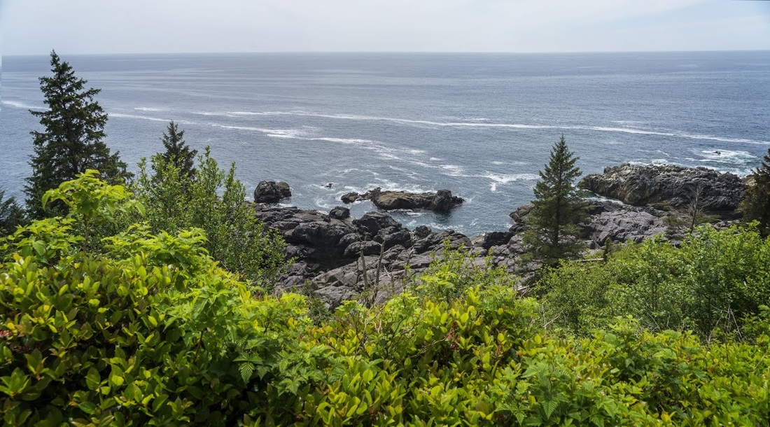
The coastline is a constant variety of coves and inlets stacked high with rocky outcrops meaning the sounds of the pacific hammering the shore are a constant when close to the cliff tops, but within the forest just a few metres back the sound is gone entirely leaving an incredibly tranquil environment in which to wander.
I found it strange that after 10km in the heat and humidity of the forest I arrived at at Pachena Point feeling fresh, the added oxygen at sea level is such a bonus.
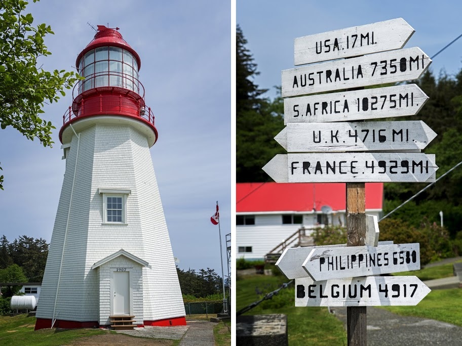
The lightstation is still a family home with a beautiful house and gardens set back from the 100ft cliffs. The name Pachena comes from the First Nation Pacheedaht Tribe and translates as 'foam on the rocks'
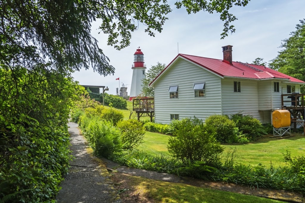
The lightstation has four huge diesel tanks set back into the trees on the left and a long supply cable reaching down to the pacific where a resupply vessel ensures the needs of the family are constantly met.
The lighthouse was completed in 1907 and recently restored, in fact until April 2016 it was surrounded by scaffolding so I was very fortunate to get the timing just right giving me a view of the newly restored structure. There is also a sign here to remind me that I'm just 4716 miles from home.
The view from the lighthouse is (as you would expect) one of open ocean, as an englishman it does my heart good to be close to the sea again, I live in a beautiful place but it is so far from the cost it leaves me longing for a little oceanside at times.
I only spent about 10 minutes at Pachena Point before returning to the trail to head back. After 4 km I came across my german friend once more. He had a little stove out and was cooking up some food right by the trail so I sat with him a while and he told me he already realised he was hauling too much gear but he was still going to make it by just adding another day to his target, I wished him well before continuing.
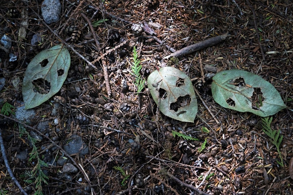
My hike out was even more enjoyable than the hike in, I took my time to enjoy the forest and just being here on the west coast trail, I even had time to wonder what these leaves had died of, there were hundreds of them like this....I don't know what killed them but it looks like they were terrified first.
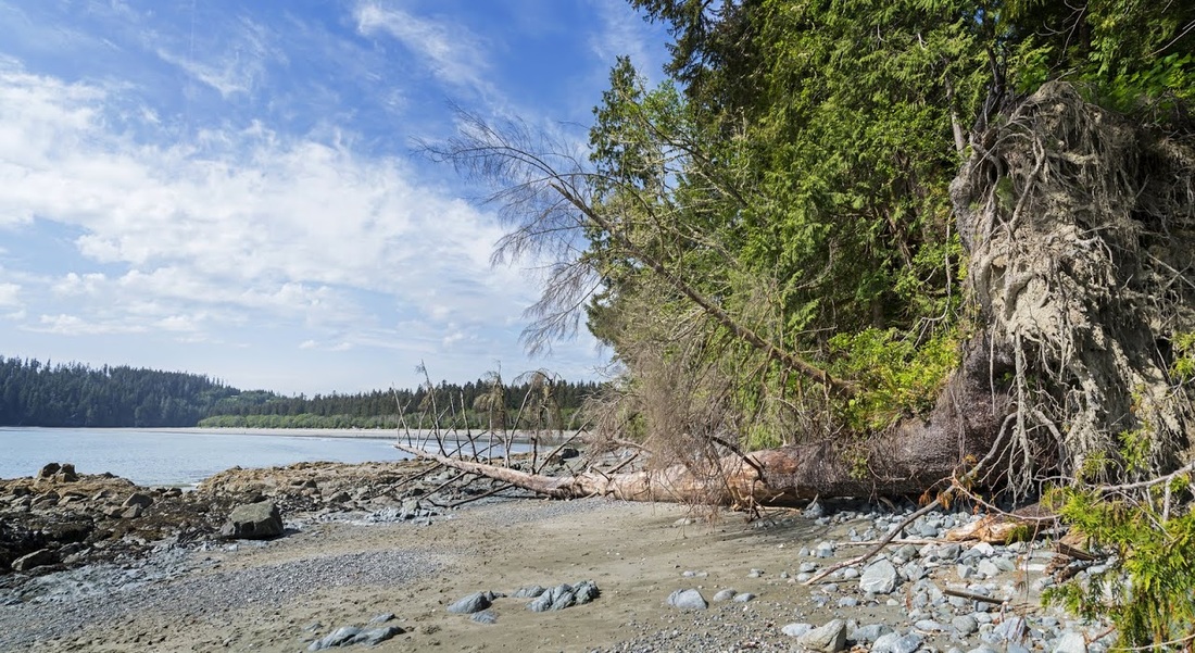
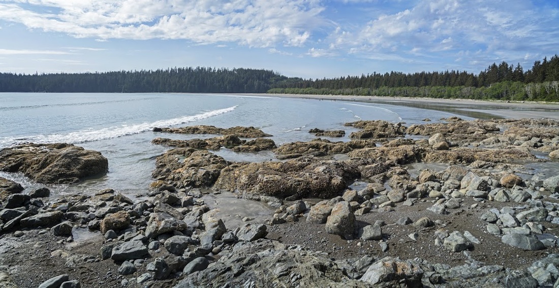
Before I reached the ladders again I broke off the trail to the beach area where I could circumnavigate the rocks now the tide had fully receded
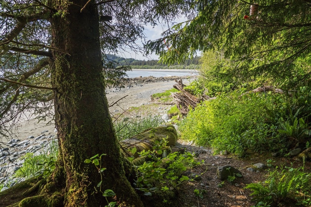
The beach was surrounded by rock pools that were teeming with life, on the edges of the forest were littered the corpses of ancient cedars finally undermined by the relentless pacific waves.
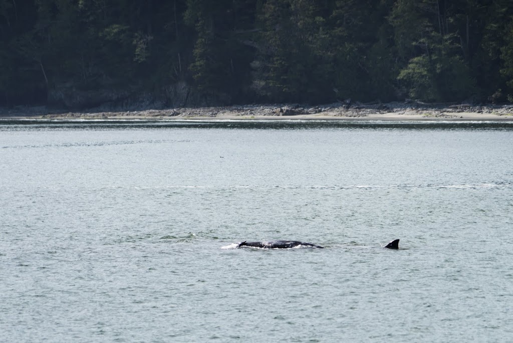
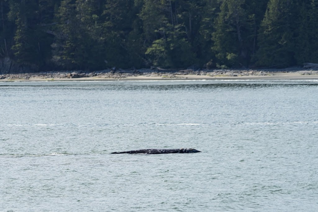
As I made my way across the beach I was surprised to see a whale barrel rolling in the bay close to shore, I watched for a while hoping for a breach or similar but he just kept on spinning before finally disappearing beneath the gentle waves leaving nothing more than glimpses of himself for the camera.
Back in Pachena Bay there were kids running in and out of the water squealing at the temperature of the northern pacific, as I was crossing the beach anyway I took off my boots and socks and made the last few hundred metres of the hike barefoot in the waves, and those kids were right to squeal, I almost did the same.
I returned to the ranger station to sign out at 14:30 only to find they had already gone (opening times say 16:00 closure) a note on the door instructed people to use the pencils and forms provided to note your return and post it in the nearby box.
There was something really special about this trail, I don't know if it's reputation left me in awe or if the tranquility of the beautiful old growth forest worked it's magic, or perhaps the proximity to the ocean and a whale sighting to end the day topped it off. Whatever it was I was left genuinely contemplating a return visit to do the whole thing, I don't know if I'll ever actually do it as we have so many things still to see, but I'll always have this day to remember on the wonderful Pacific Coast Trail.