free to be able to rate and comment on reports (as well as access 1:25000 mapping).
It was always going to be a small gathering anyway; a few of us on the SMD course, who mostly “knew” each other only via our module discussion boards, had long talked about meeting up to do some walking. Sadly, Georgina and her husband had to cancel due to a death in her family. John and I discussed whether to go ahead, since it’d only be the two of us, but we were both still up for it. We were booked into the same B&B; we’d meet there on Friday night, have some dinner, and make a plan for the Sat.
My original plan had been to spend Friday in “my nearest <
insert company name here> office,” which is what IT is *constantly* telling me to do (coolly impervious to my protests that it’s a four-hour trip each way), to get all the latest and greatest software updates. But I’m soon to be getting a new laptop, which also requires a trip to said office (don’t even get me started

), so I decided to not bother with an interim upgrade. Yeah, yeah, blah, blah, boring…the point is, and the happy news is, that I found myself with an extra day to spend in the Lakeland fells!
Fri 10 June
Skiddaw Little Man, Skiddaw, Bakestall
5 hrs / 17km / 951mHaving already climbed Scafell Pike, Scafell, and Helvellyn during trips past, I figured I might as well go for the next highest English one. Skiddaw also had the added bonus of being one of the northern fells, which I’ve not visited previously. You can read that to mean that it’s an area for which there are no lingering memories—this was the first time I’ve been to the Lakes in eons, and I decided that it’s high time to lay old ghosts to rest. That said, I’m still not sure I’d be very happy hanging out in Coniston, but that’s more to do with a higher probability of running into person or persons I might know (awkward!) than being emotionally distraught. Anyway, ‘nuff of that rot.
I’ve forgotten how easy it is, relative to some of the far-flung Scottish venues I’ve been to, to get to Keswick. Three hours from door to walk start, and that included both a petrol stop and a leisurely breakfast stop. I thought I’d gone wrong as I flew past a signpost for the A591, so carried on to the next roundabout to backtrack. But wait, there’s another A591 sign (toward Carlisle), and this one includes a sign for Ormathwaite—aha, that’s the road I want! My plan was to follow the route documented on WH by trailmasher. The final few hundred metres of the road up to the car park is dire—we’re not talking pot-holes as much as we’re talking chasm-holes and canyon-holes! The price to be paid for a high start, perhaps. I was on my way just a few minutes after 8am. It’s been a while since I’ve been out by myself, and I enjoyed the solitude, the relaxed feeling of my time being my own (both travelling and walking), and the heightened sense of adventure and awareness that comes with a solo venture.
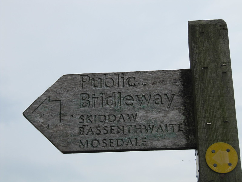
my kind of navigating!
I wondered if there’d be a path…

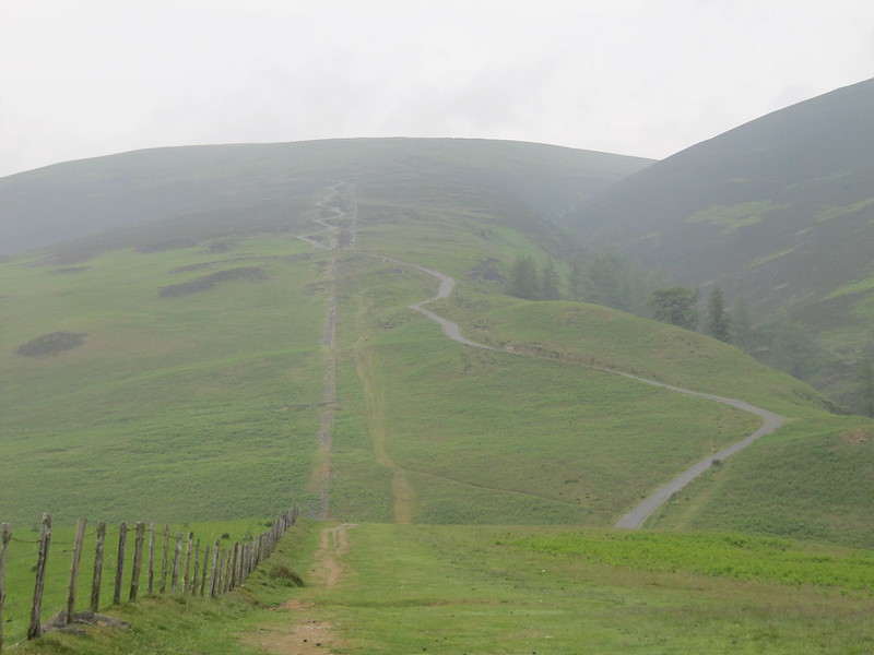
The morning was very hazy, the cloud hanging low over the tops. I was hoping they’d eventually clear, but HA.
I made my way up the easy track, but steep pull, to the first Hewitt/Wainwright of the weekend (9:00). Save the jokes about Karen climbing up, or being on top of, a Little Man; I’m sure I thought about them all at the time (the jokes, that is, not the little men.

Oh, I do amuse myself).
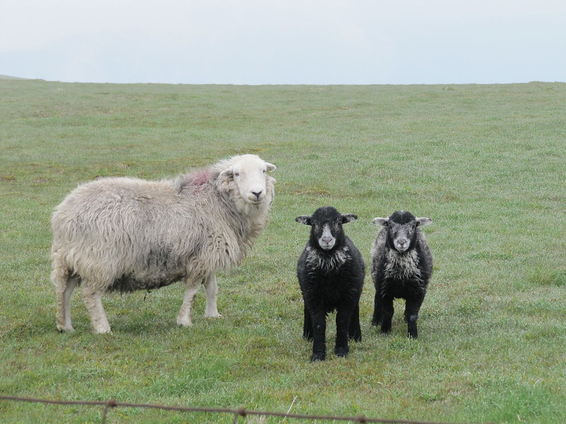
too cute! (and yet they make me hungry at the same time)
A short while later found me on the top of Skiddaw (9:30), where I saw heehaw, which rhymes when I say it in my head (heehaw...Skiddaw...yes?). Not much to see here, so moving right along. I kept checking to make sure I was heading in the correct direction, toward Bakestall, but it was fairly straightforward, even in the mist. There was still a good path, mostly. I dropped off the wrong side of Bakestall, but soon realized what I done, and corrected it by backtracking and finding the path I was meant to be on. Still not much to see, so still moving right along. I stopped just below Skiddaw House (England’s highest youth hostel) to have my peppered salami, goats’ cheese, and roasted red pepper sandwich (yumMEE; a winner, this combo). Not quite a km after the hostel, I was meant to turn SW to head up the shoulder of Burnt Horse, which would eventually take me onto Lonscale Fell. Whooops, missed that turn. Nae bother, I’d dithered about including it anyway, and quite enjoyed walking along the Cumbria Way ‘neath its rather dramatic crags. What I could see of them, that is. I got back to the car just after 1pm, exactly 5 hours after setting off.
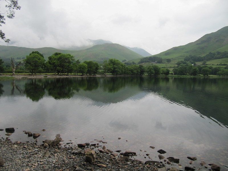
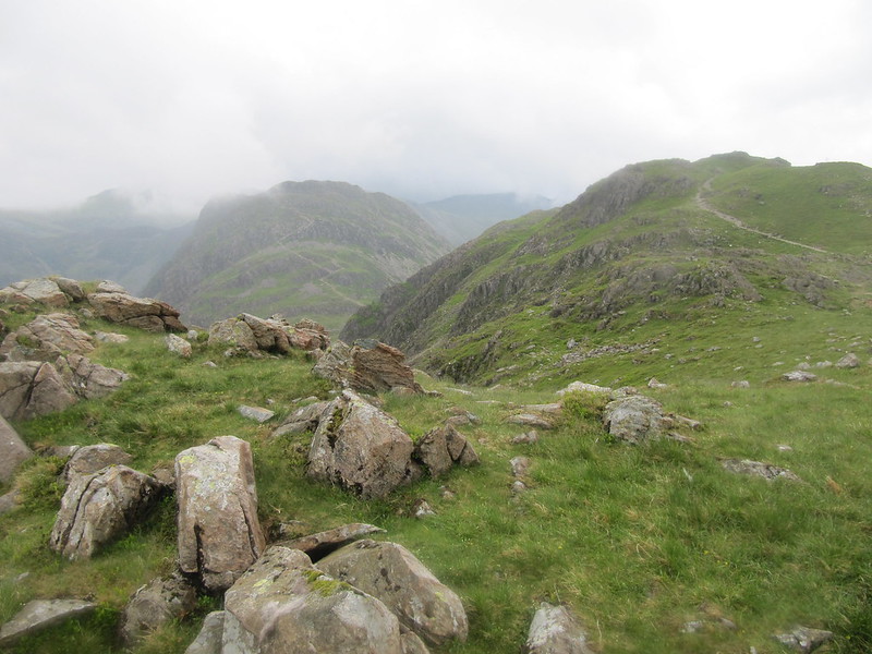
just imagine how even more lovely and green this view, were it not for the mist...
I then headed into the heaving fleshpot that is Keswick and tried to enjoy having a wee mooch around the shops. Too, too, too many people! I checked into the B&B, got cleaned up, settled down with my book, and tried not to think too much about food while I waited for John, who wasn’t due to arrive until 7:30-8pm.
Sat 11 June
Red Pike, High Stile, High Crag, Haystacks
8 hrs / 19km / 1227mWe had several ideas. Continuing with the northern fells theme, I’d suggested either Blencathra or Bowscale Fell / Bannerdale Crags / Souther Fell from
The High Fells of Lakeland Pathfinder Guide I’d treated myself to, but neither of these options would fill the day, and John had suggested a route from an old (70s) “Classic British Walks” book he’d brought along. His route included a drive to Buttermere, then the ridge along Red Pike / High Stile / High Crag / Haystacks – along to Honister, where we’d cross the road, and then walk the ridge on the other side of the valley.

. I’m not going to bother listing those hills, because they ended up having no significance to our actual route. The description in this book of his gave a distance 13 miles, and gave a time estimate of 7 hours. Whoever wrote this description must have been England’s version of Cameron McNeish, because those stats appear to be completely unrealistic, as we discovered throughout the day.
We parked at Gatesgarth, paid and displayed (£4), and said a brief good morning to the two guys parked next to us. Chatting about the day’s plans, as you do, we told them what we had in mind. They thought that 7 hours was a bit, <ahem> shall we say ambitious (mad), and reckoned it would take at least 10 hours. We then realized that we should have continued up past Buttermere to park. Since we’d already paid, we decided to just leave the car there, and walk toward Red Pike along the lake. I was eyeing the ridge that ran all the way from Red Pike to Fleetwith Pike, and suggested that we consider adding FP after Haystacks, and coming down its steep shoulder. We were already beginning to realize how unrealistic it was to think about doing the ridge around the entire valley. John agreed, so that became our plan, which also had several escape options, depending on how the day went.
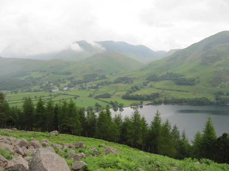
not bad at the off; cloud about, but at least it was dry. 'Tis quite a beautiful area...
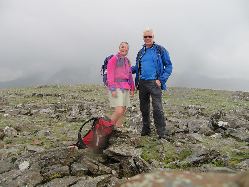
gaining a bit of height
It was warm and muggy, and I was dripping sweat as we climbed up toward Bleaberry Tarn (Tarns, not lochans. Lakes, not lochs. Ghylls not gullies. Becks, not burns. Fells, not hills. Bealach? Nope. Sheesh, it’s like being in a whole other country!). A brief breather at the tarn, before the final steep pull to the top of Red Pike. That part wasn’t prolonged, perhaps only 150m or so, but it wasn’t nice, either. Very scrabbly scree, with not many solid steps, and then through a narrow bit just below the top. There were dozens of people at the cairn, having come from many different directions. OK, “dozens” is probably a slight exaggeration, but I couldn’t help feeling as though I wasn’t in Kansas any longer. This summit was also a checkpoint for some fell-running event or competition, so there were even more people running past us as we carried on toward High Stile.
summit, High Stile
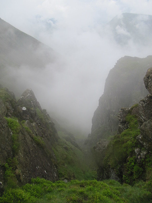
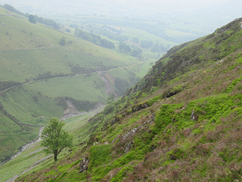
dramatic gullies (ghylls? or does a ghyll have water in it?)
It all went a bit wrong here, as the cloud came down and the rain came on. We thought we’d gotten to High Crag (wrong), and knew that we’d need to descend a couple of hundred metres from there, so we did start to descend, but there was no clear path. The rocks were mossy and slippery, and the angle was steep (that is, I wasn’t very happy). When we stopped to have a look at the map, and take a bearing (little viz at this point), we realized that we were descending to Buttermere, having not yet reached High Crag. So back up we went, steeply, and directly over the top, rather than traversing, the way we’d made our way down. When we topped out here, I was completely disoriented, but we found a path, and a line of cairns, and started following them, thinking we must be right (aw, shaddup
). I took another bearing, but following it just felt completely wrong. We eventually realized, with the help of a trio who happened along, that we were actually going in the exact opposite direction we were meant to be going; in fact, the line of cairns was leading us back to High Stile. Hm, imagine that, the bearing was correct, but I lacked the confidence to believe it. We eventually got headed in the correct direction. By this time, it was getting on toward 2pm, so we stopped to have some food.
I think this is Haystacks behind, from just before the Scarth Gap (after descending Seat)
John was keen to carry on to Haystacks (we’d realized by now that even including Fleetwith Pike was a bit too hopeful); I’d have been happy to descend Scarth Gap Pass and call it a day. I didn’t mind, though, so we climbed up to the triple-cairned Haystacks, which included a couple of proper scrambles. The rain, which had been somewhat intermittent, came on in earnest. I didn’t put even my waterproof jacket on, which in hindsight was a mistake. I wasn’t cold, but it’s oogy and uncomfortable to be soaked through. It seemed a long way to just below the quarry, where we picked up the clear descent path that we'd seen from across the valley. We got back to the car just before 6pm, 8 hours and 19km after setting off (that is, we’d taken an hour longer to do essentially half the walk from John’s “classics” book , and with just about the same distance; even given our mistaken descent and reascent, it still doesn’t add up). Anyway, nae matter, it was a good, tough day.
I started the weekend feeling as though the Lake District fells are much more benign than the Scottish hills, but I finished the weekend realizing that I’d done as much distance and ascent as for many Scotland routes, gotten just as lost, just as wet, and ended up with just as few views as I have for many Highland wanders. I've also discovered about a dozen midge bites (oooooooh itchy city! Pass the After Bite.). No' so many differences, then. Oh, 'cept for the number of people everywhere...(scratch scratch)
P.S.
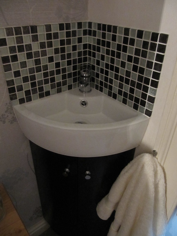
the ridiculously small sink in my B&B room (about as wide as my hand); washing my face was a real challenge...nevermind trying to fill a water bottle!
...but other than that, and a slight parking issue (limited) that found me schlepping my stuff about two blocks, Bramblewood Cottage was very nice. Conveniently located to the town centre, delicious breakfasts (fresh fruit and options other than "full Cumbrian cooked," but you have to order them the night before), and a good-sized clean comfortable single room with a larger-than-single bed. Oh, and the room was on the ground floor, rather than being tucked away in the attic as an afterthought. All for a very reasonable £36. (scratch scratch)
