
Canada - Dodging the lightning on a ridge with no name.
When hiking to Bryant Lake last month I saw a nice looking ridge with a couple of summits on it close to the Powderface Trail, since then we have been inundated with thunderstorms and incredible lightning displays.
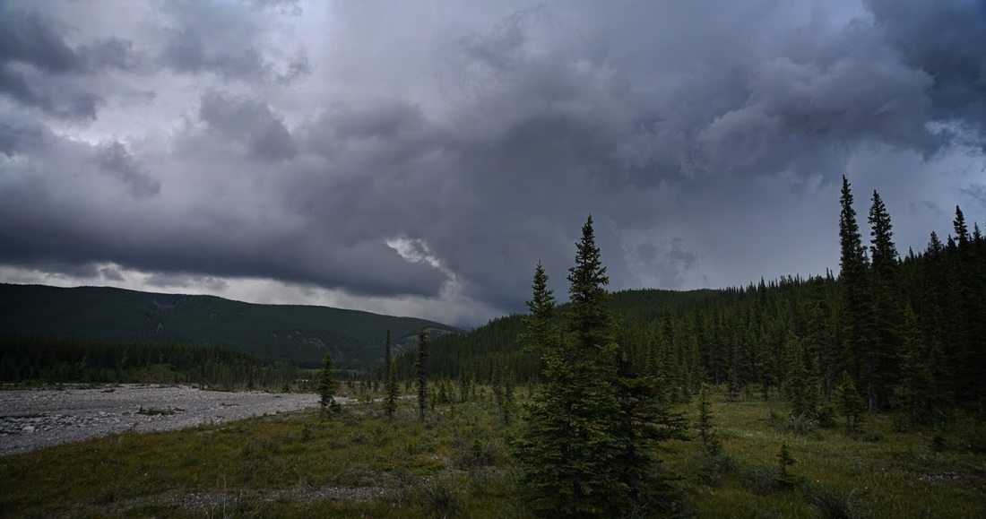
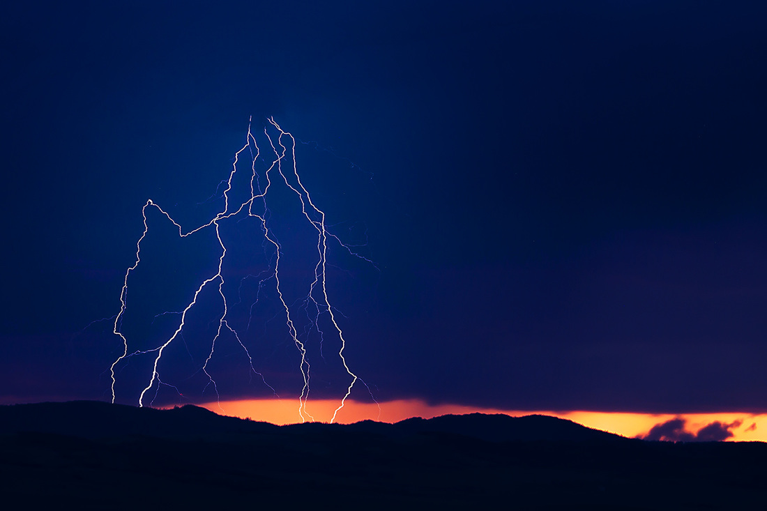
Obviously those are not the conditions to be out on a bare ridge so I have been away from the hills for all of that time. After all you wouldn't want to be out in the open under this.

Today there was a reduction in storms and I decided a reduction was enough for me to go out to Canyon Creek and see what conditions were like.
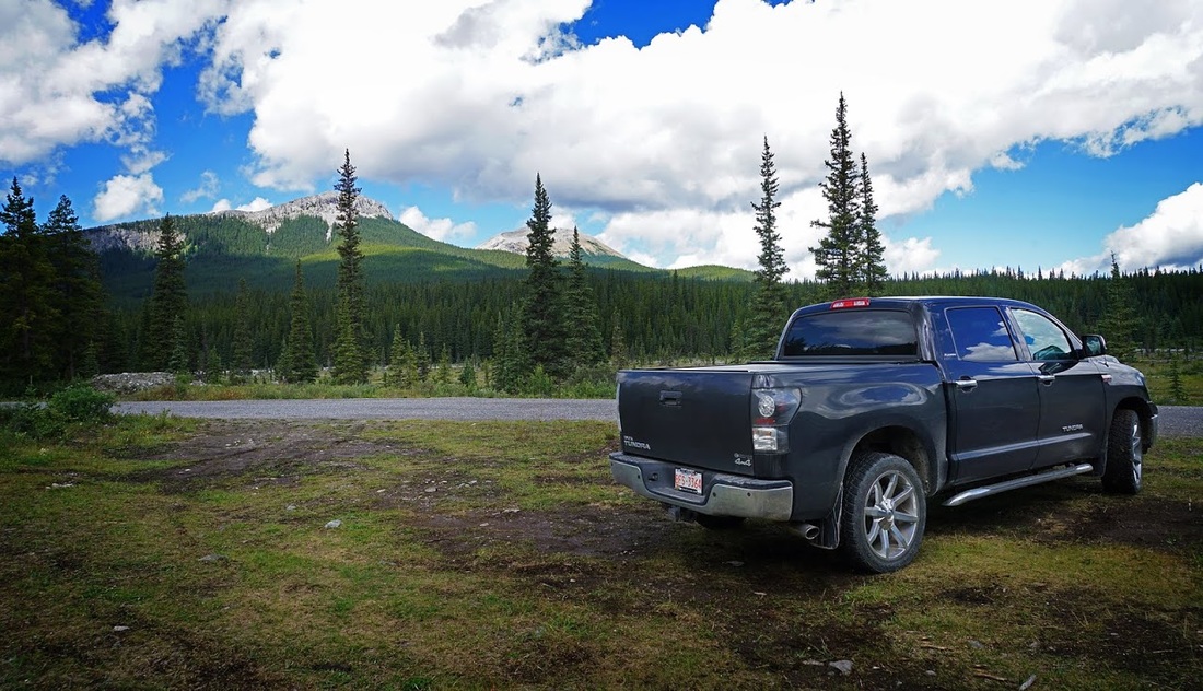
Canyon Creek is on the Powderface Trail. To reach the trailhead take highway 66 from its junction with Highway 22 just south of Bragg Creek and follow 66 to its end 28km west. At the end of the route continue straight onto the gravel logging road, this is the Powderface Trail. Follow Powderface for 15km to Canyon Creek, parking is on the east side of the road before the bridge.
When I arrived the sky was full of cloud already but that little ridge visible from the parking area seemed like an easy target for the day, I calculated that I could be up and down before the storms built up, so without further ado I booted up and got going.
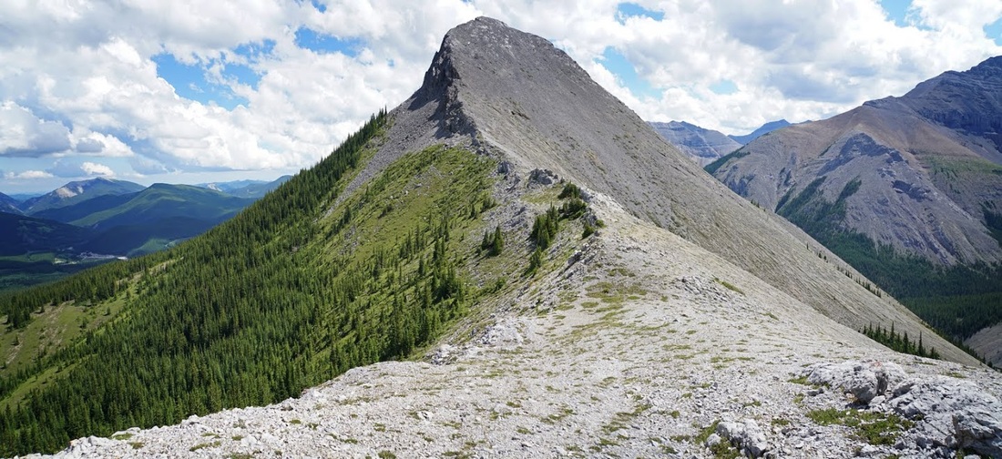
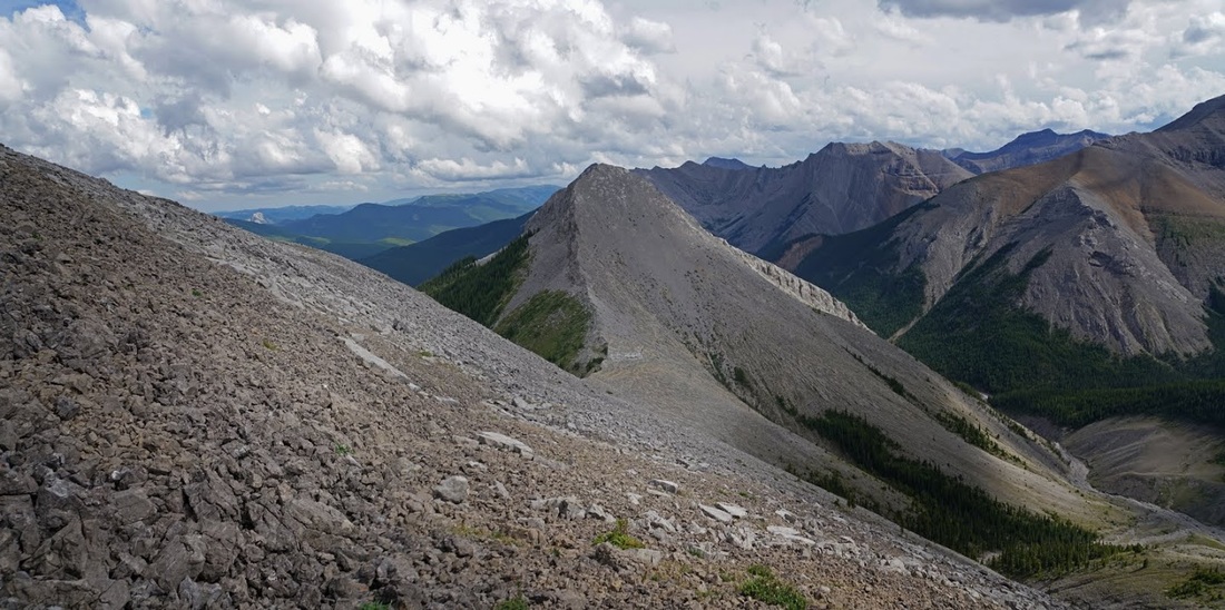
heading west on Canyon Creek soon brings almost the whole ascent ridge into view, as you can see below the initial stages are a steep grunt to a lovely long ridge that culminates in a nice unnamed summit at 436425. As Mt Bryant is to the left I can't see why these haven't picked up the name 'Bryants Bumps' or something similar.
I had no route or trail descriptions for this lump so I followed Canyon Creek to the first junction where the north fork comes in from the east side of Mt Bryant, from here you can see a route up through the trees.
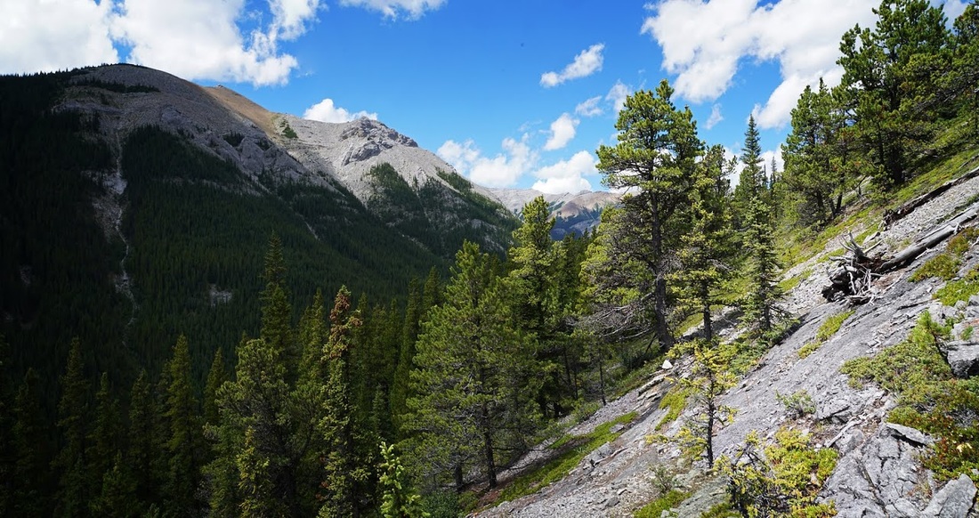
It's good going on the initial ascent and though steep it has a few easier sections that allow a breather, the ground is loose throughout with no sign of a trail or even animal tracks to follow.
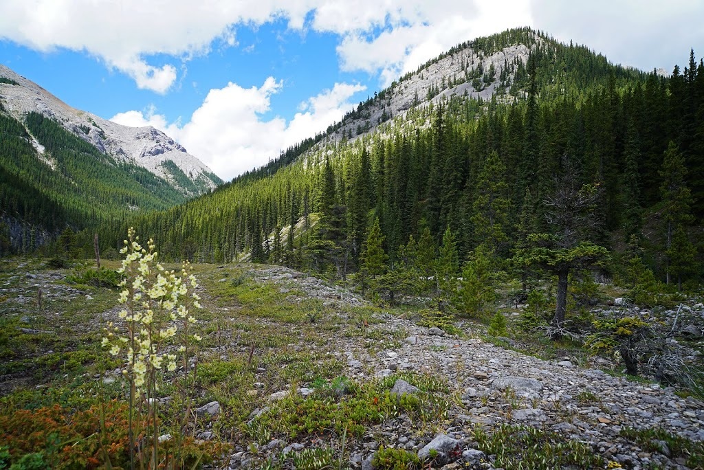
The steep climb means the views along north Canyon Creek are soon opening up, the hillside steepens significantly before hitting an easy scramble up the rockwall. I later noted that this scramble could be avoided by walking further up North Canyon Creek before ascending.
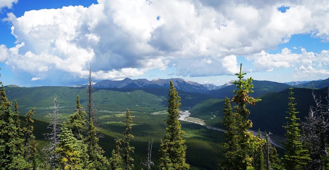
As I reach the lower end of ridge it suddenly feels so good to be back in the hills. I can now see east to Moose Mountain where dark clouds are beginning to gather. I can see where canyon creek meets the powderface trail and my truck in the small grassy area there.
Once on the lower ridge the going is much easier, the forest still reaches up to the drop off on the east side and the gentle slope on the west side makes for an easy route. There's still no sign of a trial, I guess this is not a popular lump.
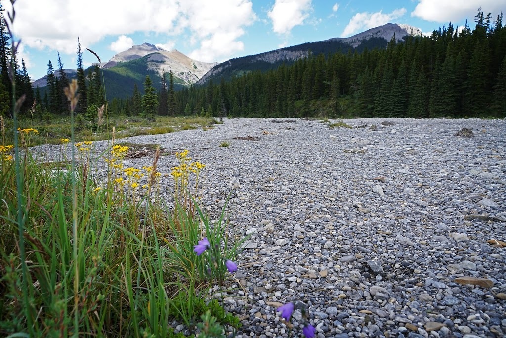
It really is a lovely hike along the lower ridge and soon I've ascended beyond the forest and into the open spaces above. Looking back over the route so far with Mt Bryant to the west (right) and Compression Ridge directly behind me to the south beyond the dry bed of Canyon Creek.
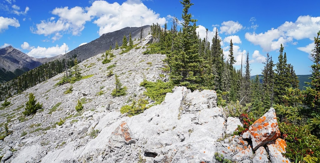
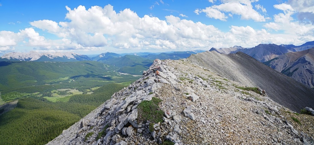
What lies ahead now is a crisp ridgeline rising more aggressively toward its tiny summit leaving the forests falling away on both sides of the bare rock. There's still no trail but it's not like I could take a wrong turn.
There are a few small steps in the ridge that lift me ever higher, I can now see Nihahi Ridge over the top of Compression Ridge and Mt Howard to the right of that. I can see the powderface trail cutting through the forest from its bridge over Canyon Creek and the tree covered foothills beyond. Dark clouds are still bubbling up but currently staying over Moose Mountain to the east.
At the summit a small cairn gives away the fact that others have gone before me, I guess they trod softly on their ascent...or perhaps ascended a different way (though why would you miss out that lovely ridge) On the far left of this shot is the north fork of Canyon Creek leading to Bryant Lake, the three additional peaks directly north are all without name and simply referred to as coordinates on a map. How can such a beautiful ridge and it's bumps remain nameless for so long.
This is as far back as I can get without dropping off a steep descent back to tree level, as I stand here it strikes me that I could make that drop and keep on going. There are clear 'bail out' options on the left should lightning threaten and it seems such a waste to come all this way and stop at this one sumit.
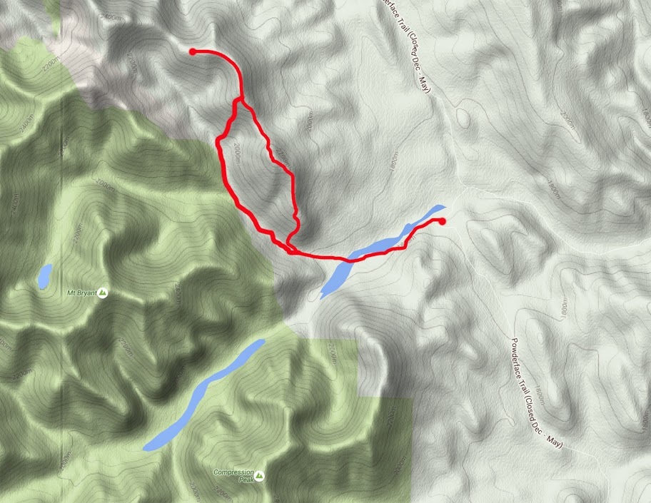
I had a short rest and a snack before dropping off that summit and continuing north, the first part of the descent to the col is very steep and demands concentration but it eases off after losing about 100 metres, I then lose another 75m to the col.
From the col there is a nice level section of about 1/2 km then a steep ascent on loose rock to a nub where the gradient eases for the final ascent to the second summit of the day.
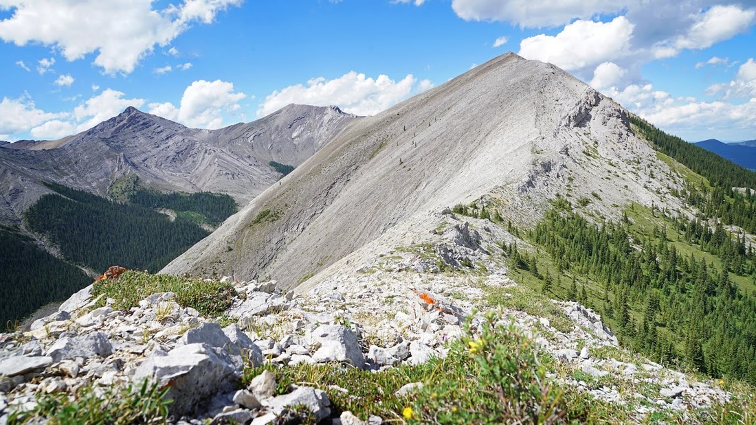
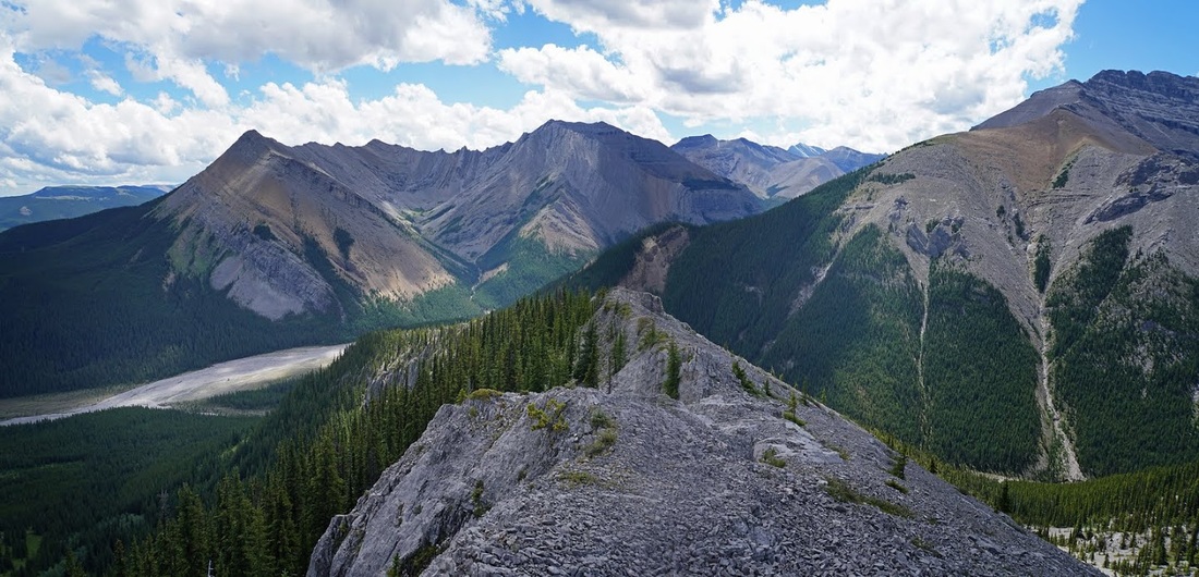
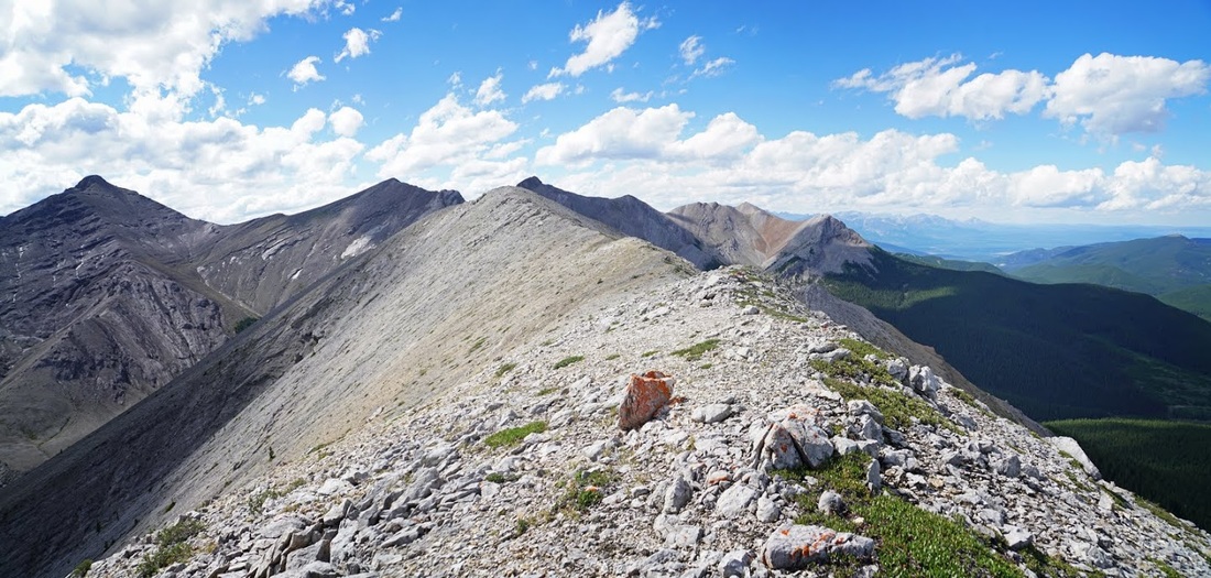
This summit is very different to the last, there's a good dome and plenty of space to move around. looking back to the first summit provides a good indication of that steep initial descent angle from there.
The only problem with going on is it leads to this, another wonderful long ridgeline continuing north. Just a small step down and I could be taking in another 1.5km of ridge, again there are bail out options on the left which is enough to convince me to keep on rolling.
I'm soon halfway along the easy going ridge, there's little more than undulations along here and the storms have stayed away to the east for the most part. Moose Mountain is now left behind and the heavily forested Powderface Ridge fills the space between.
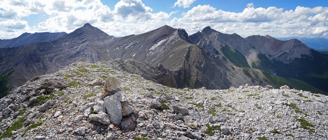
Up ahead I can see Belmore Browne peak which I hiked in 2012 and the brown ridge between it and another 'no name' peak which I ticked off that day too. On the far horizon is Black Rock Mountain and to my left two more unnamed peaks.
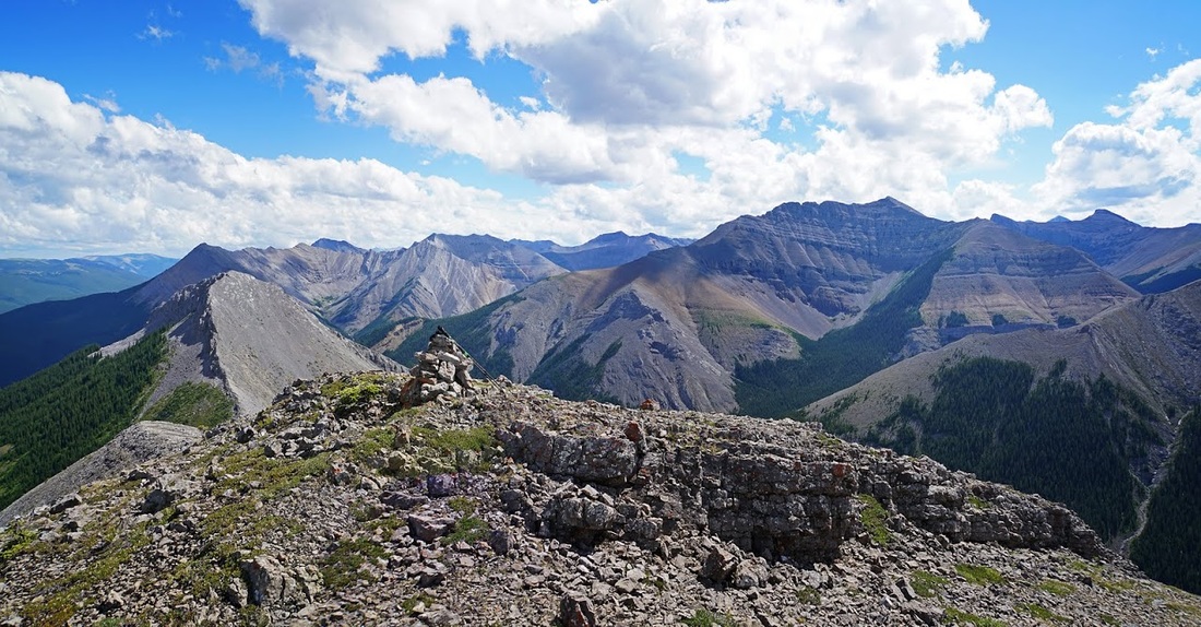
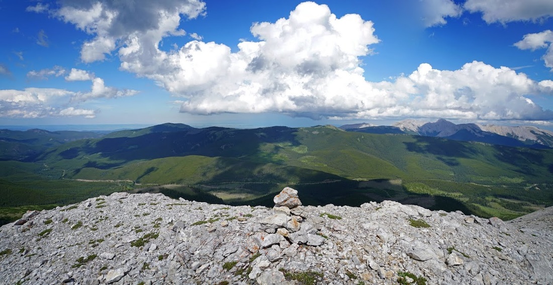
A nice steady wander with just a small ascent in the last few hundred metres and I am at my third cairn of the day. Directly east is Powderface Ridge and beyond that heavy rain falling on the prairies. As the huge clouds billow across the sky their shadows dance along the forest covered ridges below. The summit of Moose Mountain is now scraping the clouds and there are more active storms all around.
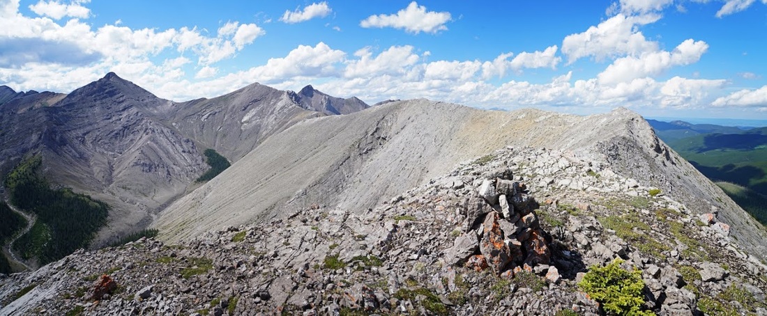
Looking north the ridge continues but a significant scramble would be required to make the initial descent (perhaps even requiring a rope) I didn't investigate this further as it was already after 4pm and continuing further would take far too long for today. A closer look at Belmore Brown and it's brown ridge connector is available from here and the pointed tip of Tiara Peak sits prominently in the centre of the frame (no prizes for guessing why it's named so)
As I made my return along the ridge I reached the middle summit of the three when lightning cracked down over the first summit, then it did it again and I bailed. I skidded and stumbled down the scree onto a steep grassy slope and down into the relative safety of the canyon below. The thunder rattled the ground as I hurried into the tighter spaces of North Canyon Creek, fortunately the rain stayed away.
Dropping into Canyon Creek had made the hike a bit longer than it would otherwise have been but the weather continued to show that it was a wise decision. Thunder and lightning hammered the area around me but thankfully not right on me. The final couple of kilometres across the open ground of Canyon Creek did have me concerned, as the only water filled bag around holding two carbon poles I didn't fancy my chances and made some significant strides back to the truck.
Incredibly I managed to get back to the truck without getting anything more than a few spots of rain on me, I changed my boots and began the journey home as the heavens opened. At home I stood on the balcony watching the lightning hammer the foothills during sunset.
I'm really glad I decided to check out that little lump I'd spotted a month ago, who would have thought that it would lead to such a beautiful ridgewalk, and how on earth does this wonderful wander not have a name of its own.
Obviously those are not the conditions to be out on a bare ridge so I have been away from the hills for all of that time. After all you wouldn't want to be out in the open under this.
Today there was a reduction in storms and I decided a reduction was enough for me to go out to Canyon Creek and see what conditions were like.
Canyon Creek is on the Powderface Trail. To reach the trailhead take highway 66 from its junction with Highway 22 just south of Bragg Creek and follow 66 to its end 28km west. At the end of the route continue straight onto the gravel logging road, this is the Powderface Trail. Follow Powderface for 15km to Canyon Creek, parking is on the east side of the road before the bridge.
When I arrived the sky was full of cloud already but that little ridge visible from the parking area seemed like an easy target for the day, I calculated that I could be up and down before the storms built up, so without further ado I booted up and got going.
heading west on Canyon Creek soon brings almost the whole ascent ridge into view, as you can see below the initial stages are a steep grunt to a lovely long ridge that culminates in a nice unnamed summit at 436425. As Mt Bryant is to the left I can't see why these haven't picked up the name 'Bryants Bumps' or something similar.
I had no route or trail descriptions for this lump so I followed Canyon Creek to the first junction where the north fork comes in from the east side of Mt Bryant, from here you can see a route up through the trees.
It's good going on the initial ascent and though steep it has a few easier sections that allow a breather, the ground is loose throughout with no sign of a trail or even animal tracks to follow.
The steep climb means the views along north Canyon Creek are soon opening up, the hillside steepens significantly before hitting an easy scramble up the rockwall. I later noted that this scramble could be avoided by walking further up North Canyon Creek before ascending.
As I reach the lower end of ridge it suddenly feels so good to be back in the hills. I can now see east to Moose Mountain where dark clouds are beginning to gather. I can see where canyon creek meets the powderface trail and my truck in the small grassy area there.
Once on the lower ridge the going is much easier, the forest still reaches up to the drop off on the east side and the gentle slope on the west side makes for an easy route. There's still no sign of a trial, I guess this is not a popular lump.
It really is a lovely hike along the lower ridge and soon I've ascended beyond the forest and into the open spaces above. Looking back over the route so far with Mt Bryant to the west (right) and Compression Ridge directly behind me to the south beyond the dry bed of Canyon Creek.
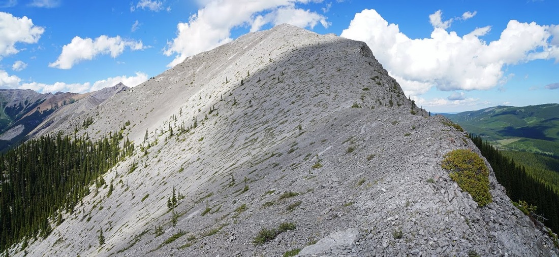
What lies ahead now is a crisp ridgeline rising more aggressively toward its tiny summit leaving the forests falling away on both sides of the bare rock. There's still no trail but it's not like I could take a wrong turn.
There are a few small steps in the ridge that lift me ever higher, I can now see Nihahi Ridge over the top of Compression Ridge and Mt Howard to the right of that. I can see the powderface trail cutting through the forest from its bridge over Canyon Creek and the tree covered foothills beyond. Dark clouds are still bubbling up but currently staying over Moose Mountain to the east.
At the summit a small cairn gives away the fact that others have gone before me, I guess they trod softly on their ascent...or perhaps ascended a different way (though why would you miss out that lovely ridge) On the far left of this shot is the north fork of Canyon Creek leading to Bryant Lake, the three additional peaks directly north are all without name and simply referred to as coordinates on a map. How can such a beautiful ridge and it's bumps remain nameless for so long.
This is as far back as I can get without dropping off a steep descent back to tree level, as I stand here it strikes me that I could make that drop and keep on going. There are clear 'bail out' options on the left should lightning threaten and it seems such a waste to come all this way and stop at this one sumit.
I had a short rest and a snack before dropping off that summit and continuing north, the first part of the descent to the col is very steep and demands concentration but it eases off after losing about 100 metres, I then lose another 75m to the col.
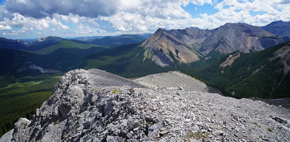
From the col there is a nice level section of about 1/2 km then a steep ascent on loose rock to a nub where the gradient eases for the final ascent to the second summit of the day.
This summit is very different to the last, there's a good dome and plenty of space to move around. looking back to the first summit provides a good indication of that steep initial descent angle from there.
The only problem with going on is it leads to this, another wonderful long ridgeline continuing north. Just a small step down and I could be taking in another 1.5km of ridge, again there are bail out options on the left which is enough to convince me to keep on rolling.
I'm soon halfway along the easy going ridge, there's little more than undulations along here and the storms have stayed away to the east for the most part. Moose Mountain is now left behind and the heavily forested Powderface Ridge fills the space between.
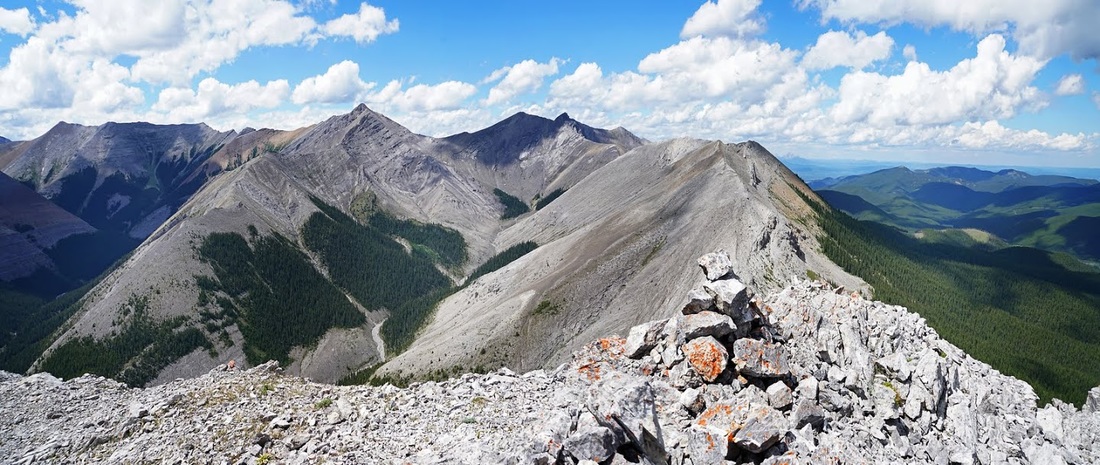
Up ahead I can see Belmore Browne peak which I hiked in 2012 and the brown ridge between it and another 'no name' peak which I ticked off that day too. On the far horizon is Black Rock Mountain and to my left two more unnamed peaks.
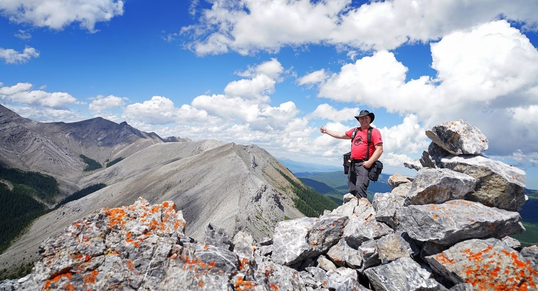
A nice steady wander with just a small ascent in the last few hundred metres and I am at my third cairn of the day. Directly east is Powderface Ridge and beyond that heavy rain falling on the prairies. As the huge clouds billow across the sky their shadows dance along the forest covered ridges below. The summit of Moose Mountain is now scraping the clouds and there are more active storms all around.
Looking north the ridge continues but a significant scramble would be required to make the initial descent (perhaps even requiring a rope) I didn't investigate this further as it was already after 4pm and continuing further would take far too long for today. A closer look at Belmore Brown and it's brown ridge connector is available from here and the pointed tip of Tiara Peak sits prominently in the centre of the frame (no prizes for guessing why it's named so)
As I made my return along the ridge I reached the middle summit of the three when lightning cracked down over the first summit, then it did it again and I bailed. I skidded and stumbled down the scree onto a steep grassy slope and down into the relative safety of the canyon below. The thunder rattled the ground as I hurried into the tighter spaces of North Canyon Creek, fortunately the rain stayed away.
Dropping into Canyon Creek had made the hike a bit longer than it would otherwise have been but the weather continued to show that it was a wise decision. Thunder and lightning hammered the area around me but thankfully not right on me. The final couple of kilometres across the open ground of Canyon Creek did have me concerned, as the only water filled bag around holding two carbon poles I didn't fancy my chances and made some significant strides back to the truck.
Incredibly I managed to get back to the truck without getting anything more than a few spots of rain on me, I changed my boots and began the journey home as the heavens opened. At home I stood on the balcony watching the lightning hammer the foothills during sunset.
I'm really glad I decided to check out that little lump I'd spotted a month ago, who would have thought that it would lead to such a beautiful ridgewalk, and how on earth does this wonderful wander not have a name of its own.