free to be able to rate and comment on reports (as well as access 1:25000 mapping).
EDIT - I should clarify - "My favourite one day walk"
As you ascend the narrowest section of the Mattertal through the village of St. Niklaus, you are hemmed in by the beetling cliffs 1000m high on either side, with the occasional majestic snow peak appearing behind . Between these two however exists a huge area of (often moraine filled) hanging valleys which are accessed by a series of paths collectively known as the Höhen Weg. you can in fact walk the whole way from Visp in the Rhone valley to Tasch only a few Km from Zermatt and also go into the adjacent valley - the Turtmanntal - at two places.
The central focus of the area is the beautiful little village of Jungen - (Jungu in the local language) set on a sunny South facing shelf.
This is a tourist office depiction of the Northern end where there is lots of habitation: South of Jungen (L in the picture) the only route (at the moment) is via the Topali SAC hut Around Zermatt there is of course lots of stunning scenery, but the appalling mess left by the ski installations is (for me anyway) a major downside. Around Jungen is what I think is the nicest one day walk in the area - the Rundweg or circular walk. In fact I think it is probably the nicest walk I know anywhere, and I've done it many times.
Map of the walking paths around JungenThe map is a bit complicated - but the signposting on the ground is first class.
I have already described Jungen village in Hohenweg 1
As you leave the village a signpost tells you all you need to know. It is better to go anticlockwiseThe route sets off through scatttered trees and trends upwards below steep rocks. In the hot sun the smell of the pines is quite intoxicating. There are a lot of pictures - I just kept shooting as I went along - but hopefully you will enjoy them.
It is an easy path suitable for families but there are occasional rope handrails for those of a nervous disposition
 Looking back to JungenA wider view
Down To your R, you cross the top of a number of huge gullies that fall 1000m to the valley floor
Some sort of equipment I think rather than an art installation Above St. Niklaus on the other side of the valley is the village of Grächen: the circuit of Monte Rosa comes through here on the Europaweg from Zermatt, goes diagonally L to Hannigalp (lift) and then traverses the Saas valley on a balcony walk to Saas Fee - 6hrs or so - even if you take the lift Two views looking back - The Weisshorn is still looking over your shoulder A wider viewEventually the path takes a sharp turn L and you look North towards Moosalp and the mountains across the Rhone valleyAt this point you turn on to a North facing slope and there is a dramatic change in the vegetation.
Up to now it has been almost all grass - I'm sure there are flowers earlier in the season but by August they have all been burnt up by the morning sun. Here it is mainly "heaths" - Bearberry, Bilberry, juniper and particularly Alpenrose (wild Azalia) : and the flowers proliferate.
Alpenrose - wild AzaleaL - Orchis mascula - Narrow leaved Orchid .................. R Gentiana purpurea - Purple gentian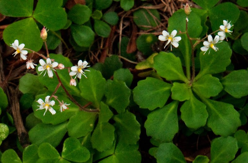 Saxifraga cuneifolia - Saxifrage with wedge-shaped leaves
 Convallaria majallis - Lily of the valleyThe path continues past some rocks to a very detailed signpost
 Directly up the valley - the Augstbordtal - is the Schwartzhorn, and to its L the 2893m Augstbord pass from Grüben in the Turtmanntal: if you are doing the "walking" Haute Route from Chamonix you will almost certainly traverse this pass. From Zinal you cross the Meid or the Forcletta pass to Grüben, come this way to St. Niklaus and continue via Grächen to finish at Saas Fee. The fork to the R heads up here and also to Moosalp, but the Rundweg keeps L and zig-zags quite steeply up to the highest point on the path - above the rocks you walked below earlier. You cross a drystone wall at about 2350m
The path up the Augstbordtal The Rundweg keeps L
 climbing up to the highest point. In the distance the mountains above Saas Grund
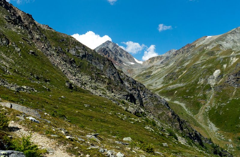 Another view of the Schwartzhorn
 Looking back across the wall L Arnica montana - Mountain Arnica R Geranium sylvaticum - Wood Crane's-bill almost at the maximum height of its range
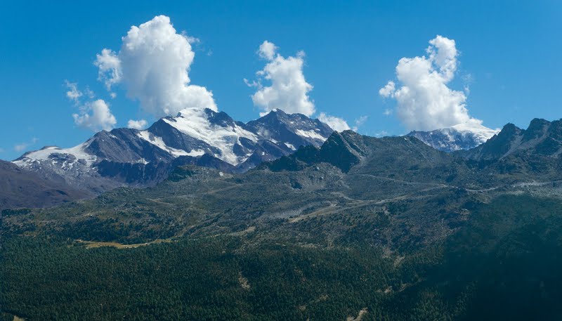 Zoomed view of the mountains on the far side of the Saas valley - the 3993m Fletchhorn, 4010m Lagginhorn and the 4017m Weissmeis just appearing through the cloud
 Another zoomed image: the Mischabel: The snowy col at the top of the Reid glacier is the 3850m Windjoch: the 3925m Ulrichshorn on its L and the 4327m Nadelhorn to the R: The 4545m Dom (the highest mountain completely in Switzerland) is at the back far R
The path continues horizontally for a short while and then turns down quite steeply. If you continue, you complete the Rundweg by descending through the woods back to the village - there are more nice flowers.
L Polygala alpestris - Subalpine Milkwort ................... R Saxifraa Aspera - Stiff-haired Saxifrage L Erigeron alpinus - Alpine Fleabane................... R Gymnadenia conopsia - Fragrant OrchidHowever if you do this you are missing out on maybe the best part of the walk. About 150m below the high point you can take a R turn and walk up into the amazing Jungtal. Better still I found that I could save around 100m of descent and reascent, by leaving the path just where it starts to descend and traversing horizontally a few metres to a ridge - there is a tiny track.
 The start of the descent where I left the path
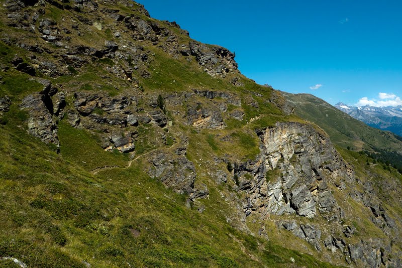 Looking back at the horizontal section of the path
 From the ridge I climbed this grassy gully....
 ...traversed along this ridge and soon came to another path (that descends from the Augstbord pass) - see map - there were a few hang gliders about
 Looking across into the Jungtal
 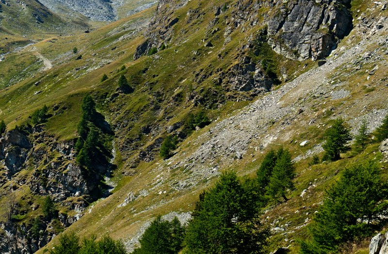 A closer view - you can just see a path traversing the slope (above the gully in the shade)
 I could probably just have continued traversing - the terrain is very benign, but it was easier to descend the path a bit, and then turn R at a junction
This path was signposted Jungtal and a second turn L was also signposted 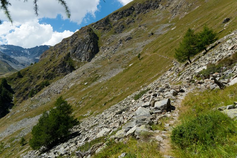 The (same) little path - much more obvious now - continued horizontally across the slope until it joined the main path up from Jungen
 The Jungtal is a classic hanging valley : the main path can be seen below
 Looking back
 Cowsheds at the entrance to the valley
 The path now zig-zags up on to one of the most wonderful lateral moraines I have ever seen. stemming from the ice age, it has become grassed over and thousands of years of erosion have rounded the top leaving just a few huge boulders behind - magic
 Edit 2018: Sitting on the moraine in 2018. a number of major boulder falls threatened the cowsheds so there no cows in the Jungtal this year
 There is another one on the other side of the valley
If you continue up this moraine the path traverses L across the head of the valley and climbs over a 3000m col - the Wasulicke - to reach Topali -
but as I have said, that is another storyUnlike most of the valleys on the route which are largely stone filled, the Jungtal is grassy with cows grazing beside a tinkling stream and very special I think.
I turned around here and followed the main track back to the village, but took a few more photos before I left.
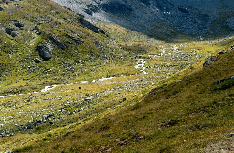 The valley floor
 A wider view up the valley - the Wasulicke is out of sight on the L
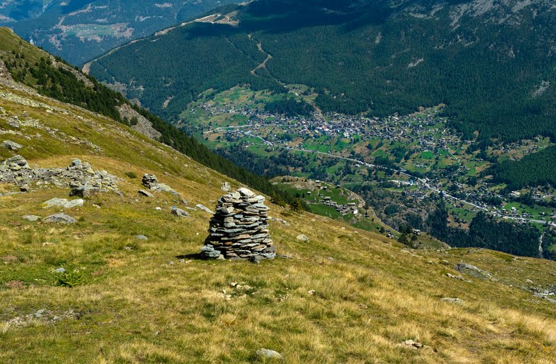 A cairn at the end of the moraine - across the Mattertal you are looking right up the lift to Hannigalp
  Looking out of the mouth of the valley just beyond the cowsheds
 Looking back across the upper track
 Minuarta laricifolia - Larch-leaved Sandwort
  looking back up the main trackThe track descends easily to the village beside a stone wall: This a Blumenweg" - flower walk - and there are lots of pictures of things I don't think I have ever seen. sadly they never seem to be out when I am there
 I found when I got down that I had just missed the (hourly) lift so I had a long soft drink and then a beer in the Stubli.
Edit 2018
Sadly the old Stubli closed a couple of years ago
- biut a new one has been built this year - just above the lift
- so you can have a beer and watch the queue at the same time
Even more my favourite walk now
