free to be able to rate and comment on reports (as well as access 1:25000 mapping).
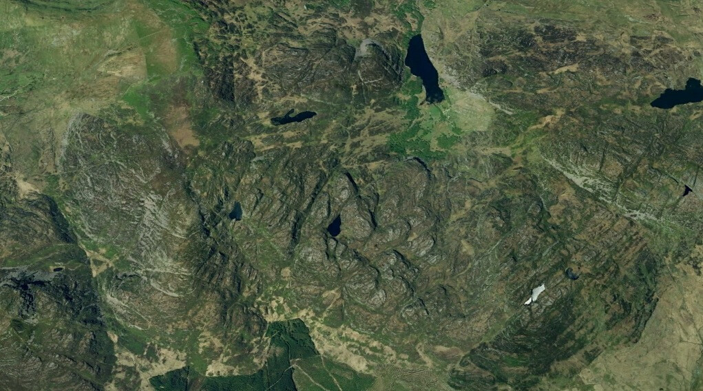
I was idly looking at the UK Hewitts map, when I happened to notice that there was a range of hills between the North Snowdon group and the Cardair Idris group running in a North-South direction that I didn’t recognize at all.
A couple of clicks took me to “Rhinogs”. Again idly, I clicked on a couple of the links, and the pictures that popped up immediately caught my interest: these really looked like hills with attitude. I also took a look on Google Earth, which only served to whet still further my appetite for a visit: the longish stretch between Moel Ysgyfarnagod and Rhinog Fawr seemed to consist mainly of rock pavement; but miles and miles and miles of it!
It looked absolutely sensational. The only downside to the route was that it is linear, so it would require some cycling – unfortunately along a dead straight A road - to close the round, and/or some car shuffling if there was more than just me.
So when the forecast for the weekend of 25/26 March was unequivocally good (so good in fact that the CEO insisted that I took some sun screen!), that was that: route booked.
Emailing round, Dr Frank thought he’d be available; Chris fancied the route, but was unavoidably prevented from joining us by virtue of the fact that he was in Tenerife. So Dr Frank and I agreed to meet at the turn off to Cefn Clwydd, just South of Trawsfynydd at 08.00.
Preparatory sleep planning didn’t work at all. We had friends coming round on the Saturday, and then, just after they’d left I realized that the clocks were going forward that night. So an effective 4.15 departure, rather than the 5.15 originally envisaged..

.
However, driving towards Dolgellau as the early morning sun caught the tops of the hills, it was impossible to suppress a grin: it was going to be a great day!
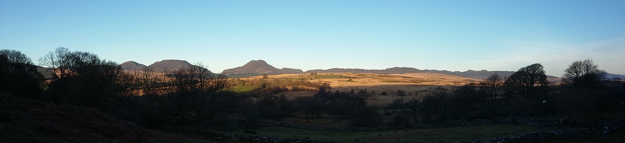
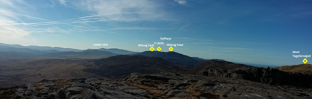
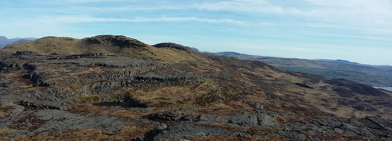
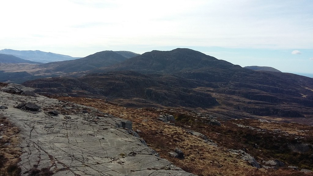
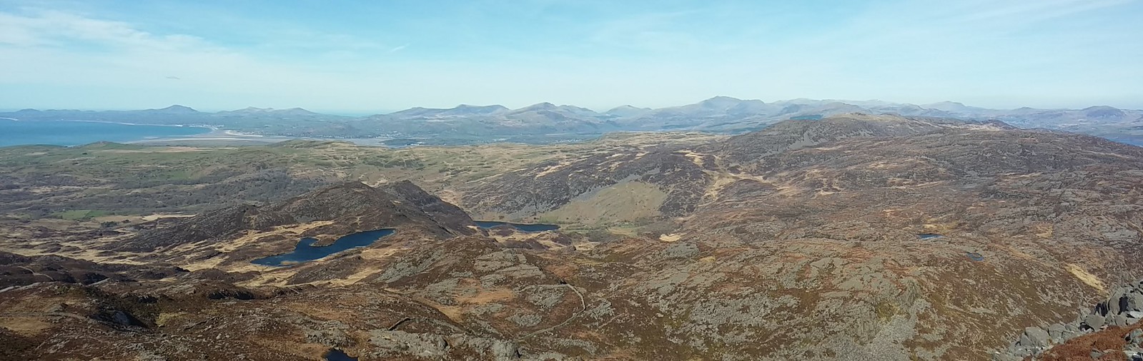
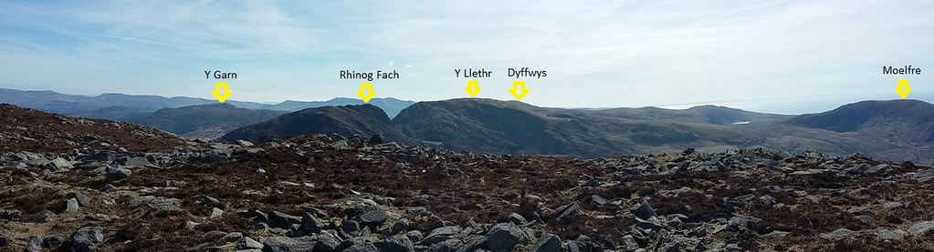
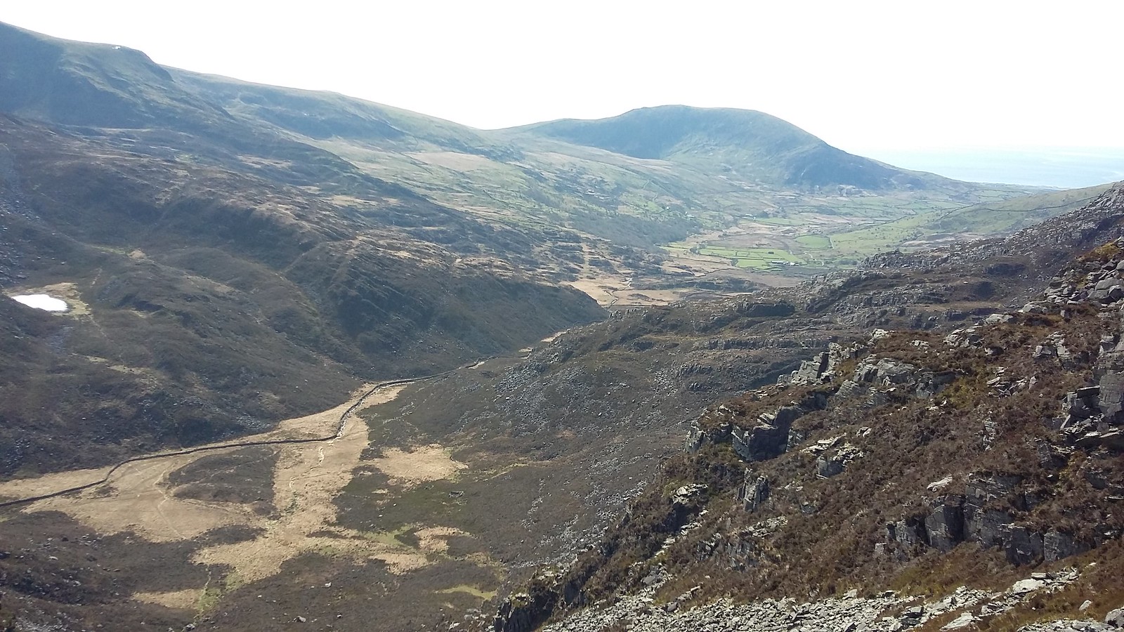
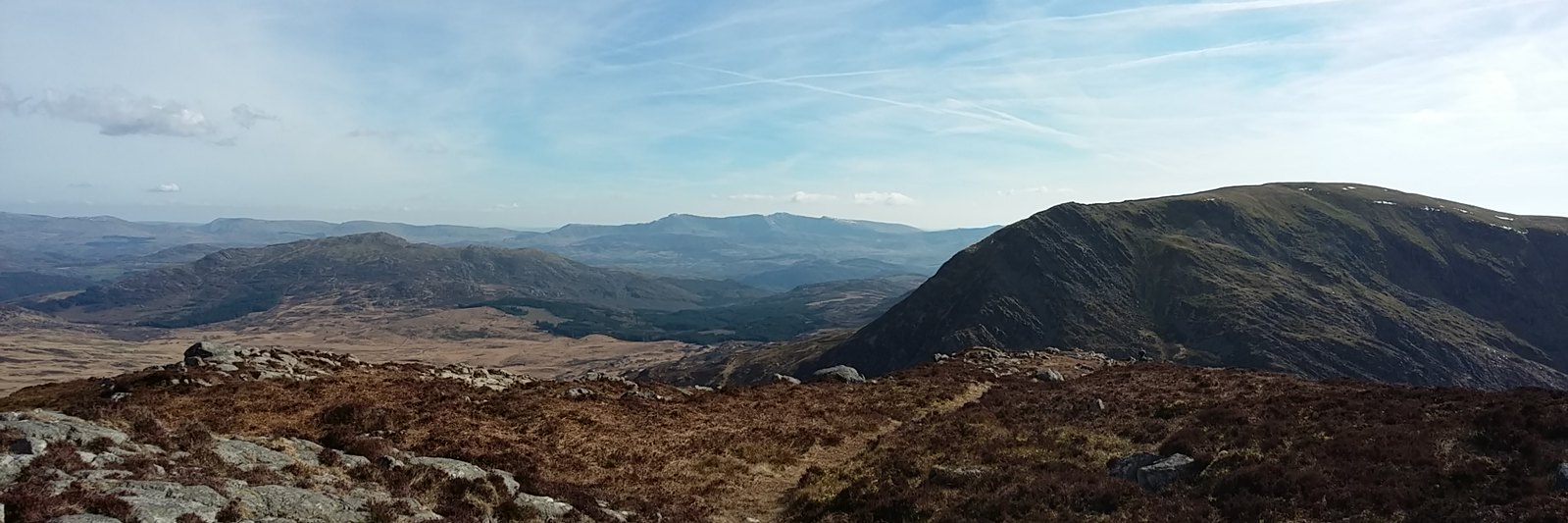
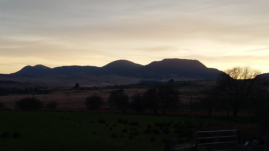
20170326_075316. Cycling up from Ganllwyd to our meeting point at Trawfynydd, I was treated to just the adrenaline-inducing views that one wants at the start of a walk! Almost the whole of the planned route is visible in the morning light: on the far right Moel Ysgyfarnogod, then moving left, Rhinog Fawr, Rhinog Fach and Yr Llethr, with Diffwys partially hidden behind the trees on the far left. Wonderful

.
When I get to the start I find that Dr Frank is wearing the same clownish walking gear as I: shorts over Ron Hills

Definitely something genetic...

Makes me wonder what our dad used to wear in his walking and climbing days......

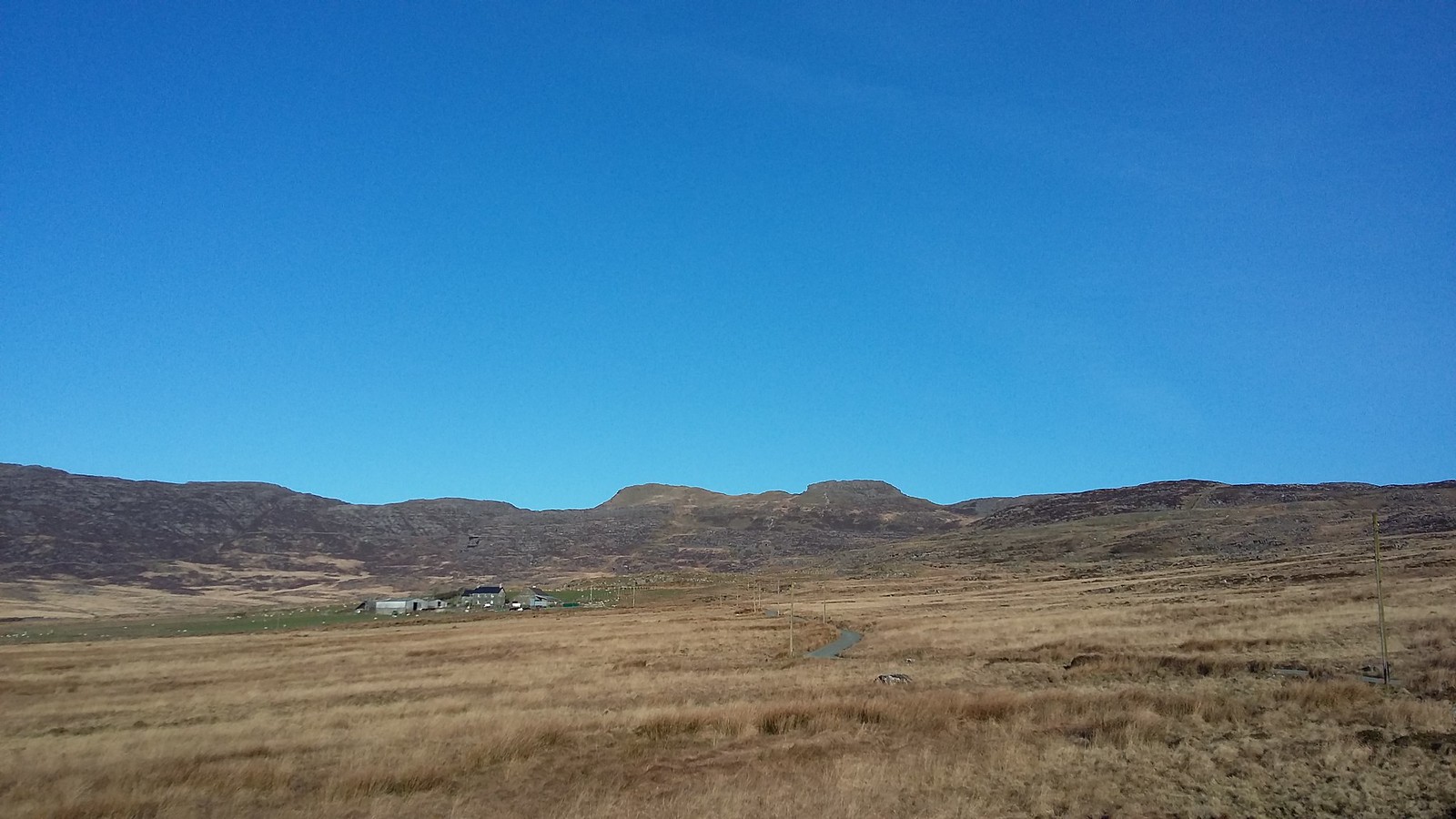
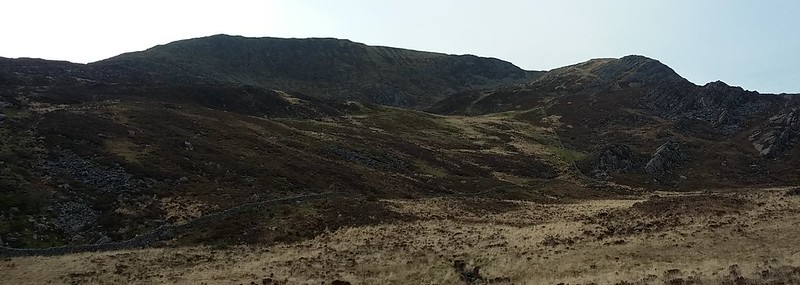
20170326_083928. Looking from where we parked up, close to the end of the track, towards Foel Penolau (slightly to the right of centre) and Moel Ysgyfarnogod (slightly to the left of centre). That's a seriously blue sky!
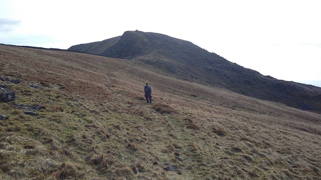
20170326_090236. After the usual extended faff, we get started at about 8.45. Looking back South from the early part of the ascent, it's pretty spectacular.
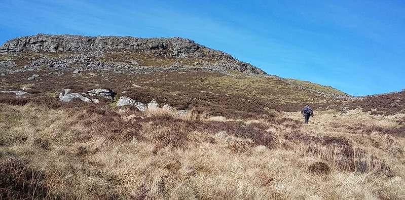
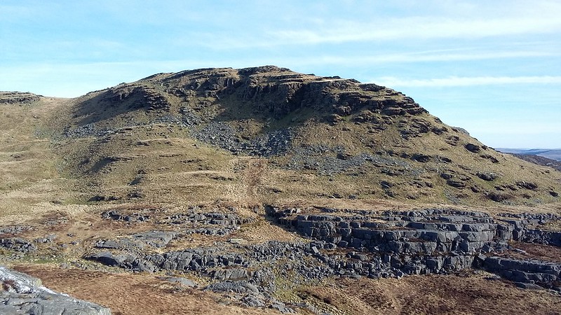
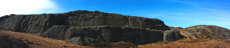
20170326_092552. Approaching Foel Penolau. A very slight scramble gets us up to the summit. We've both worked up a bit of a sweat now, so we strip off our jackets, Dr Frank threading his behind the elasticated chord webbing on the back of his sac.
20170326_093505. Looking back East from the summit at the (low) Dyffwys and Moel y Gyrafolen. In the centre background are the Blaenau Ffestiniog hills that I walked around a couple of weeks ago, and about a fifth of the way in from the LHS is a tiny triangular pimple that is Yr Wyddfa (Snowdon summit).

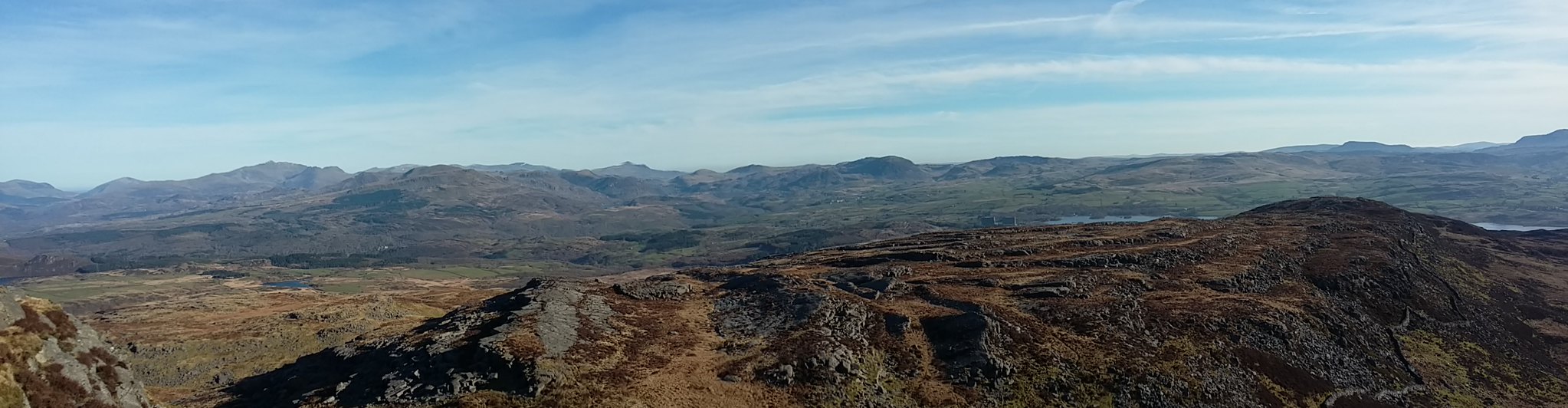
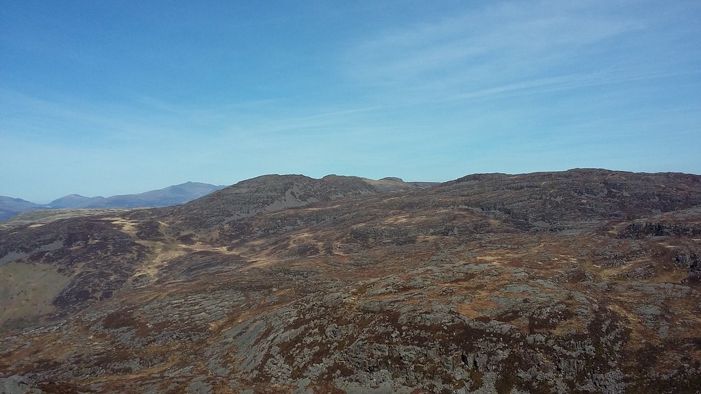
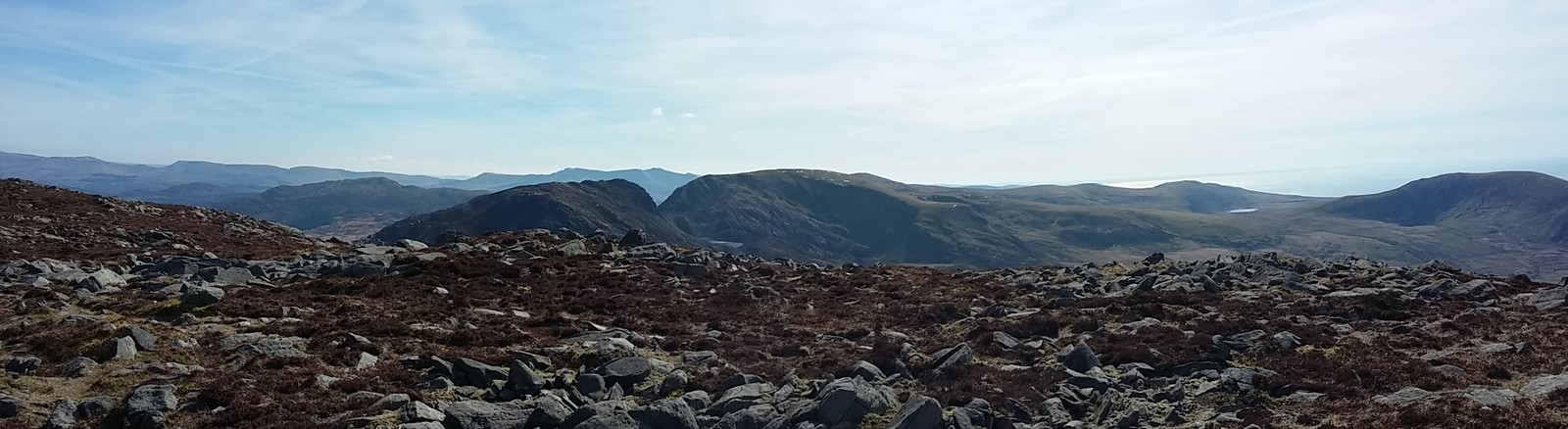
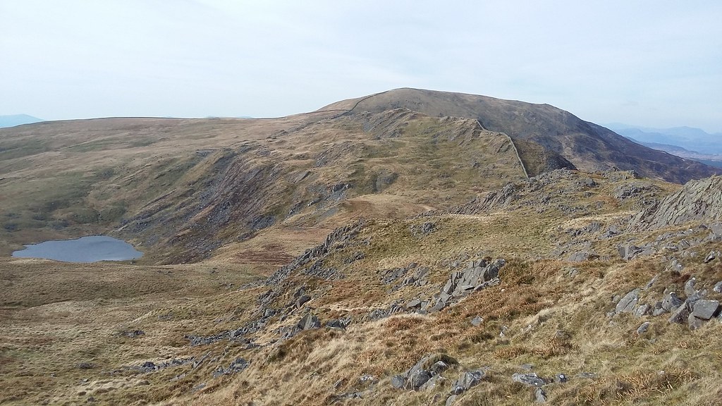
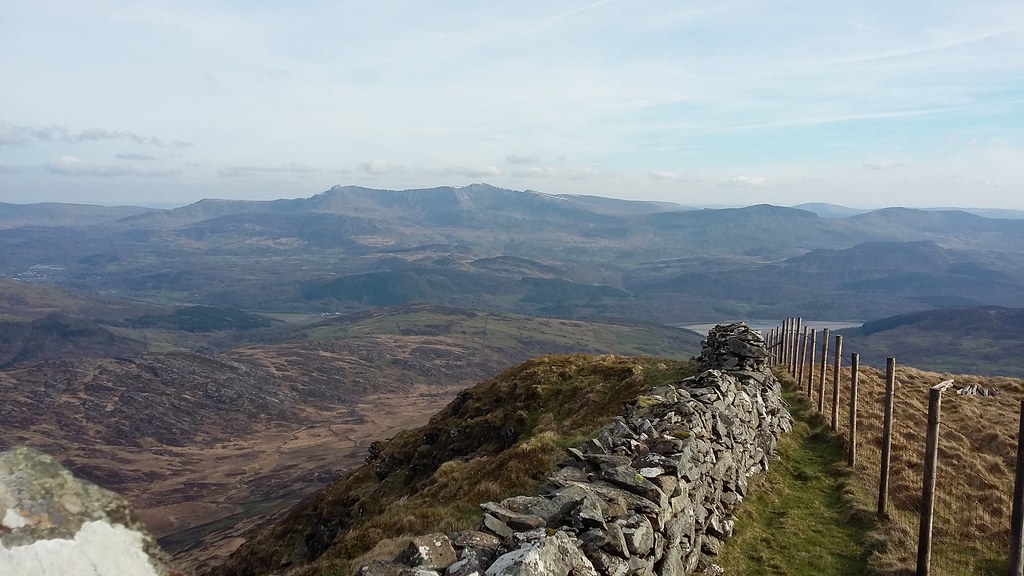
20170326_093658. Looking due South, we can see most of the route we plan to follow. Rhinog Fawr looks much closer than it actually is....
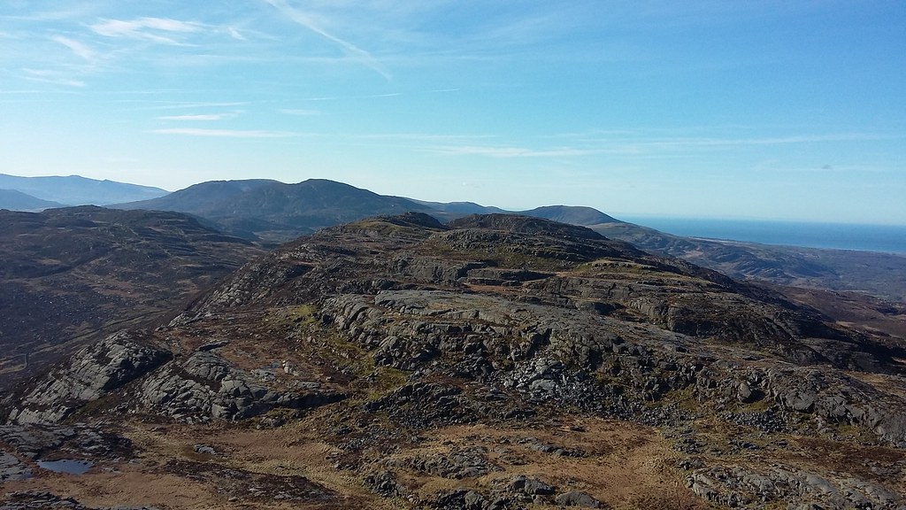
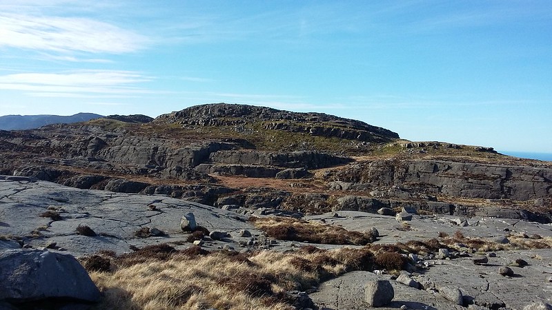
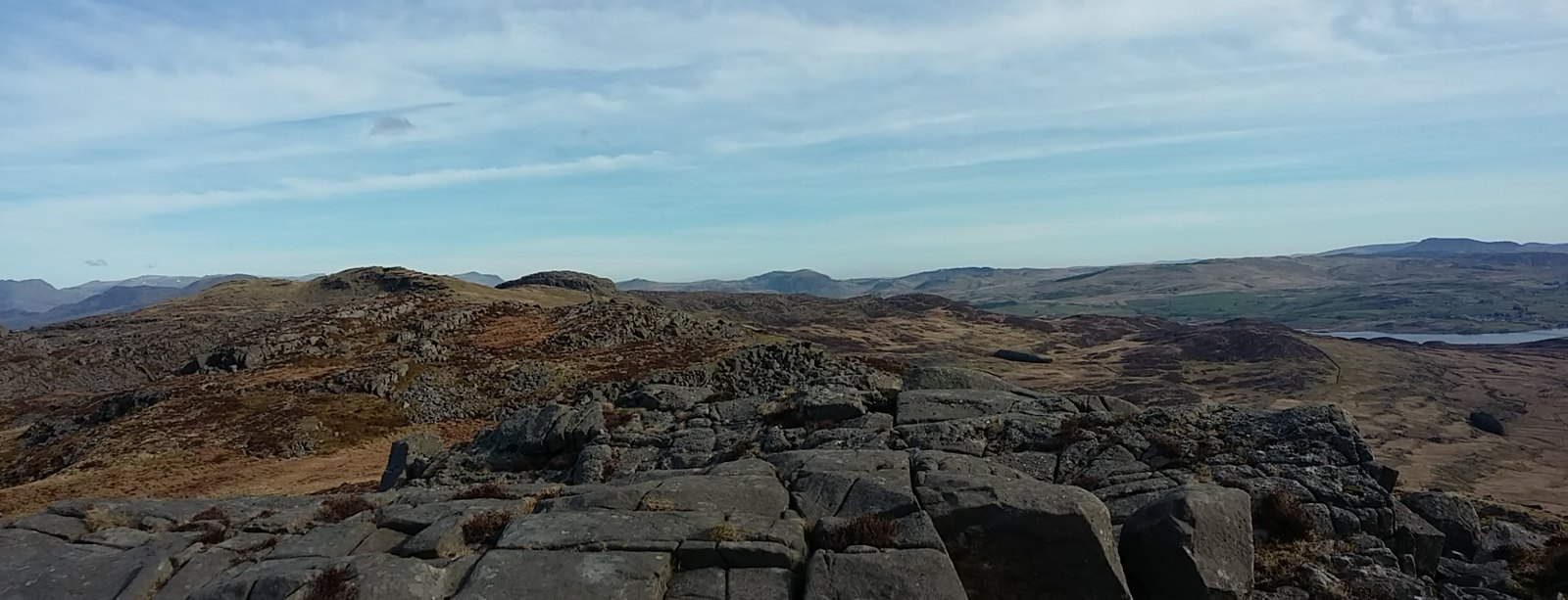
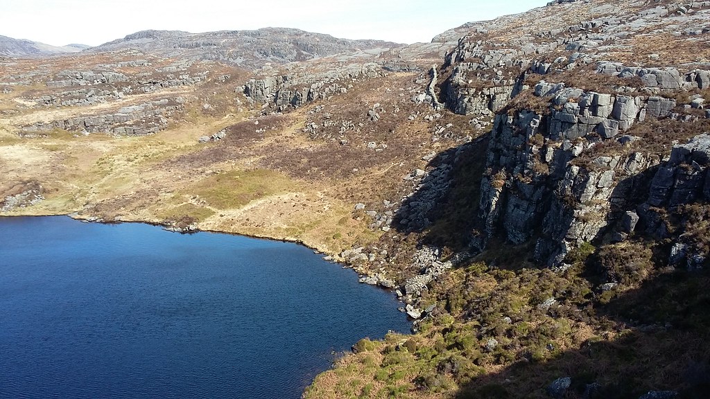
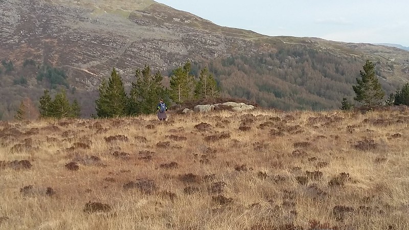
20170326_093716. The rock pavement I'd so much wanted to see is already apparent. It really is reminiscent of a pachyderm's skin! The cairn of Moel Ysgyfarnagod is visible more or less centre pic in the background. The sun is shining brightly, but there's a strong breeze so in fact it's quite chilly, and quite impossible to hold the camera still - so I take multiple pics in the hope that at least one isn't too blurred.
20170326_094751. It's something of a scramble down a cliff to get there, a bit awkward for me only being able to put load on my left arm - although looking back like this, it's apparent that there are ways of descending that would avoid a scramble.
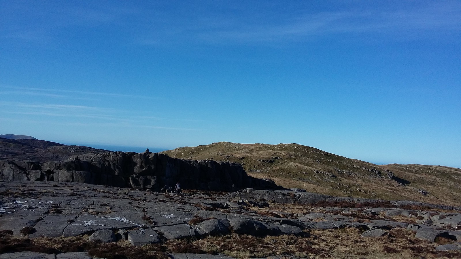
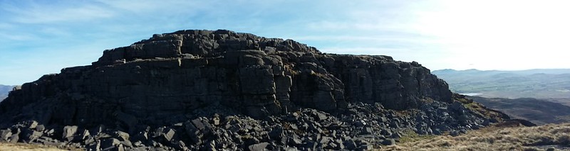
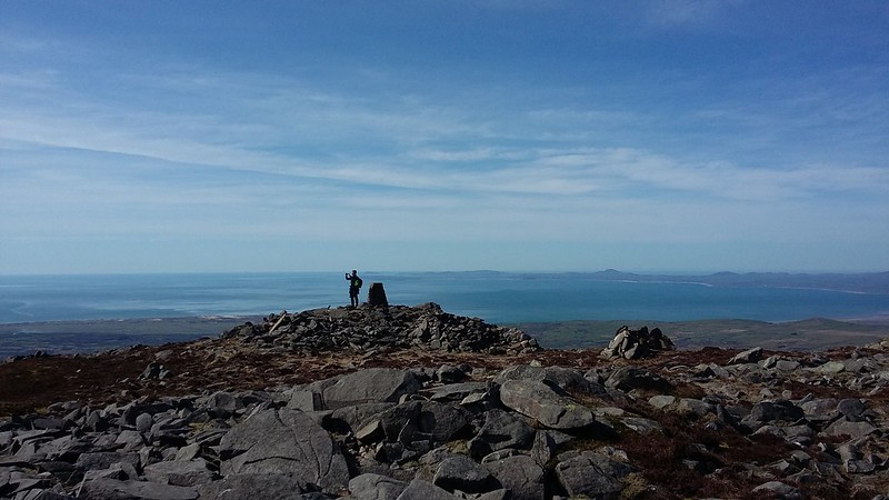
. 20170326_095303. At Moel Ysgyfarnagod - the first Hewitt. And the first horn. Time for a croissant and marmelade breakfast. The views continue to amaze. This is looking more or less due North: the Snowdon group in the distant background centre, I think, and the Glyders to the right; Moelwyns centre middle background, and Moel Siabod RHS.
20170326_095606. And looking ahead - wild, or what?
20170326_100345. The descent from MY is straightforward enough - this is looking back at it.
20170326_100626. ...and looking forward at the route ahead.
20170326_101145. ...with an interesting scramble down or two on the way.
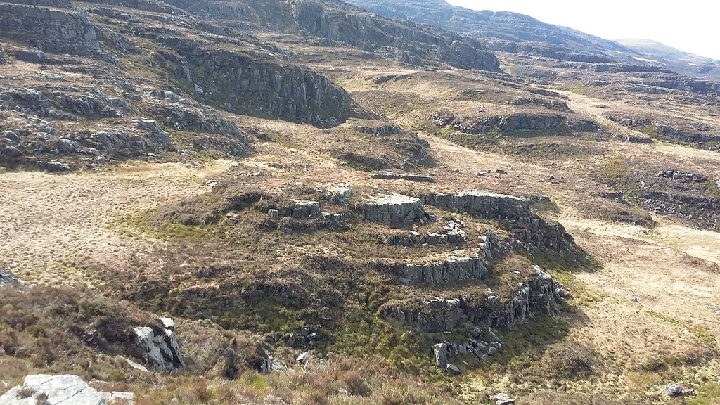
20170326_101604. Fantastical rock pavement landscape - looking back at Moel Ysgyfarnagod.
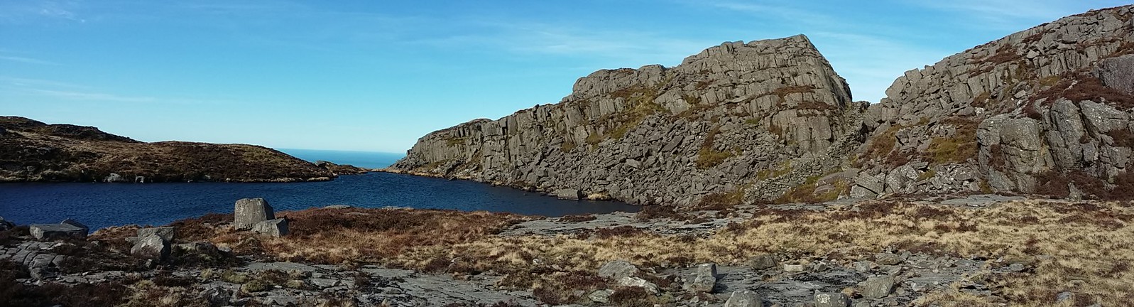
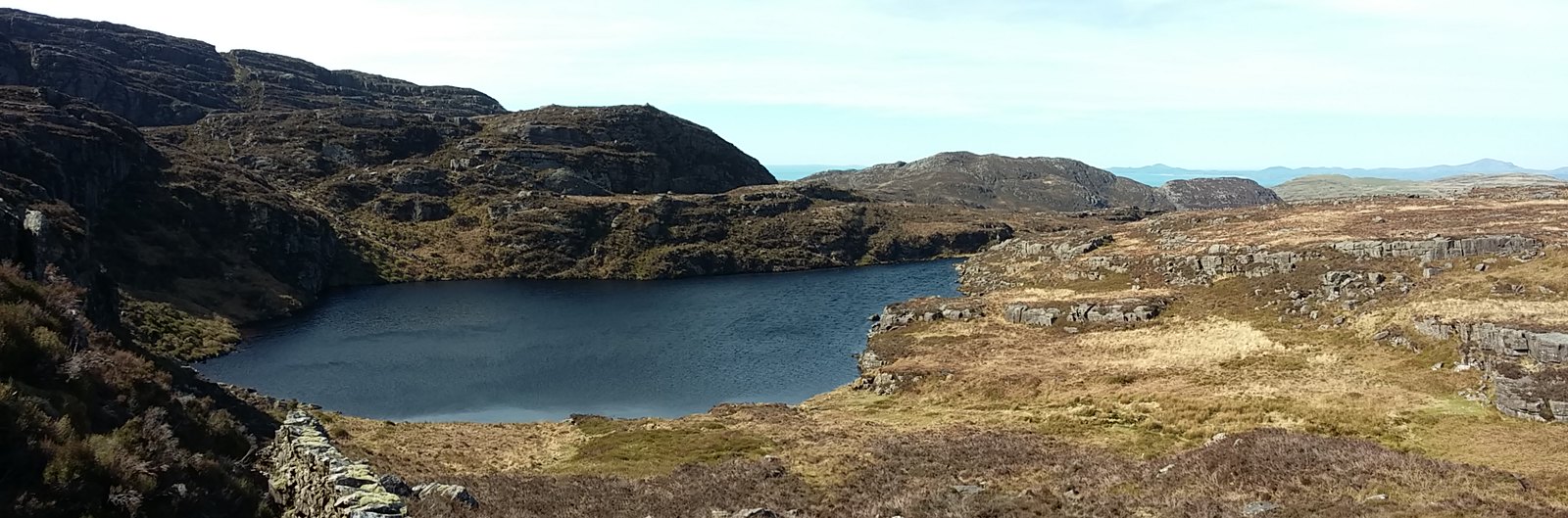
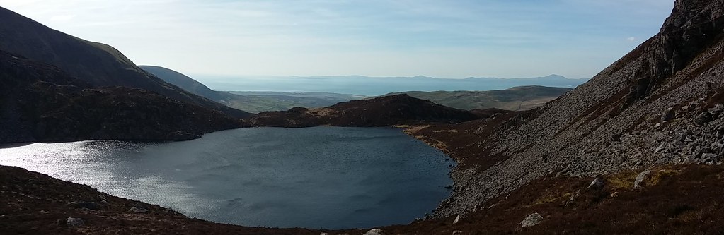
20170326_102150. Llyn Du, one of many many small llynau en route.
20170326_103130. The fantastical rock pavement landscape continues... ...this shot looking back the way we've come again.
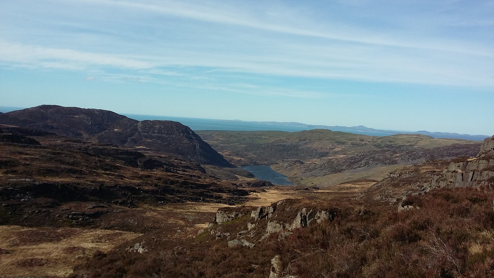
20170326_103250. And this looking ahead across wild landscape towards Llyn Pryfed and Craig Wion, the slight summit on the RHS.
20170326_110040.
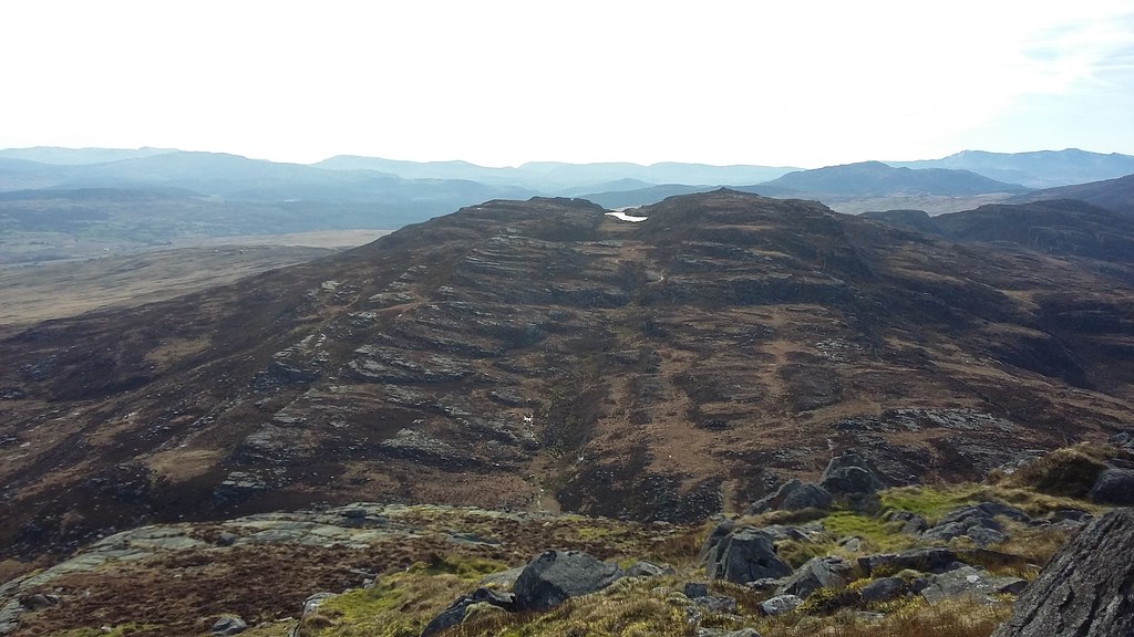
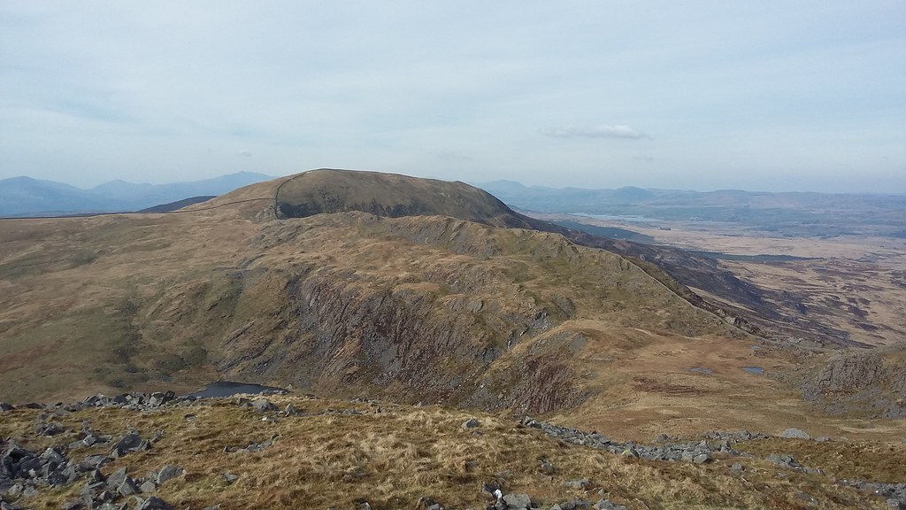
Craig Wion LHS, Rhinog Fawr just right of centre, and Rhinog Fach behind and to the left of it. Again, it doesn't look that far away, but it is!
20170326_110439. The approach to Craig Wion. The wind is still pretty strong, so we aim for the shelter of the low cliffs ahead, where we stop for a second breakfast. Dr Frank unshoulders his pack, and starts to rummage for his food, when...
"Oh no! My jacket's dropped off!"
He holds up his sac: the (manufacturer's) knot in the elasticated chord webbing that was holding his jacket has come undone.
"I'll have to go back for it - it's got my wallet and car keys in it!" he groans.
So after consuming a short second breakfast, we set off back to look for it. I point out that it could be quite a challenge because of the roughness of the terrain in which a jacket might be quite difficult to see, and because we'd frequently used slightly different routes, and we'd no idea at all where it had dropped...
I like to put a positive spin on things.
But, miracle of miracles, we find it a mere couple of hundred metres back along the way;
...so what could have meant a disastrous end to the day turns out to be little more that a very minor inconvenience (though a very salutory lesson on a number of dimensions!).
20170326_112524. The relief at not having the day ruined certainly puts a spring in our joint steps, and, heads down, we crack on across the never-ending rock pavement - again I'm struck by its similarity to a pachyderm's skin. There's a big semi-cliff drop ahead that is only apparently if you look closely at the pic.
20170326_112559.
As is almost invariably the case with really dramatic landscapes, photos never seem to capable of doing justice to the intensity of the experience lived at time. The sensation of just being in the centre of this crazy place defies description. This pic looking back to where we've just come from gives some very slight sense of what it's like... It's worth clicking on the pic to get the full-size image, better to get a more representative impression.
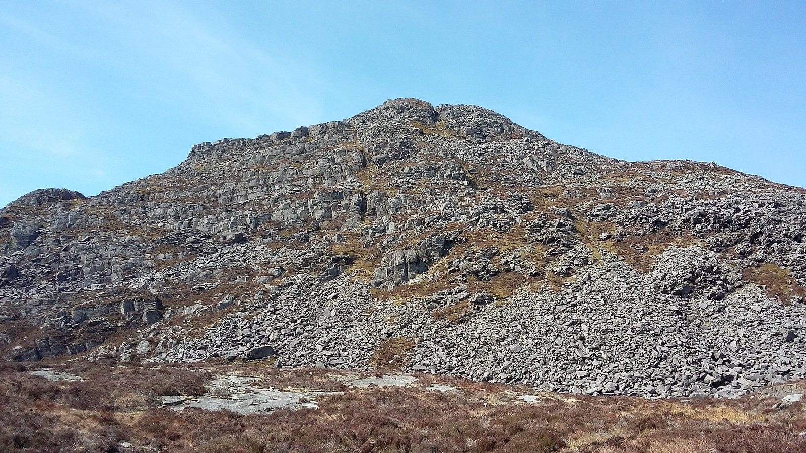
20170326_113726. Lots of ups and downs, including minor down-scrambles (avoidable with a bit of searching if this isn't your bag), and generally pretty tough country. Rhinog Fawr
is slowly getting nearer...
20170326_114050. Then this amazing Greek theatre-like rock formation! We both involuntarily exclaim aloud. Again the pic doesn't do it justice: in the flesh (rock???) it's truly sensational. We just stand and stare at it. I've no idea what the geological formation is, and subsequent research hasn't revealed any information either. If anyone has any idea, I'd be most interested to hear...
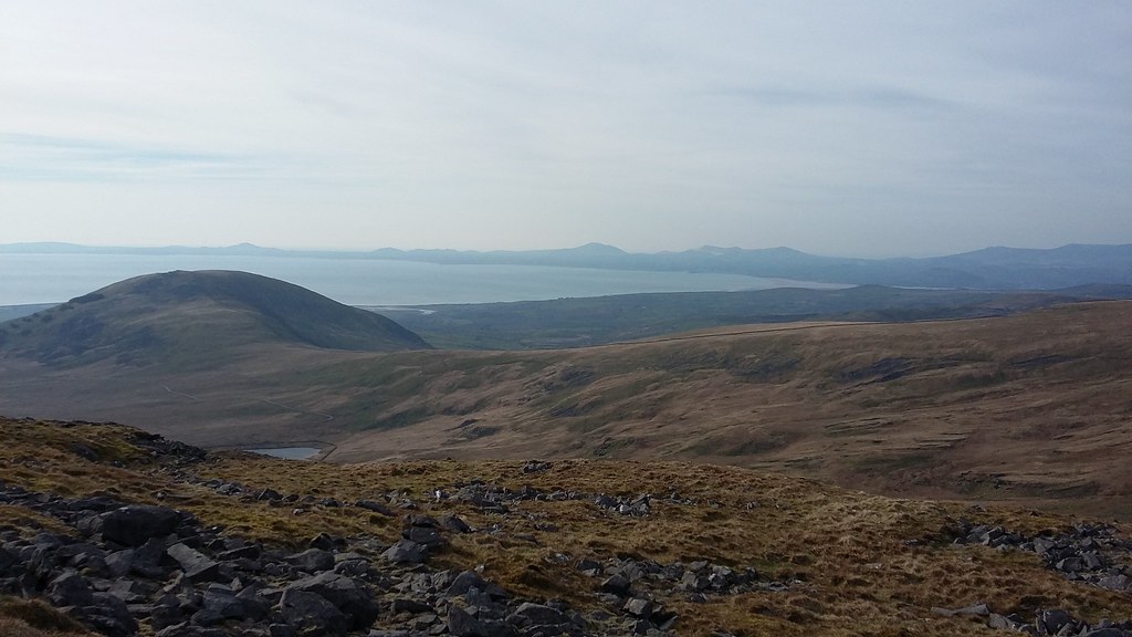
20170326_114055. Looking more or less due West from the same point towards Llyn Cwm Bychan, with the sea and the Lleyn Peninsula in the background.
20170326_122358. Going on from the strange ancient Greek theatre-like rock formation, we (actually I) get a bit disorientated by the up-and-down topography, so I have to stop and sort out bearings, location etc. And then we get back on track, which is aimed at passing by Llyn Morwynion. From the map it looked wonderfully situated, in the middle of a huge expanse of rough rock pavement.
20170326_122419. Looking back over the terrain we've traversed over the past hour. Yet again, it doesn't look very far, but it felt pretty damned tough. With narry a sheep nor a bird to soften the edges of the bleakness.
. Indeed twice so far we've progressed over several hundred metres at a time on top of walls, because that was easier than walking on the ground; and we do it again on a couple of other occasions later in the day.
20170326_123201. Llyn Morwynion is a pretty magical place, and, prompted by growlings and gurglings from our respective alimentary canals, it's an easy decision to stop here for lunch. Dr Frank's lunch is a bit luxurious: cherry tomatoes (which as usual he generously shares), some fancy sarnies, etc. Mine is the staple cheese, salami and Branston Pickle. Slightly disturbing: we both
always take the same food ...
family genetics??? OCD???
20170326_124930. Looking back down on our lunch spot from the top of the steep ascent behind the llyn.
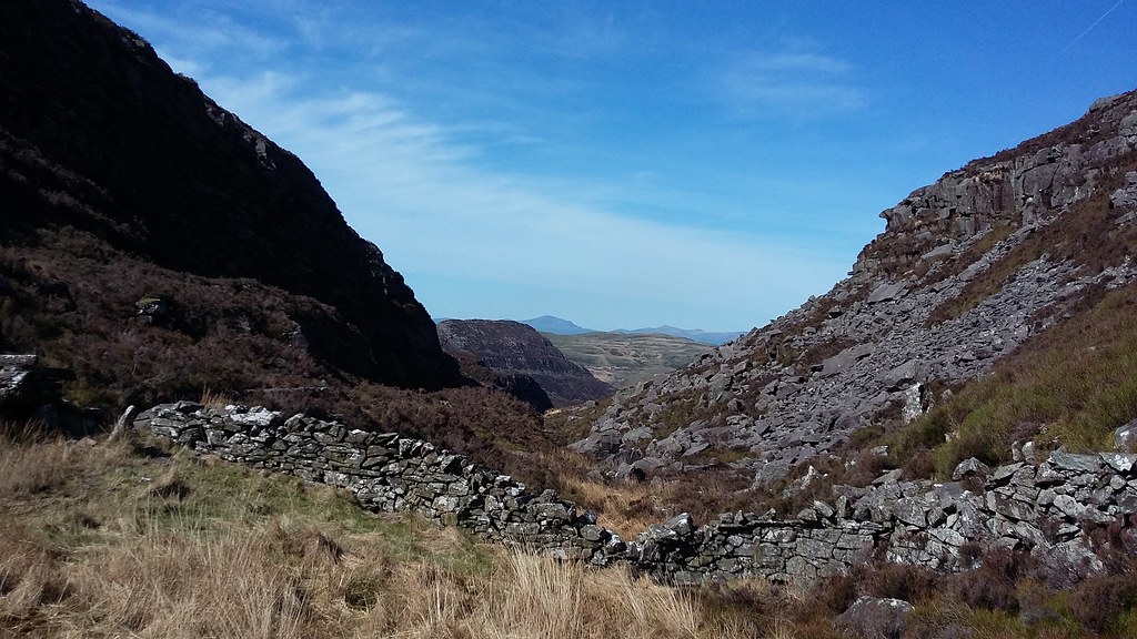
20170326_125633. Looking down Bwlch Tyddiad to where the Roman Steps must be (but unfortunately I only read about them after the walk, otherwise we might have wandered down and taken a look).
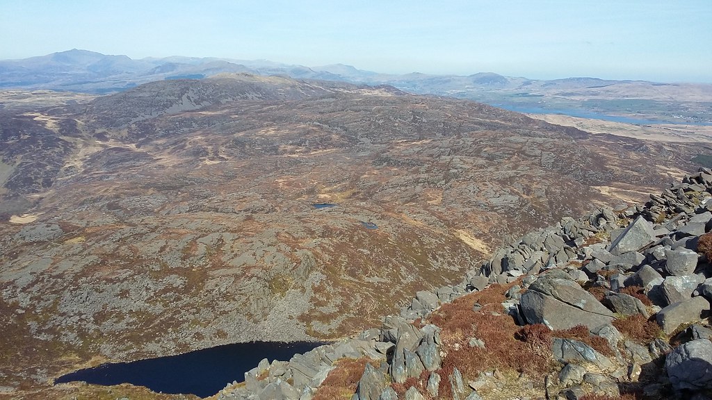
20170326_130528. Looking back more or less due North over the huge expanse of rock pavement we've traversed. Yr Wyddfa (aka Snowdon) is (I think, but will stand corrected) the triangular pimple about 1/3 of the way in from the left.
20170326_130547.
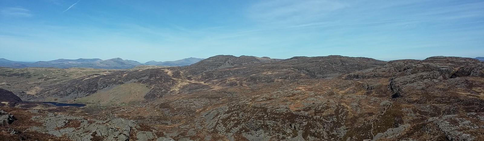
20170326_133604. Another half an hour of fairly intense up and down, followed by steep ascent gets us to the summit of Rhinog Mawr. Yet again stupendous views. Looking North, moving left to right, the Lleyn Peninsula shows on the LHS, Gloyw Llyn and Llyn Cwm Bychan in the middle ground, followed by the Nantile hills, and the Snowdon/Glyders/Carnddau 3000ers in the far background. Not half bad!
[/url]20170326_133658. And in the same direction, but looking downwards a little towards Llyn Du (second one - there are many Llyn Du's in Wales!!).
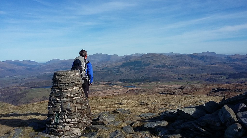
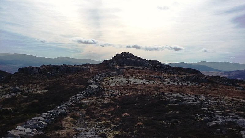
20170326_134257. The second Hewitt, Rhinog Mawr; and the second "horn". I think I'm getting sunburn! Hard to credit that it's still March.
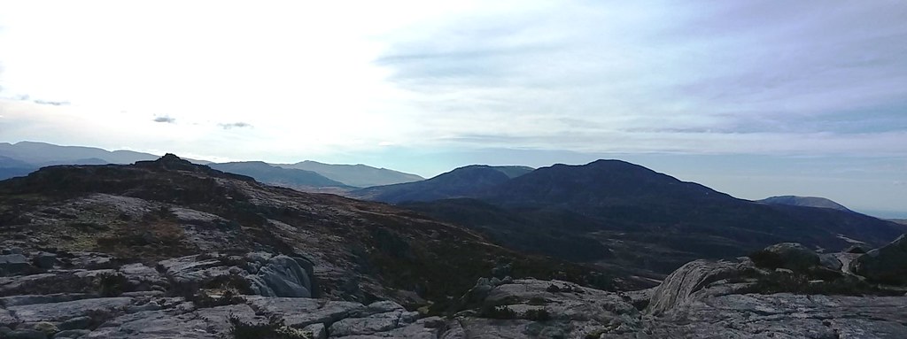
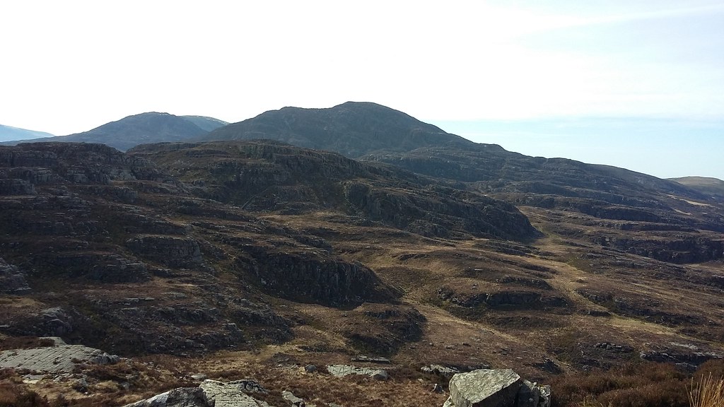
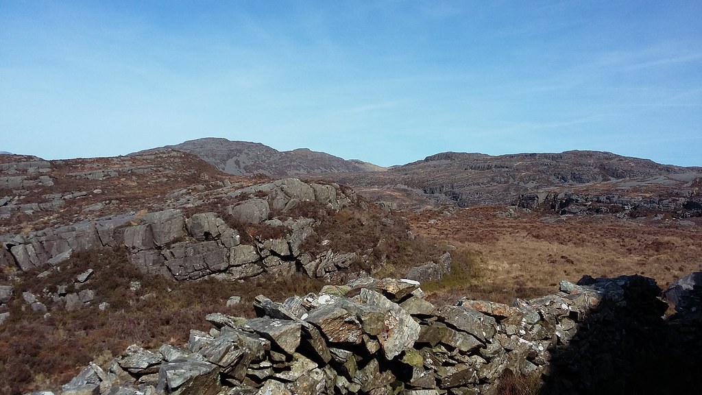
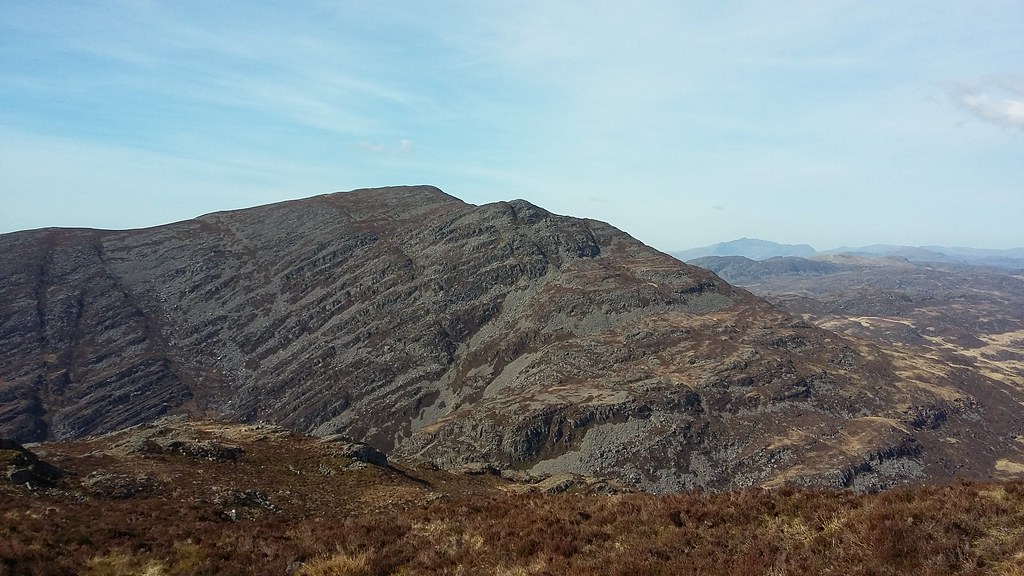
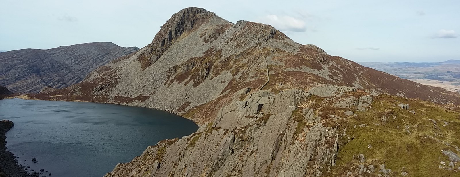
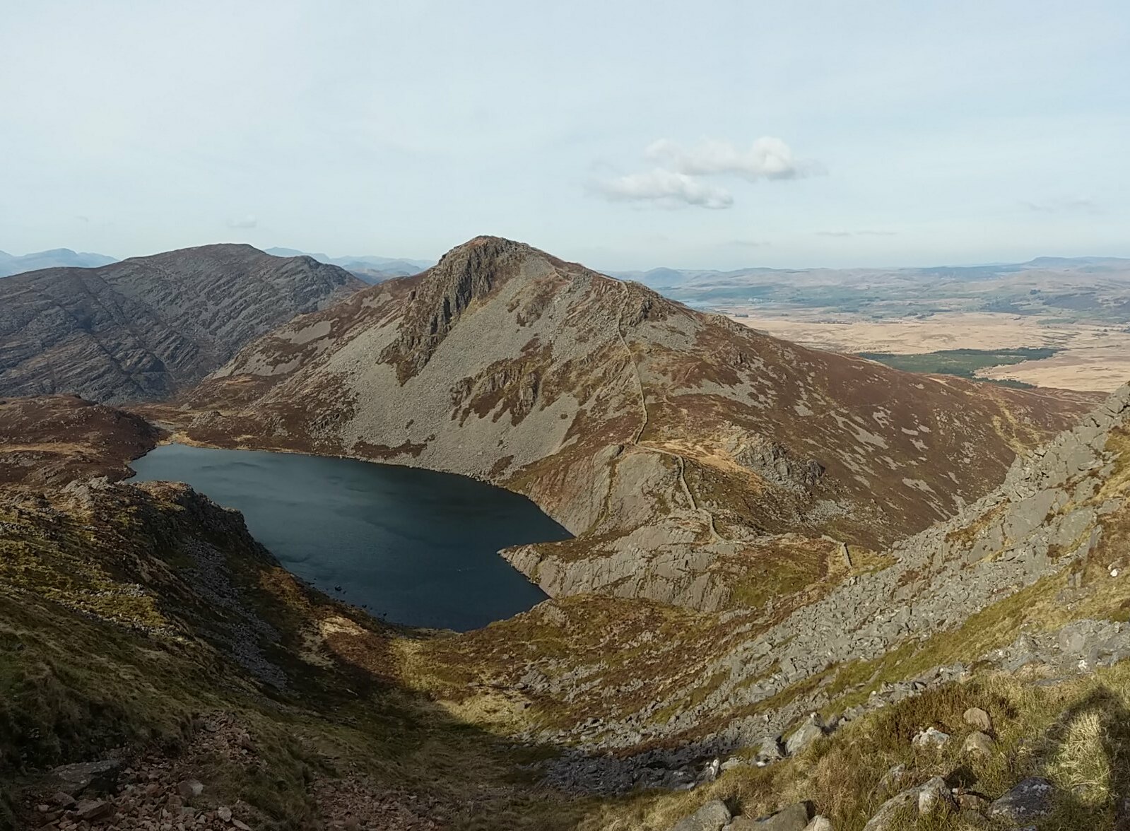
20170326_134353. Looking ahead towards Rhinog Fawr and Y Llethr. Diffwys (we've started calling it "Diffuse" ...) just visible behind Y Llethr.
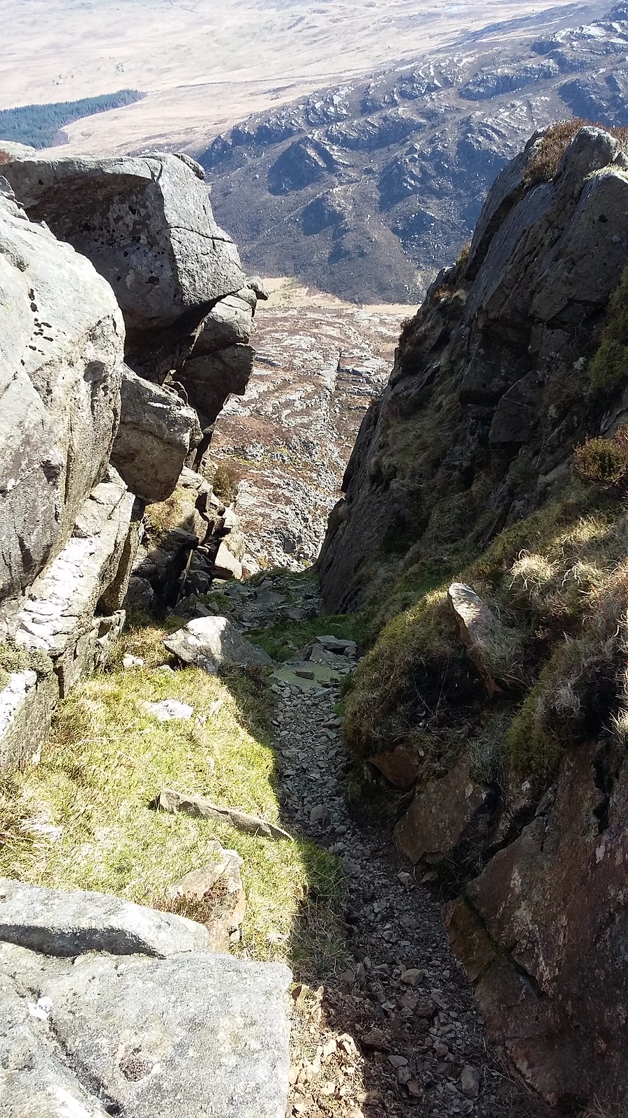
20170326_135403. The descent to the bwlch between R Fach and R Fawr is via this little cleft (if you want it to be reasonably easy).
20170326_135606. It's a goodly drop too - about 370m down, and same up to Rhinog Fach.
20170326_140940. Visually stunning...
20170326_140812. Looking South-West down Bwlch Drws-Ardudwy and Cwm Nantcool towards the sea. That dark green looks soft from here, but it's very deceptive. Close up it turns out to be dense deep heather overlying moss-covered boulder fields - as we are soon to discover as we tackle the start of the ascent to Rhinog Fach.
20170326_141521. ... and where the rock isn't covered by heather, it's just steep and rough: slow slow going. This is looking back at the descent of the first part.
But the descent is nothing compared to the ascent up the other side, which is horrendously slow for the reasons noted above. It takes something like 40 minutes to flog painfully through probably the toughest heather-covered boulder terrain I've ever traversed, and that only gets us about a third of the way up. I've subsequently looked back over other reports in WH and realized that we took absolutely the wrong route. So, in case anyone reading this is thinking of doing the Rhinogs (which I highly recommend as one of the best routes in the country), do NOT simply yomp straight up the hill from the bwlch. Looking at my pics and reading others' reports, it's clear that the best way up is to contour round to either the East or West sides, and pick out a route on rock that avoids the heather-covered boulder fields.
How tough the ascent is on the wrong route becomes apparent to me writing this report also, because almost an hour passes between a pic taken on the latter stages of the descent from Rhinog Fawr, to the next pic ...
20170326_151455. ... looking back at Rhinog Fawr from the point at which the ascent flattens out into the gently sloping plateau that leads to the summit of Rhinog Fach. As we approach the summit, we meet the first fellow walkers of the day, with whom we exchange a few pleasantries before going our opposite ways.
It's just amazing that there's no-one out on these utterly spectacular hills. We've already reflected earlier on the likelihood of there being something like 1000 - 2000 people on Snowdon. And this short distance away there's just magic and solitude.
20170326_152428. And looking back in the same direction from the summit itself. No pic of the summit BECAUSE THE HORN IS MISSING
. Just an uninspiring cairn.
20170326_153320. In the absence of a horn we don't linger, but head on towards Y Llethr, the route to which looks - and turns out to be - perfectly straightforward.
20170326_153717.
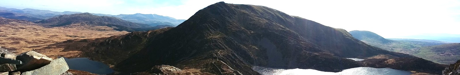
The view from the descent is a breathtaking panorama of rock and water, that is, however (at least for a point-and-click person equipped only with a smartphone), very difficult to capture on camera. This is the poor best of multiple attempts...
20170326_154431.
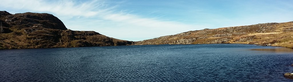
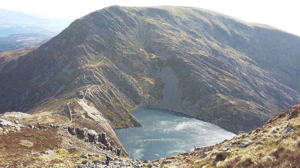
20170326_154857. Llyn Hywel is just wonderful...
20170326_155703. ... from every angle, this looking back from the ascent to Y Llethr.
20170326_160556.
We swig the last few mouthfuls of our meager water supply. Water has not worked out well today. Dr Frank's bottle has dropped out of his sac somewhere along the way; and for pretty well the first time in years I haven't lugged my standard 4 litres of water with me, assuming that - it being Wales - there would be plenty of streams from which one could slake one's thirst, so I only brought a litre. Big mistake! It's like the Carneddau - bone dry except for the llyns, from which I don't fancy drinking. The only moving water we've identified so far has been by sound, deep in a boulder field, totally inaccessible. We can only hope we find some running water soon...
20170326_162652. The summit of Y Llethr is also without a horn. But the ridge ahead that leads to Diffuse, and that looked so appealing from the map, promises to be just that.
20170326_163106.
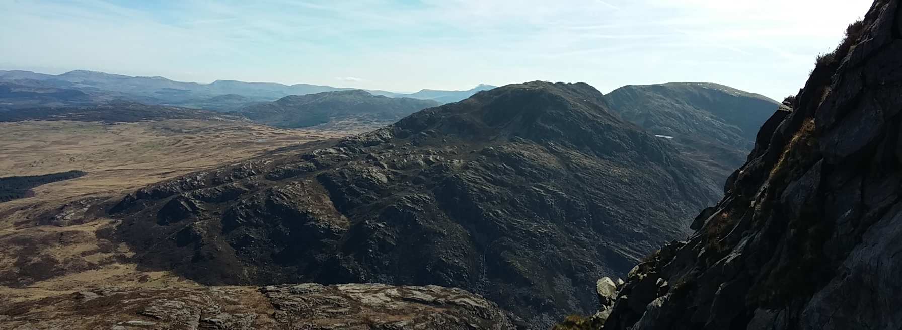
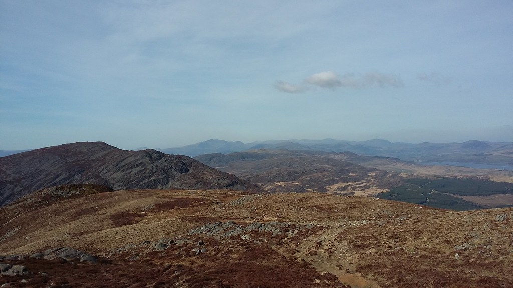
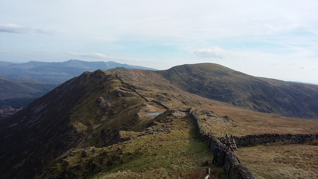
20170326_170609. Looking back along the ridge, it's been an easy relaxing walk - just what is needed at this time of day. We're both far more tired that we would have expected for this length of walk, with a modest amount of ascent. That tough stuff earlier on has really had an effect...
20170326_170616. Ahead is what looks like the summit of Diffuse; but it isn't; it's just the perspective on the wall as it crests the summit plateau; and in fact this point is not even the summit.
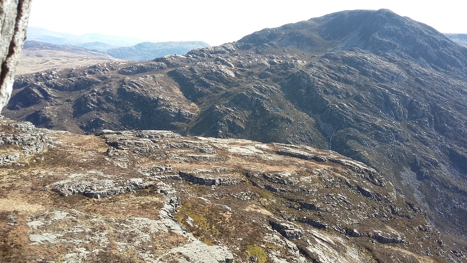
0170326_171424. The summit itself is in fact pretty unprepossessing - or rather, it's effectively invisible, with nothing to mark it. But the views make up for it.

This is looking back along the whole length of the ridge to Y Llethr...
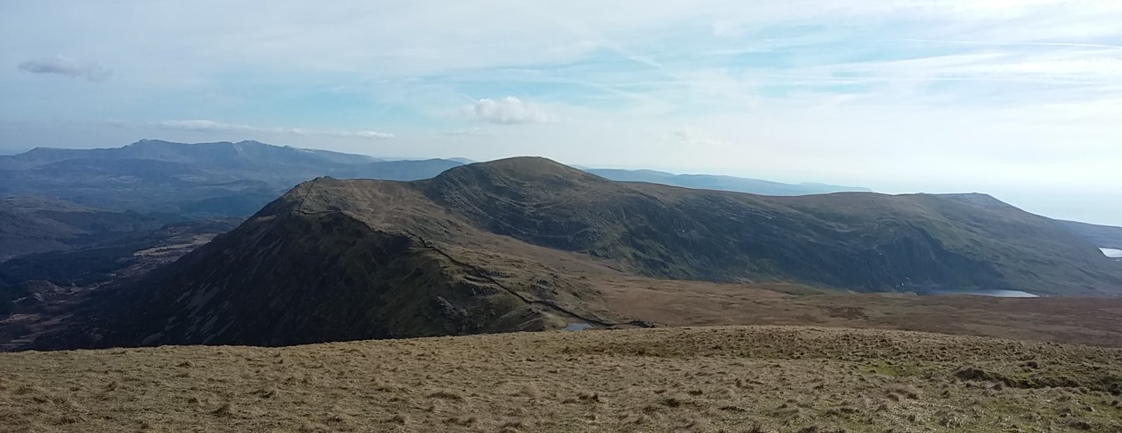
20170326_171428. ... and turning anticlockwise, this looking North West towards Moelfre (foreground) and the Lleyn Peninsula (background)...
20170326_172618 ... and this a little further along from the summit, as we're about to start the steep descent, looking South South West towards Cadair Idris. Our route takes us down the steep section of the ridge to about the 500m level, when we bear left across the rough ground visible on the LHS of the pic, more or less in the direction of Y Garn, aiming to hit the forest track.
About 10 minutes after this, as we get to the flatter rough ground, we come across the first running water of the day...
20170326_175111. ...just deep enough to enable us to fill our bottles. Boy, water never tasted so good
.
20170326_180227. Much refreshed, we continue to hack through the rough ground. This pic is looking back up the way we have just come.
20170326_182449.
20170326_182459. This is just before the 50m or so descent through the forestry to the track. We're kind of expecting the worst, knowing how very difficult it is getting through forestry. And we're not disappointed.
It takes an absolute age to get down that mere 50m, beset as we are with the 3-fold perils of hidden boulders, rotten timber - some hidden and some blocking our way; and both liberally bedecked with brambles.
But eventually we do make it, surprisingly without injury, and it's a short walk down the unmetalled track to the car park. Where we see the couple we passed on Rhinog Fach, just packing their car. This is very fortunate indeed, because Dr Frank is now suffering very badly from cramp, his electrolyte having dropped out of his sac along with his water somewhere en route. The couple very kindly respond to our enfeebled entreaties, and take us down the track to the main road, from where we intend to hitch back to the car; but they even more kindly make a detour to take us right back to the car - a good few miles. If you should read this: many many thanks to that kind couple from Lincolnshire that is holidaying in Barmouth! Who says that kindness is dead!
20170326_192623.
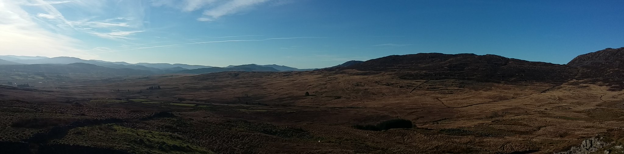
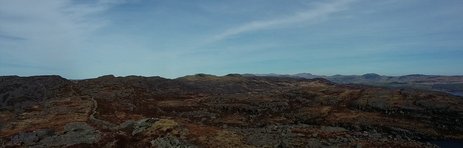
On the way back to Trawsfynydd I can't resist stopping to snap this to create the other bookend for the day...
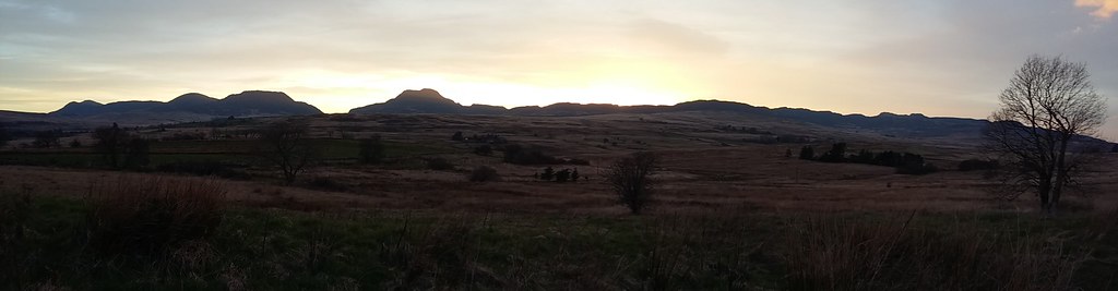
20170326_192747. ... the whole of the route in evening light.
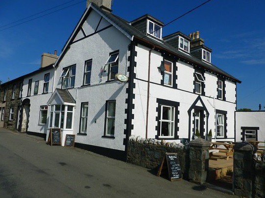
. Having collected my bike from Dr Frank's car, and recalling our earlier shortage of liquid, there is now an urgent need to replenish liquid and electrolyte levels. So we repair to an establishment of cultural, architectural and historical distinction in Trawfynydd, and take the necessary action. I have to say that I feel more tired than after walks of twice the distance and ascent: this was one very tough walk! It took us 2.5 hours longer than Naismith, and even allowing about 1.5 hours for the 200+ pics and food stops, that's well outside expectations. Conclusion: the terrain has a very significant effect on theoretical times!
Summary. Probably the best walk I've done South of the border: some of the most dramatic landscape imaginable - enough to elicit involuntarily audible "ohs" and "ahs": huge contrasts; character and views, near and far, high and low - in every way sensational. Massively to be recommended - should be on every walker's bucket list. The only things I will do differently when I do it next time are:-
1. Take a better route up Rhinog Fach.
2. Start earlier and extend the route to include Y Garn.
