free to be able to rate and comment on reports (as well as access 1:25000 mapping).
One week after a great snowy day out in the Lake District the unpredictable weather of the British hills had struck once again and all of that lovely white stuff had melted away save for the odd patch spied on Helvellyn. Still with a beautiful day forecast on the Sunday an opportunity to return was too great to miss and once again the journey over the A66, (a route that I could probably drive in my sleep, and have done once or twice

), was undertaken. This time however Nicola and Grace joined me and the mighty Hughie for what has unfortunately become a rare family outing.
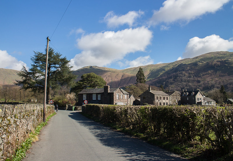
With the fitness levels of Nicola and Grace being questionable there was little point in being overly ambitious so we parked up at Grasmere, that most wonderful of Lakeland villages, and set off up Red Bank Road before turning up the public footpath up Silver How.
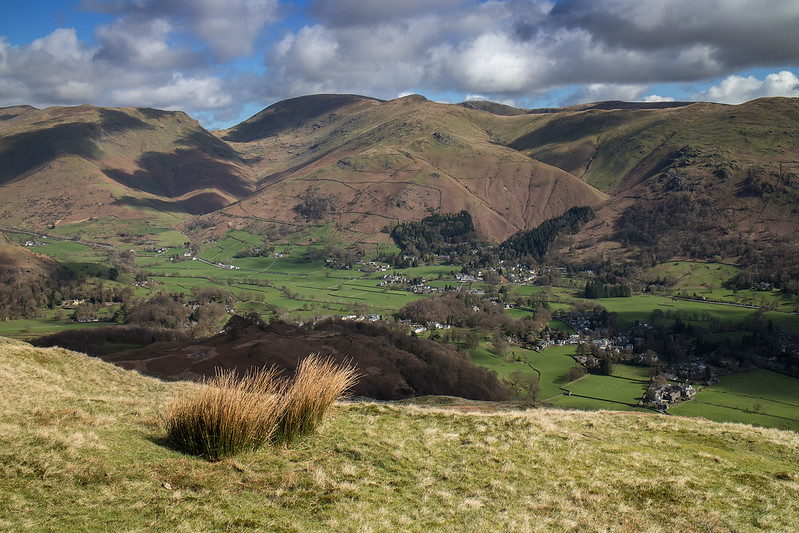
 Looking back at Grasmere
 by
Anthony Young, on Flickr
 Not so much Silver How as Rusty How
 by
Anthony Young, on Flickr
 On to the open fellside
 by
Anthony Young, on Flickr
 Following the wall
 by
Anthony Young, on Flickr
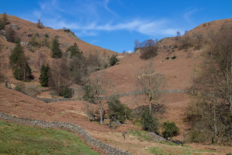
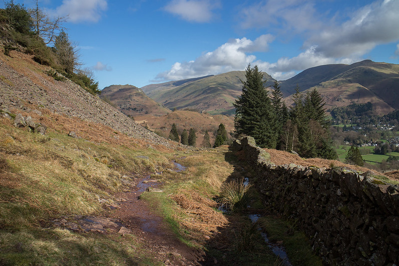
The countryside around these parts is idyllic, mirror like lakes, beautiful natural mature trees, rugged crags all backed by higher fells. All of this can be enjoyed to the full on the fairly easy walk up Silver How eased by some very fine stone pitching up the ascent gully that would otherwise be an eroded mess.
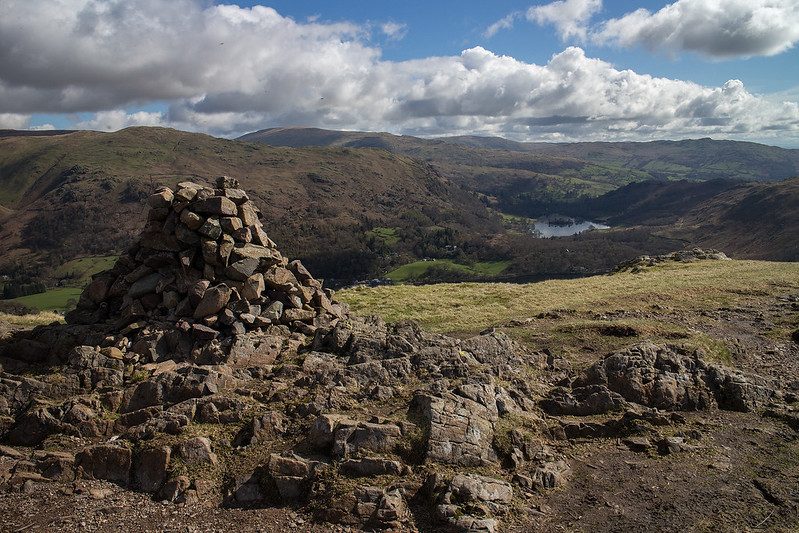
 Grasmere and Rydal Water
 by
Anthony Young, on Flickr
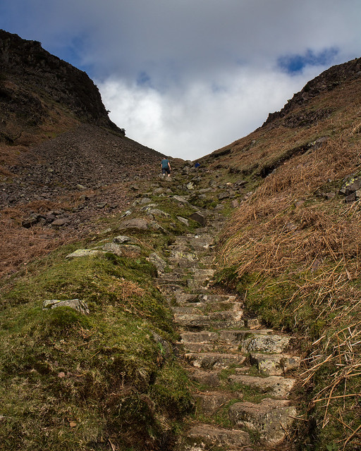 Stone pitching up the gully
 by
Anthony Young, on Flickr
 Looking down on Dow Bank
 by
Anthony Young, on Flickr
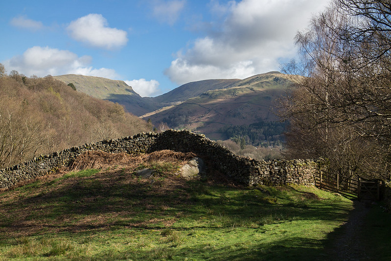
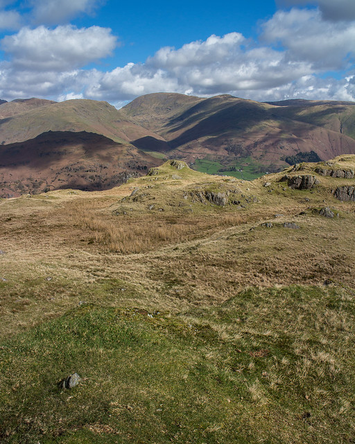
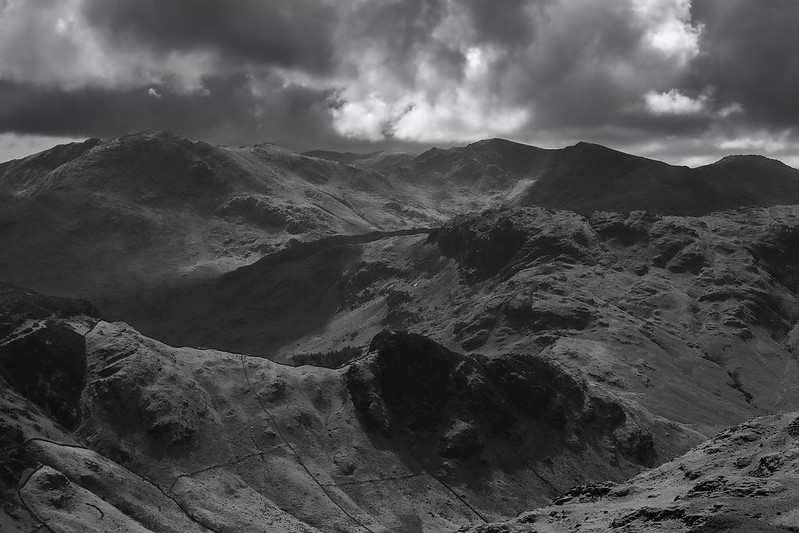
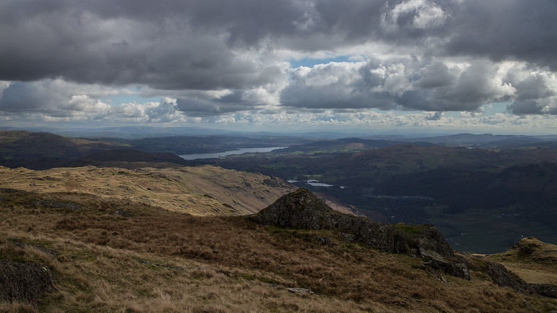
It was a magnificent day and a magnificent view to match form the modest summit of Silver How. The Helvellyn Range behind the shaggy terrier of Helm Crag and the Western arm of the Fairfield Horseshoe provide fine interest before moving around to the Lakes of Grasmere, Rydal Water and Windemere. The Forests of the South Lakes give way to the Fine ridges of the Coniston Fells before Langdales finest are beautifully seen to the West.
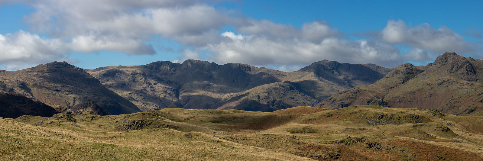 Langdale Fells from Silver How
 by
Anthony Young, on Flickr (click on pic to see full size)
 Silver How
 by
Anthony Young, on Flickr
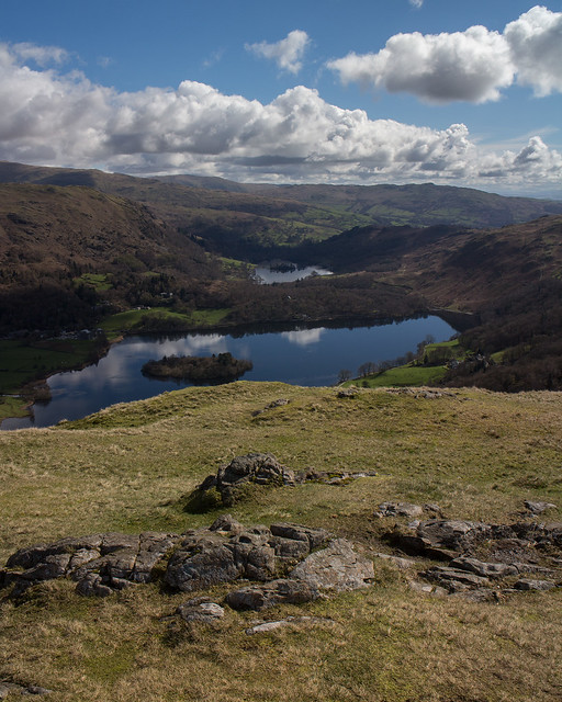 Grasmere and Rydal Water from Silver How
 by
Anthony Young, on Flickr
 Seat Sandal, Fairfield and others
 by
Anthony Young, on Flickr
 Langdale from Silver How
 by
Anthony Young, on Flickr
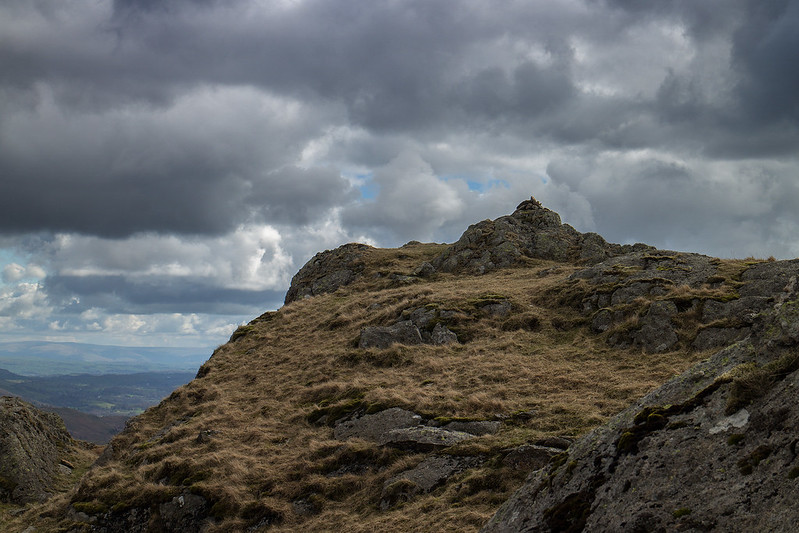
We lingered a while, who wouldn't? before heading in the general direction of Blea Rigg. Before this however there was the small matter of three Birkett tops that as I was here I thought I may as well visit. The first, Lang How looks quite promising at first before you realise the real top is just a grassy rise, the next, Swinescar Pike provides confusion if nothing else. Hill bagging UK gives the top as a prominent cairn on a grassy mound but the OS map certainly points towards a odd grassy knoll to the North West. There is little doubt that the cairn is slightly higher but when the actual book is consulted it sides with the OS map for both grid reference and description. Wherever the top is the view down to Langdale is superb with Crinkle Crags taking center stage.
 Tarn near Lang How
 by
Anthony Young, on Flickr
 Looking down to Langdale and Youdel from Lang How
 by
Anthony Young, on Flickr
 Langdale from Swinescar Pike
 by
Anthony Young, on Flickr
 Swinescar Pike Summit?
 by
Anthony Young, on Flickr
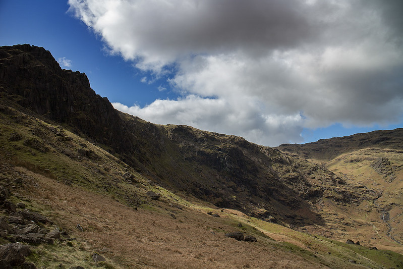
The Landscape around these parts is very typical of much of the Lake District, rough craggy terrain with a multitude of paths winding around the obstacles reveling different views at every turn, it's hard to imagine many places with as much charm as this especially on a beautiful spring day. The next Birkett, Raw Pike/Castle How was reached and we took in the fine view to the Coniston fells before the final winding climb up to the days modest high point of Blea Rigg.
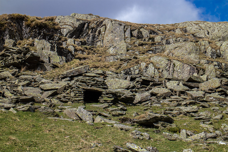 Old Shepard's/miner's shelter
 by
Anthony Young, on Flickr
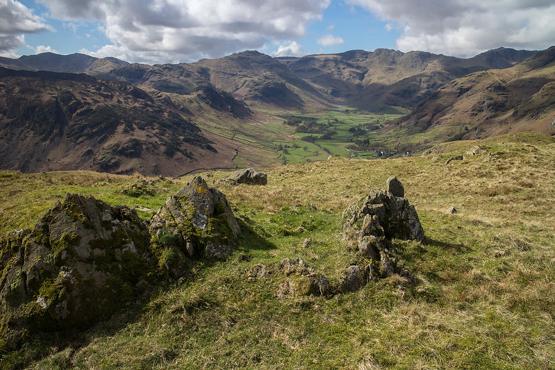
 Coniston Fells from Raw Pike
 by
Anthony Young, on Flickr
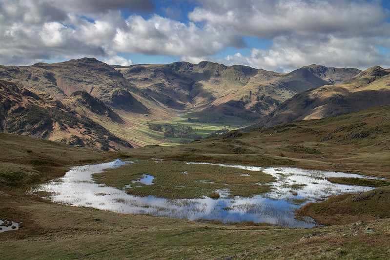
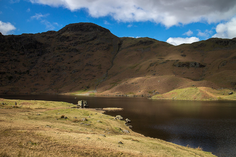
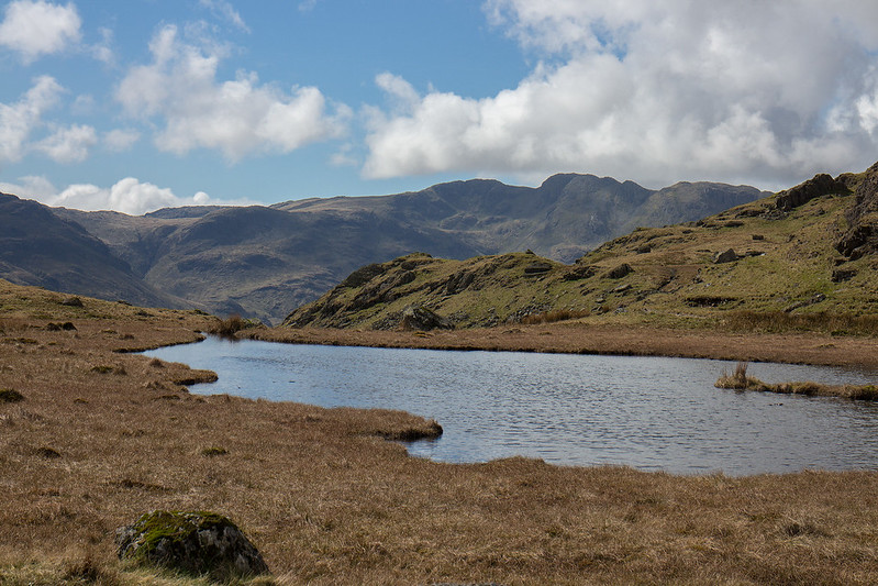 Tarn and Crinkle Crags
 by
Anthony Young, on Flickr
 Easedale Tarn from the route up Blea Rigg
 by
Anthony Young, on Flickr
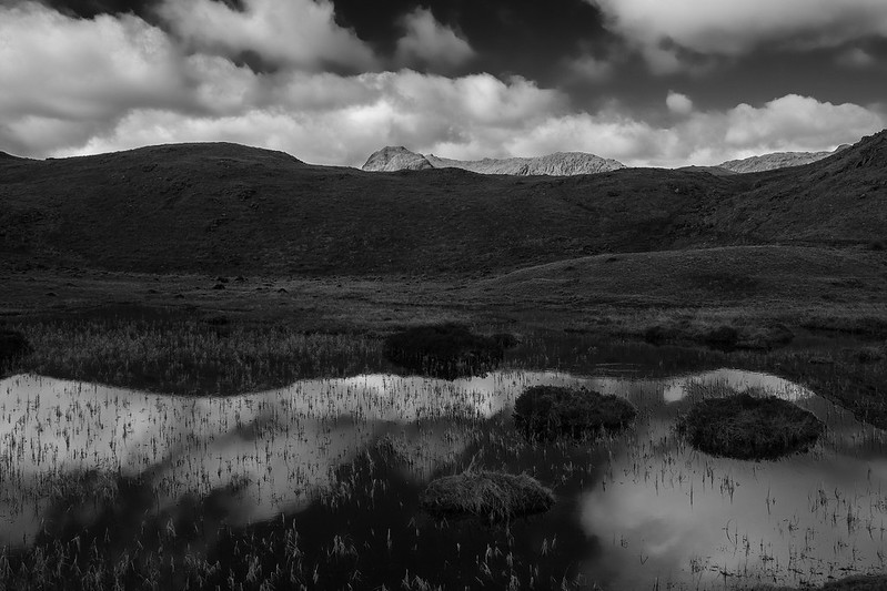
 Coniston Mono
 by
Anthony Young, on Flickr
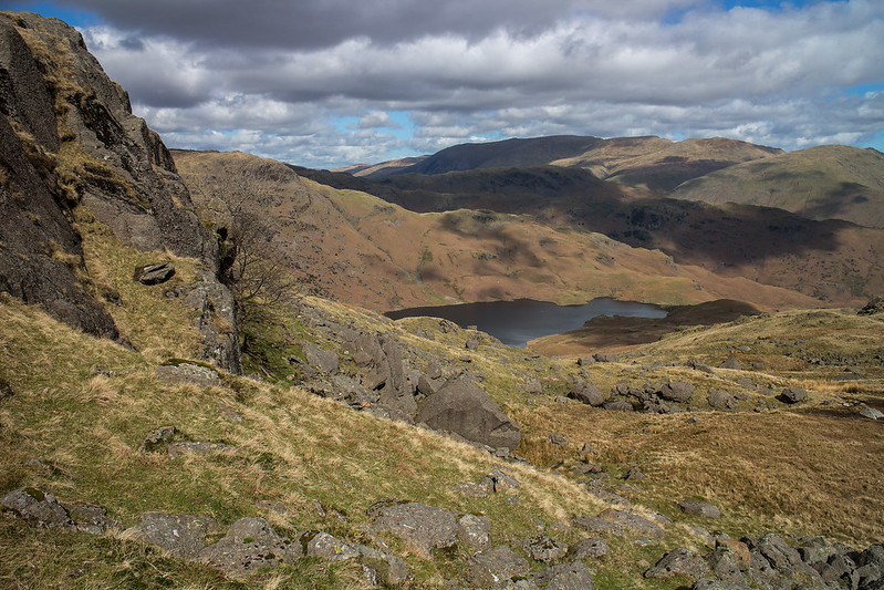
 A distant Windemere from Blea Rigg
 by
Anthony Young, on Flickr
We arrived at Blea Rigg with the sun hiding and a cool breeze so we found shelter and had lunch before heading down an easy grassy gully to link with the path down to Easedale Tarn. At this point I realised that I had no pics of my companions so to prove I wasn't imagining my company for the day I grabbed a sneaky shot.
 Blea Rigg
 by
Anthony Young, on Flickr
 Blea Crag
 by
Anthony Young, on Flickr
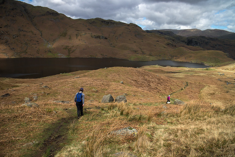 My camera shy companions
 by
Anthony Young, on Flickr
Easedale Tarn looked beautiful in early summer colour but we didn't linger and followed the fine path down to Grasmere enjoying the fine waterfalls in Sourmilk Gill on the way down.
 Tarn Crag above Easedale Tarn
 by
Anthony Young, on Flickr
 Tarn Crag and Sourmilk Gill
 by
Anthony Young, on Flickr
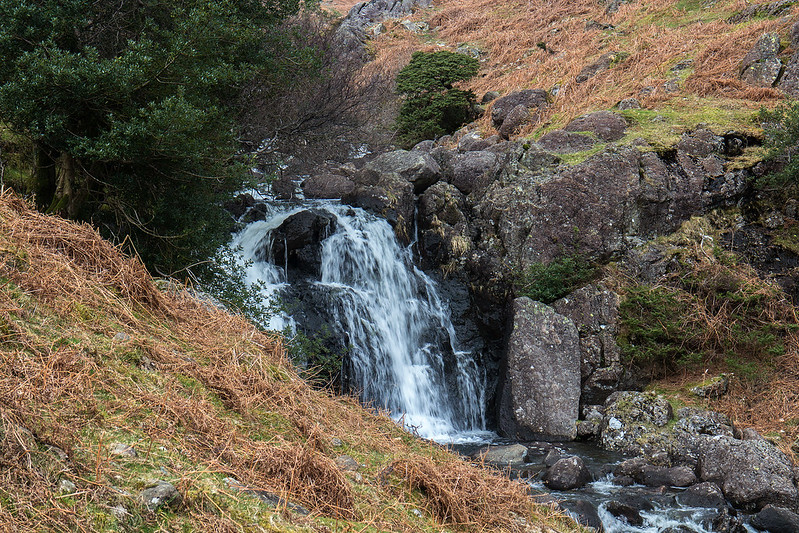 Falls in Sourmilk Gill
 by
Anthony Young, on Flickr
 ...and again
 by
Anthony Young, on Flickr
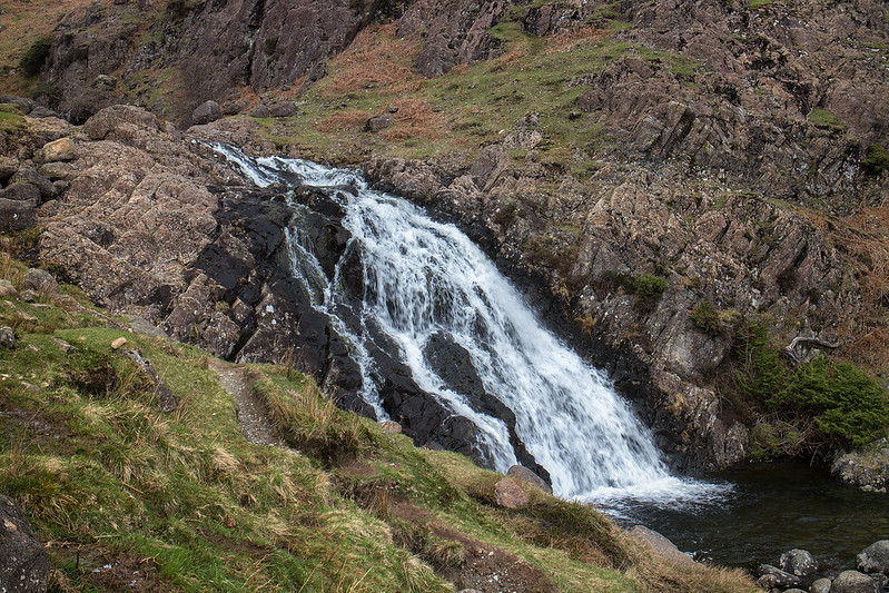
 Over the wall to the falls
 by
Anthony Young, on Flickr
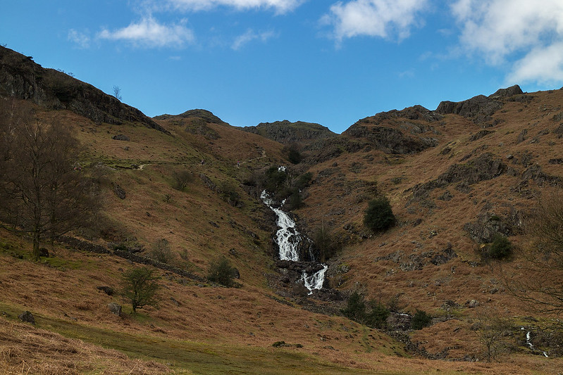 Looking up Sourmilk Gill
 by
Anthony Young, on Flickr
This was a nice easy family outing taking in some of the Lakes most charming landscapes. There is a sting in the tale however as regards parking. For some reason in an act of wanton abandon I parked in the main parking area at Grasmere. An attempt to pay at the time was foiled by lack of change and broken card readers on both machines but, never fear, in this age of technology you can simply pay on the companies website once you return home as I duly did. Imagine my surprise then when a demand for £30 dropped through my letterbox this morning as I am a common criminal who doesn't pay his way. I have of course lodged an appeal containing my confirmation of payment from Nochex so we will see if these incompetent muppets see sense.
