free to be able to rate and comment on reports (as well as access 1:25000 mapping).
Time taken: 2 hours
Distance: 4 km
Ascent: about 500m
Highest elevation: 464m
Weather: Scorchio!
(Plus 73km on the bike - not included in above stats)
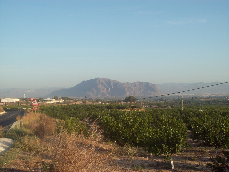
My absence around these parts of late has been due to a non-walking holiday to the Costa Blanca. There are actually a lot of good hills along the Costa Blanca, the best being the ones to the N of the region, around Benidorm. Typically we ended up on the salt flats to the S, about as far from the hills as you could get! However, I knew I couldn't really enjoy a two week beach holiday properly withouth getting some exercise and scenery, so I had done some research before going. None of the massive mountain ranges I had in mind here, but a good bit of exploring nonetheless.
Looking through Google satellite images, I had identified the Sierra de Callosa as a range of hills I might just be able to reach on bike from our apartment near Torrevieja, so once we were there, I tried to get hold of a map. Not particuarly easy, and I ended up with a 1:500,000 scale road map which didn't show any hills on it, other than the occasional name of a larger mountain range. I had to research most of the names and details in this report after I got home, as the whole day out was a bit of a guessing game.
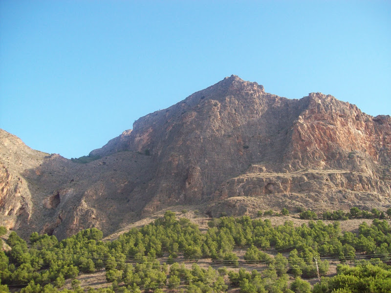
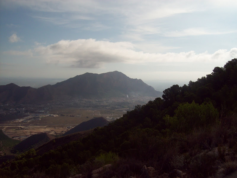
I knew roughly where Sierra de Callosa was on my map, and had noticed it from the coast too, as it is rises very abruptly from the surrounding land. Having hired a bike, I left at 7:30am to avoid the worst of the heat, and started pedalling towards Orihuela. There were some great views of my possible objective on the way.
Sierra de Callosa from the cycle over:
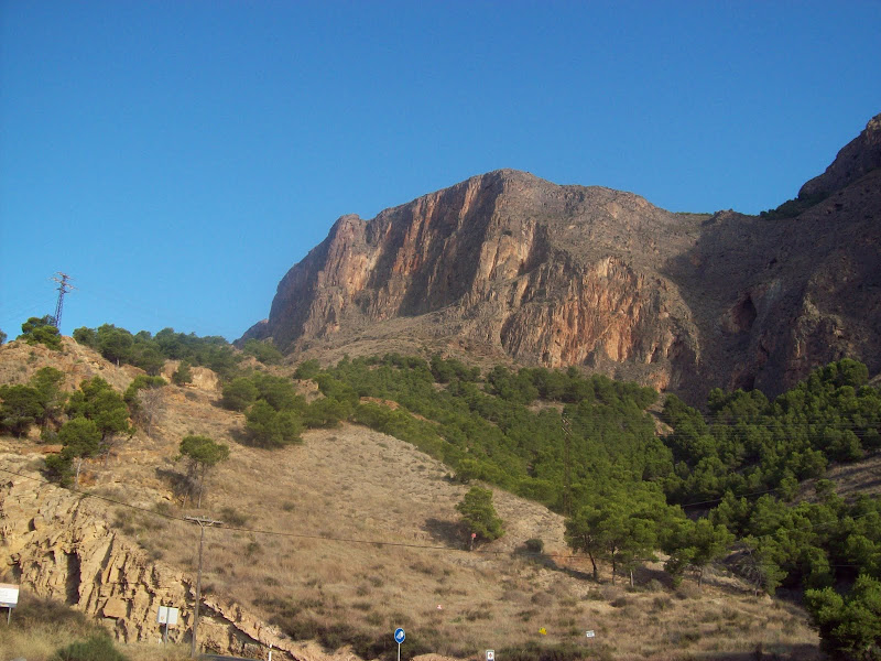
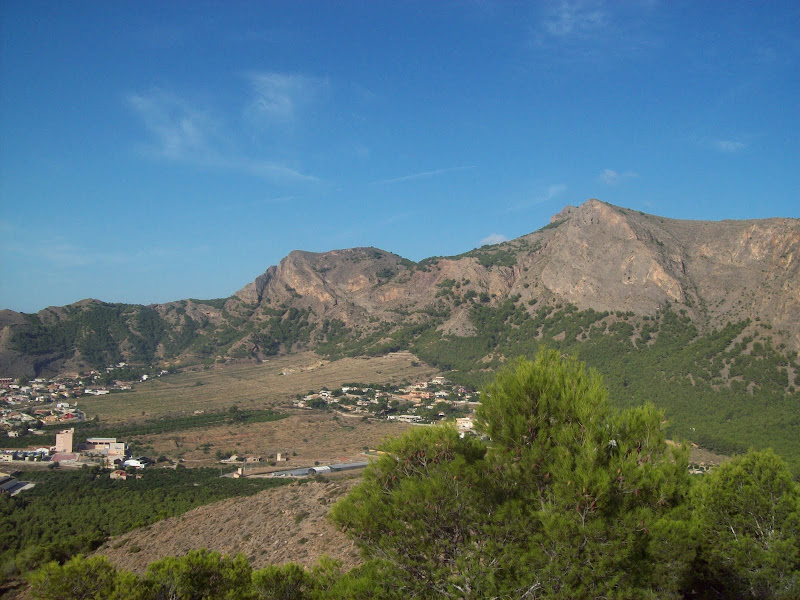
As it turned out, Orihuela was actually a bit west of the Sierra de Callosa, and by the time I was there (a 22 mile ride), I was actually much closer to the Sierra de Orihuela range of hills, while lower, these were also extremely steep and rocky, and looked like a more suitable objective. The east-most summit was identified with a massive iron cross, and was called Cruz de la Muela (cross of the hill, I'd imagine). I thought I'd find my way onto the hill once I got across town, but the south side of the eastern end was nothing but massive vertical cliffs. It was very impressive, but I couldn't see a way through. I cycled along the main road west for a couple of miles, looking for a break, and just as I was about to give up, I found a possible route.
South face of Cruz de la Muela from the N side of Orihuela:
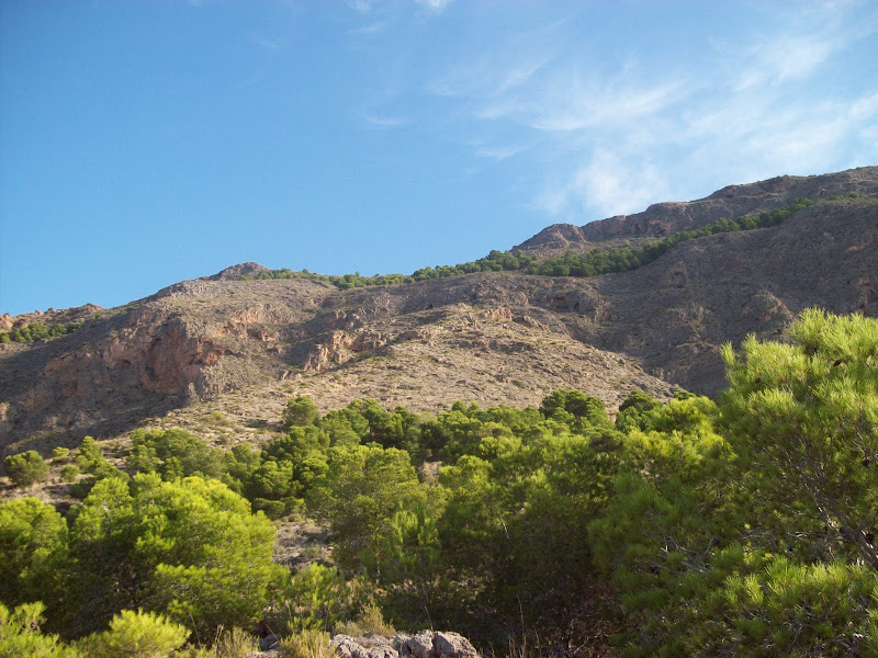
No obvious ascent route on the S face:
Hills in the area:
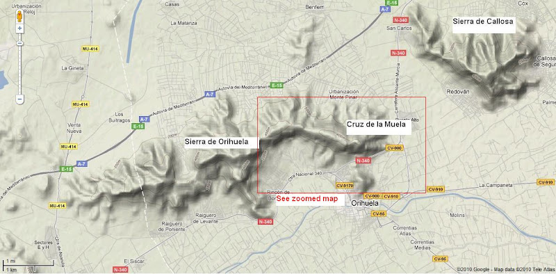
Zoom into Cruz de la Muela:
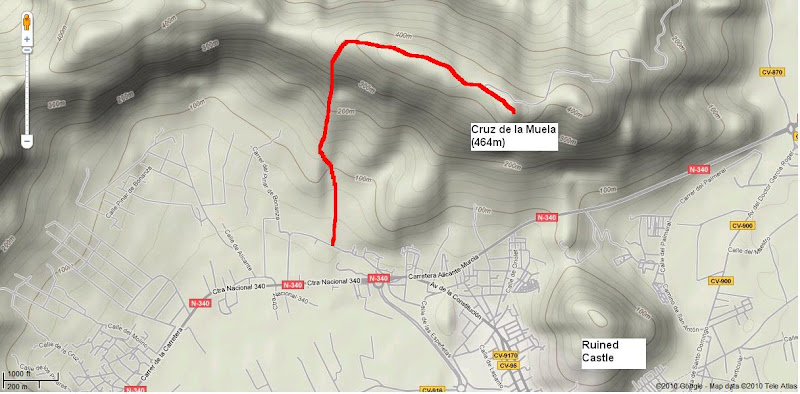
West of the summit, the hillside gradient seemed to ease off a bit, and it looked possible to ascend easy-angled slabs to the ridge, before heading east to the summit. I was unsure how to get on the hillside, but a side-road then a track suddenly appeared on my right, allowing me easy access (I hadn't wanted to climb any fences or go through any yards, as my Spanish is appalling and I didn't want to have to try and explain myself!)
Looking W along the Sierra de Orihuela from the ascent route:
A track led through conifers into a dry river bed. Crossing the river bed, I was able to get onto a rocky spur which led all the way onto the ridge. The route varied between walking over slabs and easy scrambling, and the rock was lovely (a mixture of gabbro and limestone I think). There was little sign of anyone else having used the route.
Up the route of ascent:
My only concern was the gunshots I could hear over the next spur. Apparenlty Sunday is hunting day in Spain, but the info I had read previously suggested the hunting season didn't start for another month! Luckily I didn't get shot or shouted at.
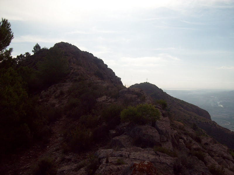
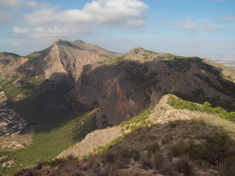
Looking W along the ridge:
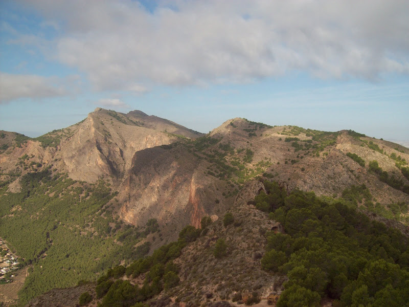
Once on the ridge, it was easy scrambling east towards the highest point. In fact this point appeared to be marginally higher than the summit with the cross on it. I could also see the summit with the cross on from here, and lo and behold, there was a massive path up it from the north side! Typical of my route finding that I didn't discover this.
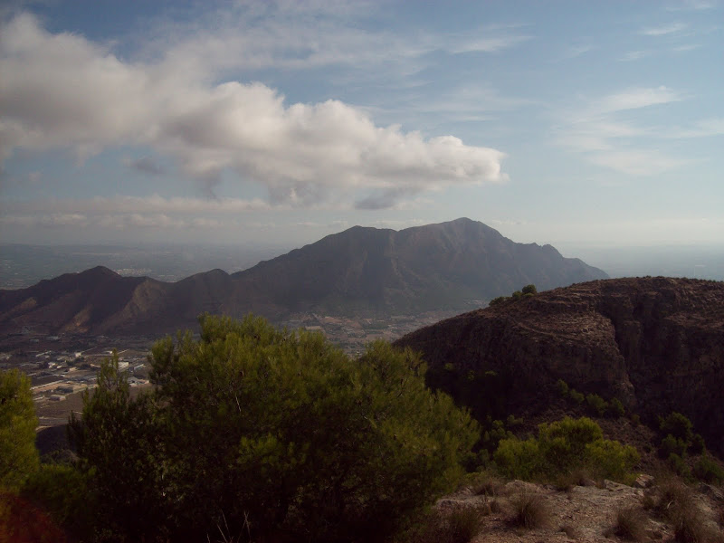
East to Sierra de Callosa:
NW from the summit ridge:
West along the ridge again:
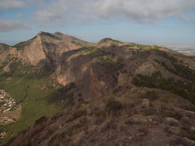
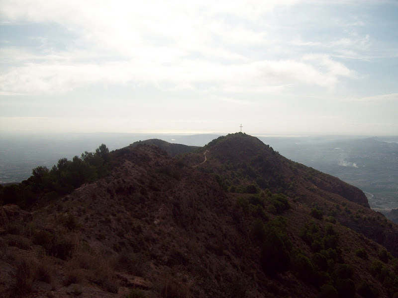
Heading east along the ridge, the cross of Cruz de la Muela just visible:
The cross again, with the Costa Blanca in the background:
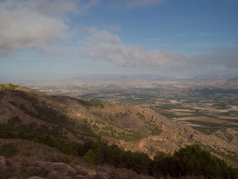
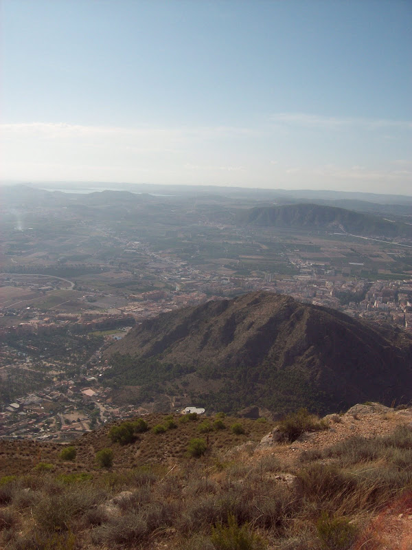
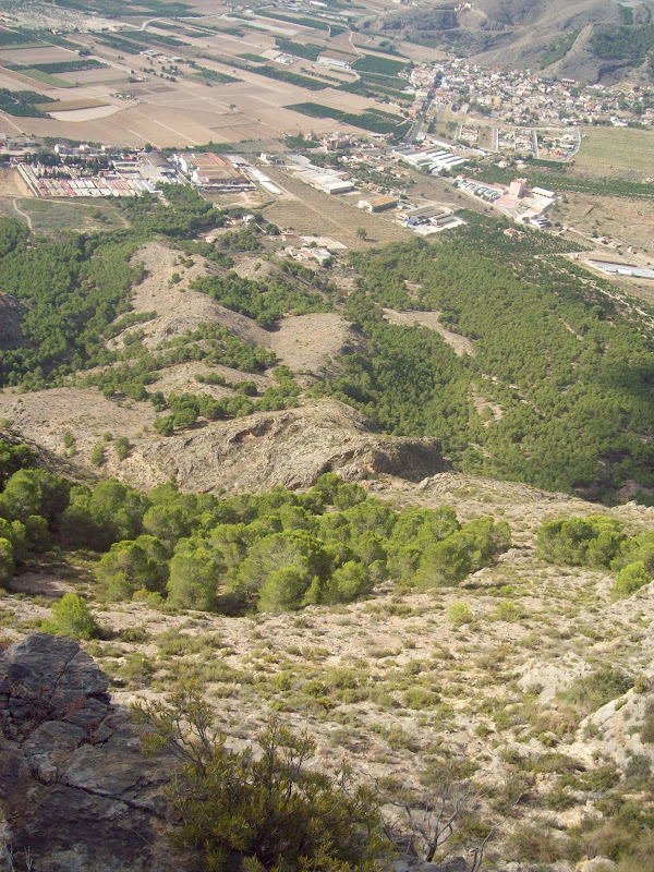
Actually I was glad that I had been unaware of the path, as I probably would have used it and missed out on the scrambling otherwise. There was a descent of about 50m through scrubby bushes from the highest summit, and suddenly I was joining crowds of other walkers for the last ascent to the cross. It appeared to be quite a popular walk. Well worth it too - a sort of desert version of Ben A'an. The views across to Sierra de Callosa were impressive, as were those to the N to all sorts of other mountain ranges that I haven't managed to identify. Looking down onto Orihuela was also interesting, a ruined castle standing on a rock to the N of the town. Haze obscured the larger, spikier mountains to the east.
Sierra de Callosa from the summit:
Looking down on Orihuela:
East again:
I opted for the same descent route, as I hadn't climbed anything that I was concerned about reversing, and also my bike was back that way. It was nice to leave the big path and head back over the quieter ridge again. Away from the cross, I only encountered two other people.
Back down the ascent/descent route:
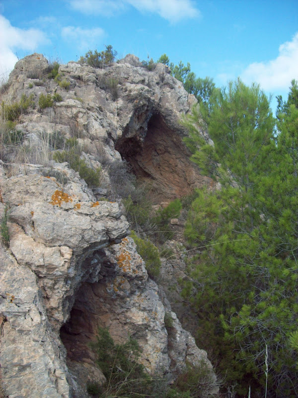
The soft limestone made for some interesting features on the ridge. I detoured briefly to look at a couple of caves.
Some limestone caves on the ridge:
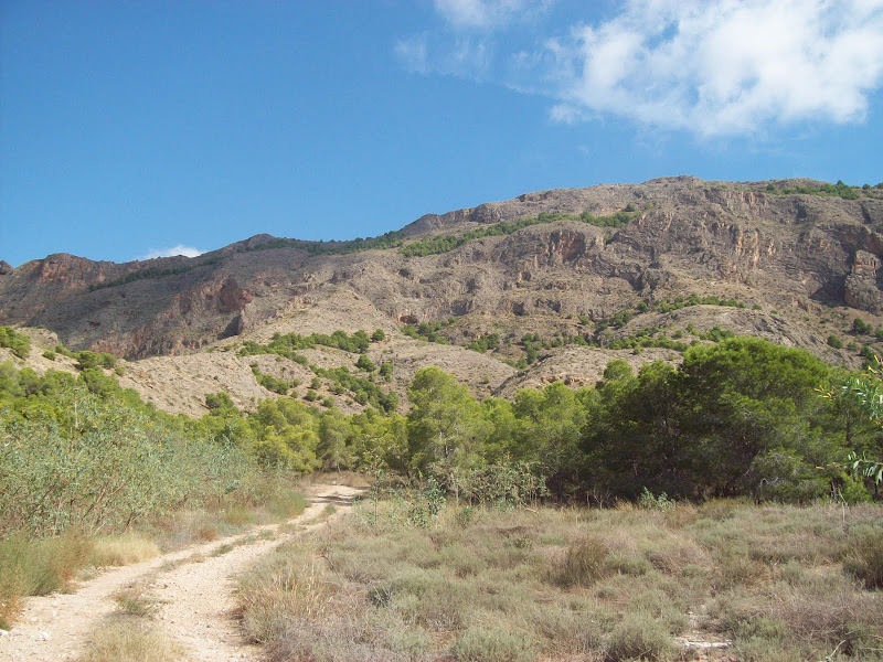
Looking back up to the ridge from the bottom:
I was still feeling pretty fresh by the time I got back to the bike at 11.30am, but the cycle back to Torrevieja in the heat pretty much finished me off. Still, the off the cuff exploration without really knowing where I was headed was loads of fun.
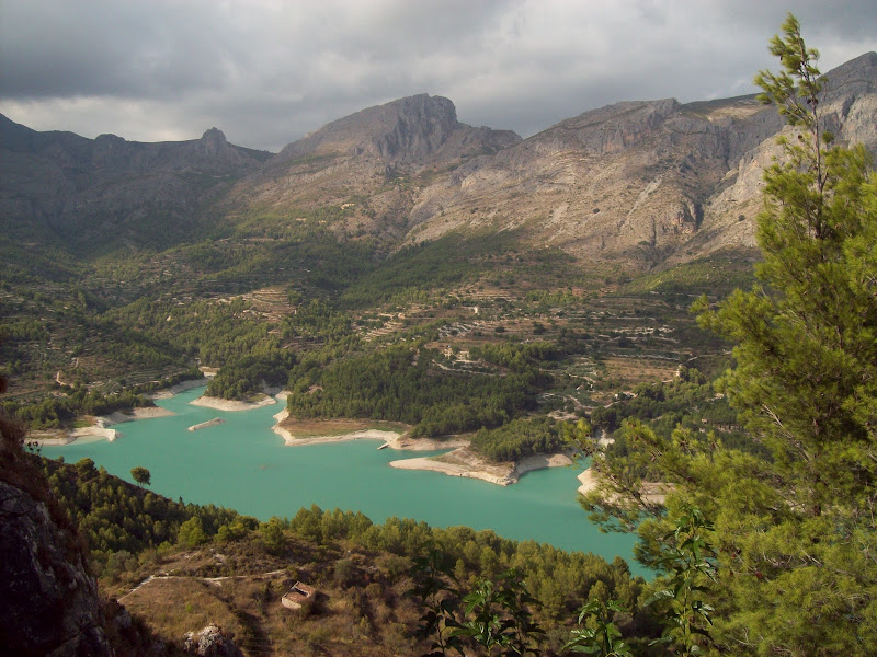
Originally I had hoped to hire a car and head for the larger hills inland from Benidorm (in particular, Puig Campana looked impressive at 1400m with some absolutely massive cliffs), but things didn't work out as planned. We did manage to get a car, but my wife wasn't too keen on walking up any hills, so we took a scenic drive through the area instead, down the Guadalest Valley. The views were impressive enough to have me planning a return visit, with more walking built in!
Guadalest valley: