free to be able to rate and comment on reports (as well as access 1:25000 mapping).
As I left the faint trail, the ground ahead towards the ridge was trackless and covered in rough boulders, ankle breaking terrain. I had a sudden realisation of where I was, on my own in the wilds of Scandinavia, half way up a mountain, 4 days into a cross-country canoeing trip and therefore miles from help if anything should go wrong. Care was going to be required...
On the Saturday before, we'd set off from a rough gravel car park on the fringes of the Rogen Nature Reserve, our starting point for an epic canoeing trip from this remote corner of Sweden to the small mining town of Røros in Norway. On the way we expected to paddle many lakes, some moderate whitewater, and to have to portage our canoes for considerable distances through this incredible terrain. And so it was proving.
As this is a hillwalking forum, I'll keep the report mostly to that small bit of the trip, but first I'll give you a flavour of how I'd reached this spot in the wilderness.
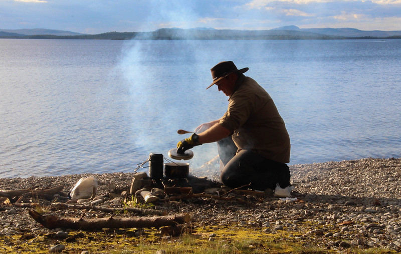
The first day had been simple, after an 800m carry that is. We'd then merely had to paddle for a couple of hours to our overnight camp spot, at the start of the next portage.
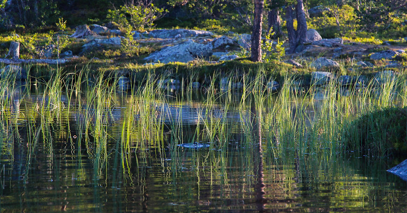
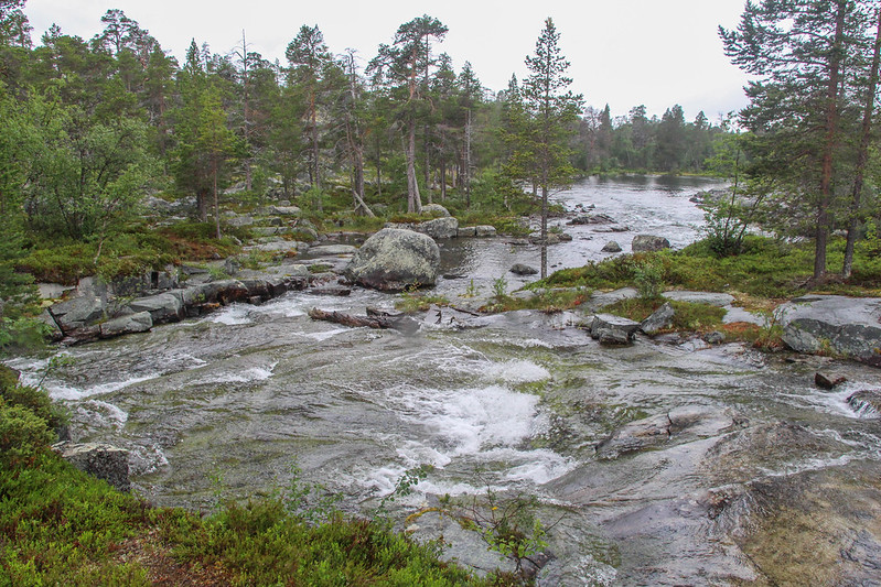
The following day had been much more fun, involving small lakes and river sections, 3 of which were too rocky to paddle so had to be portaged. We'd then reached Rogen itself, a massive 18km lake at about 750m altitude, which felt bleak and exposed, but fortunately the wind stayed reasonably low.


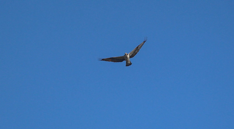
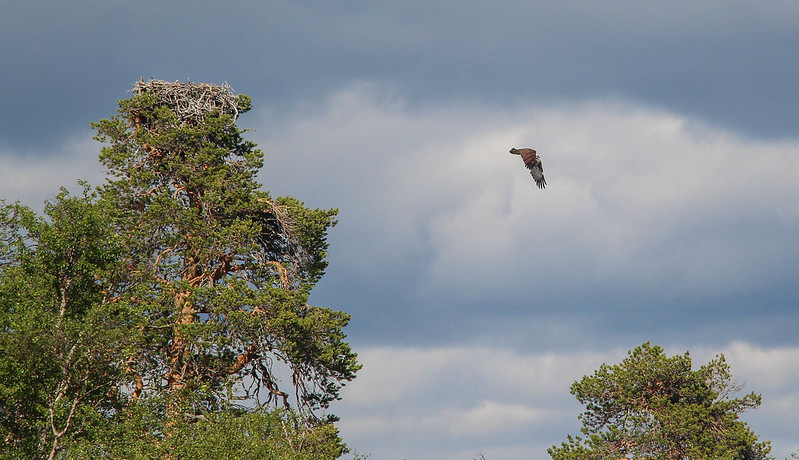
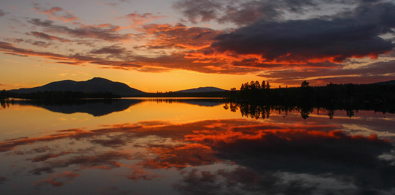
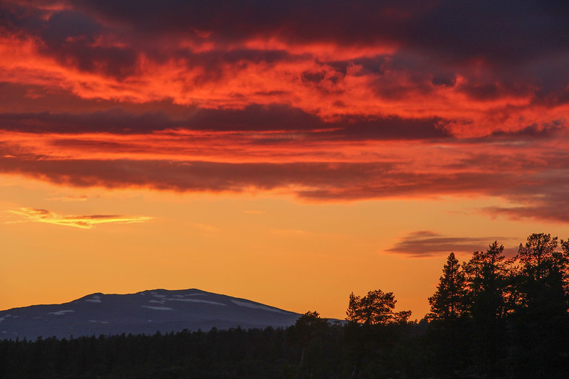
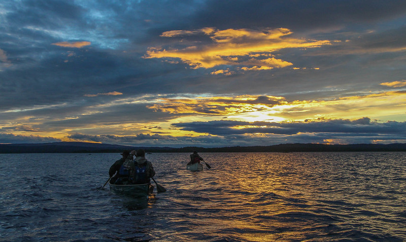
Another camp, then a short portage brought as to an area we call the "Thousand Lakes" where we rested for a day, exploring the many lakes and islands where osprey lord it over all, before we were treated to possibly the most spectacular sunset I can remember.
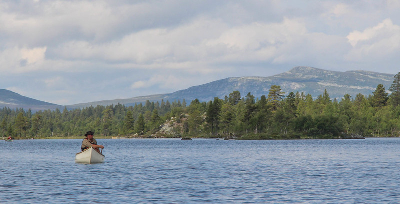
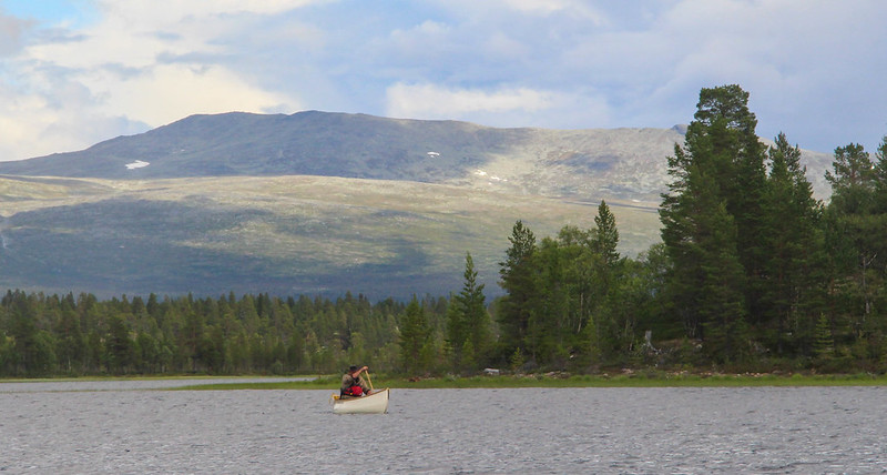
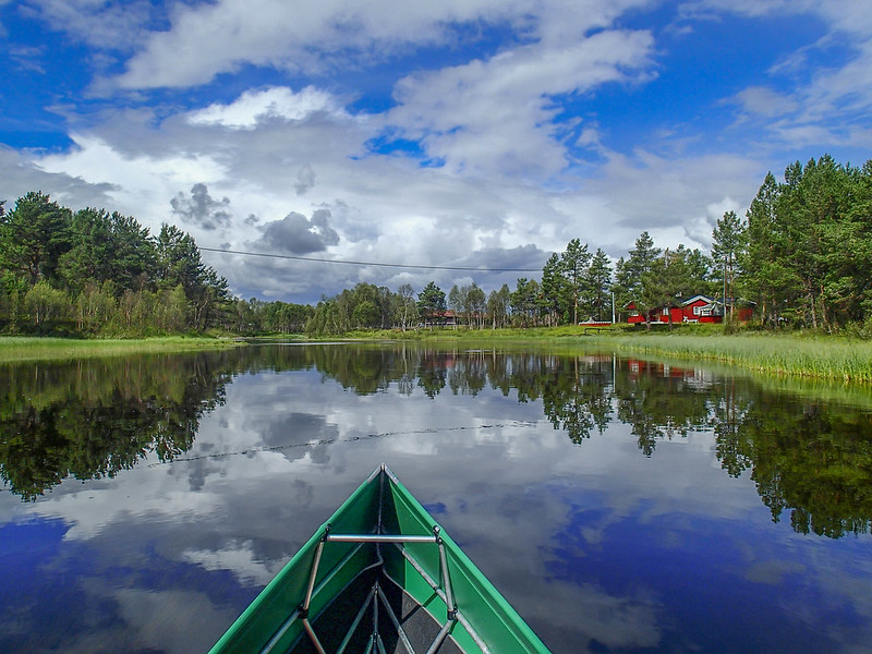
Returning the next day to Lake Rogen, we paddled for 12km in stunning, calm conditions before camping for the night. It was from here that I'd start my walk, as an early start to hit the lake before the wind rose meant we'd finished by mid-afternoon and had many hours of daylight left.


At last, I hear you cry, some walking! Without a canoe on my head either. To the north of our campsite, a trail crossed the shoulder of a rounded, double-summitted mountain, Bustvålen. I hoped there would then be a route following the broad ridge to the higher summit at 1024m.
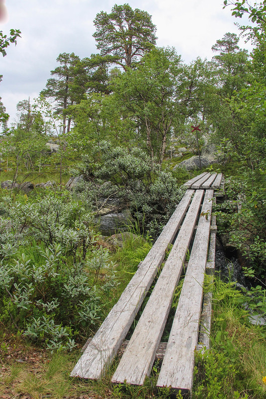
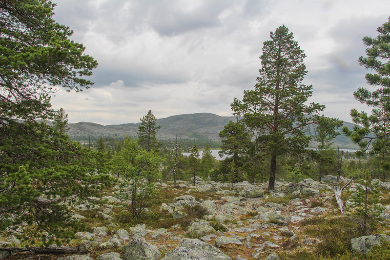
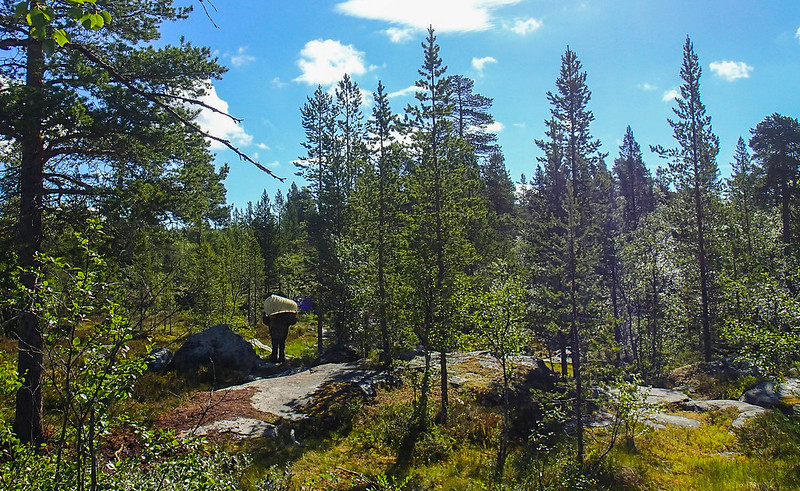
A boardwalk helped cross a boggy section near camp. Every now and then a red cross on a pole marked the winter route of a snowmobile trail, demonstrating just how deep the snow must be here to cover all the boulders and make it passable for skidoos. My target showed its head above the pine-studded plateau.
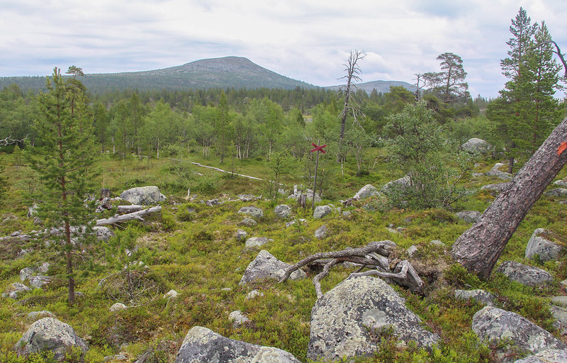
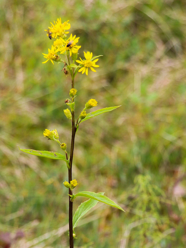
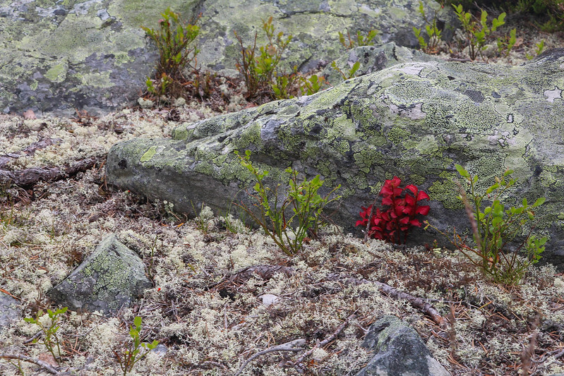
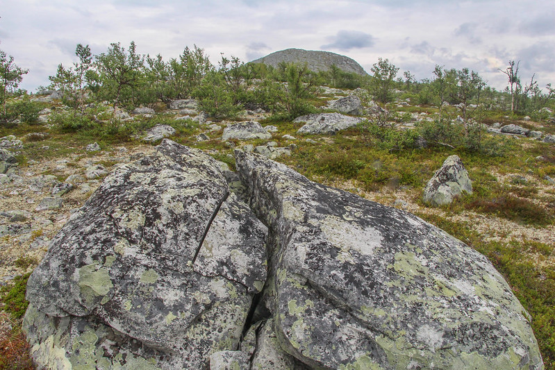
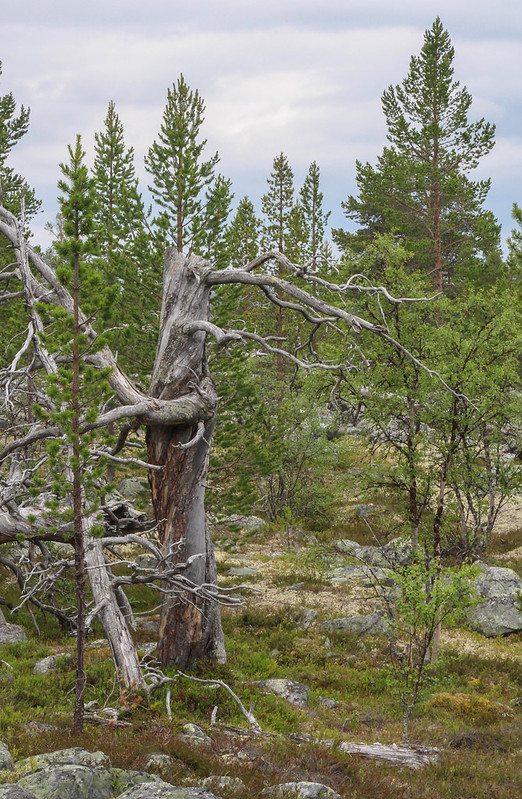
This part of Scandinavia, straddling the border between Sweden and Norway at about 62 degrees north, is rough country, covered in rocks, to which pine forests, moss and bilberries somehow cling. Its difficult country to walk through, there is little soil above the rocks, so you are constantly stepping on or between them. Its not bare country, there are many small flowers, mosses and lichens, but it is very different to the moors of Britain. Altitude and latitude bring long, harsh, winters, and the plants are generally smaller versions of their lowland cousins.

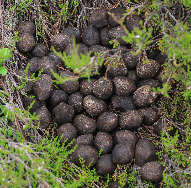
As I followed the narrow trail, marked by red paint on trees or rocks more than on the ground, I came across some animal dung, which further research suggests is from a loose moose.
I reached the crest of the broad ridge, gaining a vista of the land beyond. Here I was going to turn right and head steadily uphill. Looking around me, I tried to fix some landmarks in my head, as it would be quite easy to march straight over the faint path without noticing it on my return. It was here where I started to feel committed and alone in this wide land, none of my companions having wanted to hill walk after a day canoeing. I, though, was determined to get a view of the land from above.
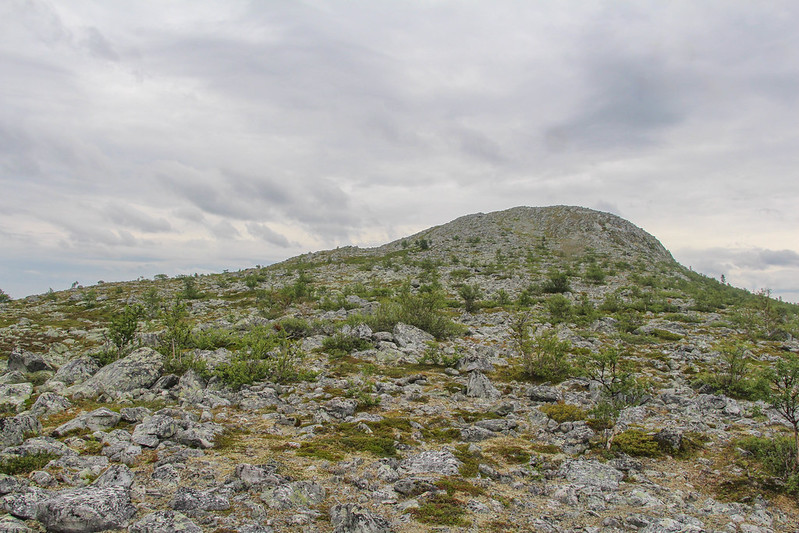
Picking my way through the moss and boulders, Bustvålen's summit came into sight.
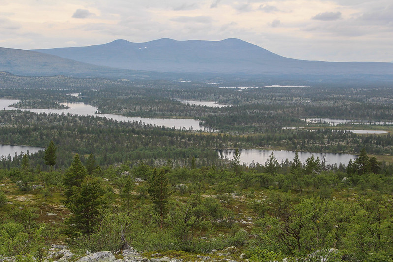
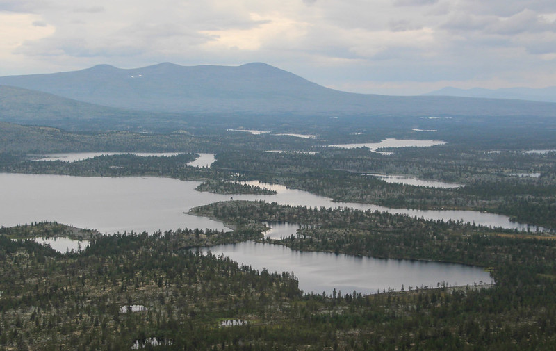
Here I got my first look down to Rogen lake, where our camp was.
The pine trees were well behind me now, the summit looking bare and rockier ahead. Rather than tackle the steep, craggy, slope above, I angled left up a slight gully where what looked like grass turned out to be moss and low bilberries. Sadly this year the crop of fruit is very late and we hardly saw any actual bilberries.
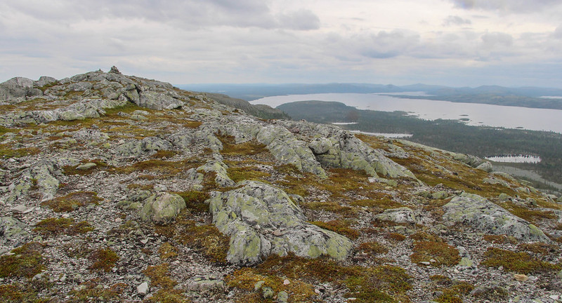
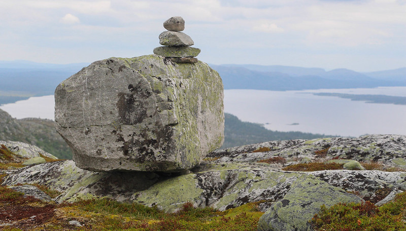
Soon enough I was on the summit ridge, which turned out to be pleasant and almost Lake District like. A small cairn tempered my feeling of solitude a little.
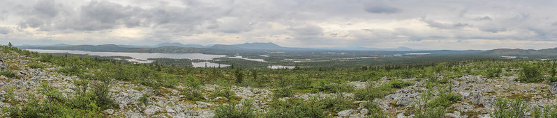
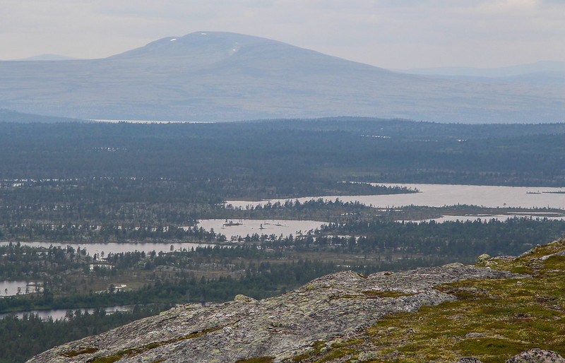
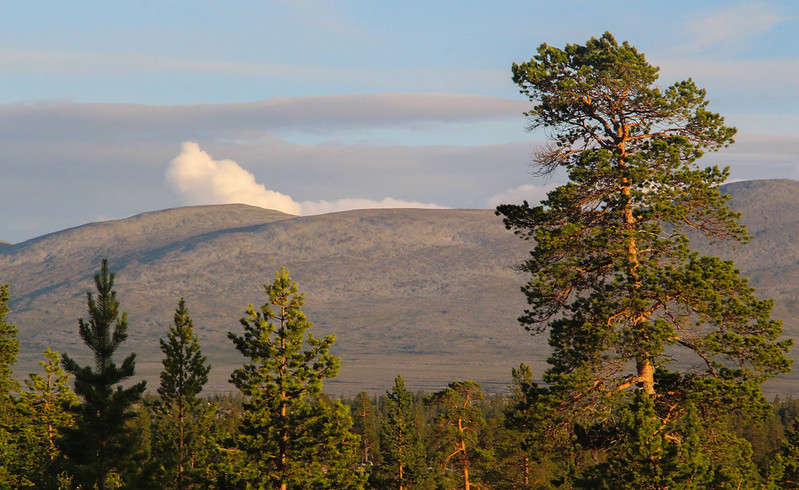
Looking around me, I could see huge swathes of this wild border country around me. To the north, snow still clung to the distant slopes.
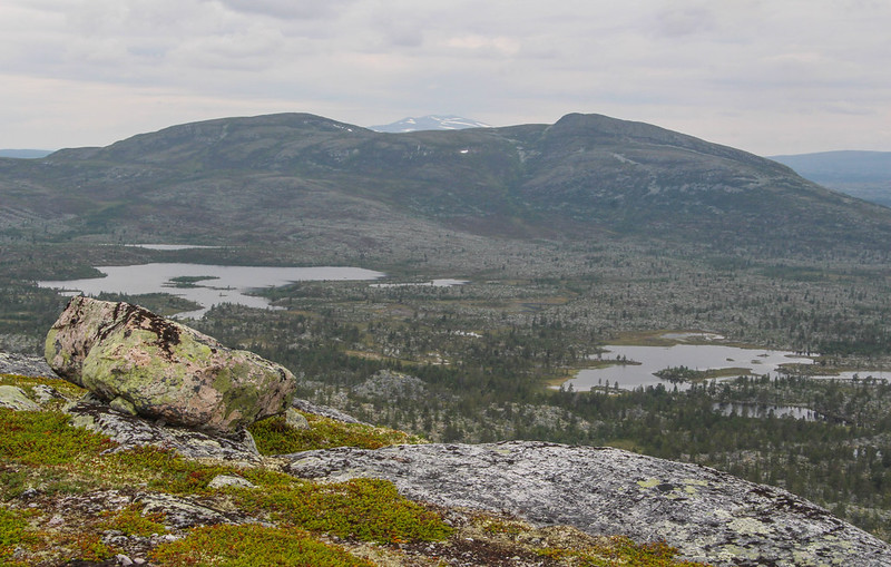
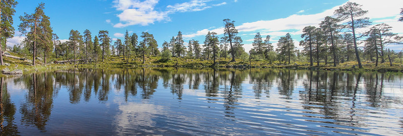
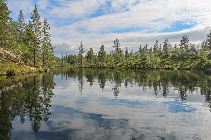
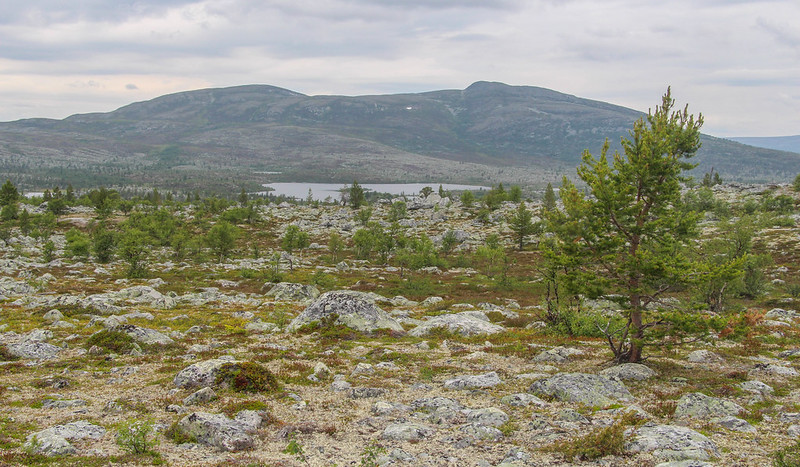
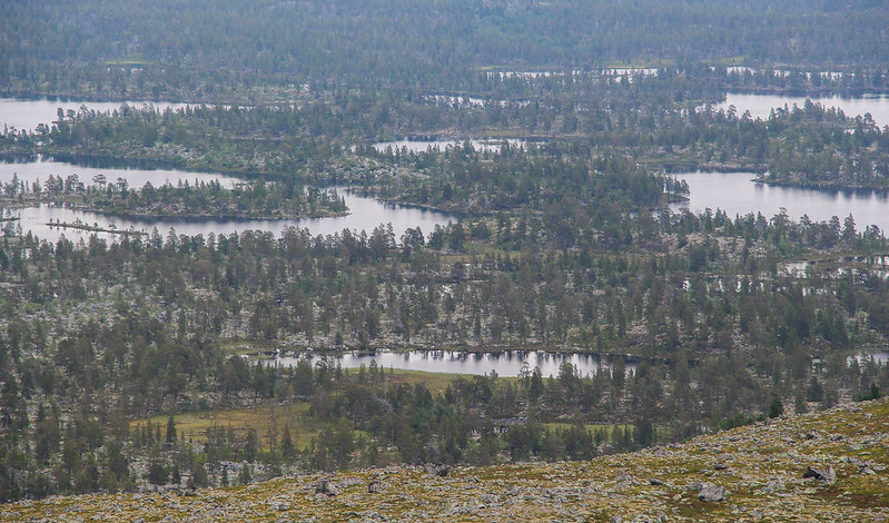
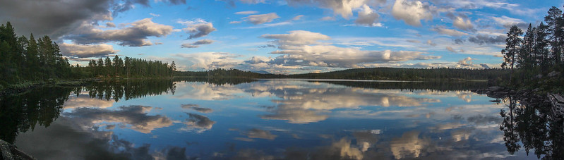
Below these hills, the "Thousand Lakes" area was strung out across the plateau. This is basically the remnants of glacial moraine, in fact this type of landscape of thin, scraped-out lakes and rough piles of boulders is known as Rogen Moraine after this place.
To the east and south, immense Rogen lake spread out before me. We'd paddled from left to right across this massive puddle that morning.
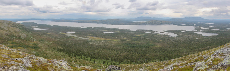
Further west was our route ahead, leaving the big lake and heading down the Roa river system into Norway to an even bigger lake called Femunden, which was somehow hidden in the landscape despite being 60km long...
The next 20km of canoeing would take 4 days.

For now, though, it was time to pick my way carefully downwards, roughly following my outward route. As I descended, troll-like figures lurked in the corners of my eyes.
Fortunately I did find the path, though not quite where I left it

Following this back to camp, I was feeling lucky that I'd had a chance to see the land through which we were passing from above.
So, those who are reading this for the hills, if you made it this far, are now excused

The rest of this report will try to catch a flavour of the rest of our expedition, a tale of many carries, a little bit of canoeing, injury in the wilderness, canoeing on a lake the size of a sea, and running a river all the way to our destination.
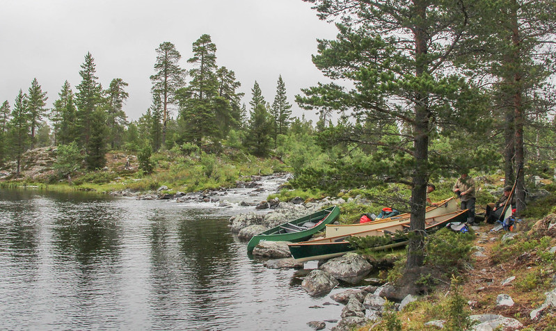
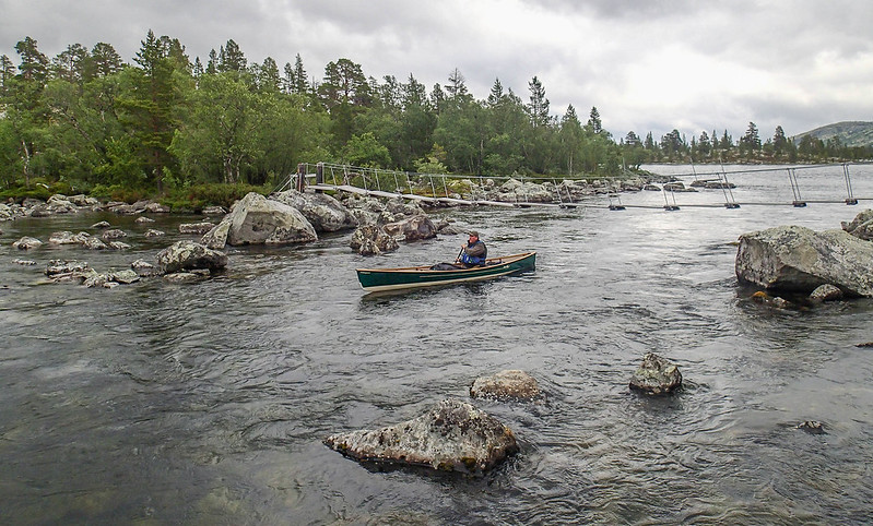
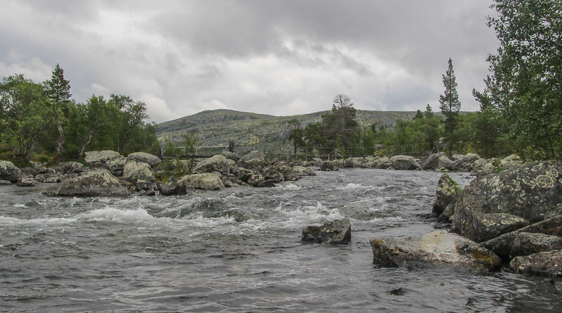
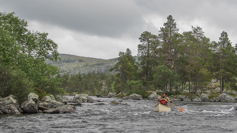
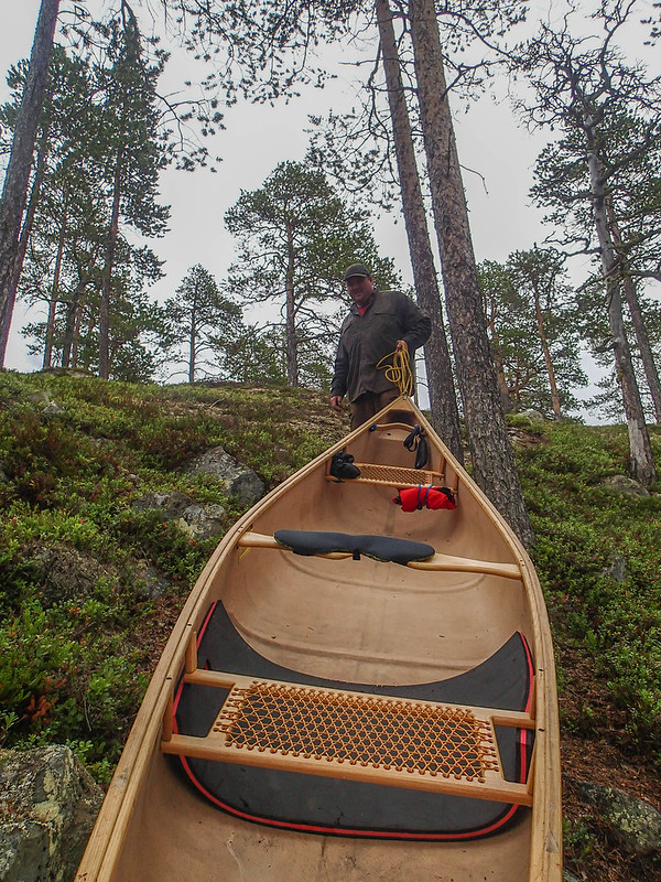
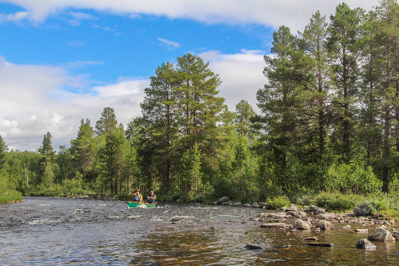
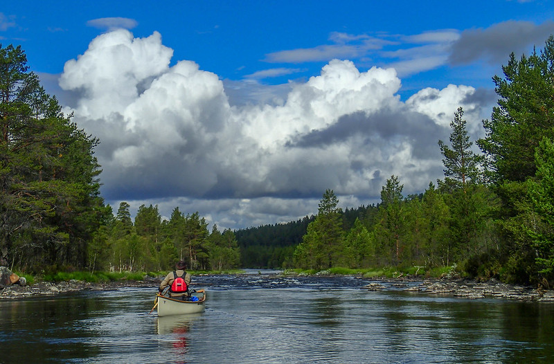
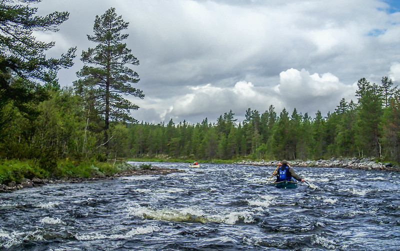
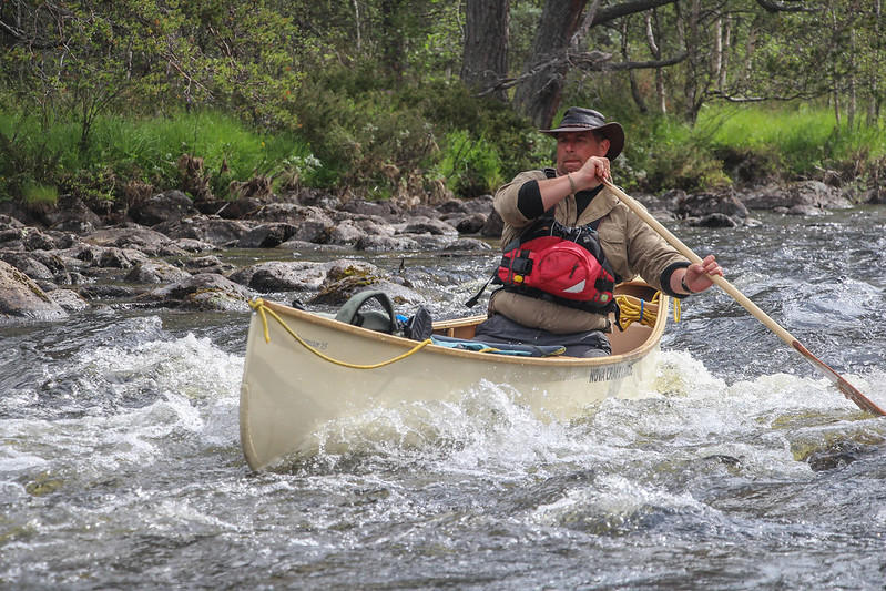
The day after I'd climbed the hill, we set off down the Roa system. The first day was marked by some moderate whitewater river sections, and a few portages.

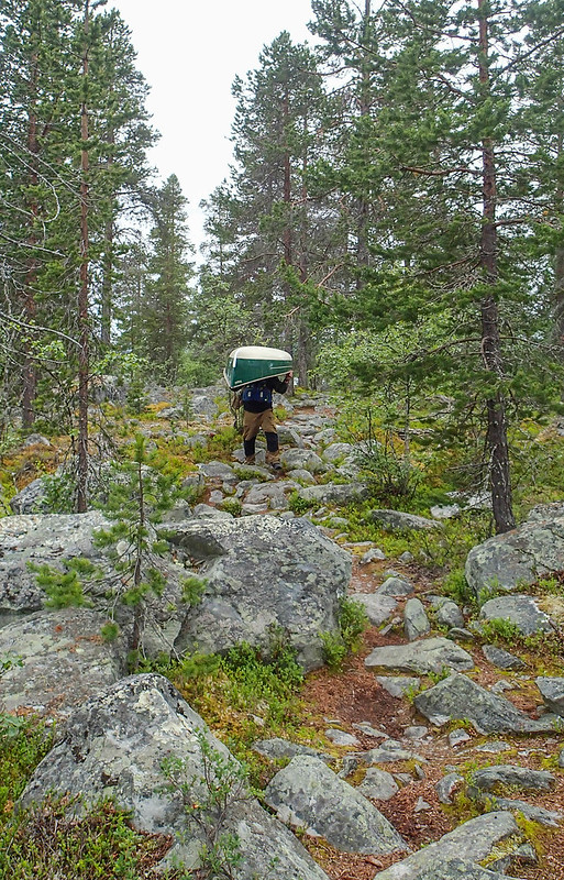
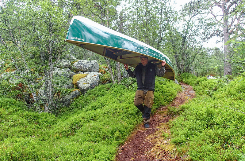
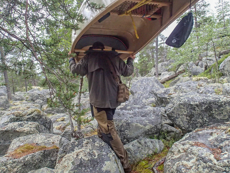
Our portaging was basically taking each of the 4 of us two trips. One with personal bags, one with a canoe or the communal bags. The terrain was pretty hard going with a canoe on your head.
And it was on one of these carries that we had a near-disaster. One of my companions, Dris, slipped and badly twisted his ankle. In serious pain, we wondered if we would have to get him evacuated somehow. Phone signal was available in places, we could walk up an hill and get enough to make a call, or we could deploy our "SPOT" satellite beacon thing if we had no other option.
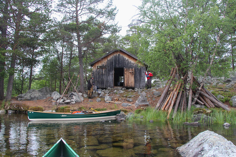
After giving Dris time to recover a little, and strapping his ankle, we decided that as we only had one paddle to a hut, we would spend the night there and see how he was in the morning.
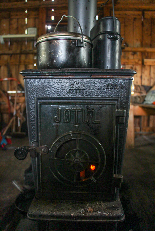
These state-run huts are a godsend, basically a wooden bothy.
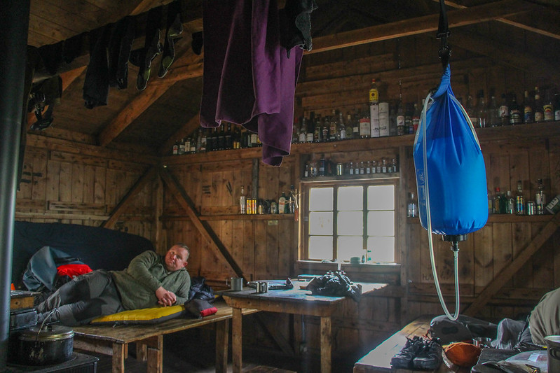
In the morning, Dris could walk, but not carry. Paul and I resigned ourselves to an extra carry each, making it 3. Of course, this actually means you cover each leg of a portage 5 times, as you also have to get back to the start after each one. Mark, the last of our group, struggles for speed anyway due to having broken his back playing rugby in his twenties, but just plods on steadily.
The next day was tough. Several portages linked some small lakes, the relief of paddling all too brief. And one of them, now christened the Portage from Hell was horrendous, a 600m boulder field through which we precariously balanced with canoes on our heads, followed by a steep downward slope.

It took us most of the day to cover 3 1/2 km or river, lake and portage. Mostly portage. When the rain began, and another hut appeared, we called it a day.
The following day was a little better, for we had some larger lakes in the morning, then some river running. At that point, we met our biggest challenge, for we knew the next 5km were hard rapids, not something we could run in laden open canoes, and this would be a long portage indeed. Effectively, it took us a 2 days to get from the hut to Lake Femunden, via a woodland camp. The country we passed through was, though, wonderful and strangely I loved (almost!) every minute of it.
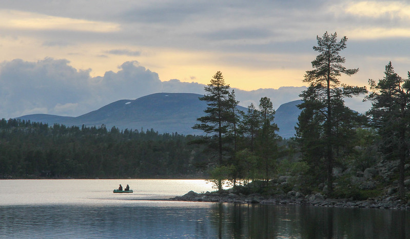

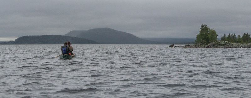
At the end of the second day of this portage, we came out onto the enormous expanse of Femunden in a soft, gentle rain and perfect calm conditions. Despite the fact we'd been going for 10 hours at that point, all but 1 of which were carrying, we made the decision to paddle to the head of the lake whilst conditions were good. This lake has a ferocious reputation, and we knew we had to grasp the calm conditions whilst we could. We grabbed a meal on a beach, and headed onwards into the sunset.

This was a committing, but exhilarating experience, and after 2 more hours we finally reached a safe camp at 10.30 pm.


We were now 3 days from the finish. This was a mix of lakes and rivers again, but the portages were short and few, and we could really enjoy ourselves. The feeling of paddling on wild whitewater rivers through this amazing terrain, at a reasonably amendable grade, was something I'll never forget.


One of the most amazing trips of my life, Scandinavia really is one of the world's most spectacular regions, and I can only recommend it.
If anybody hasn't already had enough pictures and text that has little to do with hillwalking, the full story is here:
http://www.songofthepaddle.co.uk/forum/showthread.php/54049-Rogen-to-R%C3%B8ros-%E2%80%93-a-Canoe-Journey-from-Sweden-to-Norway