free to be able to rate and comment on reports (as well as access 1:25000 mapping).
Iceland report continued from
here and
here.
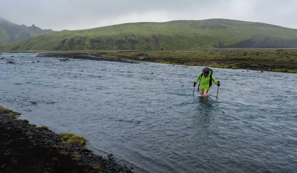
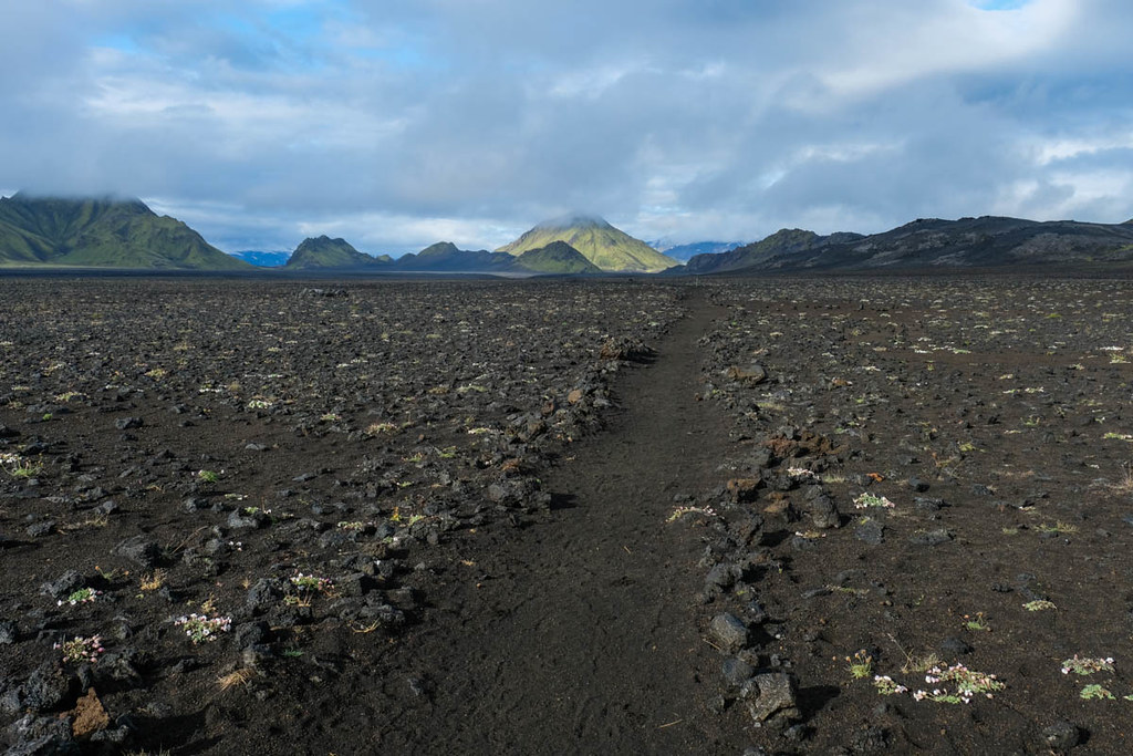
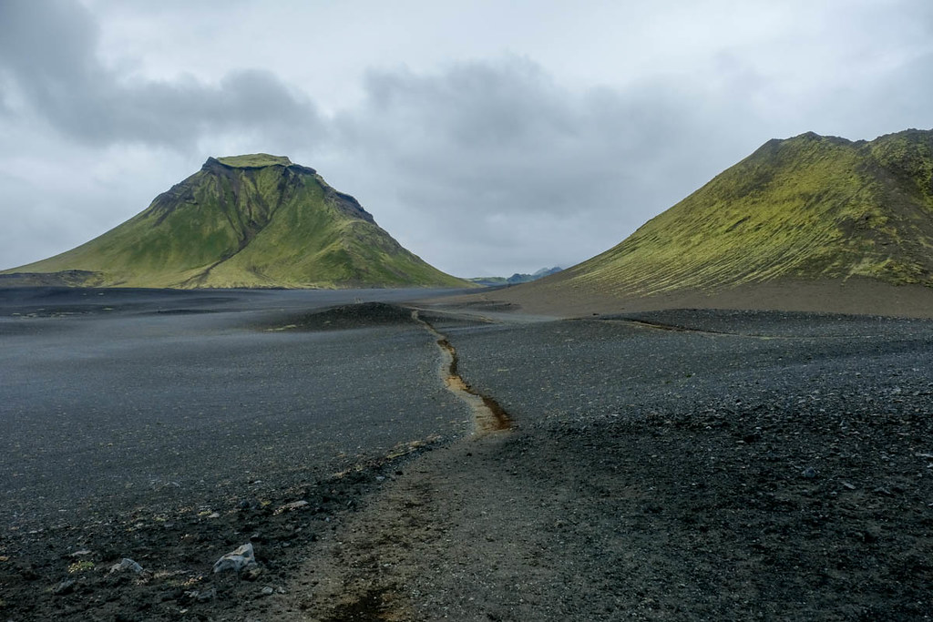
The rains were very heavy overnight, but light in the morning and we got the tent packed up without getting soaked. The trek was now of completely different character, running across a barren lava field though with the isolated sharp peaks known as Inselbergs all around. A wide river was crossed using a bridge, but the second river required a wade - more than knee deep and very cold!
It soon brightened up a little, however, giving atmospheric views of this new volcanic world. There was another river, but easy to cross this time.

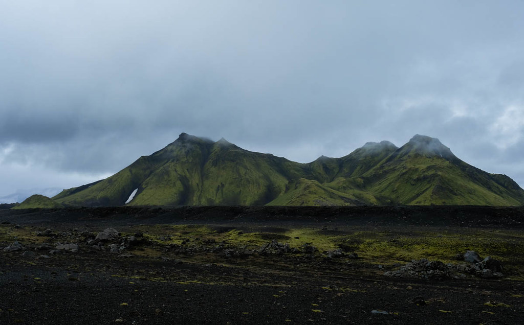
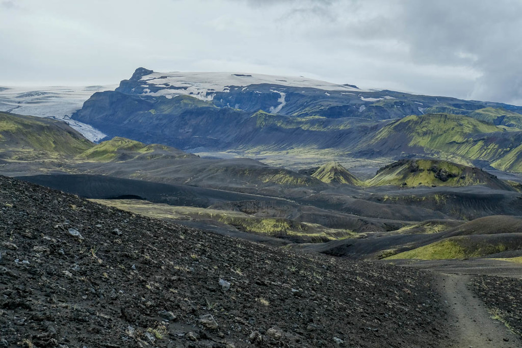
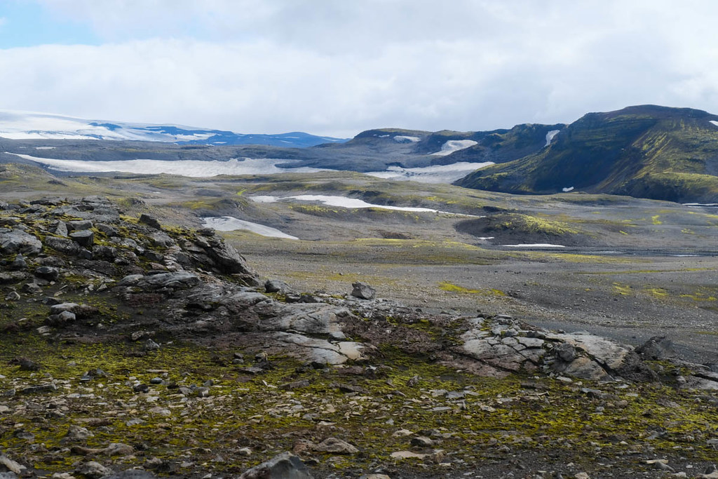
Occasionally there were glimpses to some of Iceland's ice-caps in the distance.

The trail then descended to the hut / camping area at Botnar/Emstur - the end of the third stage for many Laugavegur walks - but a very bleak and unforgiving spot.
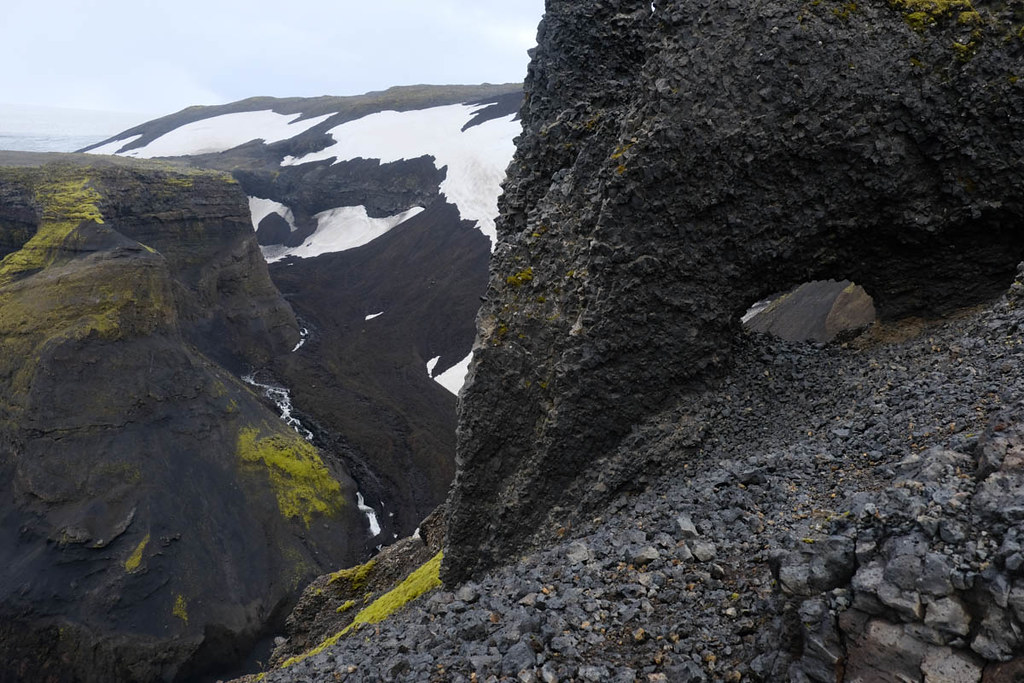
Beyond the hut the trail led down grey ash gullies and eventually descended a brief steeper bit (with a fairly uselessly placed chain alongside) to reach a deep ravine with a gushing cataract through it - but thankfully a bridge above. On the far side the trail swung left along an easy ledge - again with chains but not actually needed.

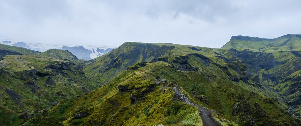
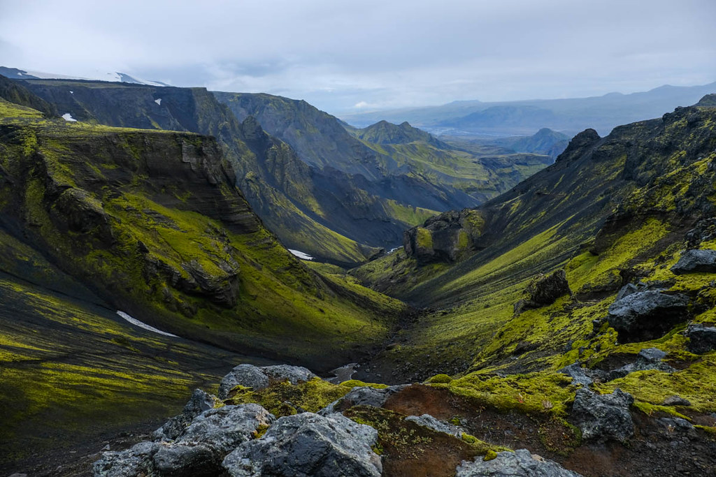
The walk now headed through the floor of a valley (above the gorge), eventually climbing and coming near the rim of the now much deeper gorge.
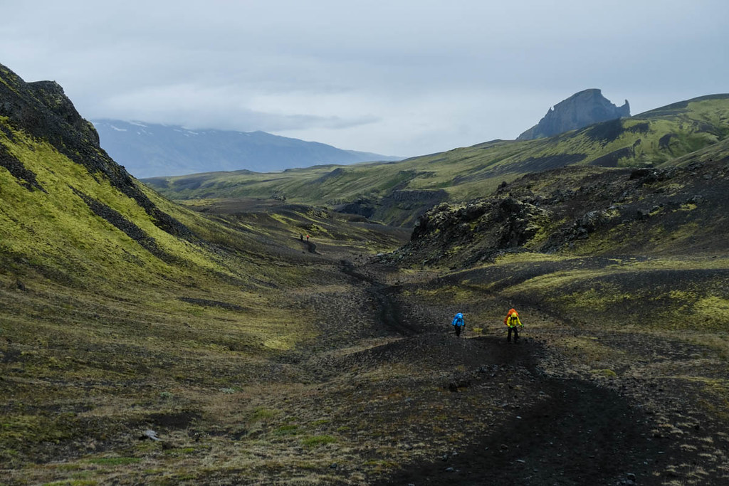

A distant building could be seen at one point as the route crossed some red vegetation with a steep peak (known as unicorn peak) beyond.

After some more gentle climbs and descends to the river Þröngá. This looked much smaller and shallower than the river photographed early in this report. However, as we neared it became apparent from others crossing it that it suddenly becomes a very deep channel at certain points. The water was full of debris so you couldn't see anything - but warnings came from the expletives and splashes of other trekkers suddenly going deep. The current was very strong too, so a slightly unnerving experience. No pictures of the actual crossing as it began raining heavily at this point.

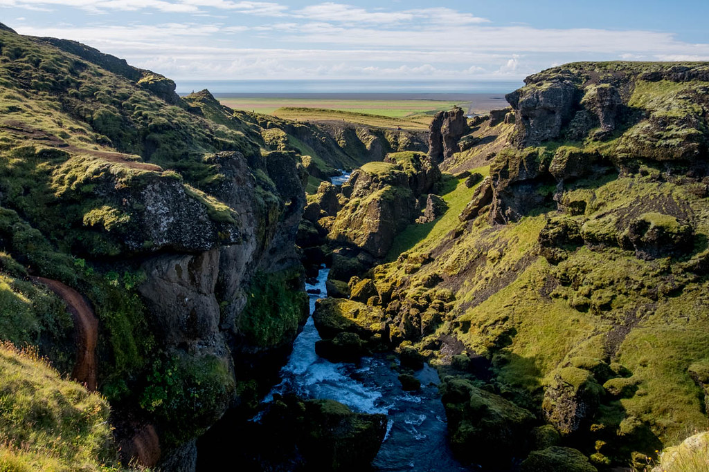
On the far side the route climbs into yet another new landscape - the woods of Þórsmörk (Thor's Forest). The trail lay over a wooded ridge before descending to a beautifully situated camping ground and hut.

We were very weary at this point after two consecutive days of around 28km each, but the comfy tent pitch on grass felt like a luxury. Later on the weather cleared a little to reveal more of the amazing landscapes around Þórsmörk - where a wide glacial river plain is flanked by forests, steep-sided gorges and peaks and finally the great ice caps of Mýrdalsjökull (with the active Katla volcano beneath) and Eyjafjallajökull. Warning signs said what to do if Katla erupted - which it apparently does every 50 years and may be overdue. What I took from these was to hope it didn't erupt.


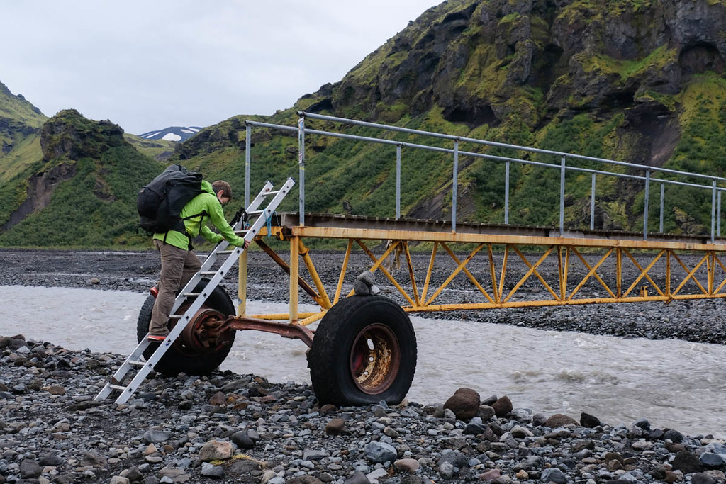
Next morning was overcast but the clouds were quite high and the rain holding off, so we decided to continue the trek with the Fimmvörðuháls. The glacial river is crossed using two big bridges on massive wheels.
The overcast conditions masked a little what was obviously a stunning setting - can only imagine how beautiful this would be in sunshine.

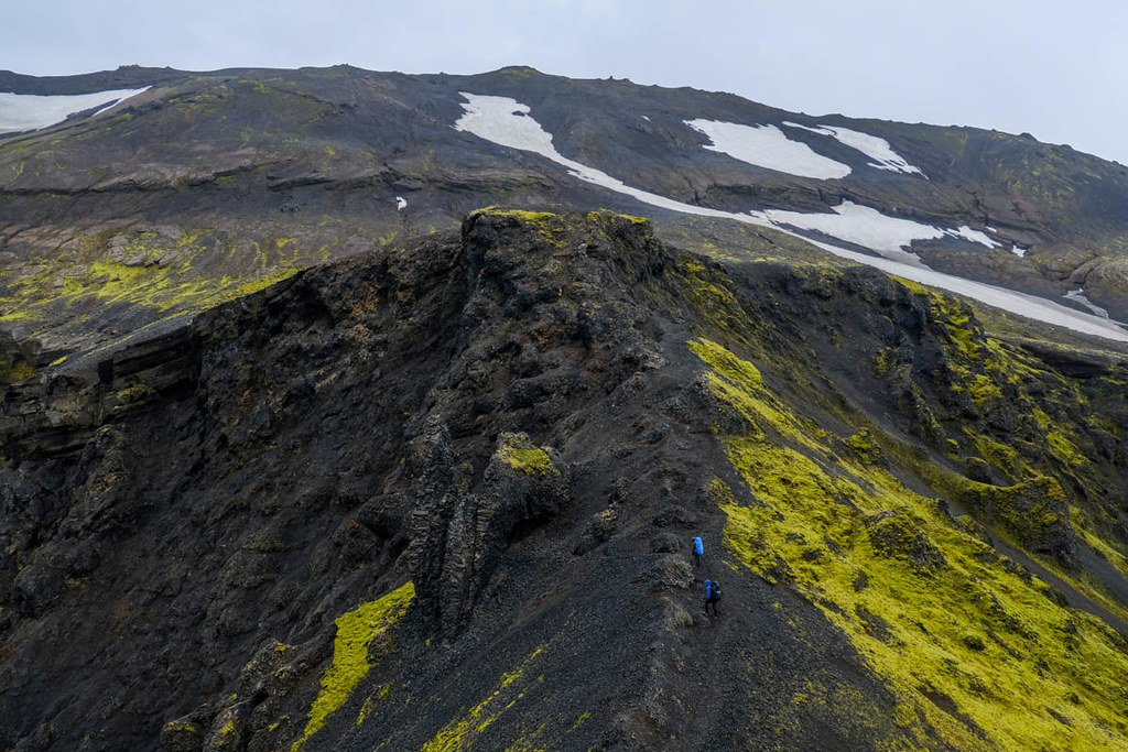
Eventually the trail begins to climb very steeply up the flank of a ridge divided from the main mountain mass by a deep ravine. Once on top of the ridge it narrows to a fine arete - known as the Kattarhyggir or Cat's Spine. I'd been worried by this in advance, but although the drops on each side are pretty big and the ridge is narrow, it didn't cause any real difficulties. It ended with a cable but not really needed.
The weather was now not great, and after the ridge broadened there was a long, steep ascent to a flat, stony plateau. After crossing the plateau the path descends briefly but steeply to a narrow neck with deep ravines on either side.
Once across the dip the route climbs a steep eroded slope connecting the plateau to the higher mountain slopes beyond. At a craggy section (pictured below) the path swings right above where the hikers are and traverses the steep and loose slope, 'protected' by a cable - this bit is known as Heljarkambur or Hell's Mohawk. I was very nervous approaching this bit which is on loose gravel, and more so once on it as most of the poles supporting the chains are very loose and in some cases completely pulled out. After traversing above the drop the route climbs to the safer slopes above.
A long, long ascent up volcanic gravel followed. By now the weather was robbing us of distant views.
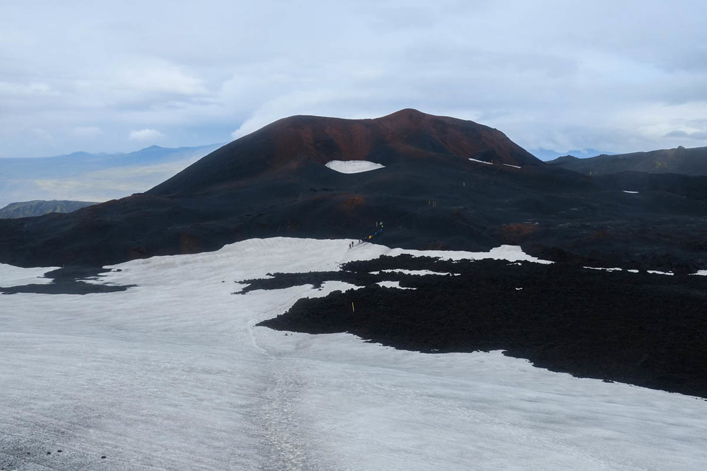
Higher up the landscape has changed greatly following the eruption of Eyjafjallajökull which wrecked air travel across Europe back in 2010. The route crosses some new lava flows and passes two brand new peaks called Magni and Modi, which can be ascended by short detours. It's strange to think of being on peaks formed only in 2010! The peaks were too hot to walk on for the first couple of years and steamed for several years after that, but seemed inactive now.
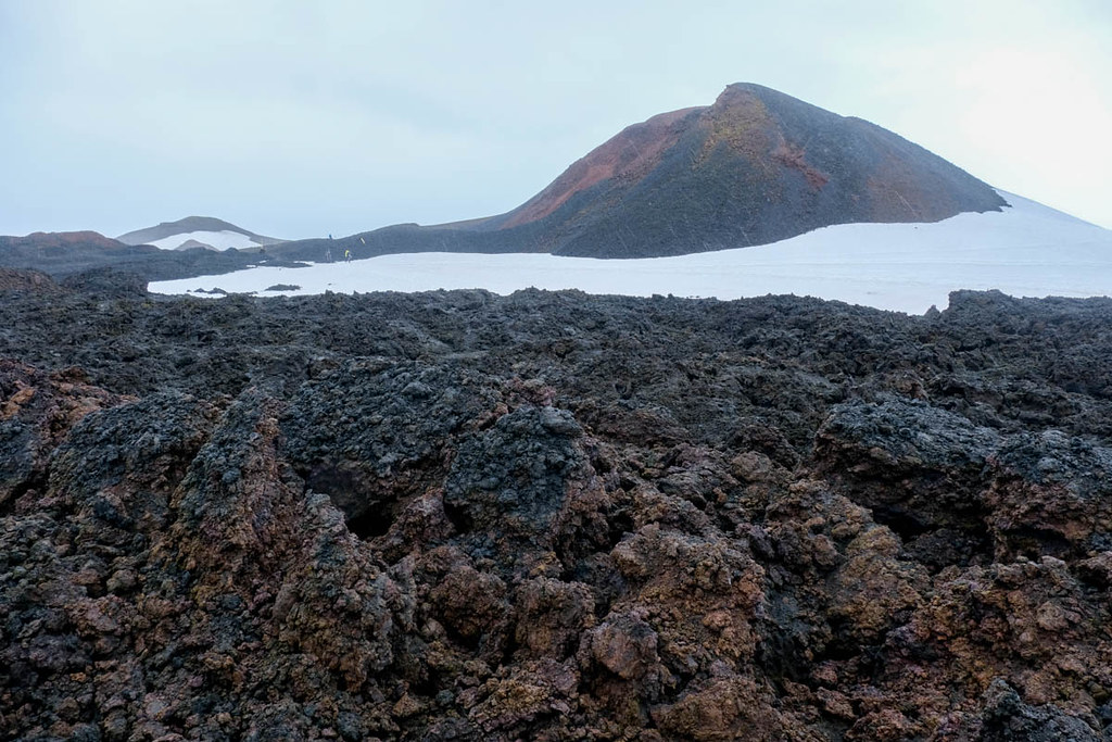
My eye was drawn by this strange volcanic pudding formation (that is not the technical term) below Modi...

The walk now continued across extensive snowfields. It was very hard to say where the highest part of the pass was, as the route crossed many snowy ridges and gravel slopes. The route currently marked by poles actually passes well to the east of the Fimmvörðuháls hut.
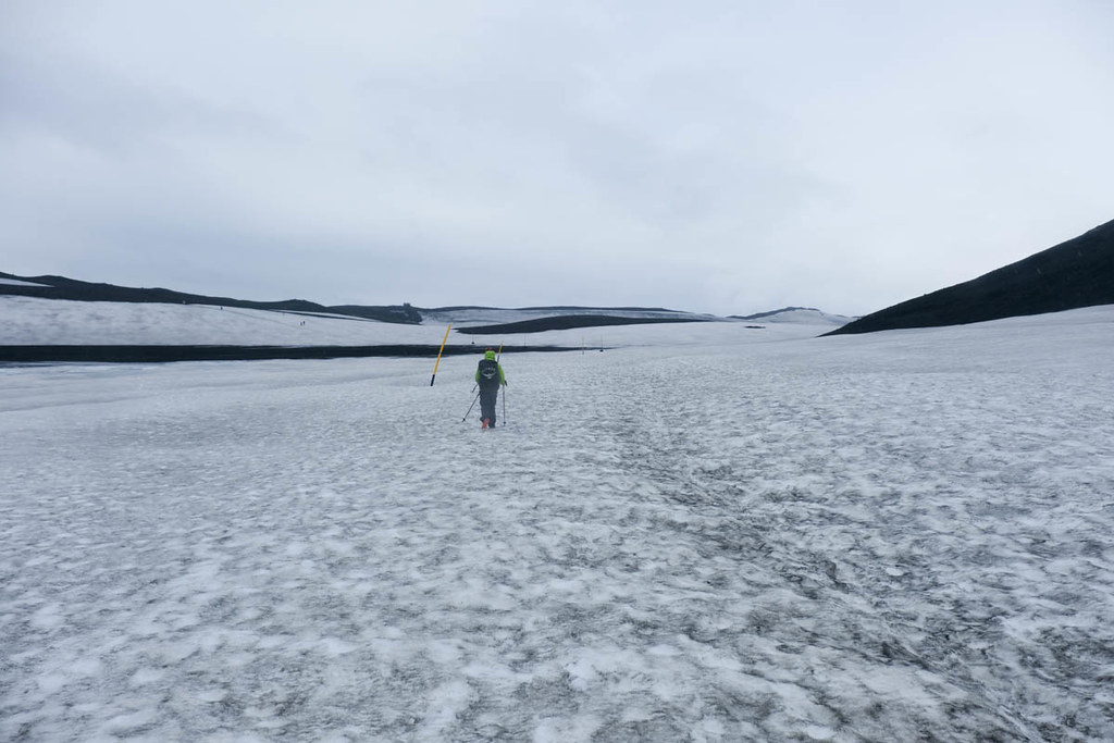
At one point the route - marked by poles bent double by the winter snows - descended a steeper snow slope, which for the lower half was more like sheet glacier ice. This wasn't mentioned in any of our guidebooks - and could only really be passed by shuffling and very carefully sliding.

Looking back at the icy bit.
After another descent and rise another tiny hut was reached. From here a rough landrover track is followed for a time. The landscape on this side of the pass is far less dramatic, with gentle, stony slopes - though the stones make hard going underfoot on the track.
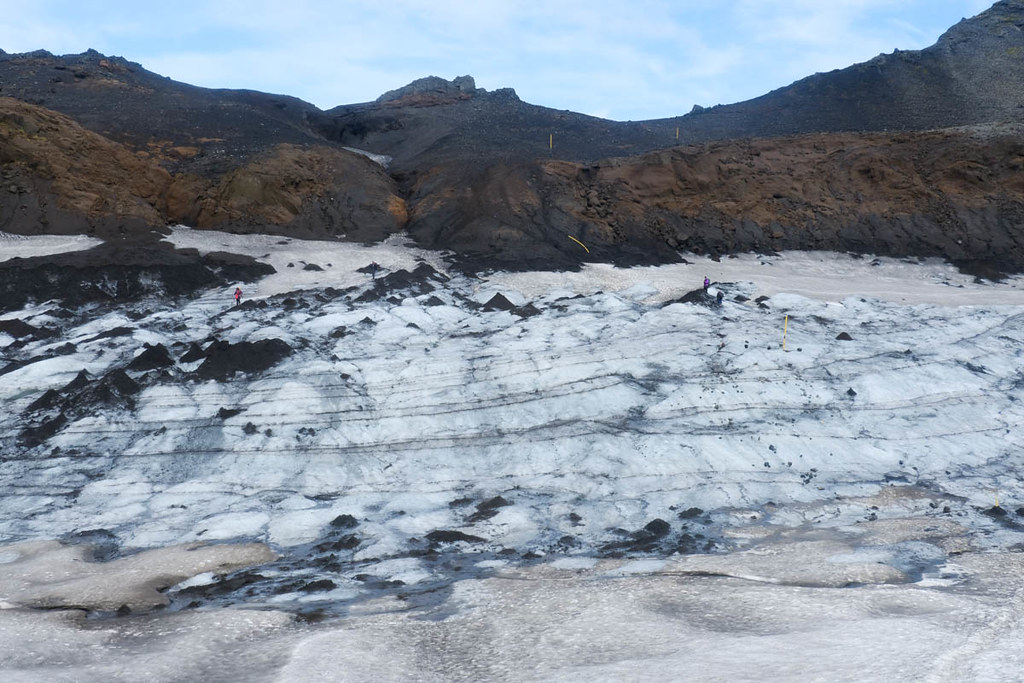
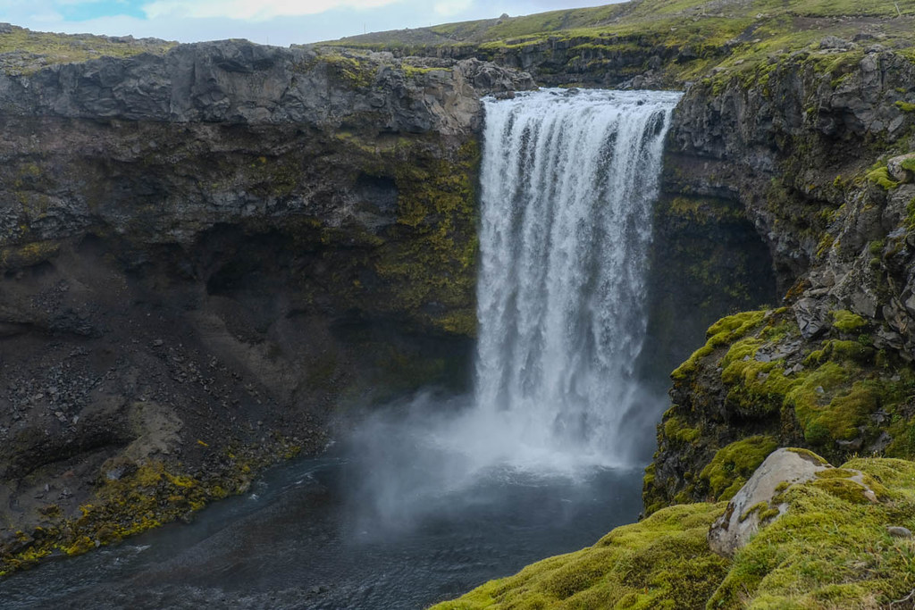
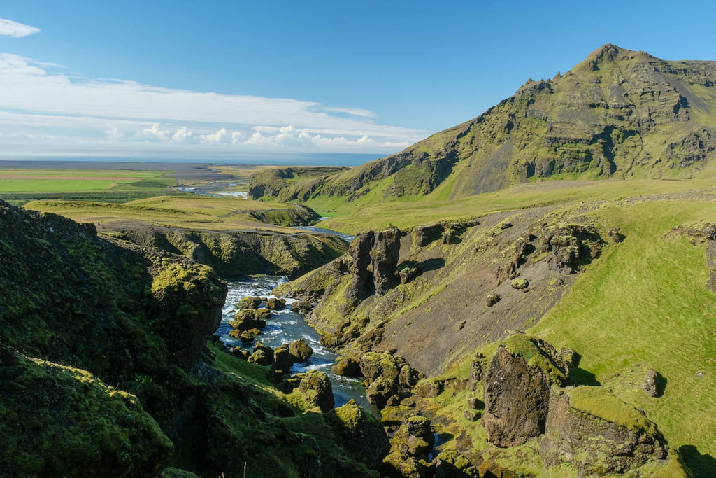
Eventually the path leaves the track and follows the Skogar river for the remaining 10km or so of the descent. The river has 20-odd waterfalls - most of them extremely spectacular - and runs through some dramatic gorges in places.
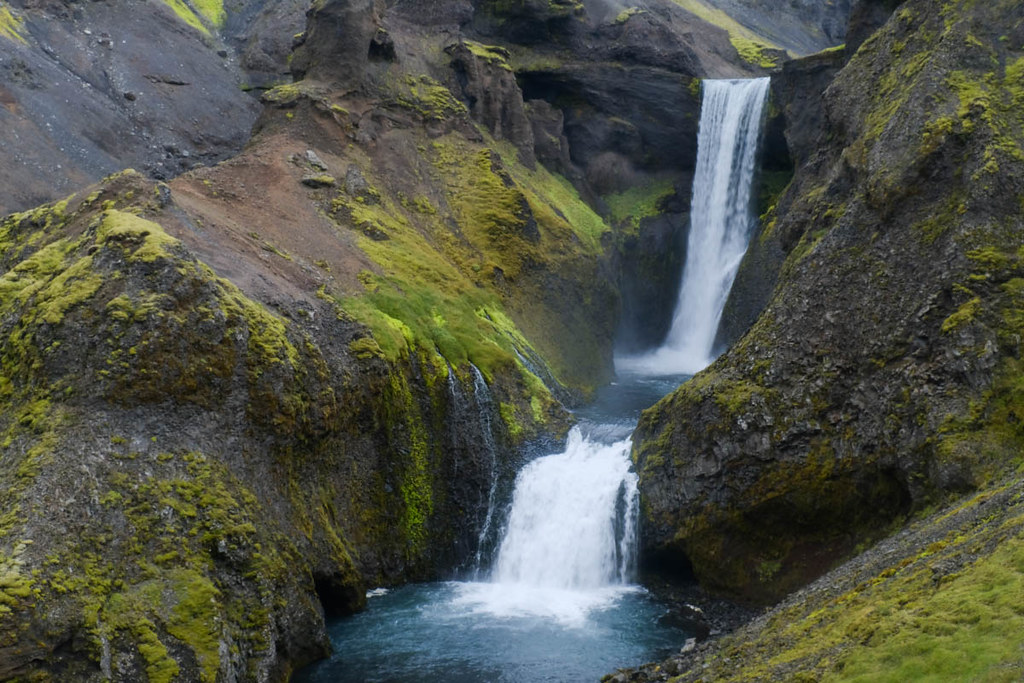


After a certain number of even such magnificent falls, you still start to get very tired.
We came back up this last part of the walk the next day for another look - and to get sunnier photos - so the following shots were actually taken the next morning.
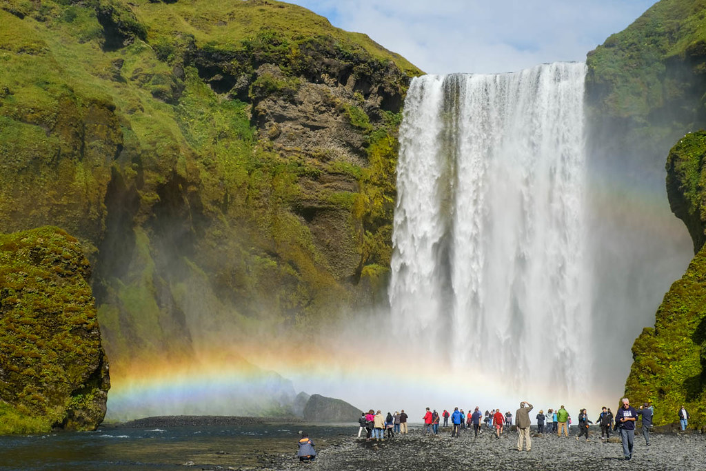
Eventually the lip of the great Skogafoss is reached - with a viewing platform and hordes and hordes of people!

527 steps rammed with trippers lead down to the foot of the falls - and a campsite just beyond. We set up camp here and got a bus back to Reyjavik the following afternoon. A satifying end to a very memorable trek.