free to be able to rate and comment on reports (as well as access 1:25000 mapping).
Hewitts: Foel Fras, Carnedd Llewelyn, Pen y Helgi Ddu, Pen Llithrig y Wrach, Creigiau Gleision.
Date: 31/08 and 01/09/2017.
Distance: 9 + 18km.
Ascent: 760 + 1310m.
Time: 2 hours, 45 minutes + 7 hours.
Weather: Showery and humid on Thursday, calm and overcast with sunny spells on Friday
While not quite at the heart of the Snowdonia meet (a semi-official one at Capel Curig organised by Alan Mountainstar - cheers

), this was as close to a 'piece de resistance' as I would mange to pull off on this visit to Wales. Much as I enjoyed getting out into the hills with my dad (and occasionally mum), I needed something a bit longer and more remote-feeling, and Dulyn Bothy held the key. Having suggested a visit here the Thursday before the meet began, I knew there would be a few others (including Alan) in attendance.
Since my parents were off to the Lake District on Saturday, this marked the end of my stay at their place. I left a bag of spare clothes with them (which I would pick up on the way back up to Scotland) and packed the rest of my stuff up for a long weekend away. I would be walking to Capel Curig from Abergwyngregyn on the north coast by way of Dulyn.
My original intention had been to start in Bethesda and take a meandering route over Drosgl and Bera Bach, but the forecast of heavy showers moved me to look at a shorter route from Aber. I cheated and got dad to drive me right up to the roadhead (elevation about 200m), starting the walk just before 4pm. He wandered along with me for the first 30 minutes or so, following the Anafon up the valley and joining the main track in the valley.
 Foel Dduarth
 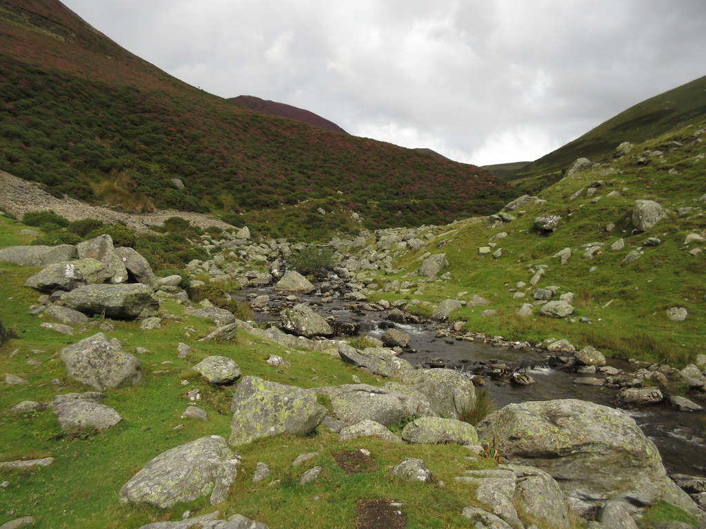 Anafon Valley
 Dad stupidly didn't bring a jacket with him as he was only walking with me for a short while. As soon as the first shower hit, he turned back, knowing he would be very wet by the time he got back to the car! I put my jacket on and carried on up to Llyn Anafon.
 Anafon
  Llyn Anafon
 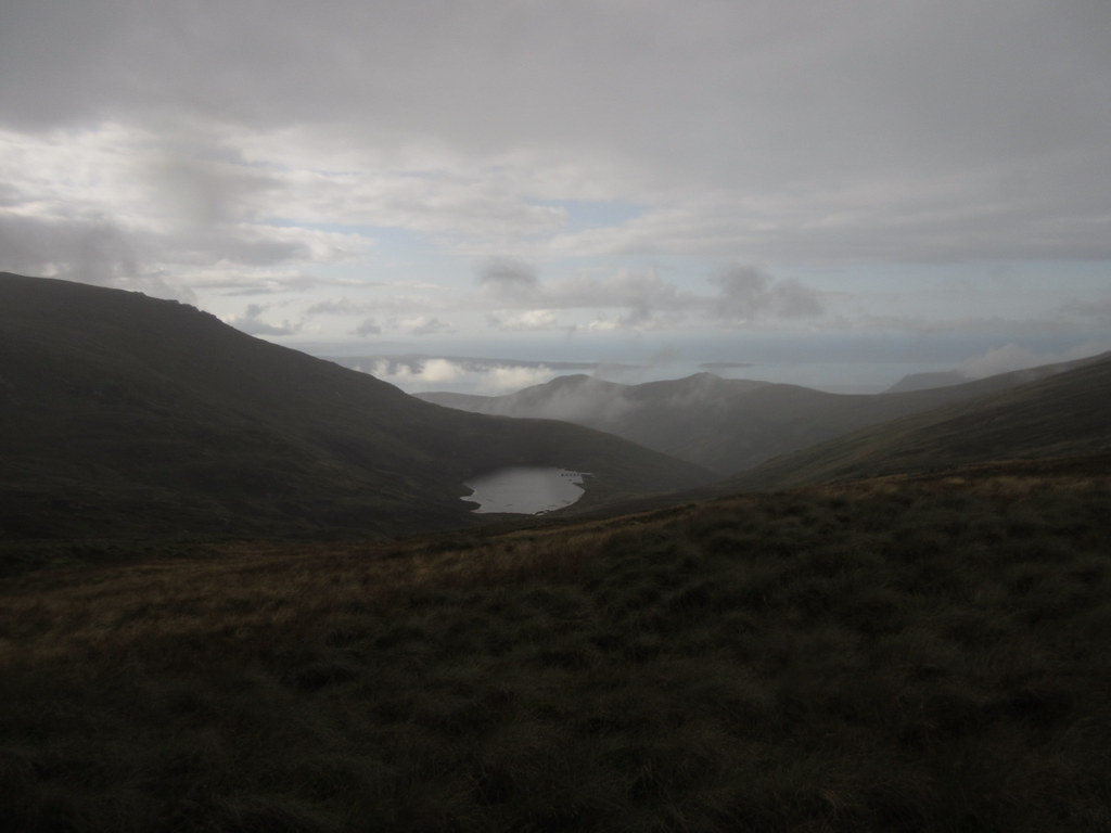 Looking back to Llyn Anafon
 The rain was unrelenting until I reached the col between Drum and Foel Fras. I had intended just to make a descending traverse to the bothy from here, avoiding all summits, but the prospect of the weather clearing had me making a beeline for the summit of Foel Fras. Not the most exciting of the Welsh 3000ers, it is nevertheless the most northerly, therefore forming either the first or last of the big traverse. For this reason, it was effectively my first summit camp, as I bivvied up here in June 1997 with my mate Gordon prior to doing the 3000erds the next day.
 North
North While the weather didn't completely clear, it certainly looked interesting for a bit before the next band of cloud moved in. I rapidly dropped down the Dulyn side of the hill, which steepened around the crags which back the lake.
 Carnedd Llewelyn and Yr Elen from Foel Fras
 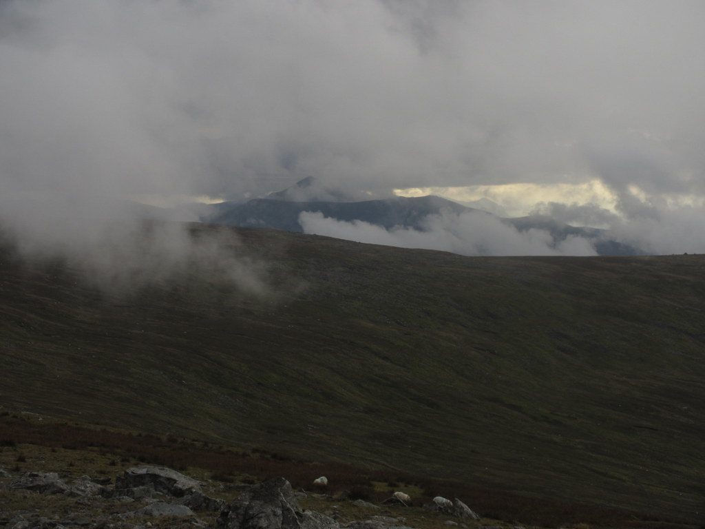 Carnedd y Filiast and Elidir
  Descent to Dulyn
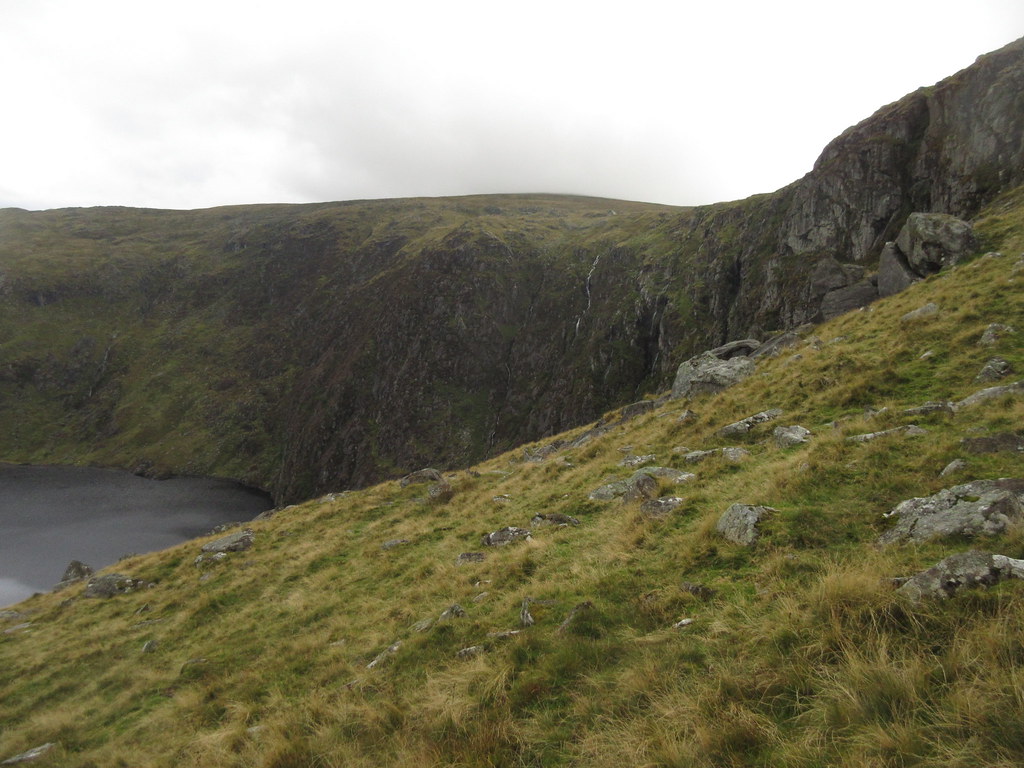
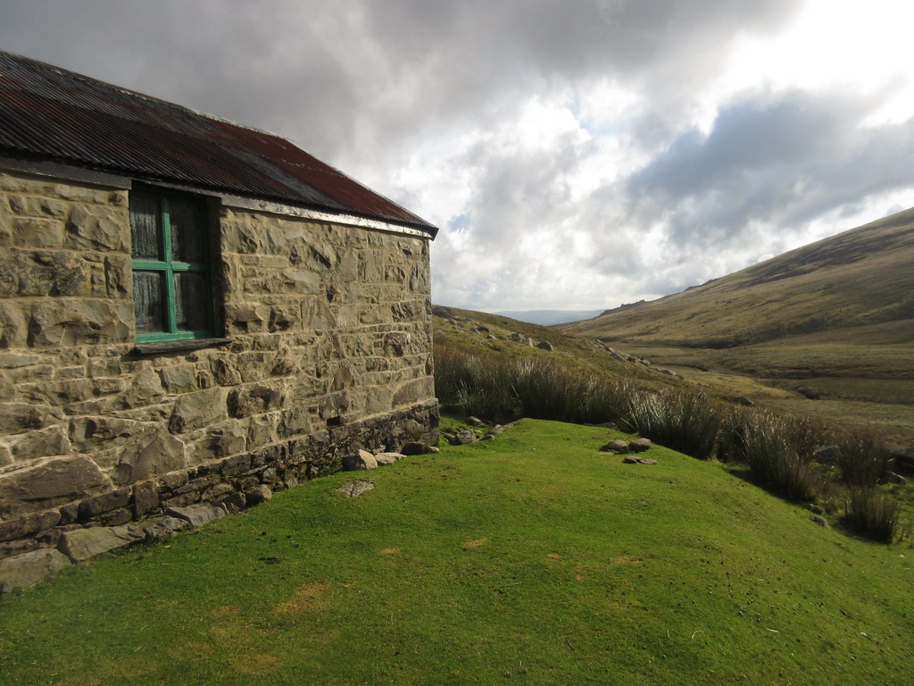
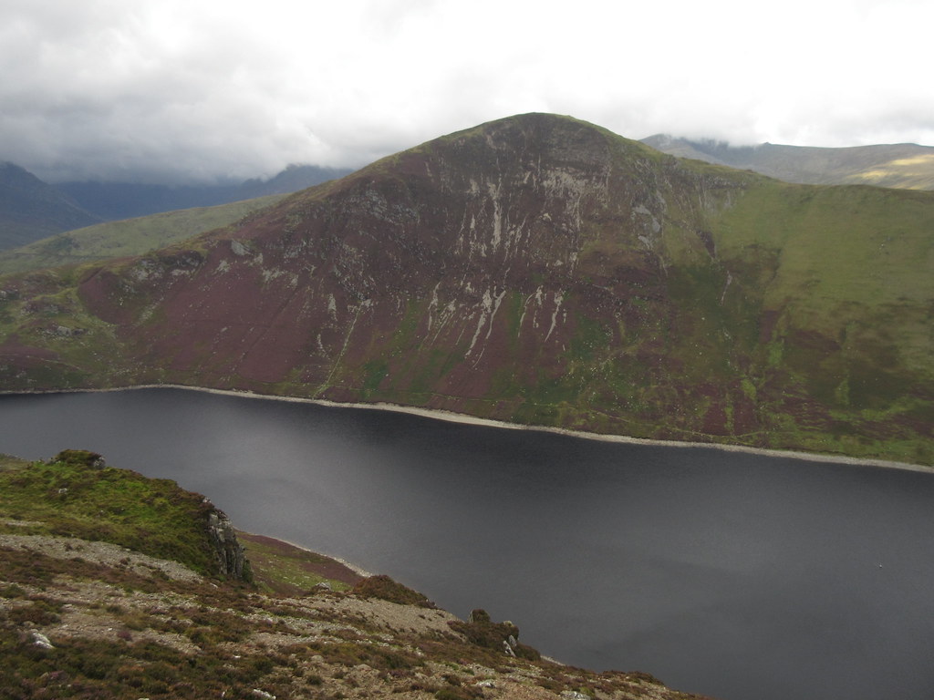
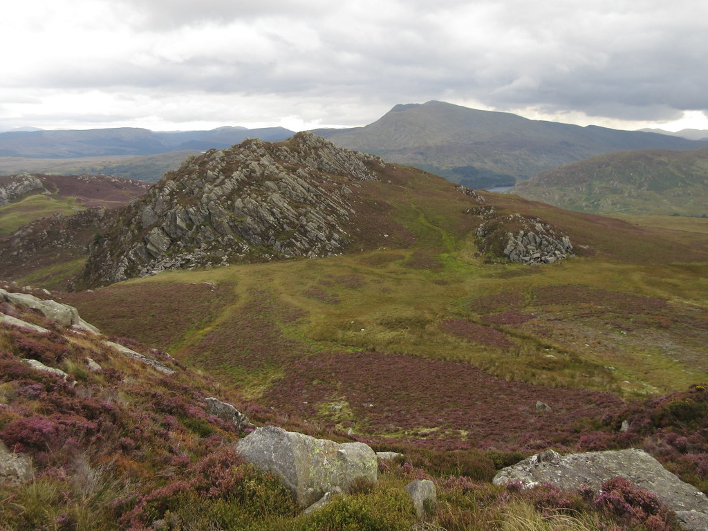
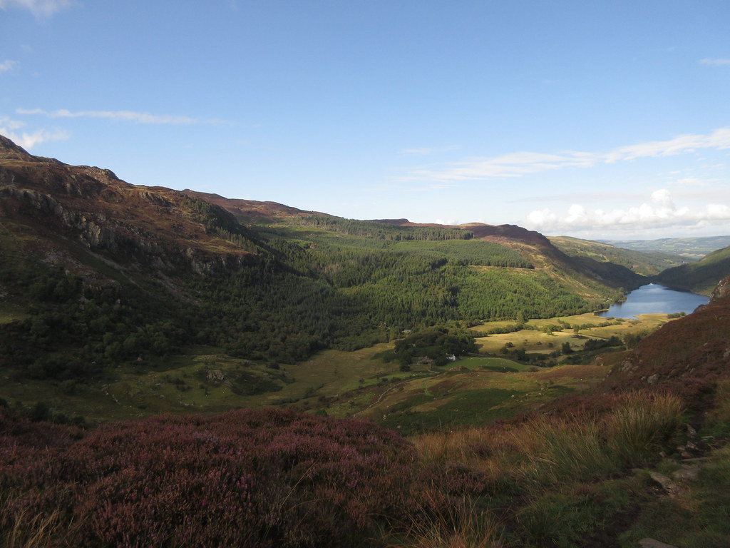
 I don't know how many times I have traversed the main ridge of the Carneddau -a dozen at least - but I have never dropped down the Dulyn side of the ridge, and have only ever done a couple of walks on that side of the range from the Conwy Valley. It is effectively the furthest part of Northern Snowdonia from Anglesey (at a whopping 30 miles from home!), so has largely been ignored in favour of closer places. Big mistake, as Dulyn is held in an impressive rocky corrie with a large natural dam of moraine and boulders holding the water back.
 Crags around Dulyn
 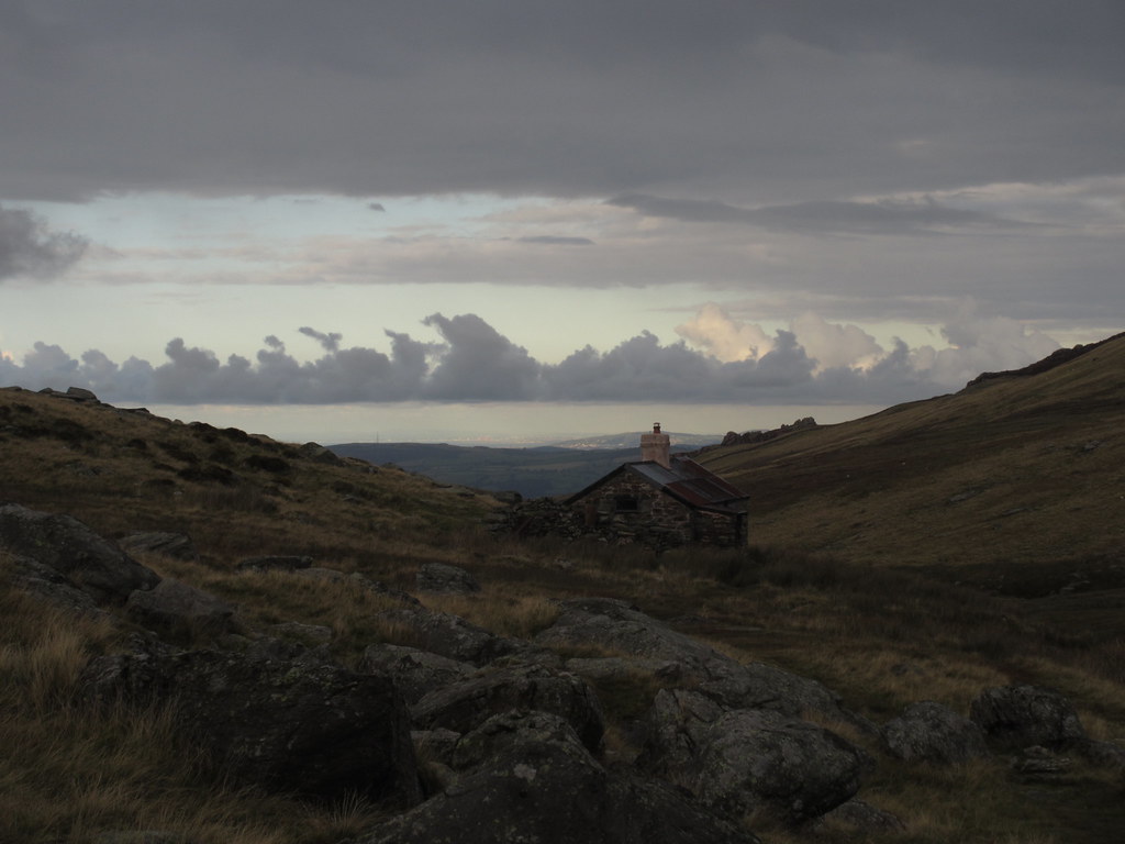 Approaching Dulyn bothy
 Before long I was down at the bothy (never visited before either). I had timed it well. A girl not on the meet was already there, and as I approached the door, I could spot f figures (which turned out to be Alan, Mick and Jamie), descending the hillside opposite (having taken the direct route). Monty and Hugh turned up shortly afterwards. Mick and Jamie (who is only 14) had walked all the way from Capel Curig, having left Newcastle before 5am the same morning and taken an impressive array of trains and buses to get there.
A good bothy night as ever. I had made my excuses about carrying coal over the hill, but had somehow managed to fit in a reasonable stash of beer

.
 Bothy night
 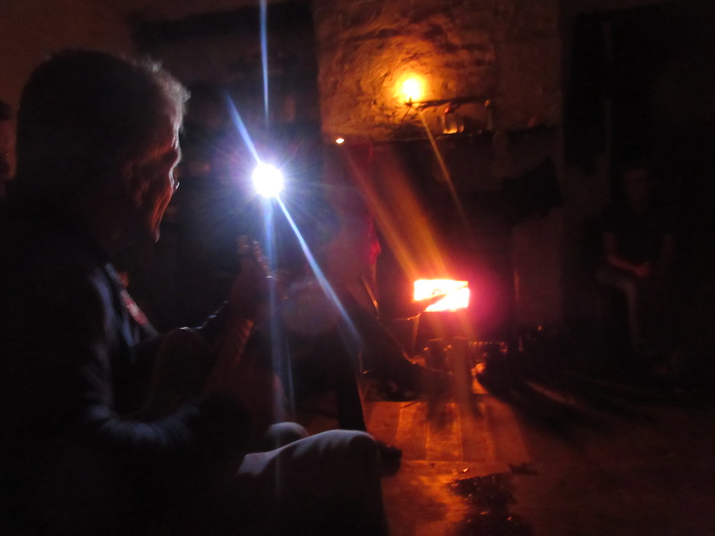 Bothy gig courtesy of Monty
 ______________________________________________
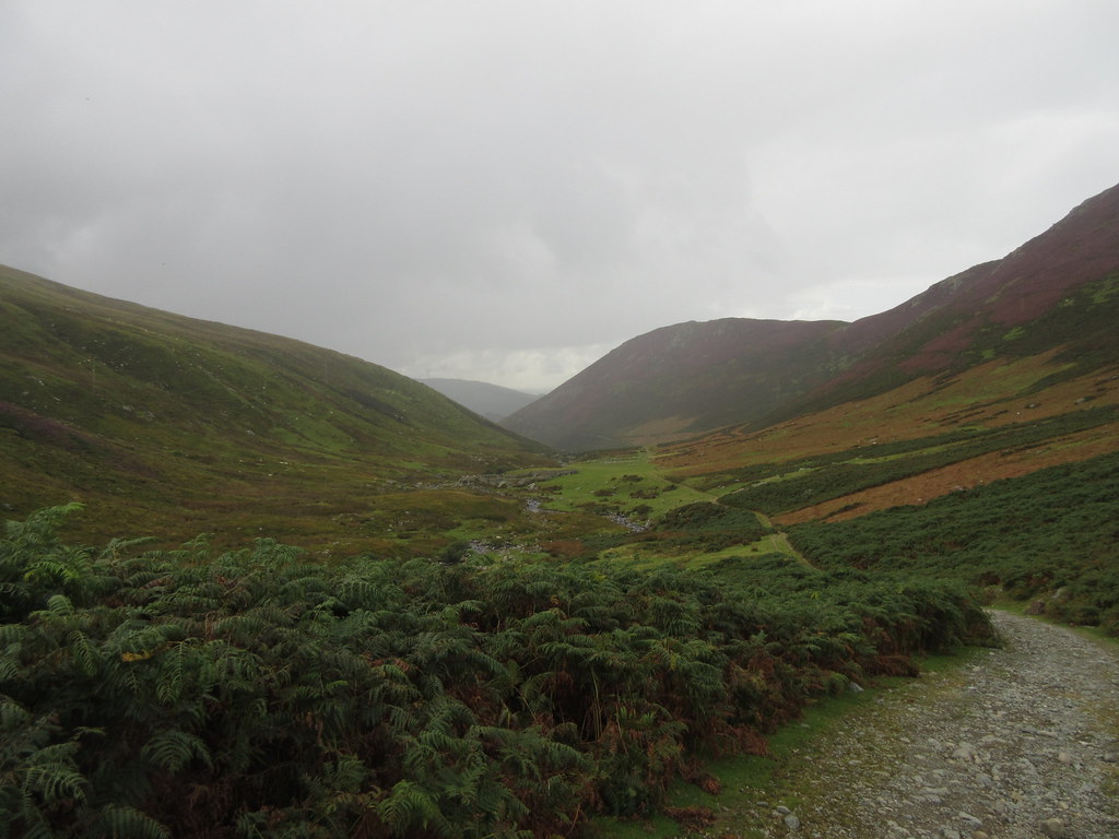
Next morning, I somehow avoided a hangover, but was still last to leave the bothy shortly after 10:15. I had a bed booked in Plas Curig hostel, but was in no rush to reach it. There was cloud on the high hills, but it was nice lower down.
 Dulyn in the morning
 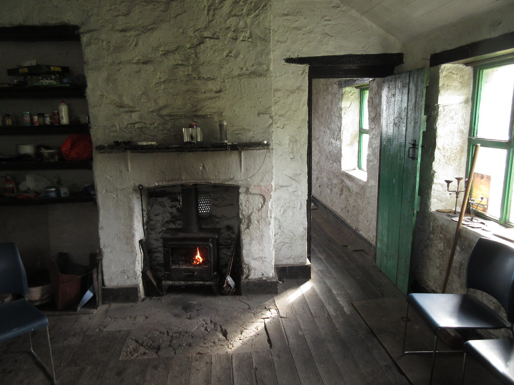 All cleared up
 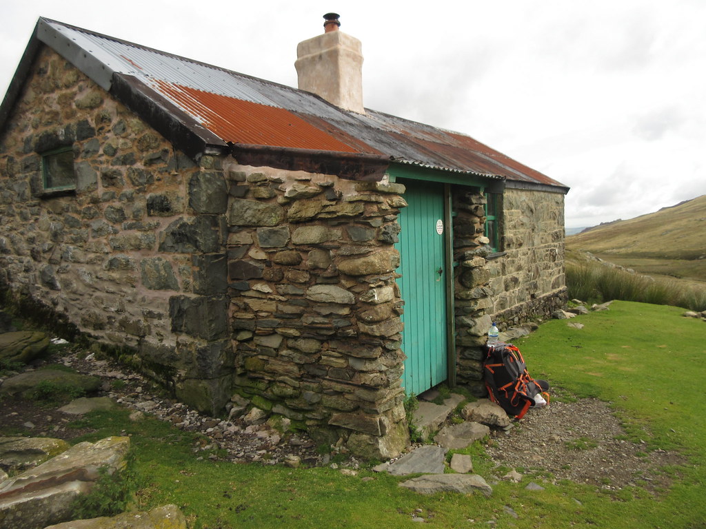 Dulyn Bothy
  Looking back to Dulyn bothy
 I walked back up to Dulyn itself and picked up the good path which heads up to Melynllyn. This follows the route of a pipe connecting the two lakes, and all of the lakes round here are joined up by a series of tunnels, pipes and aqueducts to supply water to the power station at Dolgarrog - one of the earlier hydroelectric schemes (also the site of a big disaster when the dam of Llyn Eigiau burst and flooded the village).
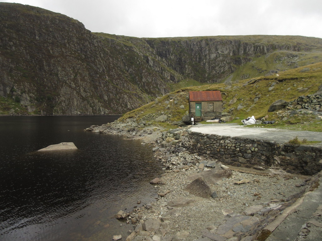 Dulyn outflow
 Melynllyn has another natural dam of moraine (but also a small man-made dam - the lowered water level today is clear to see). Once across this, I climbed up easy grassy slopes onto the plateau beneath Foel Grach and Carnedd Llywelyn.
 Looking back from the path to Melynllyn
  Path to Melynllyn
 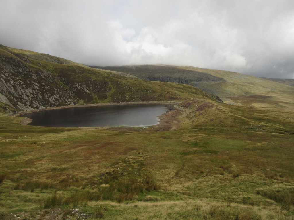 Melynllyn
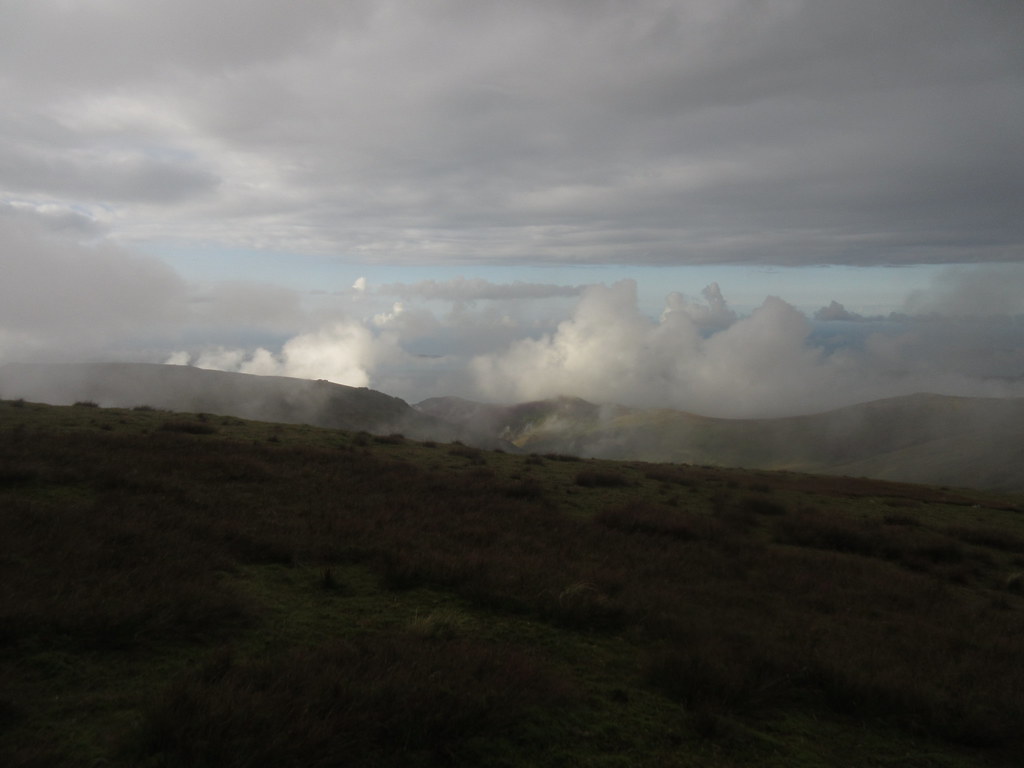
 Although it was quiet in terms of people down here, in the background was the constant clatter of the MR helicopter on exercises. I watched it land on the summits of Pen Llithryg y Wrach and Pen y Helgi Du.
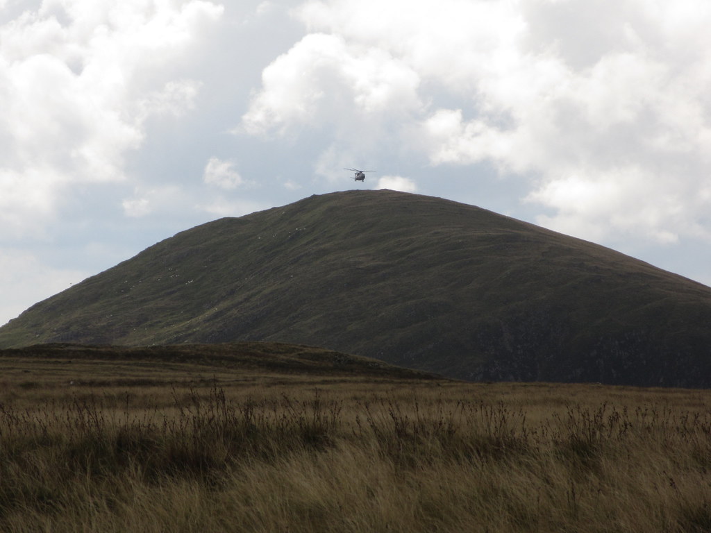 Rescue helicopter training over Pen Llithrig y Wrach
 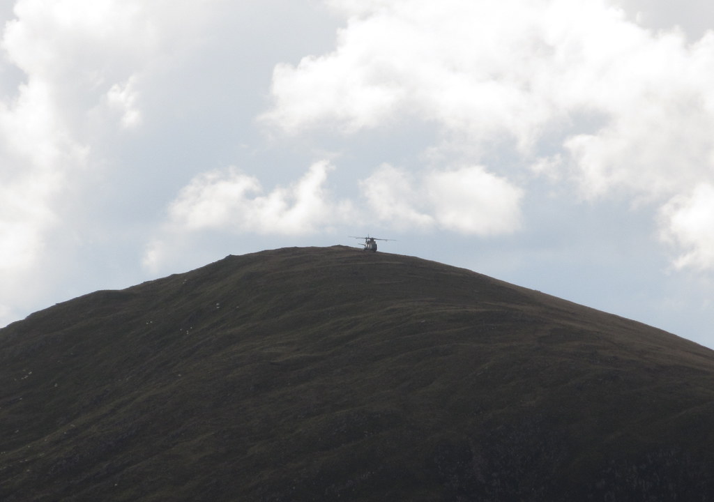 Landing on Pen Llithrig
 As the weather high up was uninspiring, I planned to take a slightly obscure route from here - into the corries rather than on the ridge. My target was the tiny Ffynon Llyffant (well of the frog), likely the highest named body of water in Wales (and not overly high at around 850m). The climbers crag of Craig yr Ysfa enlivened the slightly boggy walk in, but once there it was nice.
 Carneddau ponies
 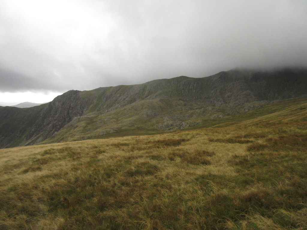 Approaching Cwm Llyffant
 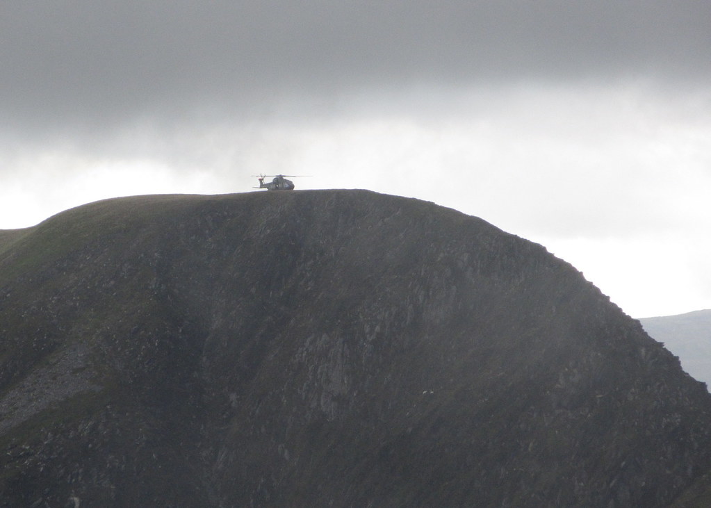 Helicopter landing on Pen y Helgi Ddu
 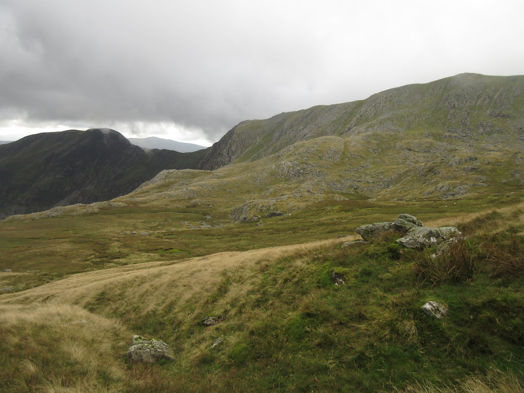 Pen y Helgi Ddu and Craig yr Ysfa
  Ffynon Llyffant
 I hadn't realised that there were aircraft remains in here, but since they are in a disturbingly large number of places, it shouldn't have come as a surprise. A handwritten memorial on one of the pieces of wreckage told the sorry tale.
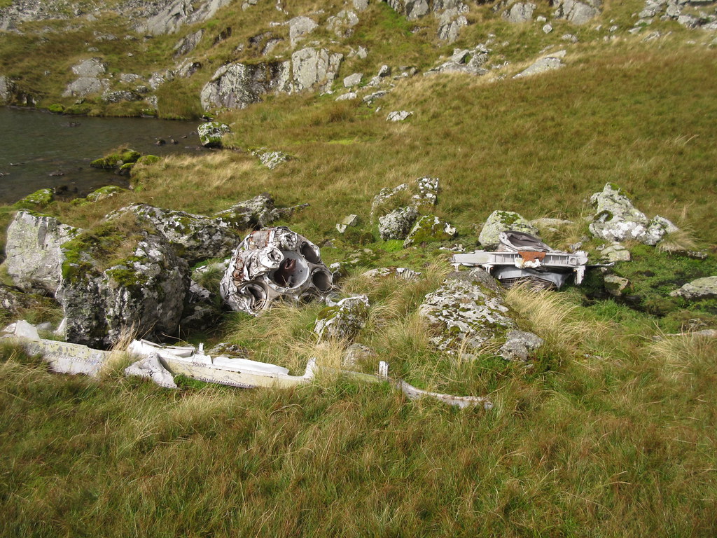 Aircraft ruins at Ffynon Llyffant
  Aircraft memorial
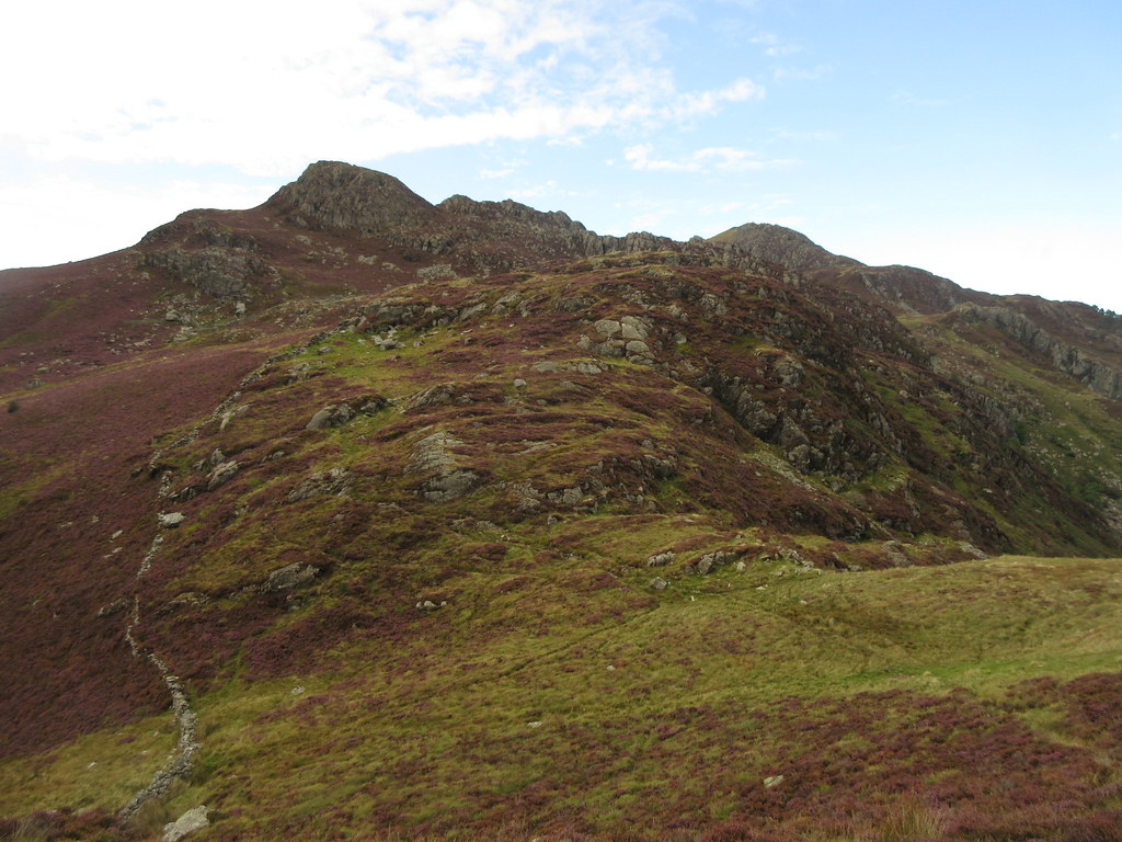
 The weather was brightening up a bit, so I decided to head up onto the ridge after all. Although not exactly a scramble, a rocky rib appeared to provide an entertaining way up to the lip of the corrie, after which I was so close to the summit of Carnedd Llywelyn that I decided to go up after all. It wasn't quite clear, but close enough.
 Looking down on Ffynon Llyffant
 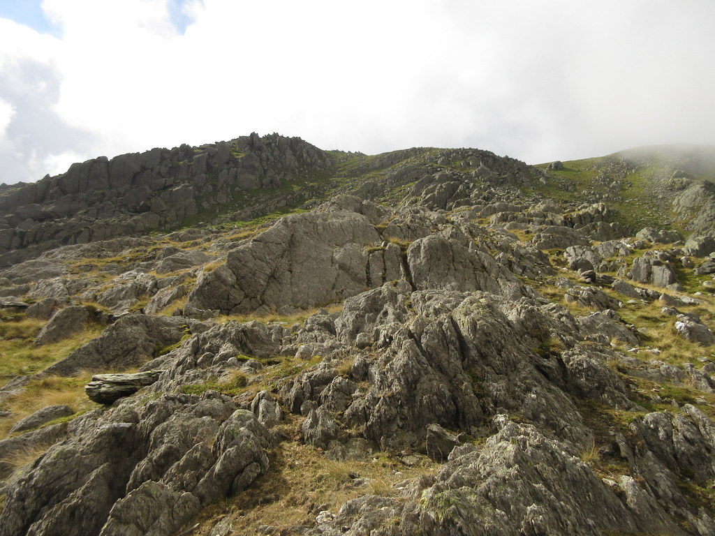 Escape from the corrie
 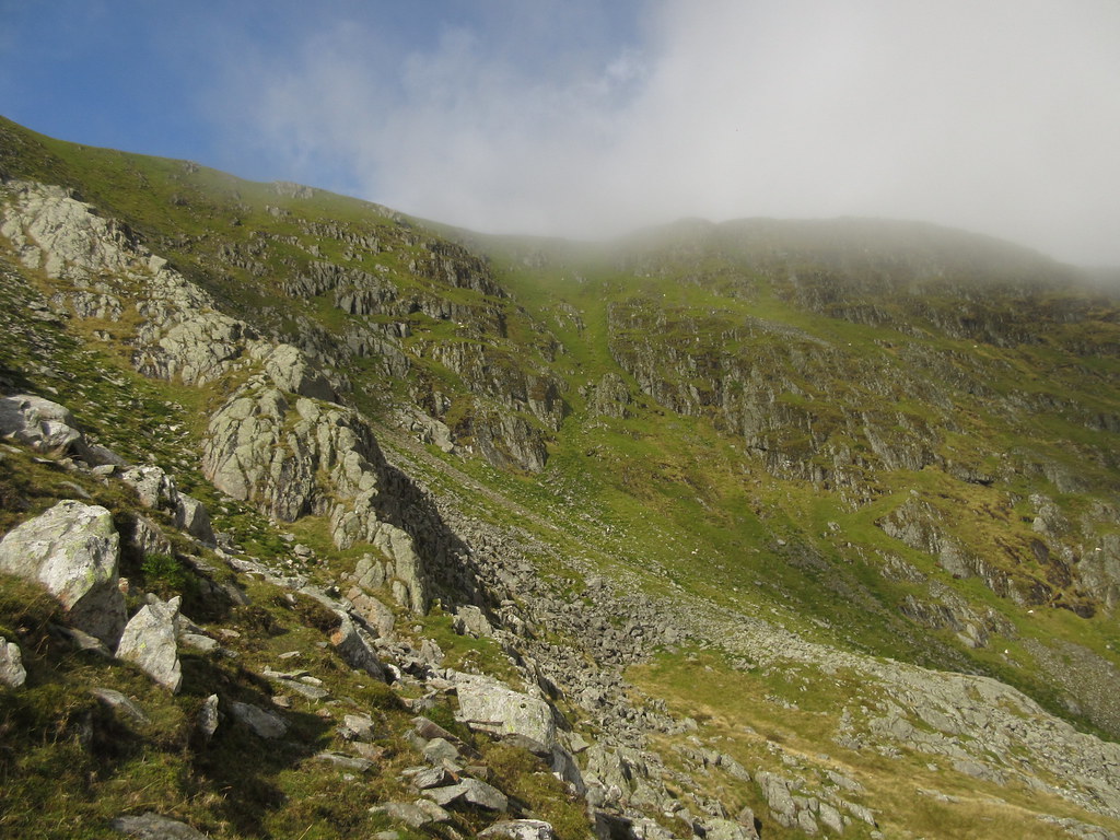 Walls of Cwm Llyffant
 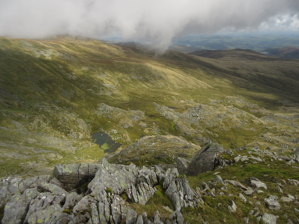 Almost on the summit of Carnedd Llewelyn
 Now to head eastwards over a series of summits that gradually diminish in height, but not interest. First was a traverse of the top of Craig yr Ysfa, an impressively steep crag which is very hard to see from anywhere else. There is an old climbers joke that it was first discovered by telescope from Scafell in the Lake District
.
 Ffynnon Llugwy and Pen y Helgi from Carnedd Dafydd
  Across the Conwy Valley
 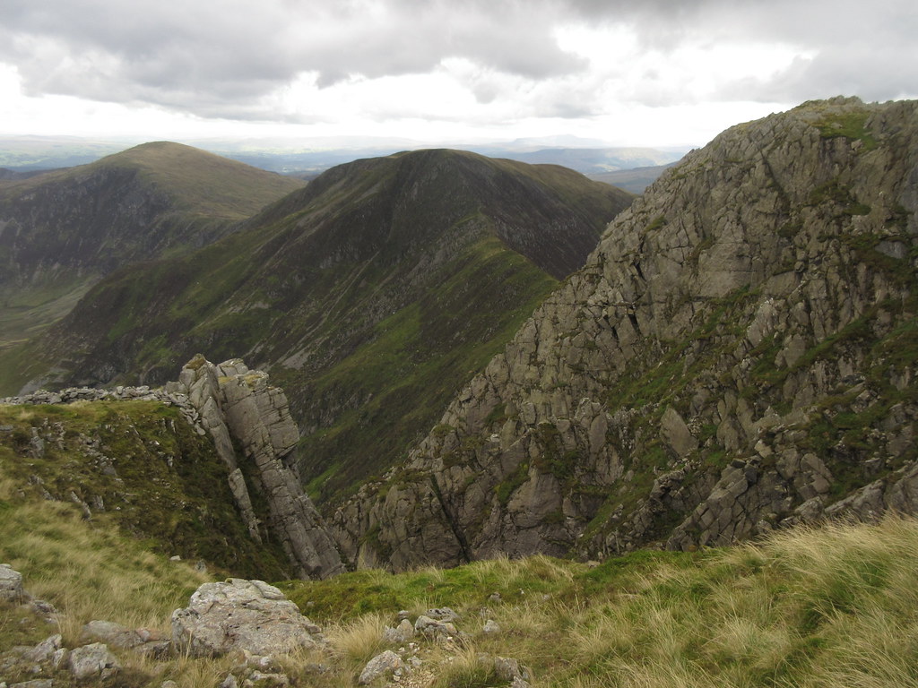 Craig yr Ysfa with Pen Llithrig and Pen y Helgi behind
 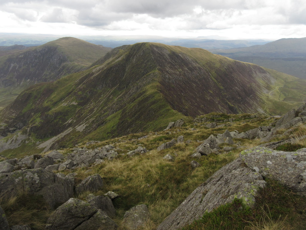 Pen y Helgi
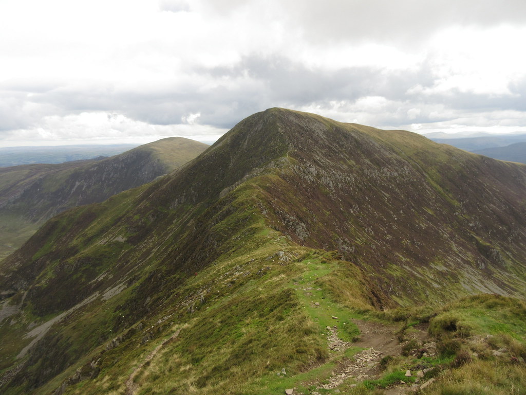
 There is a slight scamble down to Bwlch Eryl Farchog, which is a pleasant section of narrow ridge separating Ffynon Llugwy from Cwm Eigiau. Then a short, steep scrambly ascent onto Pen y Helgi Du, where the character of the ground changes quickly.
 Pen y Helgi and Bwlch Eryl Farchog
 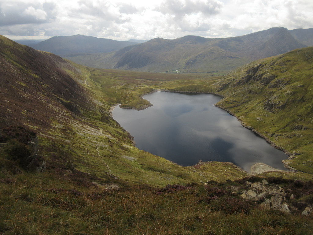 Ffynon Llugwy with Tryfan lurking in the background
 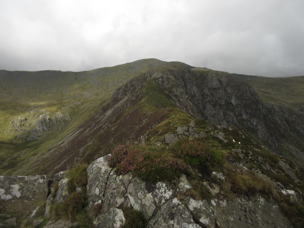 Craig yr Ysfa
 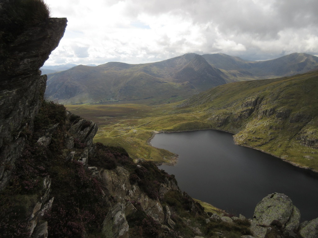 Tryfan and the Glyders
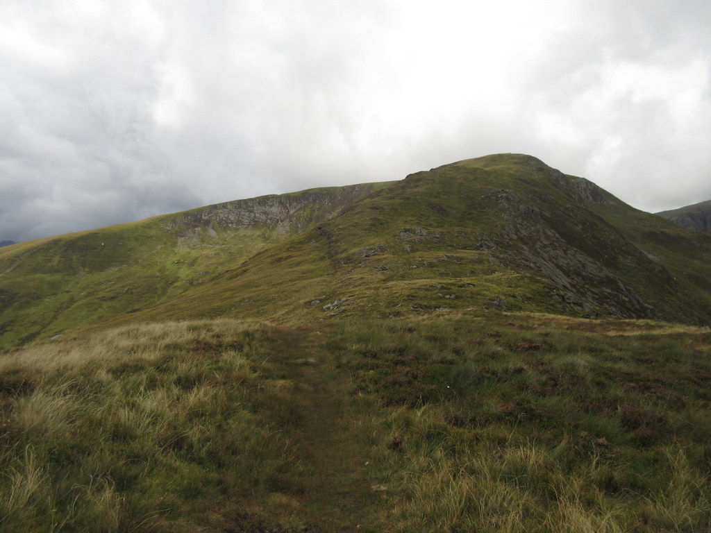
 The summit of Pen y Helgi is flat and grassy, and the descent to the east is much more like the northern end of the main Carneddau ridge again -rounded and grassy. There are some steeper drops to the north into Cwm Eigiau to provide interest, and the pull up onto Pen Llithrig y Wrach (translated directly as the 'slippery head of the witch', but more likely to be derived from the more boring 'Crach' meaning rough; ie 'Rough Slippery Hill') isn't too hard. On the ascent, I meet the first person of the day (although I have seen a couple of others crossing my path in the distance).
 Back to Pen y Helgi
 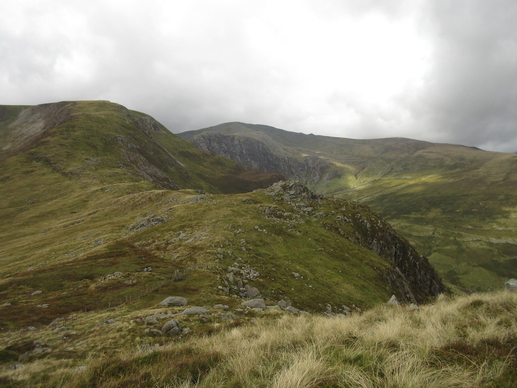 ...and back to Carnedd Llewelyn
 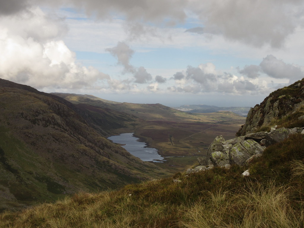 Llyn Cwm Eigiau
 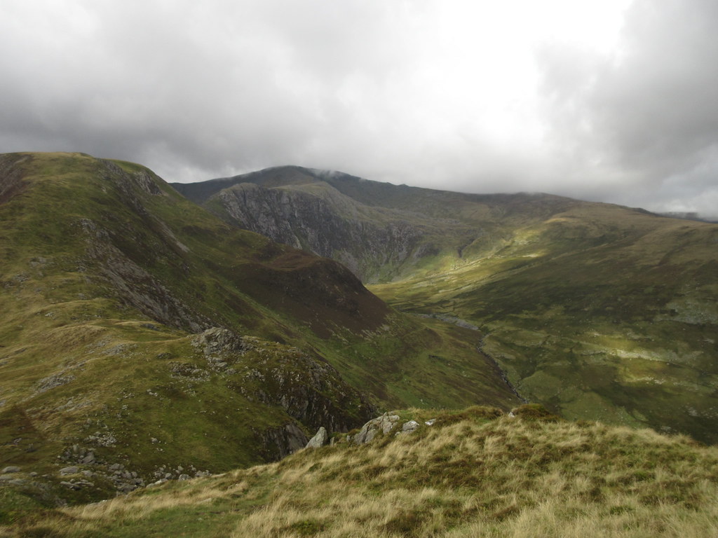 Carnedd Llewelyn from Pen Llithrig
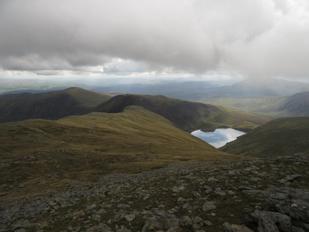
 The view back to Carnedd Llywelyn from Pen Llithrig is good, but not as good as the one down the other side to Llyn Cowlyd and Creigiau Gleision. On the way down from Pen Llithrig, the solitude is broken by a group of about 20 walkers, and down at the col above Llyn Cowlyd, I chat to another guy who seems familiar with the hills in the area. I almost go with his suggestion of walking to the NE end of Llyn Cowlyd to go up Creigiau Gleision, but in the end I stick to my original straight-up route from where we are standing. This is pathless terrain as far as Snowdonia is concerned, but being more visited than the Highlands, there is always a footprint or two to follow, even if I miss them initially.
 Creigiau Gleision across Llyn Cowlyd
  Llyn Cowlyd
 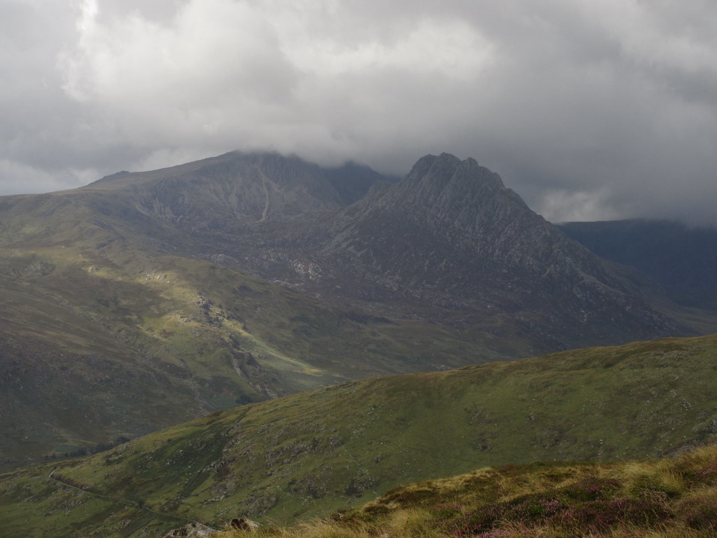 Tryfan and Glyder Fach
 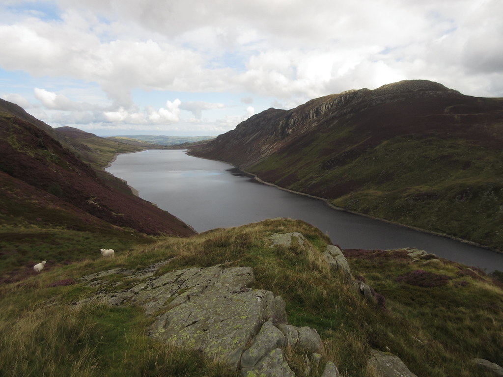 Llyn Cowlyd and Creigiau Gleision
 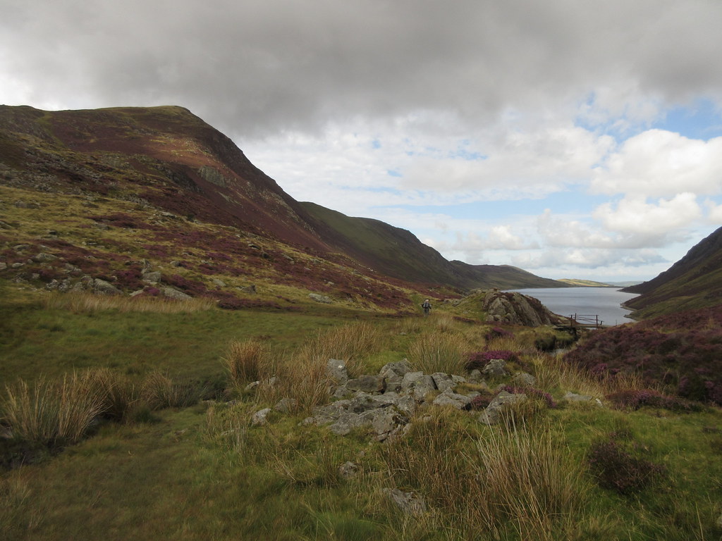 Pen Llithryg
 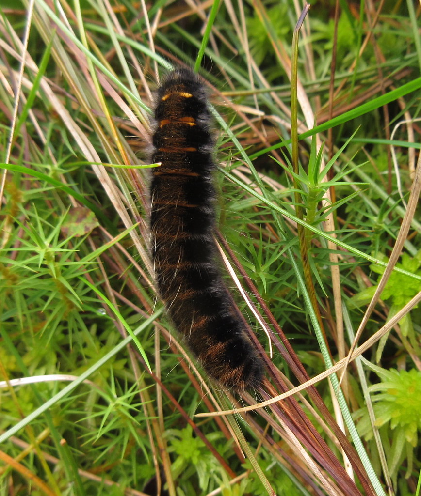 Caterpillar
  Llyn Cowlyd and Tryfan
 A short marshy section leads to the summit rocks, and again the terrain has changed completely, the ground being much more broken and heathery around here. Although I carried on a short distance north of the summit for better views onto Llyn Cowlyd, I ultimately couldn't be bothered to visit the NE top (which counts as a separate Hewitt, and probably has better views).
The Gwynt-y-Mor windfarm out at see has an impressive array of turbines. I don't think I've ever seen it so clearly before, although I'm aware some of my colleagues were responsible for the design of the cable landings.
 Pen Llithrig across Llyn Cowlyd
  Gwynt-y-Mor windfarm in Liverpool Bay
 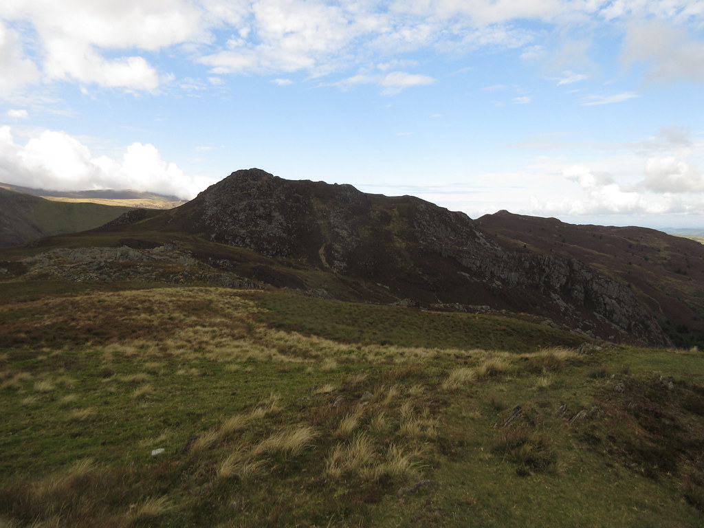 Looking back to Creigiau Gleision
 Heading back down towards Craig Wen, I spotted someone coming towards me at about twice the speed of a typical walker. I should've guessed it would be Alan (Alteknacker), who was just going for a quick afternoon round of most of the hills I had been over today!
 Craig Wen and Moel Siabod
 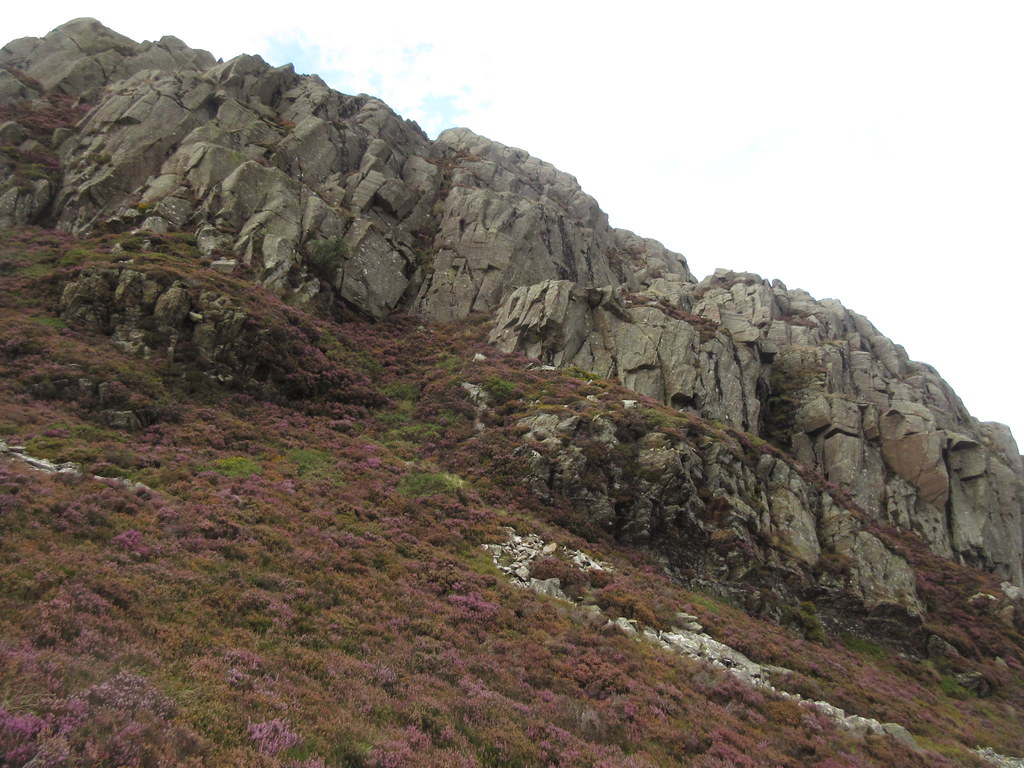 Craig Wen cliffs
 After a lower summit of Creigiau Gleision, the going got very heathery again over Craig Wen. Despite a faint path, some of this was very rough and a bit slow, albeit with some impressive crags.
 Craig Wen and Creigiau Gleision
 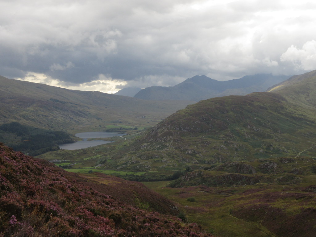 Llynau Mymbyr and Lliwedd
 The going got easier again for the last descent towards Crimpiay, which is a great little summit of no great height. From here, I was able to joint the Capel to Crafnant path, which is a popular thoroughfare, and descend into Capel Curig as the sun really came out properly for the first time in the day.
 Llyn Crafnant from Crimpiau
 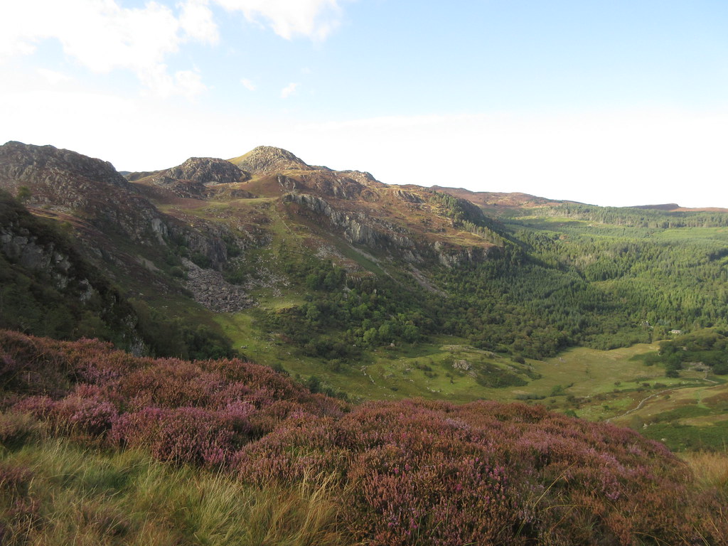 Creigiau Gleision from Crimpiau
  Moel Siabod from the Crafnant path
  Autumn is coming
 After stocking up in the worst shop in Wales (to be fair, hardly anyone lives in Capel Curig - at least they had a decent selection of Welsh beers), I headed to the hostel to have a quick dinner, then down the road to Dolgam campsite (with unexpected midges

) to catch up with everyone else...then the pub

.
