free to be able to rate and comment on reports (as well as access 1:25000 mapping).
After our last walk together a few weeks ago Chris felt as though he was struggling a bit and felt out of condition, more so now that he has just worked off shore nearly nonstop for the last 6 or 7 weeks, so is looking for something to break himself back into a trip to the hills. Not having much sympathy but understanding his needs of a gentle break back onto the fells I thought that this one would fit the bill perfectly; High Raise from Stonethwaite and a nice gentle drop off via Sergeant's Crag and Eagle Crag.
As Chris arrived at his usual time of 7ish the sky was playing host to a solid blanket of cloud after a second night of rain which didn't bode too well for the underfoot conditions from Greenup Edge onwards, but despite the cloud it was warm and humid. The forecast was good for the day and was proved correct as the day went on, although as we arrived at the busy car park at Stonethwaite the cloud was now hanging fairly low over the fells with the tops of even the lowest ones wearing a white fluffy bonnet that looked nice and picturesque but may do nothing for the views later on if they didn't lift, we could only hope.
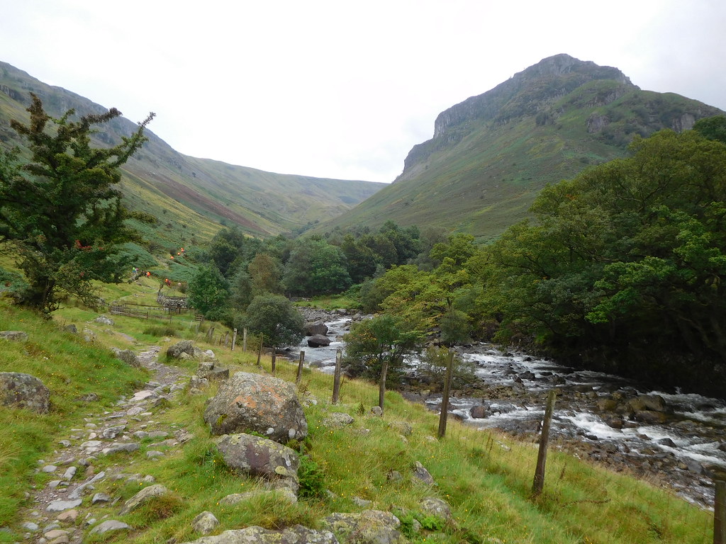
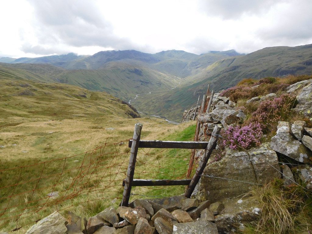
Stonethwaite is a handy place to park as it is near to several points of access onto the fells and if the one in the village/hamlet is full then there is plenty of space on the verges further back down the road by the school, we would be taking the access straight from the car park that crosses Stonethwaite Beck by the old Stonethwaite Bridge that would put us directly onto the well worn route that follows Greenup Gill and one of its tributaries right the way up to the top - or nearly so - of Lining Crag.
Once across the bridge the formerly wall enclosed path is followed southeast firstly through fields and following the Cumbria Way until the footbridge at Smithymire Island is reached from where it turns to cross the bridge whereas we continued on in the same direction for a good way.
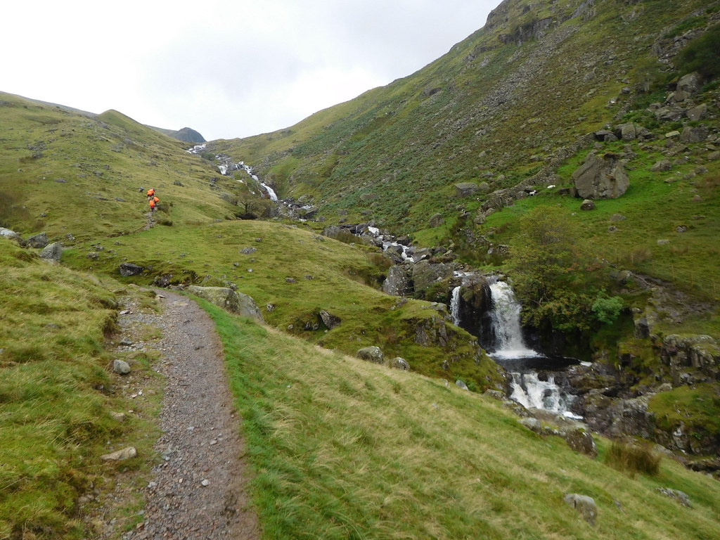
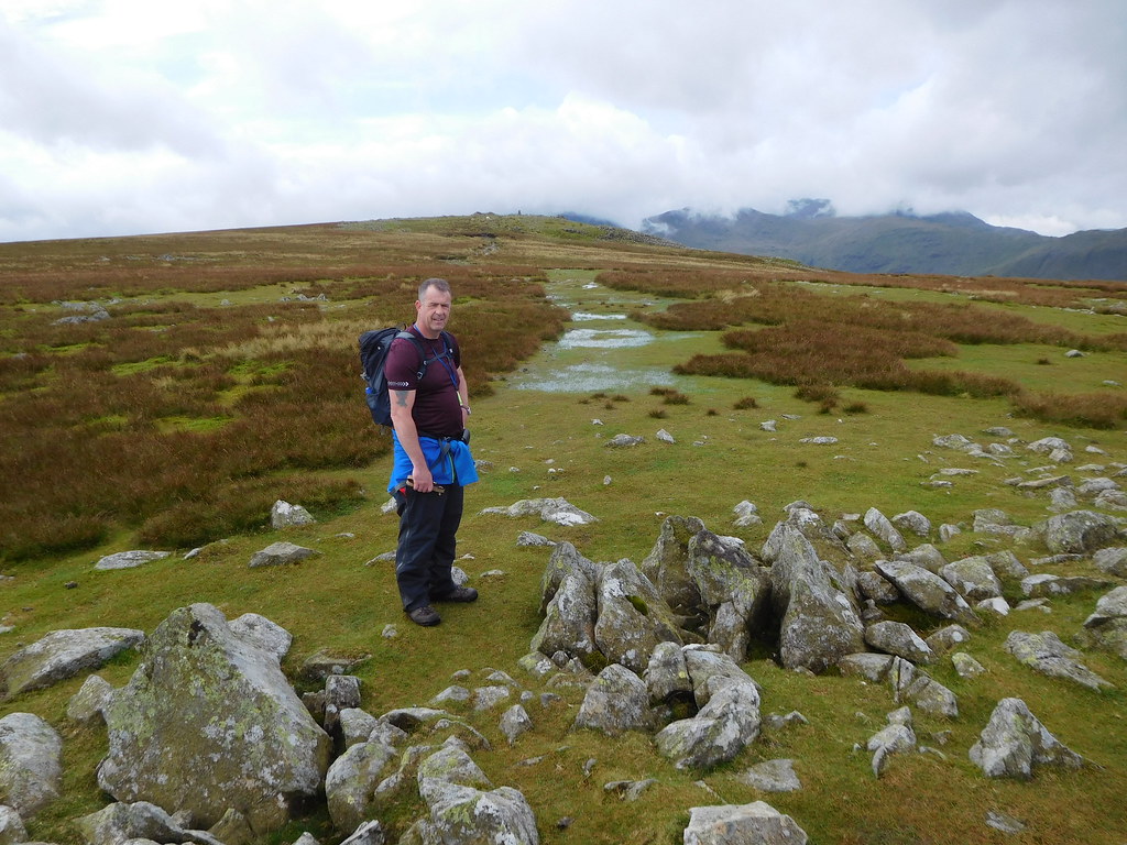
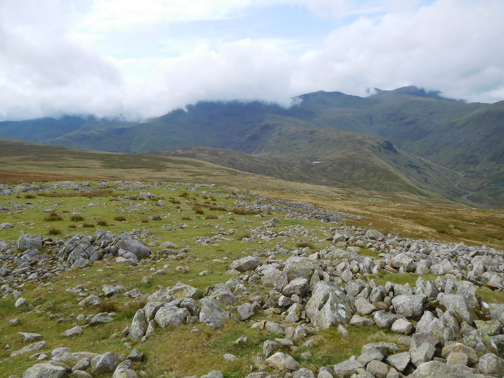
The path is quite wide and level as it follows the gill, and as we passed the campsite in its fantastic setting on the opposite side of the gill we could see one or two people moving about, getting going on their morning chores or ready for a day out. It's in a superb position for outdoor activities, set in green pastures with the trees and Alisongrass Crag giving a perfect backdrop with a great view of Eagle Crag to the south and the steep eastern slopes belonging to Ullscarf defending the front of it. Looking northwest into Borrowdale the high fells of High Spy is there to see.
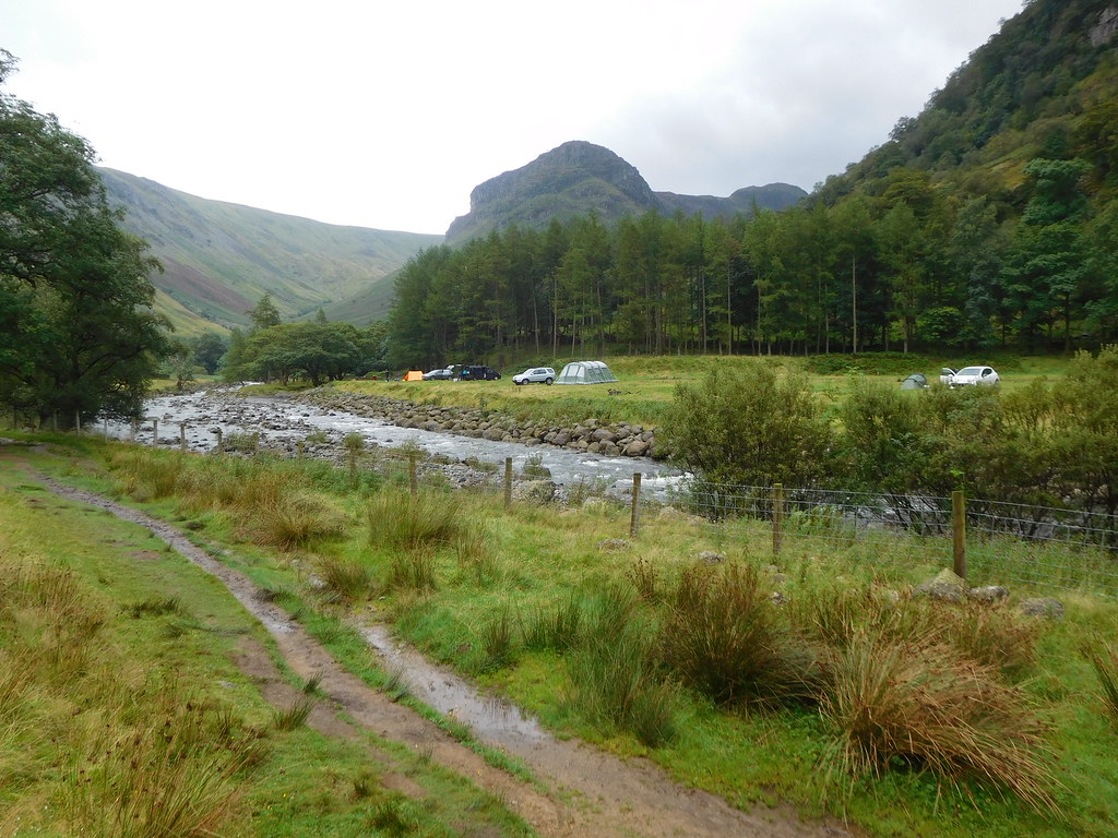 3 - Stonethwaite camp site with Eagle Crag behind
The path has been rising ever so slowly but as we approached Smithymire Island it begins to steepen, easily at first and then increasing in angle as we climbed steadily onwards with the craggy upper north face of Eagle Crag with its lower bracken covered slopes towering over us, we shall be seeing it at much closer quarters later on in the day. The bracken was dying back and the trees were beginning to take on their autumn colours, some of them sporting the coloured berries and seeds that will help to keep the birds going through the winter months. There were large patches of purple heather on the lower slopes of Ullscarf giving a much needed dash of colour to the black and grey of the surrounding crags and low clouds.
 6 - The north face of Eagles Crag above Greenup Gill
  8 - Cloud hanging over Eagles Crag
The path runs steadily uphill all the way to Greenup Edge in the ever widening but also ever steepening floor of the valley. As we approached Eagle Crag we saw a line of red/orange blobs away in front of us and as we caught them up saw that they were a large group of young ones doing their week of agony in the hopes of achieving their D of E medal.
As we passed the first of the stragglers we spoke to them and got a non committal grunt in return and this was the most that we got out of them as they looked to have no spirit left in them and were carelessly just tramping through the large amounts of water that was left over from the previous nights rain that was either lying or running down the path. As we passed the rest of them one by one they all looked to be in a similar state of mind as they blankly put one wet foot forward after another with no attempts at avoiding the worst of it.
 14 - None too enthuisastic D of E group
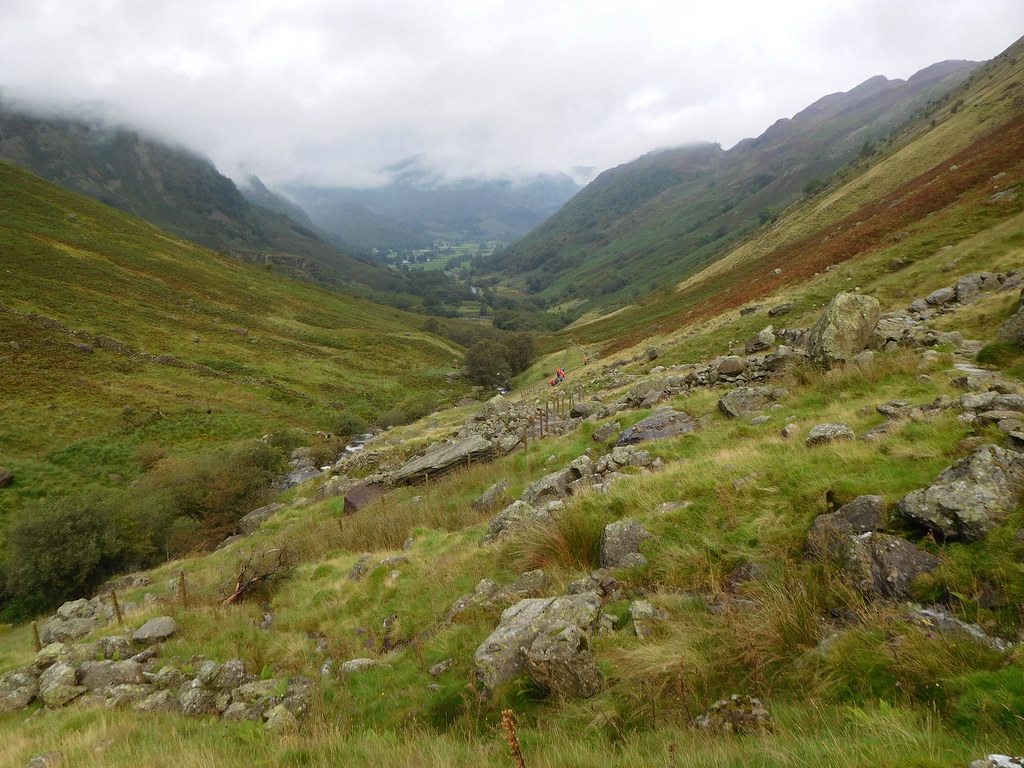
 As we were opposite Eagle Crag I turned for a look down the valley towards Borrowdale and was met with a fantastic view of the fields with the clouds hanging very low over the fells and we could only hope that they would lift before very long or we would be having another walk through clag, something that has happened all too often this year.
 11 - Looking back to a cloud covered Borrowdale
 The path gets quite close to the gill in some places and as we approached Mere Gill opposite Pounsey Crag the waterfalls were in full view, and although not in the same league as Scale Force, High Force, and similar there was plenty of water in them and looked great as the white water rushed over the rocks before dropping into the dark pools at their feet.
 12 - Waterfalls below Pounsey Crag
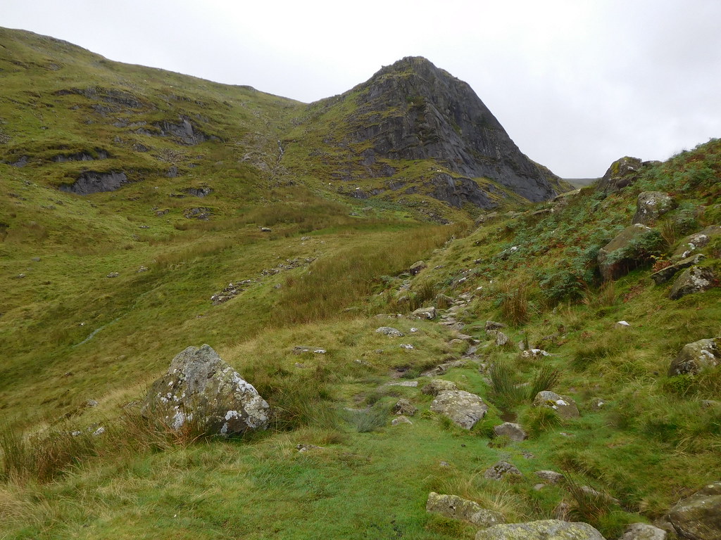
 We continued climbing now passing the front markers of the young group and finally had Lining Crag in our sights as we topped the rise and stood on the relatively level ground just prior to starting the steep climb, sometime scramble, up the partly pitch paved path that follows the course of one of the feeders of Greenup Gill. Before we got to do that there is a minor unnamed hump to negotiate that has a well paved path to help us on our way running most of the way up to the top of it.
 15 - A view of Lining Crag and Greenup Edge
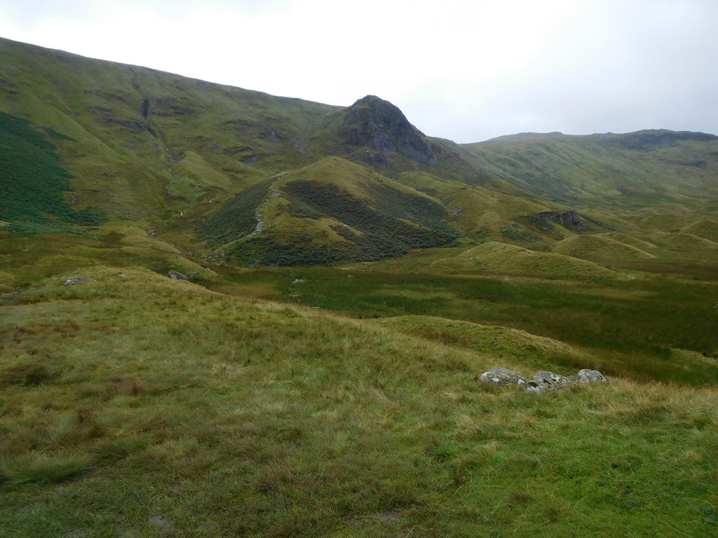
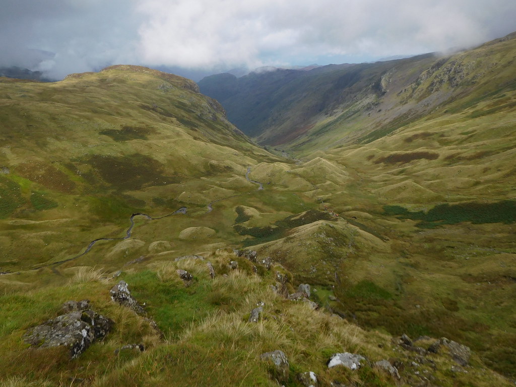
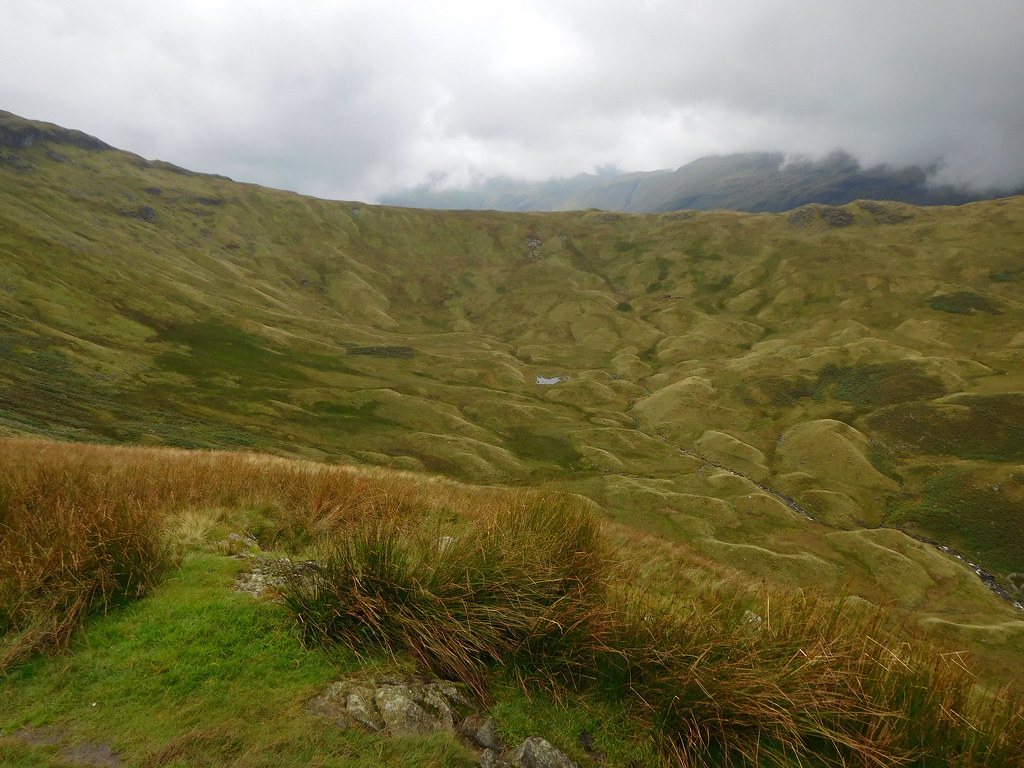
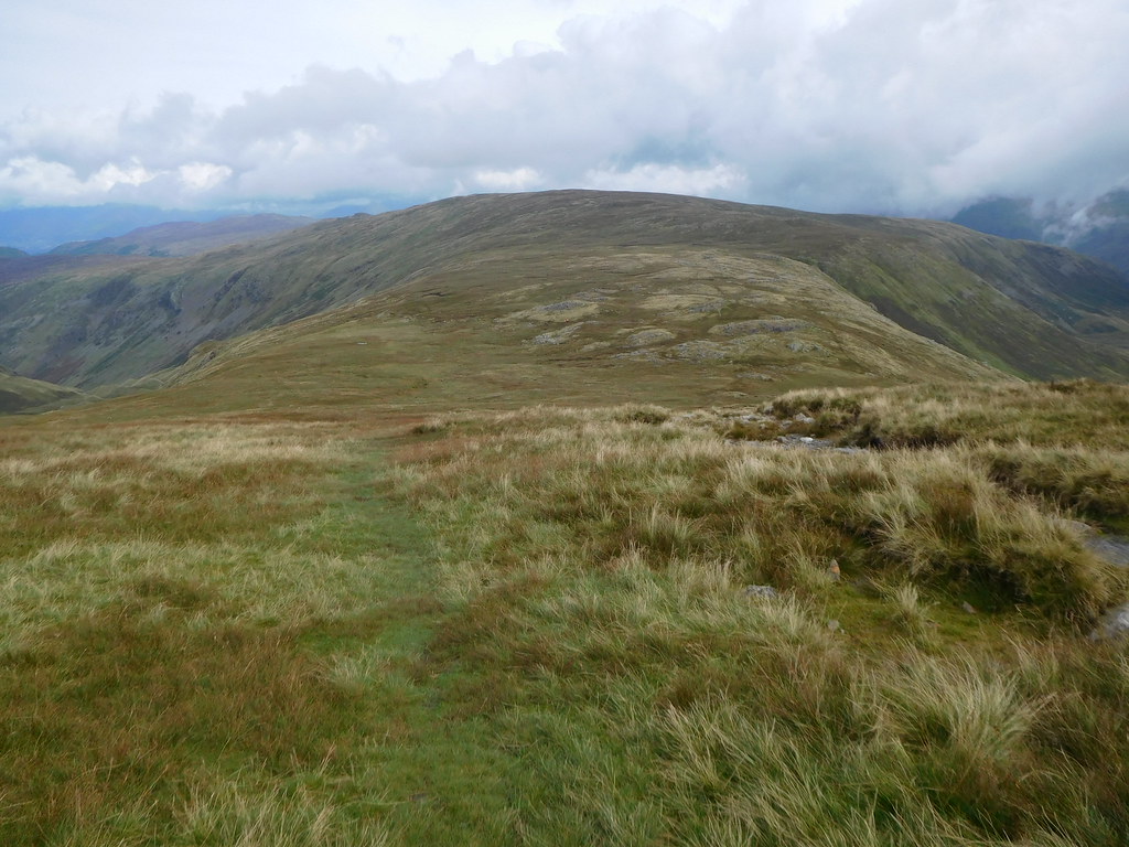
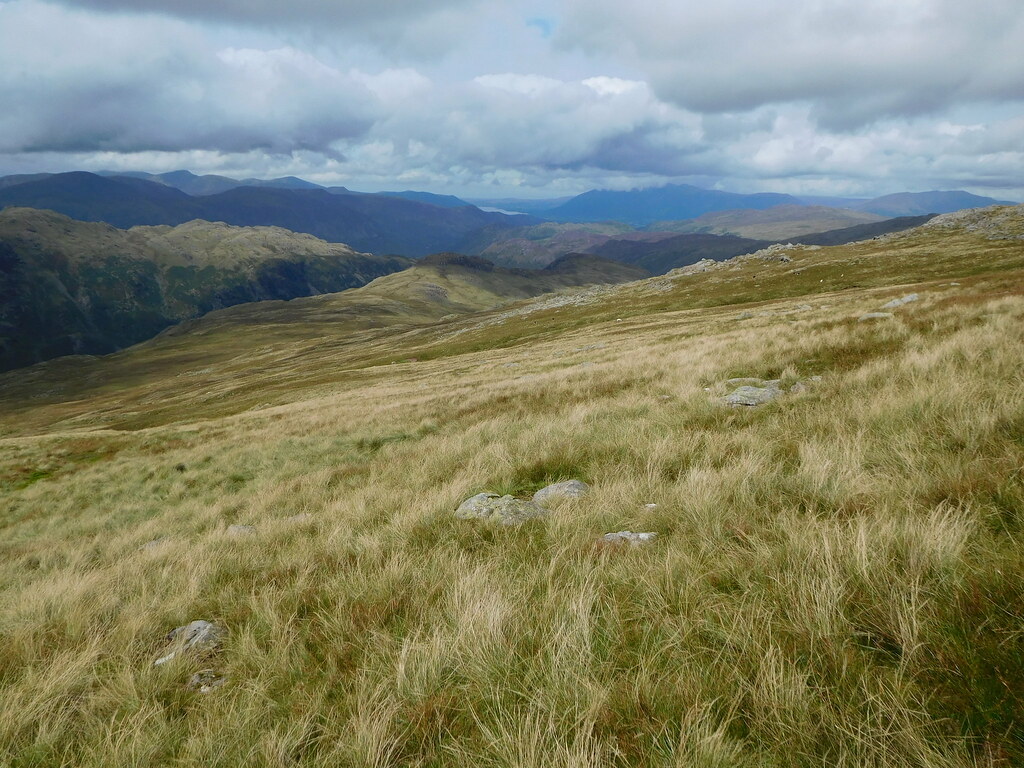
 From the top of the unnamed hillock we had a good view into the bowl of Black Gills and the head of Greenup Gill with the aptly named black feature of Long Crag stretching along top of the south rim of the hollow. Greenup Gill is fed by many fingers of water collected from the fells surrounding the massive bowl of Black Gills as they run down from the steep northern slopes. The bottom of the bowl is covered in small grass covered moraines that were presumably left behind by some glacier many thousands of years ago. The whole scene looks remarkably lush despite the roughness of the grass and with the reflection of the clouds the gill looked like a river of silver as it passes through the centre of the hollow.
 16 - Looking to Long Crag and the bowl of Black Gills
 As we arrived at the foot of Lining Crag I took a look back across our way to here with the fellside looking like a carpet of crumpled green velvet and the cloud swirling along the edge of the fell. We could see the D of E group well below us as they mustered around taking a drink, food, or simply resting and waiting for the rest of them to catch up. Despite the orange blobs it was a most wonderful sight, peaceful, quiet.
 17 Lining Crag
 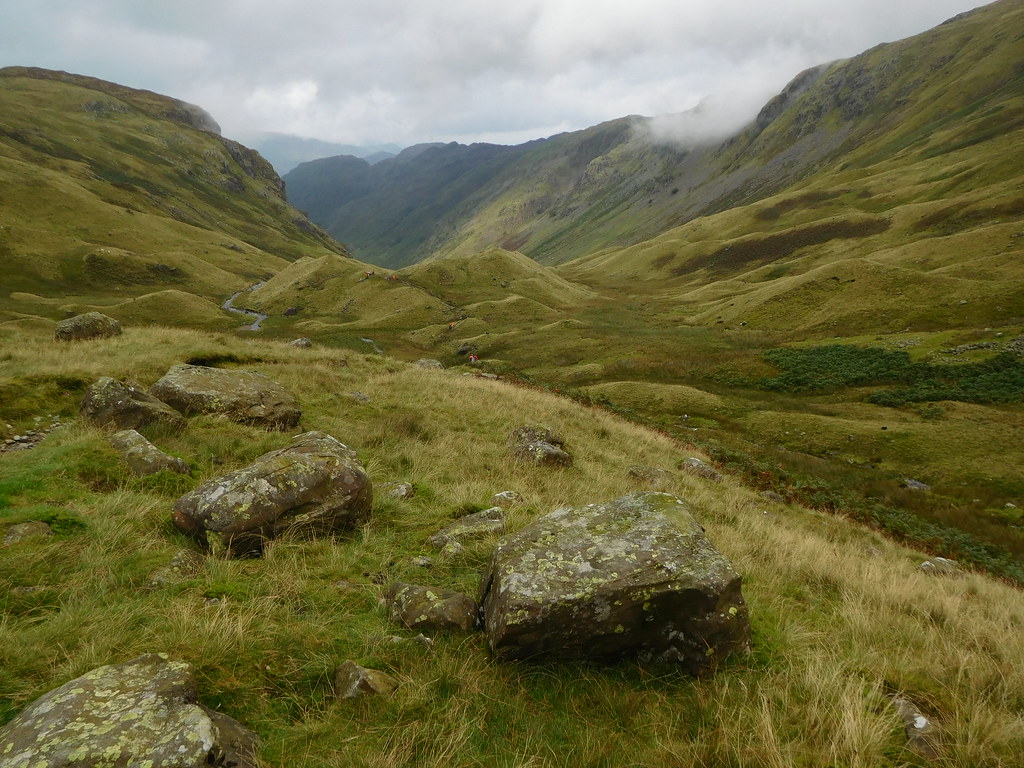 18 - Looking back along the valley
 Despite the cloud it was very warm climbing along the valley from Stonethwaite but as we have gotten higher the clouds seemed to be moving with us as all was clear to the south. We left the hillock behind to now make our way up the side of Lining Crag, a way that was running with water as we worked our way steadily upwards trying to avoid the worst of it.
We arrived at the summit unscathed with only very wet boots to mark our passage up and the views although very restricted were delightful with an even better view north than there was lower down with the large craggy bump of Sergeant's Crag to the northwest and the course of Greenup Gill making its way down from Black Gills to disappear before showing itself again for a short while before disappearing once again around the foot of Eagle Crag.
 19 - A view north from the top of Lining Crag
 From the flat rocked top we could now also see the full extent of the Black Gills basin with its small unnamed tarn sat looking like a blob of silver mercury nearly at the head of Greenup Gill, the numerous watercourses now evident by the darker green of the small gullies all running into and connecting with the main gill.
 20 - Black Gills and the tarn near the head of Greenup Gill
 Looking up and roughly south we could see the black scar of Long Crag with the height of Low White Stones sat behind it.
 21 - Looking towards Long Crag and Low White Stones from the top of Lining Crag
 The way up to here from Stonethwaite has been a one done on wet paths that at least are solid underfoot but from here on that changes as the path now passes over what is usually and mostly very wet and boggy ground and today after the recent rain those conditions are very evident indeed. Once we stepped off the flat, hard rock surface of Lining Crag the way is now over wet and slippery peat and despite the thin covering of grass it was a place to watch ones feet and walk with care. At one point the ground was so wet that the path disappeared altogether and all we could do was to make our way around the worst of it whilst trying to follow the line of cairns that attempt to guide one through this mess of ground.
 23 - Low White Stones ahead
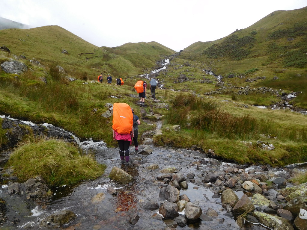
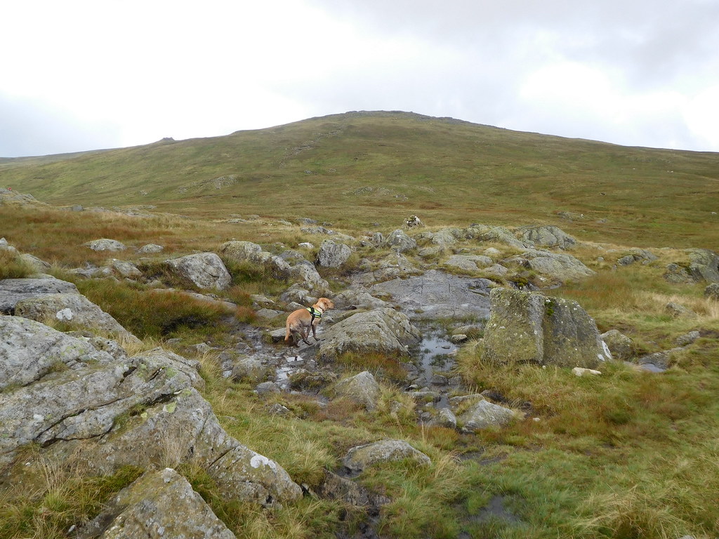
 There is no chance of getting lost even in cloud as the way is south all the way to Greenup Edge but the cairns are useful things to have around just around here. The only member of the party to be enjoying this part of the walk so far is Sonny, who doesn't give a toss how wet or dirty he gets.
As we arrived at Greenup Edge we espied a young woman perched on a high outcrop of rock on the Ullscarf side of the path and whilst we went on to try and get a decent look down into Far Easedale she climbed down to join us and as the views were not all that good we about turned and picked up the path that follows the line of the old and now gone fence that used to run southwest from Ullscarf and right the way up to Low White Stones and over High Raise.
The path up to the two summits is still rough and slippery in its lower reaches and as we walked along the young lady who was having a conversation with me suddenly went down with an almighty thud as she slipped on the wet grass and stones sticking out of it. Fortunately she suffered no apparent injuries apart from maybe her pride and after making her stop for a few minutes to recover herself she then took off and left us behind as she climbed the hill at a fair rake of knots. Maybe she was trying to convince us that she was alright or maybe the damaged pride came into the equation, in any case we didn't see her again. Earlier she had been asking me what the underfoot conditions were like on the way to Sergeant's Crag and Eagle Crag after leaving High Raise, but as we didn't see her again maybe she took another route, perhaps down into Langstrath.
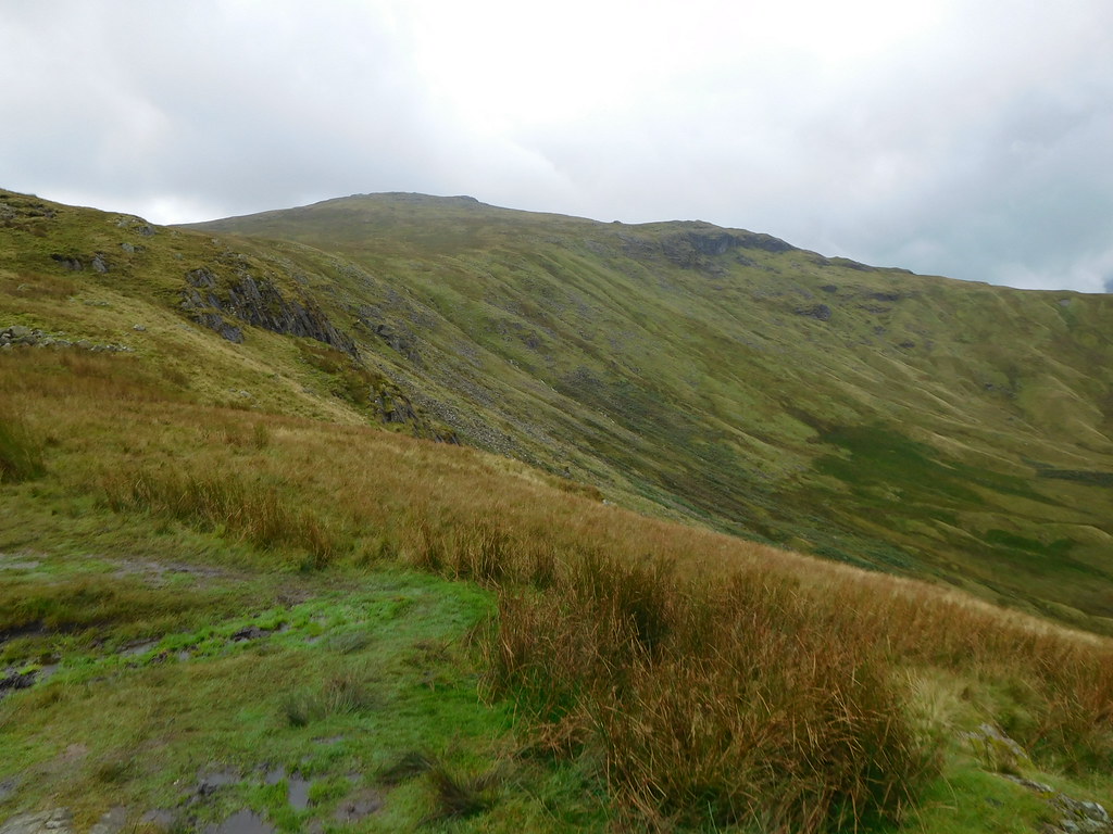
As we ascended the slopes of Low White Stones the path got progressively better as we approached the rock strewn top of this lower outlier of High Raise and looking back we had a great view of Ullscarf, a fell that we had contemplated stitching onto this walk but knowing how wet it is in that neck of the woods pushed it to one side to be done on another day.
 26 - Ullscarf from Low White Stones
 The fell is well named as the flattish top is well scattered with stones that are very light in colour and from which a decent sized cairn has been built around one of the old iron fence posts.
 27 - Chris at the the summit of Low White Stones
 Apart from over to the northeast that was still disappointedly hidden by low cloud the views were quite good and are better from the higher spot of the main summit. We had a panoramic view of the fells in the west right around to the east and although hazy was still worth the walk up here. Cloud covered Blencathra and Skiddaw were easily seen as was a touch of Derwent Water and the Derwent Fells. Rosthwaite and Stonethwaite Fells, Maiden Moor, High Spy, and Dale Head are just a few of the mountains to be seen from this Birkett.
 28 - Looking north to Derwent Water from Low White Stones summit
 The walk from LWS was an easy stroll straight up the fellside and the first point of interest is the old iron fence post set in a rock that is surrounded by other smaller ones to form the semblance of a cairn and at 745 metres is just below the main summit of High Raise at 762 metres.
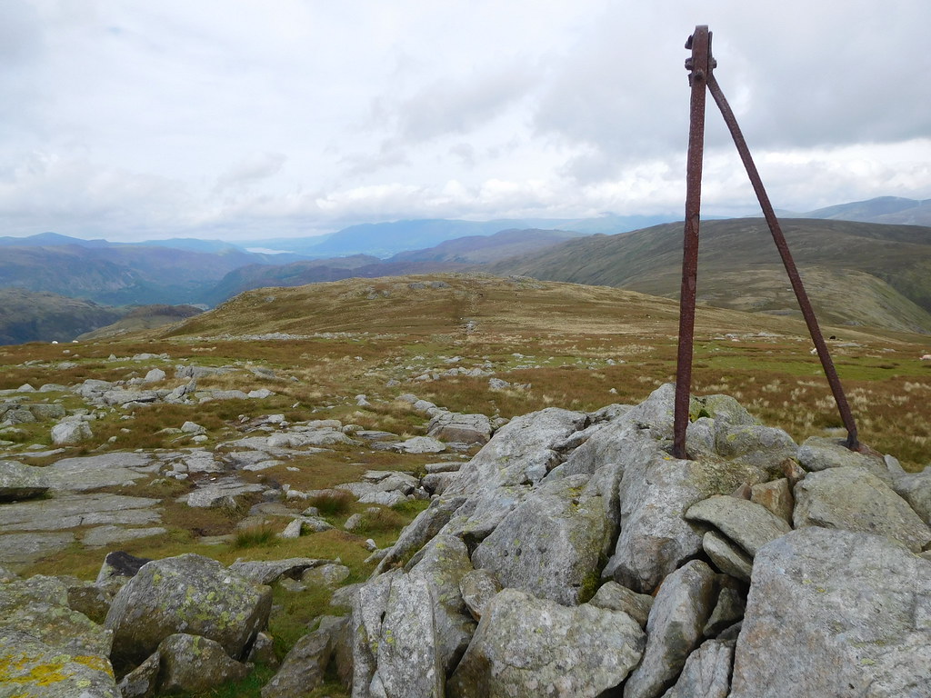 34 - Another view north from High Raise
 The last few metres of climb to the actual summit was once again easy but very wet underfoot but as we made our way there we noticed that some blue was now appearing in the cloud cover.
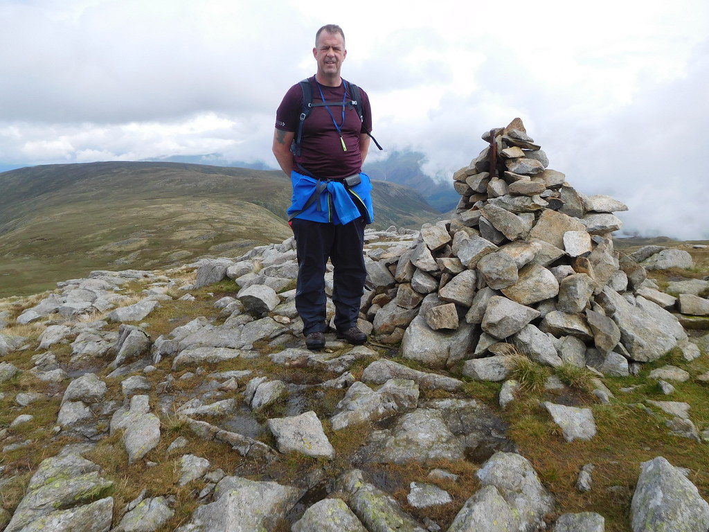
 35 - Chris on his way to High Raise summit trig column
Within a few minutes Chris was once again posing on a summit.
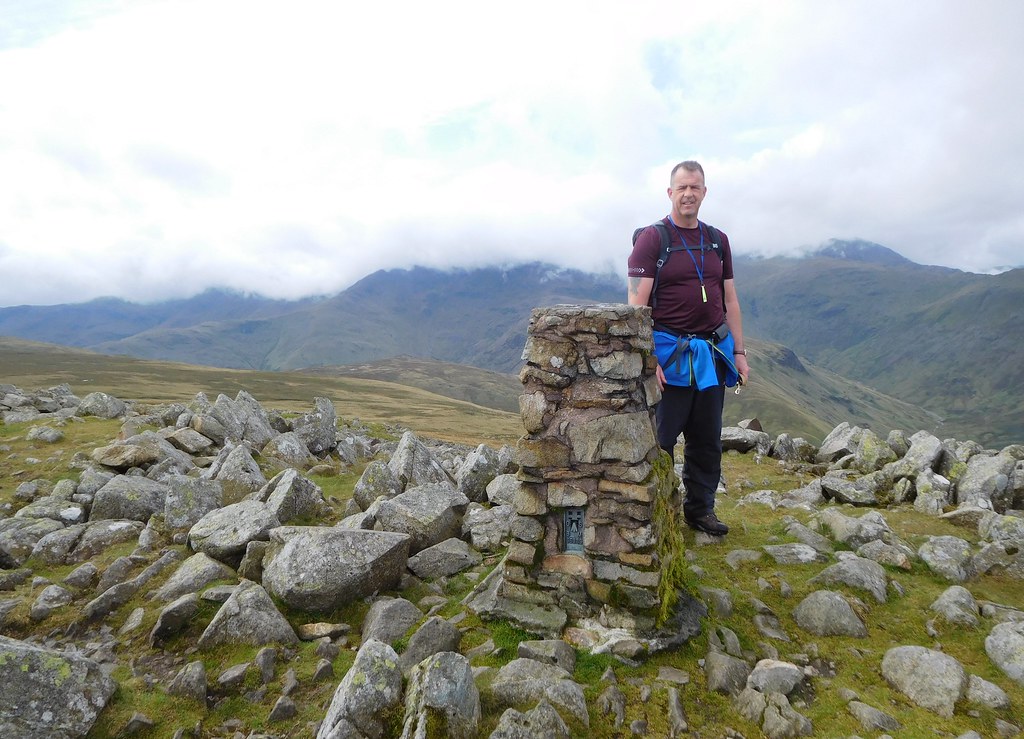 38 - Chris at High Raise summit
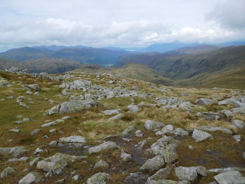
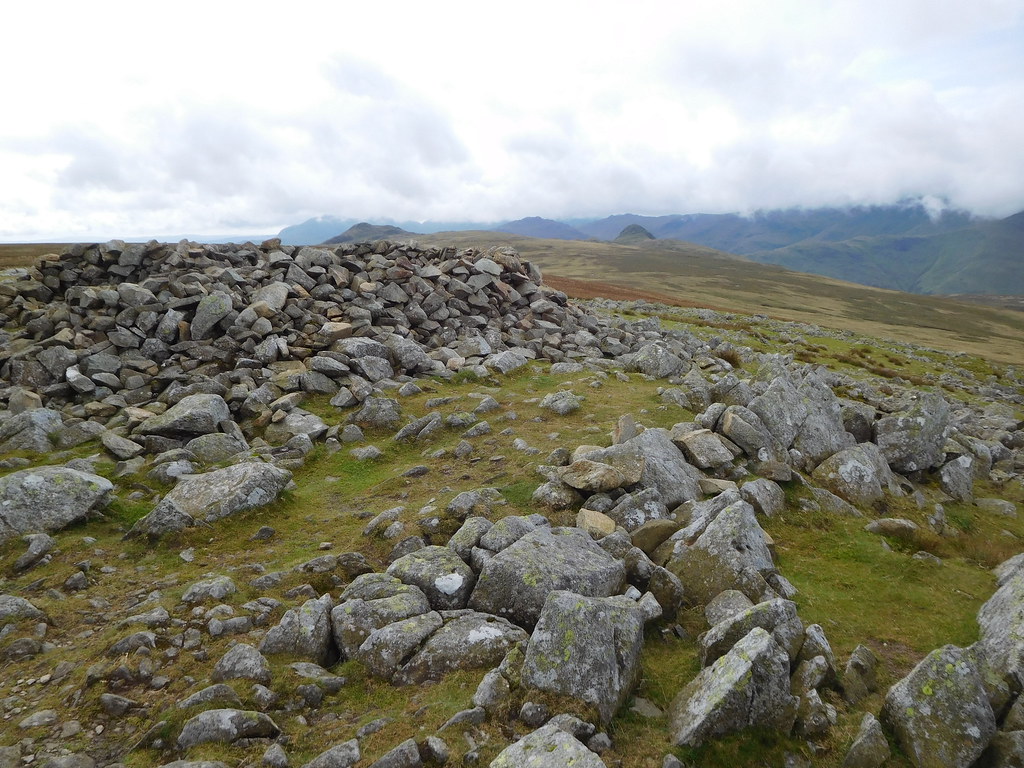
 The top of HighRaise is covered in hundreds of grey stones and rocks of all shapes and sizes and many have been used to build a large wind shelter over the top of which there are the tops of the Langdale Pikes showing and further south Crinkle Crags was virtually under cloud.
 39 - A view across to the Langdales and Crinkle Crags
 To the west and quite close by stands the great bulk of Glaramara with the flat face of Great End and the large rounded tops of Great Gable and Scafell Pike just below the clouds. The ridge line of the High Stile group of fells are there on the far skyline.
 40 - Glaramara and some western fells
 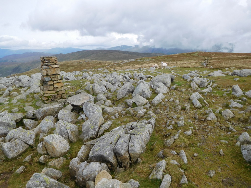 41 - Low White Stones with Ullscarf behind
 South and slightly to the west is Bow Fell, Esk Pike, Rossett Pike, and Allen Crags with the head of Langstrath sat between the two. Once again the cloud had got in the way of clear views but the unnamed tarn at the top of Stake Pass was clear to see as was the ridge that runs all the way to Rossett Pike.
 42 - Rossett Pike with Bow Fell and Esk Pike under cloud
 We had a break whilst sat in the wind shelter and was joined by a chap who was walking his own version of the Cumbria Way and was going to drop off into Langstrath to pick up the original route after leaving High Raise whilst we were going to go off piste and take the pathless route across to Sergeant's Crag and Eagle Crag.
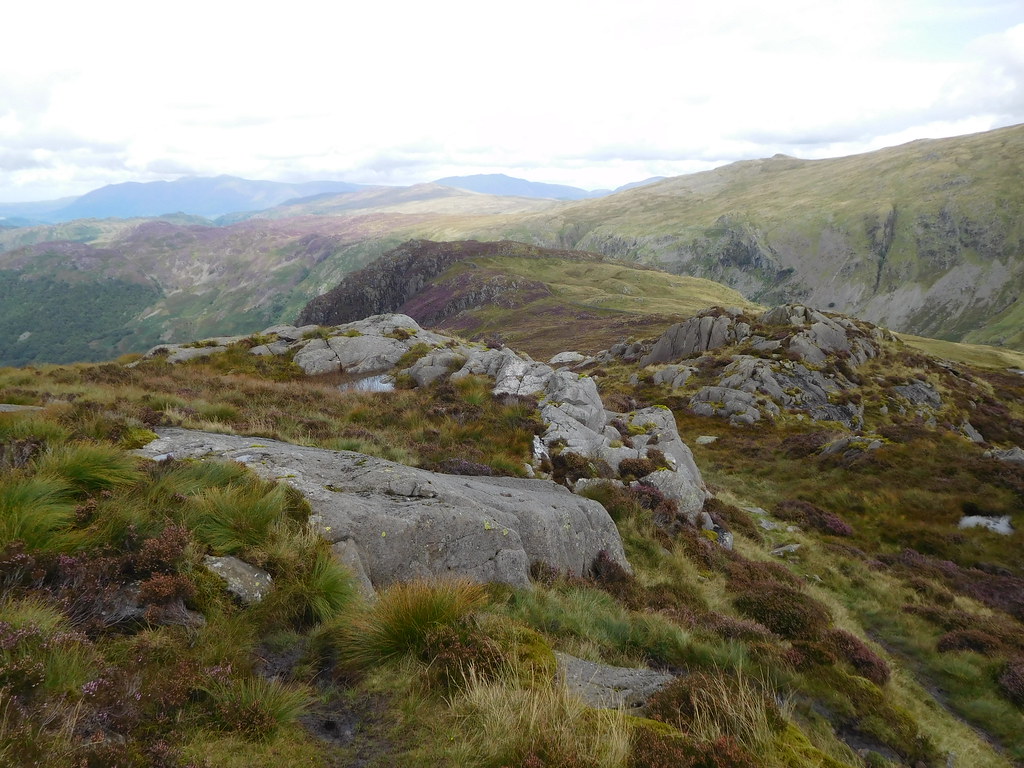
 43 - A view north over Sergeants Crag and Eagle Crag
 This route took us by the west side of Low White Stones roughly following the ridge down and along the top edge of the basin of Black Gills. This part of the walk was dry underfoot but I knew that as we reached the lower area we would be walking on wet ground again as it never seems to dry out around there. The going was easy and as we descended we could see a few paths marked in the wet ground and as we got somewhere near Bull Crag we came across a sheep trod that we followed as it was conveniently going in our direction. As this path ran out we started to move across the wet area where the paths seen from above had disappeared. We negotiated it without too much bother and as the ground level rose again we then picked up a decent path that we followed all the way to the top of Sergeant's Crag.
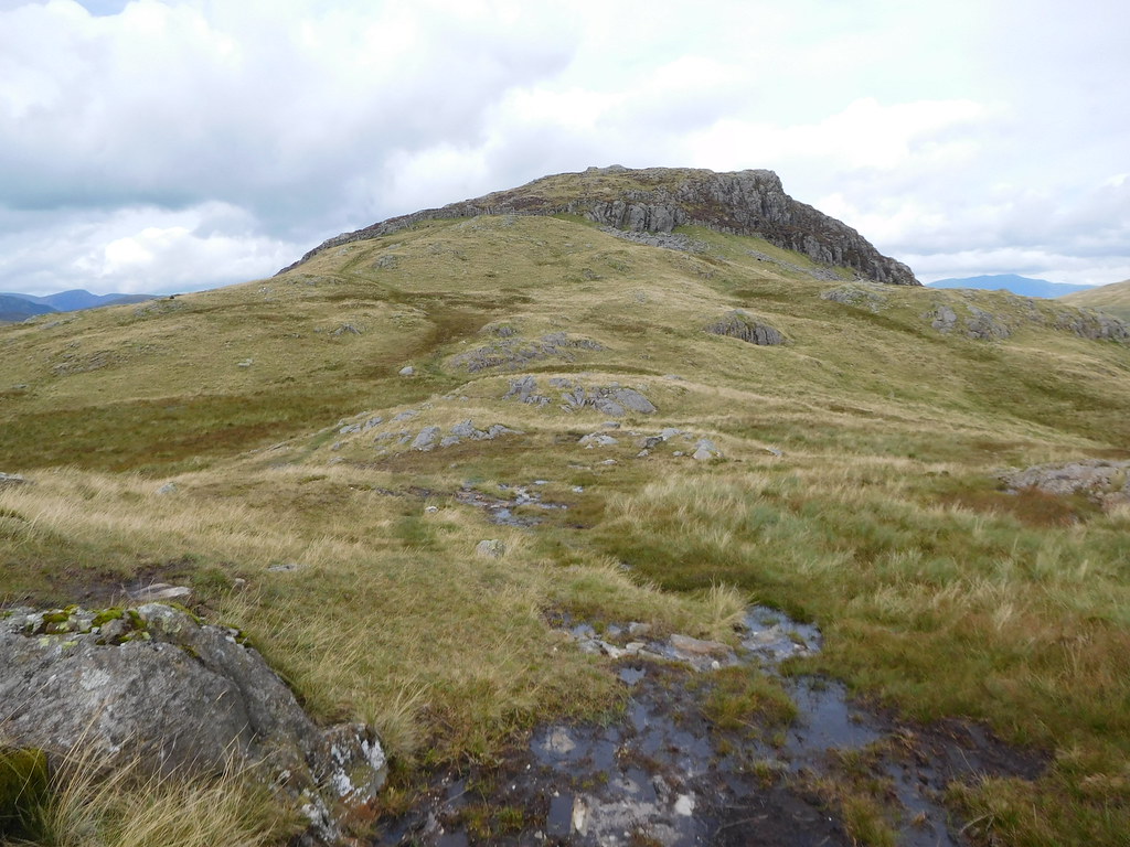 48 - Sergeants Crag
 Having a look back from a slightly higher position just before the summit we could see a fair stretch of Langstrath pointing the way to the southern fells of Bow Fell, Esk Pike, and Scafell Pike.
 49 - A peep into the head of Langstrath
 Just below the rocks of Sergeant's Crag there is a wall to scale although it's not a hard task in itself the rocks were very slippery and once stood on top of it There was an even better view into the valley of Langstrath.
 51 - Bow Fell and Esk Pike with Langstrath to the fore
From the wall it's a matter of a couple of minutes to the large outcrop of rock that forms the summit platform with its few stones forming a very small cairn on the highest point.
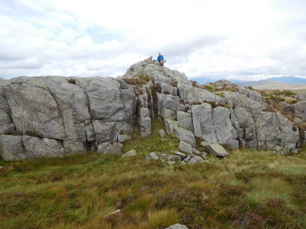 55 - Chris and Sonny on Sergeants Crag summit
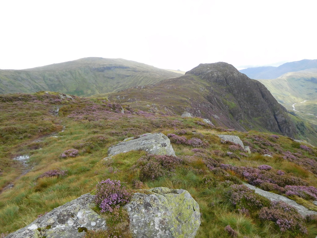
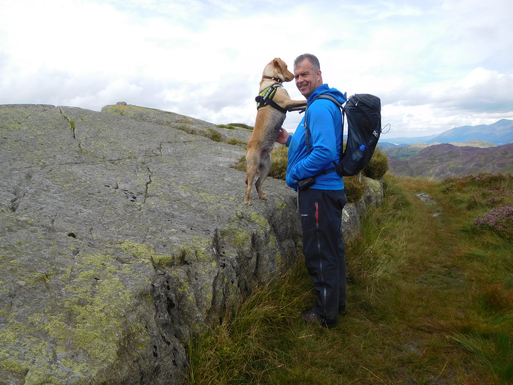
 From a distance this pair of hills along with the whole of the ridge in between doesn't look all that big, but it is. Sergeant's Crag at 571 metres is the higher of the two being 50 metres higher than its close neighbour, Eagle Crag, and when stood on top of Sergeant's Crag and looking along the long and wide ridge is the moment when you realise just how big these fells are.
 58 - Eagle Crag from Sergeants Crag
 There is a well defined path between the two but the drop off from this first fell is rather rough in places as the path drops down some steep, narrow, and rocky parts. Today everything has been wet and slippery and this part of the walk was no different with the peaty ground being like walking on ice at times. Once down from SC we followed the path down to a wall as there is no point in trying to take a short cut straight across as it's too rough. The path alongside the wall was full of water and black sticky peat and apart from the odd dry place it was a wet walk along to Eagle Crag.
 67 - Sergeants Crag with High Raise behind
 Despite the underfoot conditions we were at the summit of Eagle Crag within 10 minutes to find one stone perched on the long and sloping slab of stone that sits on the top of this fell.
 69 - Chris and Sonny at Eagle Crag summit
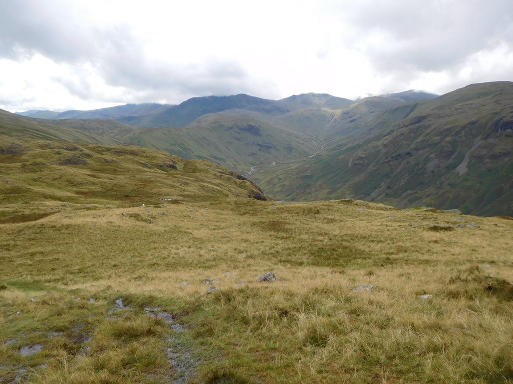
 We had a rest and a look around at the surrounding, fells that we could see from a lot higher up but now with a different perspective. We could still see Bow Fell etc to the south but now we could also see right into the Langstrath Valley far below us.
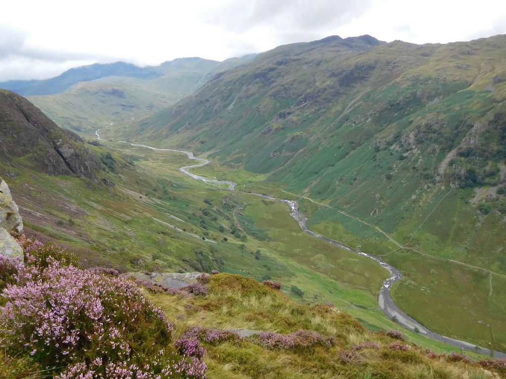 72 - Langstrath Beck from Eagle Crag
 Now that we had left the high fells the purple heather once again took charge of the colour scheme and was enhancing the look of the immediate area no end. Wainwright mentions that the fell of Eagle Crag is an awkward place to leave, and he was right. I have been on this fell four times now and have always struggled finding the correct place to leave and find the path down along the grassy ledges of its south side, a path that if the wrong way is taken one could have a serious accident. The start of the path is just south of the summit but there is another path that leads down to the north ridge, or nose may be a better word, so we thought that we would take a look and see how it went. Well, the path is clear to see as it drops steeply down through the heather over wet and greasy ground with a few rocky steps to negotiate and all was going well until the path disappeared into a gap between the clumps of heather where the ground was perhaps at its steepest. This is where I stopped and thought about what we were doing. We couldn't see beyond the heather apart from the opposite ground far below us, the ground was wet, steep, slippery, and we had our four footed friend with us, it was time to turn tail and make our way back to the summit, something that we achieved in a matter of minutes, but longer than it would have taken us to hit the ground if we had slipped going the other way.
But I did get a good view of Borrowdale before making our way back to the top.
 70 - Borrowdale from the north ridge of Eagle Crag
 We took the path down the south side and worked our way along the ledges steadily losing height until finally dropping off the last ledge and turning north over the top of Heron Crag and following the path down to a step stile in the fence at the end of the intake wall that joins up with the lower crags of Eagle Crag. From there it is a long and steep walk through the bracken on a decent path down to the west bank of Greenup Gill from where we followed the now wet path through two fields to arrive at Smithymire Island once again.
As a variation to walking back along the Greenup Edge path we turned and walked alongside Langstrath Beck to the footbridge from where we followed the lane down to the campsite and through the fields back to Stonethwaite.
Despite the cloud and lack of sunshine it has been warm, very warm, and this helped us have a good walk despite the wetness of the ground that is just a minor irritation and either has to be tolerated or stop at home. I'm intrigued by the path down the north end and will probably have a walk up one day to the foot of Eagle Crag and have a look at what we missed and to also check if it is a viable way down without the use of ropes.
