free to be able to rate and comment on reports (as well as access 1:25000 mapping).
A few weeks ago when E and I did the Cronkley Fell walk we drove to the start point that is on the main Middleton-in-Teesdale to Alston road, the B6277 and whilst doing so we passed the Visitor Centre that is situated at Bowlees and noticed that it had a large sign advertising the merits of visiting High Force, a large waterfall on the nearby River Tees. We clocked this as a possible place to park up whilst embarking on a skirmish to High Force and beyond to also have a look at Holwick, an old and small lead mining/quarrying hamlet that sits beneath the long grey length of whinstone that is in the form of a long and craggy cliff and known locally as the Holwick Scars.
We arranged to meet some long standing friends who occasionally accompany us on one of these less strenuous walks than are to be found in the Lake District. We all met at Middleton-in-Teesdale and then made the 3½ mile - 5.6km - to the Visitor Centre at Bowlees where there is a huge car park set in the trees that follow the course of Bow Lee Beck. It is quite a substantial wood stretching from Hare Hill in the north down to where the beck meets up with the River Tees near Newbiggin Bridge to the south.
Bagged and booted we set off to walk back down the tarmac road that we had arrived on to meet the main Alston road where we turned left for a short distance before starting to take the first lane that is on the opposite side of the road. There are two hand painted signs nailed to a fence post with the top one being one for Wynch Bridge - where we need to be - and the other is for Low Force with a big arrow pointing along the road. This is where we made our first error as we thought that Wynch Bridge was down the lane with the Low Force sign indicating a car park for it further along the road. The lane just didn't feel right and looking at the map noticed that we should actually be taking a lane that is further along the road. That's what happens when things are taken for granted and looking at the makeshift signs once again realised that it must be a common occurrence with walkers as this lane was actually on our way back from Holwick.
So after about turning we walked down the road for a few metres until we arrived at the right exit that is more or less opposite a lay-by where a number of cars were parked. We turned down the well made track that meandered through a couple of fields to then pass through a wall stile to enter into some trees to find Wynch Bridge spanning the River Tees. The bridge is a suspension type bridge and was built in 1830 replacing one that had been damaged by a massive flood in 1771 and finally collapsed in 1802 when some people were crossing with one man being killed in the subsequent fall into the river that is quite a way below in the rocky gorge.
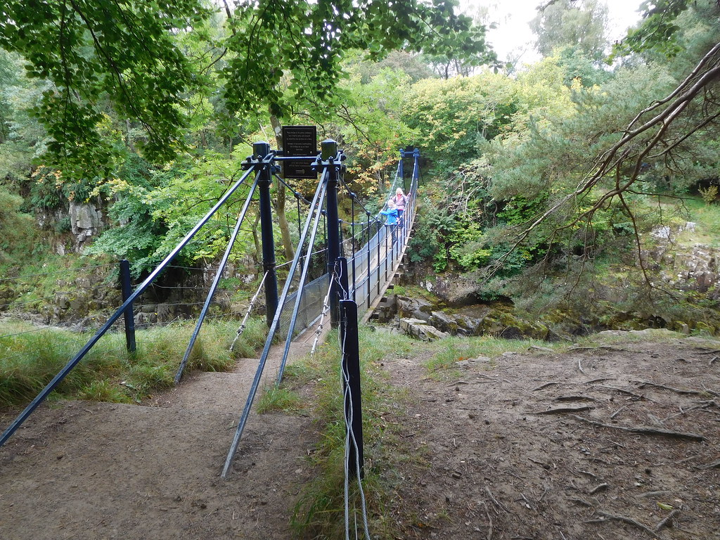 5 - Wynch Bridge over the River Tees
 Before we crossed the bridge we had a look at the waterfall of Low Force that tumbles its way into a large rock surrounded pool before falling once again over rocks as it passes beneath Wynch Bridge.
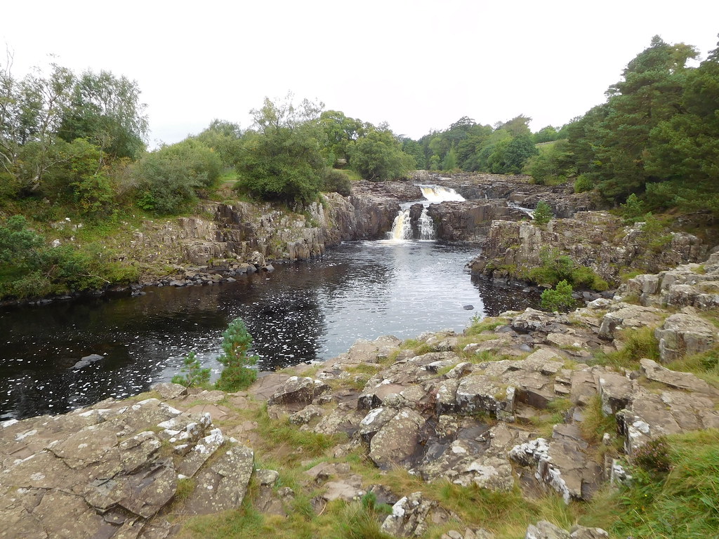 4 - Low Force Waterfall
Leaving the falls behind we now crossed the suspension bridge that has a slight bounce to it that made the girls slightly nervous, a bounce that was made a little larger by two blokes who I'm sure will live to regret it later on today. Once across the bridge we had an alternative view of the falls from further downstream.
 7 - Another view of Low Force
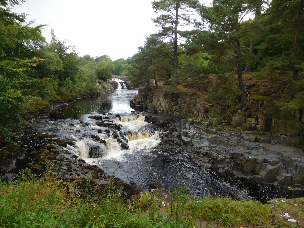
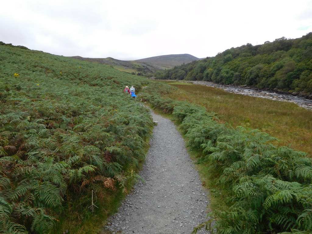
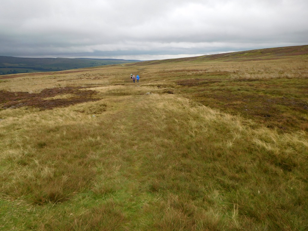
 We now had quite a long riverside walk through the trees and although there was full cloud cover it was quite bright and mild. The path is good with just a few rocky and paved areas to keep up interest and with the river on our right and fields and fells to the left the walk alongside the trees was very pleasant indeed.
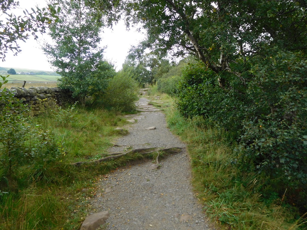 10 - A pleasant walk along the edge of the trees
 As we walked along we bumped into and spoke to a number of other amblers all of whom were walking in the opposite direction to us. At times the trees opened up revealing the river in its different lights, sometimes smooth running whilst at other points rushing over the many limestone rocks and boulders that adorn the river bed that is itself just one massive bed of limestone.
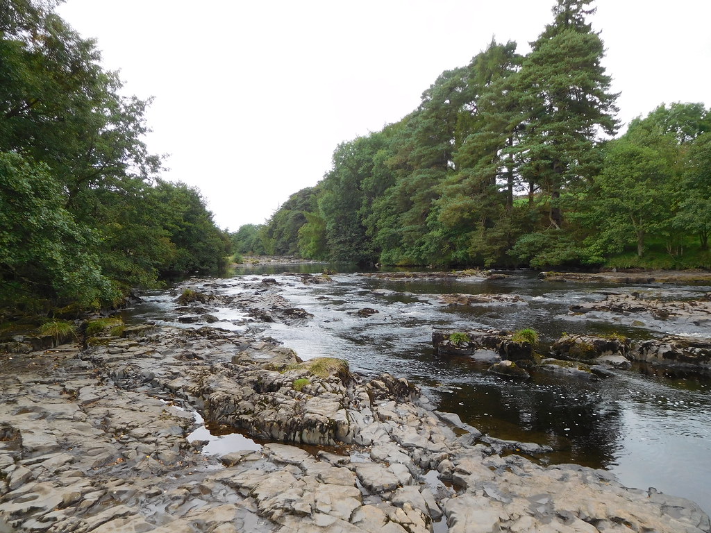 12 - Limestone bed of the River Tees
 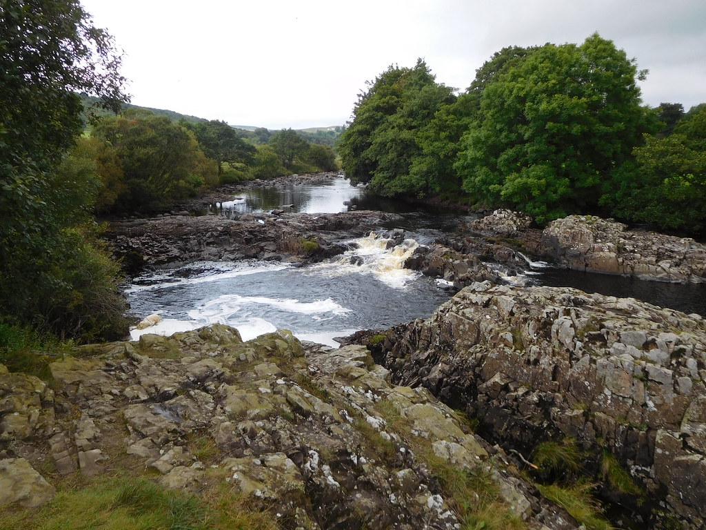 13 - The River Tees
 Just before we arrived below Keedholm Scar we passed through a gate to find a boot sterilising station…
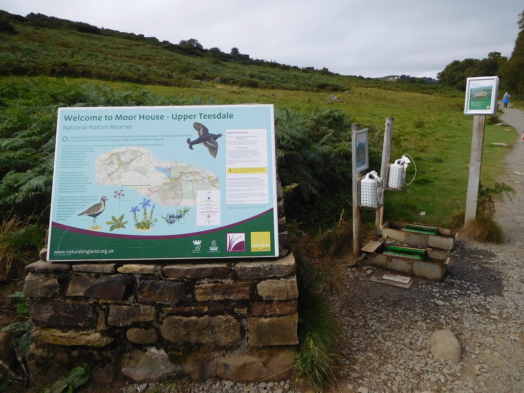 15 - Boot sterilising station
 alongside the Welcome to Moor House Nature Reserve sign and consisted of two boot baths with brushes complete with spray guns full of sterilising agent. It appears that some kind of fungal disease is attacking the juniper trees which are now dying as a result of being infected by something called Phytophthora austrocedri. This is a major problem to the trees as this juniper wood is the largest one in England so obviously needs looking after.
There is also a donations box and wind up audio info console.
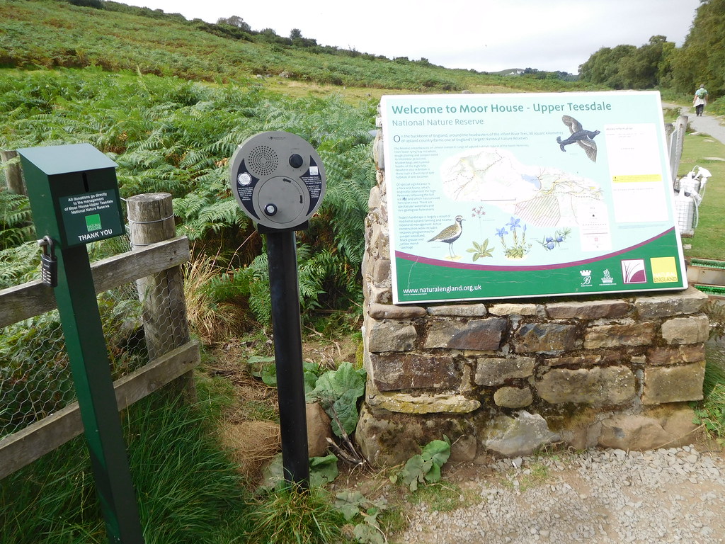 16 - Donations box and wind up audio info station
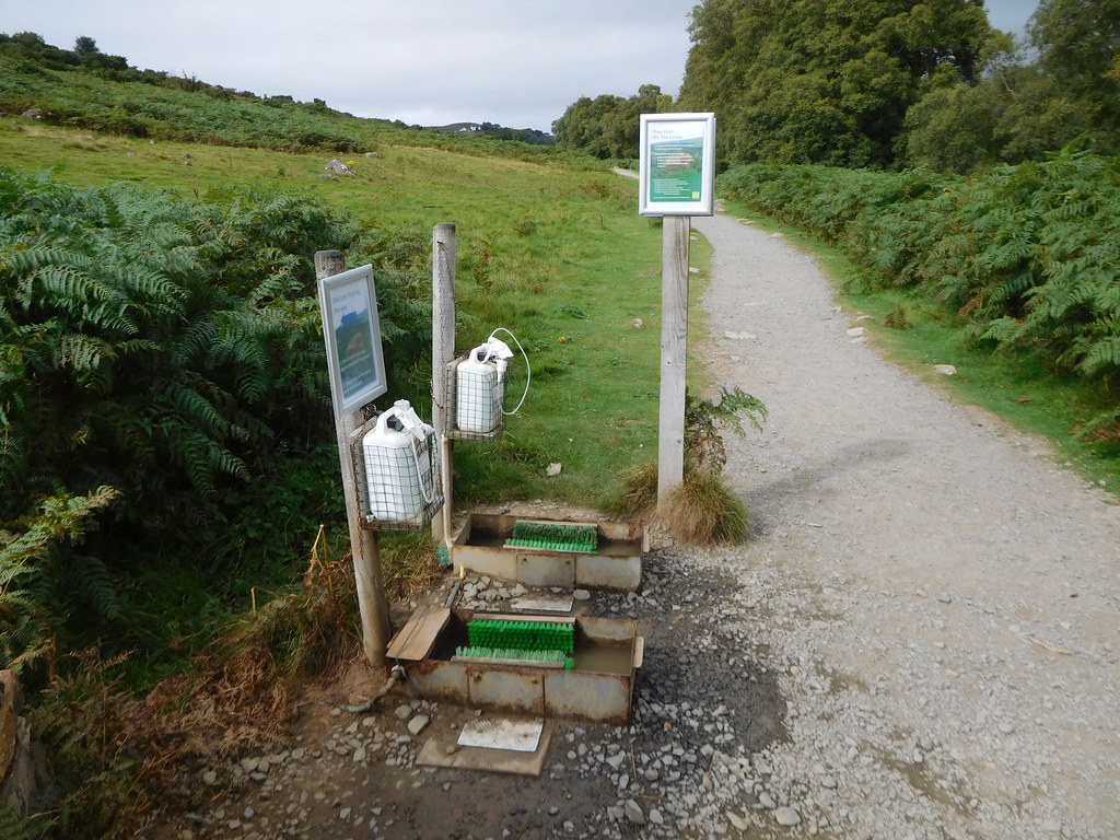 18 - Boot wash for prevention of juniper tree disease
 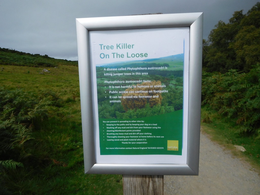 19 - Juniper tree info board
Having washed our boots we continued on for the short walk to High Force that is considered to be the largest in England falling some 70 feet - 21 metres - into a large black pool. The waterfall consists of two falls with water flowing down the two of them only after extreme rain and today just the one is flowing fast and free with the large outcrop of rock separating it from the empty gash of the other. The photo doesn't really convey the size of these falls as they thundered down over the rocks into the pool way below.
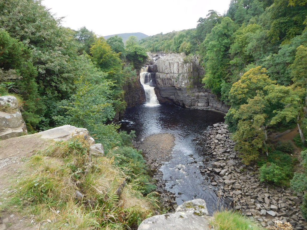 20 - High Force on the River Tees
 I stood on a small platform of rock that has worn smooth by the passing of many boots and on a wet day could be quite treacherous and a slip and a fall from here would be fatal as it's a long way down to the fast flowing water covered rocks.
Moving to the top of the falls was disappointing as I wanted to be able to see the full height from top to bottom but I wasn't able to get near enough to the edge for a look over. The falling water was deafening and looking upstream along the river showed the roughest stretch that we had seen so far with water rushing through the multitude of rocks sticking out of the river bed.
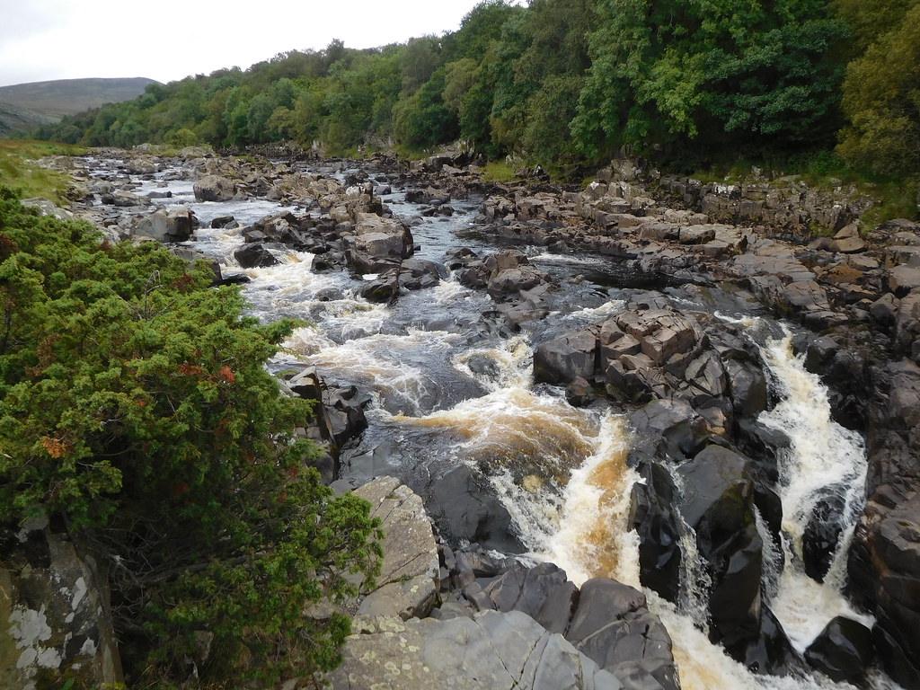 21 - The river just above the waterfall
 We left the waterfall behind to find peace and quiet as we continued on the still well made up path passing the bracken covered slopes below Bink Scar.
 23 - Plenty of bracken with Noon Hill at the back
 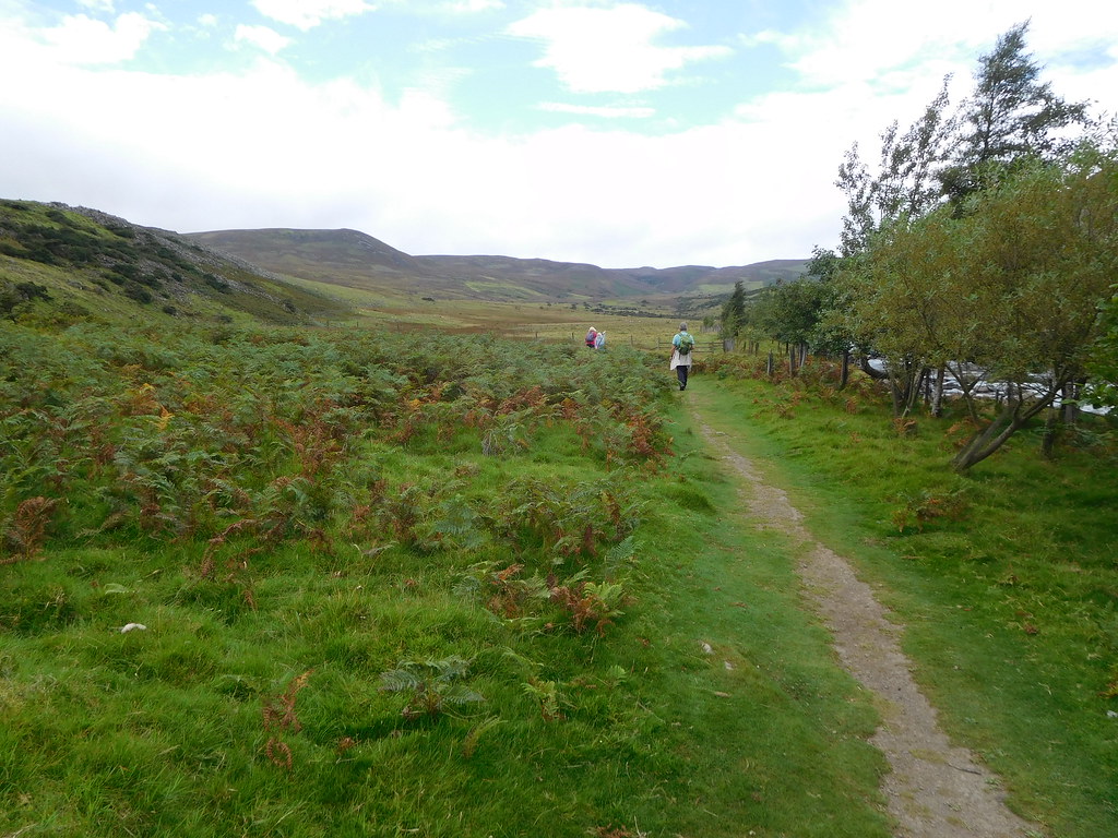 26 - Noon Hill to the left and Cronkley Fell right
 The trees had been left behind and the landscape had opened up before us, the only thing to spoil the view is a large quarry on the opposite bank of the river that is in the business of blasting and carting away the rock leaving great shelves that is used as access for their trucks and excavators to allow them to blast out even more rock for the construction industry. At least they have left the tree covered Dine Holm Scar as a foil against seeing the worst of the excavated hill of rock although the large, grey corrugated buildings are plain to see.
 30 - Dine Holm Scar
 Once past this eyesore we could see Noon Hill and Cronkley Fell ahead of us with Bracken Rigg in the foreground.
 29 - Noon Hill and Cronkley Fell ahead
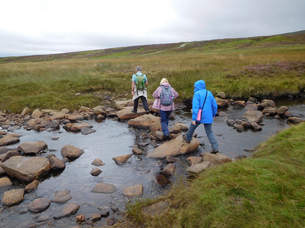
 We were now nearing Bracken Rigg along a wide green lane until we reached an unnamed watercourse that was crossed by stepping stones to find a board walk that began at the foot of the climb up the east side of Bracken Rigg. Once off the boards the path is paved in parts and as we ascended we could see the large expanse of gnarled and twisted juniper trees covering the slopes. As we left the trees behind to reach the open ground of the summit it began to rain with the temperature dropping as well.
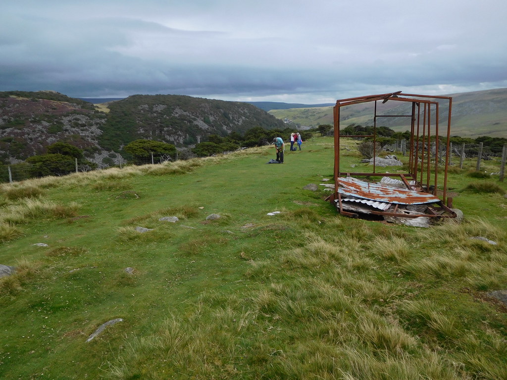 35 - Rain starts and a bit of attention is needed to the shed
 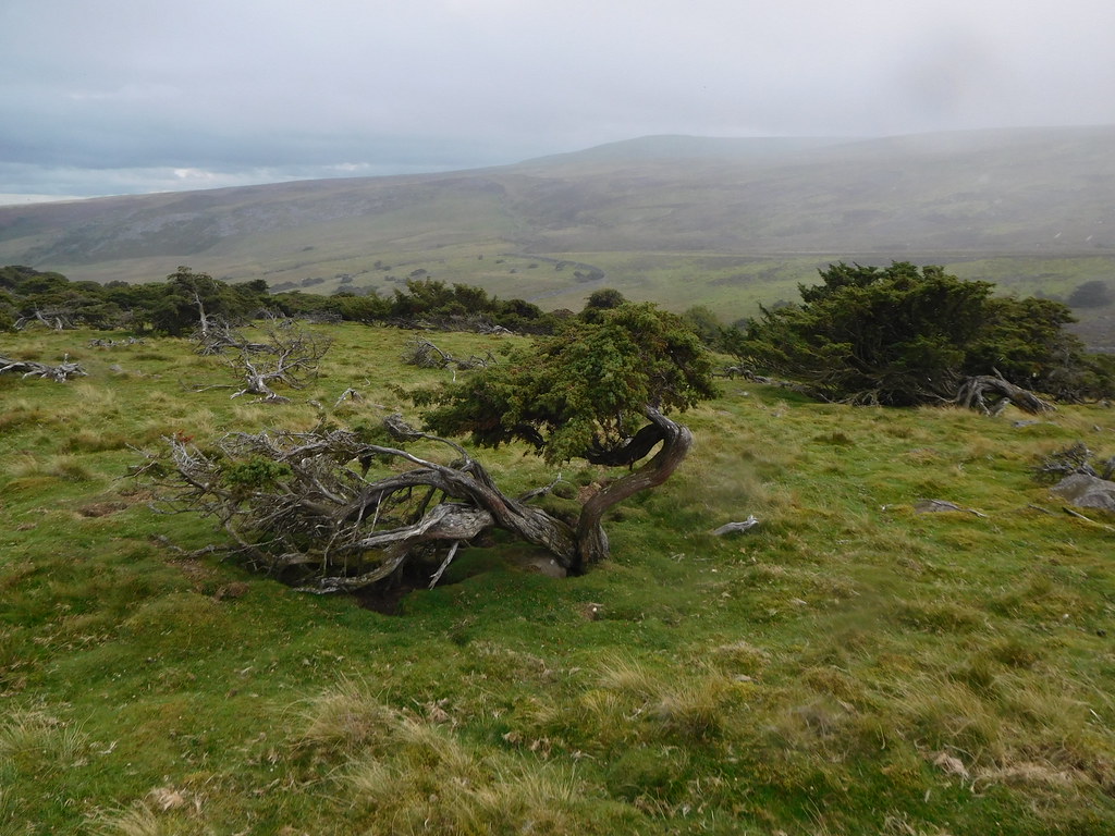 36 - Its raining and gnarled juniper trees on Bracken Rigg
 The rain combined with the wind was a damn nuisance, visibility had dropped and the wind was blowing rain onto the camera lens so that went away for a while.
From the top of Bracken Rigg we went down the west side to now leave the Pennine Way to turn south and cross Fell Dike Sike and then join a wide grassy track that is known as the Green Trod. Up until the 1890s the Green Trod was a drove road, one of the main ones that ran from Scotland to the meat markets of England. This old drove road is easy to follow as it heads east towards Whiteholm Bank crossing Skyer Beck and then alongside a wall as we climbed the easy slopes of Whiteholm Bank. The path gets a bit vague in places as the top is neared but keeping to an easterly direction soon picks up the path again.
The summit of Whiteholm Bank at 412 metres high is adorned with a fairly substantial cairn…
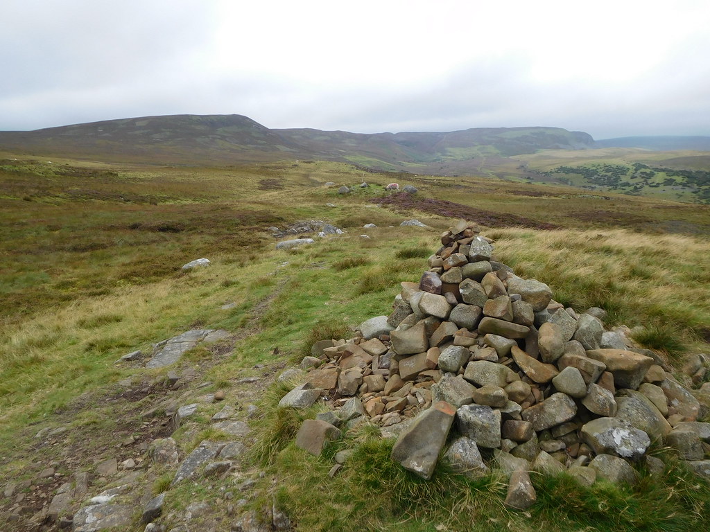 48 - Cairn on Whiteholm Bank
 from where a good view of the nearby quarries ravaged hill and the more distant Fendrith Hill covered in low cloud sitting to the north could be seen.
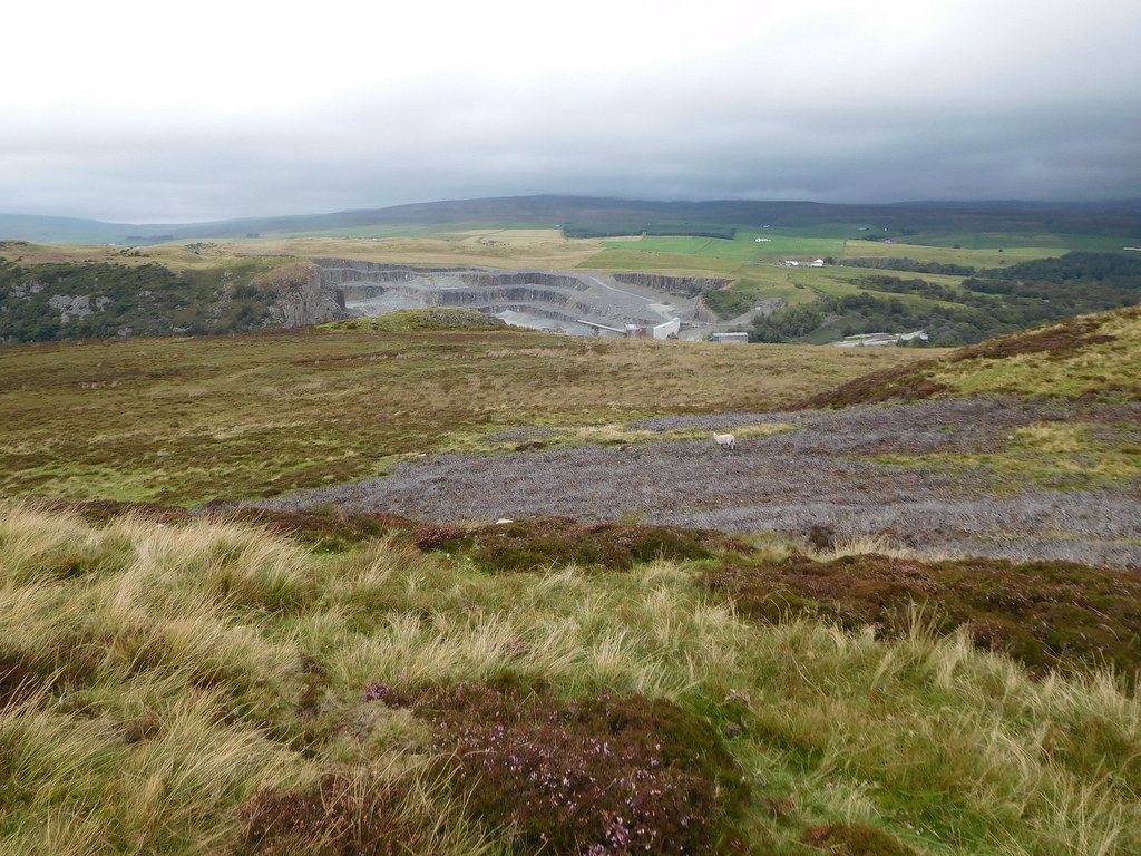 47 - Fendrith Hill behind the quarry
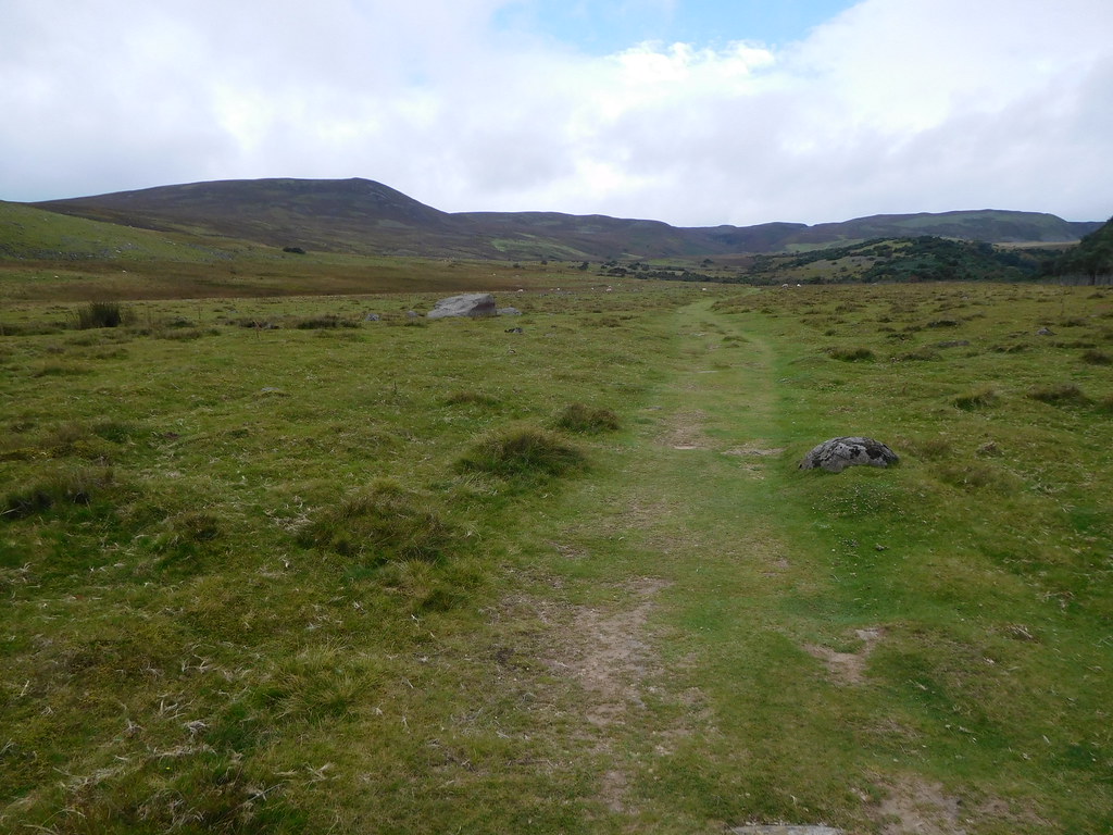
 The rain had cleared but the wind was still with us as we left Whiteholm Bank behind to continue following the wide track across the fellside…
 49 - The fellside track
 We were now making our way to an estate road that at one time was a road leading to the old mines of Silver Band and the Silverband Shop that now sit in the Warcop Military Ranges behind Mickle Fell but now serves as a means of transporting 'sportsmen' to the Grouse Butts behind Noon Hill. Just before we reached the estate road we crossed Blea Beck.
 51 - An Abbey Road moment crossing Blea Beck
 Once we had crossed the beck there was a bit of rough ground to pass over before we reached the wide and well stoned up estate road that we would now follow all the way to the old mining hamlet of Holwick. It seemed a long plod along the road with the views spoilt by the now misty conditions around the head of the fells but as the road turned slowly to the southeast it also began to lose height as we quickly descended towards Holwick Scars. We arrived at a fence, gate, and stile from where we could have turned down a track to the northwest towards Holwick Lodge and cut a big corner off but we wanted to check out the pub in Holwick.
Parked up at the gate and on either side of the stile there are two sheep sculptures hewn out of local stone.
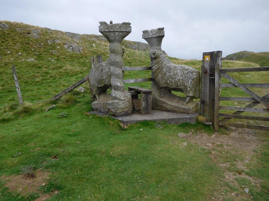 54 - Sheep sculptures at Holwick Scars
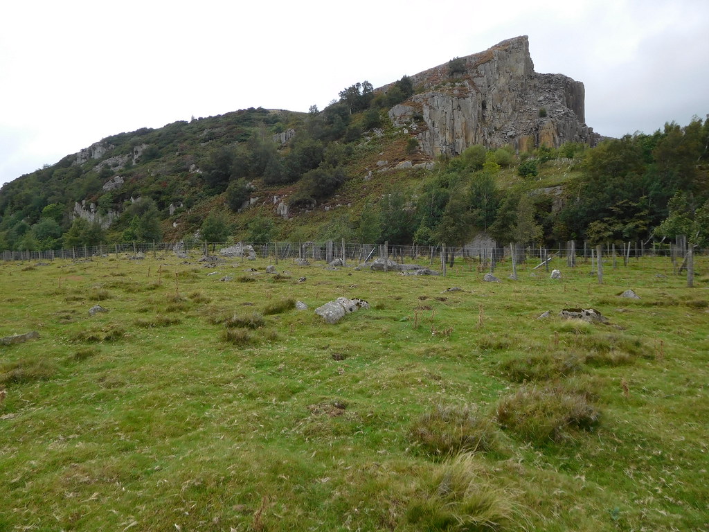
 Passing through the gate we were now entering the large cut that has Scar Beck running along its bottom with the Holwick Scars towering over us to our right. The rock is whinstone, a hard dark coloured rock that is used for road chippings and the building of dry stone walls whilst the name 'whin' derives from the sound it makes when hit with a hammer.
Whilst this place is not the Grand Canyon it still makes one feel quite small as you amble through it. Although it's not an ugly place - in fact it's quite picturesque - there has been some tree planting on the grassy slopes that lie between the various scars and in a few years the mature trees will fit in perfectly with this rocky landscape.
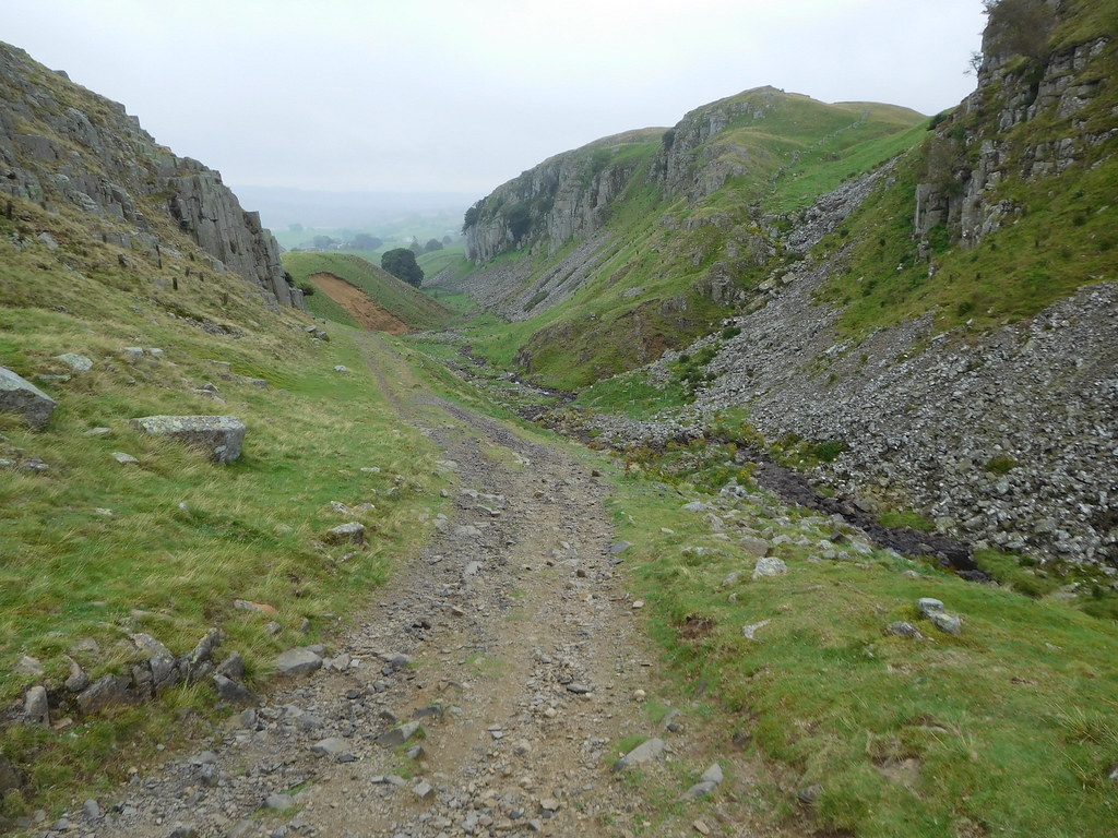 58 - Holwick Scars
 Moving on past the 'Scars' we fast approached the hamlet of Holwick. Situated where the dirt track ends and the metalled road begins there are just a small collection of houses/cottages the remnants of a much larger village that was an important and busy part of the lead mining industry in Teesdale as the long track that runs from here to the now defunct Silver Band Mine can testify.
The earliest evidence of habitation in the area comes from Mesolithic microliths dating back at least 6000 years. The people who left them, however, were not settled in the area, but hunted there during the summer. Agriculture began in the Neolithic period, and the remains of buildings have been found from the Bronze Age. The present-day village of Holwick was first recorded in 1235, though the origin of the name is uncertain, believed to mean either "dairy farm in a hollow" or "in the holly". In addition to hill farming of sheep, lead mining and iron smelting was conducted in the mediaeval period, with lead mining and stone quarrying increasing in importance throughout Teesdale in the 18th century. A suspension bridge was built across the Tees near Holwick in 1704, and collapsed in 1802, killing one. It was repaired but finally replaced in 1830. Substantial quarrying and lead mining did not continue into the 20th century, and the economy of the village has since returned to sheep farming.
 59 - Holwick
 We passed through Holwick looking for the pub that is at the bottom of the hamlet and hill which meant a bit of extra walking to find it and then return to the hamlet to find our path back to the Visitor Centre, but it was worth the walk. When we arrived at the pub that is called the Strathmore Arms we were met with a multitude of colours, flowers of all kinds and shapes were in abundance covering the whole of the ground in front of it.
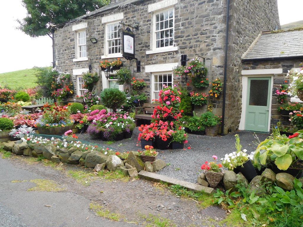 62 - A colourful Strathmore Arms at Holwick
 The beginnings and story of the pub can be found at the link below:-
http://www.strathmoregold.co.uk/about-us-news.html The pub is very nice inside and we decided to eat there once we had completed the walk and driven the short distance back. A fine meal and ale was served by the most welcoming of hosts for whom nothing seemed too much trouble. A place to be recommended.
To make our way back we had to climb back up the hill to take a path on our right that led us through a field…
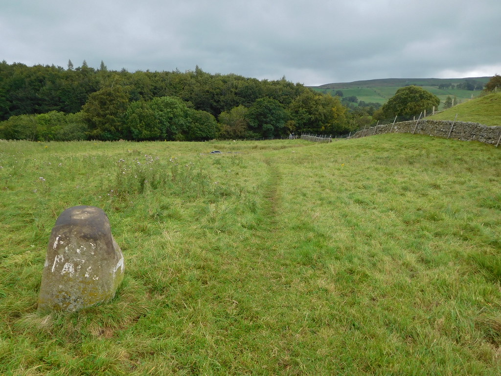 66 - Path marker
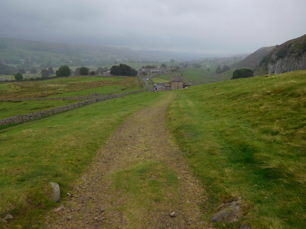
 and down to woodland and footbridge from where we crossed the River Tees. After the bridge we continued on for a short distance before turning northwest on a good path through more fields to eventually arrive at the lane where we initially went wrong. This lane took us back to the main road from where we had the short walk back to the car and then the drive back to the Strathmore Arms to be fed and watered.
A walk done on mostly good paths and tracks with not much height gain made for a good steady amble through some great countryside giving a mixture of river, woodland, pastures, and low fells with the only item to mar it was the miserable but light rain that brought a cold wind and low cloud with it. The trees were just turning into their autumn colours but there was still evidence of many wild flowers on the fellside. A walk of interesting features with the waterfalls, signs of still evident but past mining and quarrying activities - there was in fact an archaeology convention on whilst we were there with lots of people wandering through some of the old workings - and of course the Strathmore Arms that is so unlike a pub when first entered with its bar filled with tables more set out for eating than drinking. The bar is not visible from the door making the room look more like a café than a pub. There is a small pool room on the right and if walls could talk I'll bet this place would have some good tales to tell.
