free to be able to rate and comment on reports (as well as access 1:25000 mapping).
After Birks Fell I was down to my last English Hewitt and Nuttall's and I had had this walked planned for a good few weeks now. As it's a long drive south to Dartmoor I had planned 3 days away, 2 driving with bed and breakfast for 2 nights in Okehampton and one day for the walk and as E didn't fancy the long drive it was going to be a solo expedition, until that is, Jim stepped in to fill the gap. It appears that around 60 years ago he had a girlfriend that lives quite a way south of where we was going to stay and he got quite excited about the prospects - or chance - of bumping into her and having a catch up, which I thought was going to be a bit of a non-event seeing as how he doesn't know where she now lives or is even still living a good life.
I had checked out the non-firing days for the Okehampton Ranges and noted that they were open on the 8th, 9th, and 10th of October which was ideal as there was still plenty of daylight around and a good chance of some decent weather, plus it was over a weekend with the Monday doing nothing but driving instead of toiling, or as they say in the army, 'if you're marching you're not fighting'. I got us booked into a great B & B in Okehampton that was just a couple of miles away from the start of the walk at Meldon Reservoir so an ideal situation to stay and play.
Our temporary place of abode was on Station Road and our host for the short stay told us that about 2 miles up the road there is an army camp that is not fully occupied but mostly used for cadets and from the camp there was allowed access onto the moor. That was handy to know, but I had already planned our route from the reservoir and as there was not much difference in mileage to either place of start we stuck to the original plan.
After a long drive down on the Saturday with more than enough road works to delay us we duly arrived at Station Road, clocked in, then went to locate the best place for food and drink finding that at the bottom of our road there was a Wetherspoons - The White Hart - which we duly entered and was soon enjoying the simple, but good food with some of the meals including a drink of one's choice from the many varieties on show. Fed, watered and relaxed after 7½ hrs driving we made our way back for a good night's sleep and looking forward to the next day's walk on the moor.
Day 2 started with an early breakfast at 8am, well not early really but it was Sunday and in any event it was served a bit later on the Sabbath but we were away by 8:30am for the short drive south to Meldon Reservoir where we found a good sized car park and toilets with just a few cars already parked up, most owned by locals taking their dogs for their morning constitution. There was also a couple of mini-buses dropping of a good number of teenagers of both sexes and talking to a group leader established that the girls were from a private school and were having a day canoeing on the reservoir with the boys doing the donkey work of sorting and carting the canoes for the girls.
We were soon ready for the walk in hand and left the car park by the two handy sets of steps that put us directly on the metalled lane that ends at the reservoir where I took a picture of the bright coloured canoes being set up for the girls.
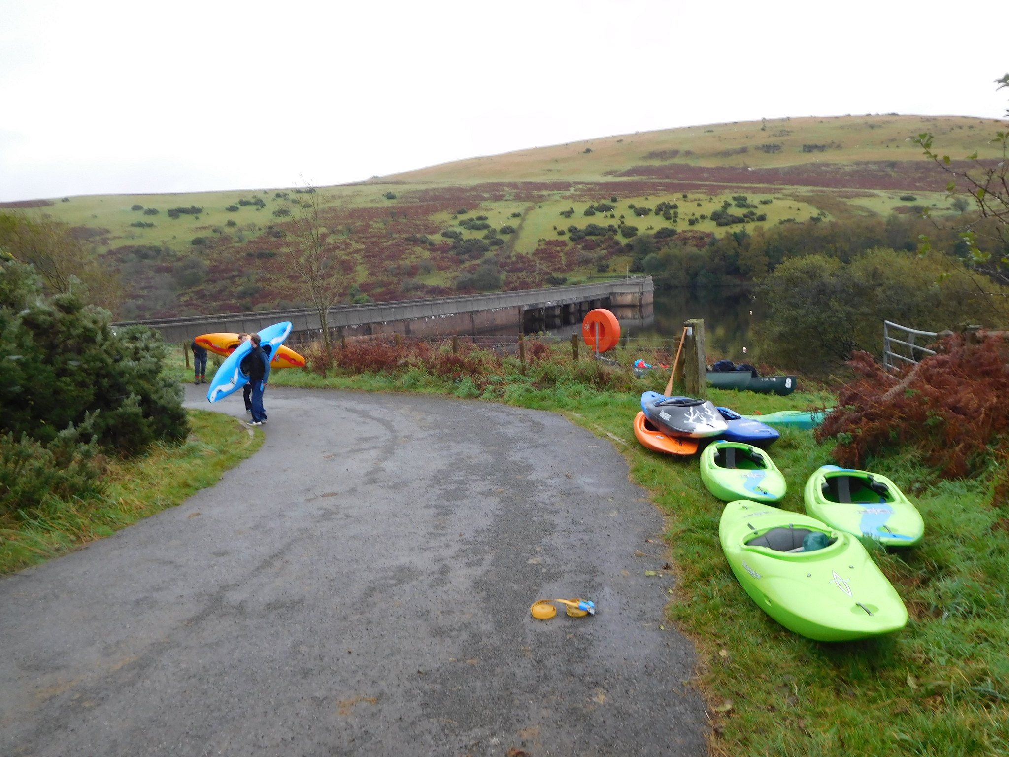 Canoeing on Meldon Reservoir
 Before we crossed the reservoir wall we had a look around and noted that the reservoir - as expected - filled a large valley that, by looking at what remains of it in front of the dam wall must have been quite a good looker before it was taken over by the water authorities. The sides leading down to the water are filled with native trees whilst what remains of the valley below the dam wall is very picturesque with juniper trees in abundance on the slopes whilst in the distance can be seen a small wood and the old iron built Meldon Viaduct that, like the Ribblehead Viaduct, was saved from destruction by the admirable efforts of the locals and various groups of the steam train fraternity.
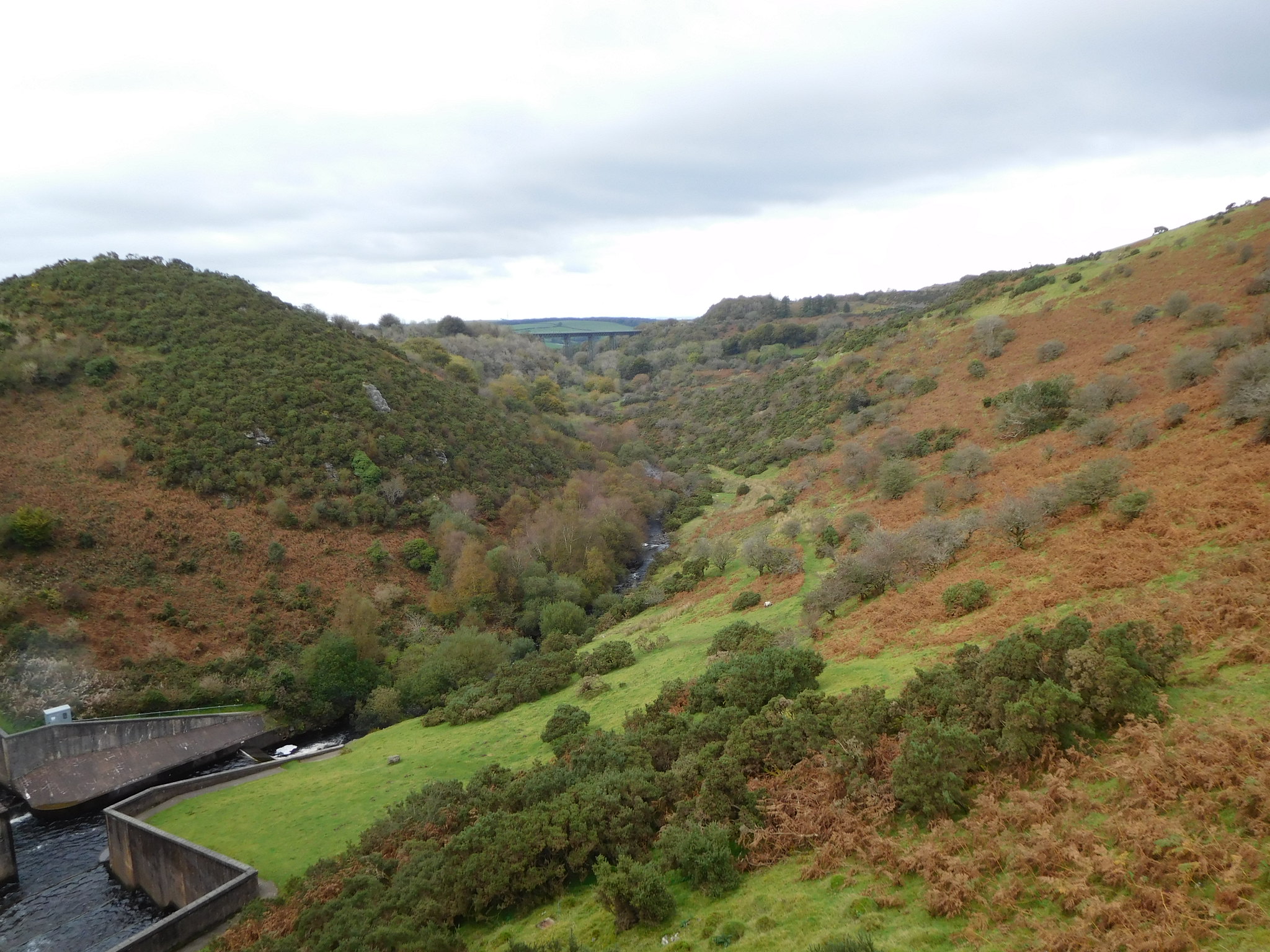 Meldon Viaduct
 There is also a great view of the front of the dam wall with the water pouring down the sluices.
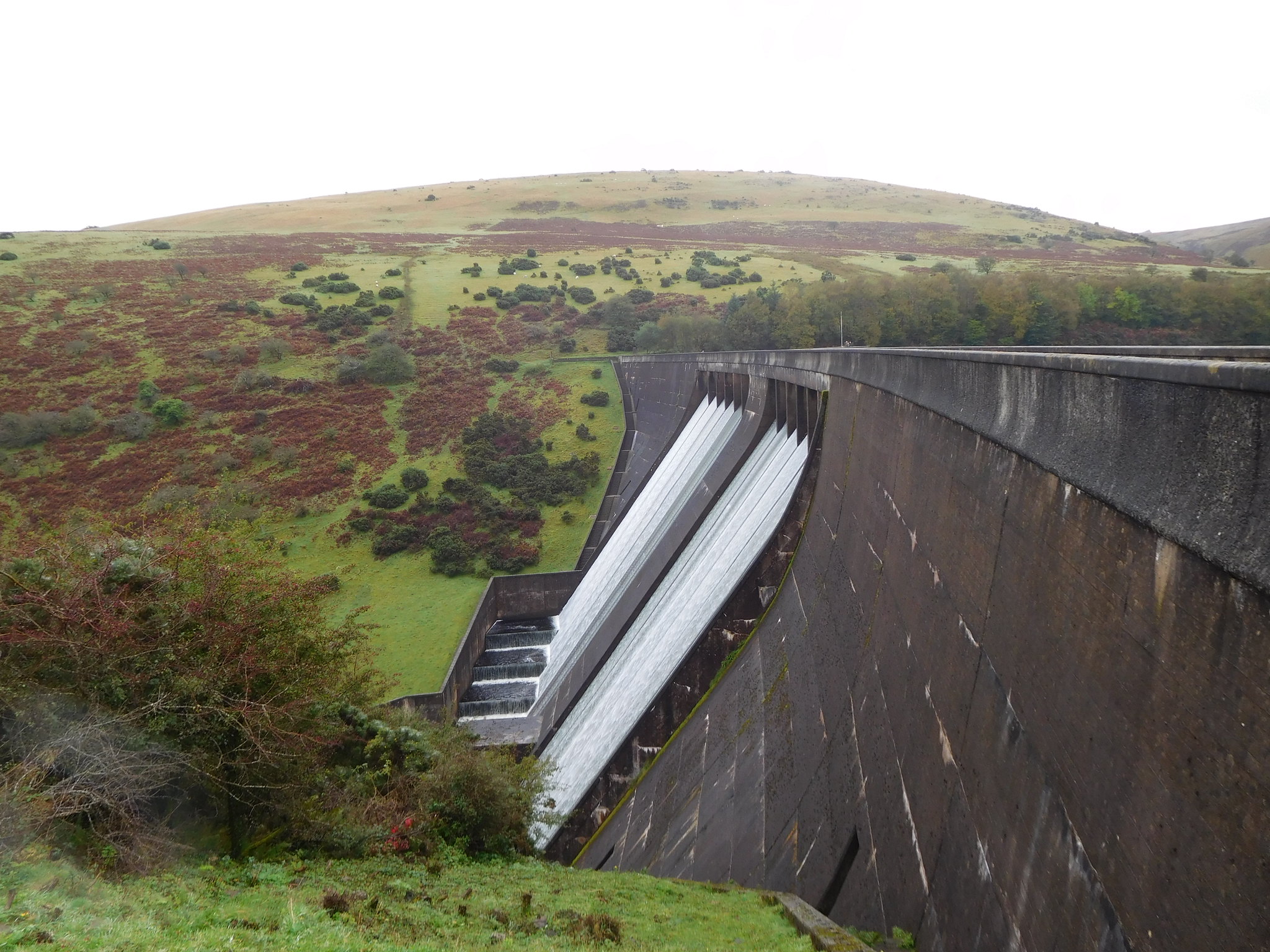 Meldon Reservoir wall with Longstone Hill behind
 After crossing over the dam wall we followed the wide grassy track southwest alongside the reservoir fence for roughly 250 metres before turning with it as it swung around to the east still following the same good and well graded track that we had set off on. This part of the track was taking us along the east side of the 412 metre high Longstone Hill that is purely a large and simple grass covered mound with a few juniper trees scattered about near the summit.
Waiting with great patience for his next meal in his droplet covered home suspended from a juniper tree was this little fellow.
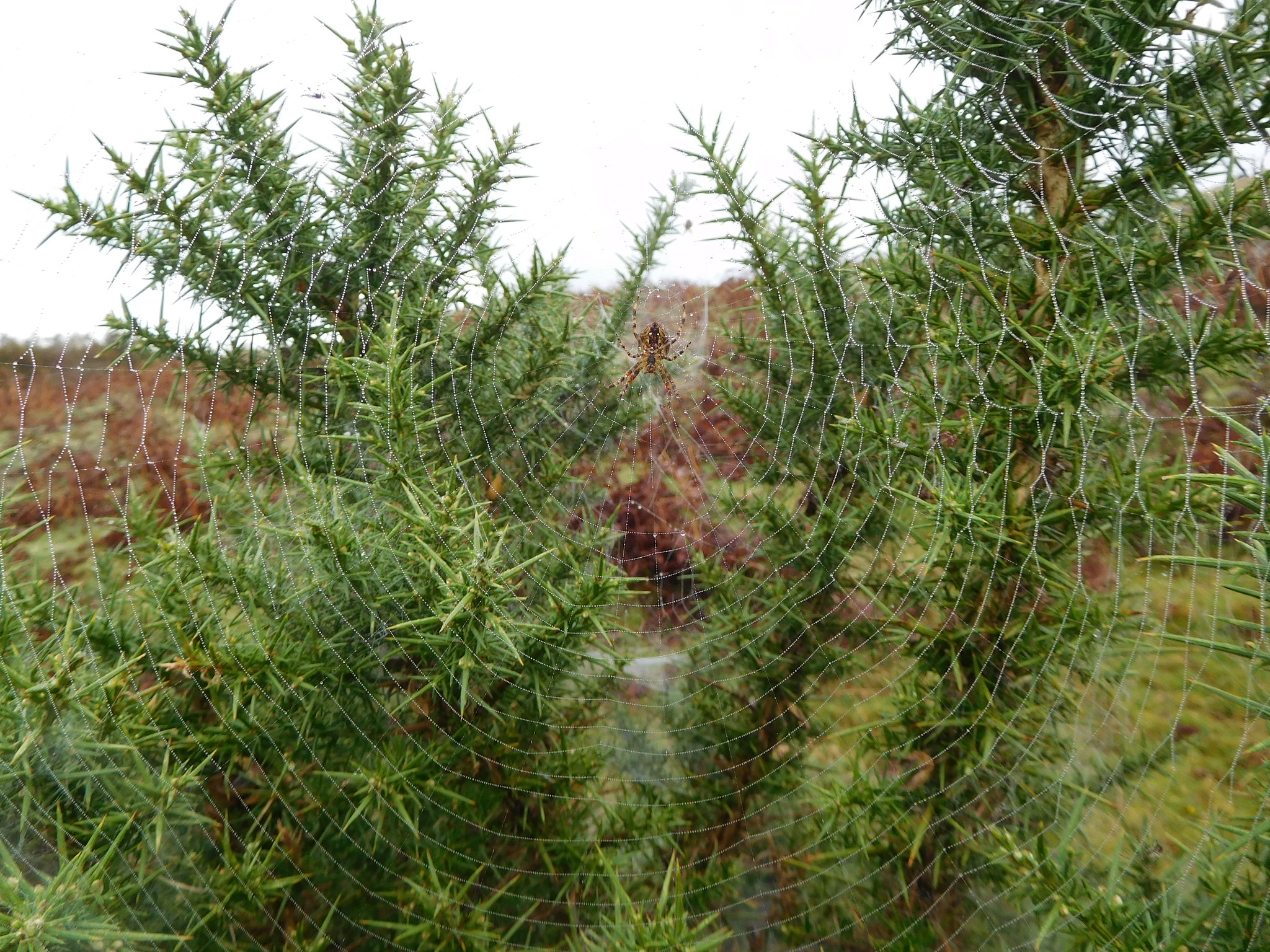 A Dartmoor local
Just before arriving at the summit we had a short view along Red-a-ven Brook with the cloud covered Black Down and West Mill Tor behind it.
 Red-a-ven Brook with Black Down left and West Mill Tor in cloud
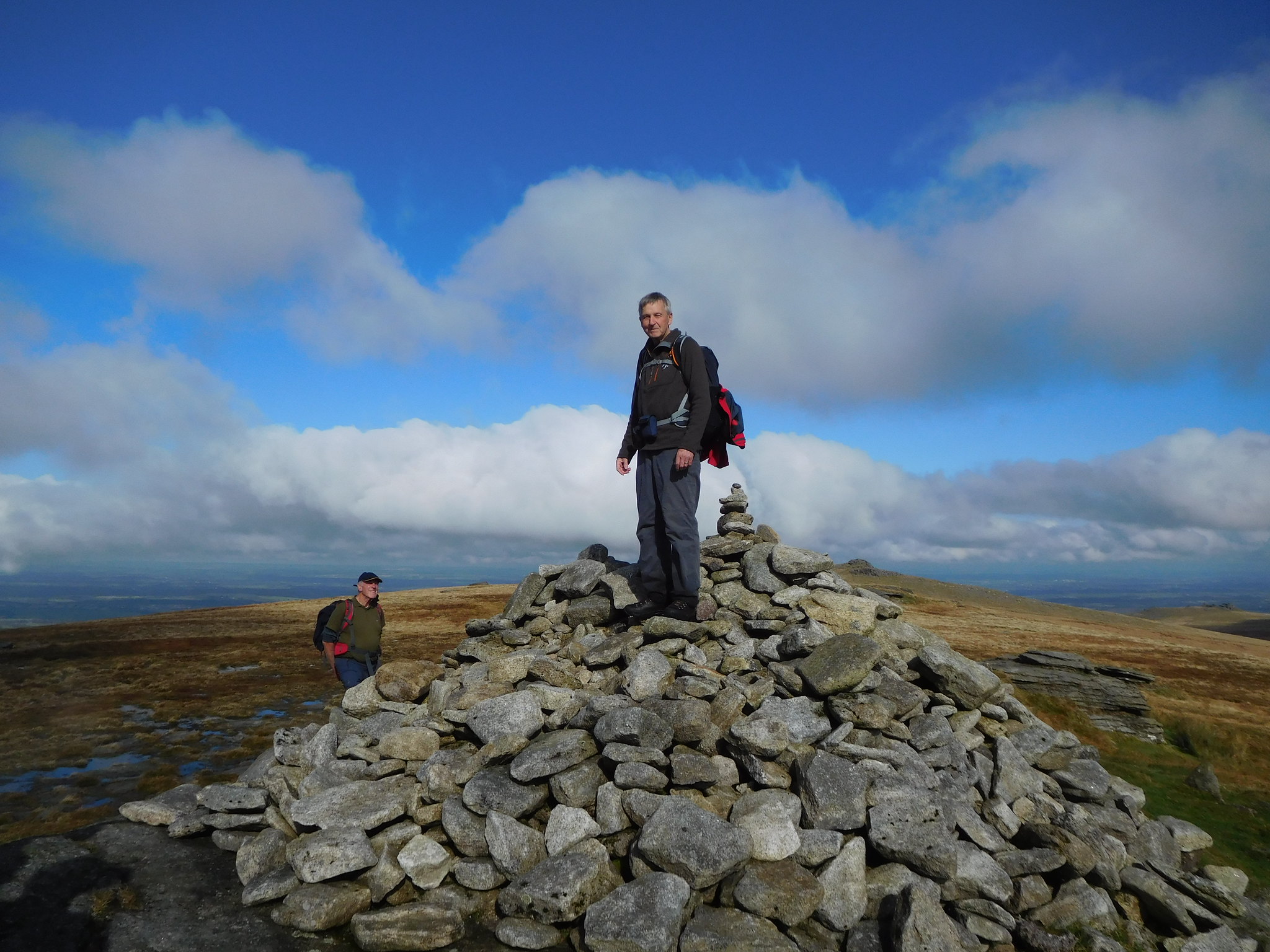
 We arrived at the summit of Longstone Hill to find a scattered stone cairn on a very large and slightly rounded area of short grass of variable colour where Jim posed in a suitable way for his first top of the day.
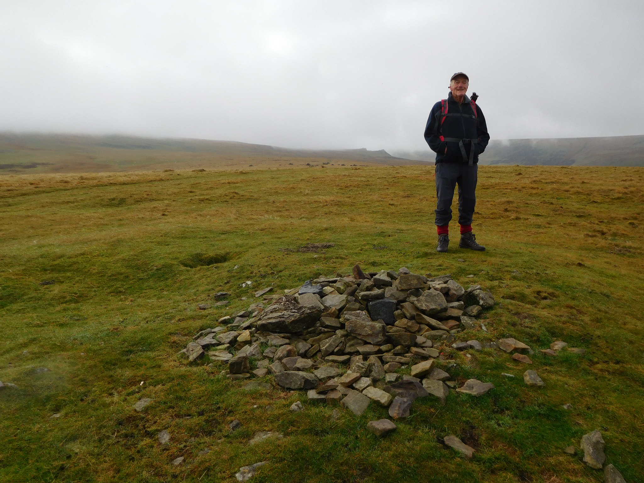 Jim at Longstone Hill summit
 Despite the low cloud cover and damp conditions it was very warm but the moisture hanging in the air was akin to a light drizzle of rain so we were reluctant to shed our top coats.
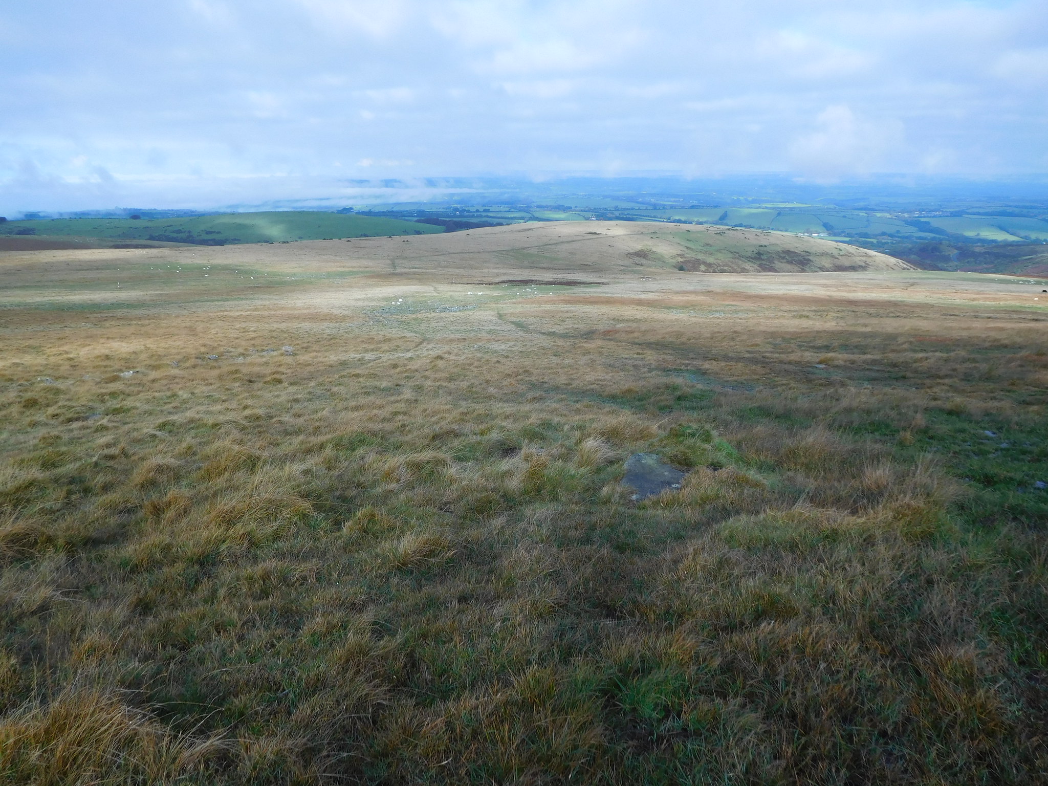
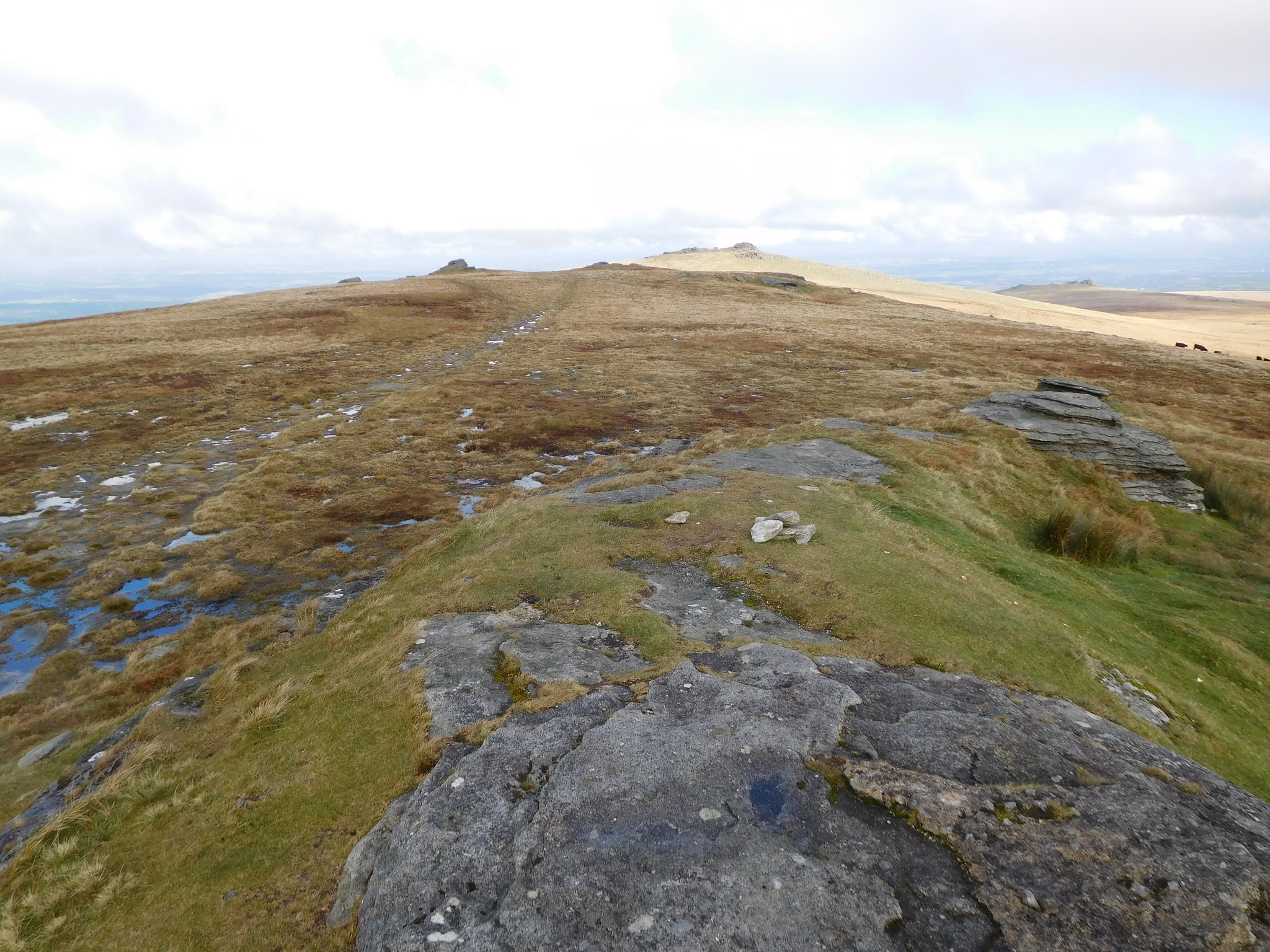
From Longstone Hill we set off along the same track but now walking south and could see one of our later in the day points of interest through the murky clag, Black Tor, with the top of Yes Tor to our right completely covered in clag.
 Black Tor in the distance
 We walked south a little too far and missed the faint path that leaves Longstone Hill for Yes Tor and now had to walk through the short rough grass that has scattered areas of rocks in it and as we did so the clouds began to lift, off Yes Tor at least.
 Cloud clearing from off Yes Tor
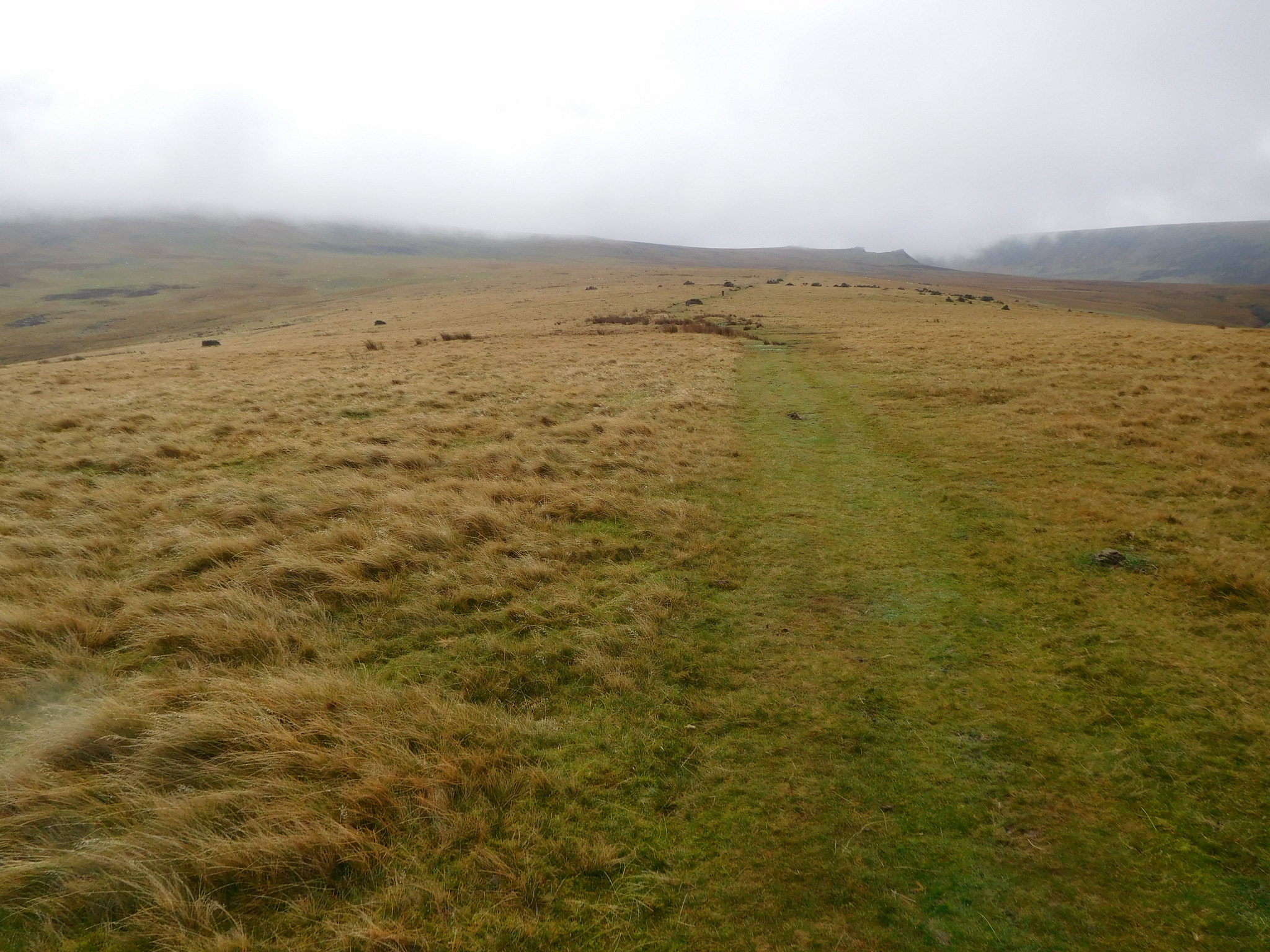
 The walking was easy but the ground wet as we walked steadily up the easy slopes in a south easterly direction to soon arrive at the earlier missed path. For perhaps 50% of the way up the side of Yes Tor the path is clear to see and wet from top to bottom especially in the middle section where the path had done a runner and we had to sweep around to the right to avoid a seriously boggy patch of ground. Once above the worst of the ground we turned back to northwest and soon picked up the path again as it became more visible, but it was still a wet walk from bottom to top of the fell.
On looking back from part way up the fellside we could see quite clearly the path that we had missed when leaving Longstone Hill.
 Longstone Hill
 When we arrived at the cairns that are marked on the map, cairns that we couldn't see, a view south gave us a look at some of the other hills.
 Corn Ridge and Woodcock Hill from the west side of Yes Tor
 As we ascended a large rock appeared on the skyline sat above a girdle of closely knitted small rocks and we found that the easiest way was to work our way through the rocks along a narrow strip of grass that put us on clear ground from where it is just a short easy stroll to the summit.
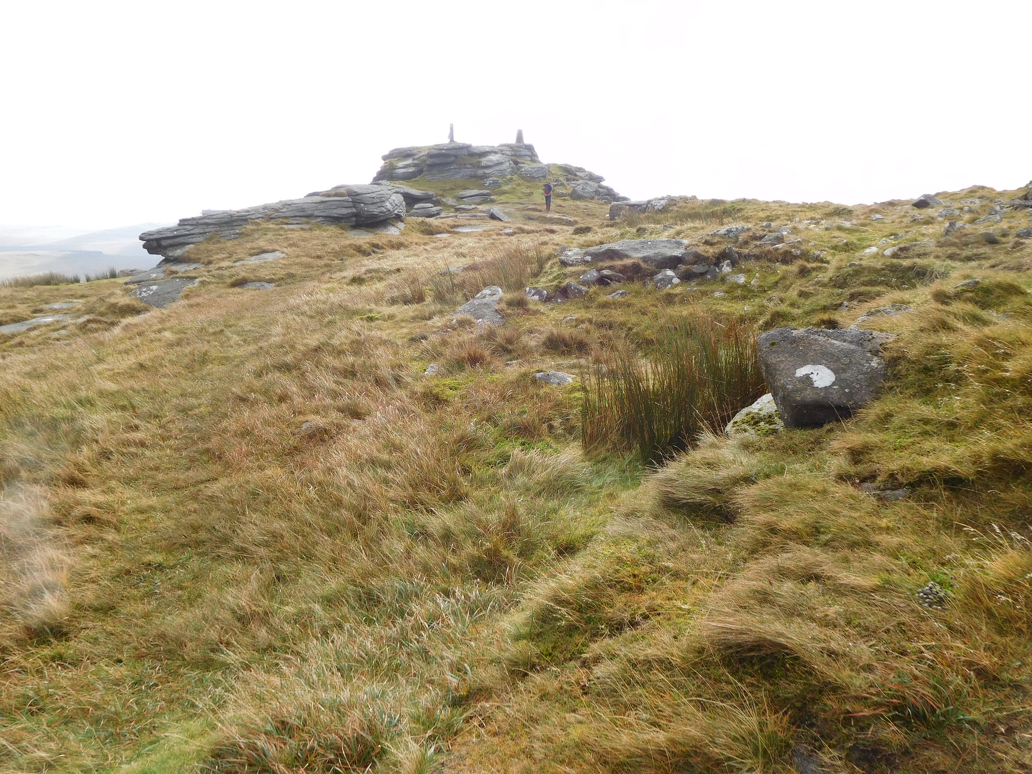 Yes Tor summit
 The sun was beginning to show itself and now the cloud had lifted it was time to shed a layer. Just before reaching the summit a good view of High Willhays was to be seen.
 High Willhays to the far left
 Whilst I have been lingering and taking some photos Jim had stormed on ahead and made the summit trig point and with a whoop and a holler made it all too plain that he had beaten me to it.
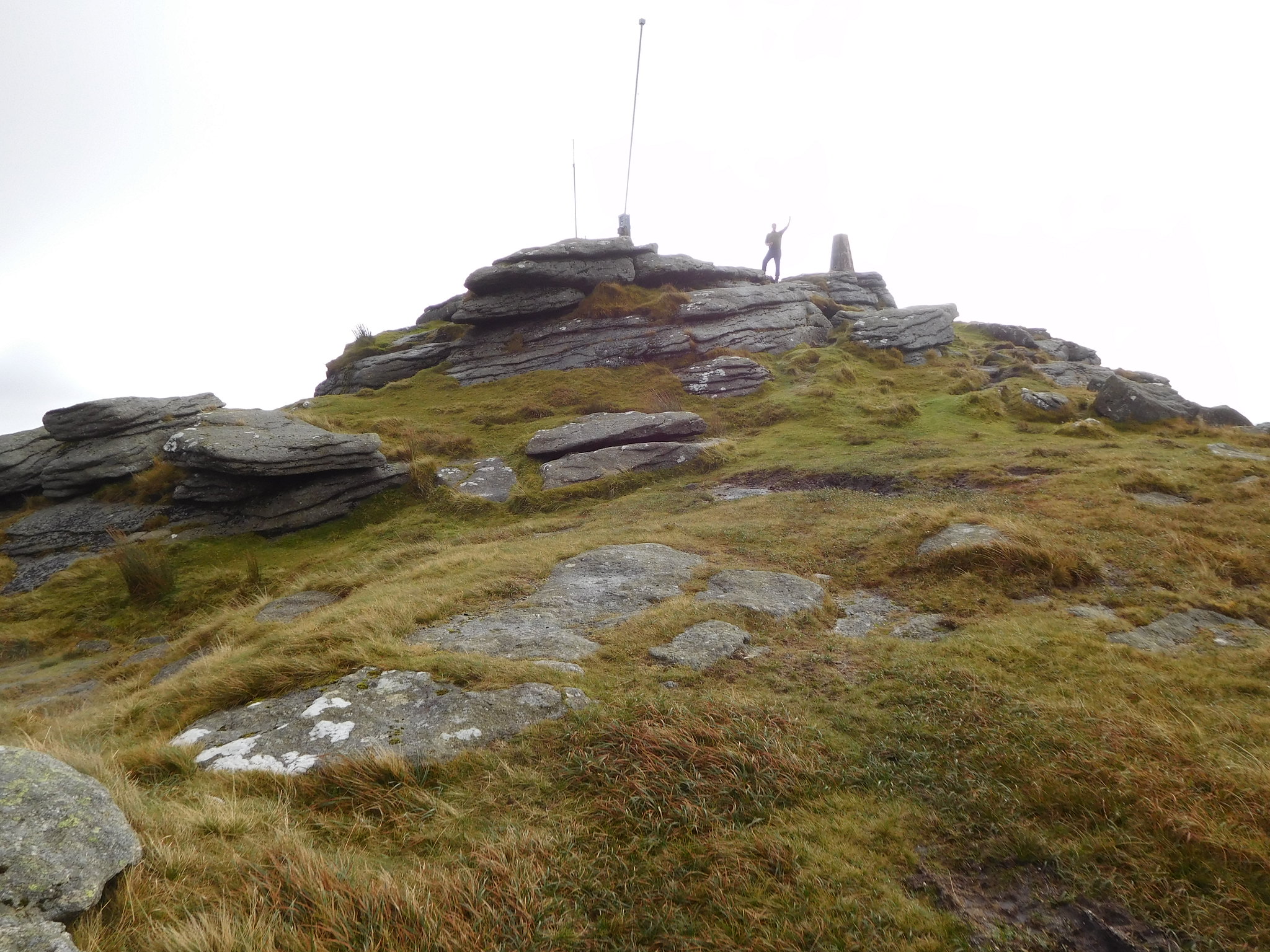 Jim on Yes Tor
 The summit of Yes Tor is decorated with two radio aerials and the trig column; there is also a handrail around the aerials that are there I would presume to keep the observers safe when the troops are on manoeuvres. Just below the rocks and tucked in to them there is a small concrete block hut complete with windows and chimney whilst over to the other side of the rocks there is another one but this is painted white and appears to be made out of either metal or reinforced plastic.
This is where Jim decided we were having a break to which I readily agreed as we were both wet with perspiration, not from the easy climb up but due to the warm and humid atmosphere.
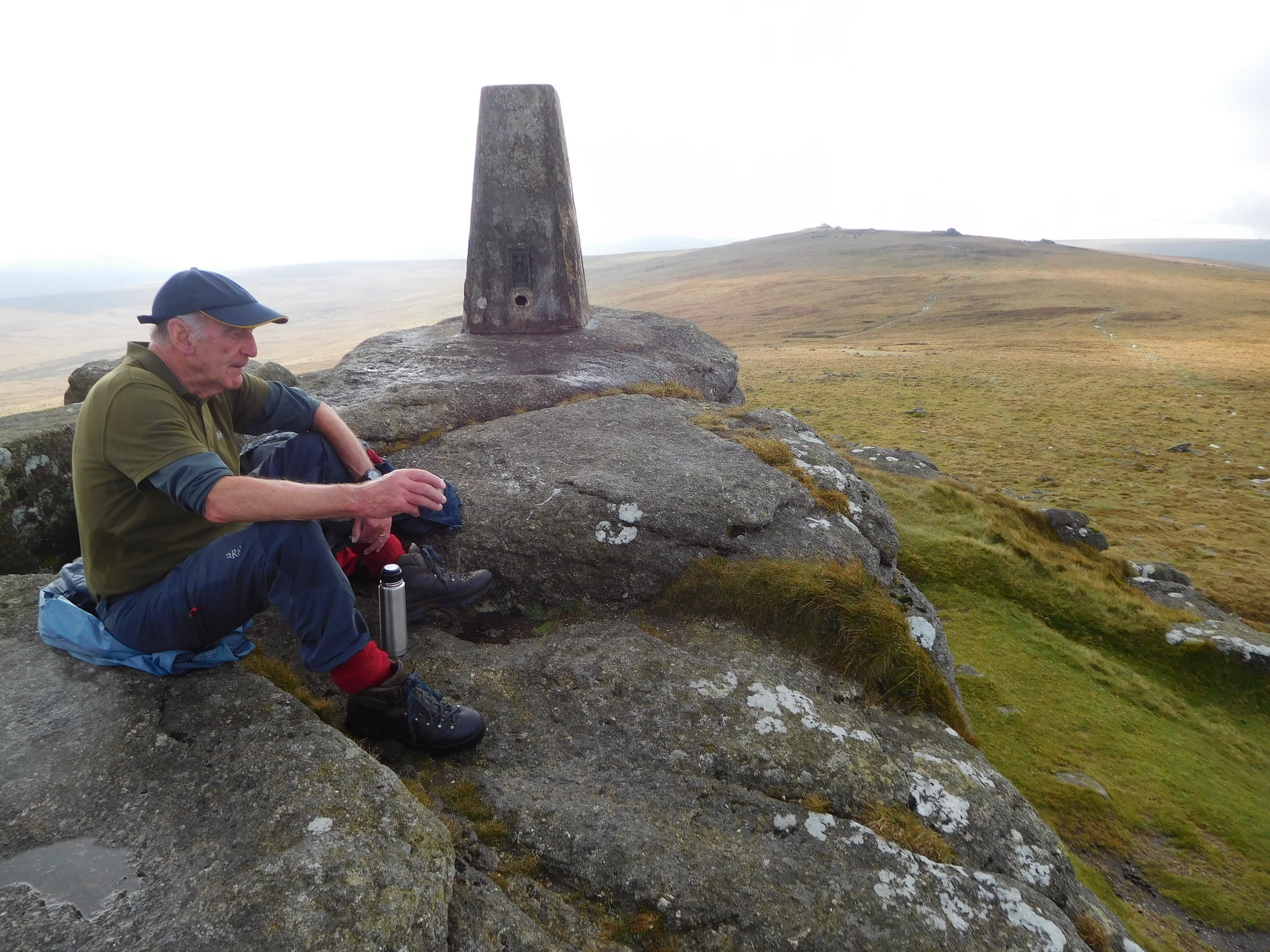 Taking a break on Yes Tor summit
 The views from this summit are very extensive and the size of the Dartmoor fells is left in no doubt when looking across them.
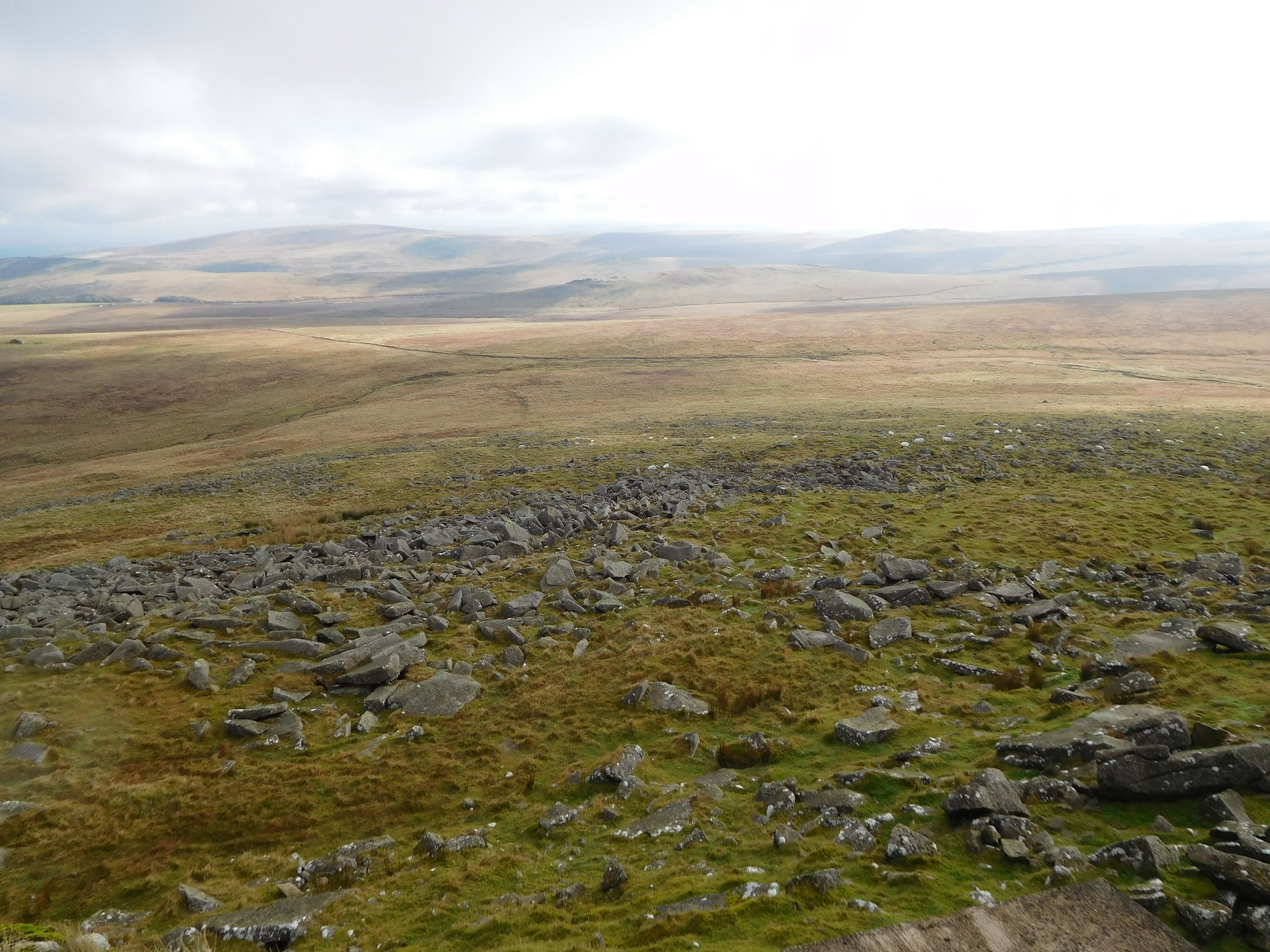 The vastness of Dartmoor from Yes Tor
 This was our second top although Longstone Hill doesn't really qualify and from this summit our third one was plain to see over to the south with the path looking exactly like the ones we have already been walking on, wet.
 High Willhays in the distance
 Once we had quenched our thirst we set off south on the wet but clear path and passing some more of the Dartmoor locals on the way.
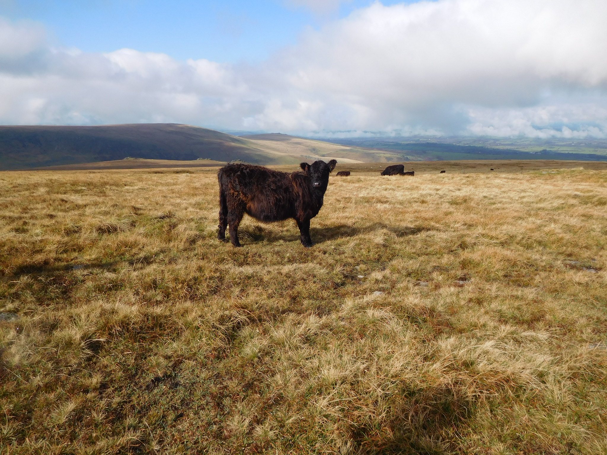 Another Dartmoor local
 Roughly halfway between the two summits there is an outcrop of rock from where I looked back to Yes Tor.
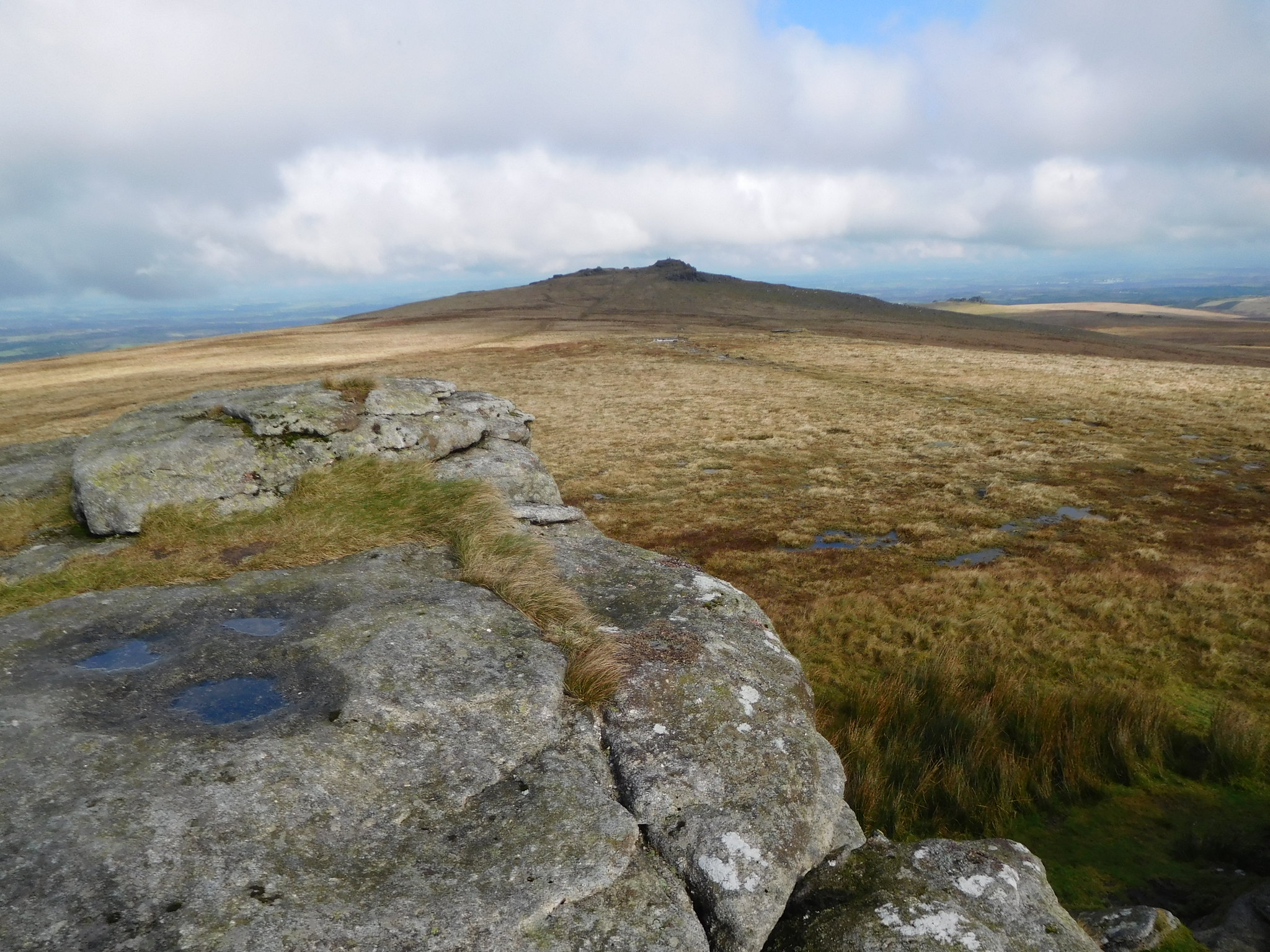 A view back to Yes Tor
This was also the place where Jim found handfuls of spent bullet casings intimating that this spot was used for one of the militaries war games.
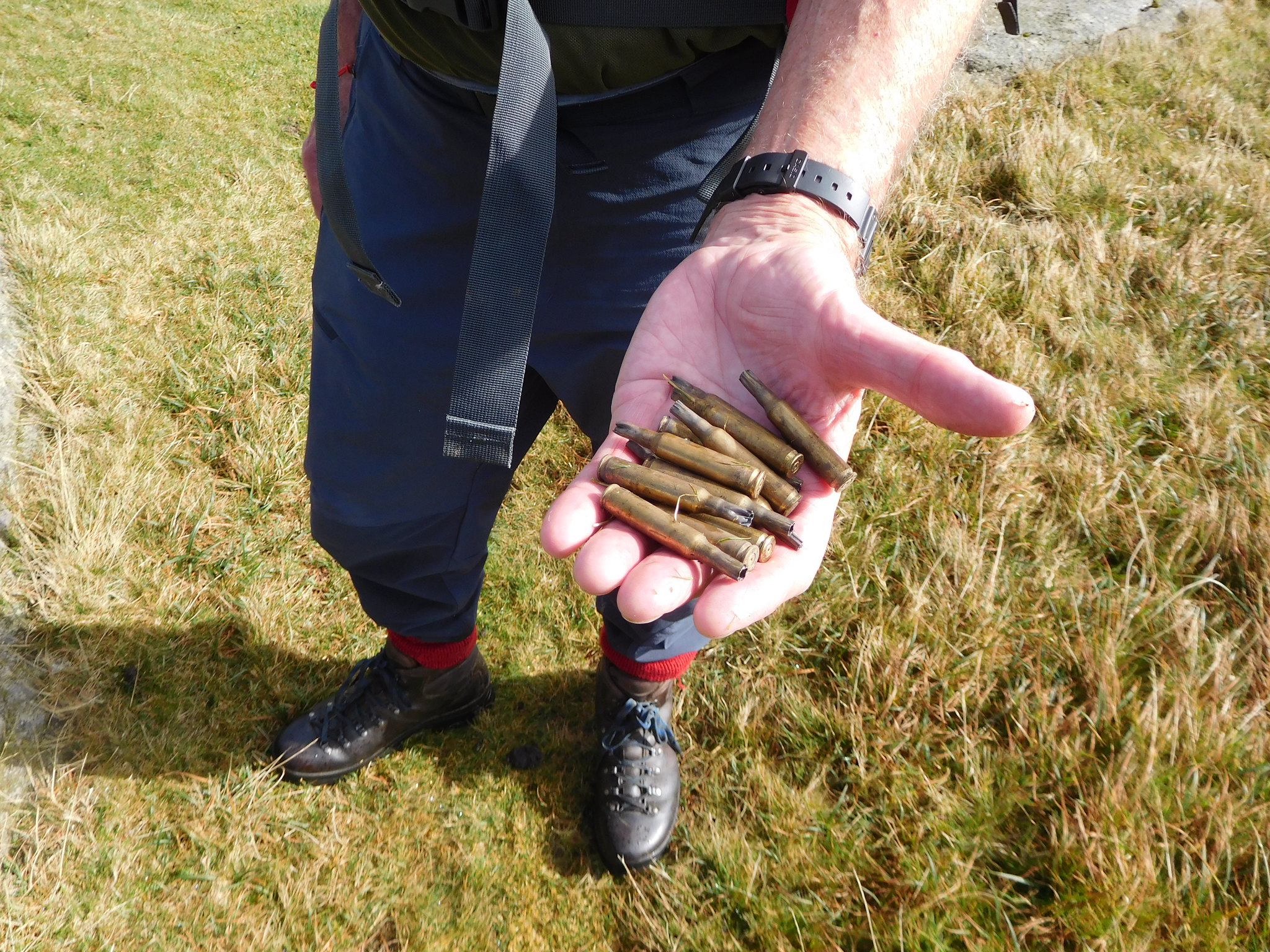 Jim with a handful of spent bullet cases
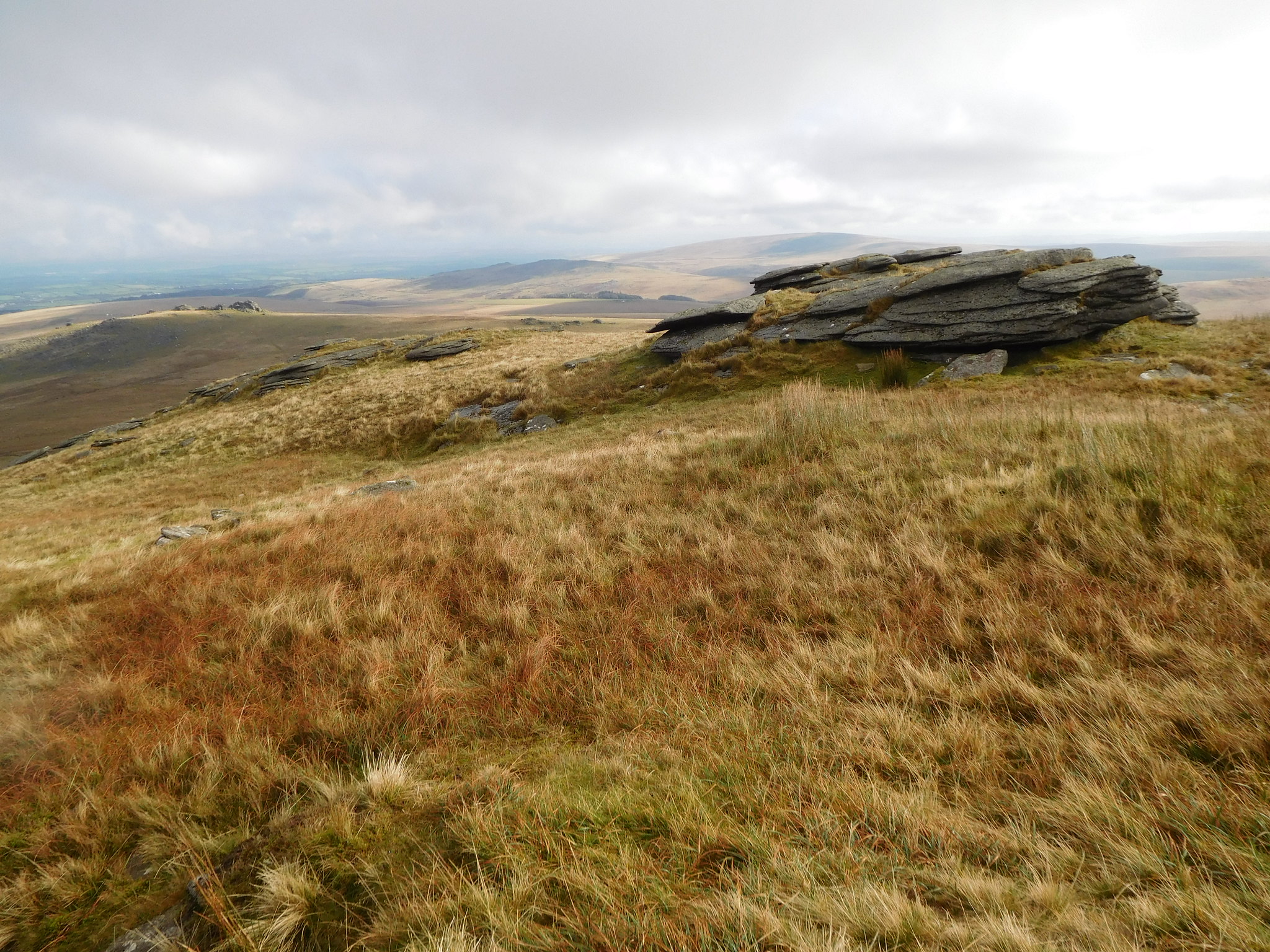
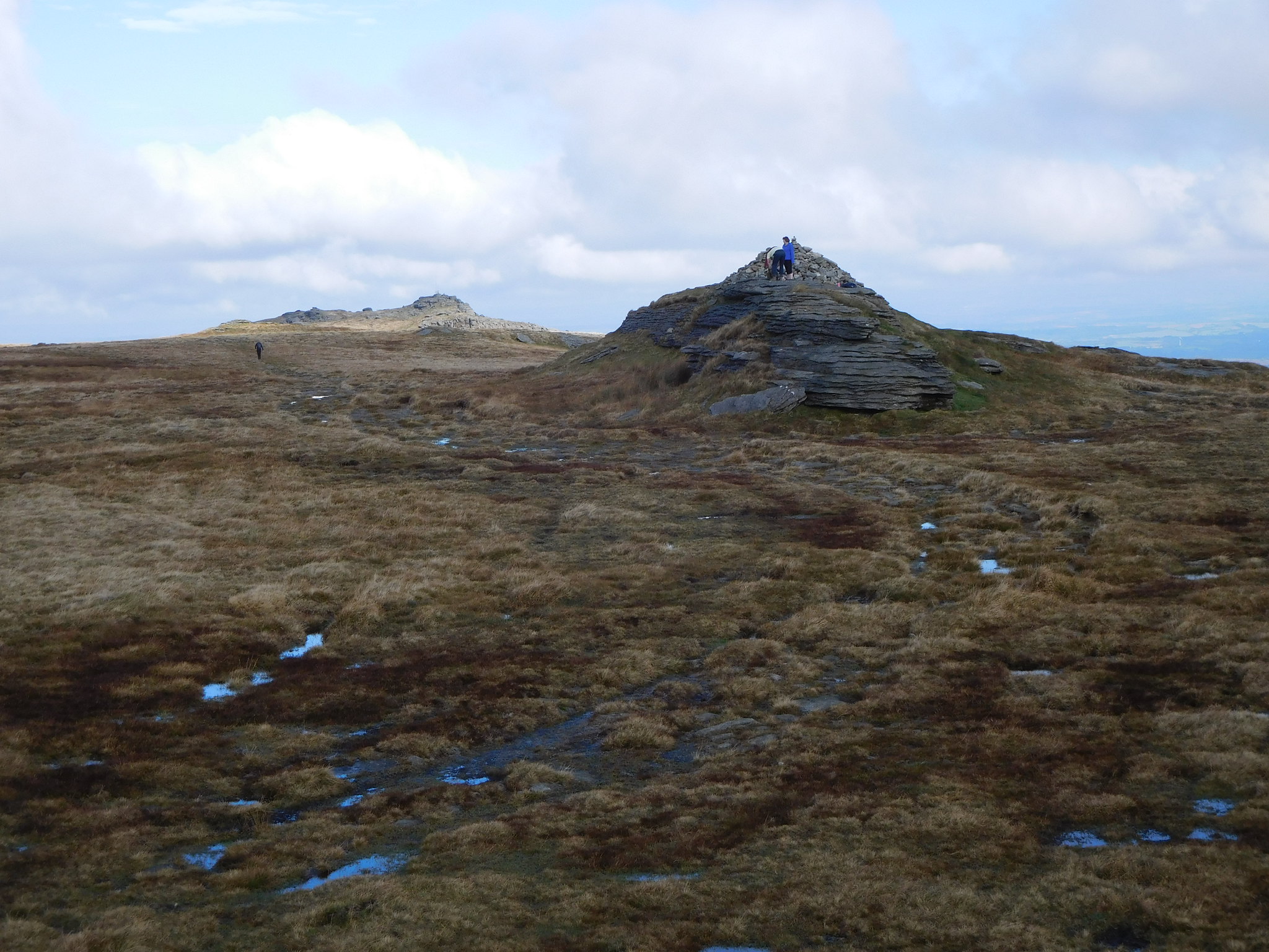
 The walk between the two tops is very easy although today very wet underfoot but as we approached the summit rocks the grass path now began to change to a welcome rock paved section taking us all the way to the summit of High Willhays, my last English Hewitt and Nuttall.
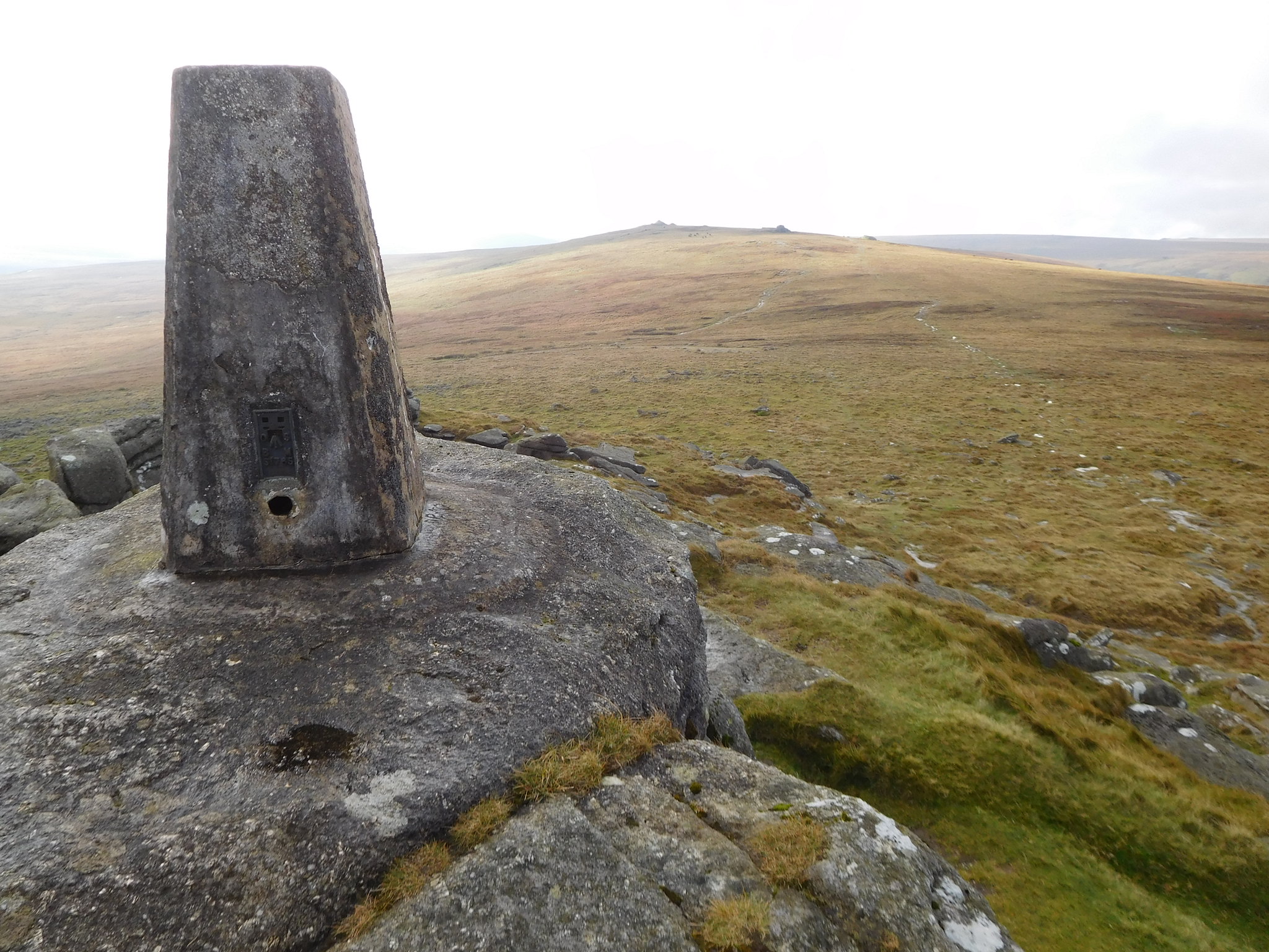
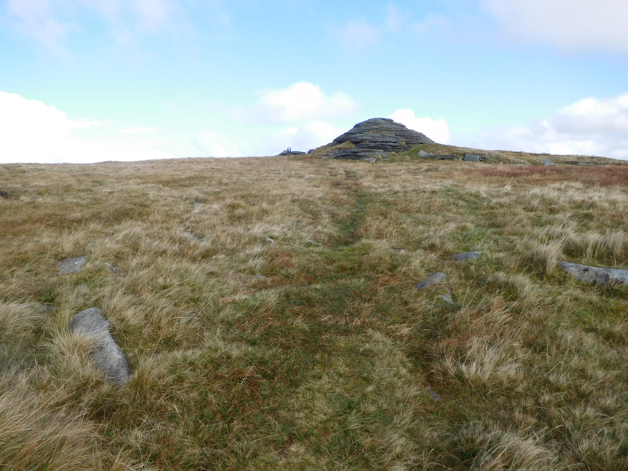
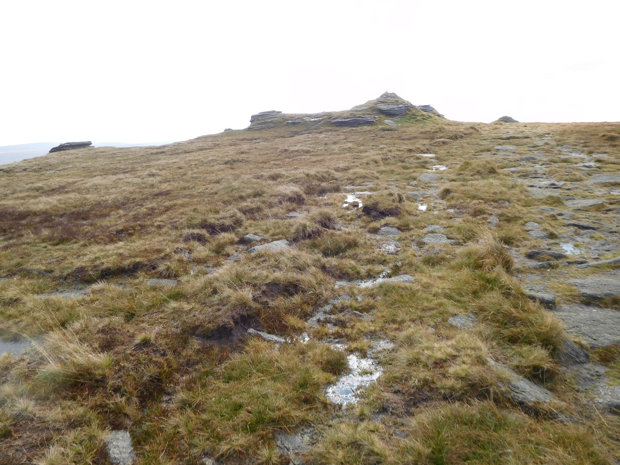 High Willhays
 The rocky tor is actually much bigger than is represented by the picture and sports a very large cairn from where a good view back is to be had of Yes Tor…
 Yes Tor from High Willhays
 and one of me posing for a final summit picture kindly taken by a lady walker.
 My last English Hewitt
 We lingered for a few minutes and had a chat with the lady and her husband who used to be in the forces and were making a trip down memory lane by revisiting some of the places on Dartmoor where they had done their training. There was also a young chap who had travelled from Chorley to bag these two Dartmoor summits.
Well it was time to leave this highest of hills in the south of England…
 High Willhays with Yes Tor behind
High Willhays has two separate summits that are a good few metres apart from each other so the second summit was also climbed as it was directly in line with our next rocky experience further down the fellside, Dinger Tor.
 Leaving High Willhays 2nd summit behind
 We were now heading for a lump of rock that is further down the fell on Fordsland Ledge from where we would then strike off to the southeast for Dinger Tor. From this small group of unnamed rocks we could see across to another rocky outcrop on which sits another two of those small observation post buildings and radio aerial.
 Unnamed tor with military boxes in the distance
 Leaving this lump of rock behind us we then set a course to the southeast for Dinger Tor which we could see in the far distance. Initially there were the makings of a path but that soon ran out into very wet ground from which there was no escape, apart from turning back and that wasn't to be an option ever considered.
 Dinger Tor ahead
 The path soon disappeared into the rough grass but we made decent headway through it with the tor getting ever bigger before us until we finally arrived at a military road that leads right down to the rocks and a large vehicle turning circle just to the south of them. The tor is easily got on as it is just a grassy bank at the back in contrast to the large weatherworn face that looks like it is full of wrinkles.
 54 - Dinger Tor
 A couple turned up with their son who was looking for a geo-cache and who we chatted to for a while whilst having a drink and bite to eat. The boy found his 'treasure' and duly signed it before replacing it where he had found it. He told us that there were literally hundreds caches on Dartmoor and he was on a mission to find them all in time.
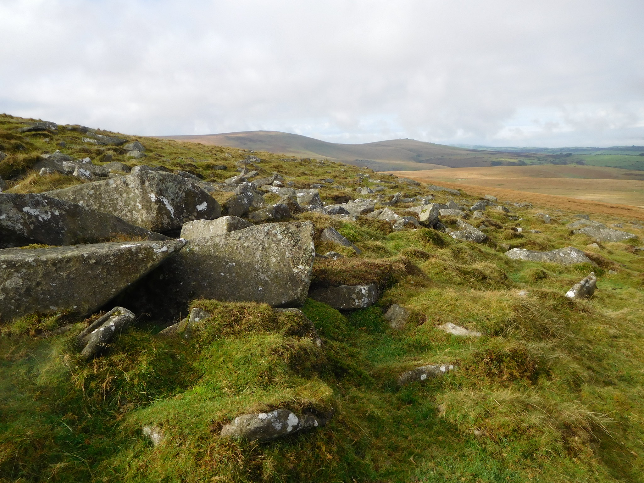
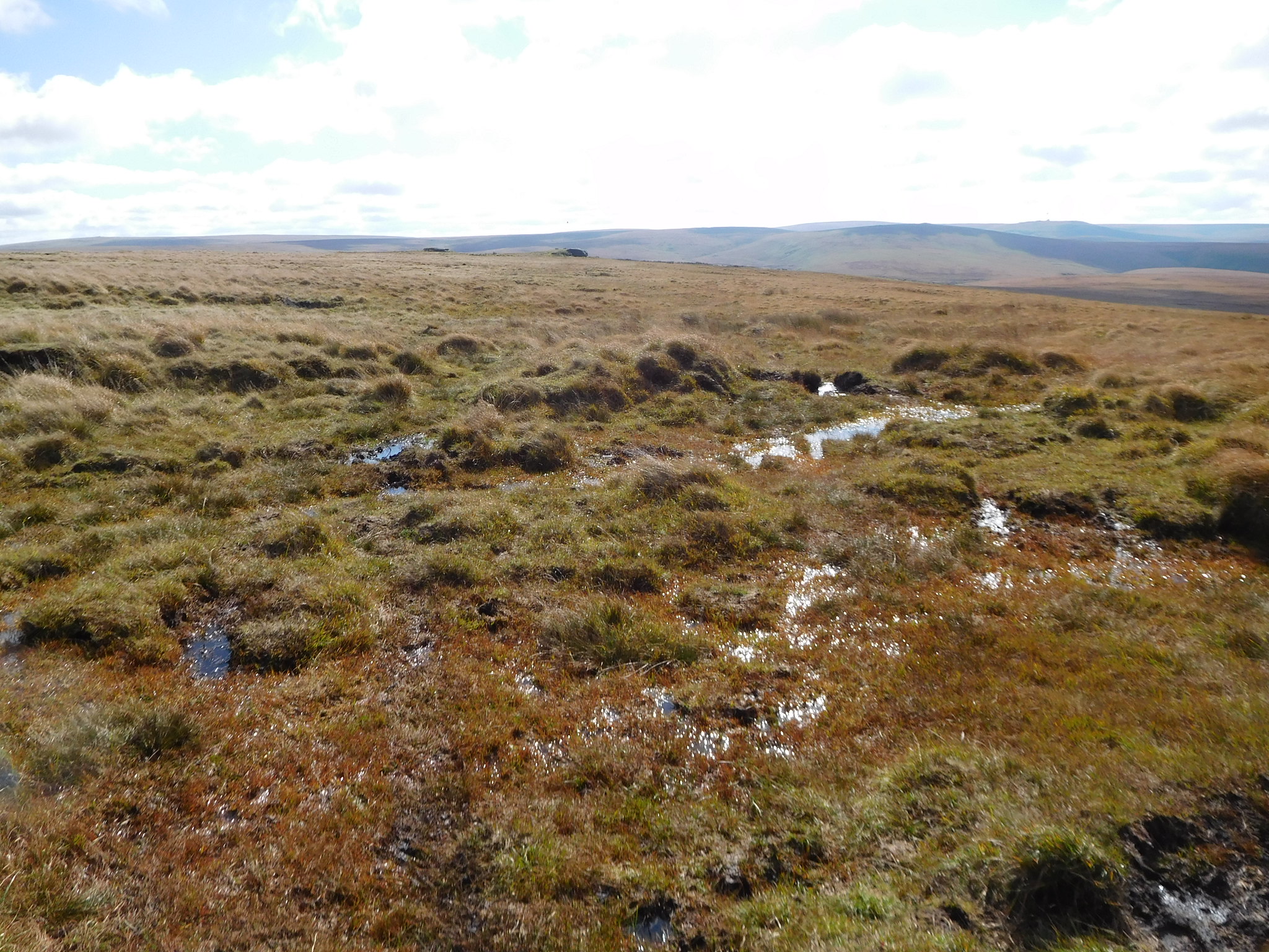
Now Dinger Tor is on the 550 metre contour with wet ground below that for quite a way to the west so as we were going for Black Tor next we endeavoured to keep at the same altitude for a while and then reducing height as the ground would allow. This plan worked out alright for a while but as we were now on pathless ground apart from the odd sheep trod and the ground consists of large clumps of long grass hiding holes, some wet and some dry, and it was with some bad luck and consternation that Jim went up to his left fetlock in a beautifully black and sticky one of them. It wasn't until I heard the stream of Lancastrian expletives exploding into the otherwise quiet surroundings that I realised what had happened as he was walking behind me hoping that I would step into one and marking the spot so that he could avoid it.
Of course the camera was out in a flash which didn't go down well with Jim as I politely asked him to re-enact the scene of actually stepping into the hole.
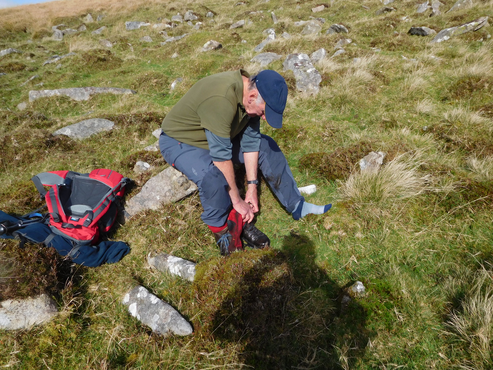 Jim stepped in a bog
 As I always carry spare socks for such an occasion I thought it only right to offer him one and through much grumbling and mumbling, moaning and cursing he eventually calmed down and changed his sock. He's 80 years young in two weeks time - probably one or less by the time this report is posted - so I suppose he is allowed an outburst or two.
Whilst waiting for the sock change I took a picture of Lints Tor that was not too far away to the south and at one point was going to make it an add on to the walk but as the ground was too rough and wet I had to consider Jim, the loss and regaining of height plus the extra walking that, to be fair at ½ mile wasn't all that much more anyway, but across this rough ground it would probably feel like 2 miles.
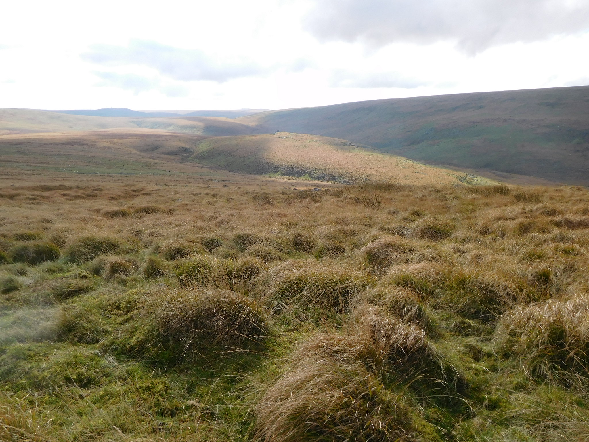 A view across to Lints Tor and Kneeset Nose
 Sock changed and feet dry once again we continued across the side of the fell passing over a couple of rocky areas on our way to Black Tor. For some reason Jim had lost height and moved down the fellside quite a way and it was whilst keeping my eye on him that I took my turn at stepping into soft ground into which I went in with both legs up to the knees. Seeing as how I had done the Good Samaritan thing and given Jim my socks I now had to walk with both boots full of water but as it was warm I was nearly dry by the time we got back to Wetherspoons.
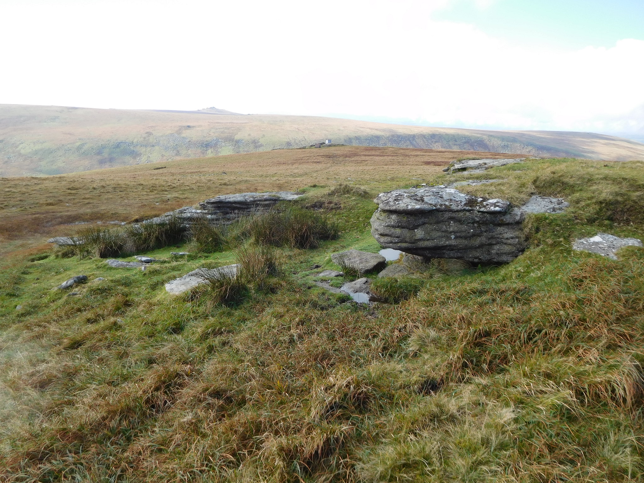
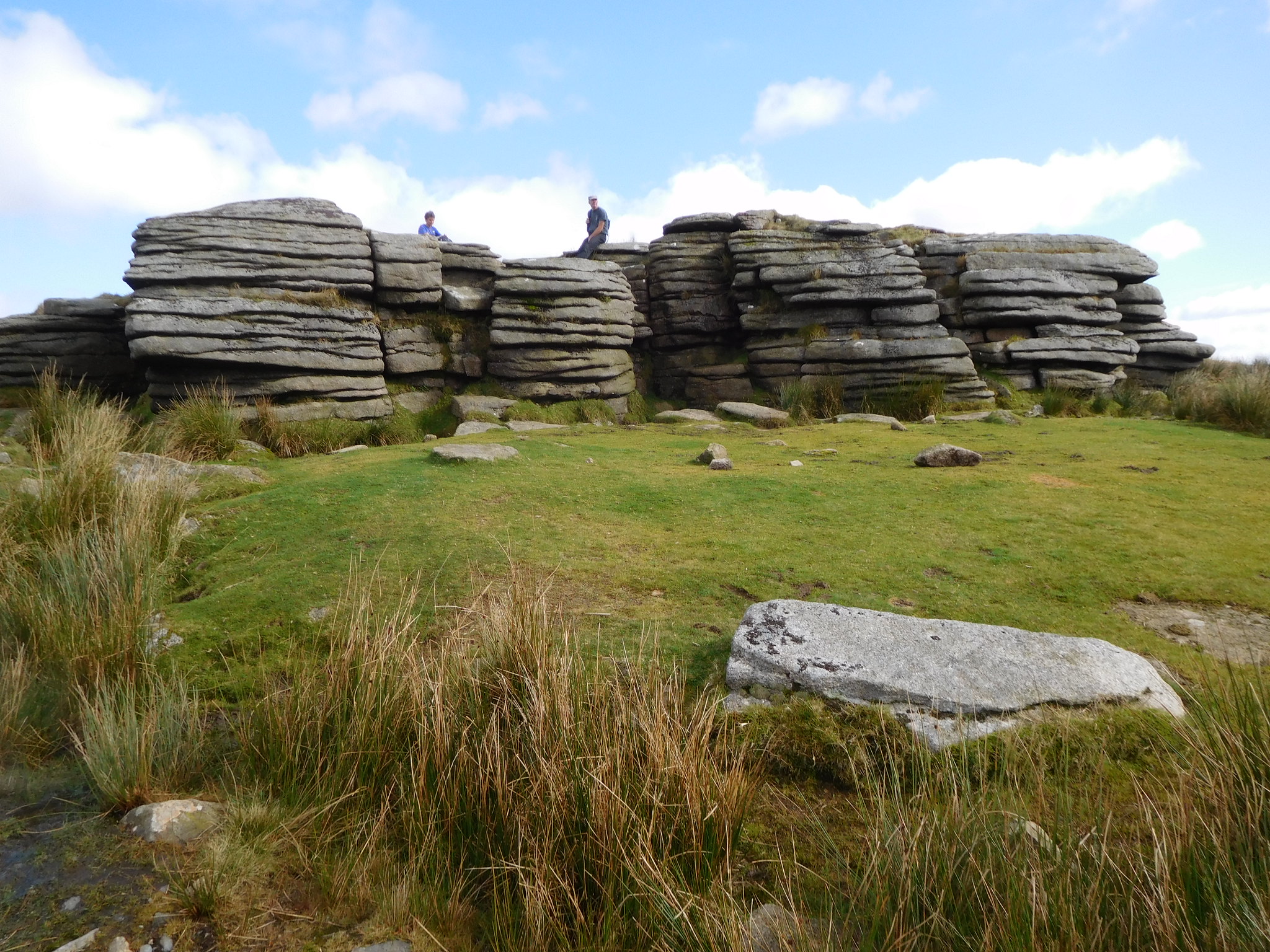
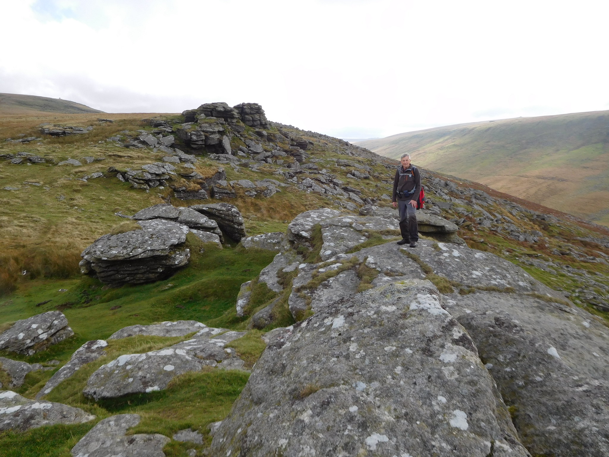
Black Tor was getting nearer by the minute and the first of the large, cracked and shattered crags was now plain to see…
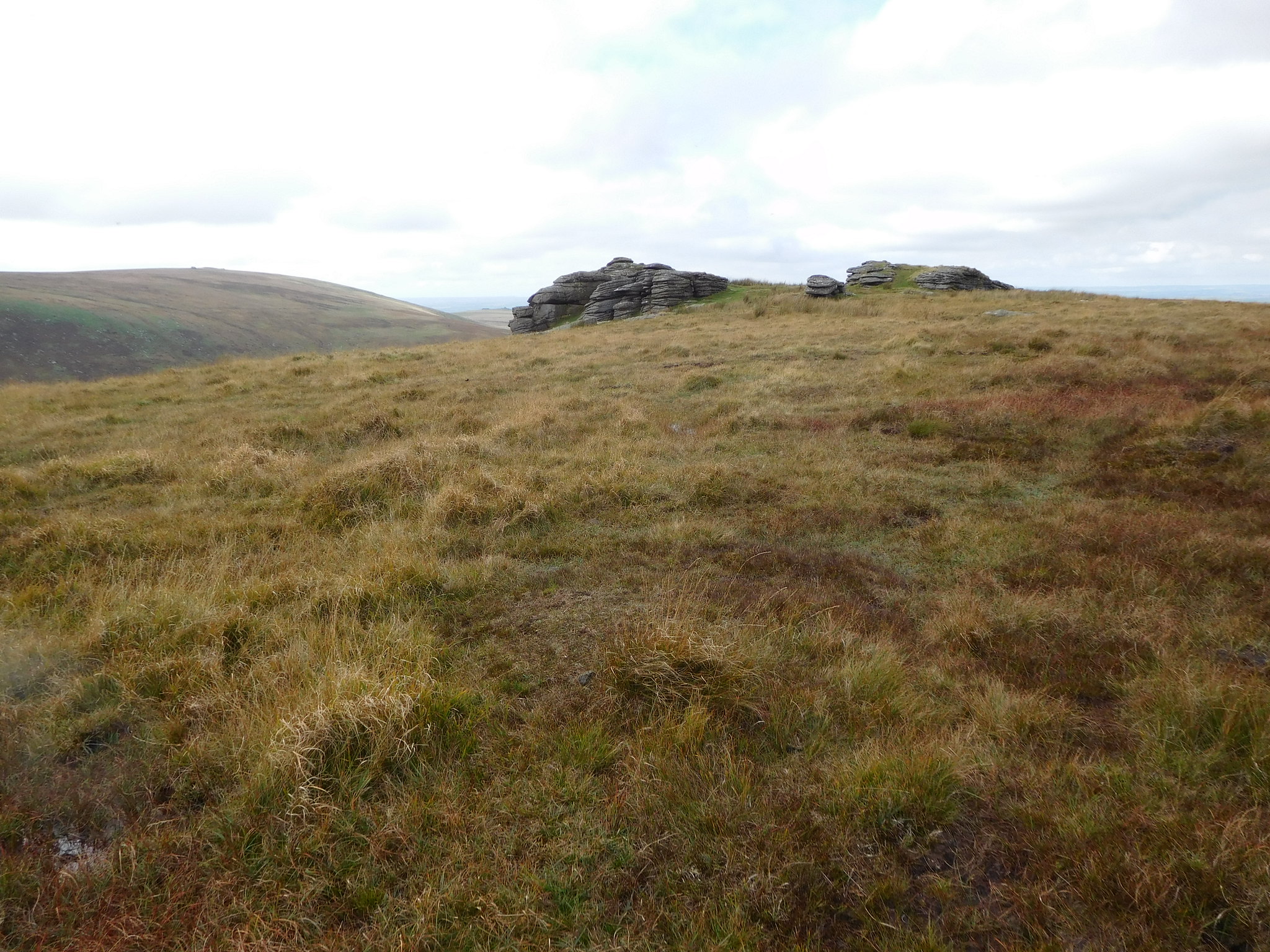 Black Tor
 as we approached it along a wet and narrow trod through the grass. From this first crag we could see the second set of rocks and also a good view into the small valley through which runs the West Okement River that is the main feeder into Meldon Reservoir. It was here that we took a short break before moving on to the next craggy outcrop.
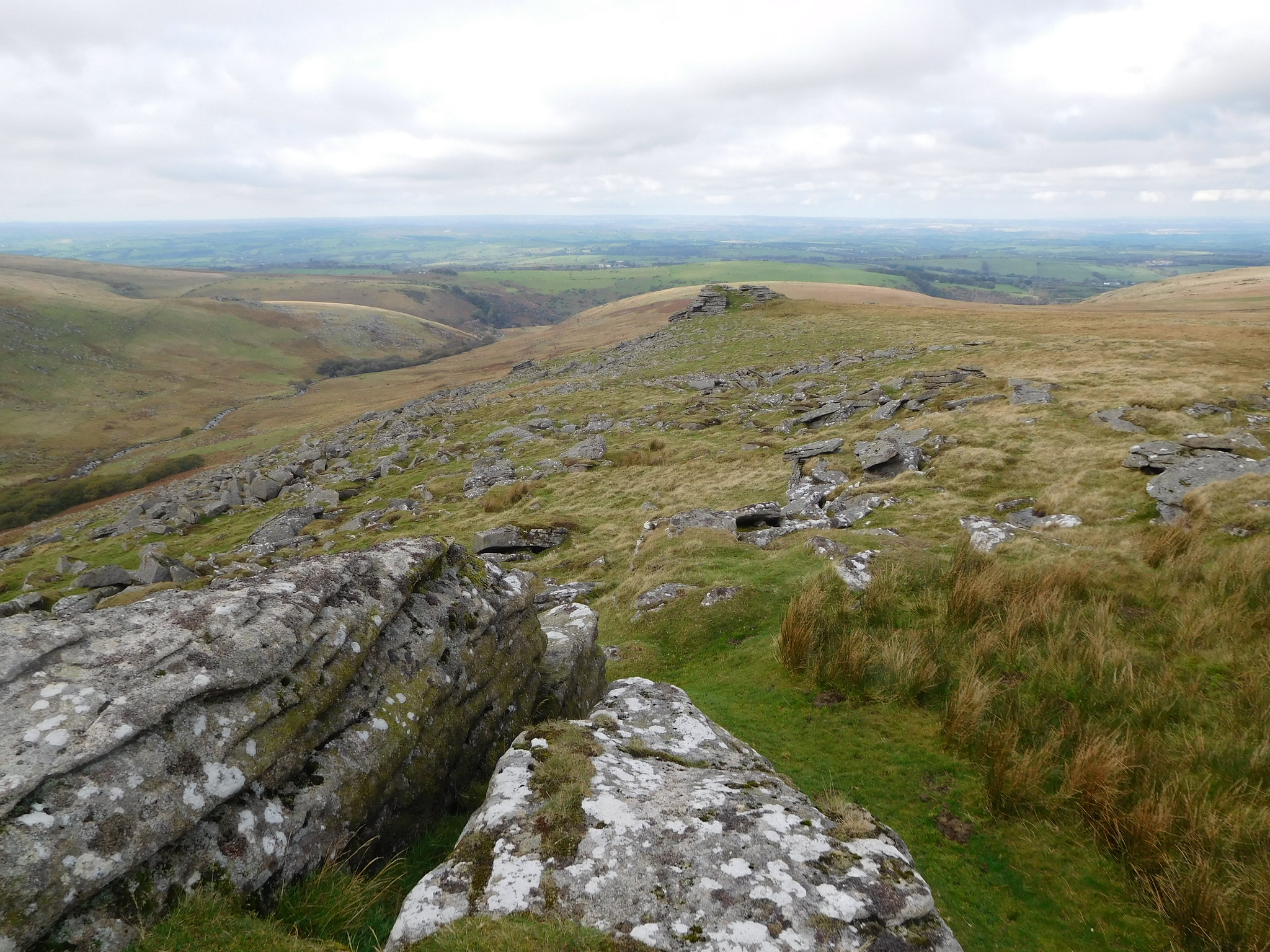 The view northwest from Black Tor
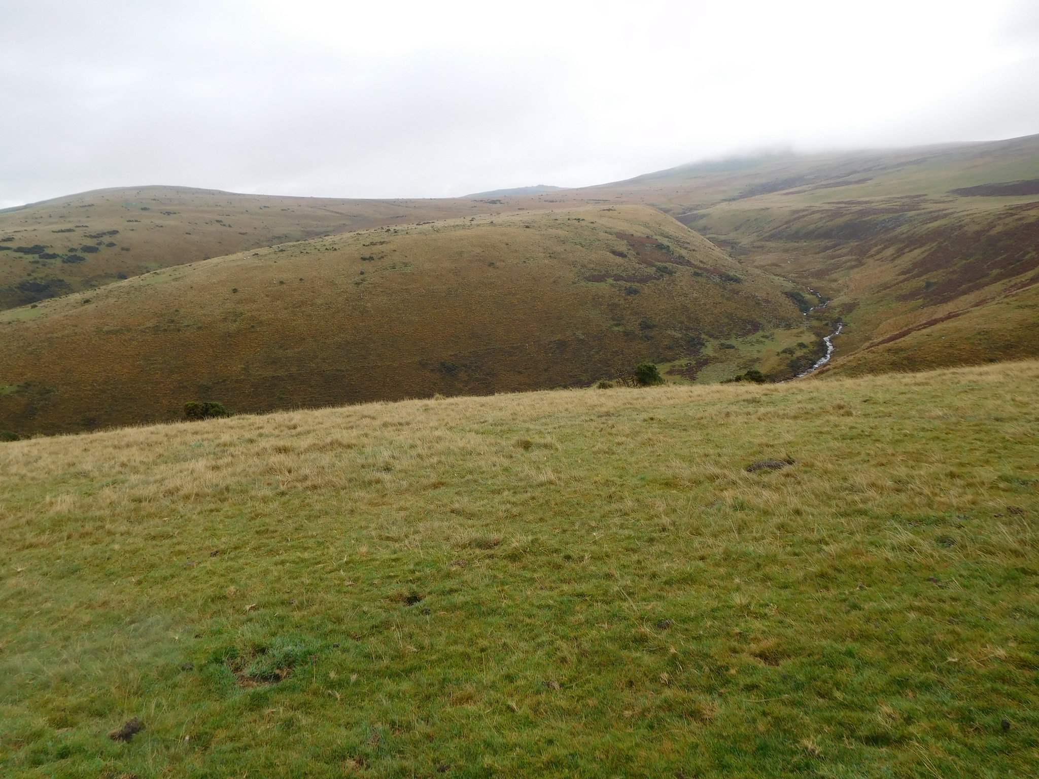
 From the second set of crags we could now see a third large mass of grey rock, once again all tumbled and split into layers and from here there was a good view of Longstone Hill and Homerton Hill with just a hint of the reservoir peeping up in the col between them.
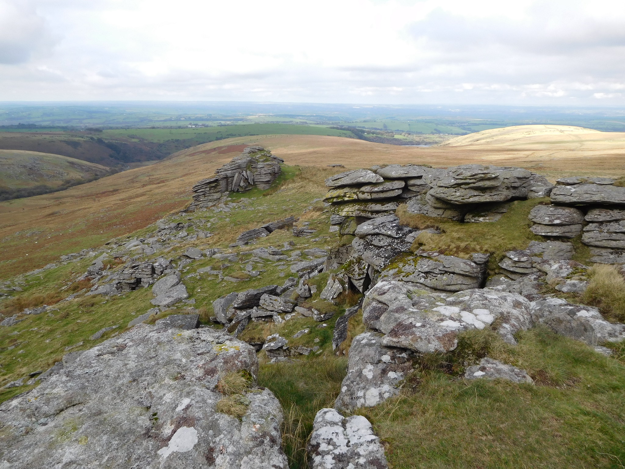 View from Black Tor
 It was here that Jim insisted on taking a picture of me and my peat bog blackened legs.
 Me at Black Tor
 Well it was nearly all over with just the walk back to the reservoir to do and for this we picked up a path that led us to just south of west that meanders through mixed ground of grass, boggy bits, and rocks but we were soon down by the river from where the path gets quite a bit rougher as it makes a way through and over a wet and rocky area as it followed the rivers course northwest all the way to the reservoir. The river is overlooked from its west side by Shelstone Tor whose slopes are covered in grey rock and scattered juniper trees with some small areas of dying bracken dotted about. I was reading that bracken has only recently acquired a roothold on Dartmoor so it can only be hoped that they begin to contain and eradicate it as soon as possible before the fells around there end up like a lot of other places, inundated with it.
From the narrow path we arrived at a good track that would take us around Vellake Corner and then back onto a decent path along the south side of the dam, then around the small tributary where we used a footbridge to cross the dam feeder that runs through the small fold between Homerton Hill and Longstone Hill. From there it was just a short walk across the green fell to pick up our outward path from this morning to once again cross the reservoir wall from where the youths from the days canoeing were just about packing up.
Another good day out with Jim with nothing seeming to phase or worry him, he just keeps going, although the incident with the wet foot would have been better not happening but once dry he was soon in his stride again. The paths have been very wet for most of the way and the pathless walk from Dinger Tor to Black Tor proved a bit challenging underfoot with the long grassed hummocks hiding all that lay between them. It has been very warm even when the cloud was down and once that lifted it has been an excellent walking day with long views across Dartmoor with its seemingly smooth and large brown coloured fells rolling into the distance dappled with sun and cloud shadows. An easy walk along easy slopes although as mentioned earlier, very wet underfoot with the hardest stretch walking from Dinger Tor to Black Tor. An early dart into Wetherspoons before a shower and then back for more made for a nice ending to a very productive day on the Dartmoor fells.
