free to be able to rate and comment on reports (as well as access 1:25000 mapping).
There are many ways of climbing to the summit of Dollywagon Pike; the most popular I would think is by walking up one of the four main paths that includes Striding Edge and passing over the summit of Helvellyn from where the ridge path leads over Nethermost Pike and High Crag before arriving at Dollywagon Pike. Then there is the way up the east side from the car park at Wythburn or from Dunmail Raise alongside Raise Beck to reach Grisedale Tarn from where the summit can be accessed by either climbing up the fell runners path alongside the wall that meets the alternative zigzag that begins near the east end of the tarn.
Having done those routes a number of times I was looking for another way to go and I had been looking at the route that Wainwright suggests, one that starts its journey from Ruthwaite Lodge - the Climbing Hut - and makes its way up the fellside passing north of Spout Crag and then up the northeast facing ridge that is known as The Tongue. Wainwright describes it as
'most interesting and exhilarating' but fails to mention that it is also a very steep climb of almost 1,600 feet - 480 metres - over mostly pathless ground. Maybe
'most interesting and exhilarating' is his way of describing a hard climb up a fellside.
The sun was shining but despite that the temperature was a mere 1°c as I pulled into my parking place for the day.
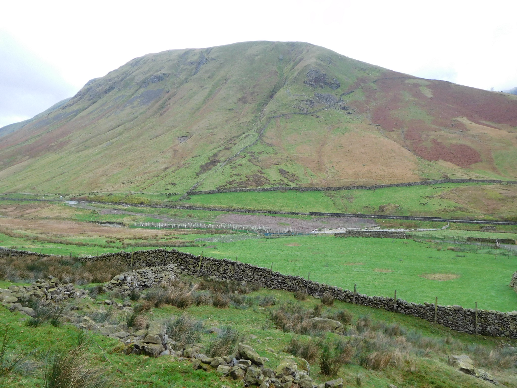
I had decided to start this walk from the lay-by at NY329 111 and old RAC box that sits just north of the house on Dunmail Raise at the western foot of Seat Sandal, make my way north across the fell and pick up the path that climbs alongside Raise Beck, that is what I was going to do. But, as I started to near the beck I had a reckless moment and decided to take the path that starts to climb up the short but steep western ridge of Seat Sandal, a climb that is initially fairly steep and harder than the beck path but begins to ease off at around the 500 metre contour. This path is easy enough to see but is fairly narrow in parts especially where it passes through various short areas of rock and boulders and to give me some encouragement whilst monitoring my progress on the way up I set my sights on a large pointed boulder that was sat way above me and was my chosen place to have my first rest on the way up although I did pause briefly soon after setting off to take a picture of Steel Fell bathed in sunlight.
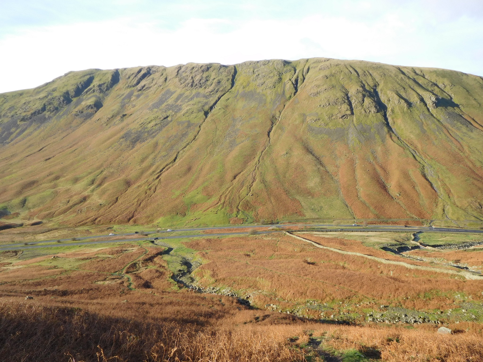 Steel Fell and Ash Crags above Dunmail Raise
 Despite the low temperature it was warm work making my way up the fellside but I soon arrived at the designated boulder stop where from this height I had a decent view of the fells and Thirlmere to the north…
 Thirlmere from the 455 metre contour
 whilst looking to the south…
 A hazy view to the south with Helm Crag etc
and after my short break and another 50 metres of height gain row after row of mountain ridges came into view…
 Steel Fell with the western fells behind
 and more of the east face of Steel Fell with Ullscarf and High Raise sitting just beyond.
 Steel Fell with Ullscarf and High Raise behind
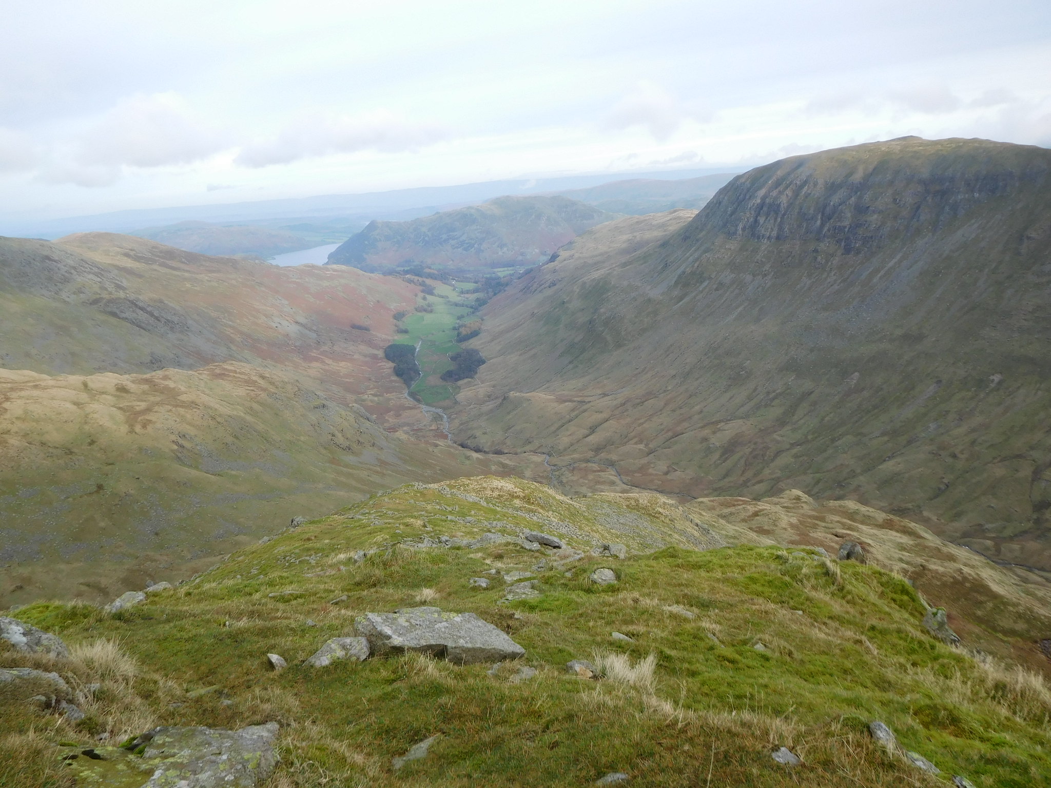
 From this photo vantage point the ground began to ease off somewhat and the path runs straight through grass but despite the lessening steepness it was still very warm going and a layer had to be shed. At about 560 metres I gave up the opportunity to reach the summit of Seat Sandal as I have been there many times before and now wanted to conserve my energy for the climb up The Tongue and worked out that I must be about on a level with Grisedale Tarn.
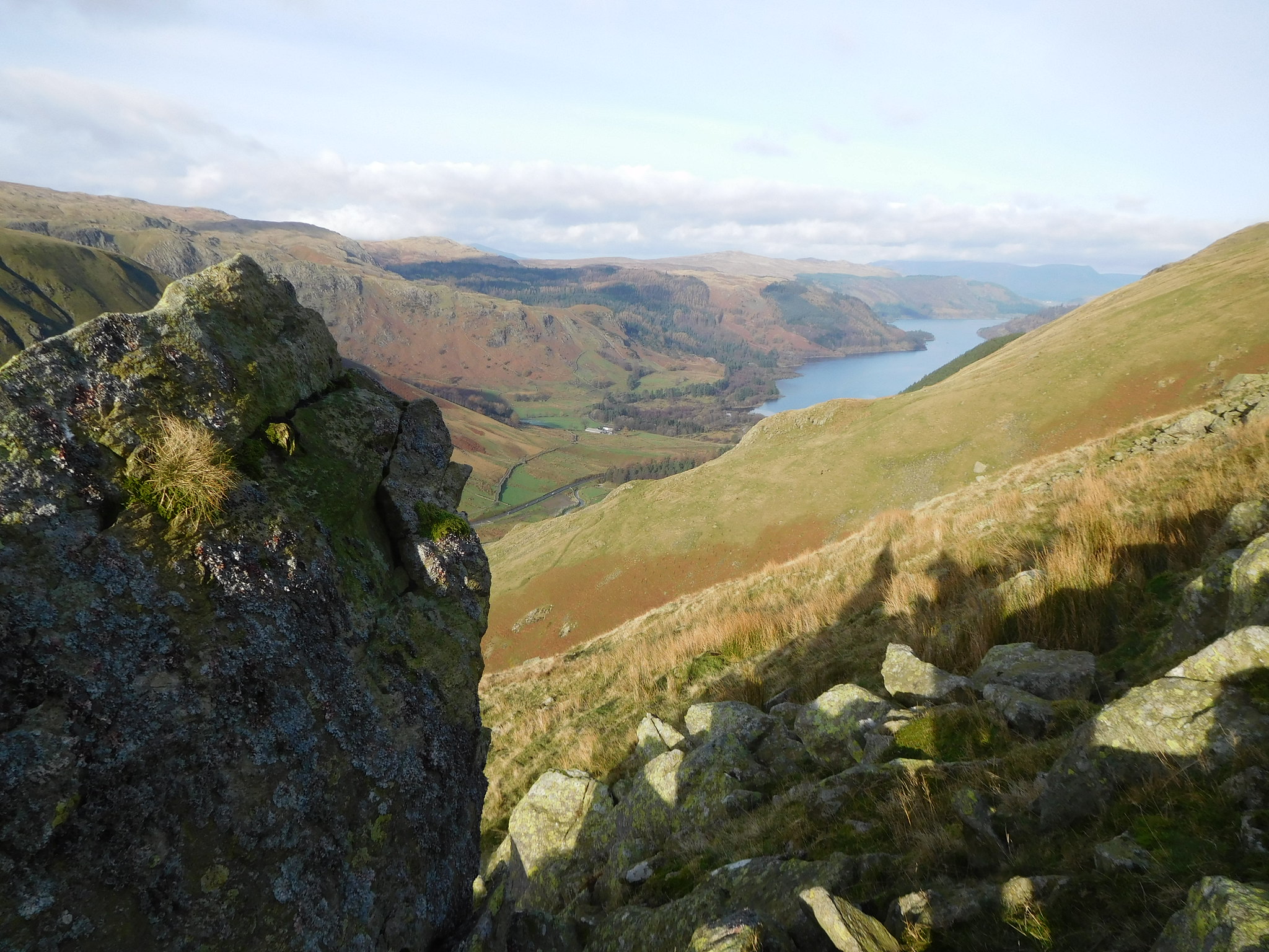
I left my eastward climb and now turned to the northeast towards the tarn walking easily over short grass until I arrived 15 minutes later at the top of Raise Beck and Grisedale Tarn…
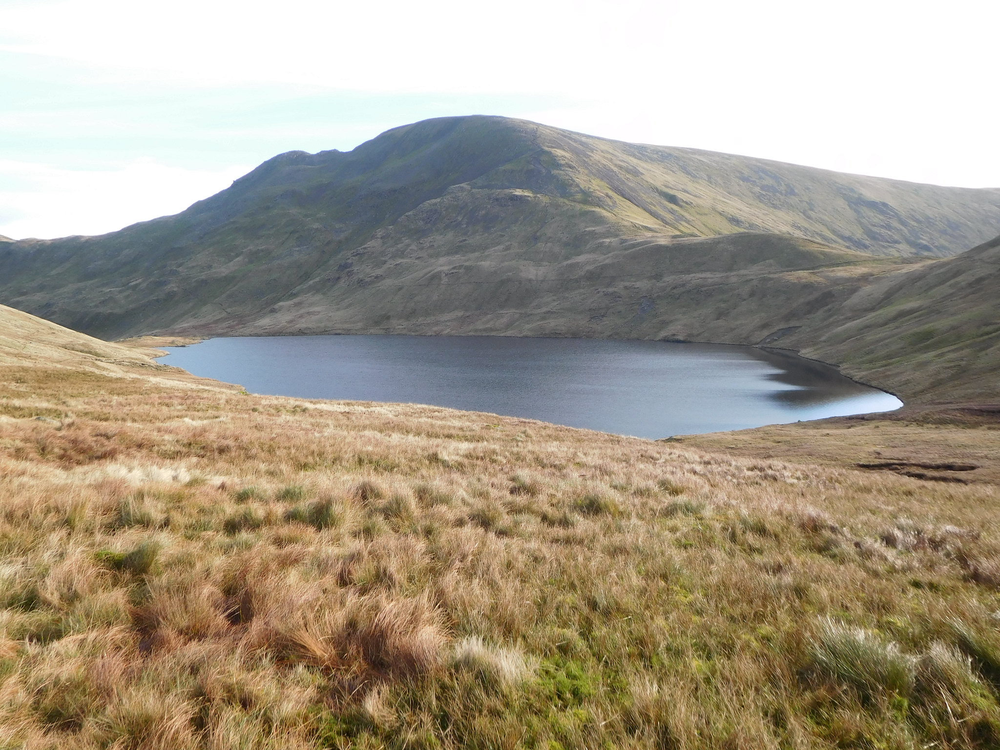 Fairfield behind Grisedale Tarn
from where I would now make my way east alongside the tarn and start the long drop off into Grisedale and Ruthwaite Lodge.
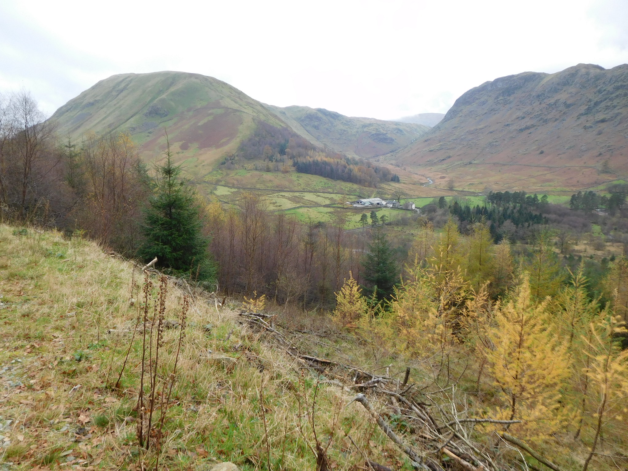
The sun was still shining and in spite of the low temperature it was warm walking along the valley where I met a few couples walking in the opposite direction to myself and who were willing to stop and pass the time of day, especially as they were going uphill. Somewhere down by Grisedale Beck - about the Tarn Crag area - there were three unattended dogs - two beagles and one golden Labrador - running loose and barking at anyone that passed by and just why they were there by themselves begs an answer to how on earth they managed to make their way into Grisedale. There was no hunt going on and no sign of anyone else apart from people walking the path on their way to the tarn and beyond.
With all the stopping and chatting to other walkers it took me nearly an hour to reach Ruthwaite Lodge…
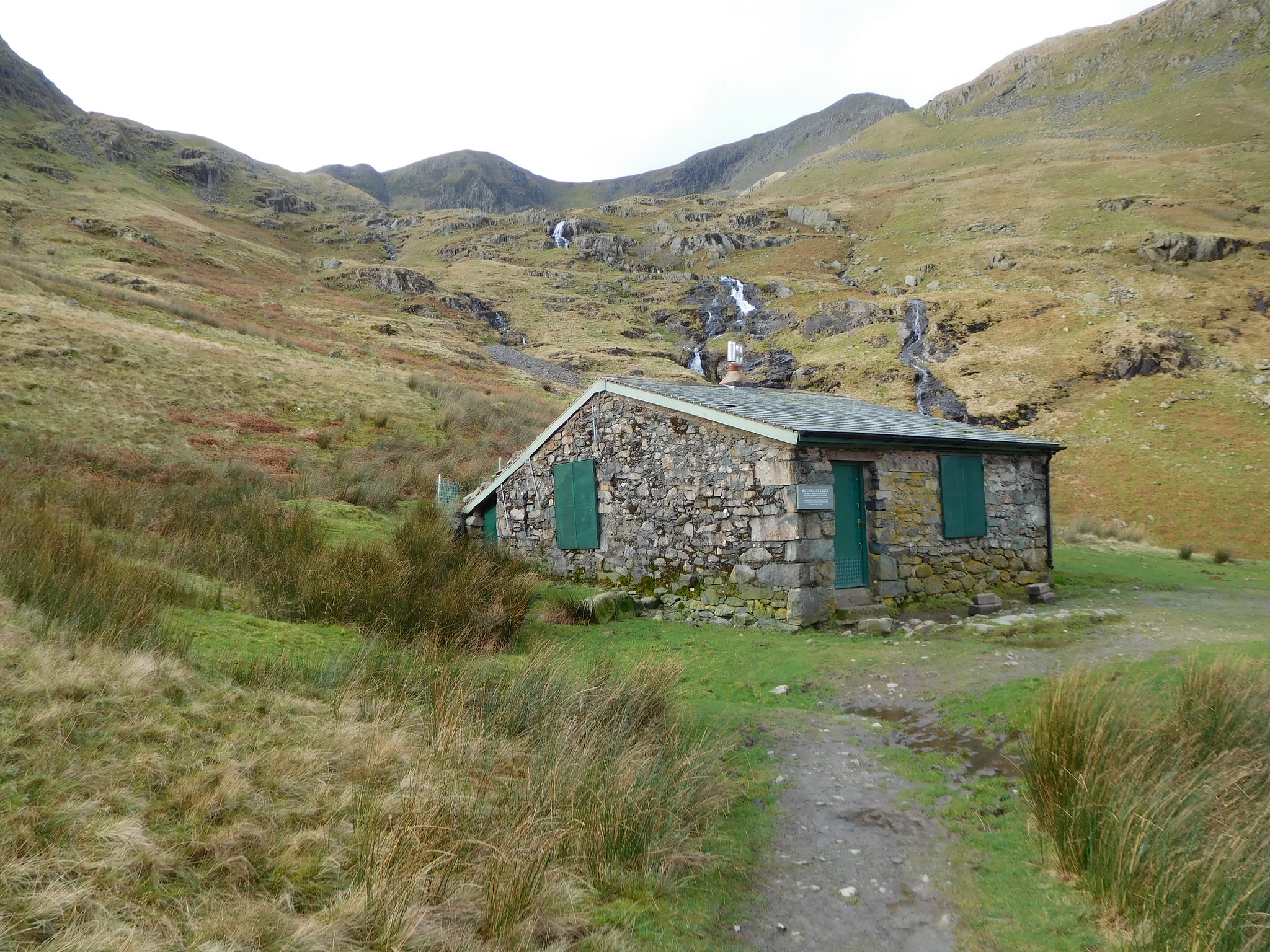 Ruthwaite Lodge Climbing Hut
 a disgustingly long time really but a welcome place to arrive at as this was where I had decided to stop, rest, and fuel up before starting on the long climb up to the summit of Dollywagon Pike via The Tongue route.
Whilst I was enjoying my break another couple arrived and as I was using the doorstep for a seat they sat down on the short wooden baulks of timber from where they passed the time of day with me before we parted company and they continued their walk up to Grisedale Tarn whilst I prepared myself for the long climb in hand.
There are the very faint makings of a thin path behind the Lodge and it does take a bit of spotting but once found it makes its way steadily up the ever steepening grassy fell to totally disappear before many metres have been climbed. The unnamed watercourse to my right was flowing quite strongly due to the recent rain and actually looked better than it does in the photo.
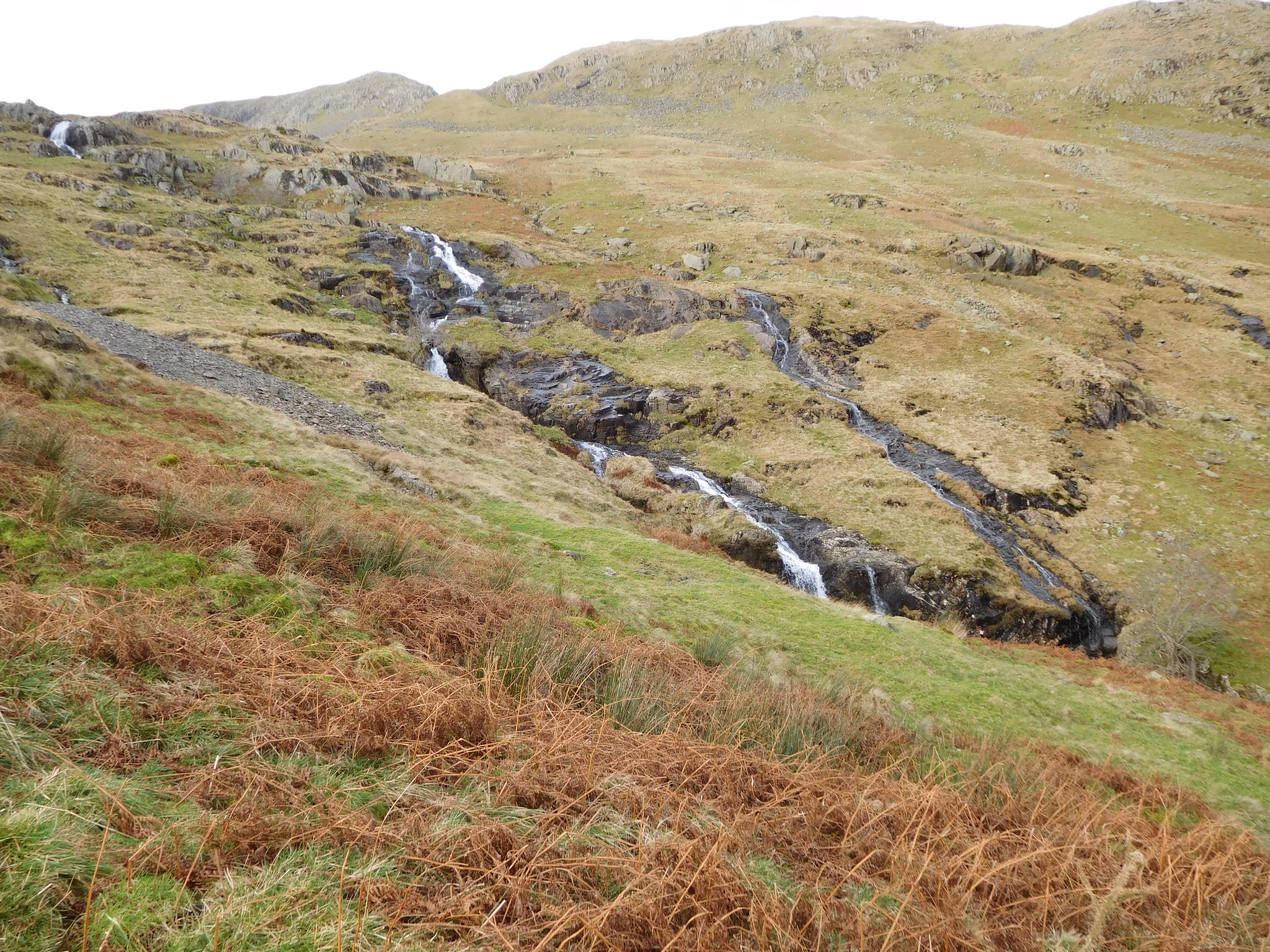 Unnamed beck running out of Ruthwaite Cove
 Upon reaching the side of Spout Crag I took a look back along Grisedale and was met not only by a great view along it…
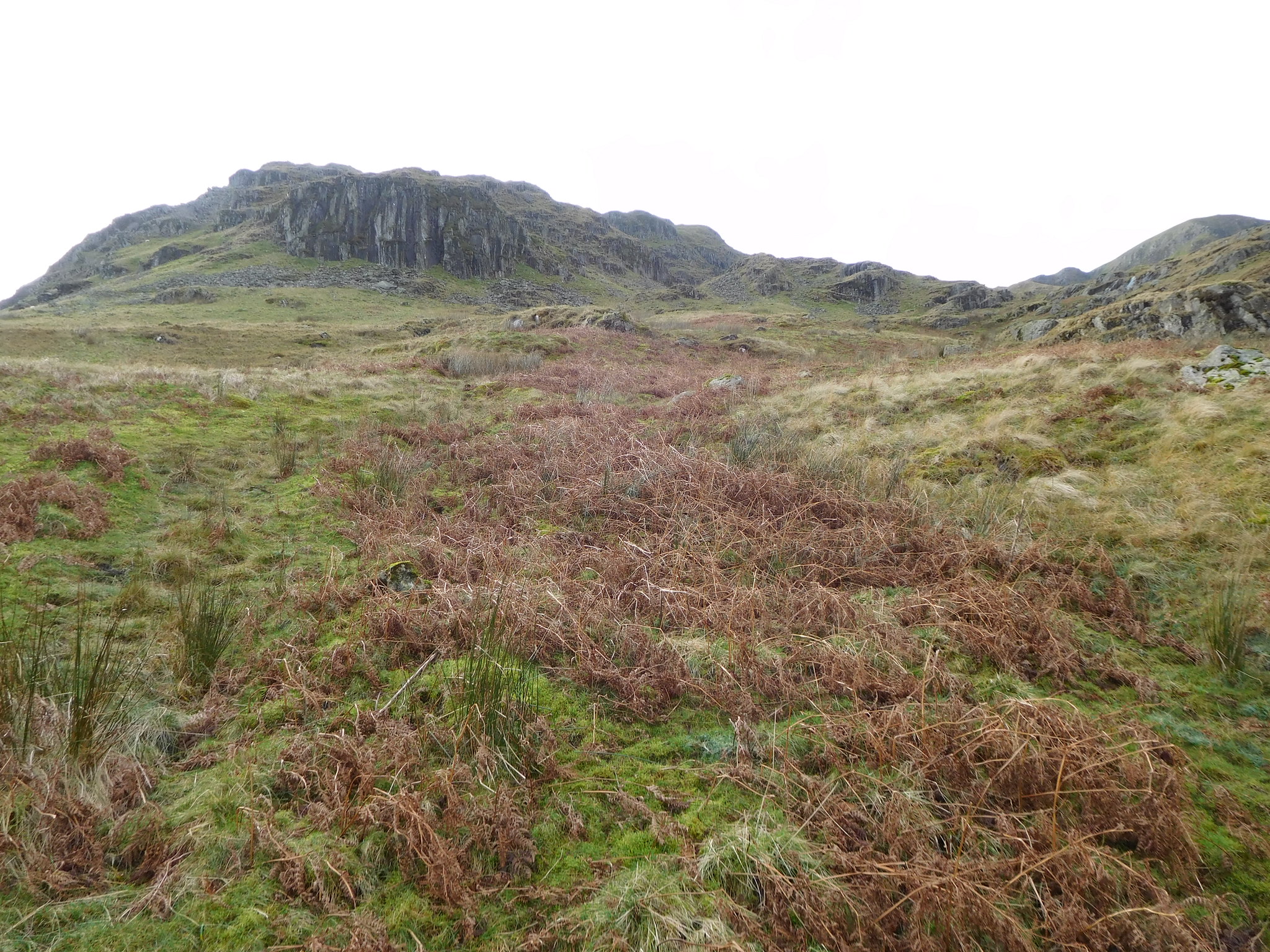 Spout Crag
 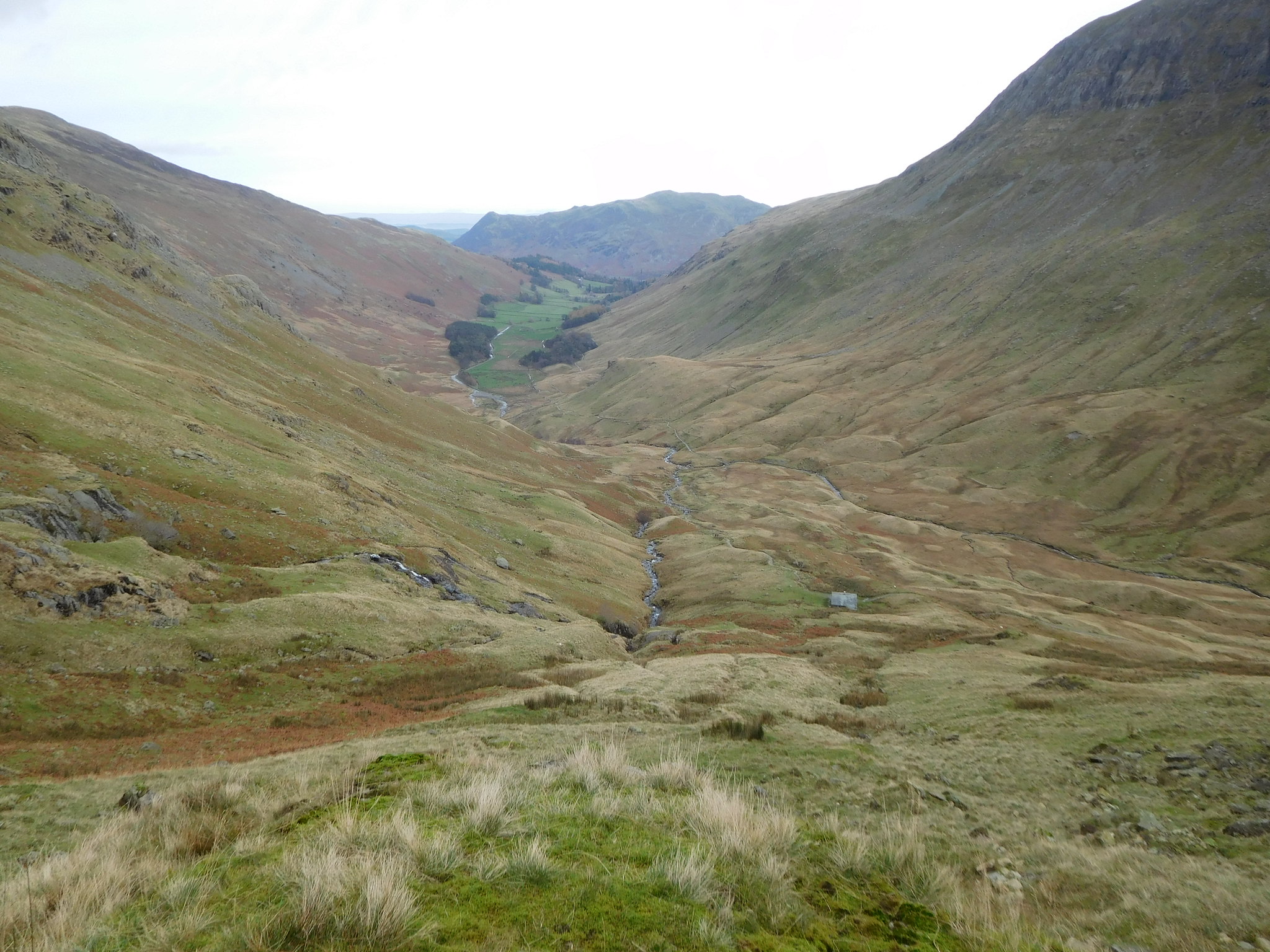 Grisedale and Place Fell from Spout Crag
 but also of a couple of walkers way down on the path looking up and thinking that me and the two fell runners and their sheep dog that were now closing in on me must be mental for taking such a route up a fellside.
As Spout Crag was neared I was put in a state of indecision as to which way to go. There is a good grassy rake/shelf that runs behind and above Spout Crag and looks a good way to go and looking at the map the ring contours above the crag didn't look too bad. As the two fell runners - being led by the dog - were by now quite close to me I thought that I might ask their advice on the best way forward.
The two runners stopped for a chat and told me that they were from Kendal and after asking them if they had done this route before they replied to the affirmative and that it got a lot steeper, it was a safe route, just follow your nose and that a path would appear somewhere near the top of Dollywagon. I decided to follow in their wake and apart from the getting steeper bit all good news then. My last question to them was 'how long does it take you to get up here then?' Twenty minutes was the reply, but 10 minutes later they were still not far ahead of me and climbing up a long grassy but rock strewn rake on all fours. I always carry walking poles and don't like using them, but that was when I took my poles in hand and commenced hauling myself up this more than steep gully.
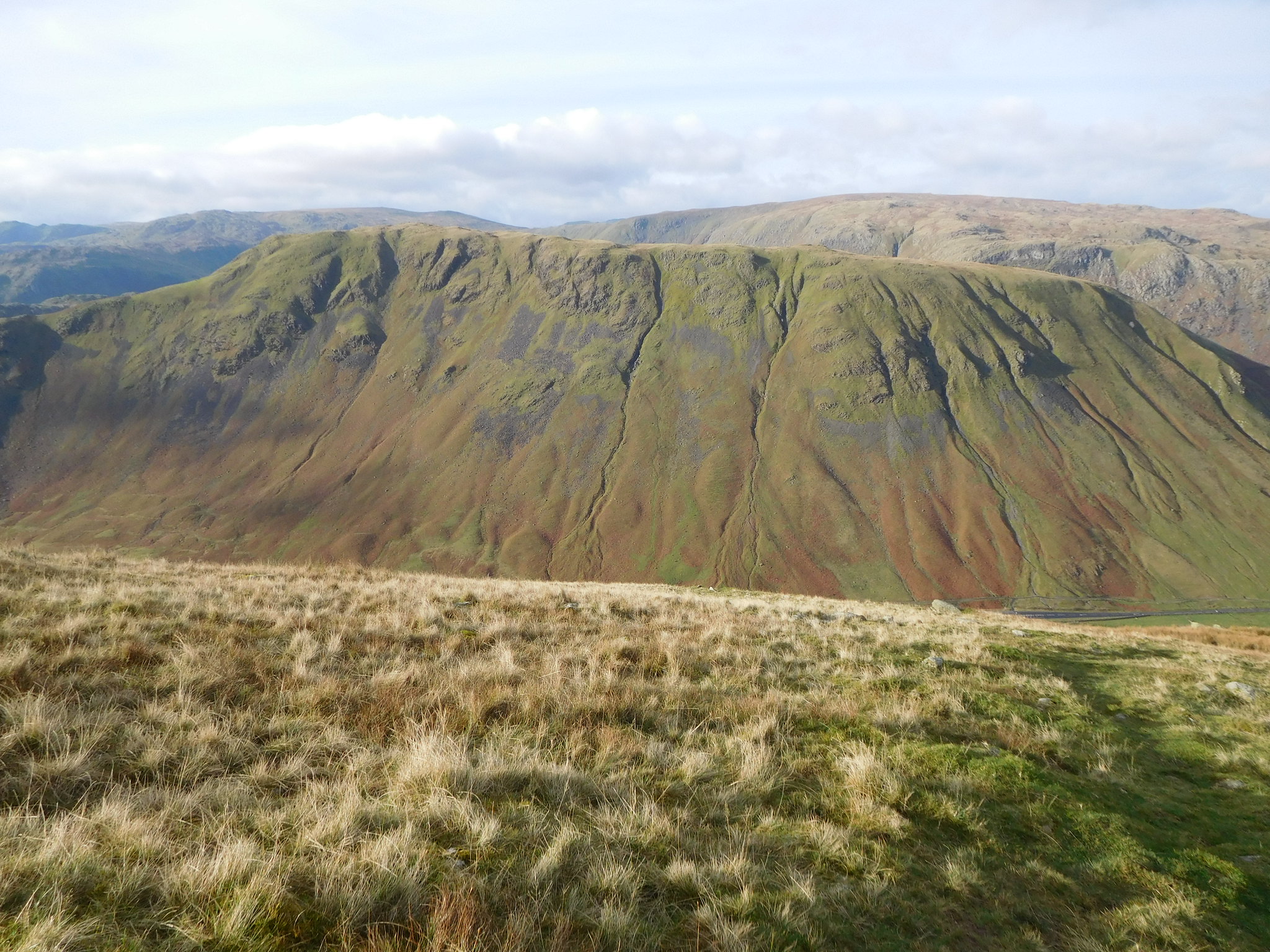
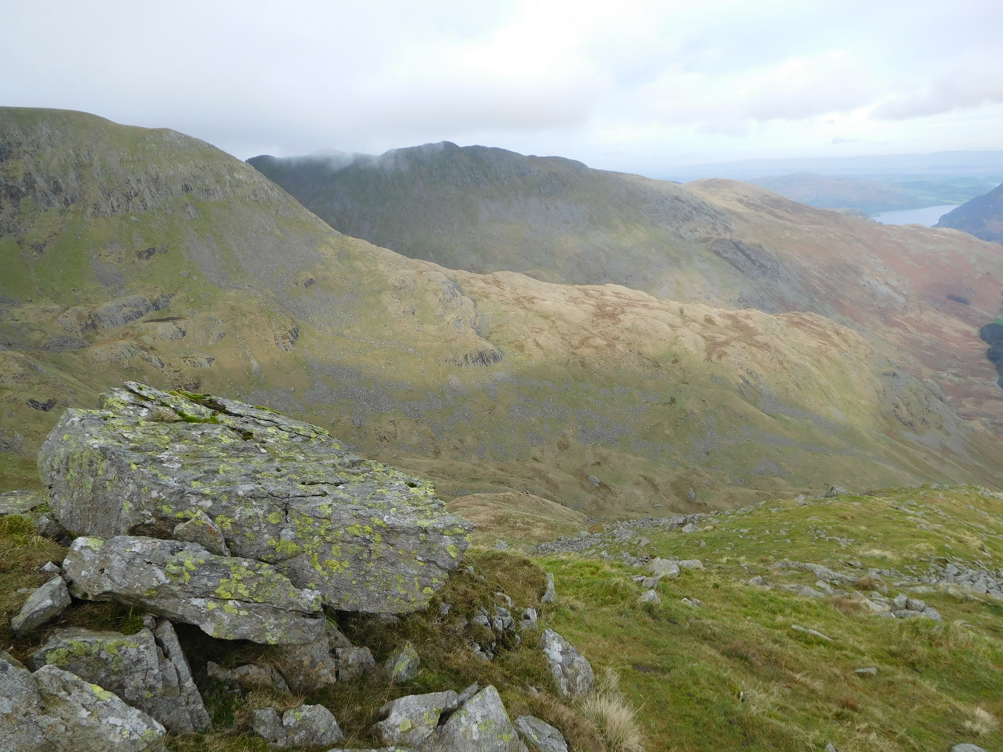
As I climbed the sun made a run for it and the clouds started dropping over the fell tops and looking across Ruthwaite Cove, High Crag and Nethermost Pike was shrouded in grey.
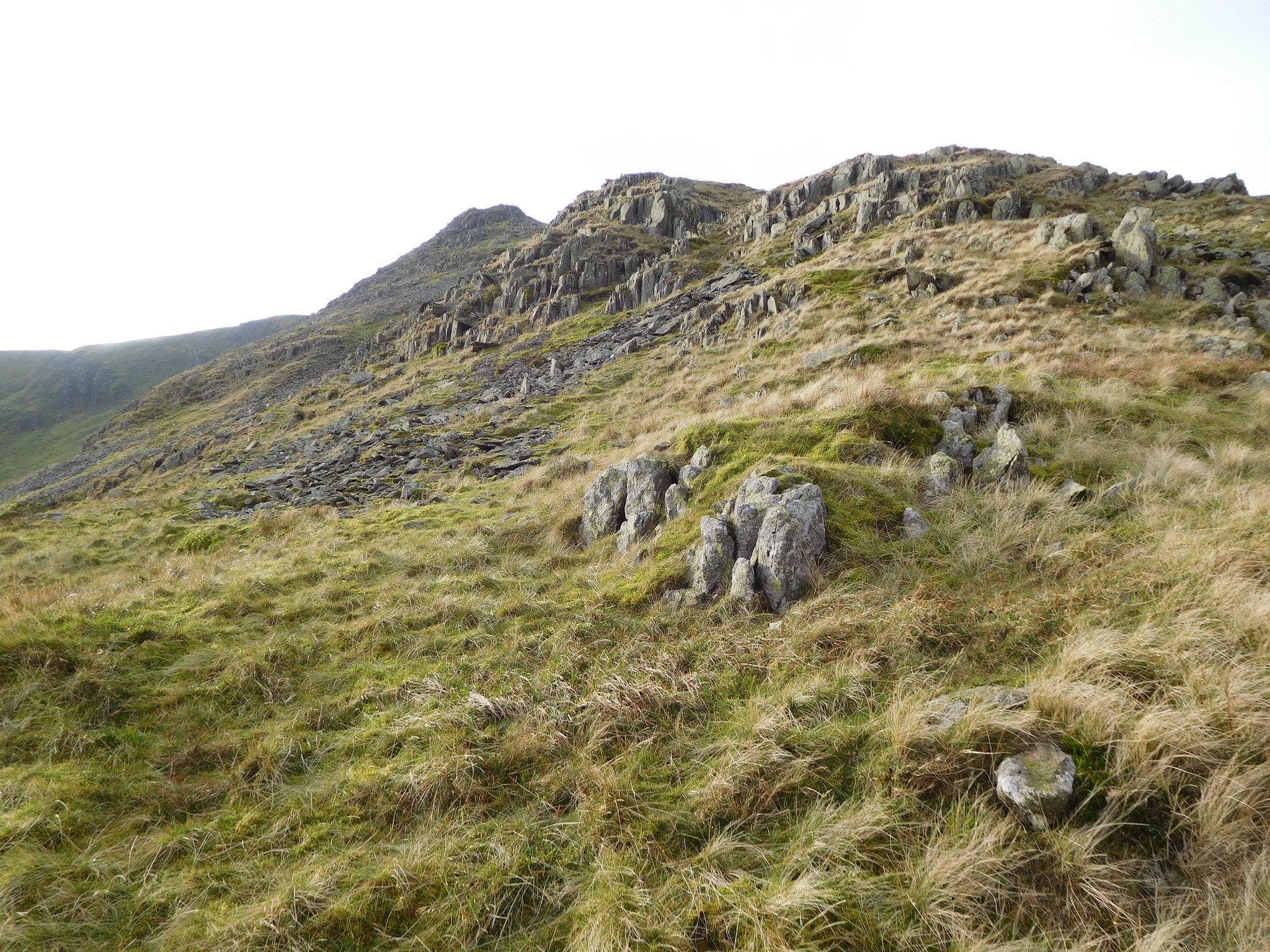
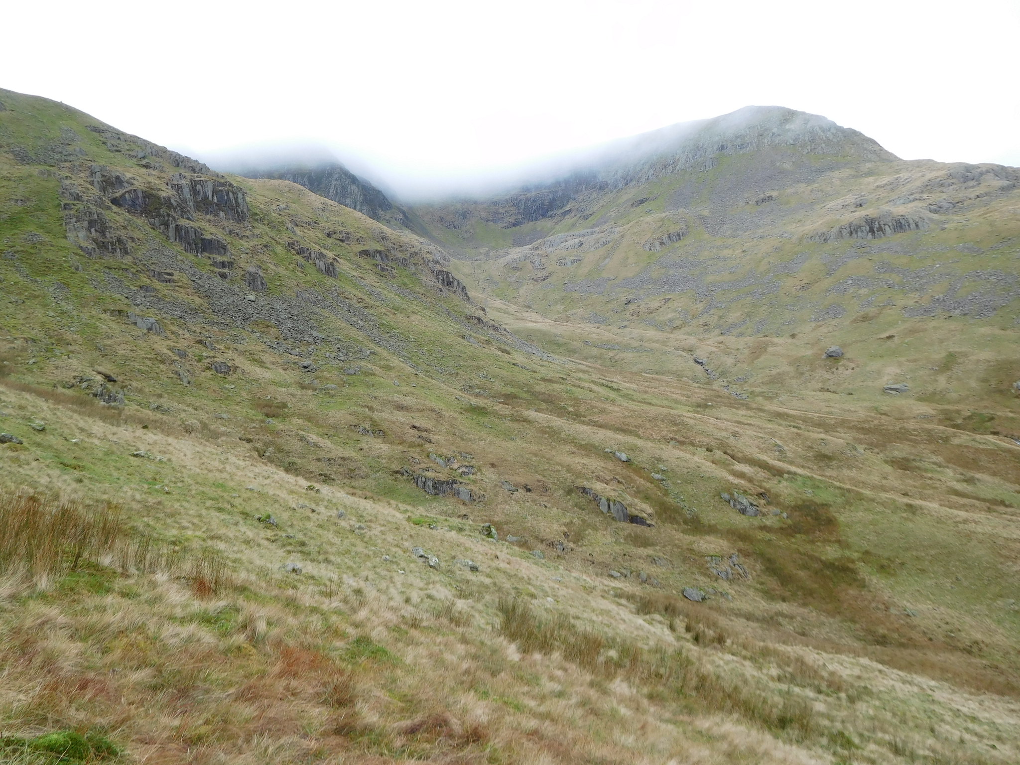 High Crag and Nethermost Pike overlooking Ruthwaite Cove
The grassy rake was well scattered with wet slippery rocks and trying to pick a decent way up amongst them was a mission in itself as the grass either side of the centre was soft and wet due to the trickles of water running down from some hidden spring somewhere above me. Getting up this was one of my harder climbs up a fell and the photo once again doesn't do justice to just how steep a climb it was. I was now nearly at the start of the climb along The Tongue.
 The long grassy rake at the foot of The Tongue
 Due to the nature of the climb it would be another 10 minutes of toil before I reached the actual start of the climb that entails working ever higher over a series of rocky knolls on which there was still no sign of the promised path at a higher level.
 Start of The Tongue
 The low cloud was swirling around now, rising and falling as the wind that had now started had its way with it. After a few minutes I arrived at a fairly level spot between the lower of the rocky knolls where I took a minutes grace to enjoy the views around me.
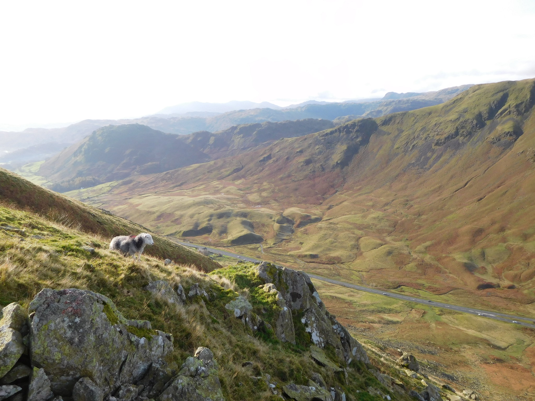
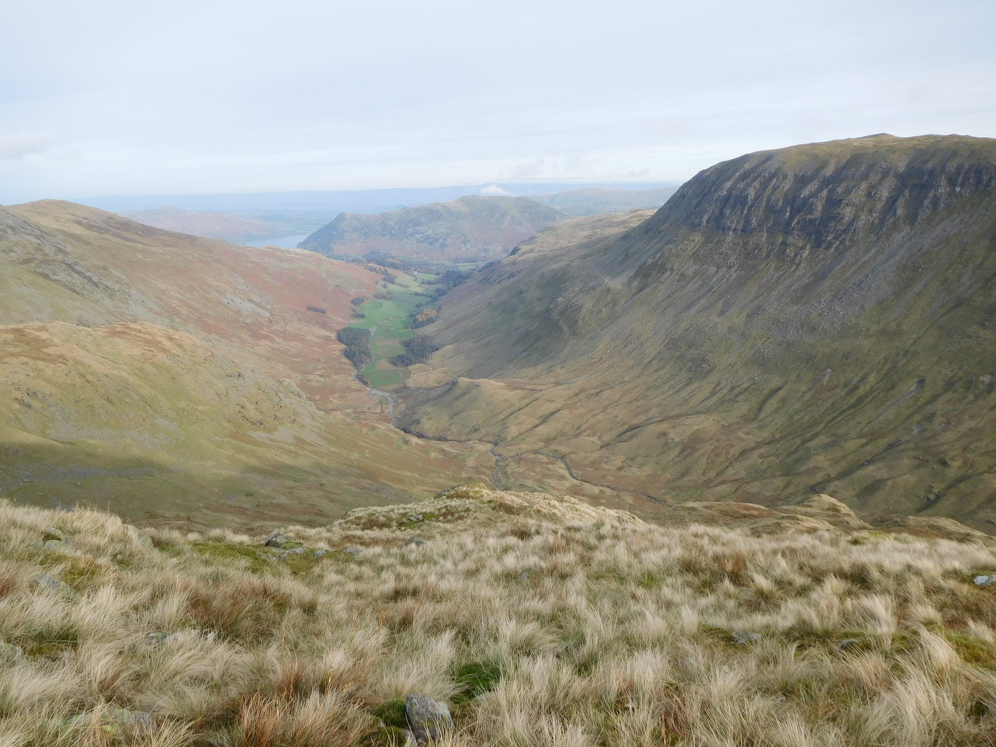 Grisedale from The Tongue
 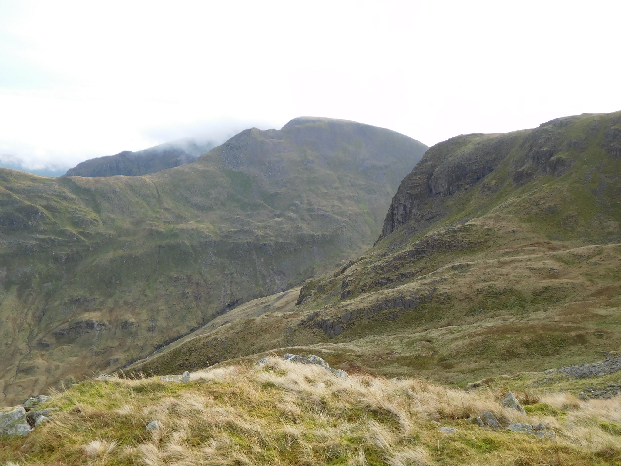 Fairfield - Cofa Pike and Deepdale Hause
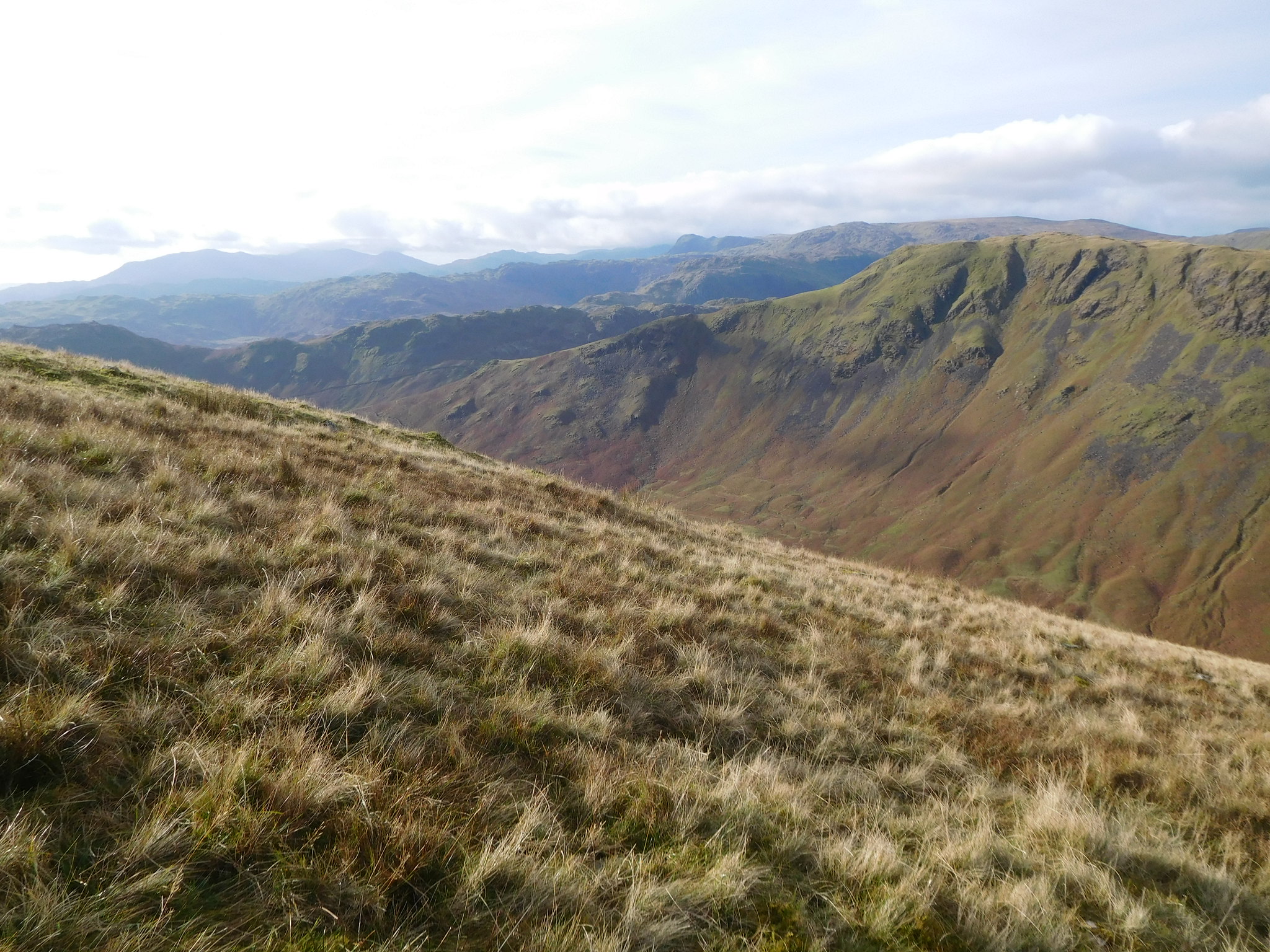
The ground was still steep and pathless as I made my way up by way of grassy rakes and ledges twisting and turning through the crags as required making the ascent as easy as possible. At about the 750 metre mark the ground started to ease off in its initial steepness and I made better progress as there was by now more firm grass to walk on and a last look back into Grisedale revealed some indication of what the climb up The Tongue was like.
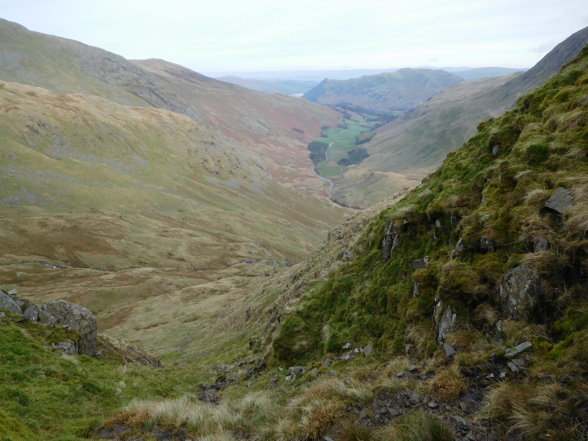
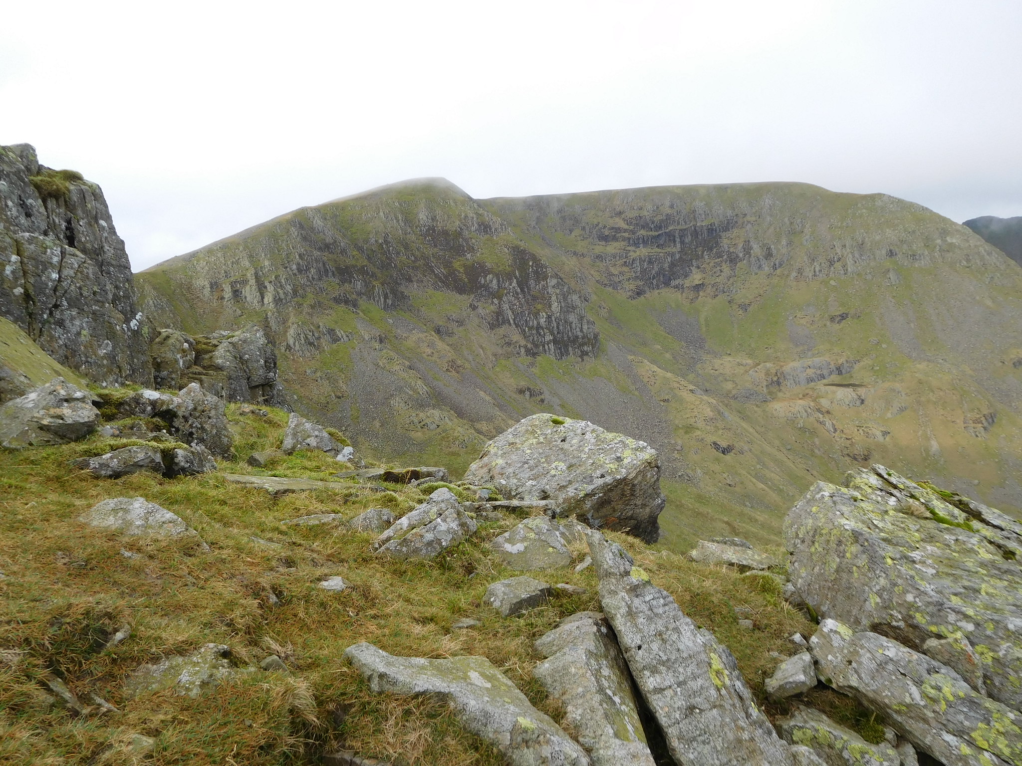
 Looking down The Tongue from just below Dollywagon summit
 The east ridge of Nethermost Pike and Striding Edge were also in view with the cloud still hanging over Striding Edge.
 Nethermost Pike east ridge and Striding Edge
A few metres higher gave me a different view in the same direction.
 High Crag and Nethermost Pike
 Soon after this the elusive path made an appearance, plain to see now that there is grass underfoot and it led directly to the top of the last of the rocky outcrops…
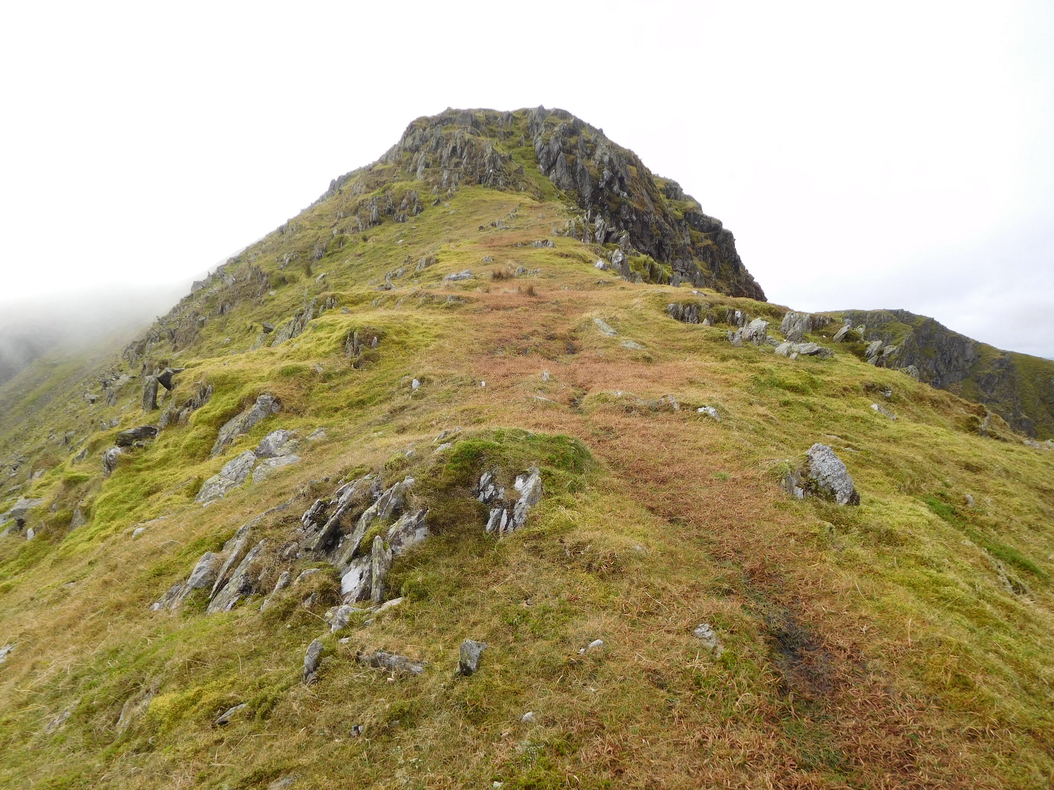 The last obstacle on the Tongue before the summit
 and I could now see that I would soon be walking in the clouds. Despite that it was a great feeling to know that I had only one more hump to defeat before the easy stroll to the summit cairn. The tussle up The Tongue had ended.
It was now merely a minute or two to the cairn but as I topped the last raise the cloud miraculously lifted leaving me with clear views in all directions, but the wind was by now so strong and cold that my fingers were getting numb and I could hardly unfasten the straps on my bag so that I could put a layer on and take some refreshment. Nevertheless, a drink was needed and I wanted to take a few photos whilst I was here, although it isn't as if I haven't been here before, but I think we all take replica photos from our return walks and they always look different as the weather conditions dictate.
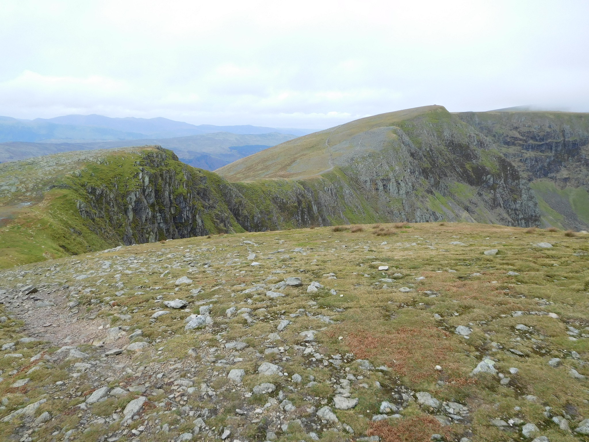 The ridge from Dollywagon Pike to High Crag
 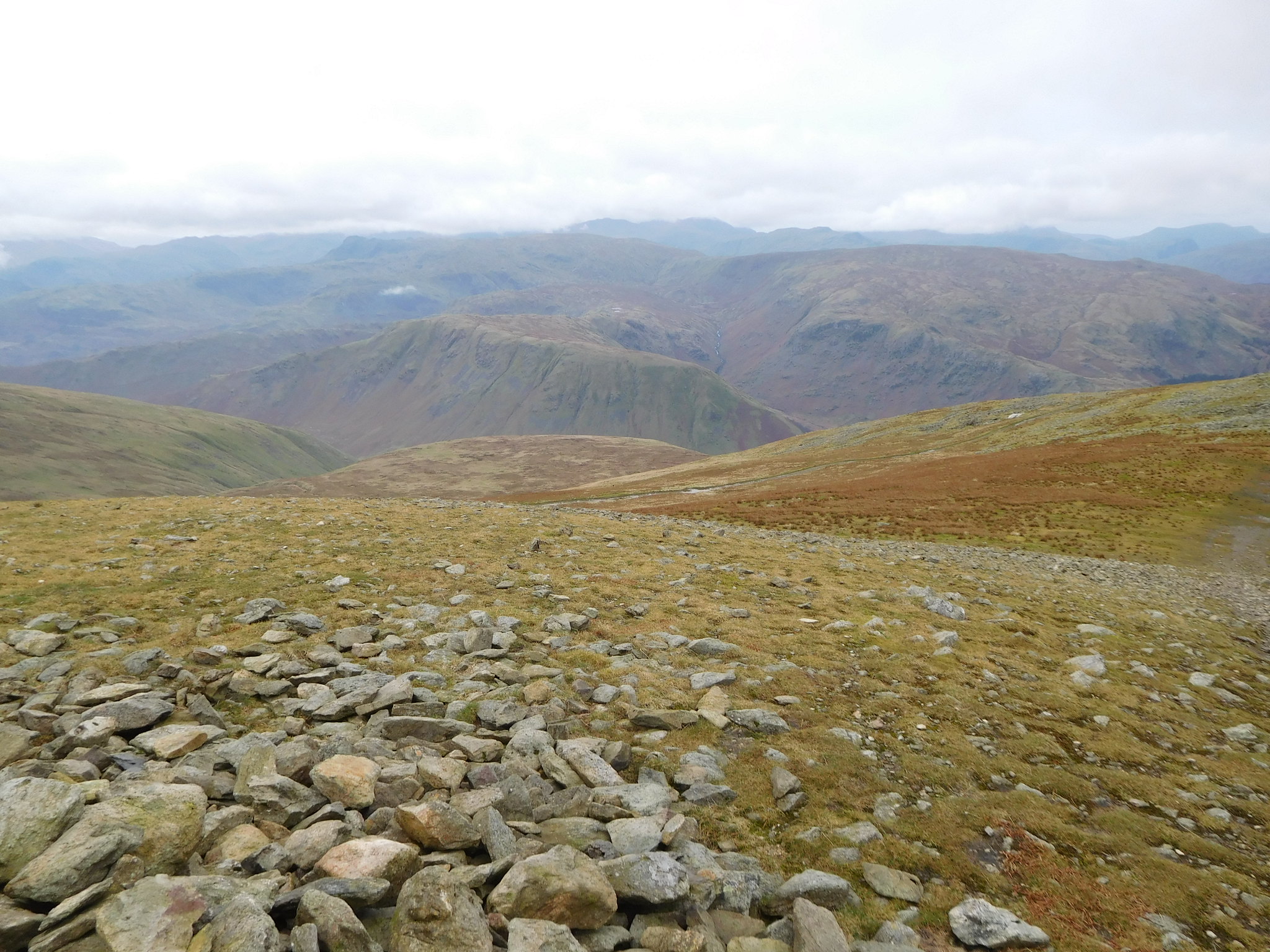 A western view from Dollywagon Pike
 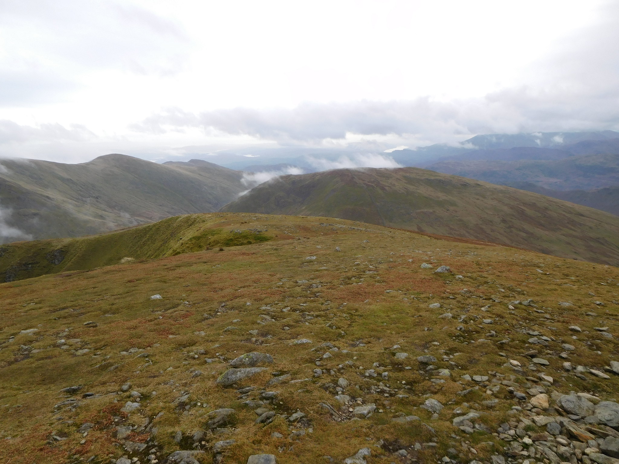 Seat Sandal and the western leg of the Fairfield Round
Bagged up and freshly watered I set off on my way down by simply following the well worn path north along the edge of Ruthwaite Cove, by passing High Crag summit by a few metres and then cutting across the fellside to miss Nethermost Pike and pick up the Wythburn path just above High Crags that runs down Birk Side, above Comb Crags and then zigzags its way down towards Comb Gill. As I started walking faster my hands began to warm up giving me the cold hurts, especially on my thumbs. It's unusual for me to get cold when I'm out walking but in spite of the steep climb up to Dollywagon Pike both my hands and feet could have been warmer so what the reason was for this odd anomaly regarding my extremities I just don't know.
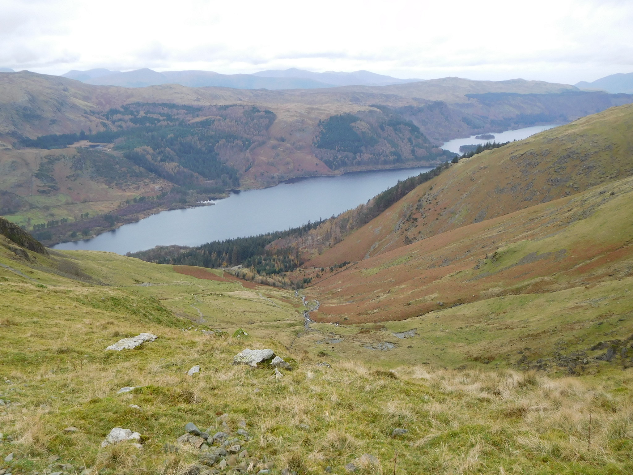
The path down is long, steep, and well made with the majority of it being either well compacted stone or pitched stone steps with a short section in the lower reaches being as it used to be years ago, rough and worn out. From Birk Side I had a good view of Thirlmere with Harrop Tarn sat in a tree lined hollow above its west flank. There is also a good view into Comb Gill and the path snaking along way down the fellside.
 Looking down Comb Gill from Birk Side
 I was in top gear on the drop off passing quite a few other walkers as I zigzagged my way down to the forestry track just behind the old Wythburn Church set in the trees just beyond the fence. Passing through a gate I followed the paved path down through the plantation until I met up with the good track that I followed south along its more or less dead straight line to the two footbridges that pass over Birkside Gill at Homesdale Green. From the forestry track I had a decent view of Steel Fell from its northern end.
 Steel Fell
 From the bridges the path now follows the wall all the way along to Raise Beck from where I got an alternative photo of Steel Fell…
 Another view of Steel Fell
 and then the easy walk from the gill back to the car.
It was 1°c and sunny with a ground frost when I set off this morning and 6°c when I arrived back at the car with full cloud cover. The walk was a bit demanding in places especially the long gully but one that has been enjoyed to the full, and I'm always pleased to be able to get onto a mountain by a different route if possible, routes that give a different perspective and views of the mountains, crags, and hills around the area. It also means seeing things of interest that would otherwise never be seen by staying on the regular routes, not that there is anything wrong with following the well worn paths and tracks that allow access onto all of the fells and mountains, paths and tracks that I regularly and most often use myself. This has been a good day.
