free to be able to rate and comment on reports (as well as access 1:25000 mapping).
Today was the day when Jim and I had our monthly date with the village walking group, and as the title of the report suggests we were heading for a snow covered High Cup Nick. There are usually around a dozen turn out for the monthly walk, a number that I'm not comfortable with as 4 x people is alright, 2 x good for the company, but ideally I love to be on the hills talking to myself. There's not much snow lying about, but enough to make the fells look glamorous with their white, black, and brown speckled winter coats on, today being spectacularly so as the sun was shining in a beautiful blue sky. We have had some low temperatures these last few days, low enough to hit the minus numbers and today with the temperature at a start of walk -7.8°c the numbers that turned out for the walk was sorely depleted with only the foolish, hard, those that didn't know better, or the ones that didn't want the stigma of being called a wimp were on the starting line, there was six of us, five men and one lady, a good mix of the above.
Our choice of start was the large and clean car park that is sited at the head of Murton Village and sits below and to the south of Murton Pike at approximately NY729219 and as we are all from the surrounding villages it took just a matter of a few minutes for the short drive there. As mentioned, the sun was shining but it made little or no difference to the very low temperature as we got booted and bagged for the walk but it did give us a feeling of well being after the strong winds and heavy rain that we have had to endure over the past week or so.
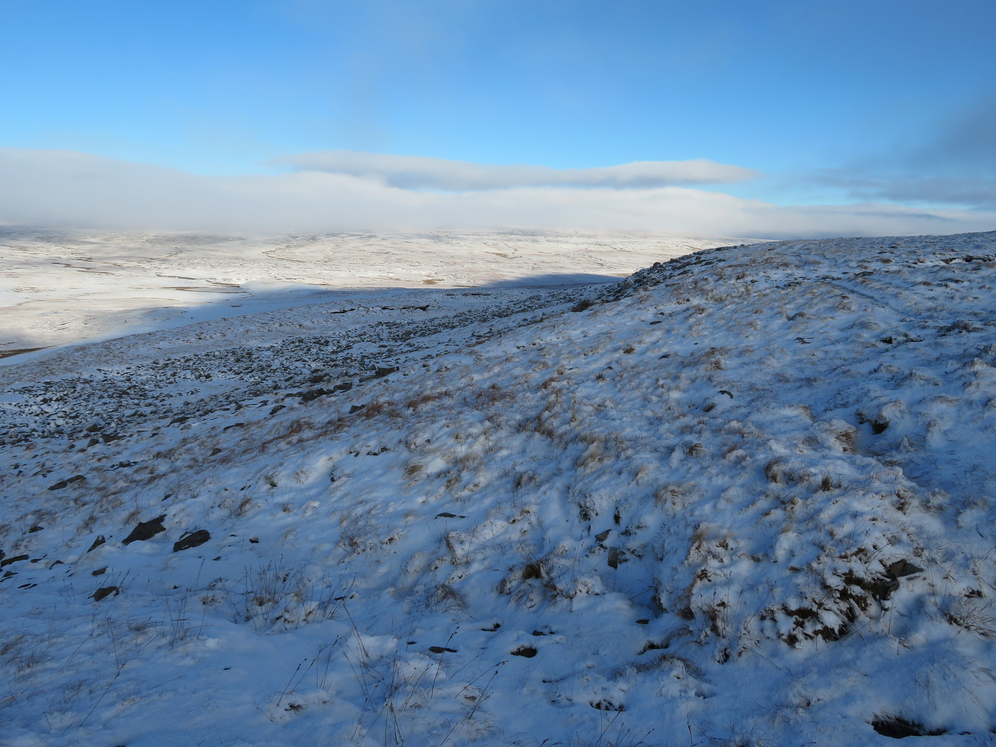
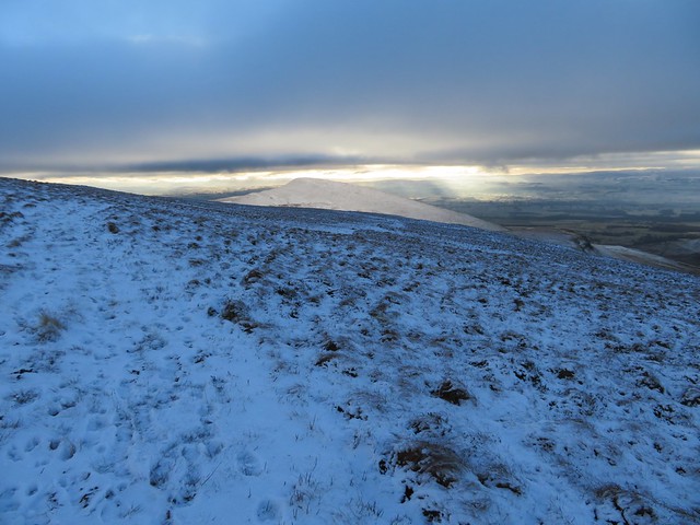
Leaving the car park via any of the two gates leading onto the fellside we immediately took to the old mine/quarry track that we would follow all the way up to its termination at the two shelters on Burnt Crag. The way is easy as the well graded track is ascended first just below the hump that has the most wonderful name of Sweety Briggs, past Low Trough from where the first photo of the day was taken…
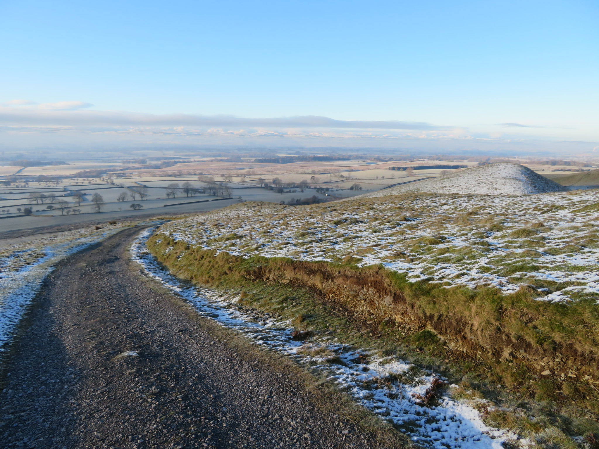 A view south west across the Eden Valley from Low Trough
 and then along the flank of Moley Hill. From this position there is a great view over the village and across the Eden Valley that today plays host to frost covered fields dissected by lines of black walls and hedges scattered amongst which there are numerous patches and copses of black trees looking like India ink sketchings against the backdrop of white frost.
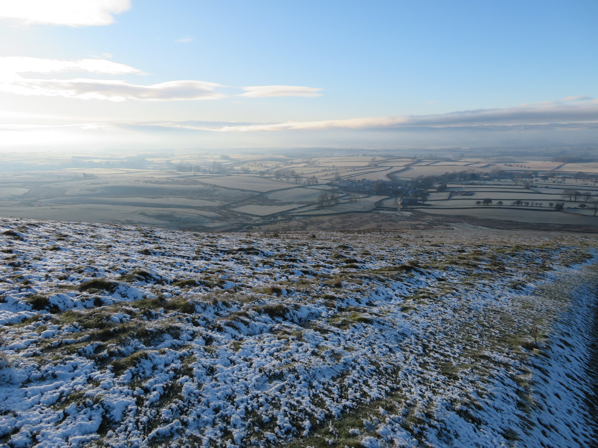 South over Murton Village
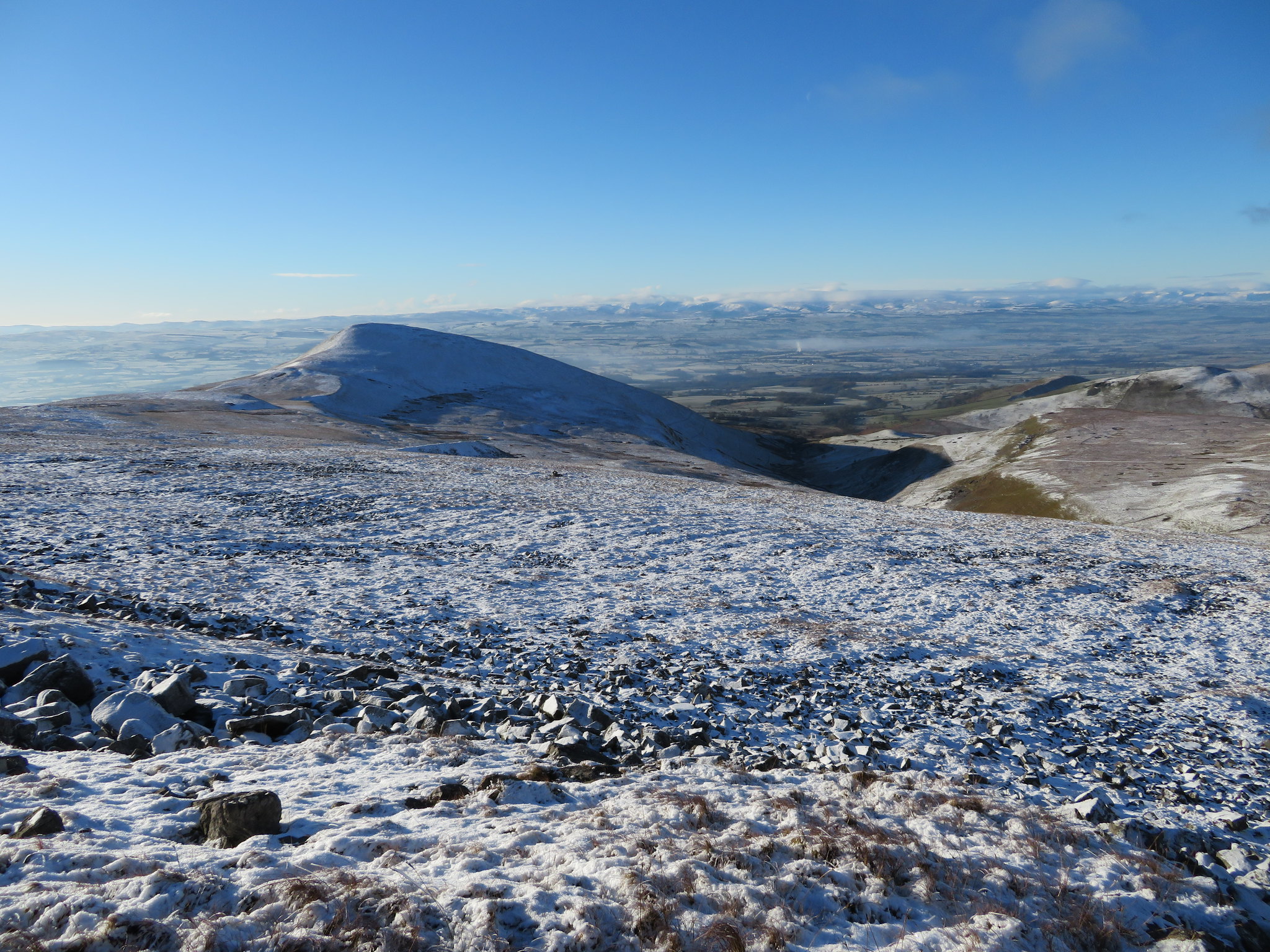
 Up to this point the track had been clear of snow and ice but slowly as we ascended it got more treacherous as the thin covering of snow covered patches of ice lurking underneath just waiting for the unwary walker to put a foot wrong. We passed various places where the signs of past quarrying/mining are obvious with large scoops taken out of the fellside leaving behind craggy faces and shattered rock on the ground. We soon arrived at the footpath that veers off to allow a visit to the summit of Murton Pike with its trig column gleaming white in the sunlight, but as we have all been up it before nobody was tempted to take the offer of a stroll up to the summit so we passed it by only looking back to take a shot of it and the Lake District mountains sitting in the far distance, but they were so clear that it looked as if one could almost touch them.
 Murton Pike with the LD mountains way behind
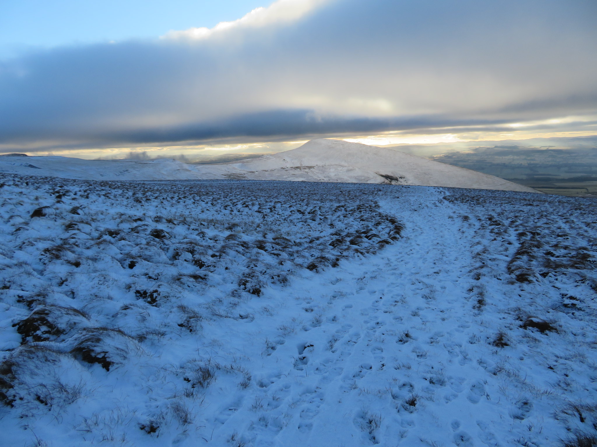
 It was still quite cold and as we got nearer to Gasdale Head where the ground had opened up we were met with a cold breeze and despite being warm hats were pulled down over ears and zips moved north as the two shelters on Burnt Crag just came into view on the skyline.
 Burnt Crag shelters on the horizon
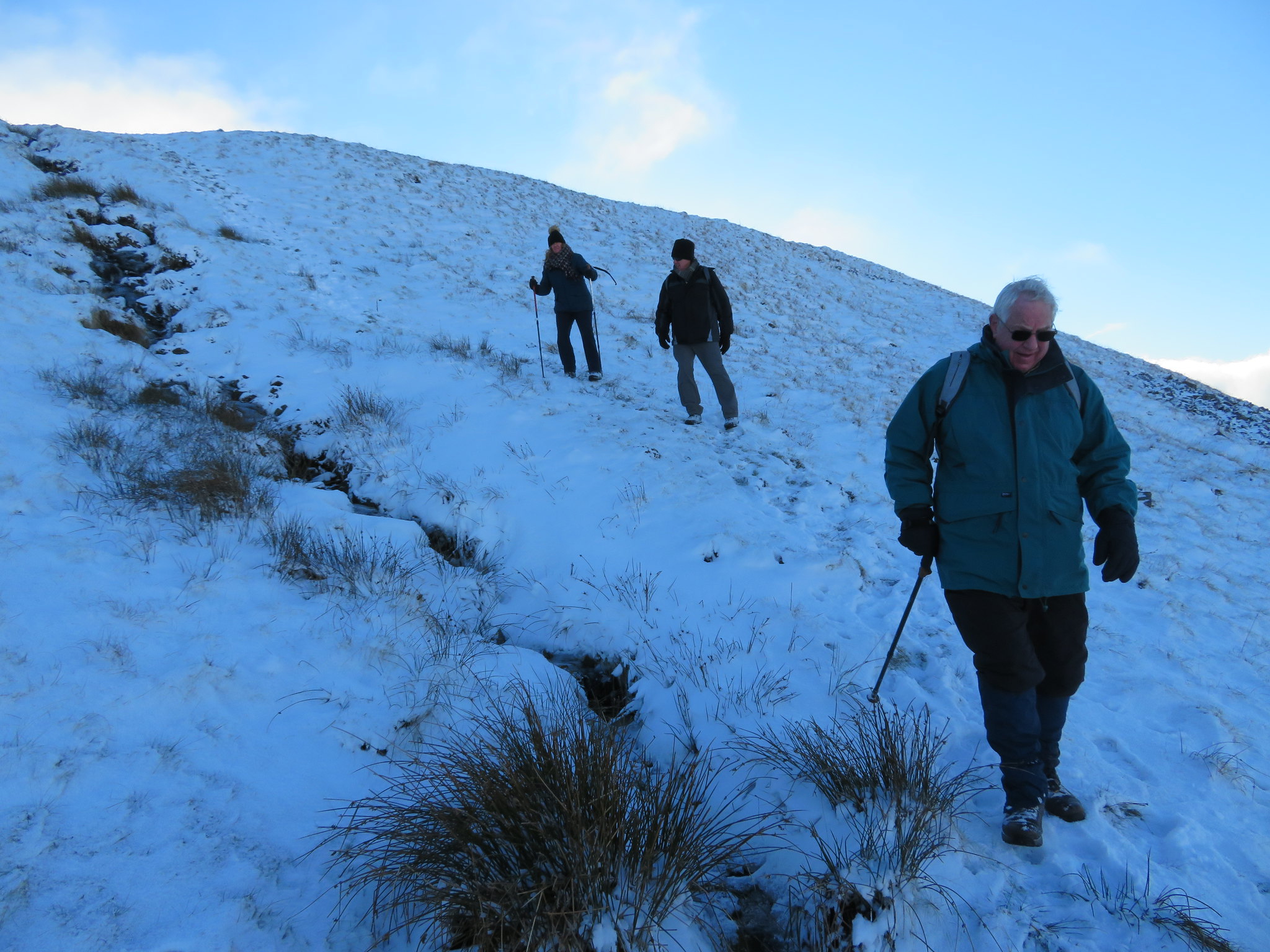
 Despite the slippery underfoot conditions all was going well with one of the party - George - berating himself for not being out for a while and not feeling hill fit but he's steady enough and keeps making his way forward with the promise of a break at the Burnt Crag shelters spurring him on. The only criticism I have of this walk - well it's not really a criticism more an observation - is that the best views are limited to the southern aspects as the northern ones offer only views across and upwards of the massive moorland fells of Murton, Dufton, and Meldon Hill.
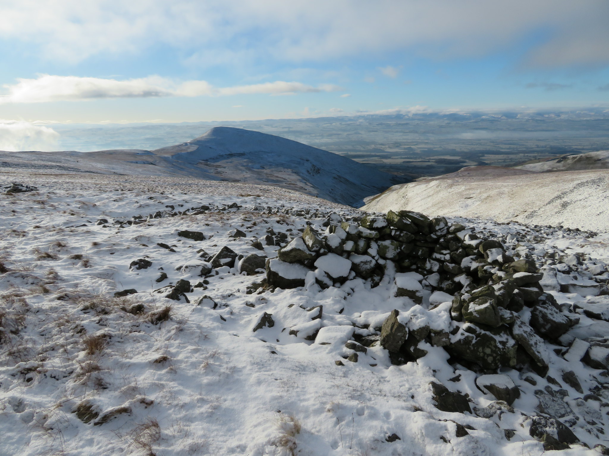
The views from Burnt Crag are nothing short of amazing, especially on a day like today with blue skies and the clarity that only a minus degree temperature day can offer. The LD mountains are way across the valley of Eden, snow covered and sparkling with the only clouds being a white fluffy bank of them hanging over the mountain tops. There was a vapour thin layer also floating just above the valley bottom in quite a few places and smoke rising vertically from scattered dwellings making for a most peaceful and tranquil scene. A scene so peaceful it's a shame that it can't be replicated throughout our much troubled world.
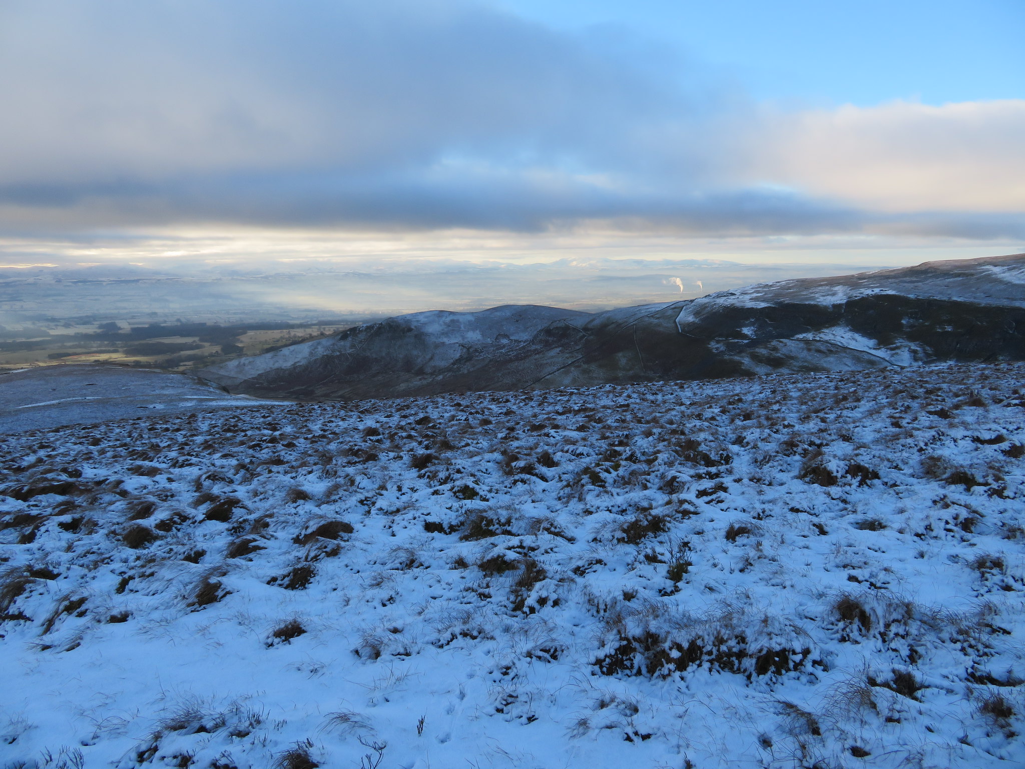
 Southwest to Murton Pike and the Lake District view from Burnt Crag
 After a short break for a snack and a drink we set off now following a fairly wide path the course of which is marked with wooden marker posts…
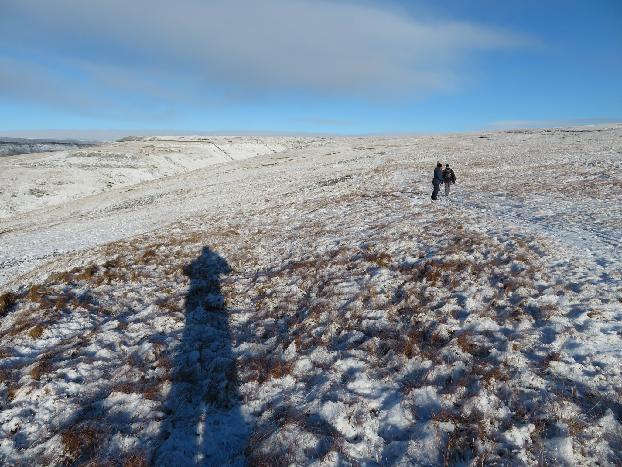 Moving towards Trundale Gill and High Cup Nick
as it wends its way across the fellside rising over short banks as it slowly rises across the west flank of Murton Fell. Within a few minutes we were almost at the point where the path drops down into the almost dry head of Trundale Gill…
 Again southwest along Trundale Gill
 with the path being quite treacherous today with the snow and ice lying on it. It was halfway down where we came across deer tracks rising up from the confines of the gill to take advantage of the path that we were using. Crossing the gill causes no problems as it is almost always dry at this point but the path out of the gill has deteriorated somewhat around halfway up and care had to be taken not to slide back down into the gill as the frozen ground mixed with ice and snow was a bit dodgy.
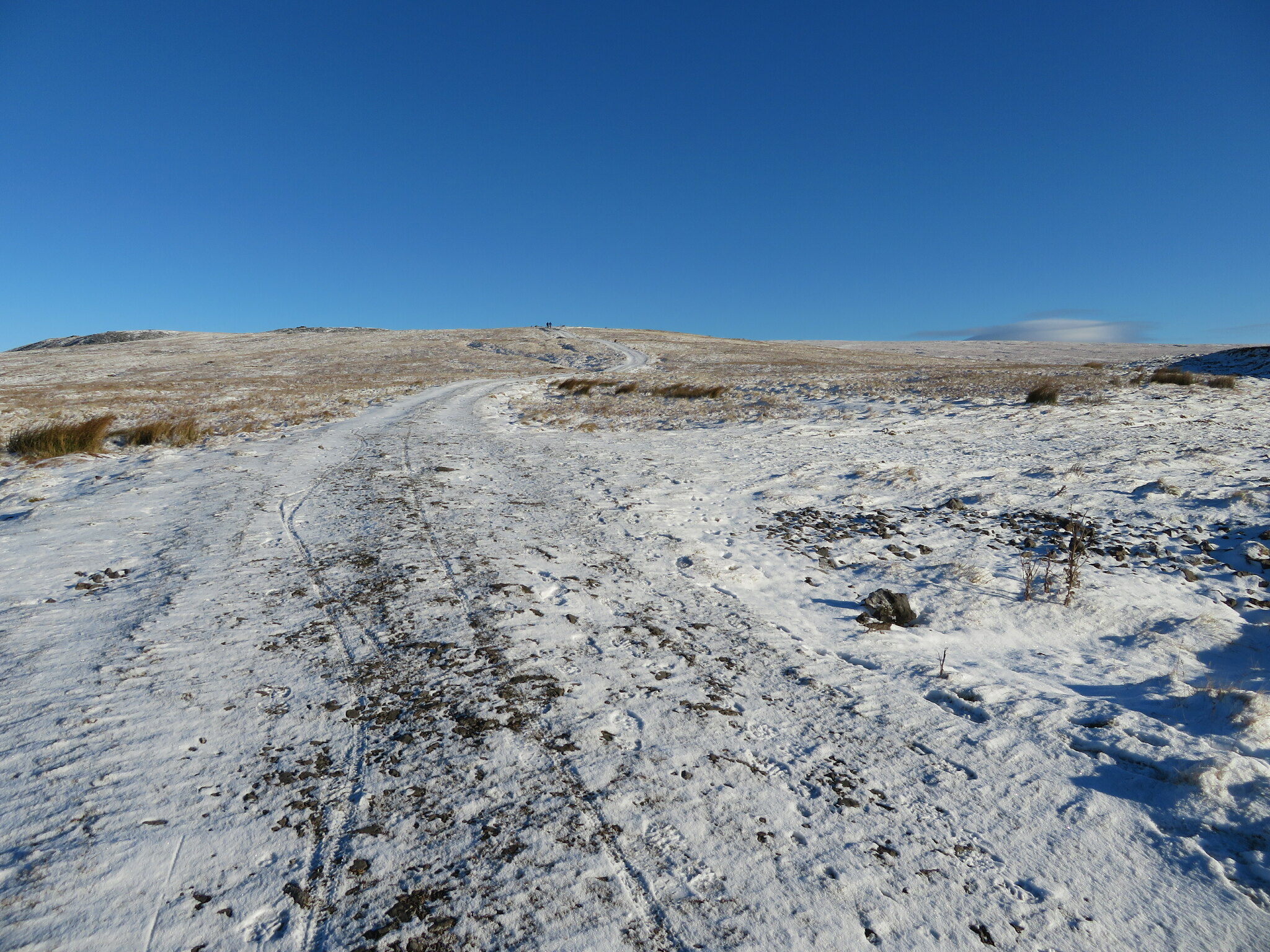
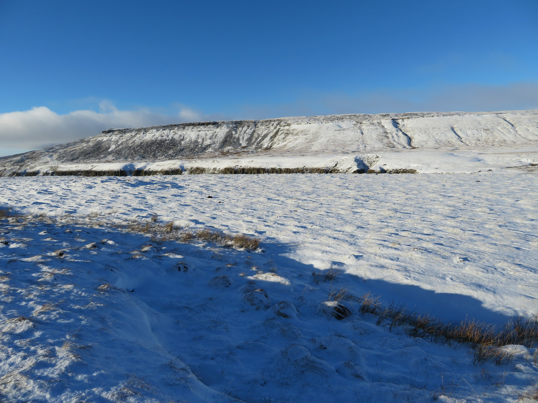
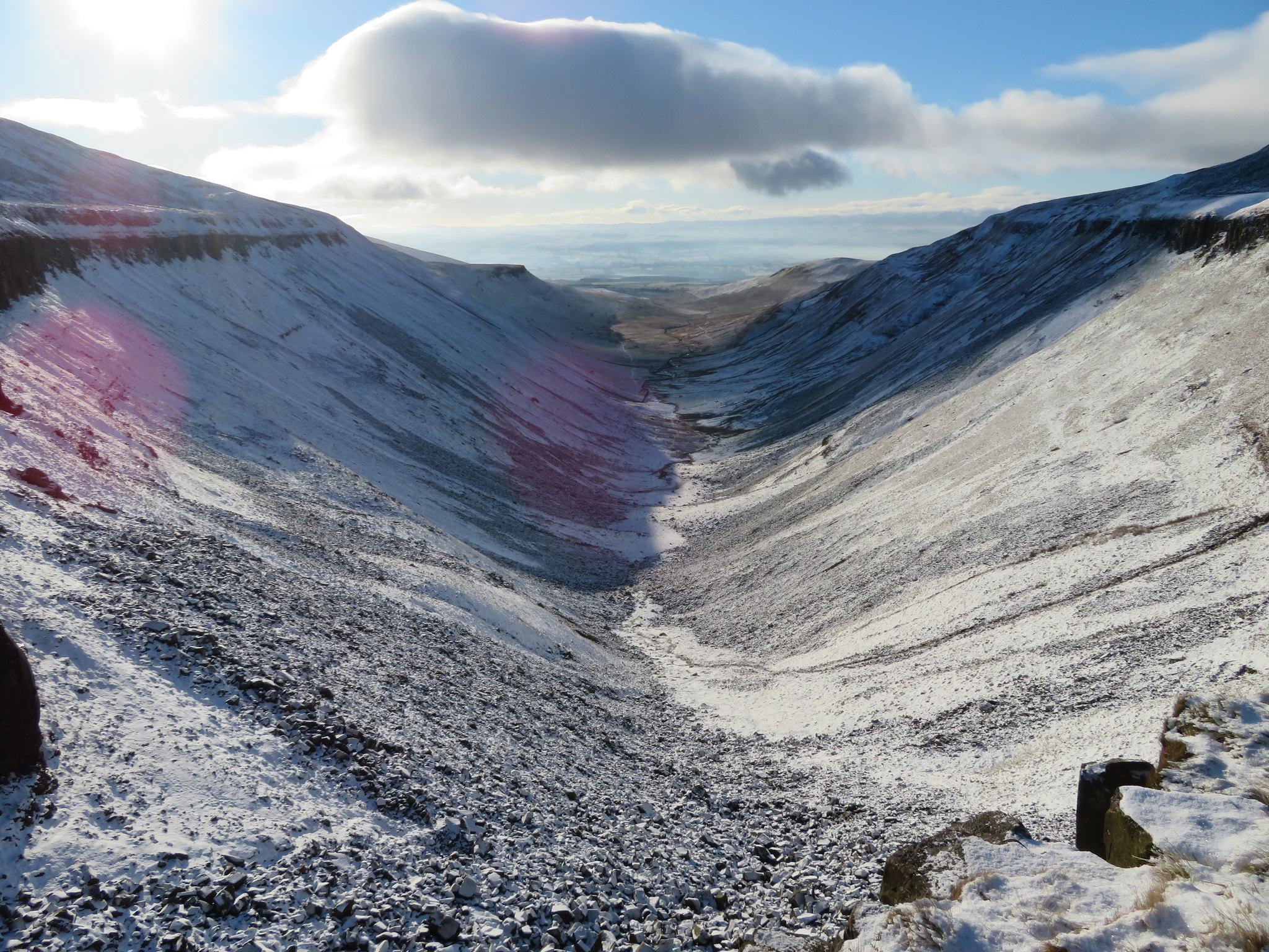
Despite the nature of the ground at this point it didn't take too long to climb out of the gill and once again in the open we continued along the way marked path as it followed the line of a dry stone wall to soon arrive at the point where HCN came into view, always an awe inspiring sight especially to those who haven't laid eyes on it before.
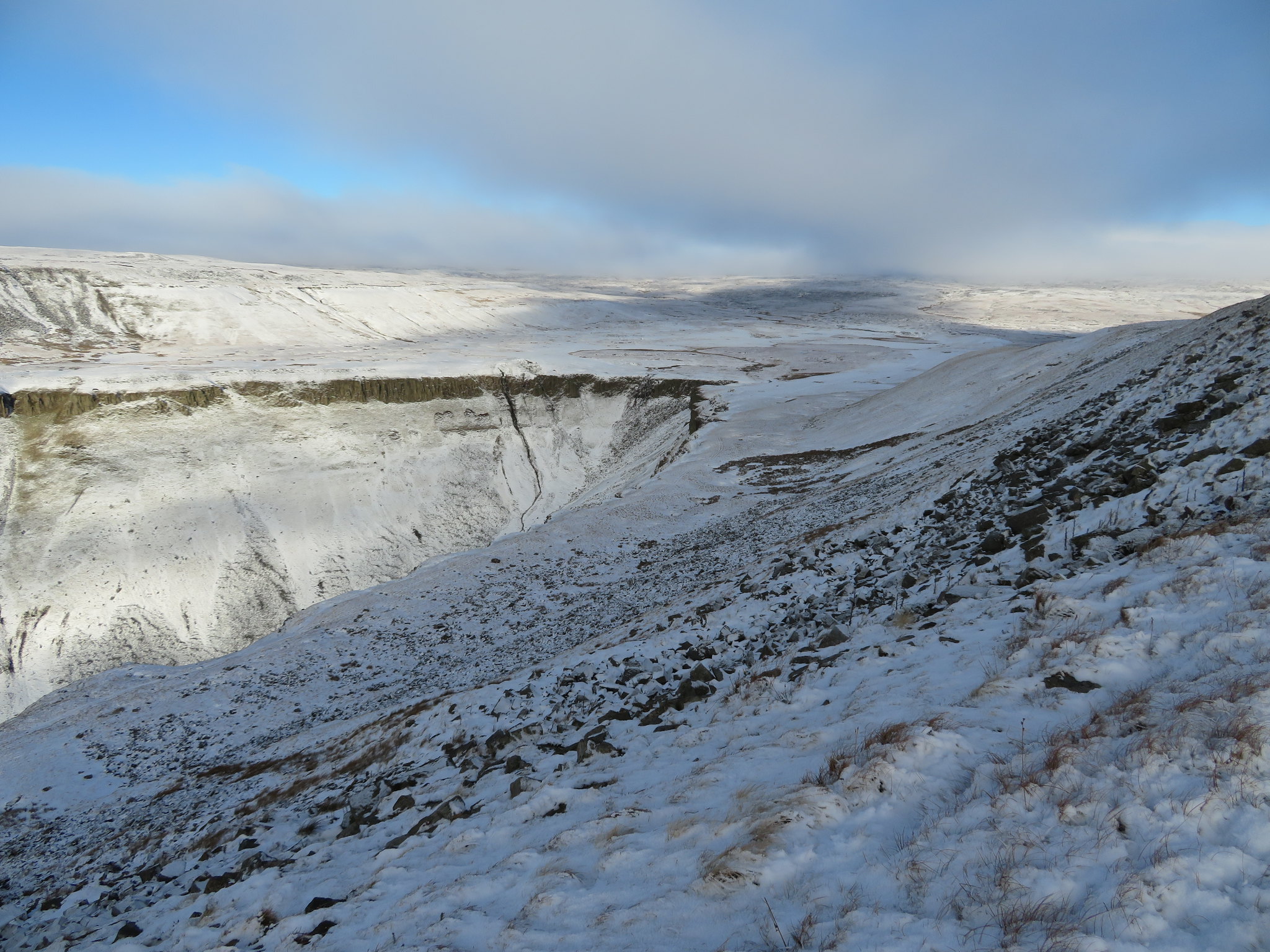 The head of High Cup Nick
 The snow makes the area look wilder than what it is, and it is wild up here with nothing but the Pennine Way and Maize Beck crossing the foot of these massive fells that rise ever higher before us.
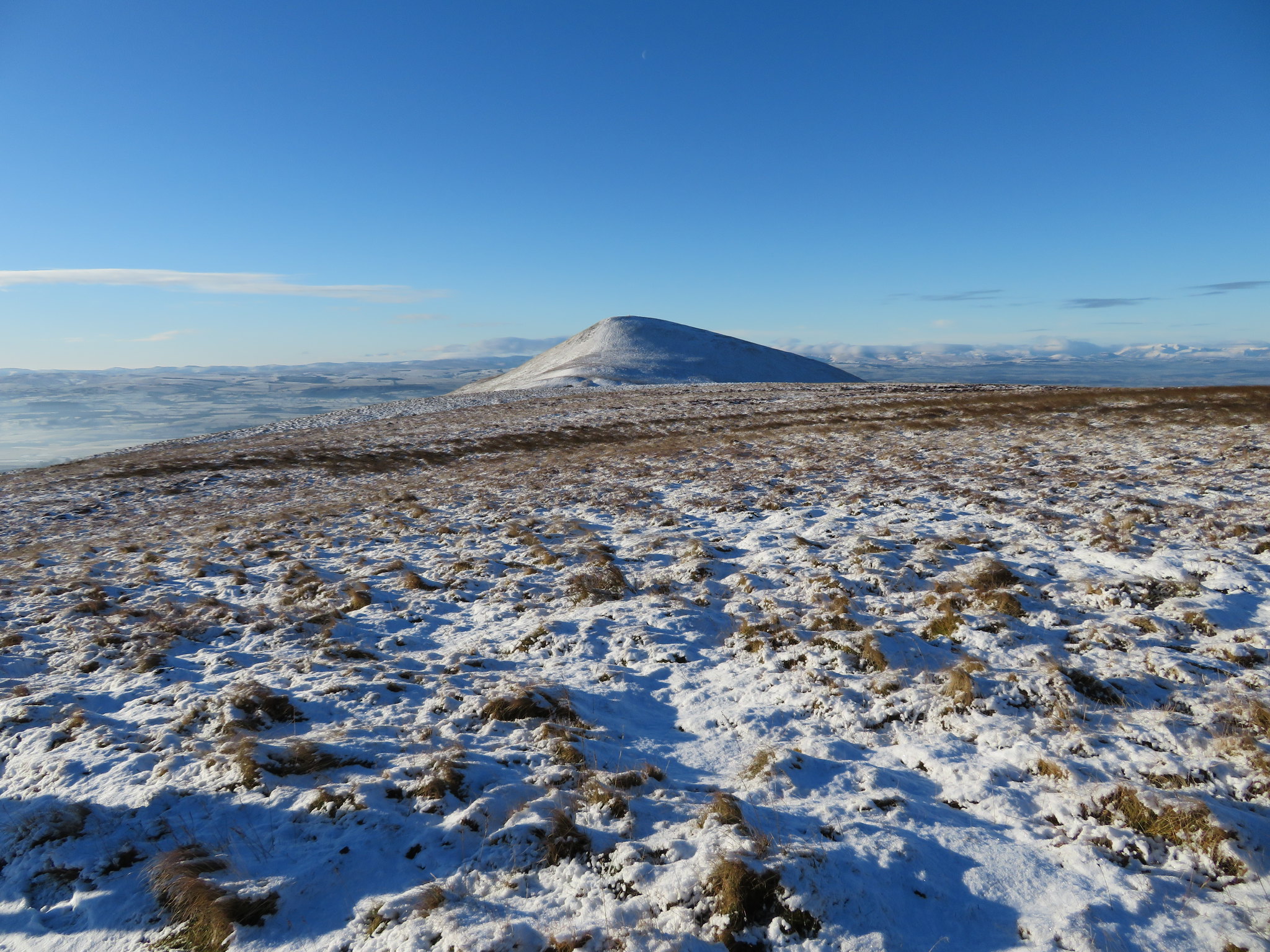
 Northeast to Meldon Hill
 We continued along the path that carries on to meet the PW but I elected to save some walking time and took a line down the snow covered fellside on a faint path the outline of which could just be seen under the snow. We broke away from the main path at about NY747258 at a point where a narrow syke/waterway runs down the fellside. It's not much of a descent…
 Descending the bank to HCN
 but again with the snow on the ground it pays to be careful especially on a slope.
Once at the bottom we struck a line towards High Cupgill Head with the long partly grass, partly rock covered scar of the high ledge of Narrowgate Beacon rising above the north side of the giant hole of HCN.
 The rocky scar below Narrowgate Beacon
 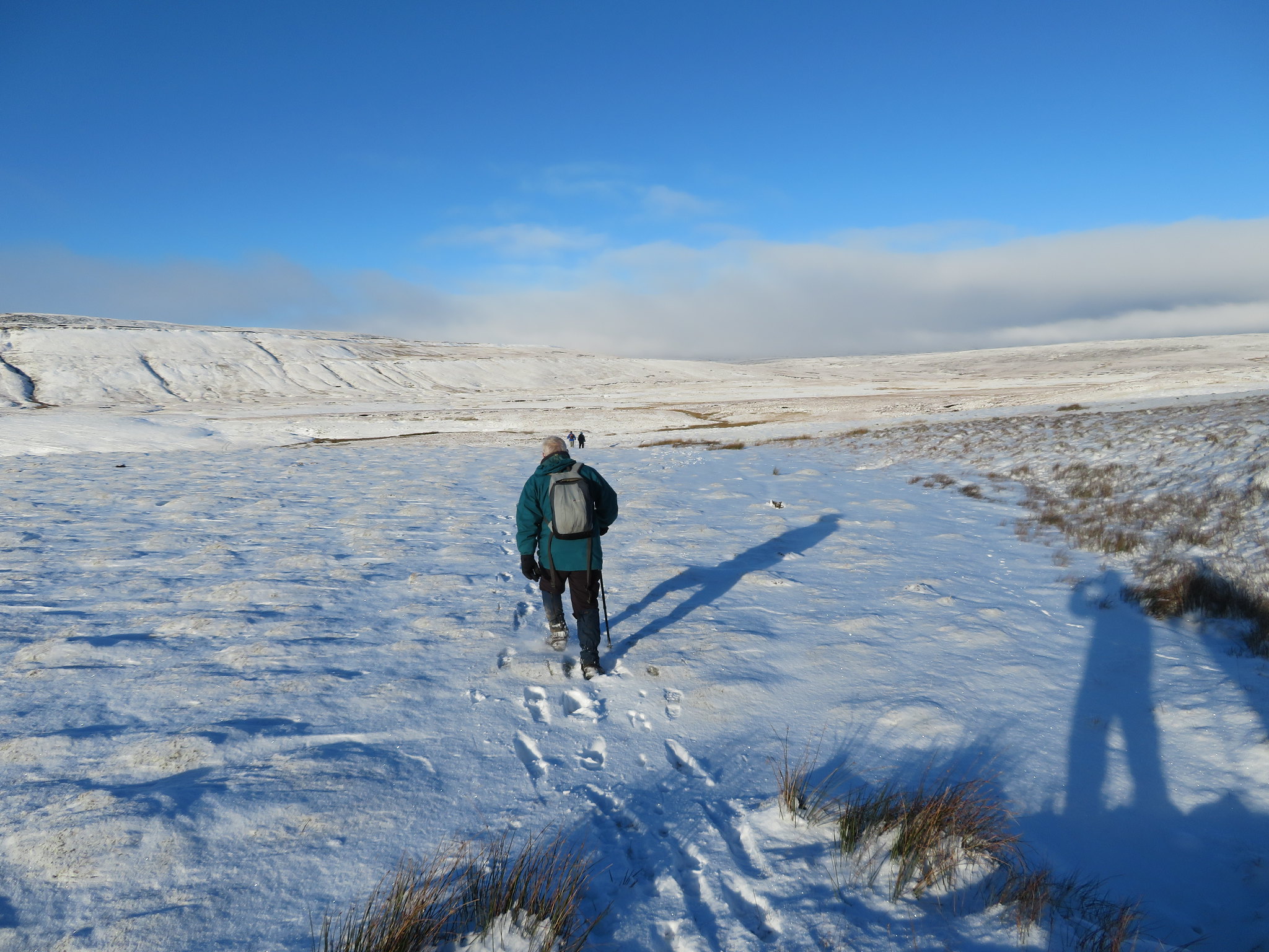 High Cup Nick and Slegistone Band ahead
 Whilst the other five made their way to stand on the top of High Cup Scar I made my way over to the head of this giant hole having to dodge around the great sheet of ice that had formed where the water runs down into the hole on its northeast corner by way of the rock strewn gully that leads down to the valley bottom path. Once across that I made my way across to the edge of the great valley and having to pass across more sheets of ice as the usually wet top was now looking more like an ice rink interspersed with patches of brown grass that came in handy at times. Trying to be careful not to get too exuberant by the view down the valley I got as close as I possibly dared as slipping down the rocky face would most likely be a one way ticket only.
I proceeded to take a number of photos of this wonder of nature but on getting home found that quite a few had a pinkish bloom on them due I think to having a mark or a smear of some sort on the lens that diffracted the bit of sunlight that managed to creep into the frame. However, I took the best of a bad bunch and introduced them into the report as shown below.
 High Cup Nick
 The adventurous five looking to be noticed.
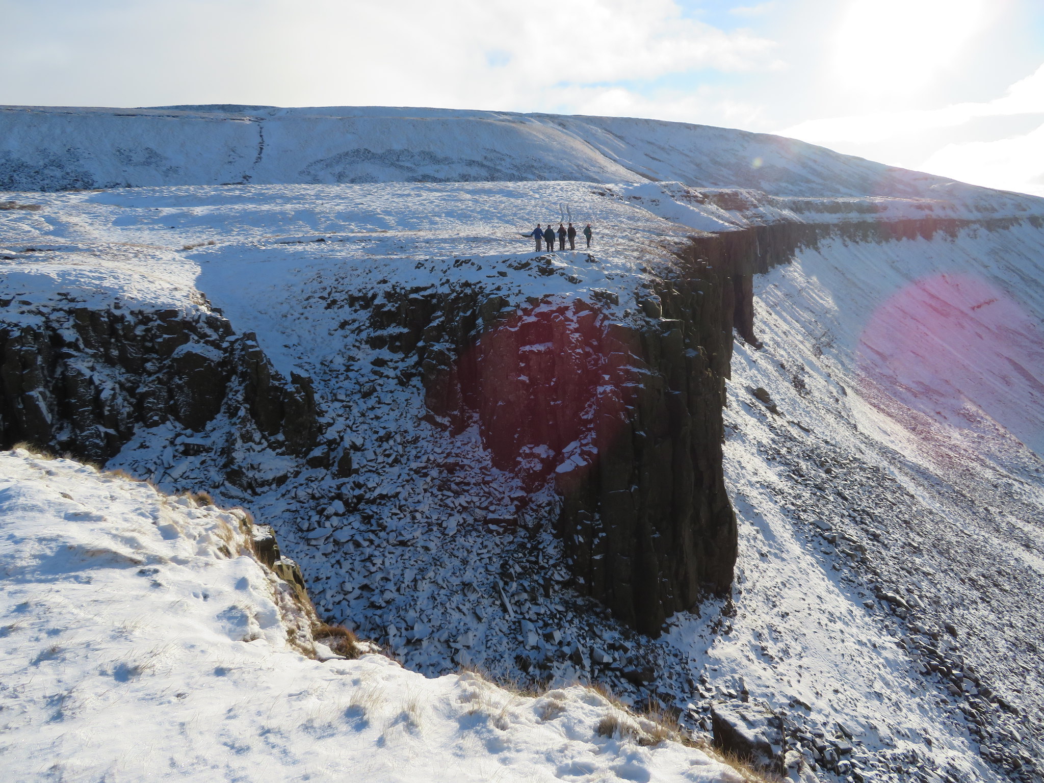 Posers on High Cup Scar
 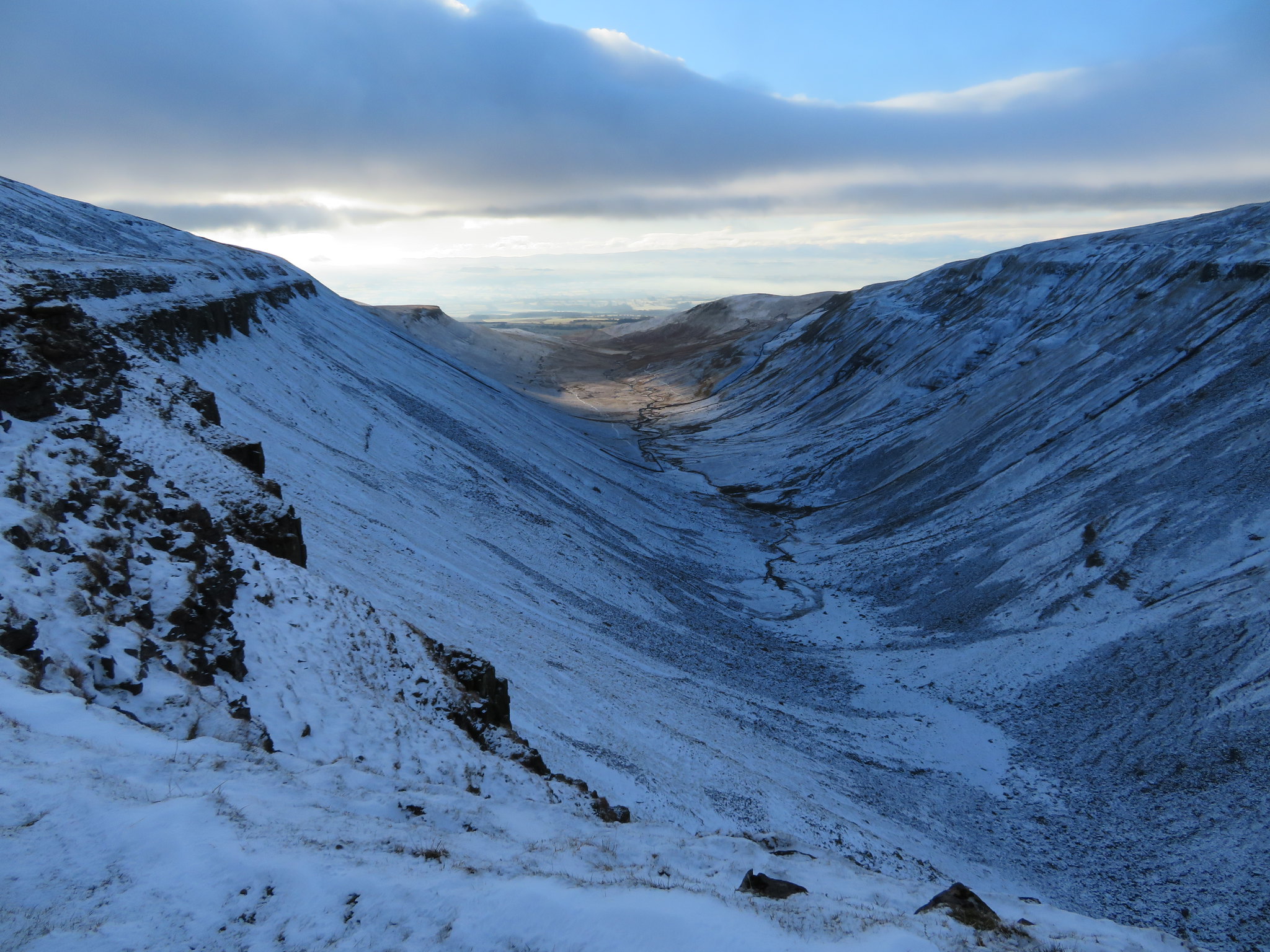 High Cup Nick from the top of High Cup Scar
 After making my way back to them we set off along the path that runs above the southeast edge, over High Cup Scar…
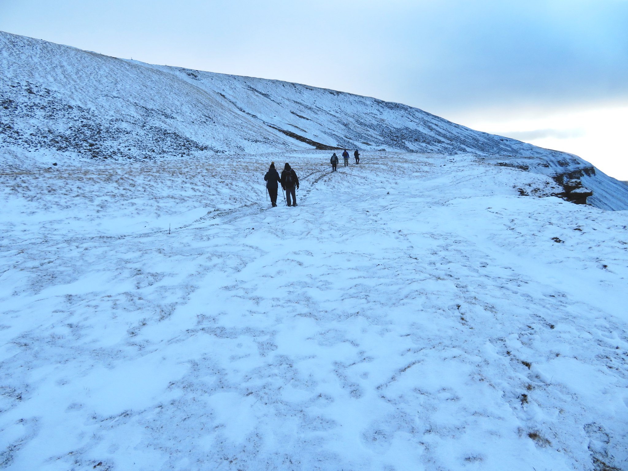 Walking along High Cup Scar
 to Middle Tongue. The path is good and obvious and follows the contour of the ground as it climbs up a couple of steadily rising banks to eventually reach a wall and ladder stile where once we had climbed over we stopped for a break in the shelter of the wall as the wind was still very cold.
From the wall it was now just a matter of following the path down the centre of Middle Tongue where the ice was plentiful on the ground and where three of the group took turns in falling over but fortunately with damage done to pride only. As we had been walking the clouds were dropping in with great banks of dark grey overhead but in front and over the Eden Valley there were still plenty of pockets of sunshine with one of these lighting up Murton Pike to our front.
 Murton Pike bathed in sunlight
 And as we got nearer Roman Fell appeared to the left of Murton Pike…
 Cloud sitting on Murton Pike
 also before we got too low a last shot of the Lake District mountains with plumes of steam rising up from the chimneys of the gypsum plant at Kirkby Thore.
 West towards the Lake District mountains
 The last photo of the day was one taken as we neared the valley bottom with a view along Trundale Gill towards Appleby-in-Westmorland and the farm of Harbour Flatt.
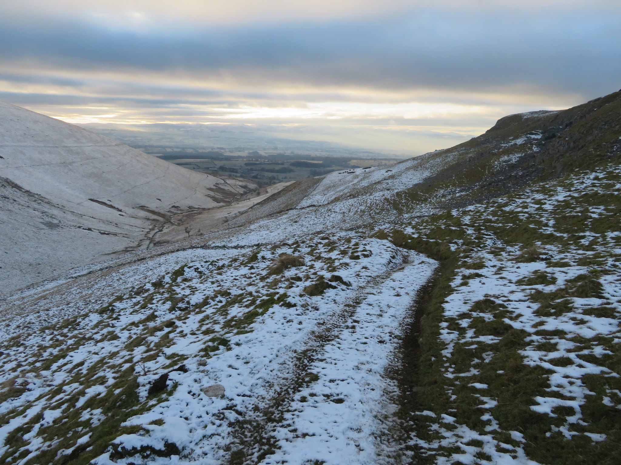 Looking southwest along Trundale Gill
 As we approached the farm I was a bit apprehensive as to what sort of a greeting we would get as I have had issues with the farmer on two occasions regarding access with him trying to stop me even though the path is way marked by a finger post at the road end and an arrow marker sign fixed to the end of one of his buildings as you pass through the farmyard. This time we saw no one - the last twice the farmer had rushed out spitting froth - so I was wondering if the farm has a new and more amenable owner or tenants.
Leaving the farm by the track we met the metalled road and turned left to walk the 2 kilometres back to the car park at Murton after having a great day out on the fells despite the very cold weather. With a minus 7.8°c start I'm not sure how cold it would have been 'up top' but steady walking kept us warm enough only getting cold when we stopped for the two breaks. It had warmed up considerably by the time we had got back to the car with a low of only minus 1.3°c.
A great walk on a gloriously sunny day for the most part and the clarity of the views was something that I hadn't seen for a long time. If anyone hasn't seen High Cup Nick in the flesh it is well worth the effort to get up there by a variety of routes and have a look.
