free to be able to rate and comment on reports (as well as access 1:25000 mapping).
Brother Frank and I had been trying to synch diaries for a walking day for a little while, when it fairly suddenly looked like week commencing 12th March might work for both of us.
Given that Monday and Tuesday were out due to other commitments, it first looked like Thursday would be the day; but then something cropped up for Frank on Thursday, and he decided to take a day's holiday on Wednesday. As a pensioner, I have the luxury of being free any day I want

.
It's a long drive (just under 3 hours one-way to the Lake District), and he had to be back by 7.00pm, so some careful route choice (= reliable timing) was necessary. The decision was: 8 hour maximum walking, ideally a bit less, so as to leave a little time for a sojourn at an establishment of cultural, historical and architectural distinction after the hard work of the day...
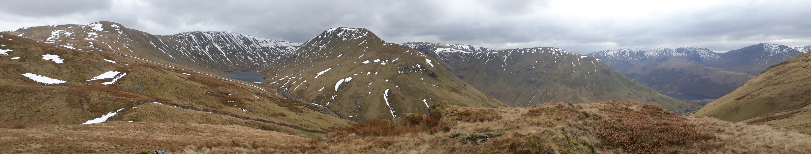
This is the route we settled on:
Frank had done a couple of these hills when doing the High Street walk in his teens, but I'd never been up any of them, and I'd missed out on getting up them as part of another round a few weeks ago due to an injury sustained in a fall on ice during the first part of the planned round.
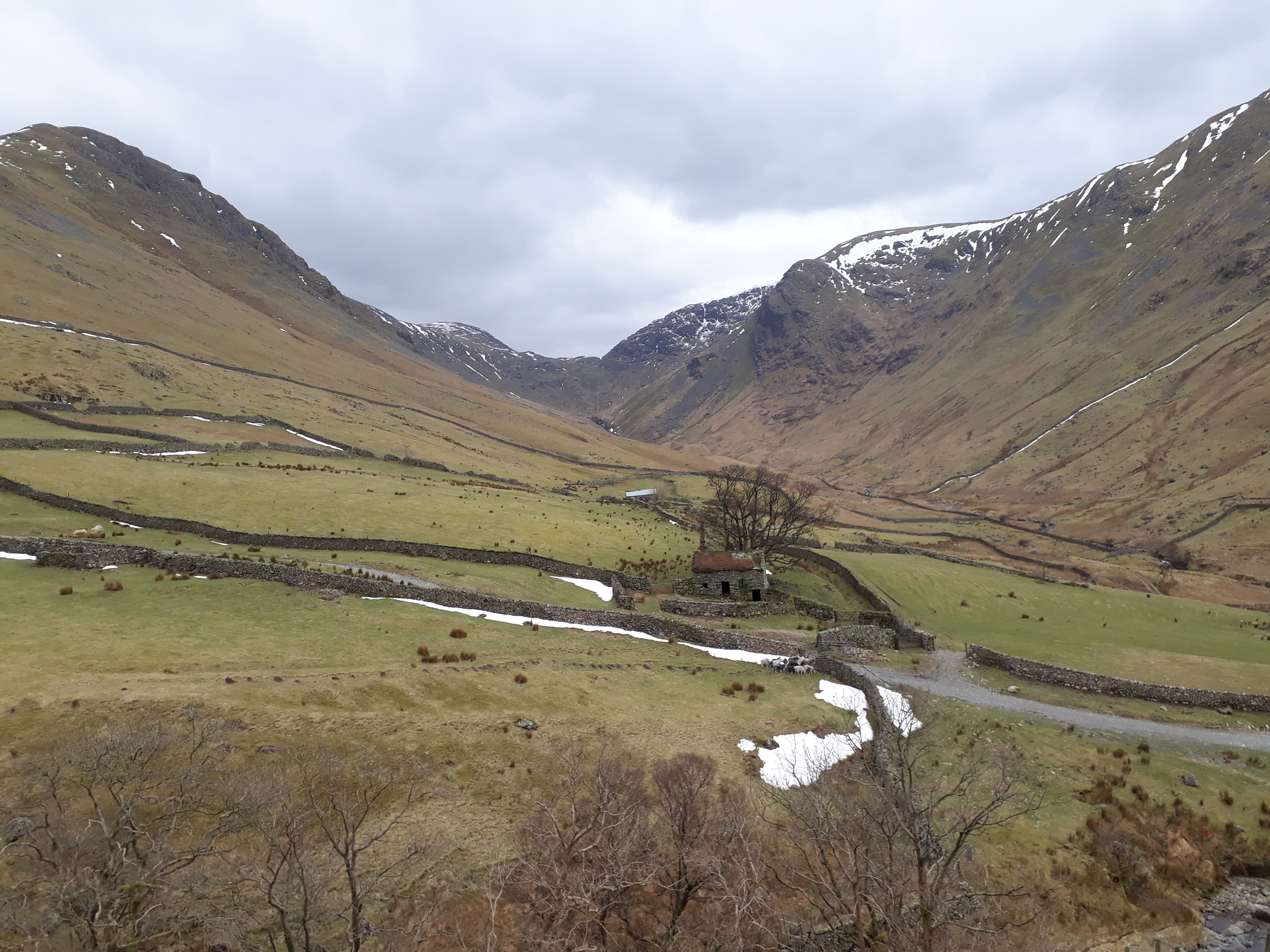
We depart from the car park just outside Hartsop bang on time. (Honesty box in the car park, so we put in probably more than had it been ticketed - perverse human psychology...).
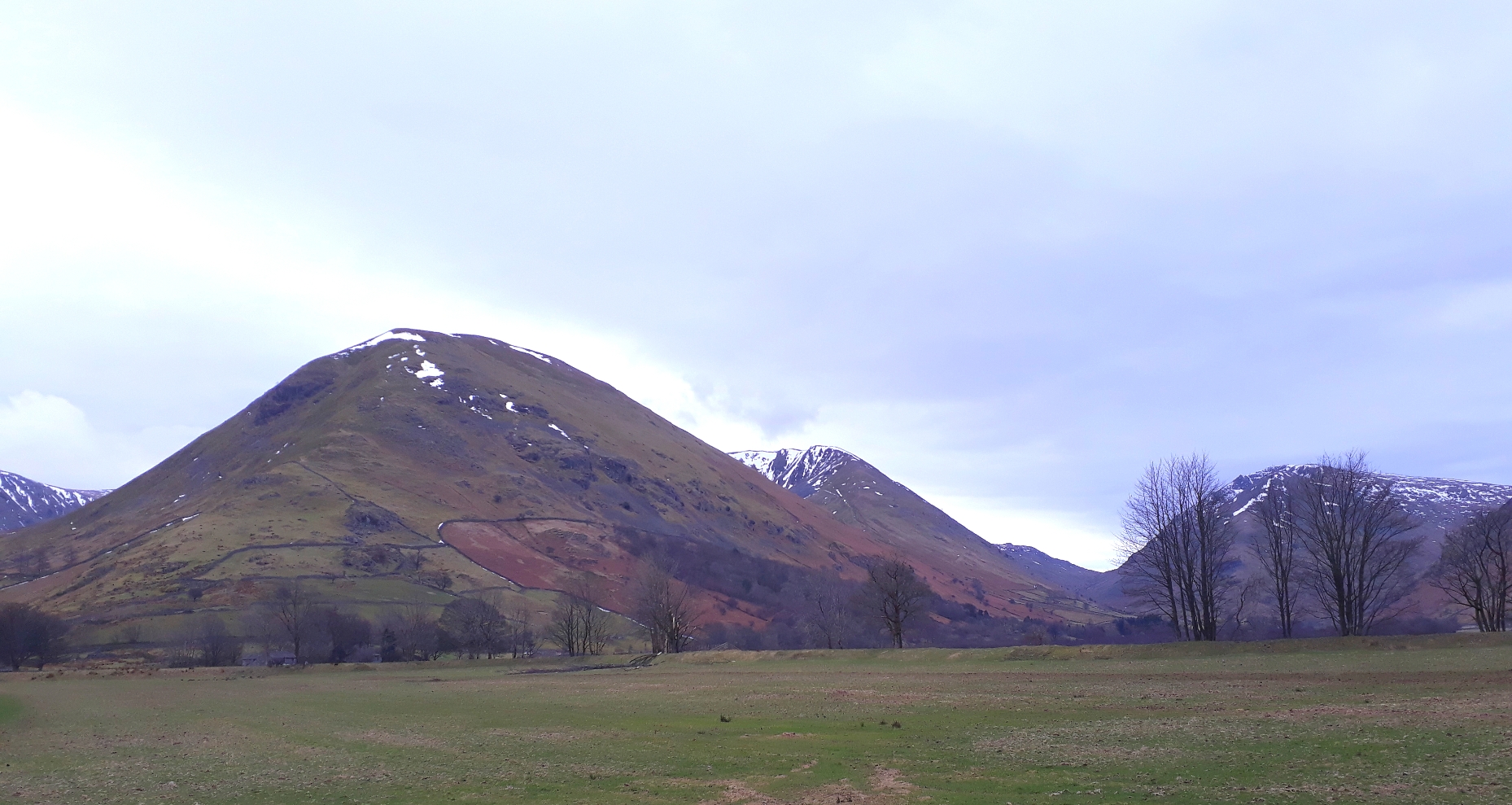
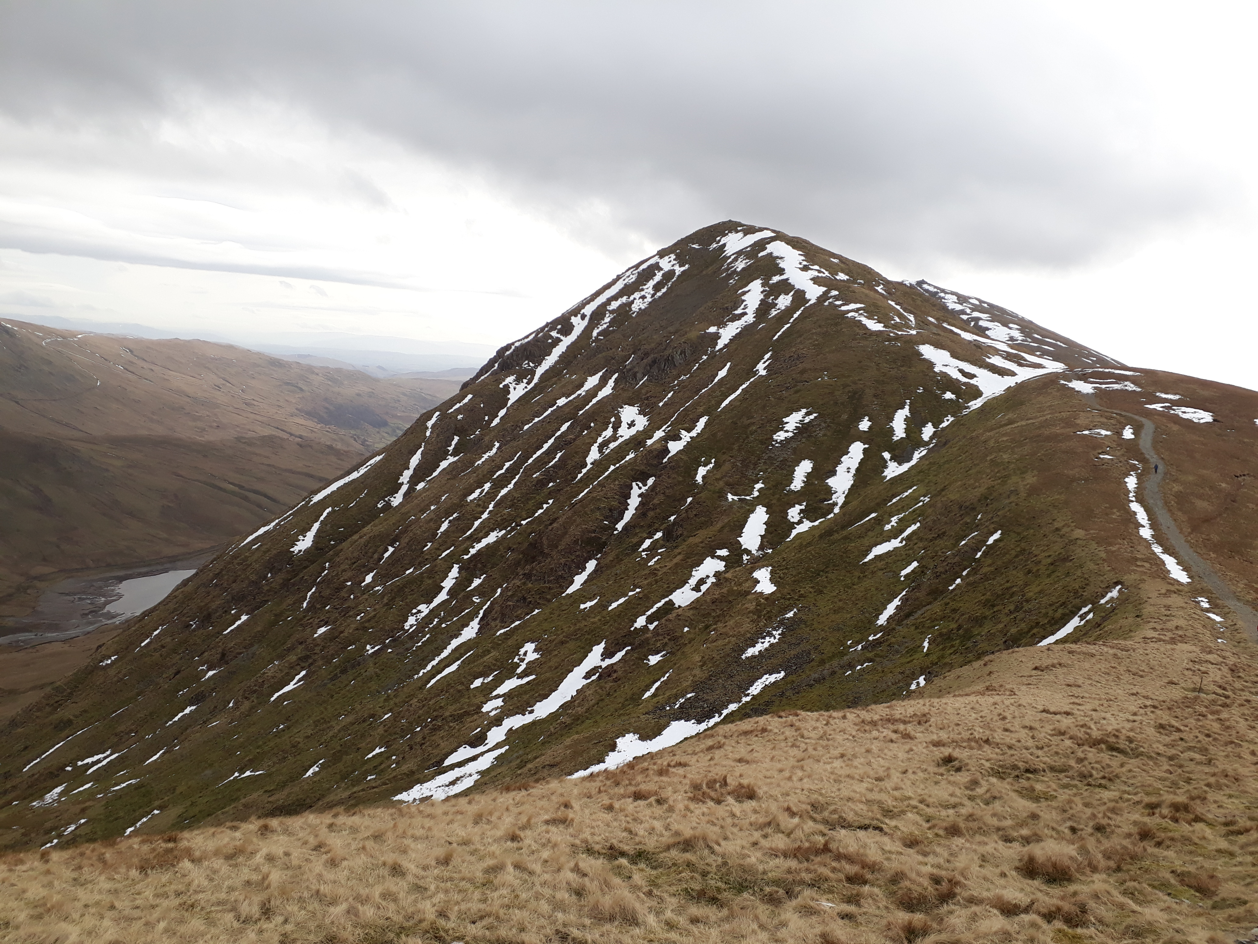
20180314_083212. Hartsop Dodd looks most enticing, while Rough Edge/Caudale Head is showing at its most spectacular just behind.
After a bit of wayfinding faff due to gates being adorned with "No Path" signs, I give up what is anyway a very weak intention not to aggravate locals, and we simply head straight up the shoulder.
20180314_085535.
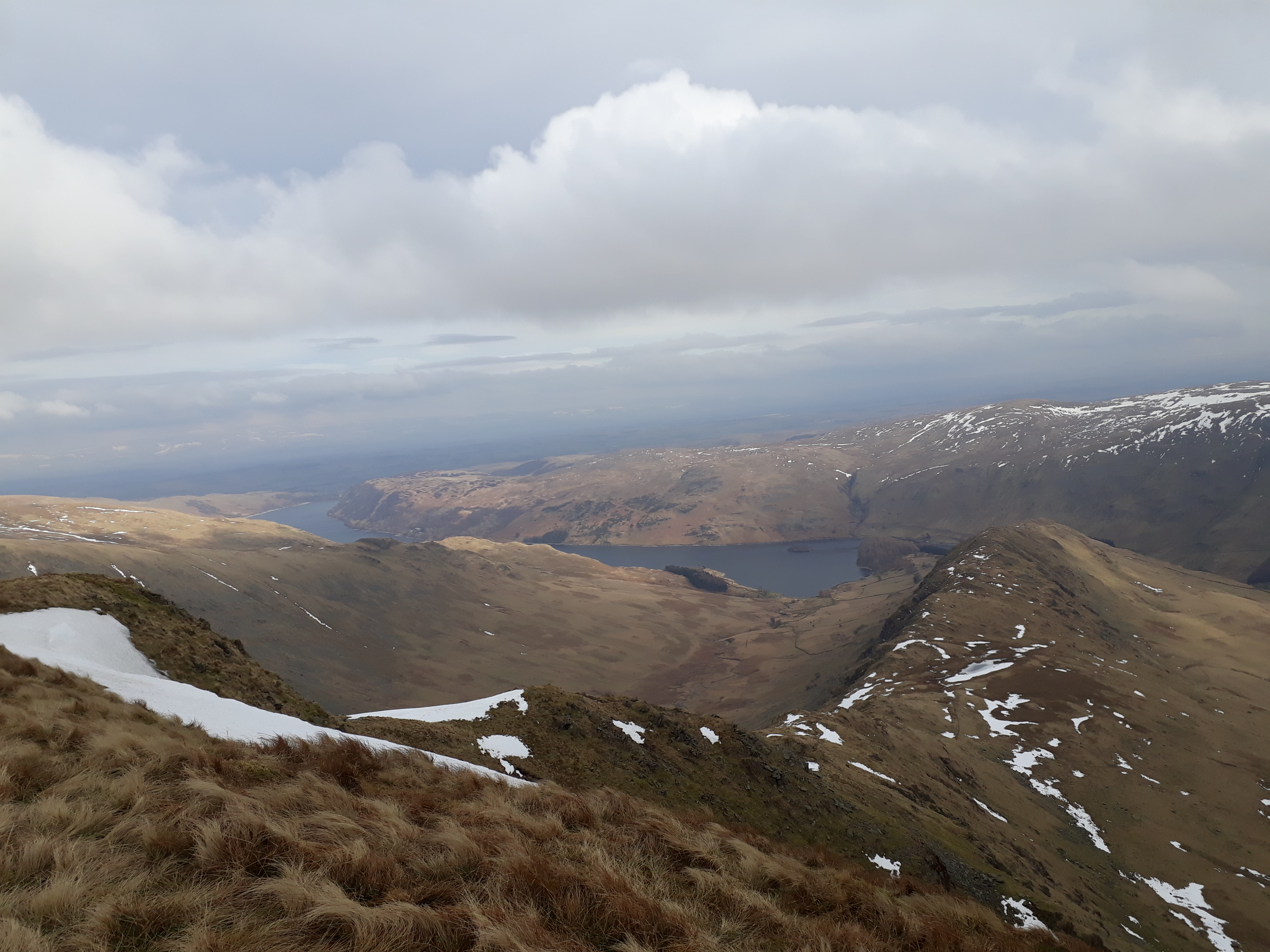
It's something of a brutal ascent, but we make reasonable pace, buoyed by the vistas that progressively unfold before us. This pic is looking north, with Hartsop in the foreground, and Ullswater in the background. The snow-capped summits on the LHS are, from left to right: Dove Crag; Hart Crag, Fairfield, and St Sunday Crag (correct me if I'm wrong here - the perspective makes identification of the latter hill a bit tricky ).
20180314_091039.
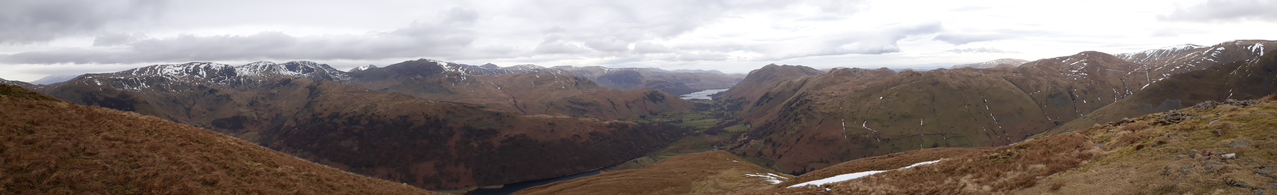
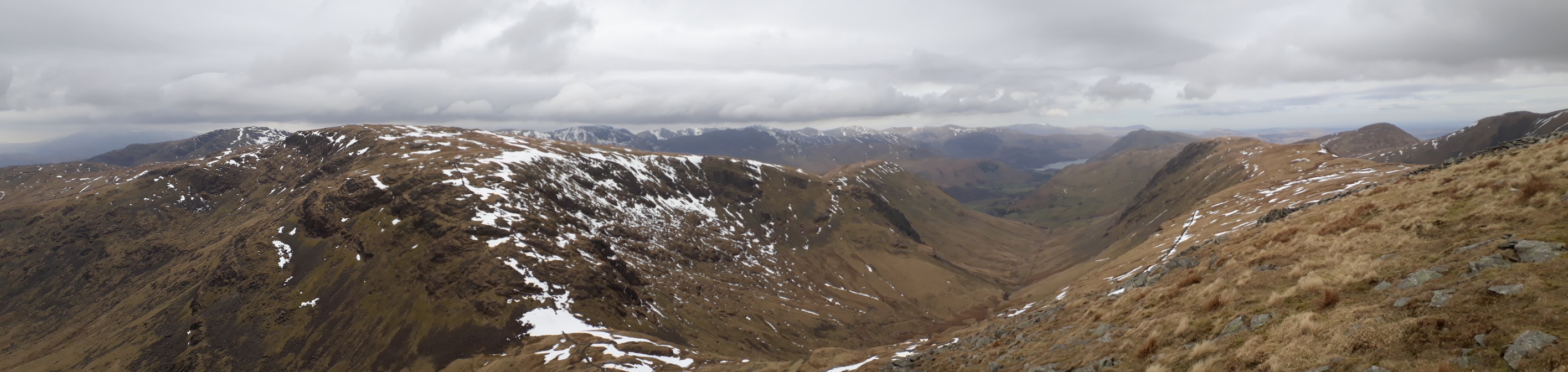
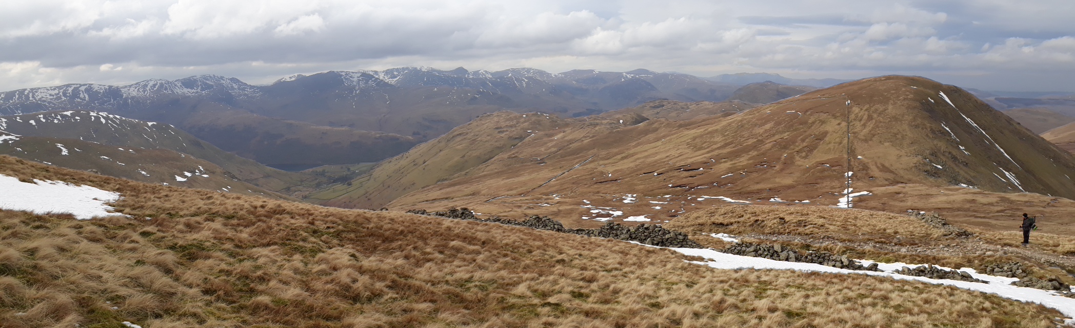
20180314_092650. Looking north towards Ullswater from the summit of Hartsop Dodd. We spend a fair bit of time trying to identify Helvellyn among this lot.
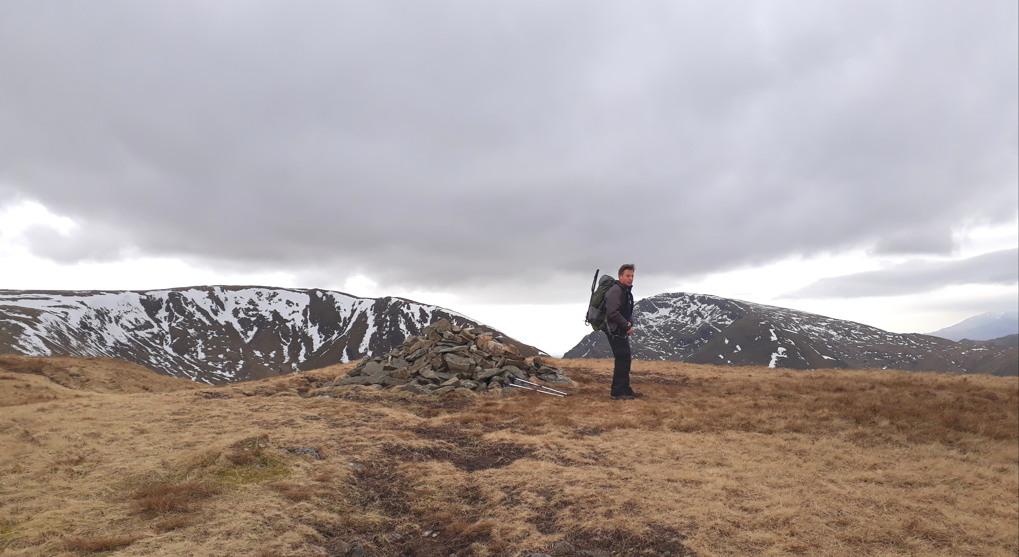
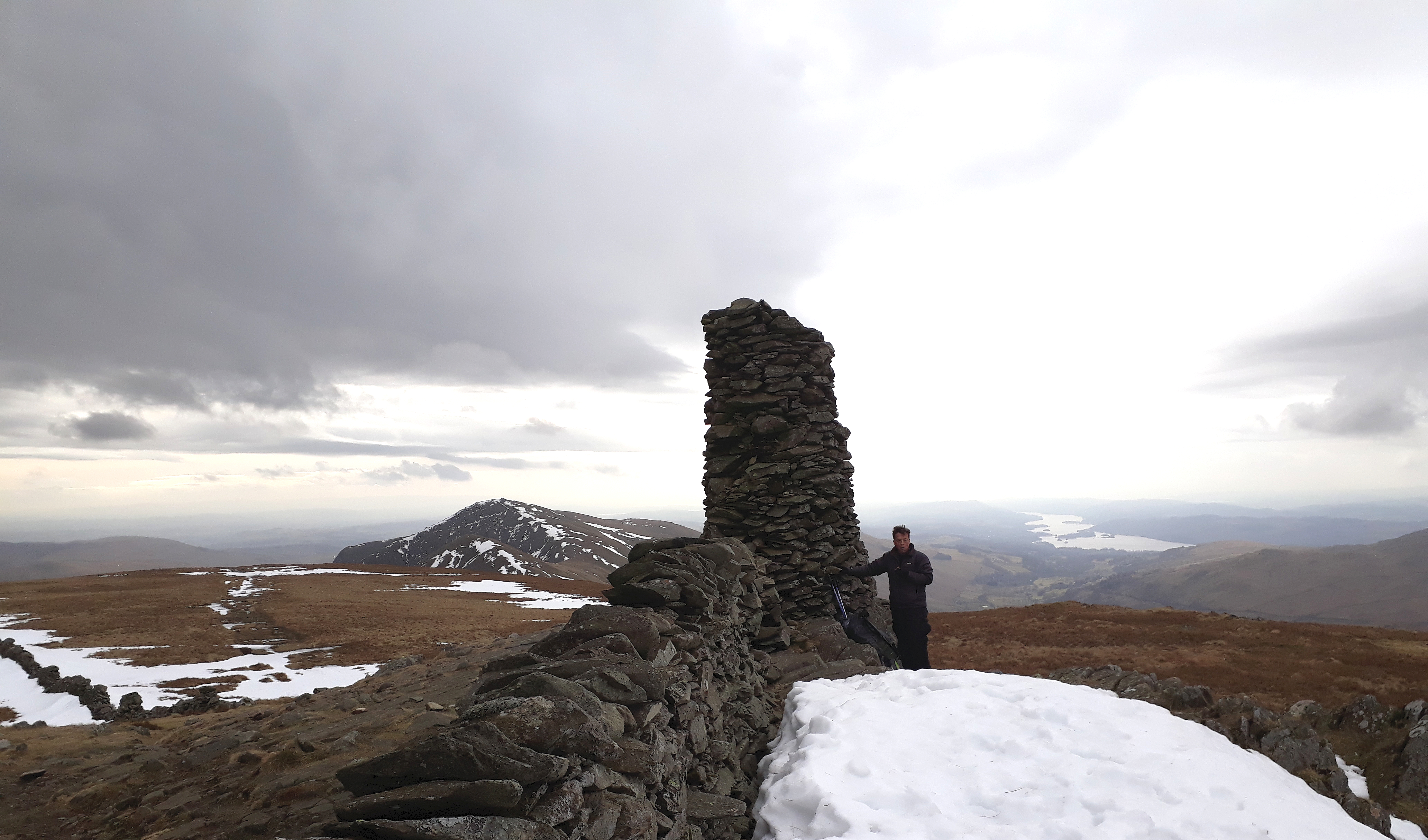
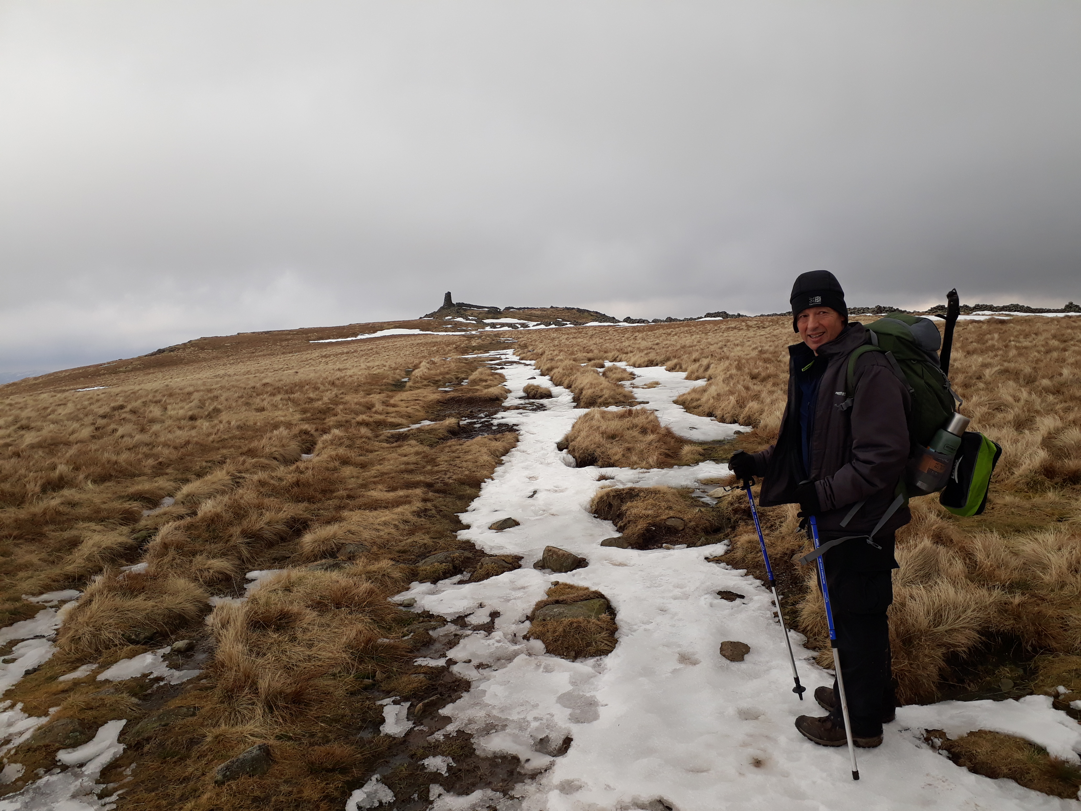
20180314_092829. The summit itself, featuring Dr Frank. Red Screes in the background, just to the right of his head, and Stony Cove Pike, our next target, on the LHS.
20180314_093311. In the background on the extreme LHS is Thornthwaite Crag, next-but-one target.
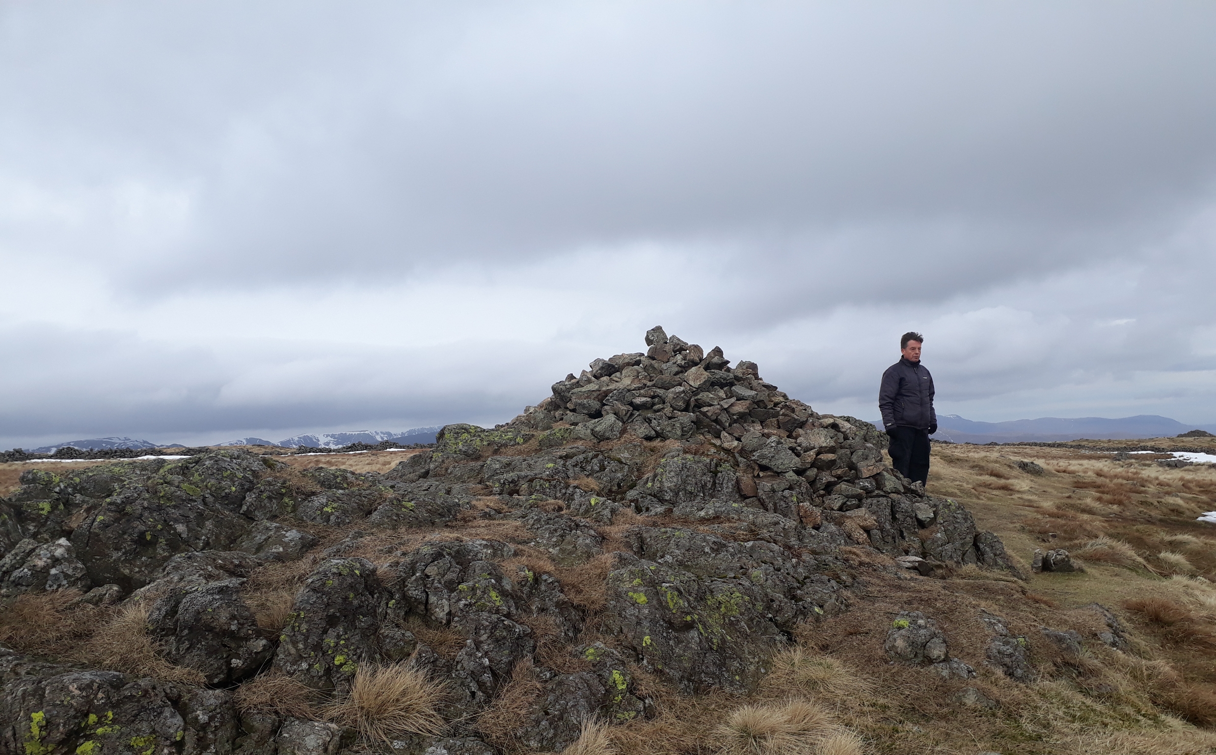
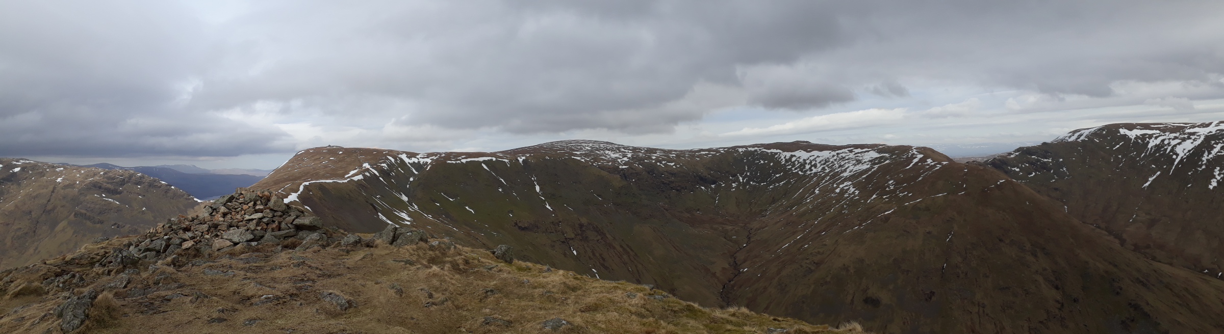
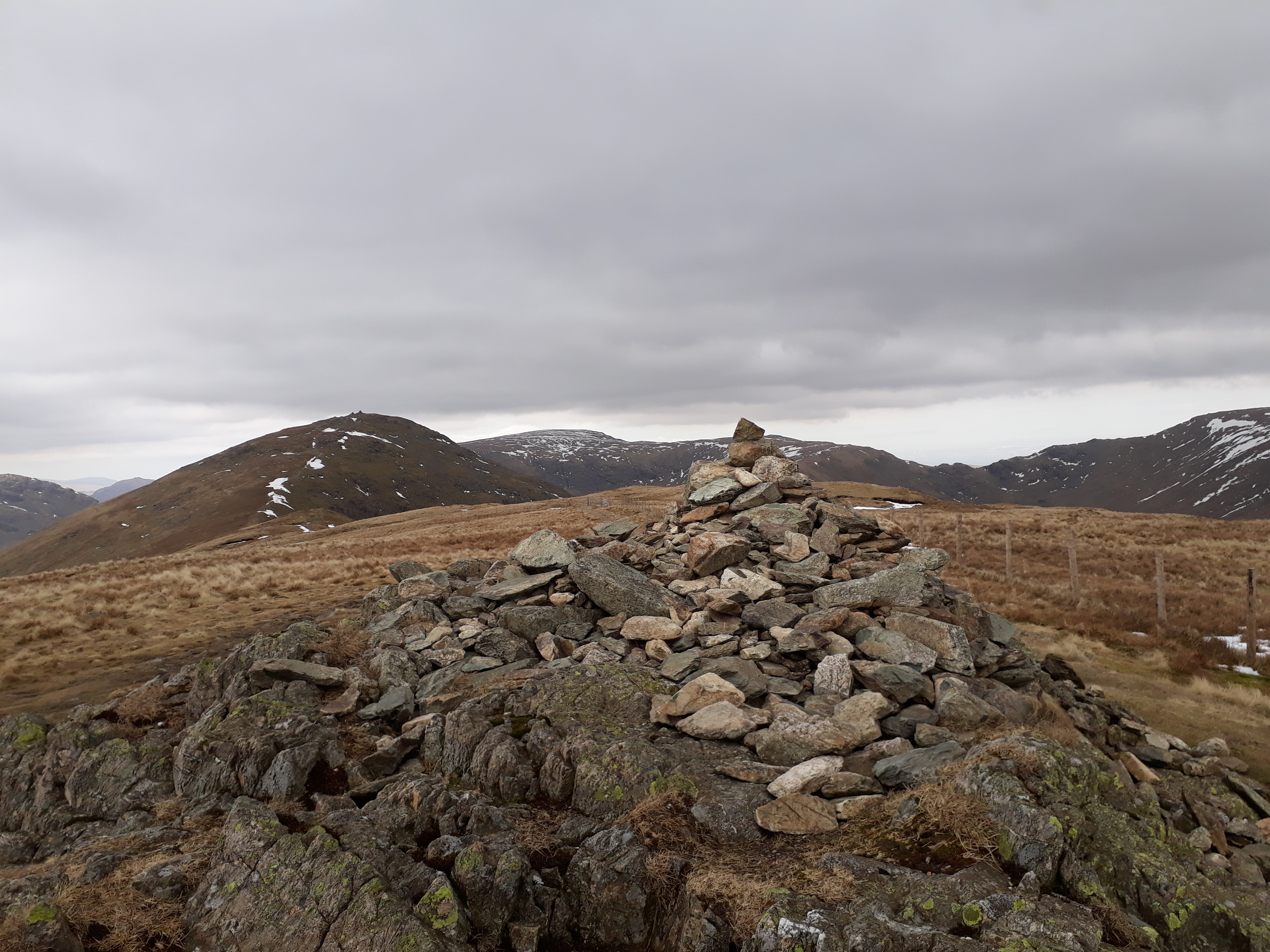
20180314_101332. Stony Cove Pike summit cairn - a bit underwhelming in itself, but affording some fine views.
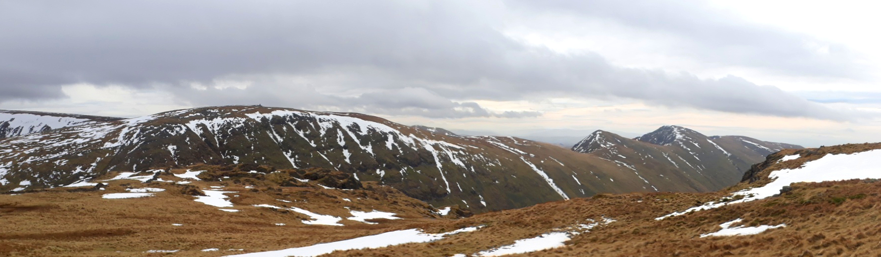
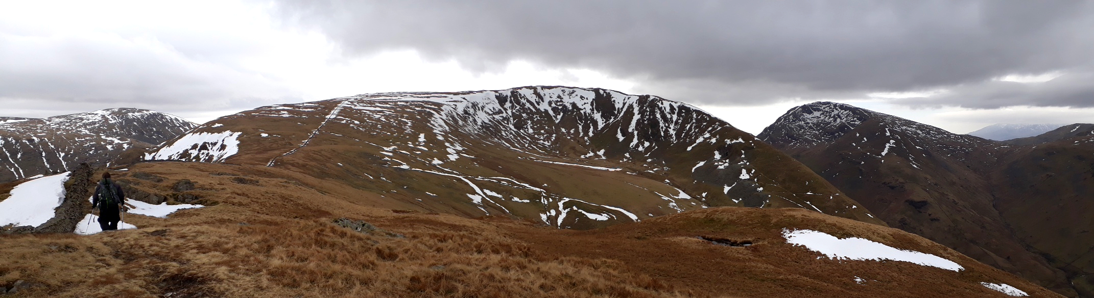
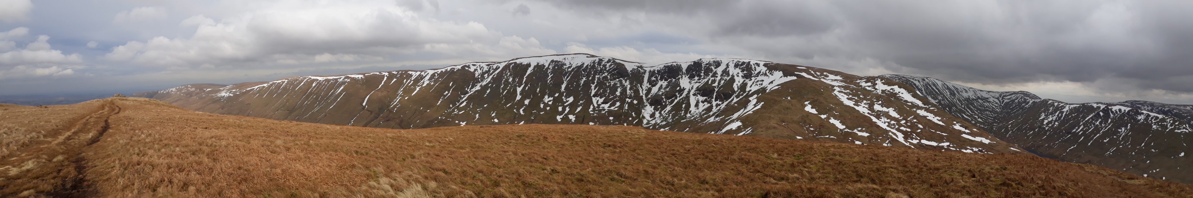
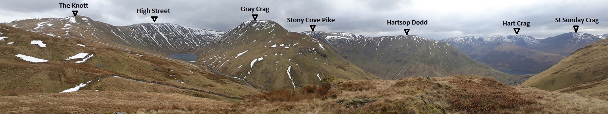
20180314_102150. Looking south east, and from left to right: Thornthwaite Crag, Froswick, Ill Bell, and Yoke.
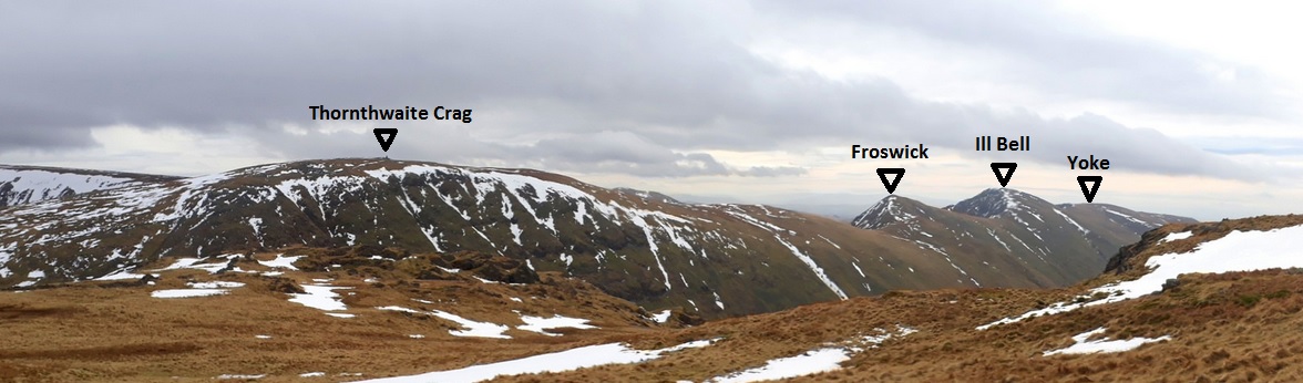
20180314_102150 labelled
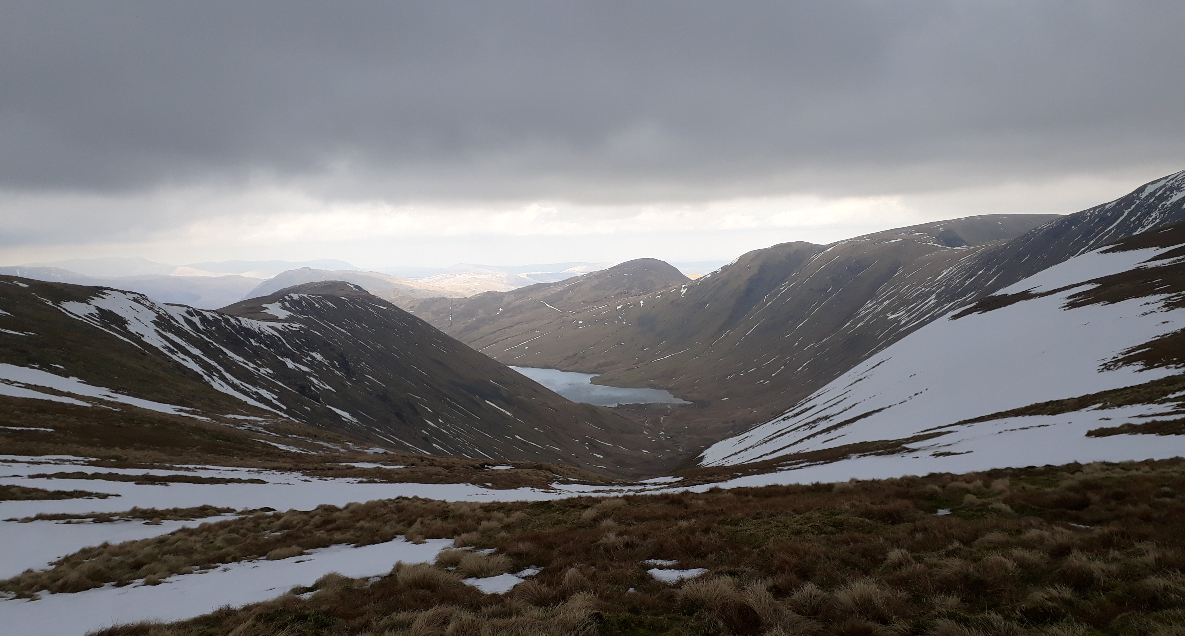
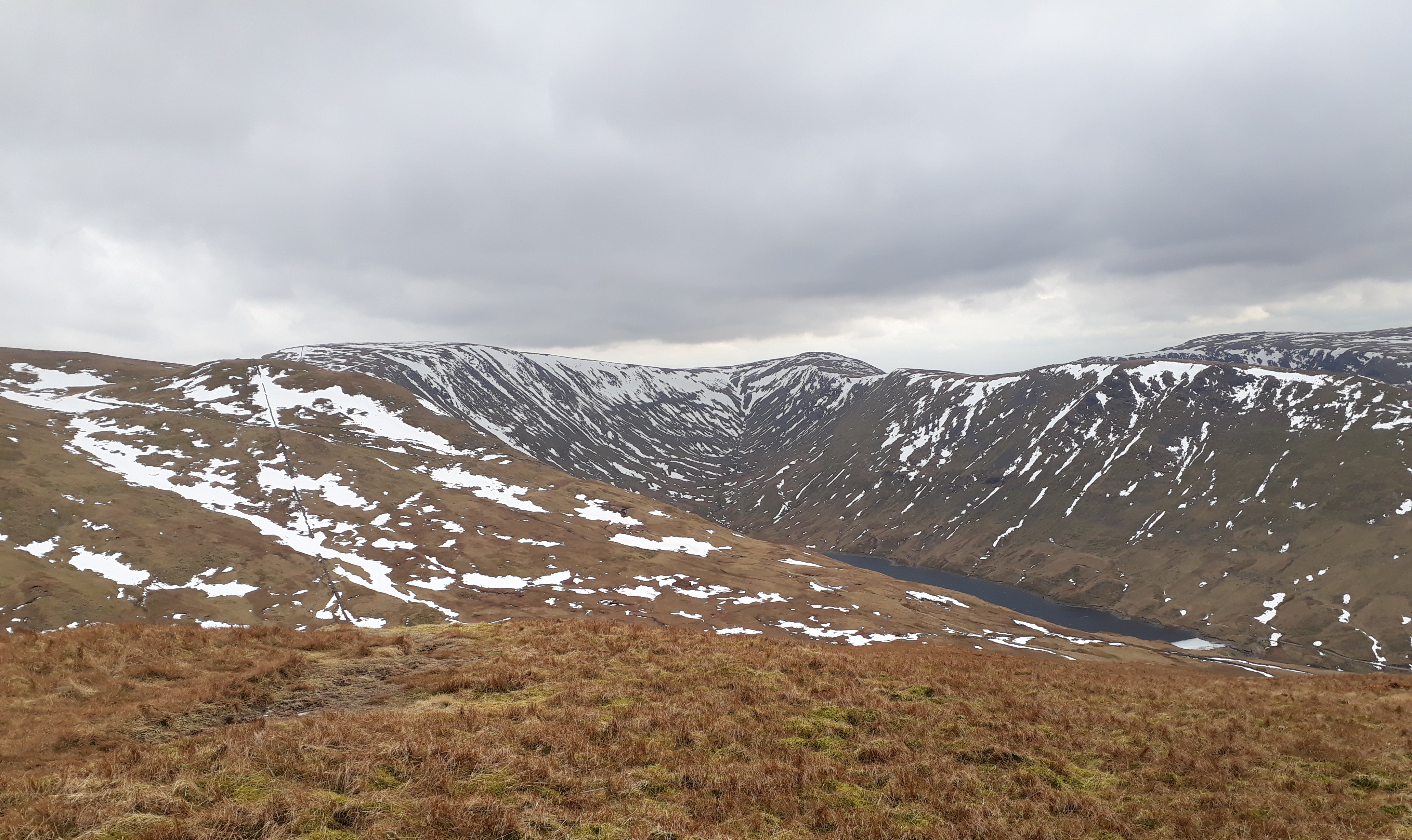
20180314_102830. This descent into Threshthwaite Mouth, a drop of about 110m, is surprisingly steep, and with patches of unpredictable snow - sometimes frozen, sometimes not - requires a good deal of care.
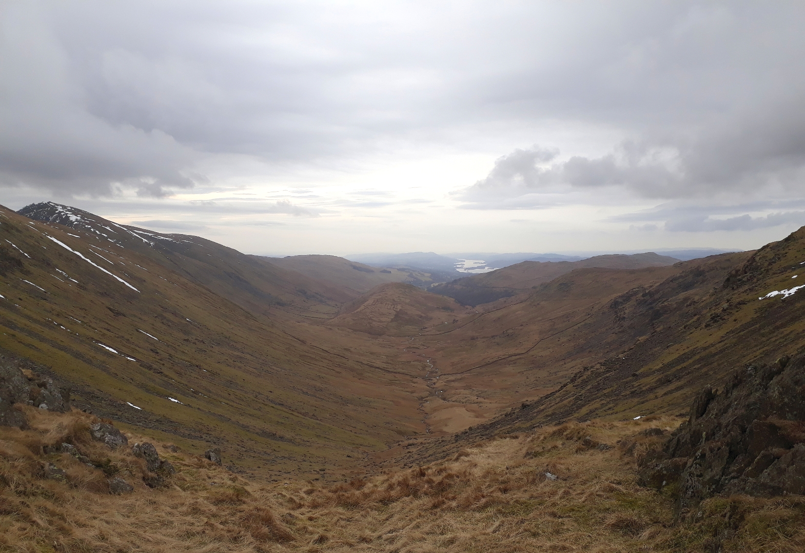
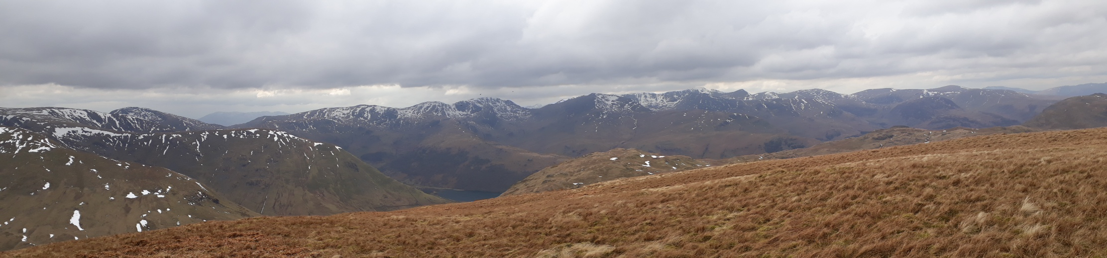
20180314_103959. Looking south from Threshthwaite Mouth down Troutbeck Park, with Windermere glinting in the background.
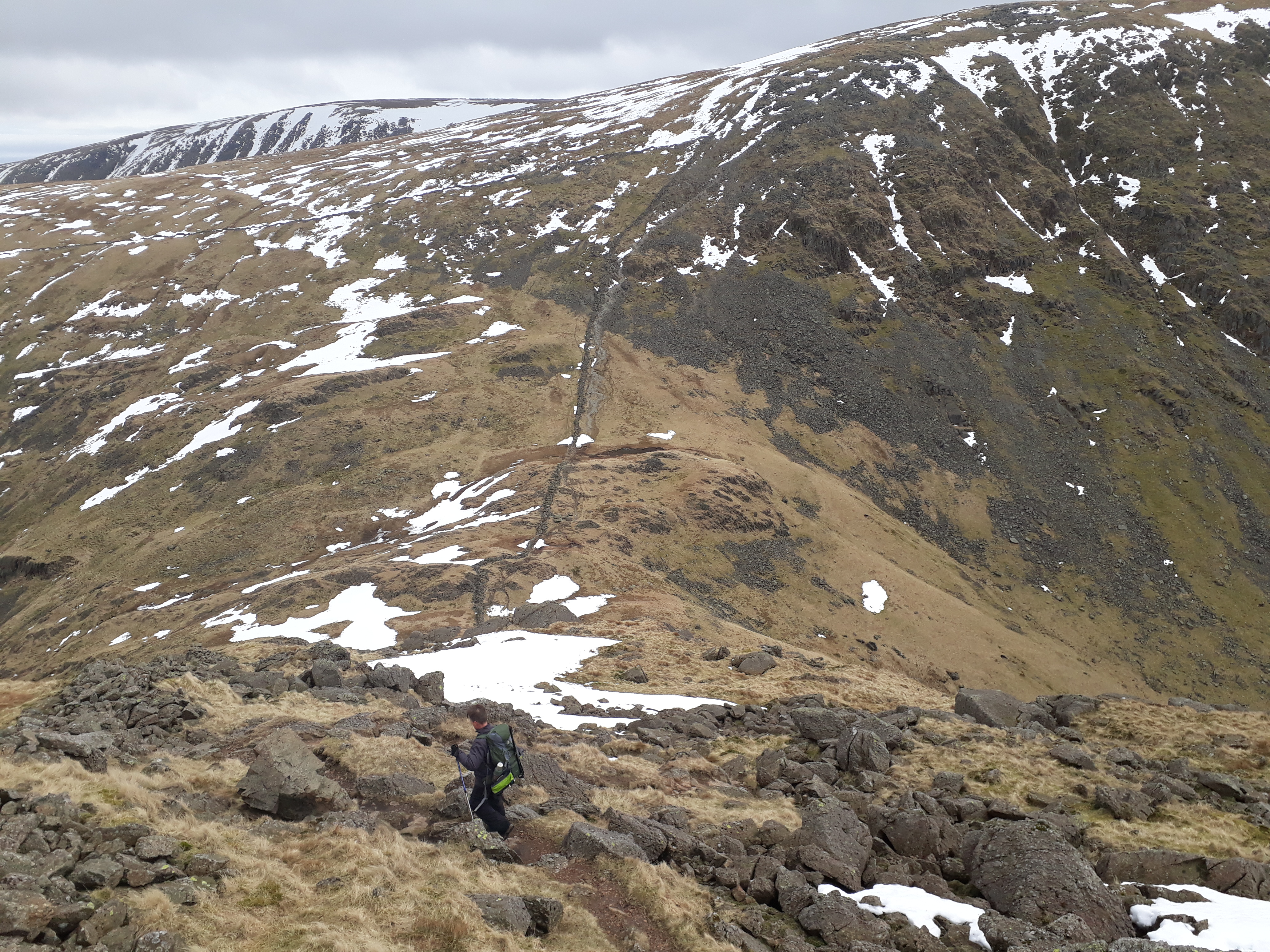
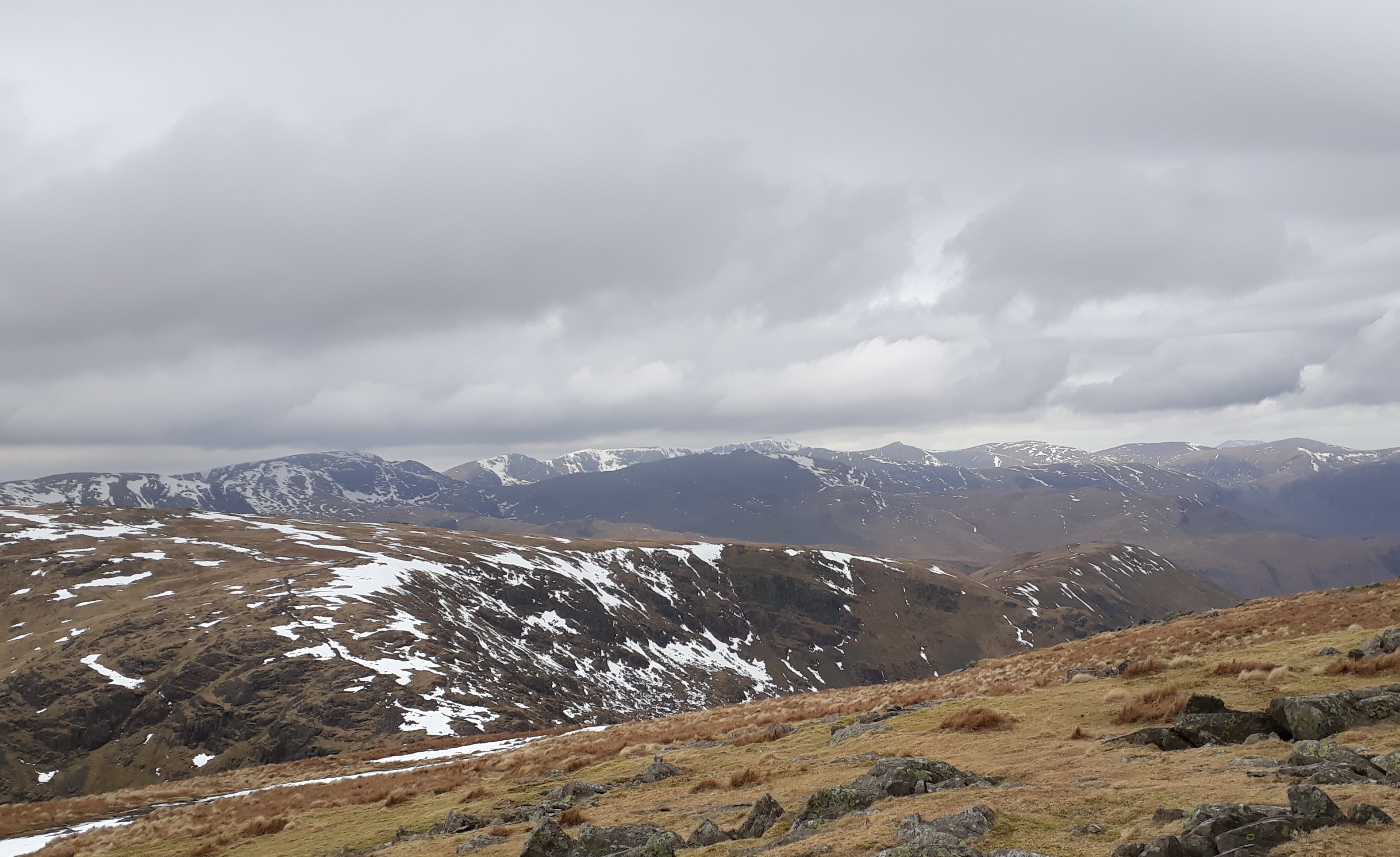
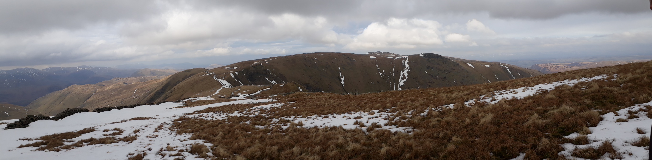
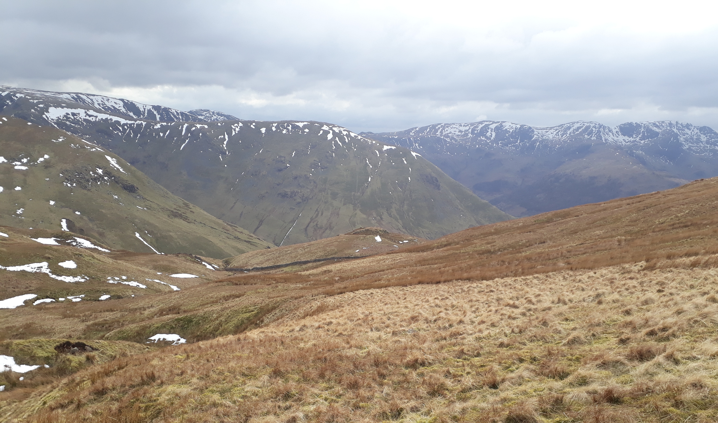
20180314_105443. Looking back the way we've just come towards Stony Cove Pike from just before the summit of Thornthwaite Crag
20180314_110406. Once on the ridge, we find that the breeze has got up rather, and the humungous cairn at Thornthwaite Crag provides some welcome shelter where we can partake of a little early lunch.
20180314_110414. The Helvellyn group is now clear of cloud...
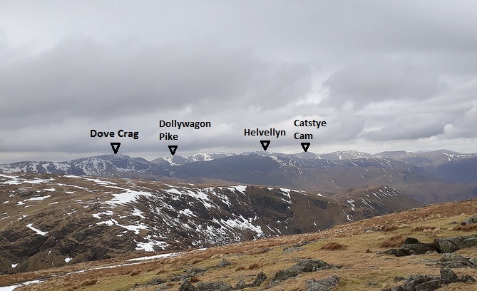
20180314_110414 labelled.
20180314_112018. Motorway to Froswick ahead.
20180314_113220. Looking back north towards Thornthwaite Crag from Froswick.

20180314_113220 labelled.

20180314_114900. The broad path continues to Ill Bell. This view looking back north from the summit towards Froswick and Thornthwaite Crag.
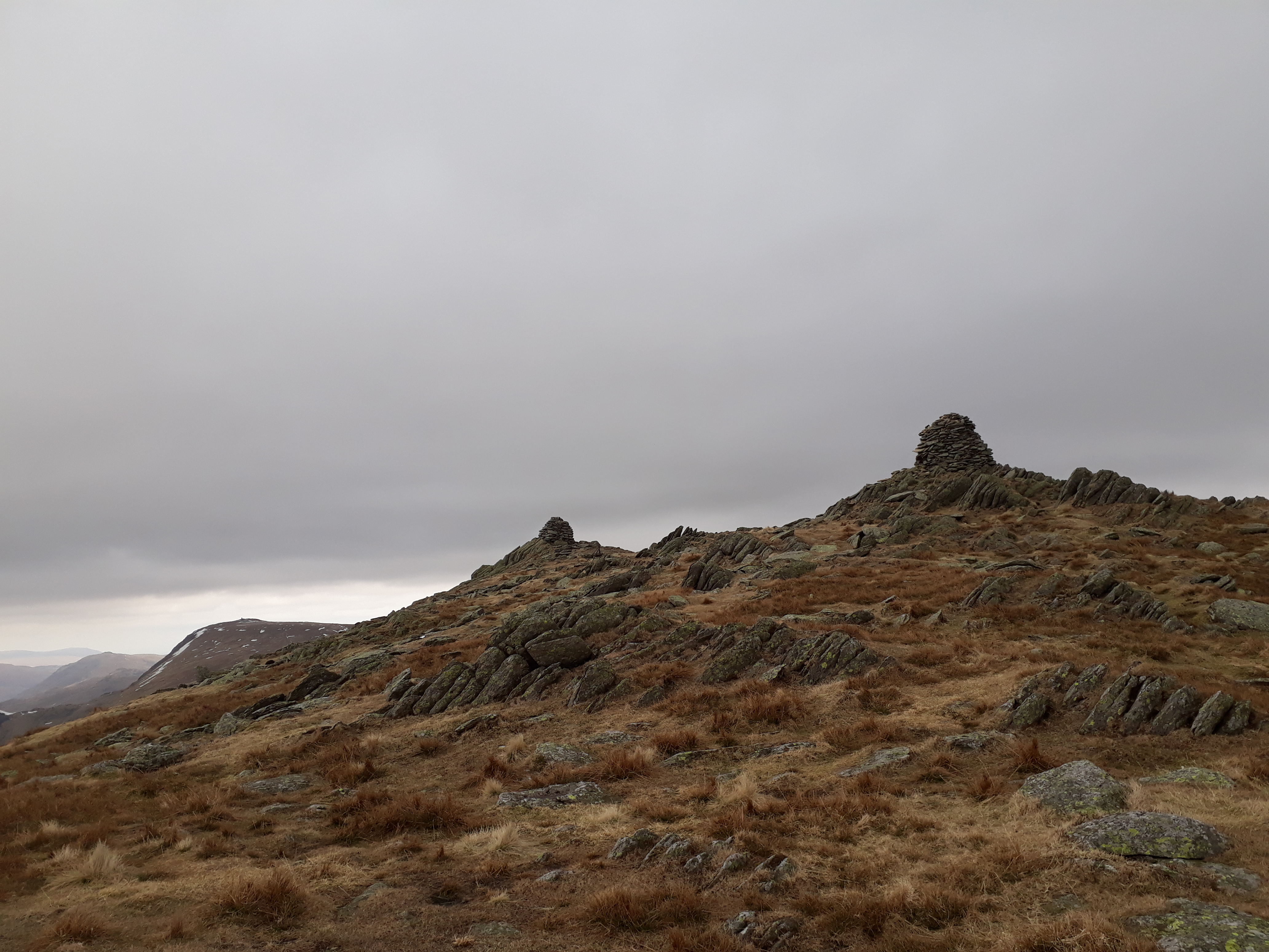
The twin cairns on Ill Bell summit.
20180314_115101. ...and looking south towards the last summit on this leg, Yoke.
20180314_120320. ...which takes just 10 minutes to reach.
Then it's back to Thornthwaite Crag the way we came - though Dr Frank spots a handy path that bypasses Froswick, avoiding the re-ascent.
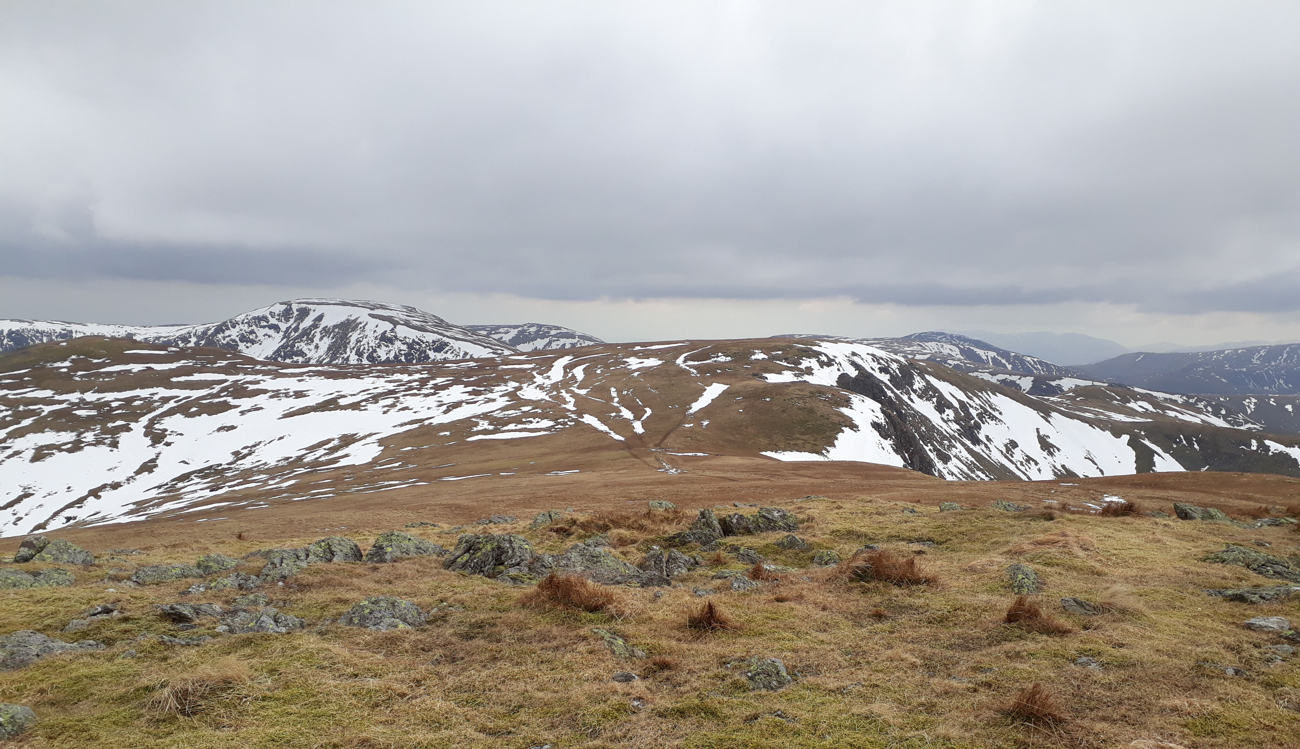
20180314_130111. Just before arriving at Thornthwaite Crag for the second time - we go for the cairn to take shelter again while we have a drink and nibble. While we're there a solo walker arrives. We've seen about 10 other walkers so far - it seems quite a lot for midweek on a cold March day. Then we head towards the highest summit of the day, High Street.
20180314_131521. Looking north towards Hayeswater, with the planned last hill of the day - Rest Dodd - in the background, centre pic.

20180314_133233. High Street is another somewhat underwhelming summit....
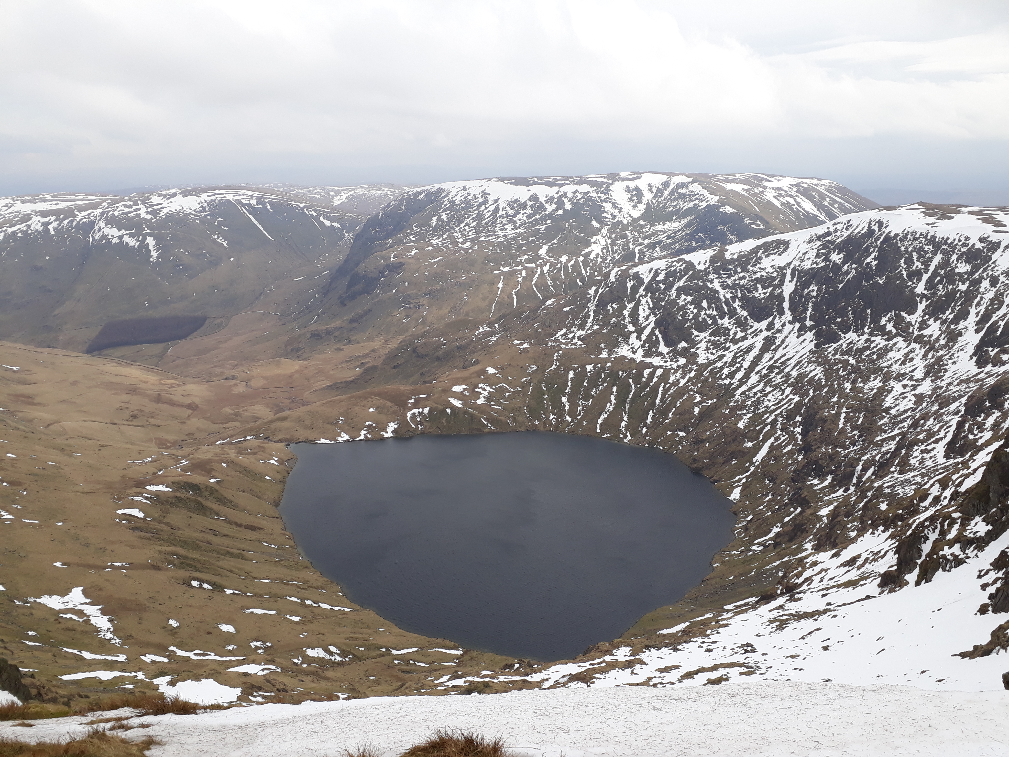
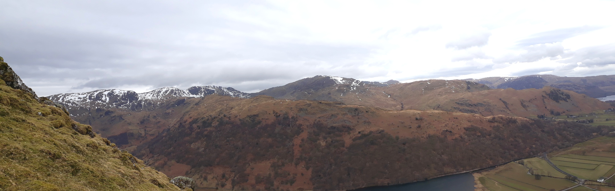
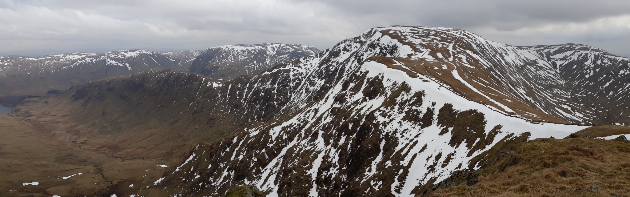
20180314_133823. ... but the scarp slope to the east is impressive. Here Blea Water viewed from the edge of the cliffs.
20180314_133848. ...and here Rough Crag, with Haweswater in the valley in the background. This had been tentatively pencilled in if time allowed, but given the time constraint, we decide to just appreciate it from a distance, fine looking though the ridge out to it is (nothing at all to do with the 225m of descent and reascent involved...).
20180314_134554. Ahead (north) Rampsgill Head (centre middle background), Kidsty Pike (RHS) and High Raise (centre far background). There's quite a strong and chilly wind blowing now, as had been forecast, to the extent that from time to time a gust blows one or other of us off balance.
20180314_135730. High Street (centre) and Rough Crag (to the left), viewed from the ascent to Rampsgill Head.
20180314_135748. Somewhere on that flat area ahead is Rampsgill Head!!! To the right Kidsty Pike.
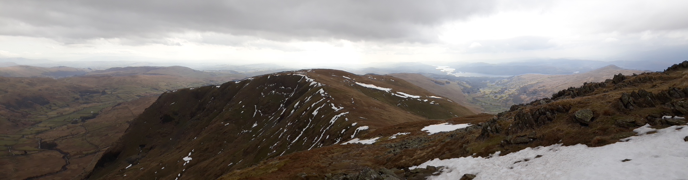
20180314_142659. It's a broad, easy-to-follow path, with a gentle ascent to the virtual summit of High Raise. This view is looking back south west from the summit towards Rampsgill Head (foreground, right), with High Street in the background, left, as we set off back the way we have come, to Rampsgill Head.
20180314_144026. We suppose this must be the summit of Rampsgill Head, but it's not really clear: there's quite a large flat area at much the same level. In the background, on the extreme left The Knott - the next target - is just visible; to the right is Rest Dodd, the last hill of the day.
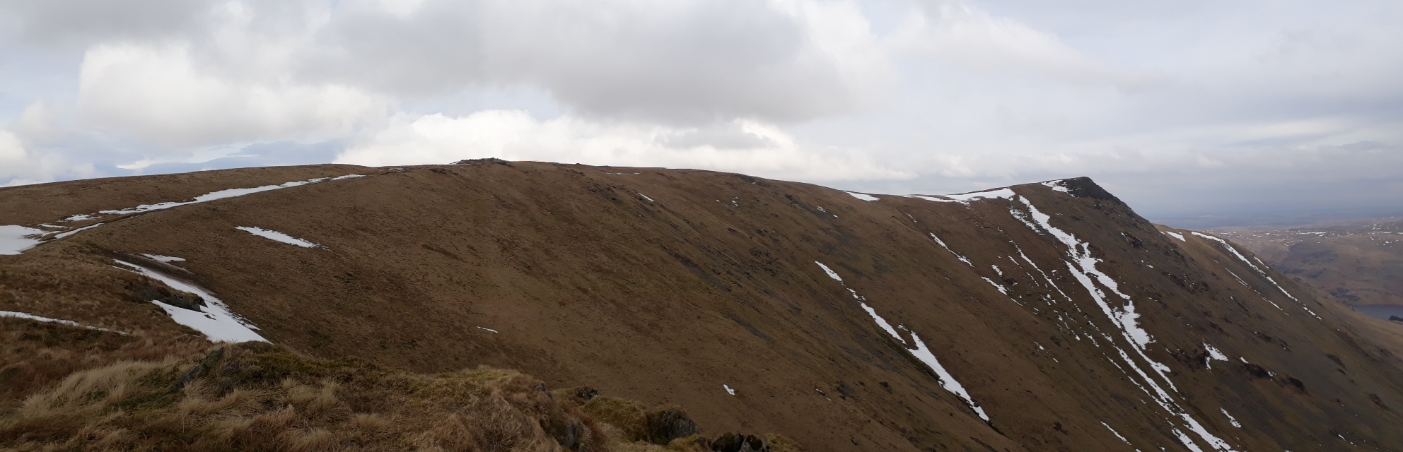
20180314_144837. The Knott is a very short walk away...
20180314_145105. And a couple of minutes walk west from the summit brings Hayeswater into view.
20180314_145703. Descending from The Knott. Ahead the last summit of the day - Rest Dodd; which at least looks like a discernible summit!
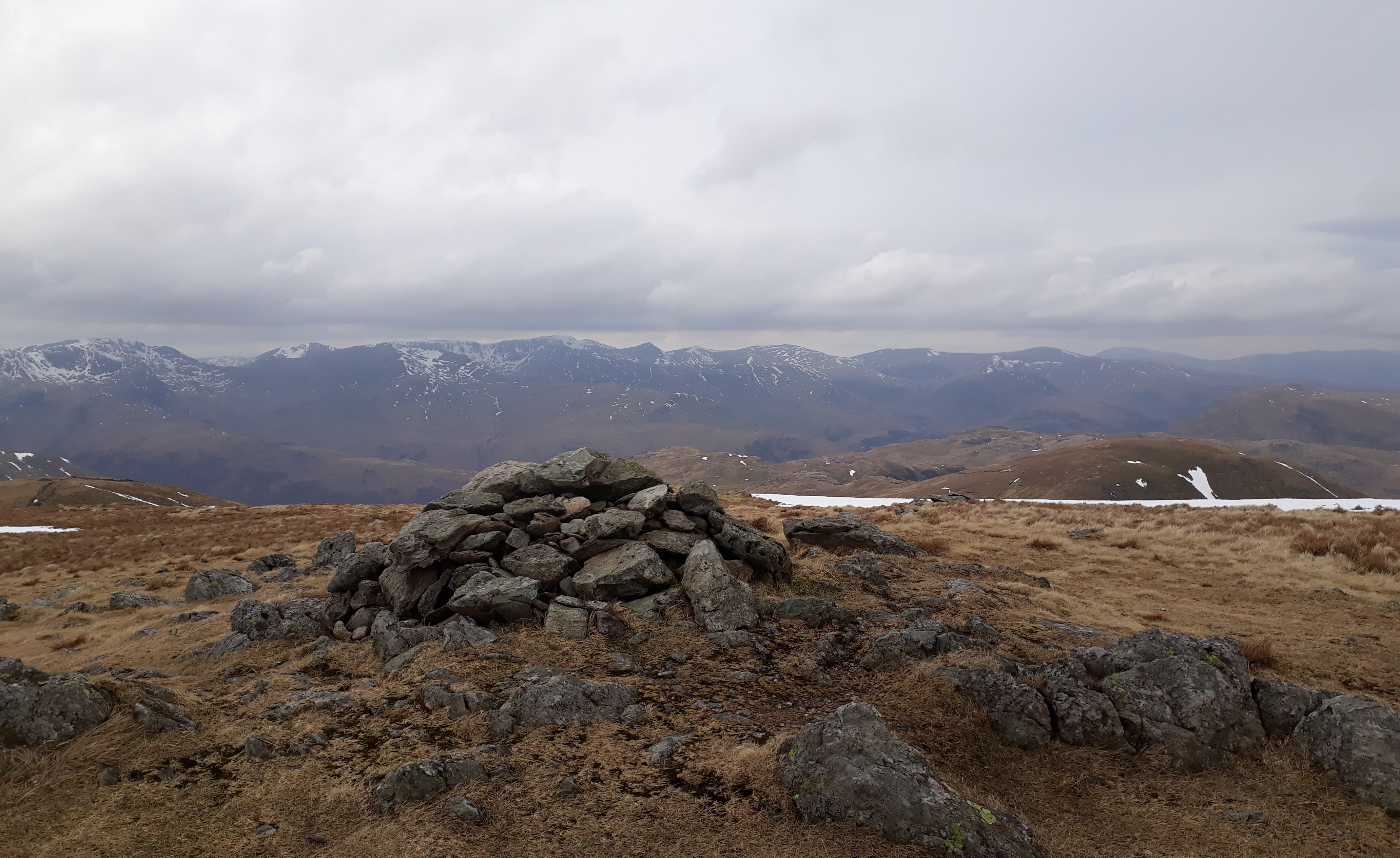
20180314_151753. 20 minutes or so to get to the summit, and some fine views, this looking roughly south east towards The Knott (from whence we've just come), High Raise (LHS) and High Street (RHS).
20180314_151841. Looking west towards Brothers Water and the Helvellyn group from Rest Dodd.
20180314_151901. Looking back south towards The Knott (middle background, LHS) Thornthwaite Crag (RHS) and High Street (LHS).
20180314_153239. Now it's all downhill, and we're making good time - about 15 minutes ahead of schedule. This is a view of the yomp back down into the valley. We take a line just to the east of Prison Crag.
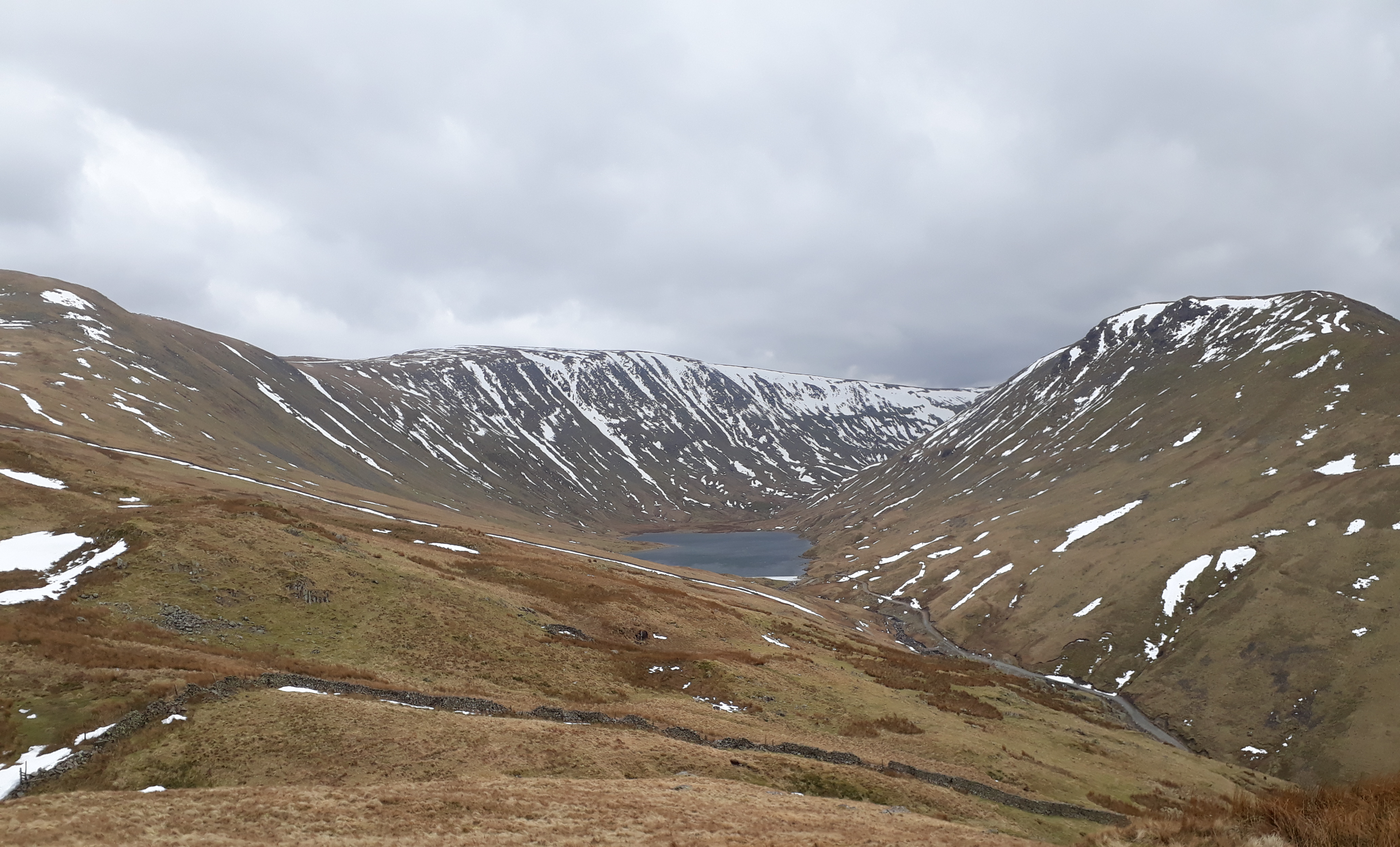
20180314_153805. On the descent from Rest Dodd to Hartsop: Hayeswater.
20180314_153821.
20180314_153821 labelled.
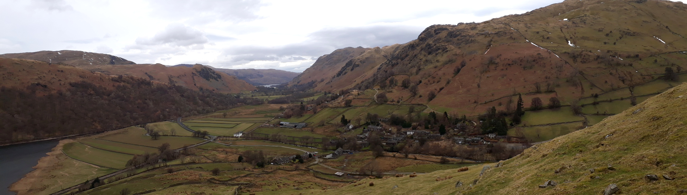
20180314_155254. On the track to Hartsop, a last look up Pasture Bottom towards Threshthwaite Mouth

20180314_161702. Couldn't resist a last pic of Hartsop Dodd before we departed...
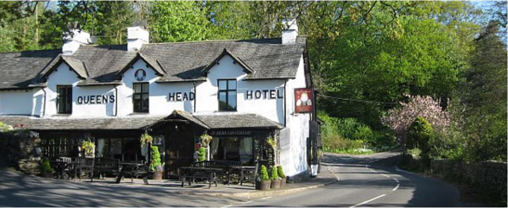
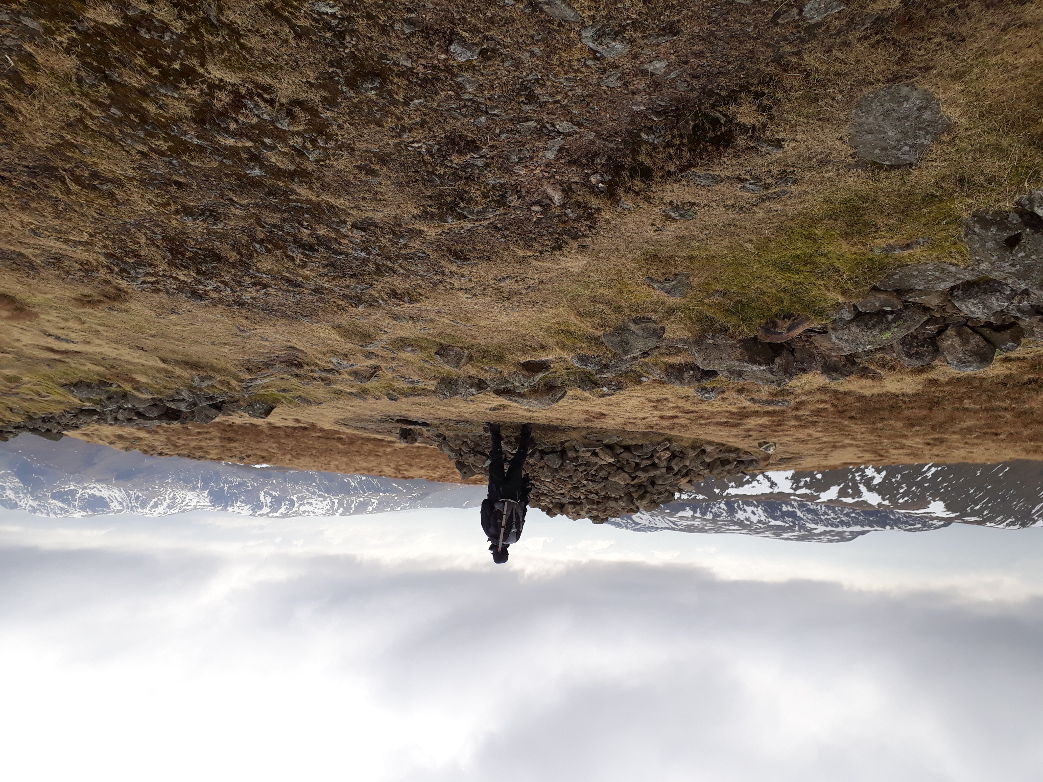
Being under the medical supervision of Dr Frank, it was necessary on the way to pay a short visit to an establishment of cultural, historical and architectural distinction in order to make up insensible loss of moisture that had occurred during the walk...
3D view of route.
