free to be able to rate and comment on reports (as well as access 1:25000 mapping).
I thought it worth publishing this short report, partly because very few have been published so far, partly because of the bike-car expedient of doing the linear route; and partly because the superb scenery deserves showcasing. The Highlands it ain't, but it's a wonderful example of Welsh pastural landscape at its best.
Our original plan had been to spend 3 days in the north of Scotland, either in Torridon (1st choice), or the Cairngorms. But the weather didn't play ball. Intense scrutiny of the Met Office runes in the days leading up to our planned departure date led me to the reluctant conclusion that we'd be better off in South Wales.
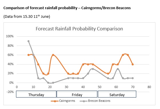
Forecast comparisons.
North west Scotland (eg Torridon) seemed to be a weather write-off.
So we agreed on South Wales - Black Mountains and Brecon Beacons. First two days in the Black Mountains, final day on the Brecon Beacons.
Generally the plan was for each route to drive to the end point, park the car, cycle to the start point, and then, at the end of the day drive back to the start point to pick up our bikes.
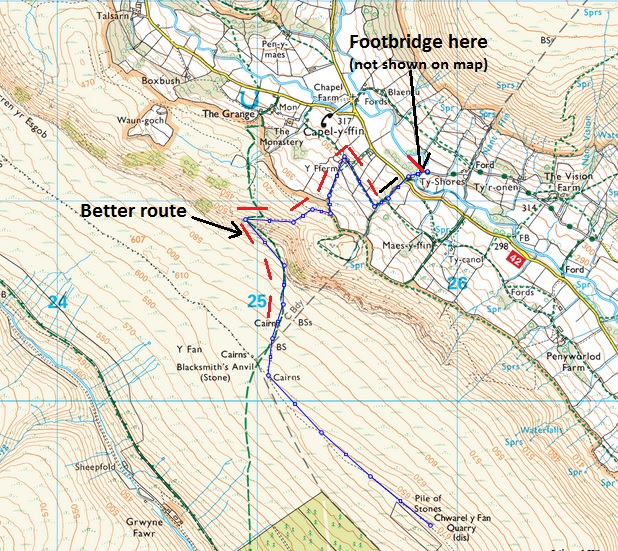
Day 1 walking route; the second route is the cycled route to the start of the walk.
Our first campsite is at Newcourt, near Felindre, so it is only a 3 or 4 miles drive to get to the Stone Circle car park, just below Twmpa, where we will leave the car. It's a huge car park, but at 08.15 it is almost full with army vehicles starting dozens of soldiers on a training exercise.
It's raining slightly at this point, and the upper levels of the hill are clag-bound. We unload our bikes from the car roof, and get off as quickly as we can.
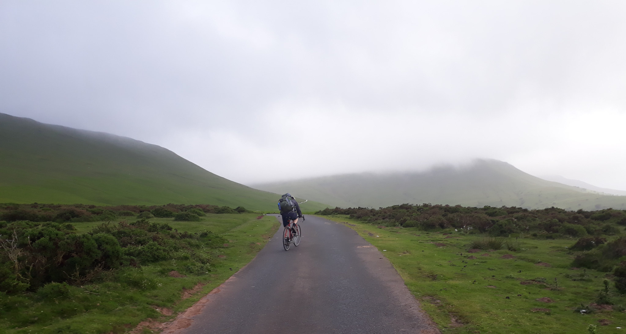
20180614_084327. It's a short pedal up to the high point on the road - about 100m of ascent; followed by a wonderful descent down the extremely picturesque Vale of Ewyas, freewheeling most of the way to our start point just north of the hamlet of Stanton.
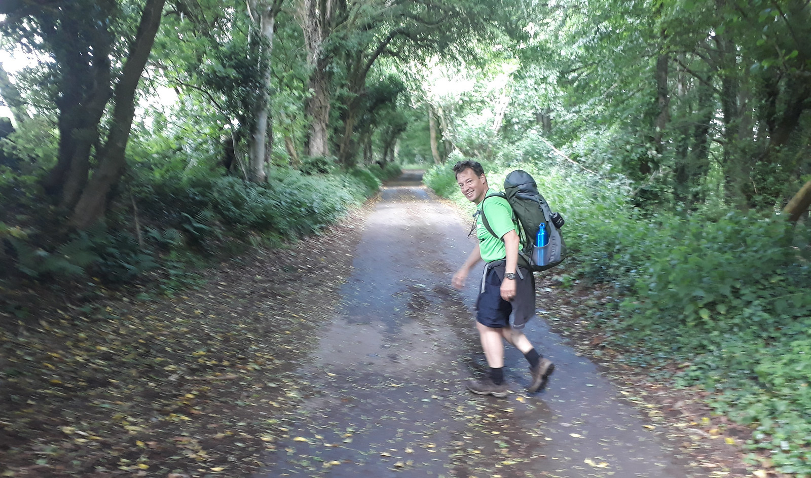
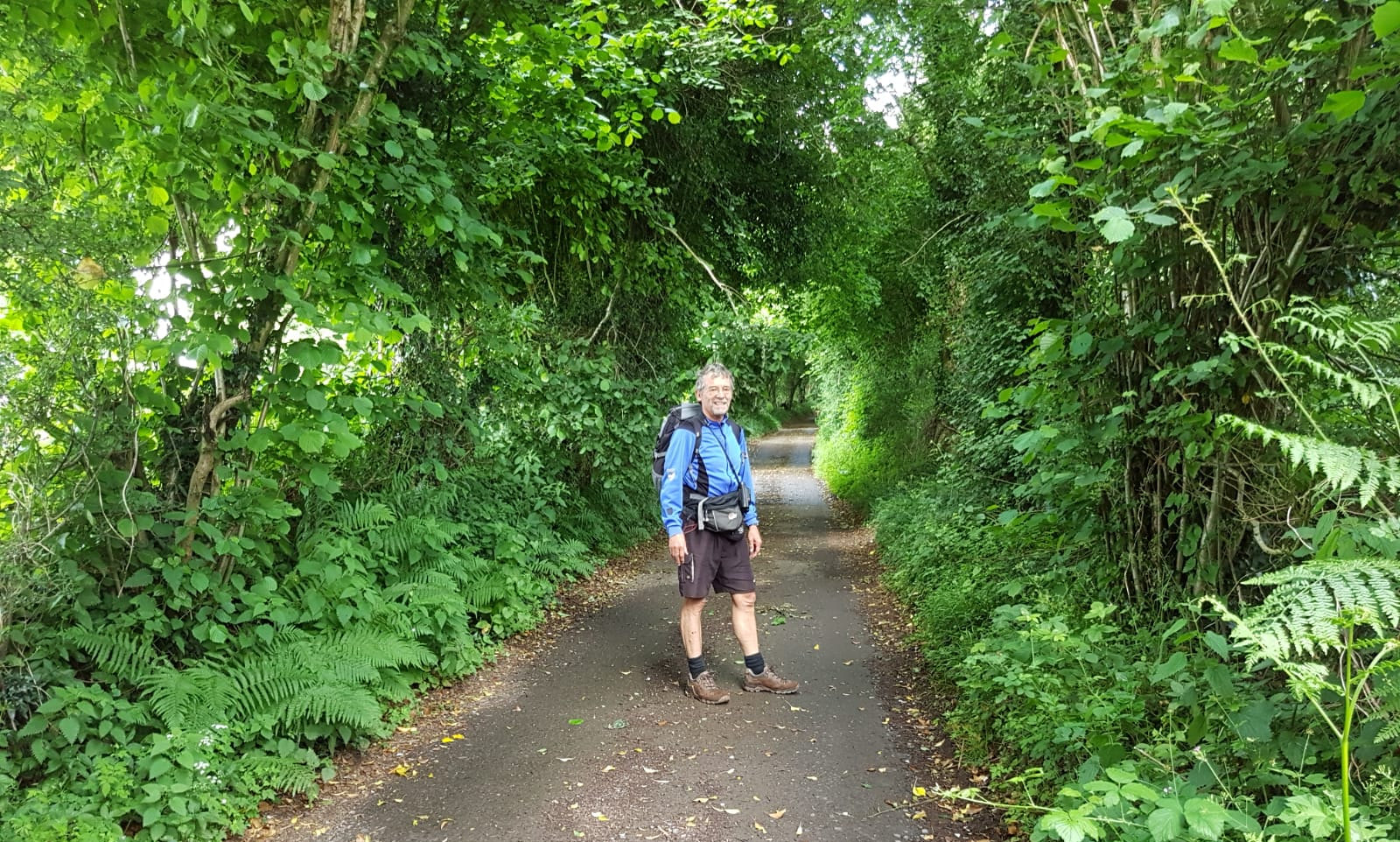
After stashing and locking our bikes, we set off up the metalled minor road that starts our route.
20180614_094820.
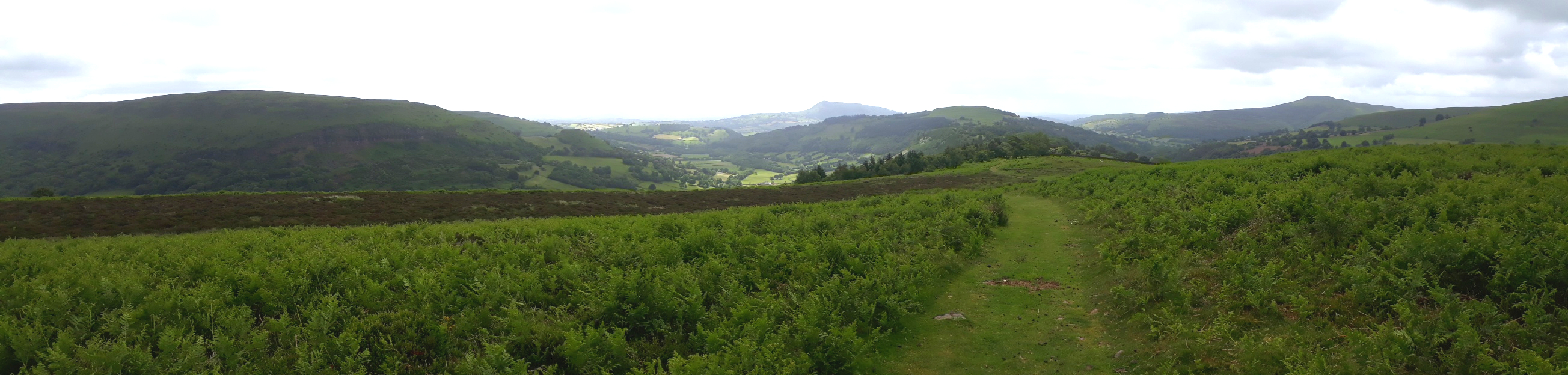
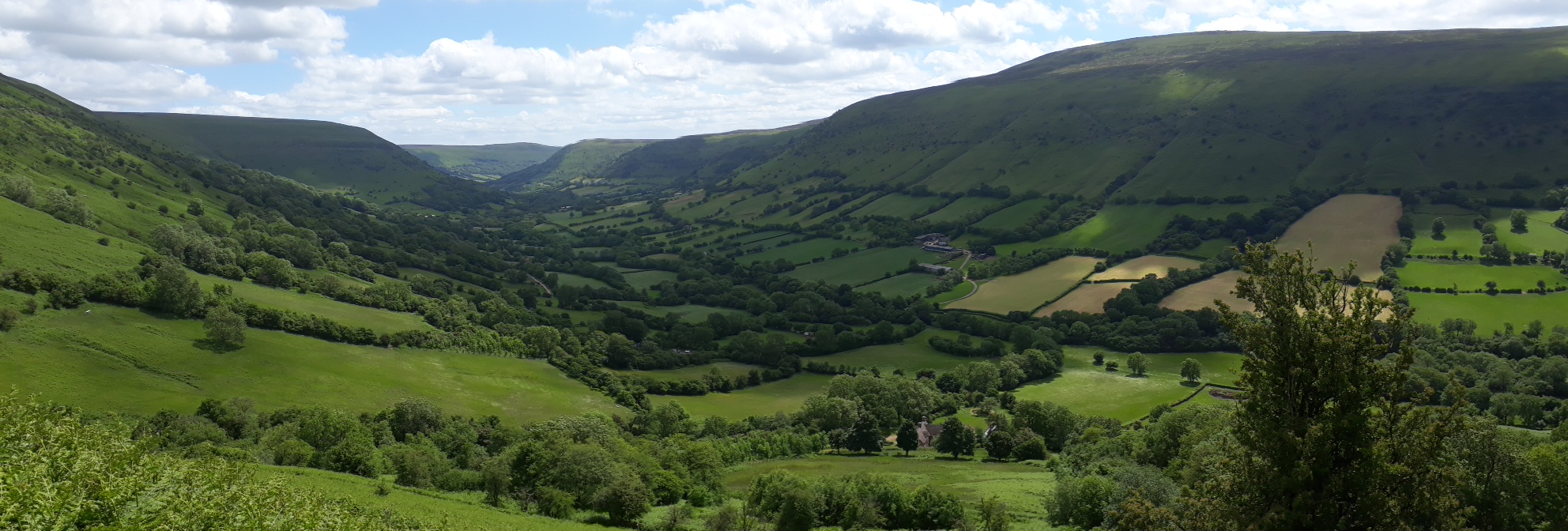
20180614_100713. Some beautiful views of the village of Cwmyoy, and the dramatic cliff that is Darren.
After about 500m we cut down right on a path through the forestry, emerging after 20 minutes or so on to grassy track that leads up on to the moor.
20180614_104533.
Again fine views of Cwmyoy and Darren are to be had from here.
20180614_110430. After a few kilometres of walking we reach the open moor. This pic is looking back along the path we've just come along.
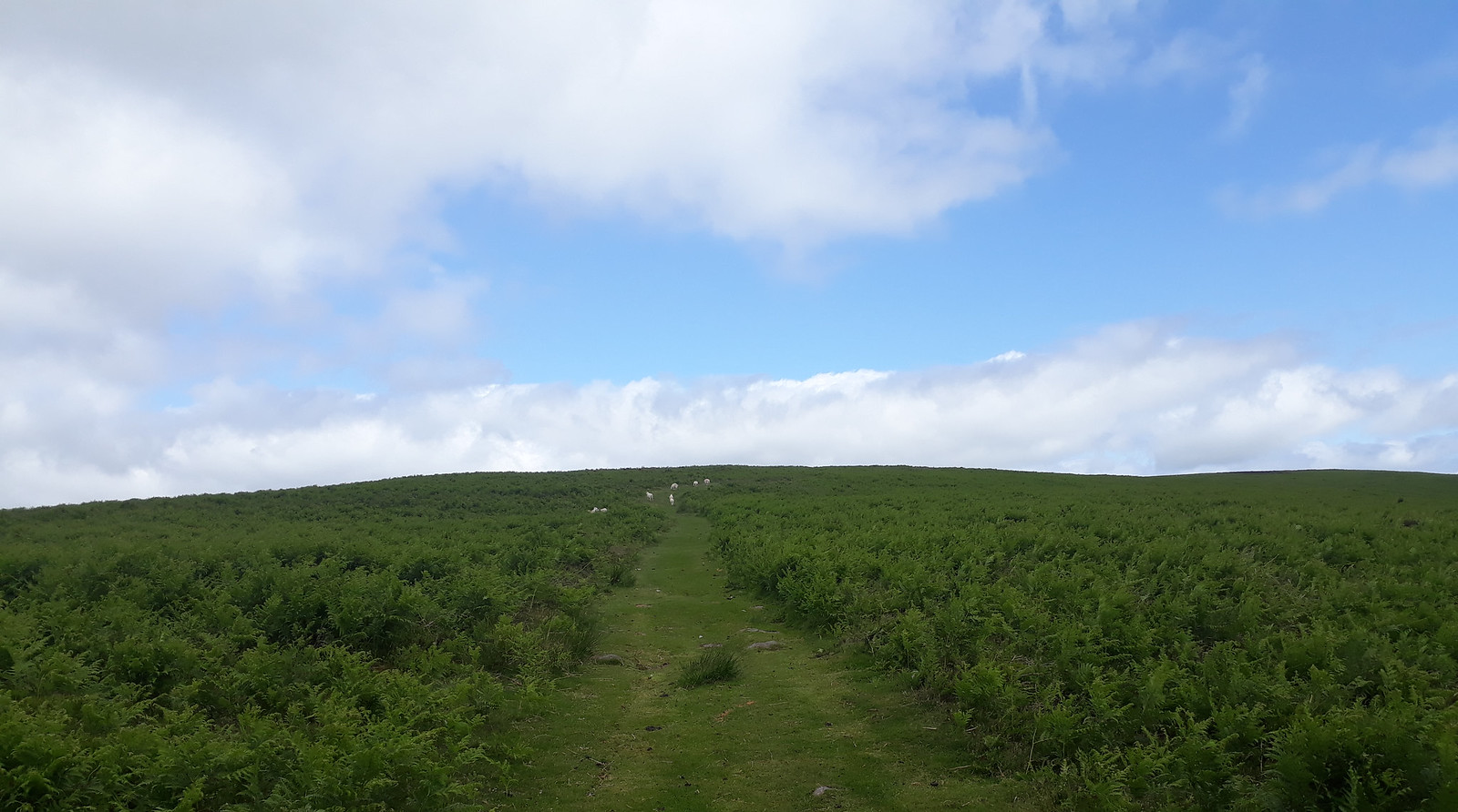
20180614_110443. The last pull on to the ridge. The path is definitely appreciated, meaning we avoid a lot of tiresome bracken-bashing.
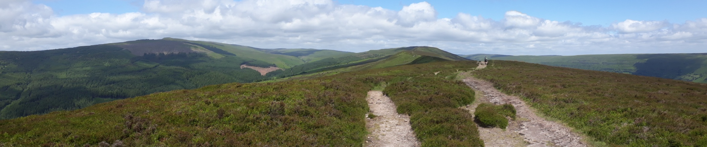
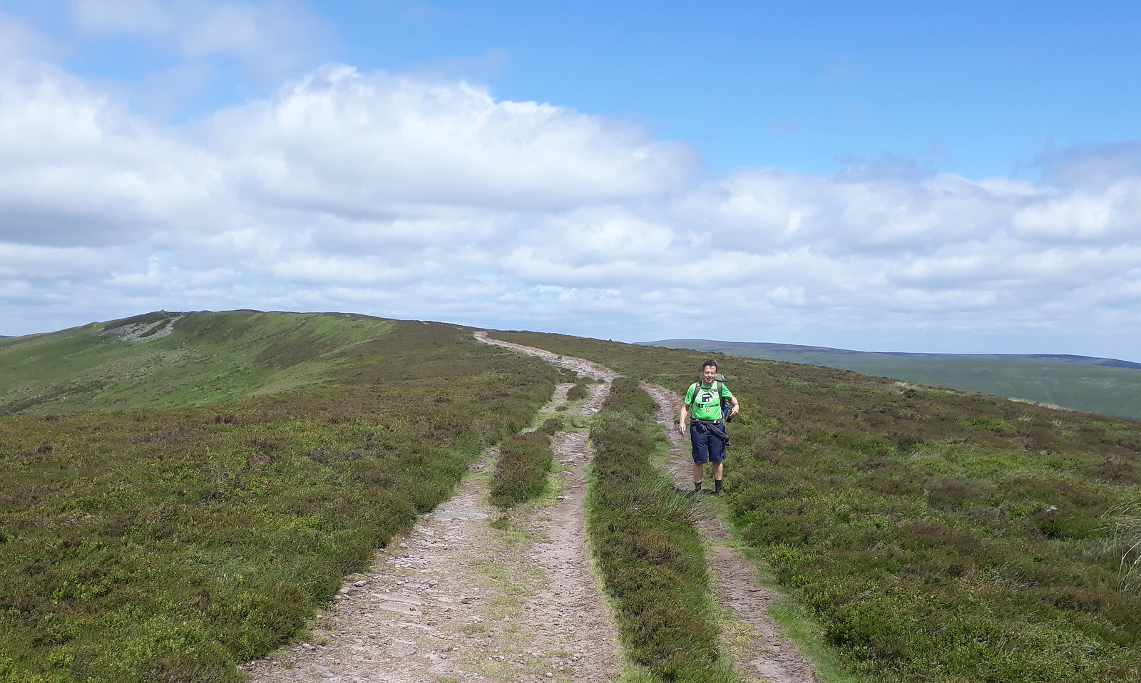
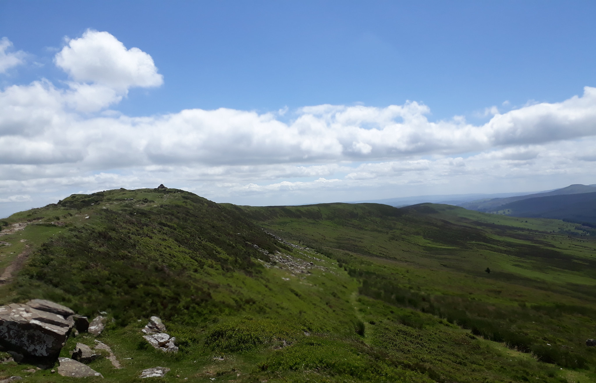
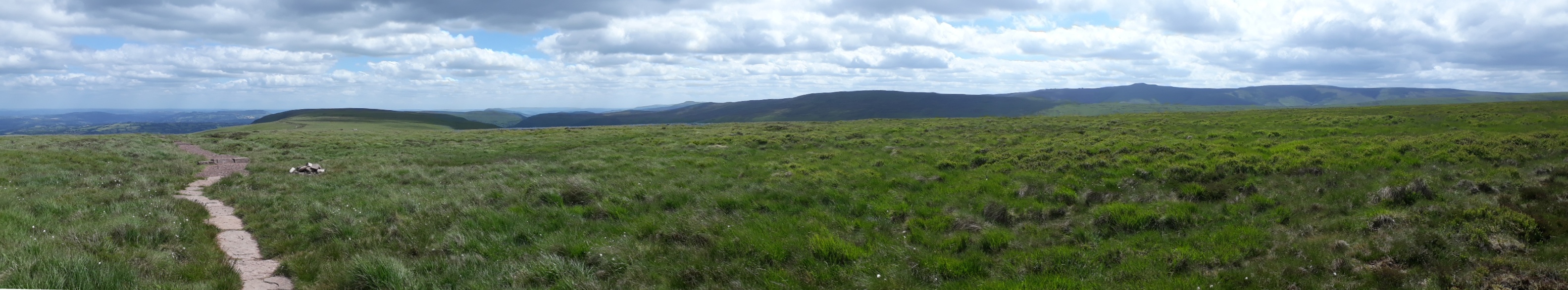
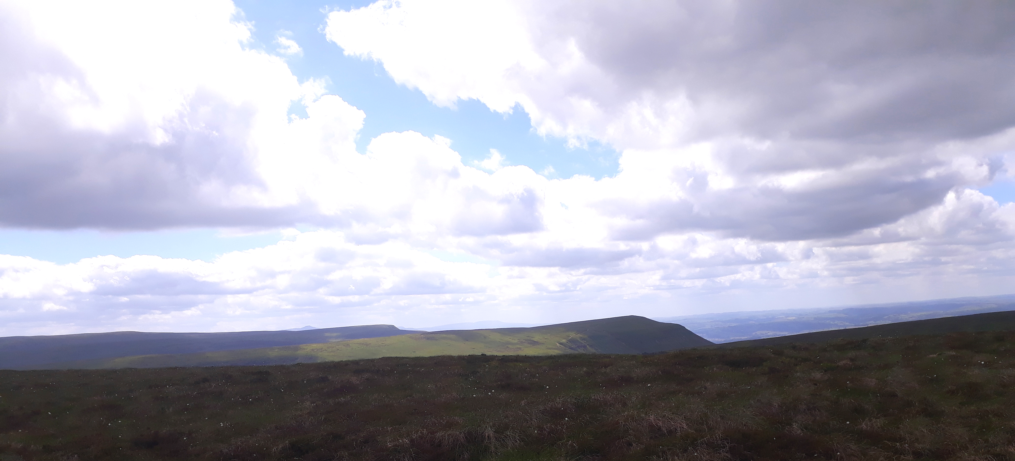
20180614_111555. On the ridge now. Miles of superb open moor walking ahead, in excellent weather. Chwarel y Fan is the hill in the distance, the first Hewitt on the walk.
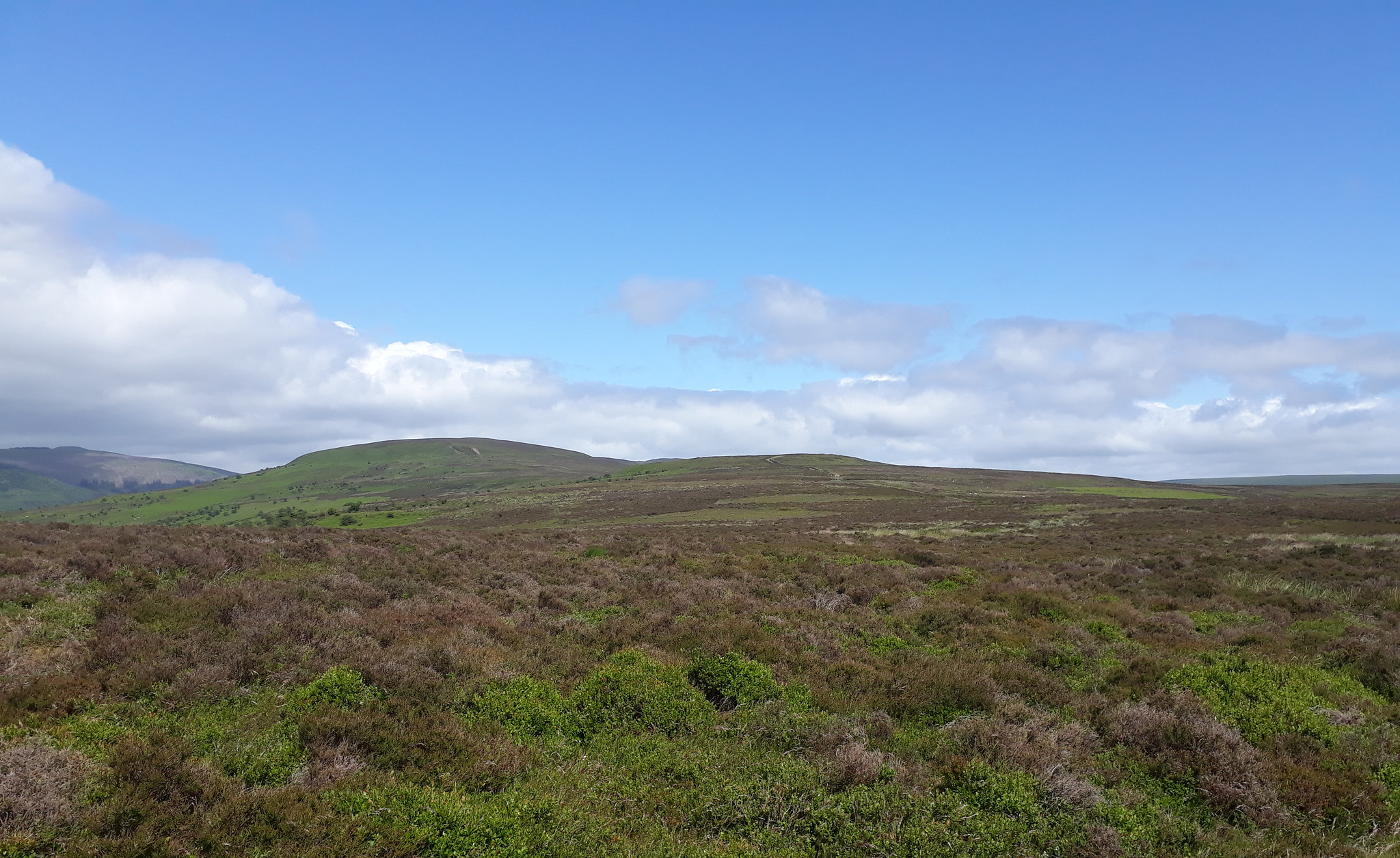
20180614_114610. The excellent path makes for quite rapid progress. Grwyne Fawr Reservoir dam just visible in the far distance on the LHS of the pic.
20180614_114636.
20180614_120624. Approaching Chwarel y Fan, Dr Frank poses for the camera

.
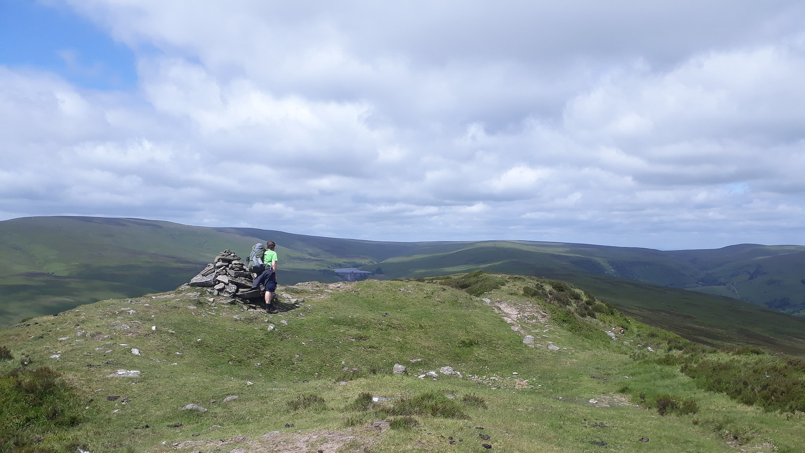
20180614_121258. The summit, with the dam more clearly visible in the background now.
Looking back the way we've come.
20180614_122148. Looking back at the summit, just after leaving it.
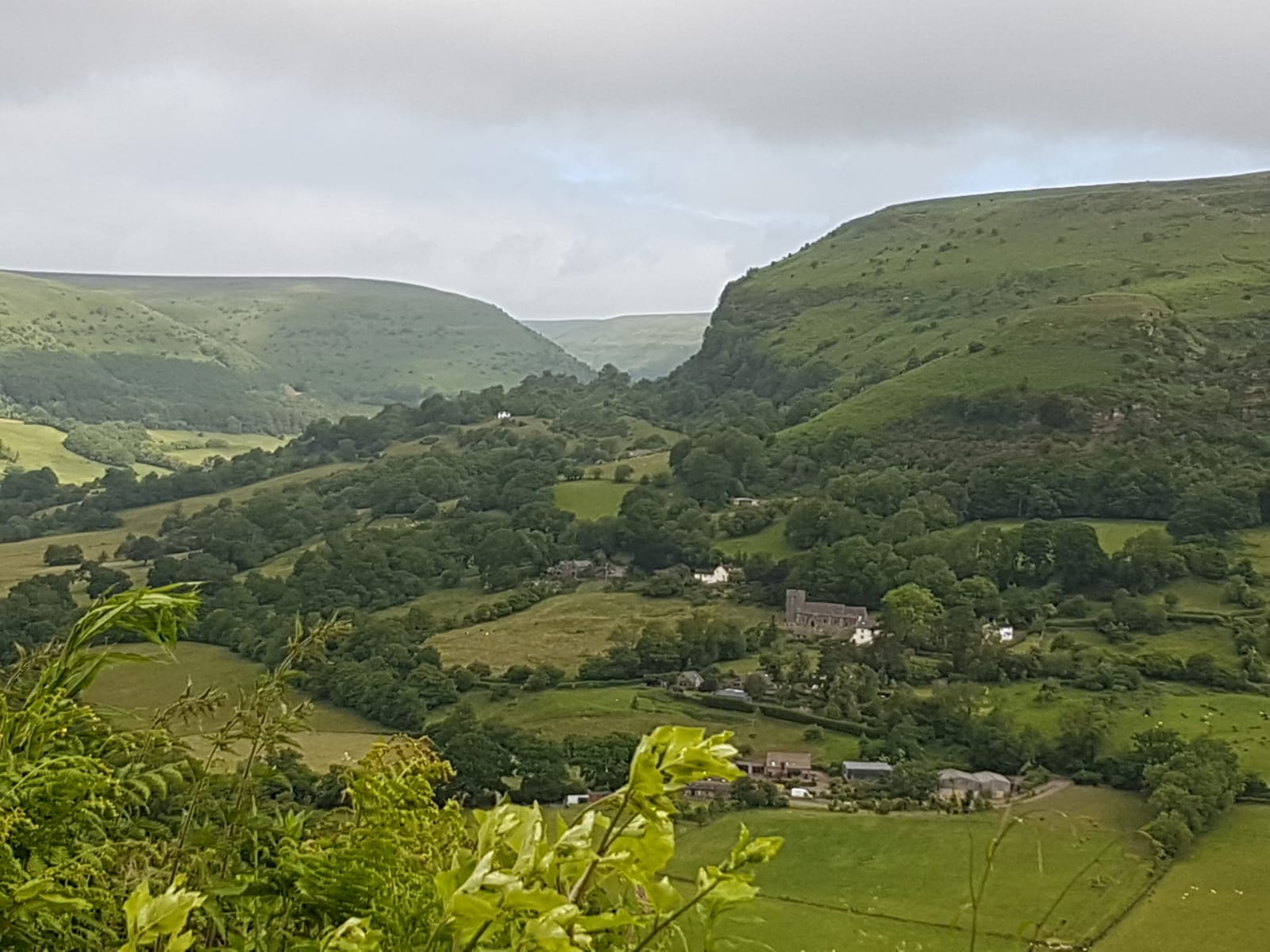
The route I've planned now takes us down east into the Vale of Ewyas, across, and up on to Offa's Dyke path. The paths that get one down to the valley all look rather meandering, so I decide to take the direct route. I've seen that there are some tightly packed contours, but we're both happy scrambling. Nothing can go wrong, can it...???
In fact I hit on the most difficult point to descend: significant crags, damp and heavily wooded to boot, so the scrambling ain't easy. A wise Dr Frank searches out a slightly more indirect zig zag route, avoiding the cliffs; I just plough on. Inevitably, he gets down to the base of the cliffs long before I do

.
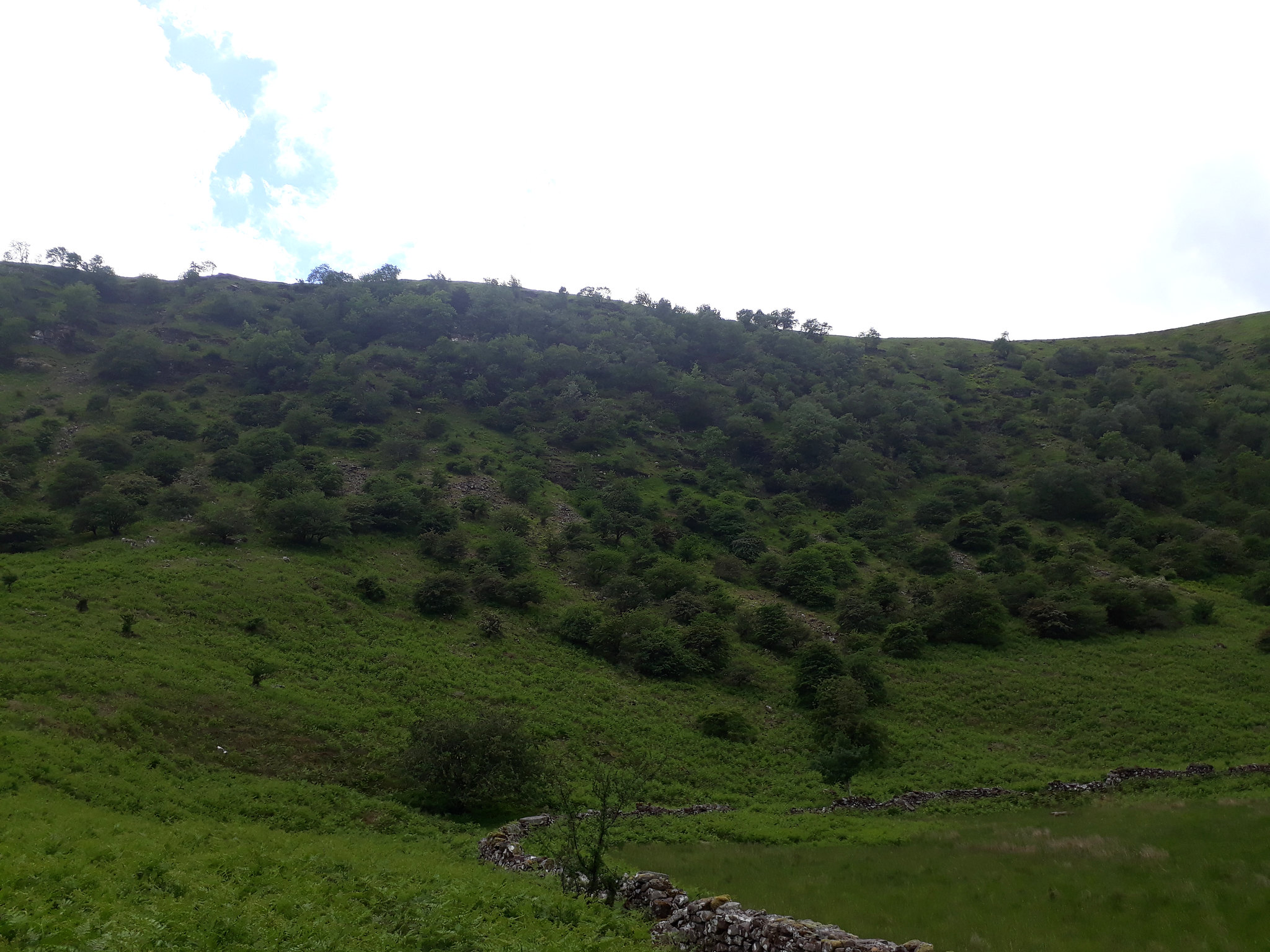
20180614_130440. These innocuous-looking woods are the place in question. My route is pretty well in the centre of the pic, Dr Frank's more to the right.
Anyone interested in following this route (which apart from this aberration I can recommend) would be better advised to follow the actual paths.
The rest of the route down into and back out of the valley bottom is a piece of cake compared to this. Even crossing the Avon Rhonddu is easier than expected: there is a footbridge over it, that is not shown on the OS map.
It is sunny and hot now, and both of us are ready for half an hour lying in the sun while we ruminate upon our lunch. Fortunately, just after the footbridge there is a grassy meadow surrounded by trees, and here we take our leisure.
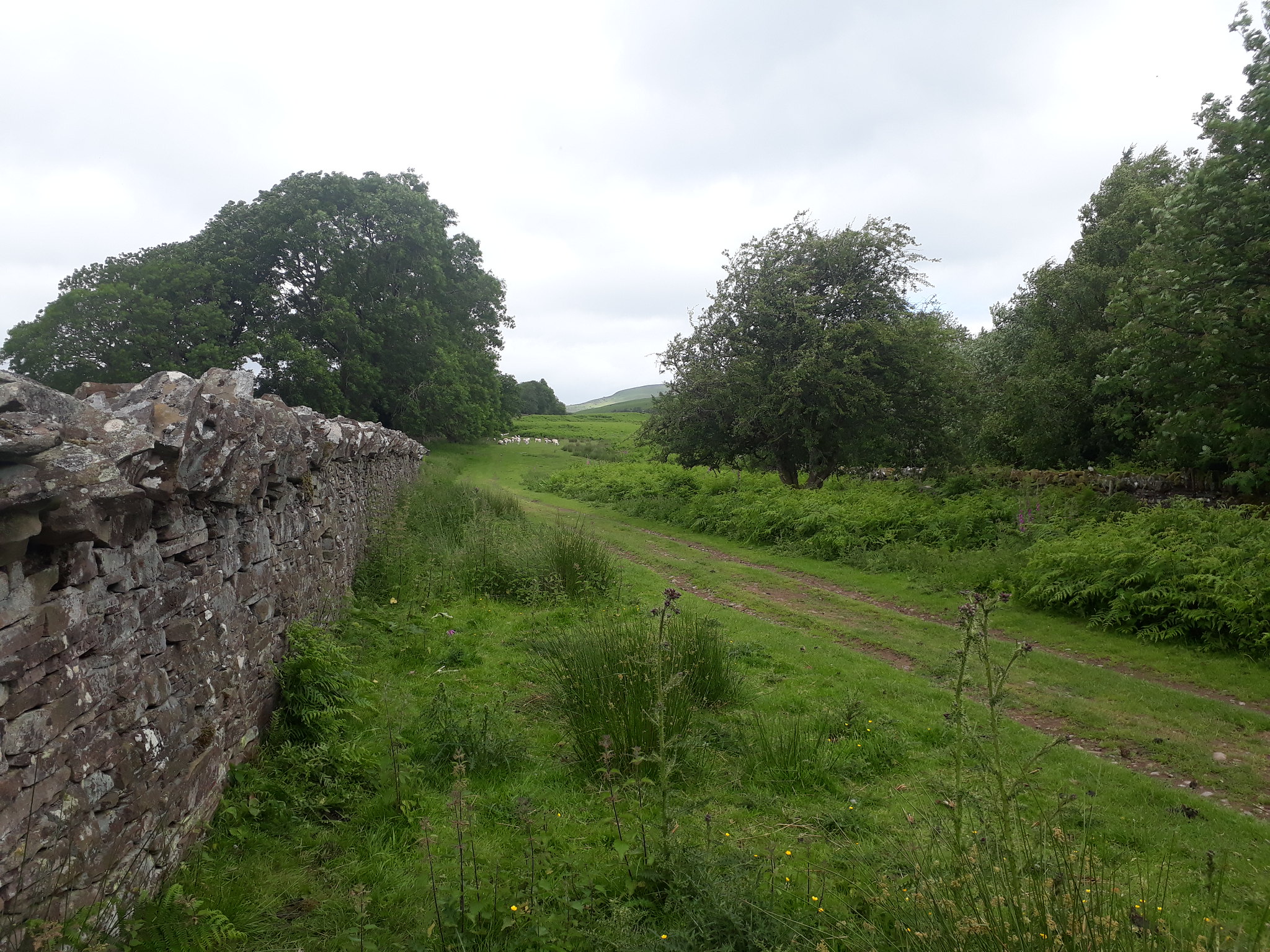
Continuing on, the route takes us along what look like some very ancient tracks, being, as they are, worn deep below the general ground level, and lined with scrub trees.
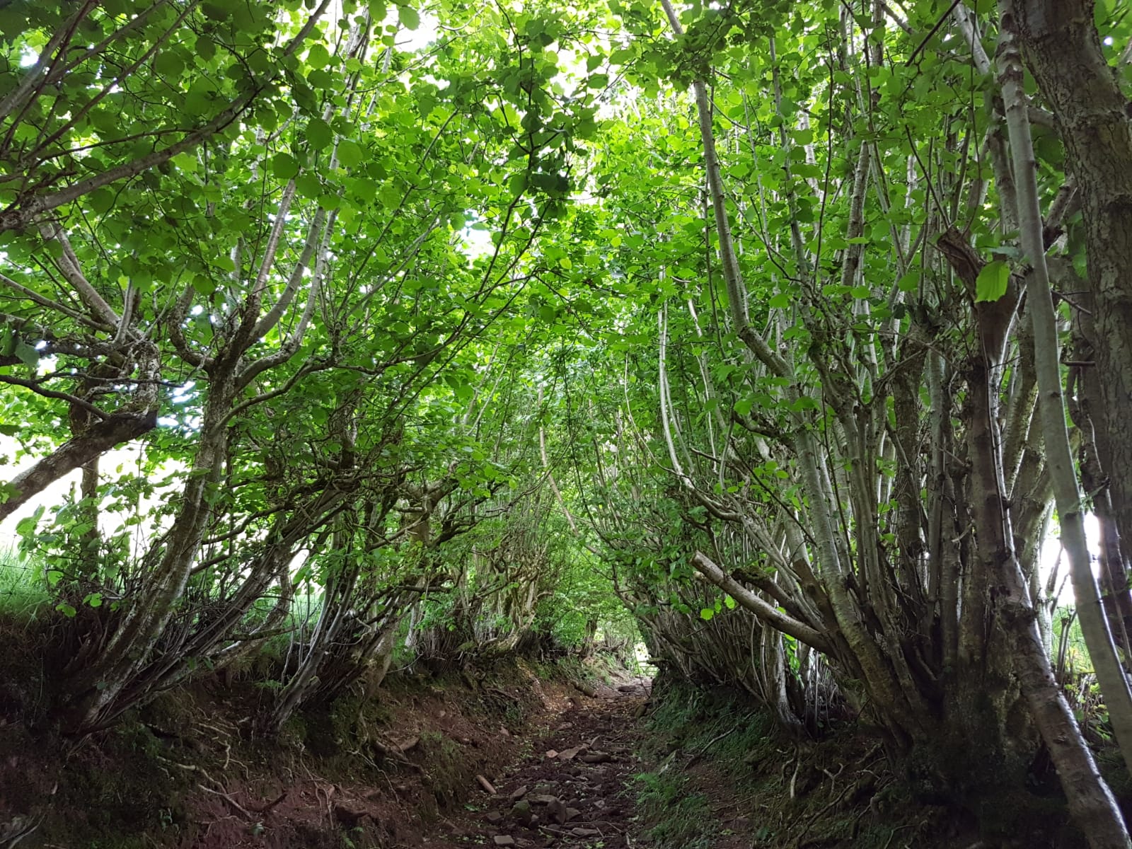
One has the feeling that one is going back centuries to a tougher more physical era - imagine the speed one would be able to travel along this...
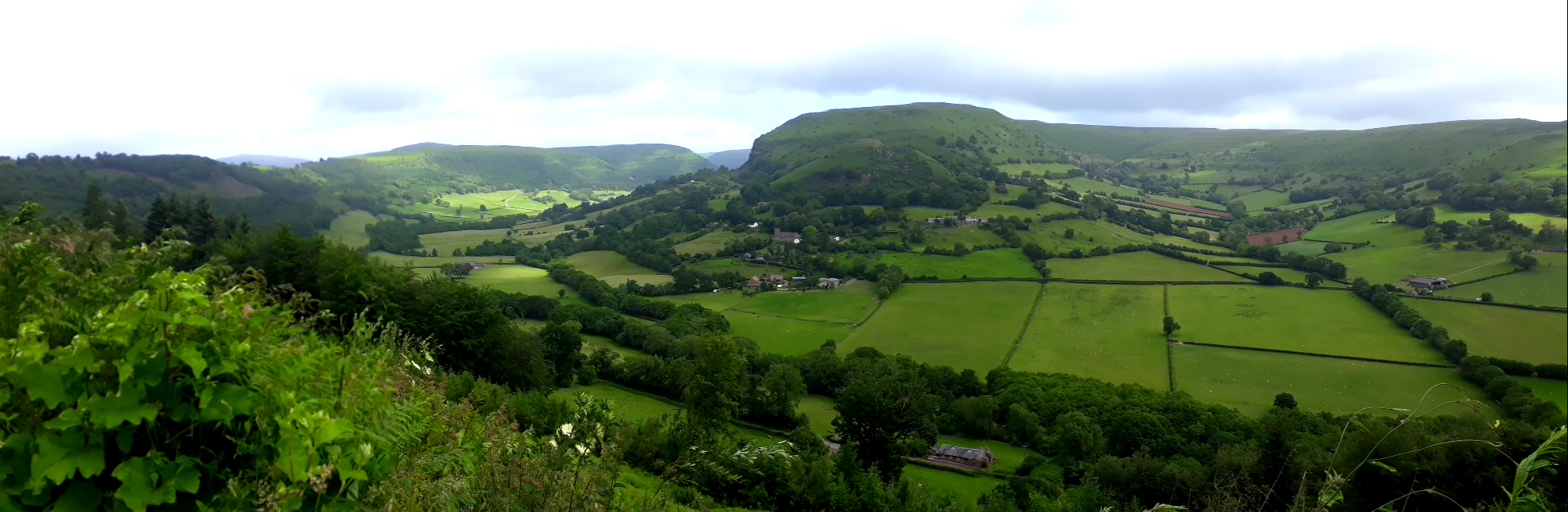
All too soon the track comes to an end, and we have to cut up north east to ascend the hill on to Offa's Dyke. The views of pastoral South Wales are tremendous, giving us plenty of excuse to stop at quite frequent intervals to admire them.
20180614_140846. This is looking south east down the Vale of Ewyas.
It's about 330m ascent up on to the Offa's Dyke path, which runs along the watershed, and, fortified by our rest and lunch, it doesn't take us too long to get there - albeit we're pretty hot and sweaty by the time we do.
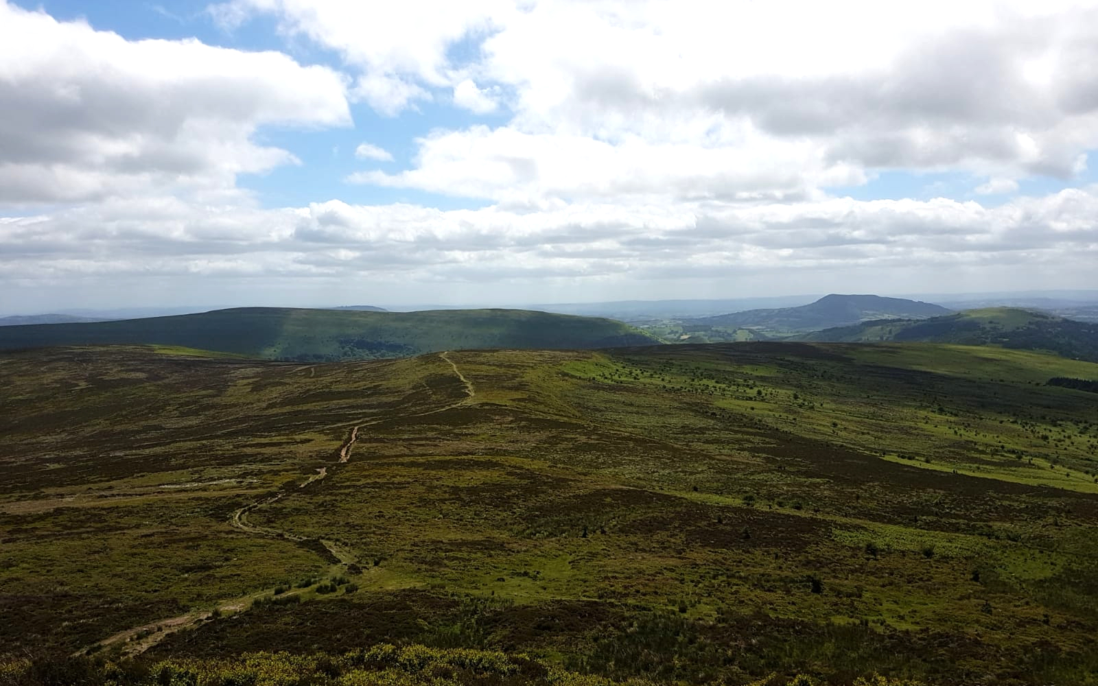
20180614_142945. Looking south east along the Offa's Dyke path at the point we join it - well paved at this point. It's rather bleak and somewhat unvarying, but not without it own particular attractiveness, especially on such a beautiful day.
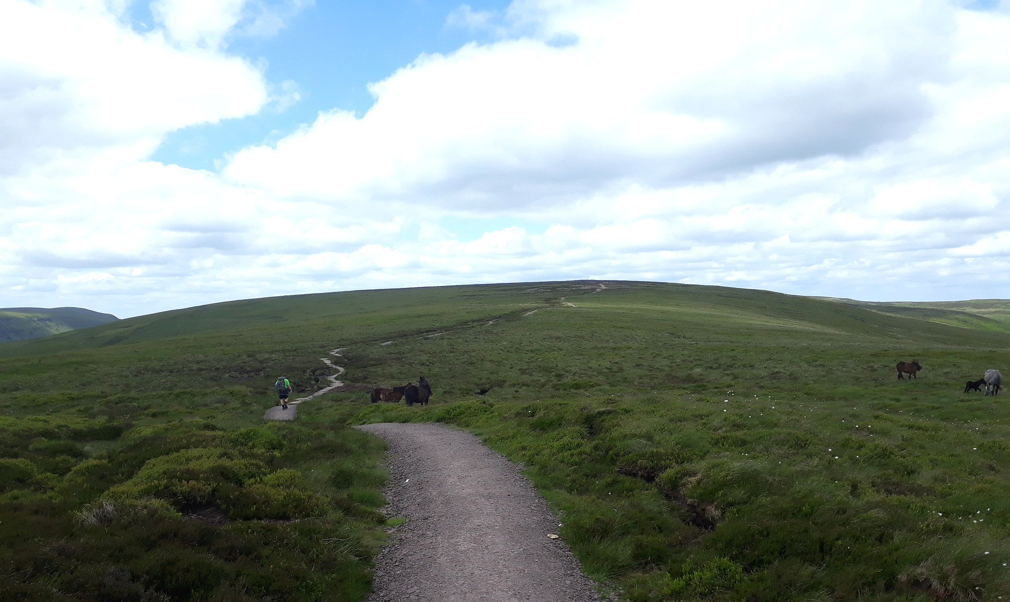
20180614_143839. Ponies roam semi-wild on the moor.
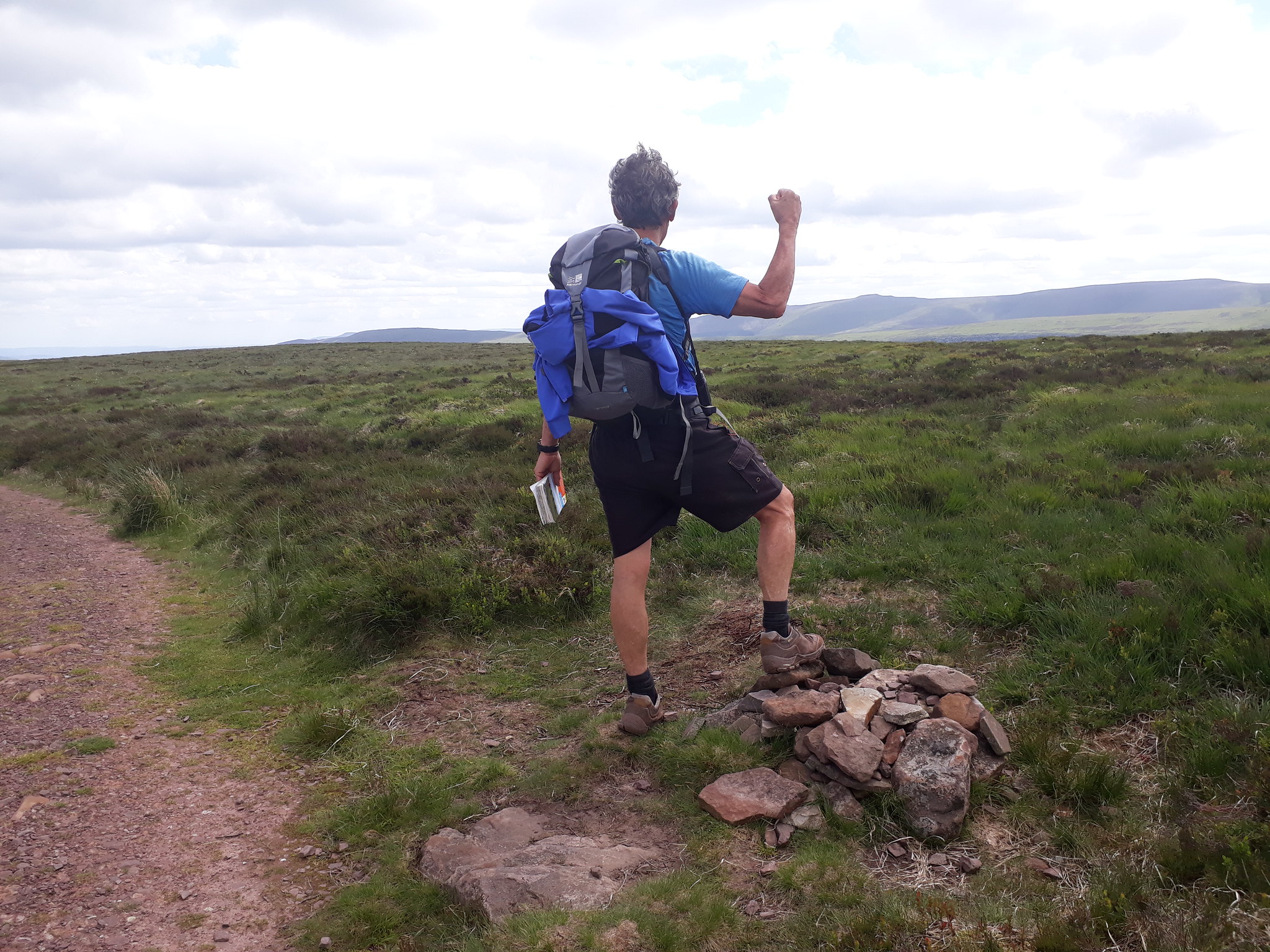
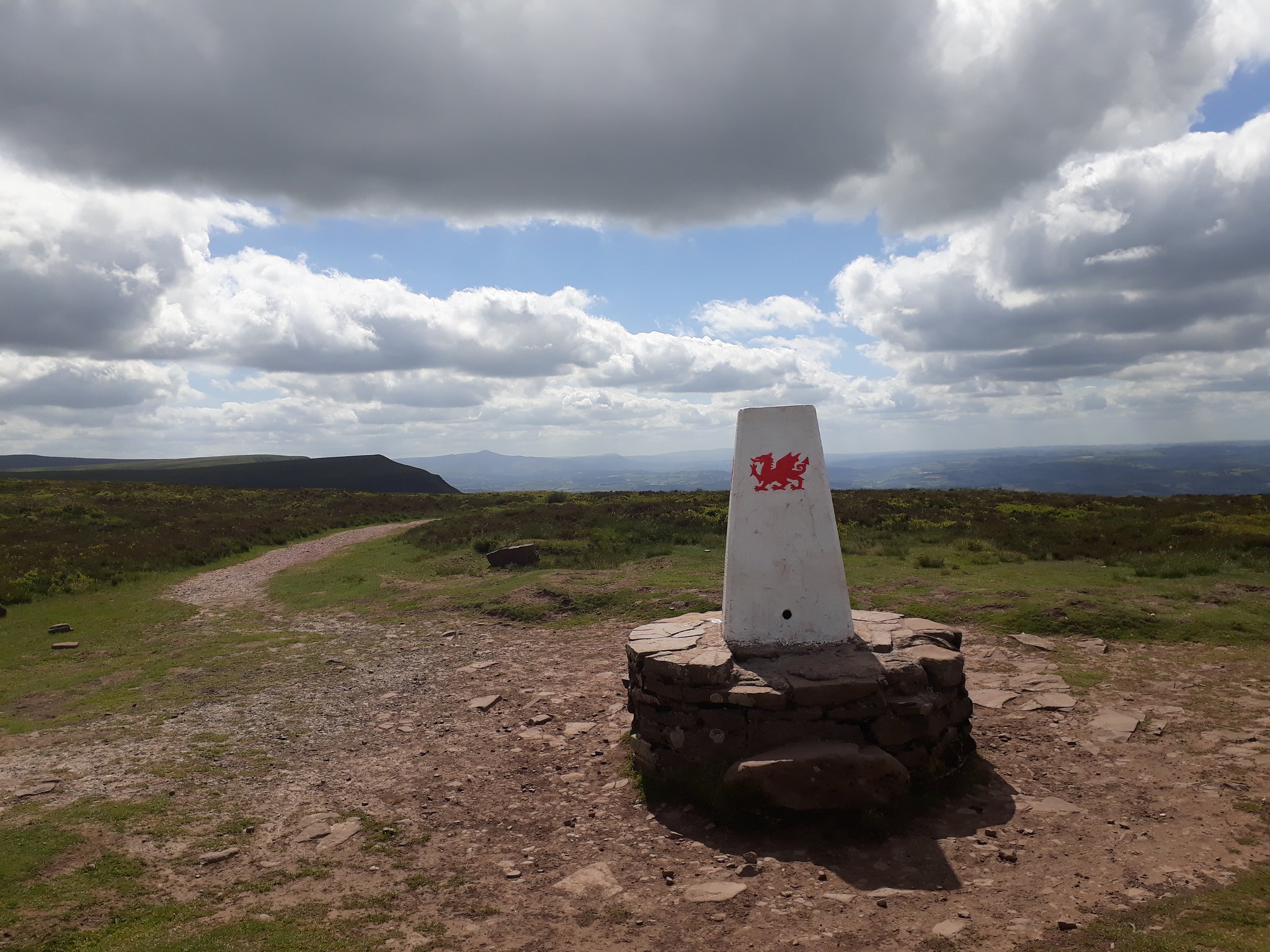
20180614_150858. We came, we saw, we conquered...

Black Mountain summit is an absolutely typical unprepossessing Welsh summit - indeed it's hard to avoid the conclusion that the summits are all competing to see which can be the most unremarkable....
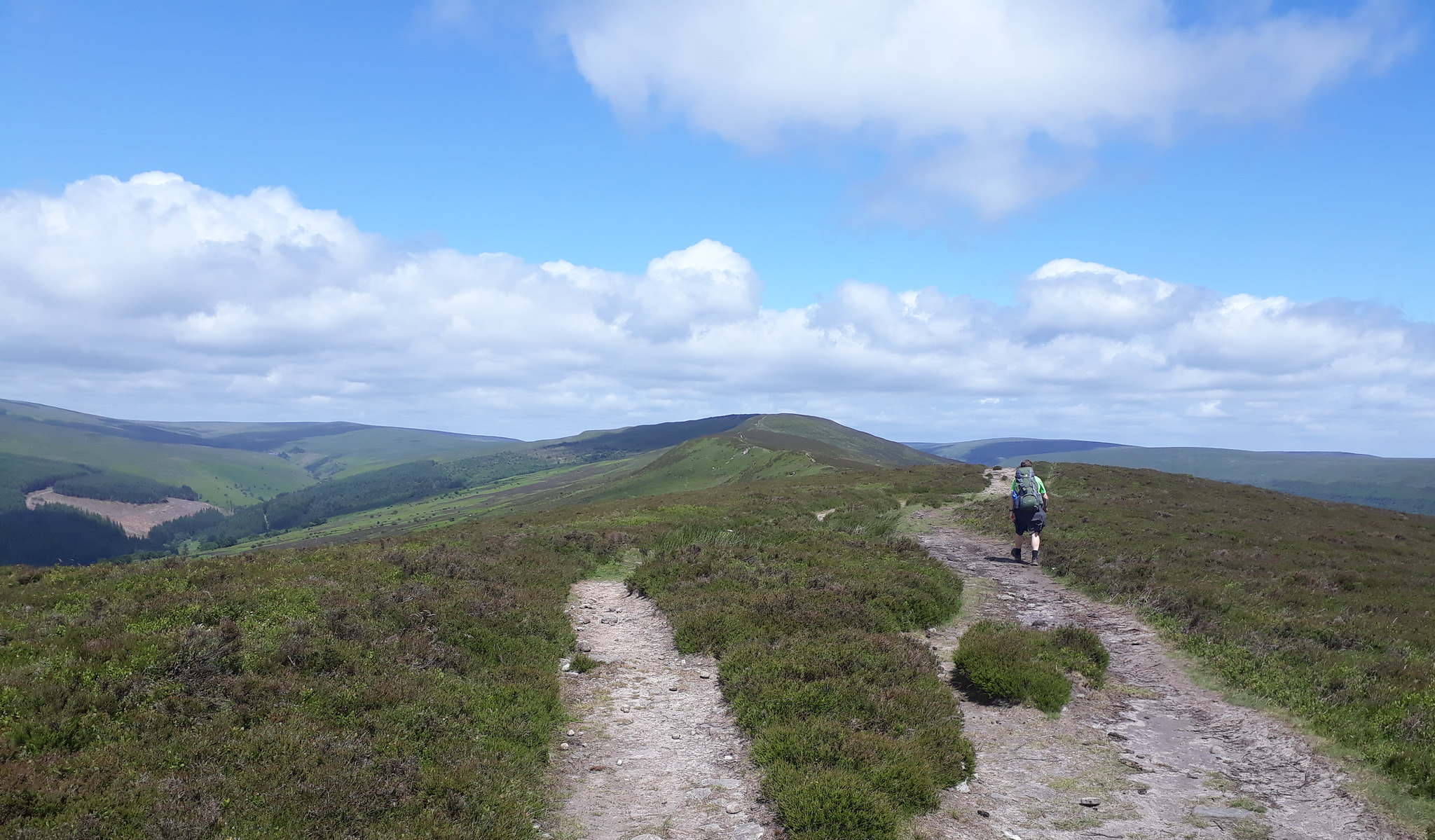
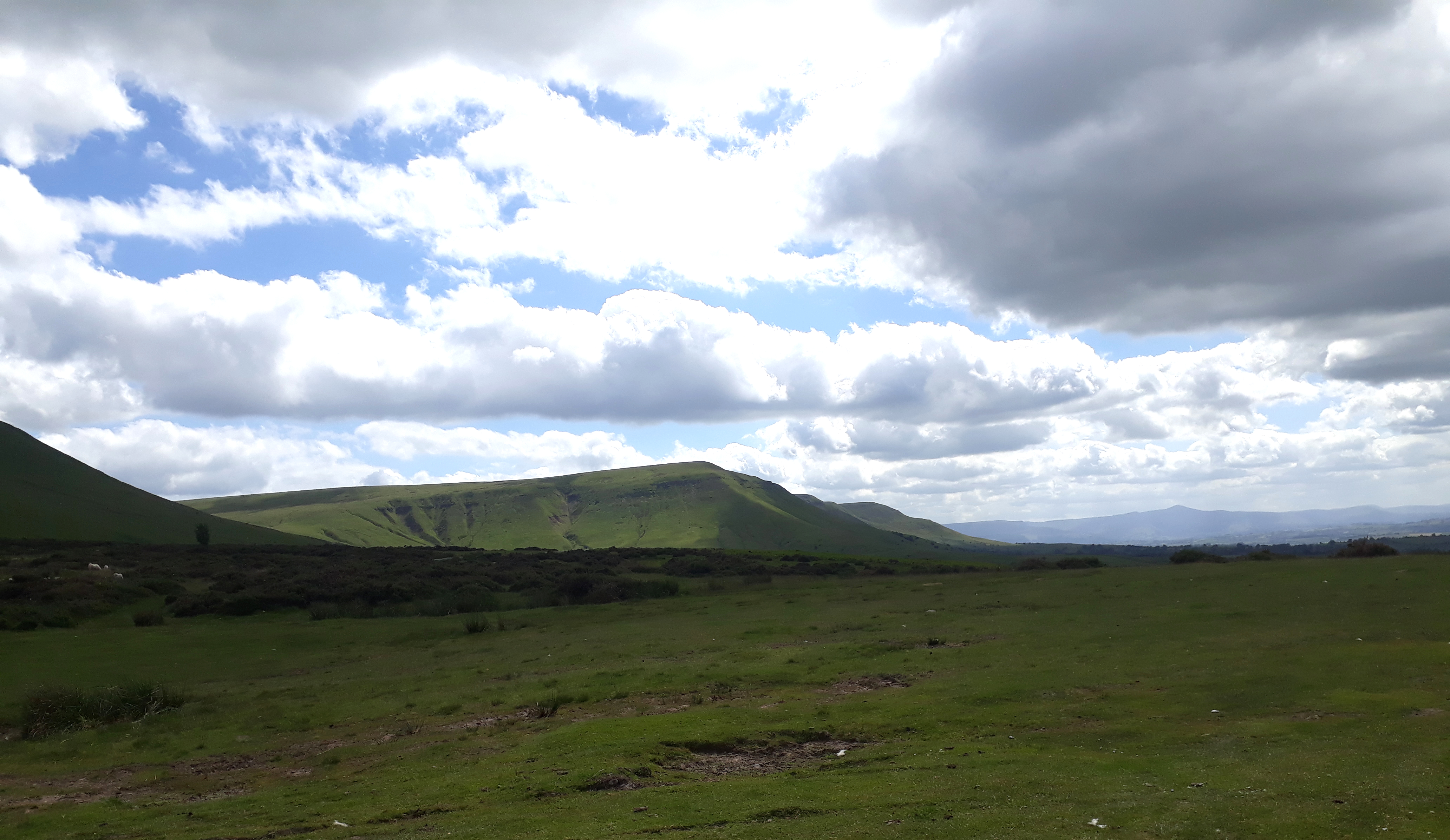
20180614_151347. As we continue on, the classic escarpments that I associate with the S Wales hills are coming into view
20180614_153134. From Black Mountain it's but a short stroll along the excellent path to Hay Bluff, at which point we drop back down the steep north-facing escarpment to the car.
At this point the afternoon sun illuminates the scarp that we couldn't see for clag in the morning...
20180614_154036. Looking back up at Hay Bluff, just before we get to the car.
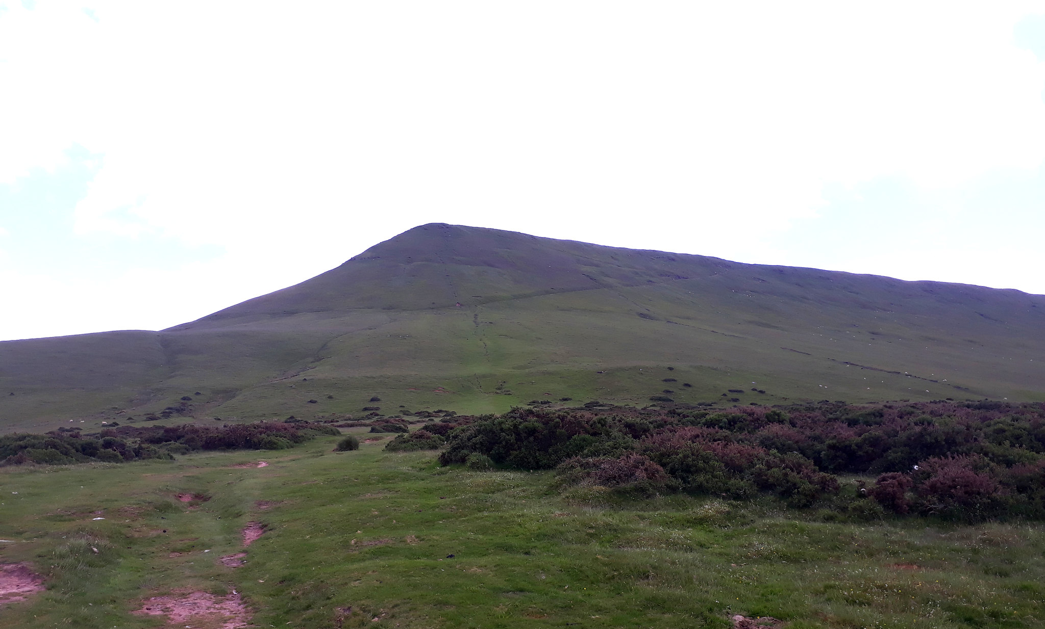
20180614_154448.. ... and looking west towards Twmpa (Lord Hereford's Knob), which will be our last hill tomorrow. We're just hoping that the weather will be as brilliant as it was today!
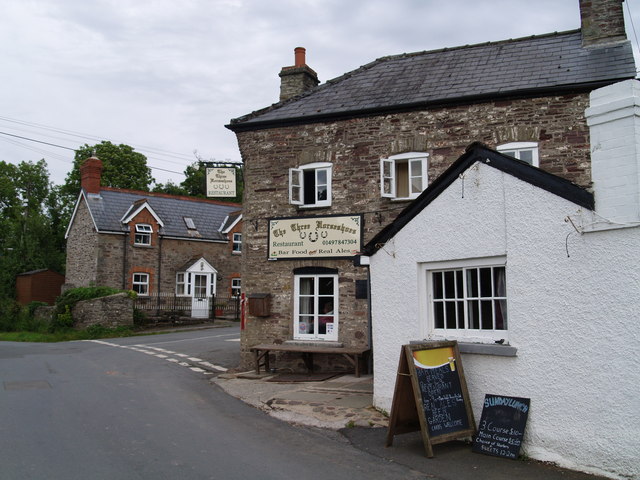
It was fortunate that I had experienced medical expertise on hand to advise me on the dire effects of insensible fluid loss that occurs on a long walk, so after driving back to Stanton to collect the bikes, and cooking up a bite to eat, we walked across the fields to a local building of cultural, historical an architectural distinction, there to make up for that insensible loss of fluid...