
Blencathra, a short walk via Scales Tarn.
I was asked to choose a walking route for the village walking group that consists of retired people of both sexes and upon suggesting Blencathra it was taken on board with great enthusiasm as quite a few had not set foot on the mountain before. Instead of climbing by the usual tourist routes either by Scales Fell or Blease Fell which to be honest I find tedious despite the views I chose a route that would take us to the summit by one of its back doors this one being via Scales Beck and the tarn that gave it its name, Scales Tarn. The height gain from either route is around the same for all three but going in from above the River Glenderamackin gives a respite from the continuous climb of both the east and west ridges, is quieter and gives the opportunity of more rest stops with space and comfort for around 12 to 15 walkers without hugging and crowding the path sides.
The indomitable Jim should have accompanied Elizabeth and I on this reconnoitre as he hadn't been this way before although E and I have on numerous occasions. Jim was off to Scotland for a week with his caravan, somewhere around Loch Lomond where no doubt he will be chatting up something with a skirt on, be it male or female.
The first few photos are shots that have been seen before but for anyone not familiar with this walk they may be helpful.
E and I managed to get parked up at the Mousthwaite Comb car park - NY349272 - where there is enough space for around 8 to 10 cars if parked sensibly otherwise ample parking can be found in the car park that is at the bottom of the lane just east of the White Horse pub.
We arrived at around 9am to find space left for only two cars and as the day was already very warm with plenty of blue sky and not much cloud about it was no wonder that people were out and about early making the best of the brilliant weather that we were fortunate to have for such a long period. We were soon booted up and ready to go up the old pack horse route that runs around the sides of Mousthwaite Comb.
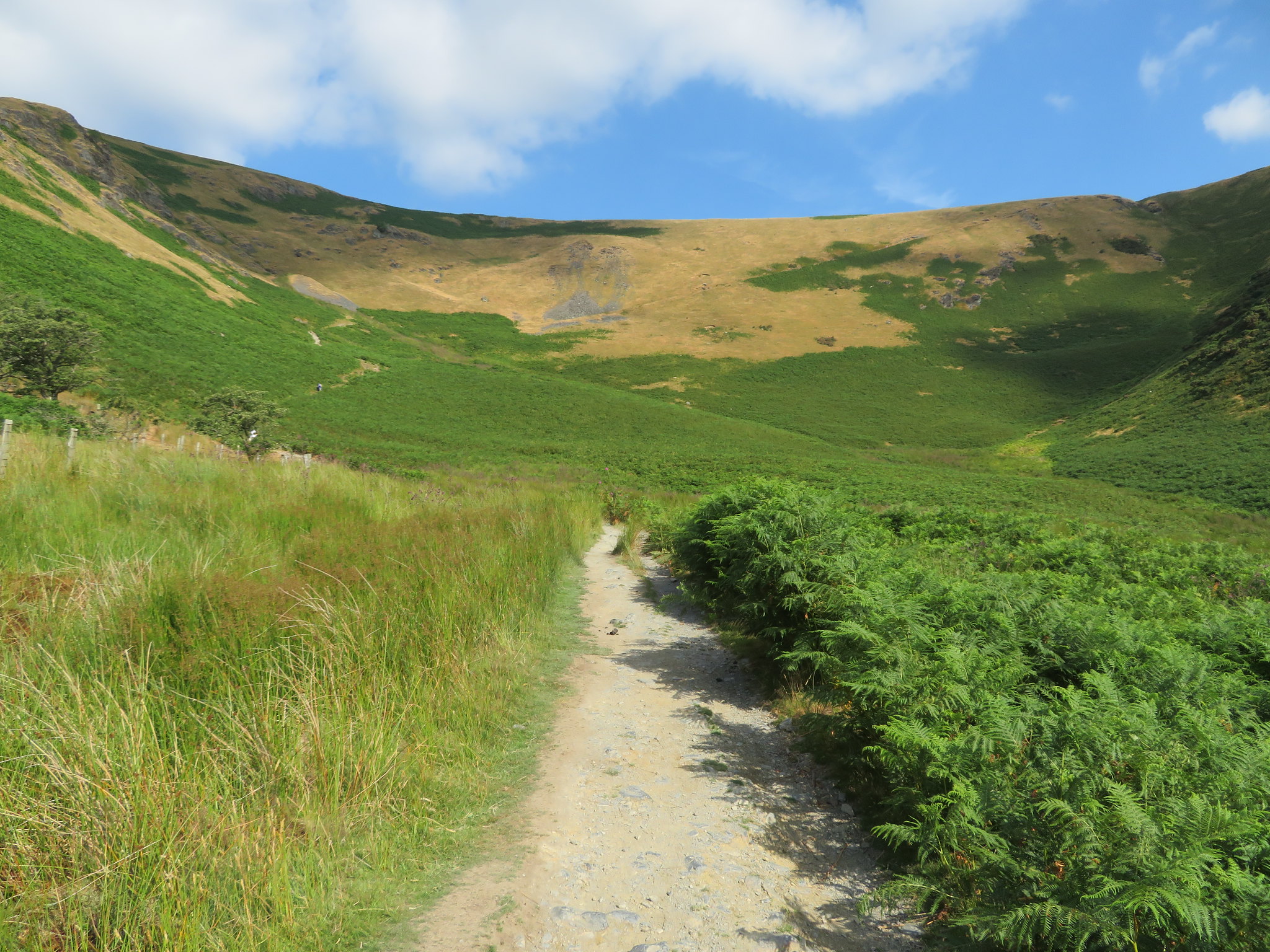 The old pony route in Mousthwaite Comb
 This route is an easy way to get to the col between Souther Fell and Scales Fell giving plenty of open views to the south as height is gained.
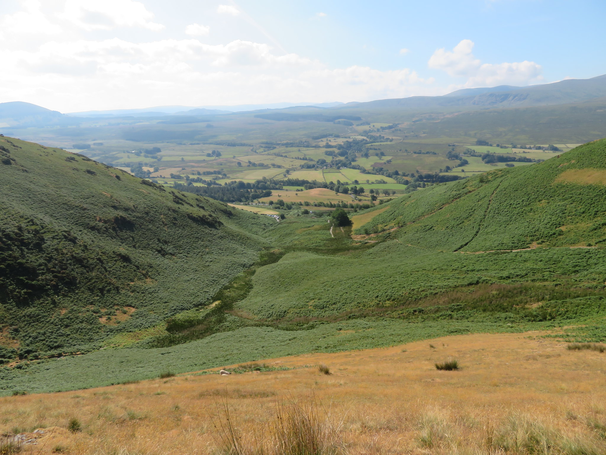 Looking down and across Mousthwaite Comb
 There were quite a few walkers using this way of ascent and like us were feeling the heat that was contained in the bowl of Mousthwaite Comb with not a breath of moving air to help cool one down. It's a nice steady climb up to the spot just below the old levels from where the path turns to the northeast and gets a little steeper as the top is neared. Once at the col we turned towards Scales Fell but instead of climbing it we veered off to the right on a well trodden path over grass to enter the valley of the River Glenderamackin…
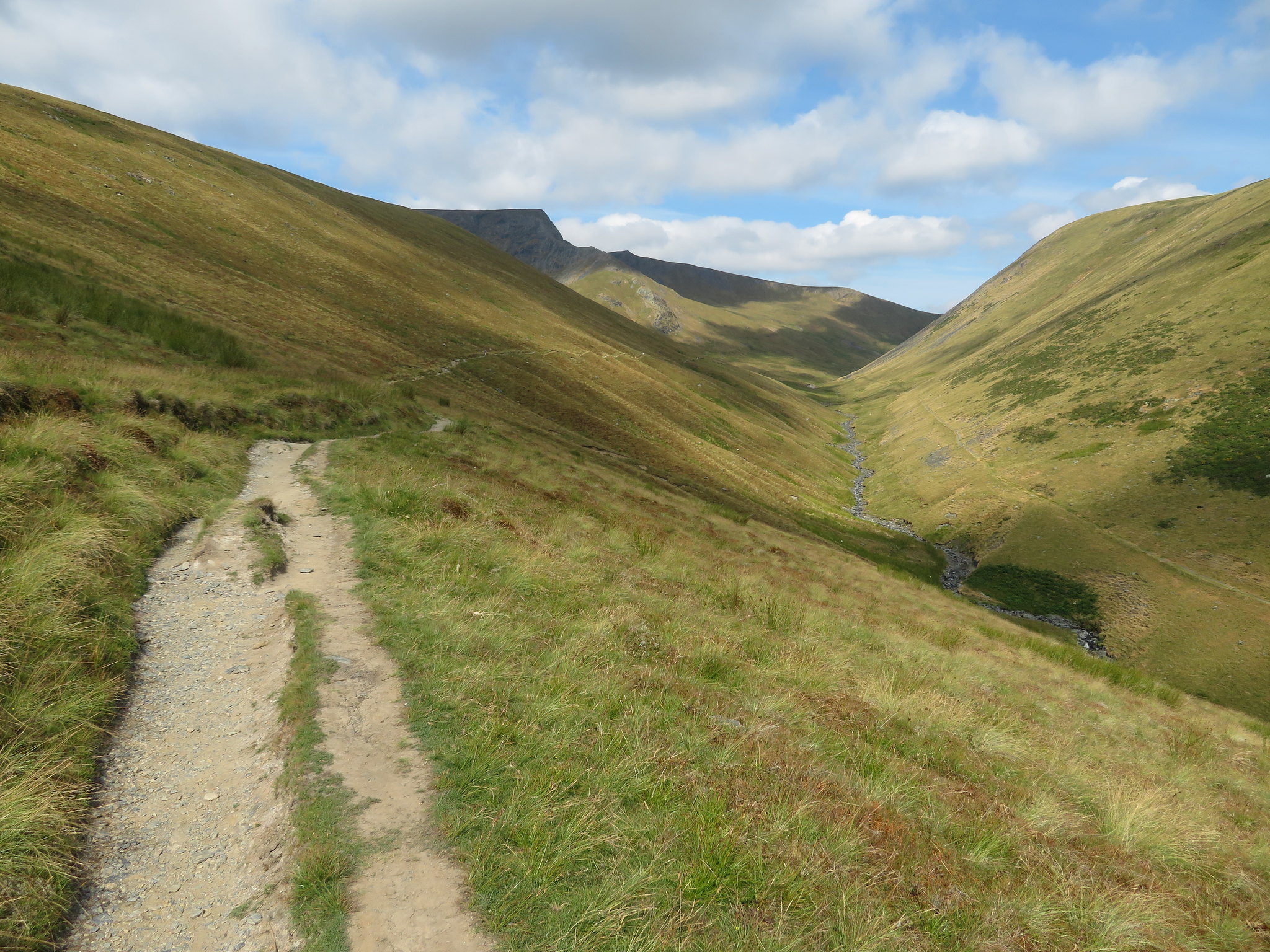 Along the River Glenderamackin towards Sharp Edge
 that has White Horse Bent and the massive fell of Bannerdale Crags to the north and our path sticking to the northern side of Scales Fell. A good steady walk along the valley with the ridge of Sharp Edge clearly in sight up to Scales Beck from where we followed the pitched stone stepped path up to Scales Tarn.
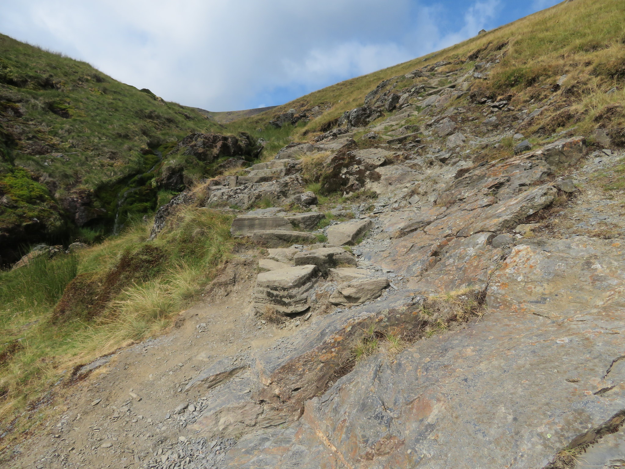
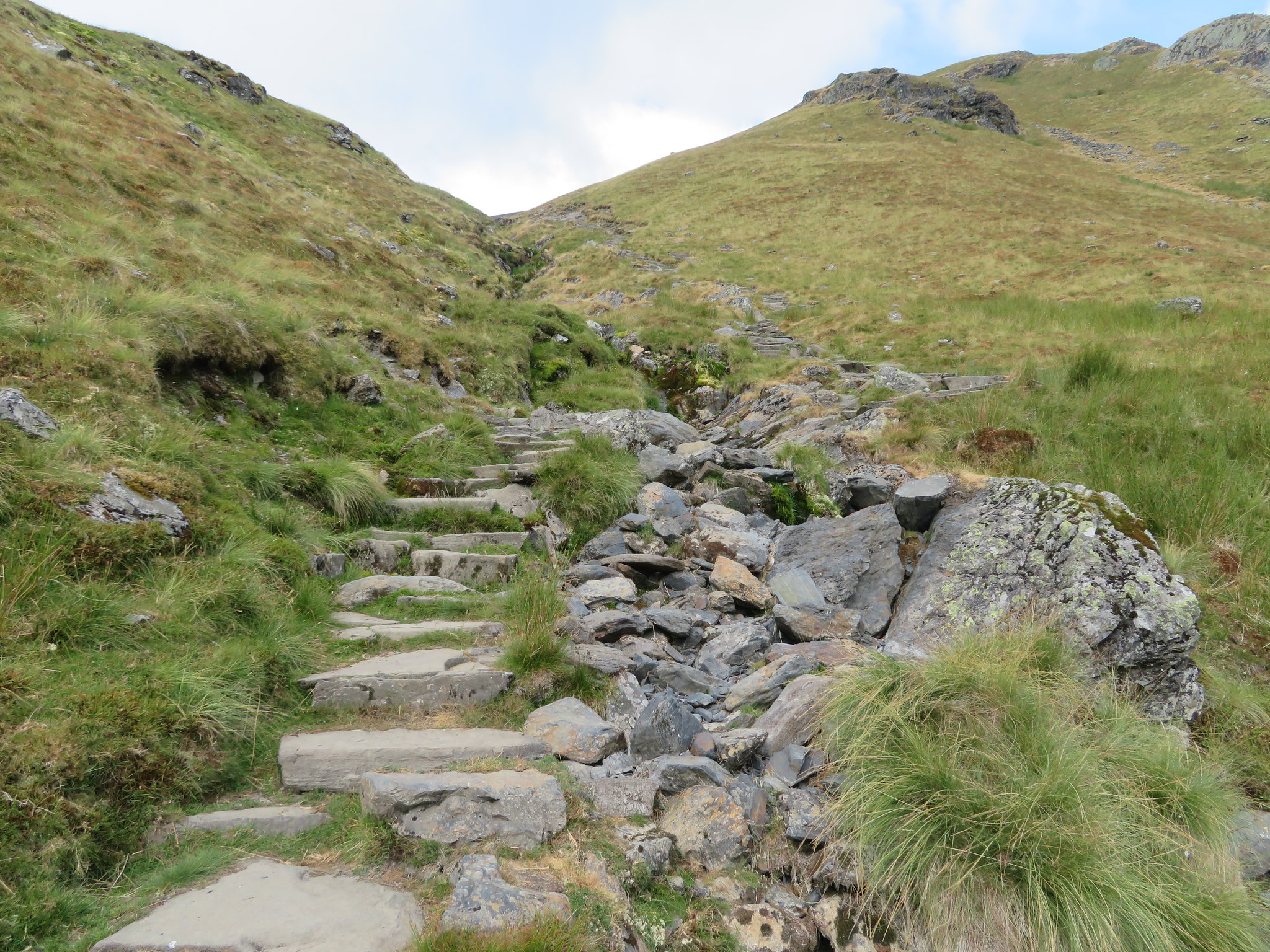 Pitched stone path to Scales Tarn
 The way up is easy enough with the beck having to be crossed near the bottom of the path but in the higher reaches there are a couple of places which some people may find a bit exposed but there is really no problem at all if care is taken especially if it's a wet day.
 Careful here
 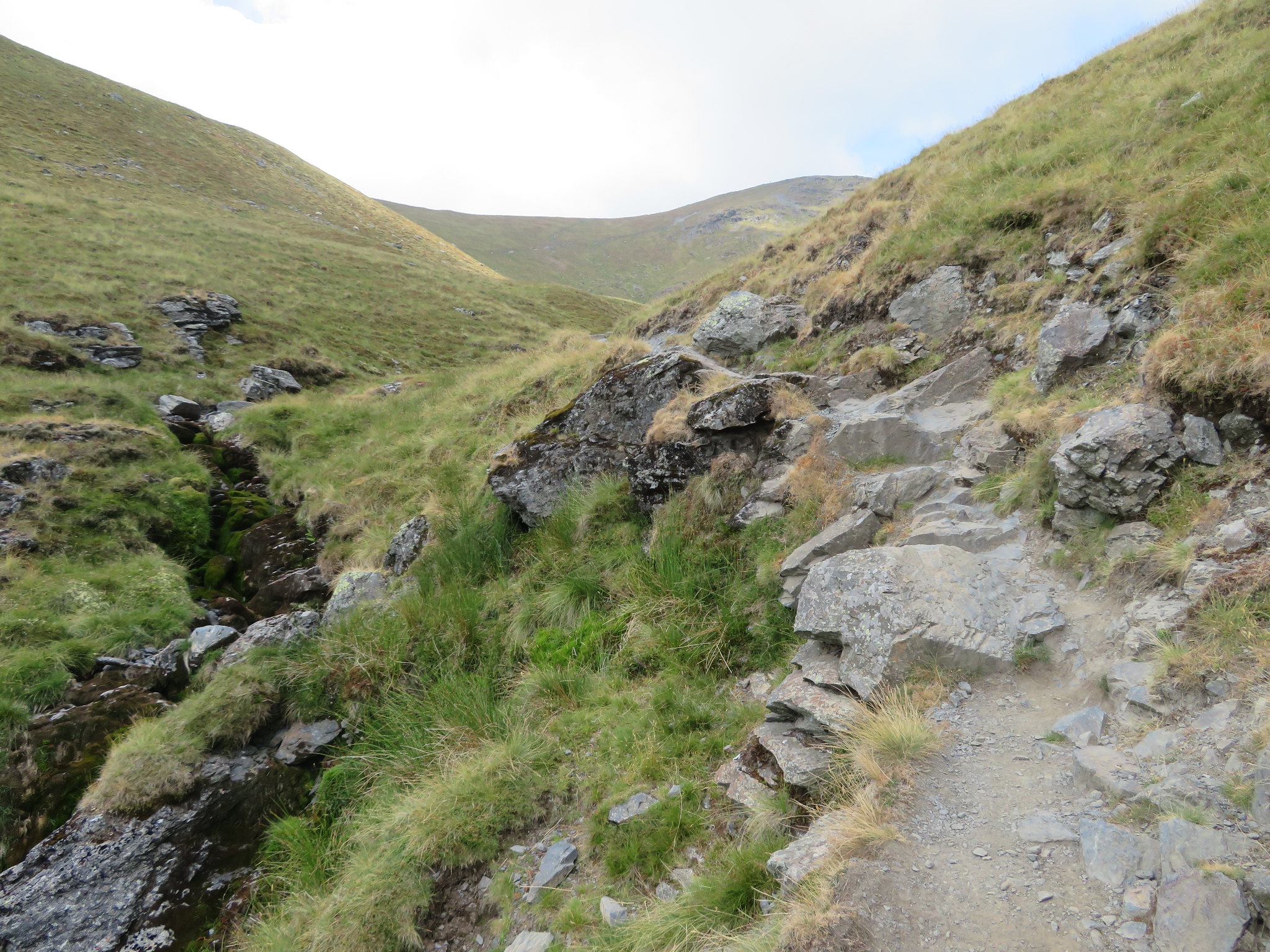 And here
 A minute or so after passing over the short rocky section the rough and narrow ridge of Sharp Edge comes into view…
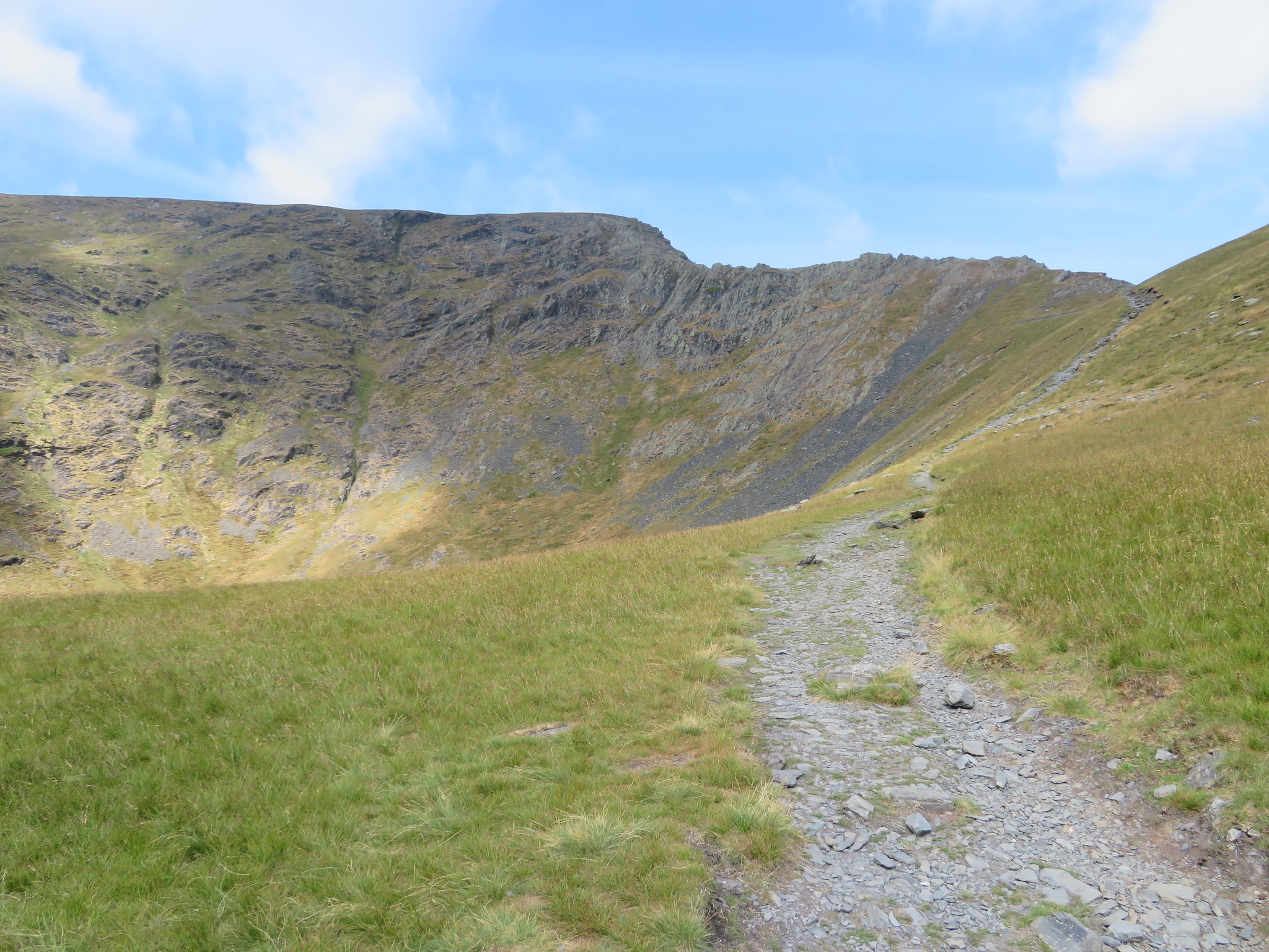 Sharp Edge
 and then the tarn sat in the bowl that is formed by the ridge of Sharp Edge, Tarn Crags, and the back of Hallsfell Top. Even on a day such as this the tarn always looks dark and is a typical corrie tarn that is almost circular in shape, is 26 feet - about 8 metres - deep and covers around 2.5 acres.
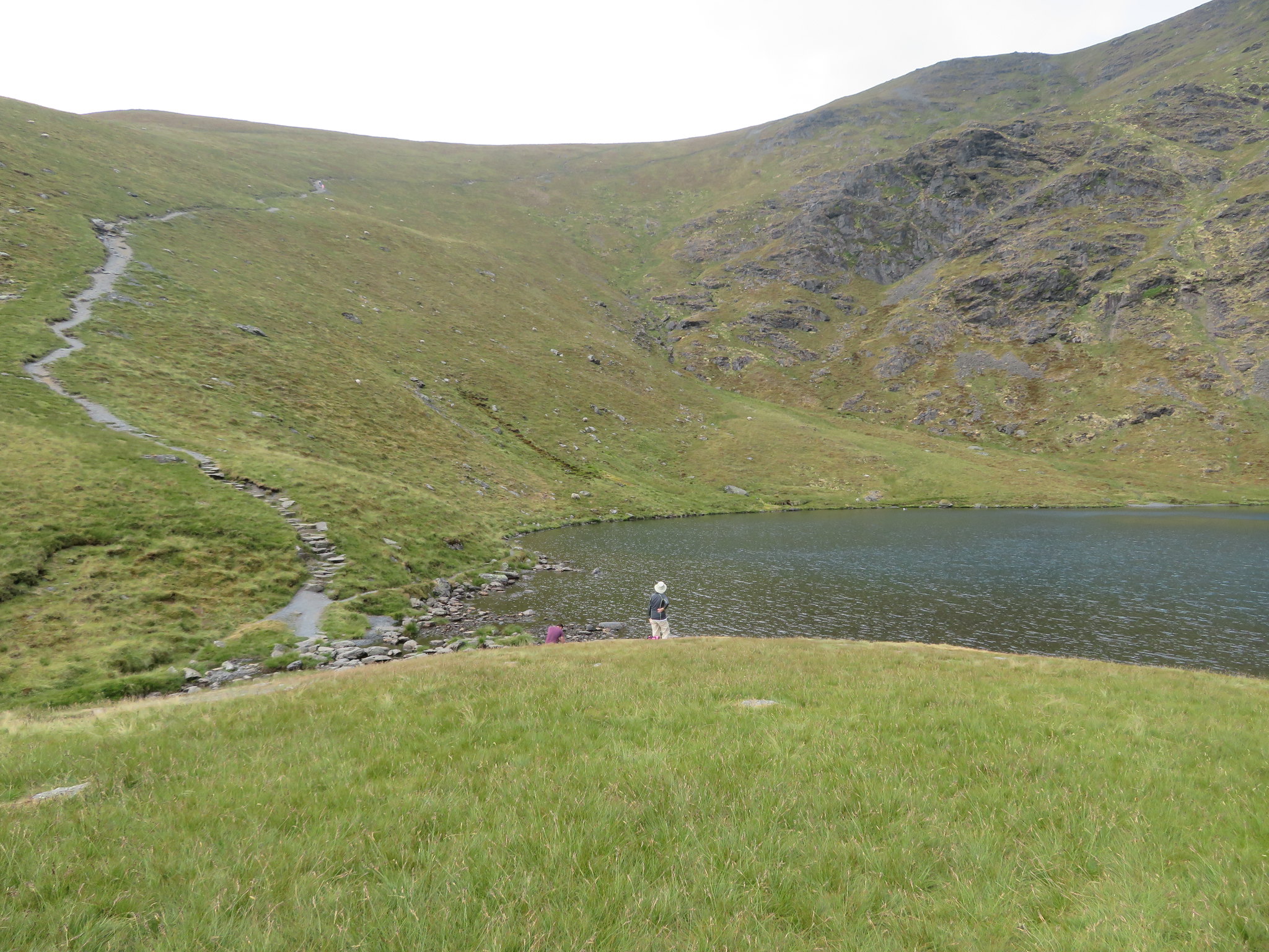
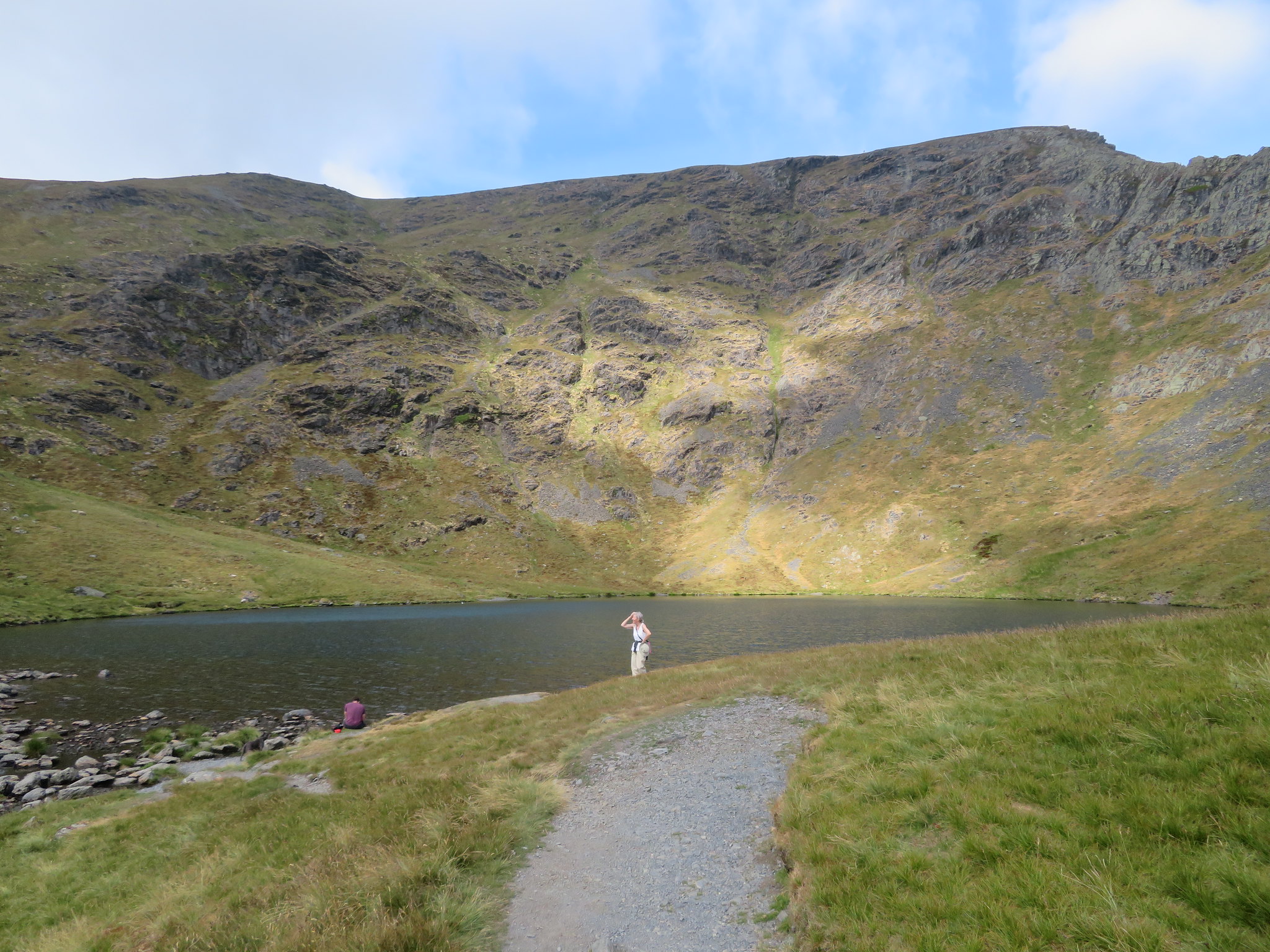 Elizabeth arrives at the tarn
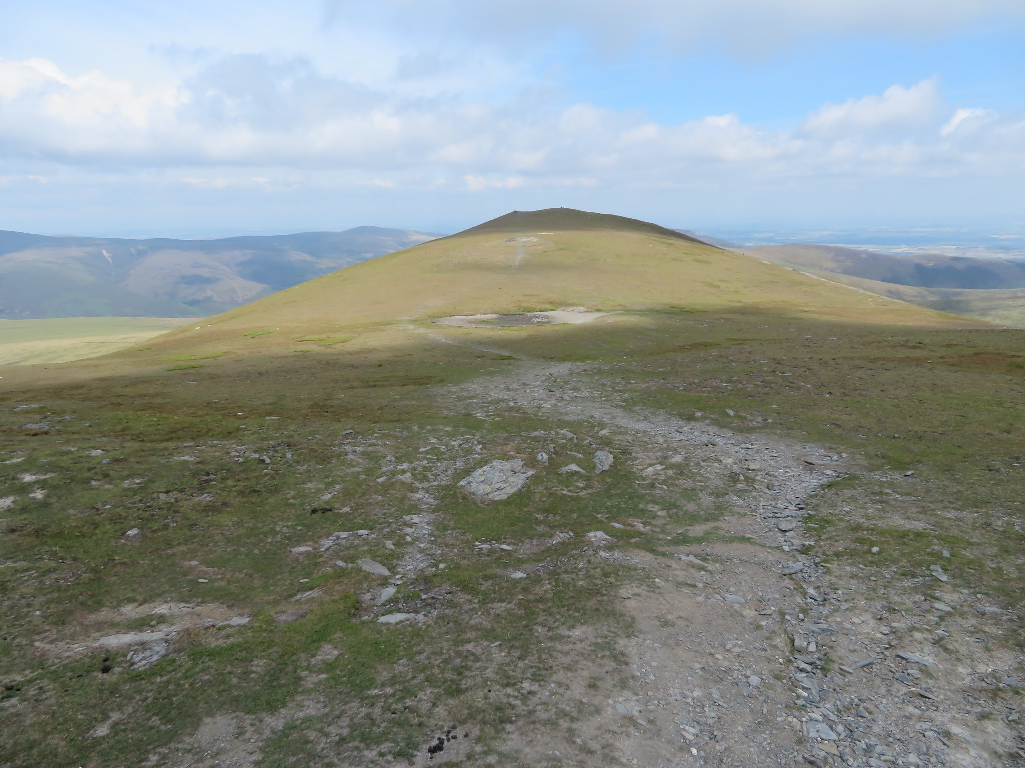
 There are a couple of large and suitable rocks ideally placed for a view of both the tarn and Sharp Edge, these we used to sit on whilst having a short break before making the climb out of the bowl along the path that climbs diagonally across the north face of Scales Fell to arrive on the edge of Tarn Crags and just north of Hallsfell Top, the summit of Blencathra.
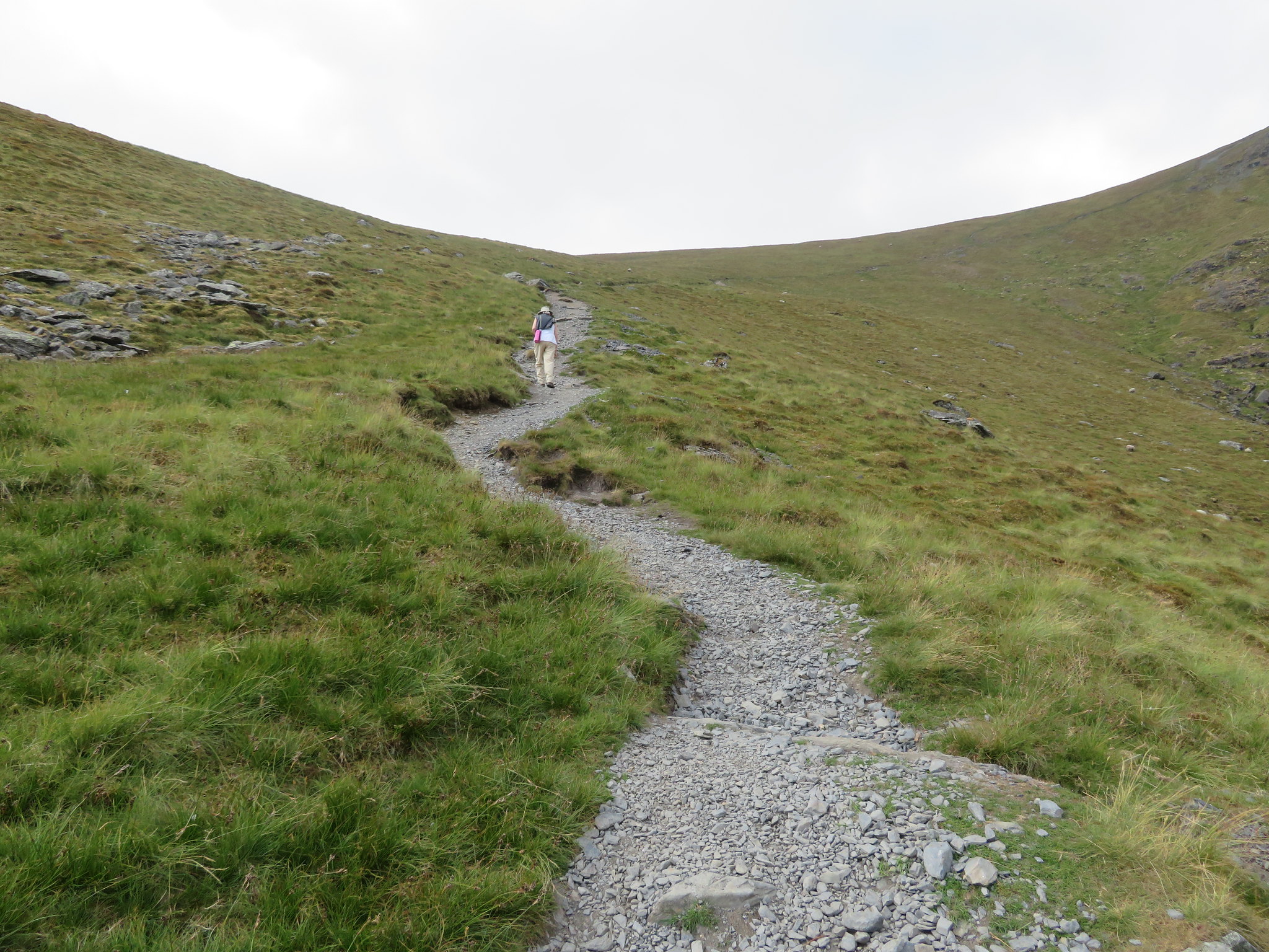
 The path to Blencathra summit from Scales Tarn
 Ever impatient to move on Elizabeth was first away taking the initial easy slopes…
 Elizabeth starting the climb from Scales Tarn
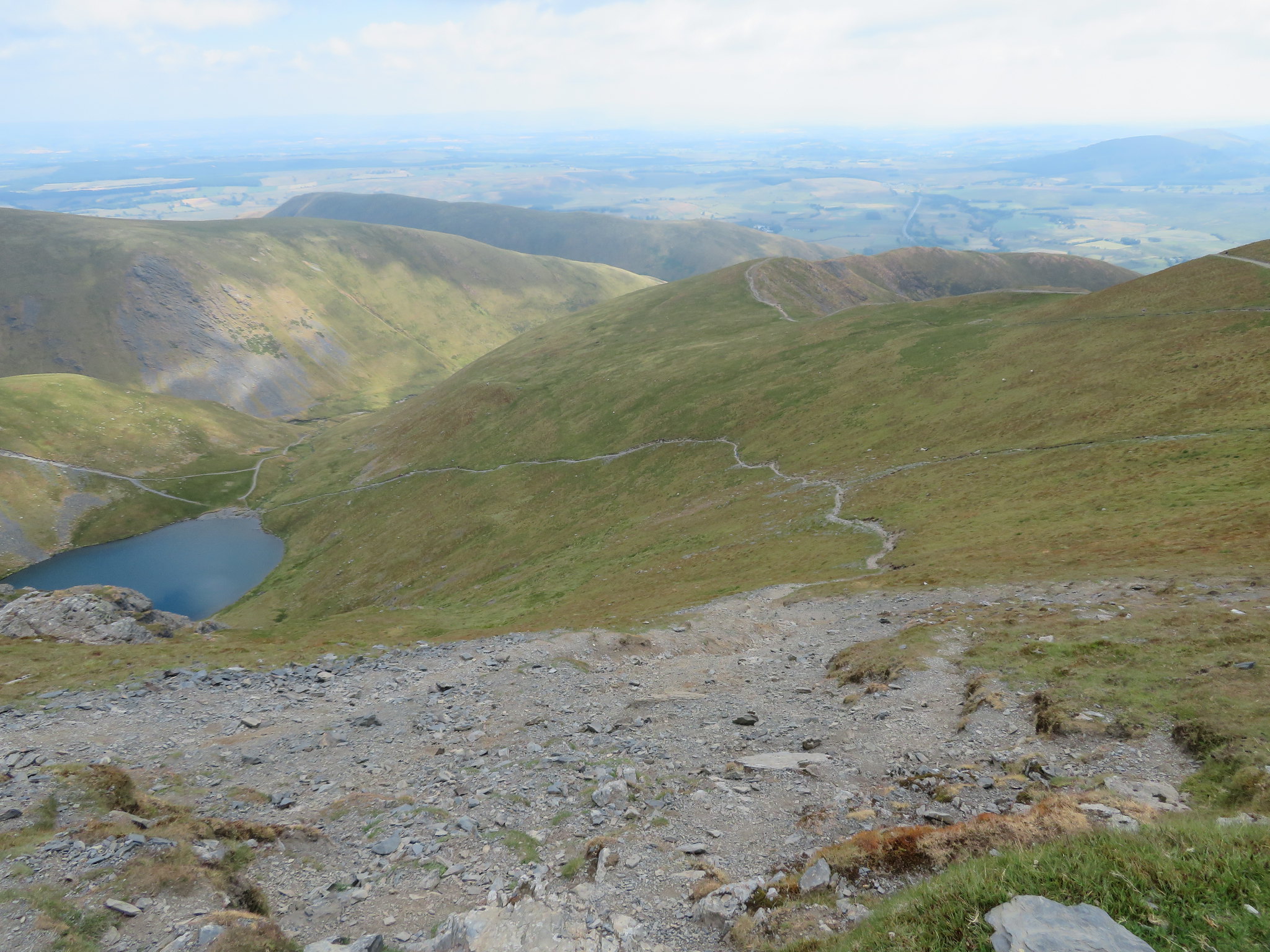
 before it steepens and gets more eroded where it swings from the southwest to a northerly direction and as I was climbing I stopped to take an ariel - well sort of - photo of the tarn.
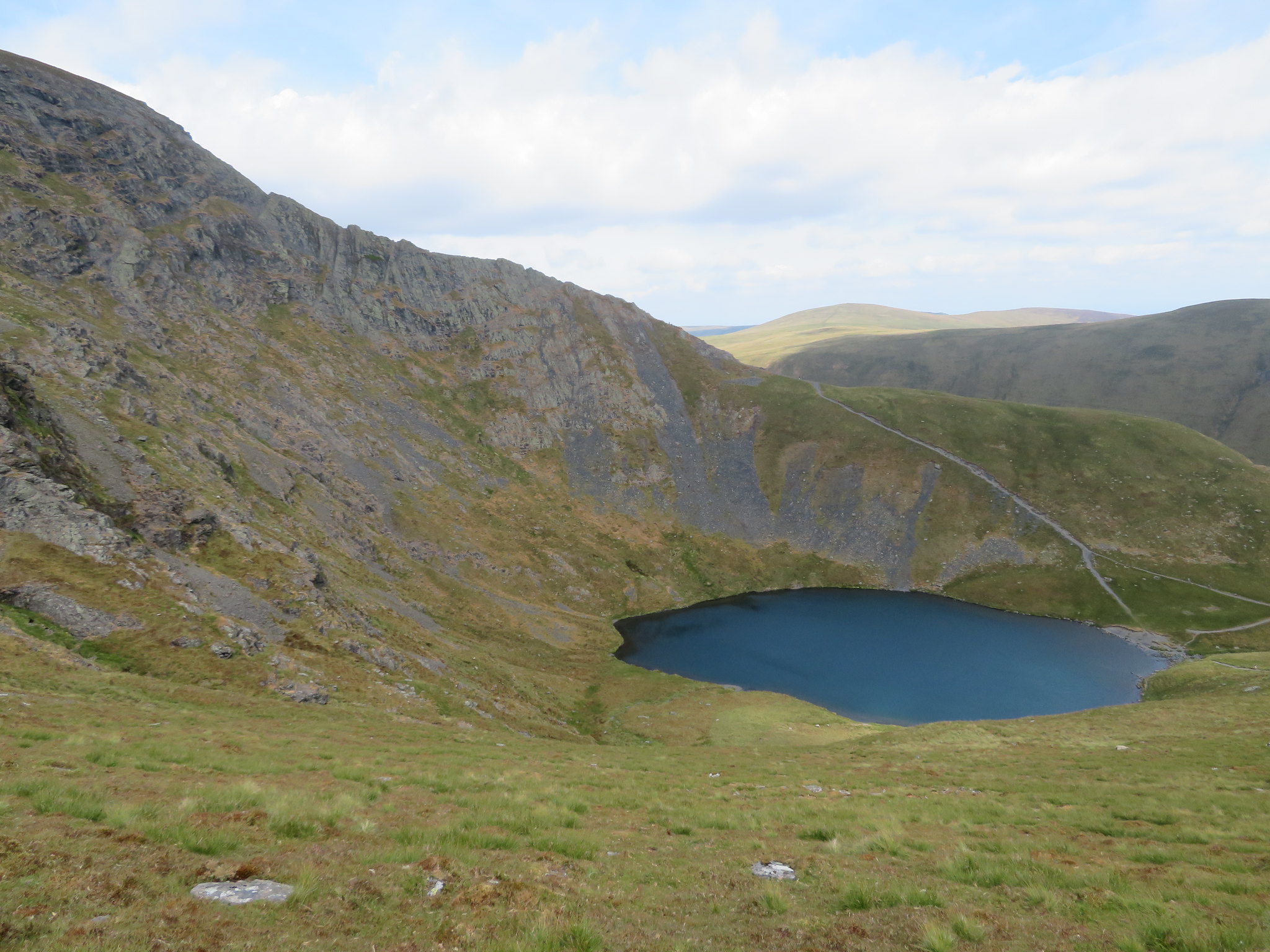 Scales Tarn and Sharp Edge
 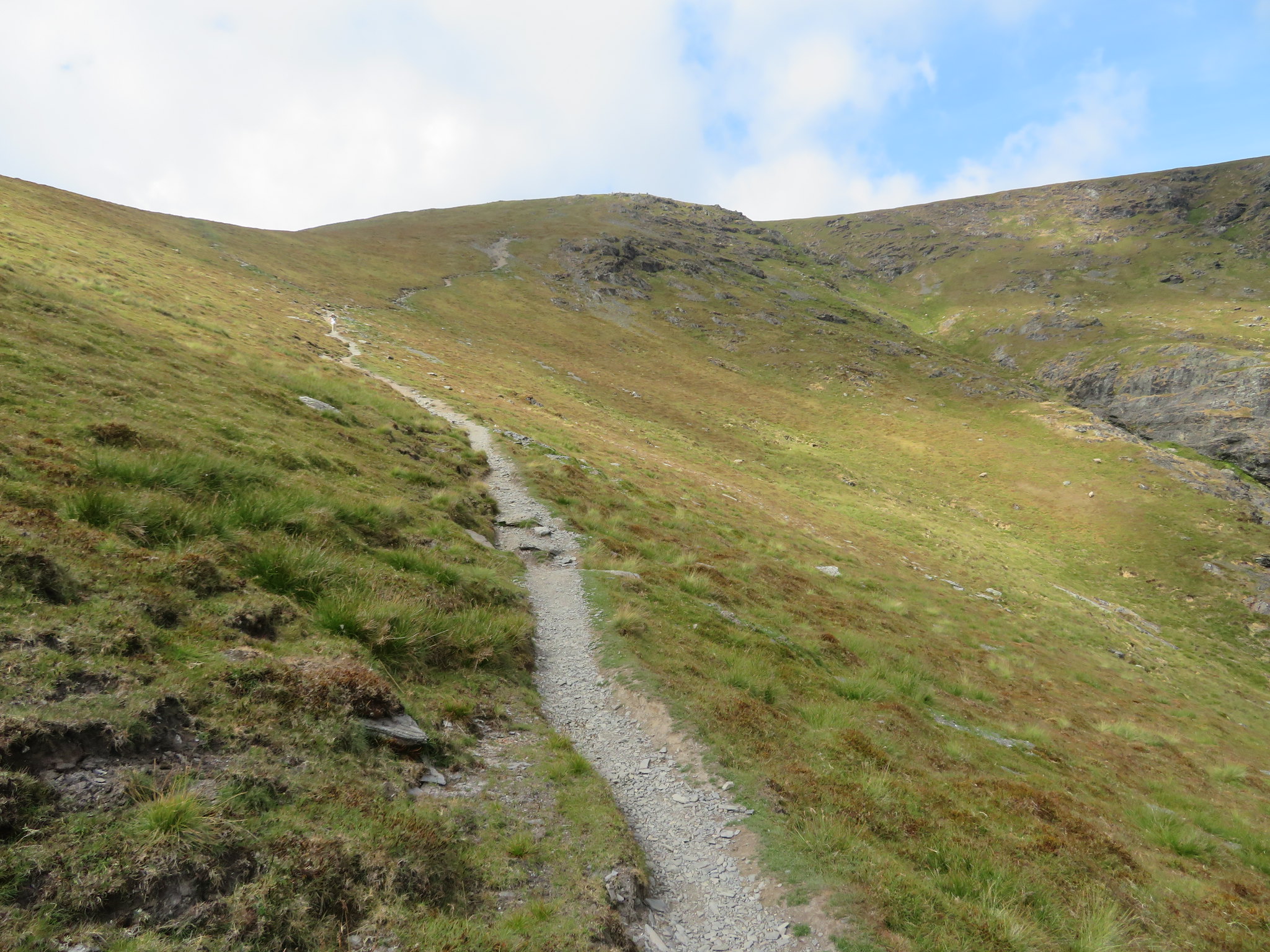 Halfway along the climb out from Scales Tarn
 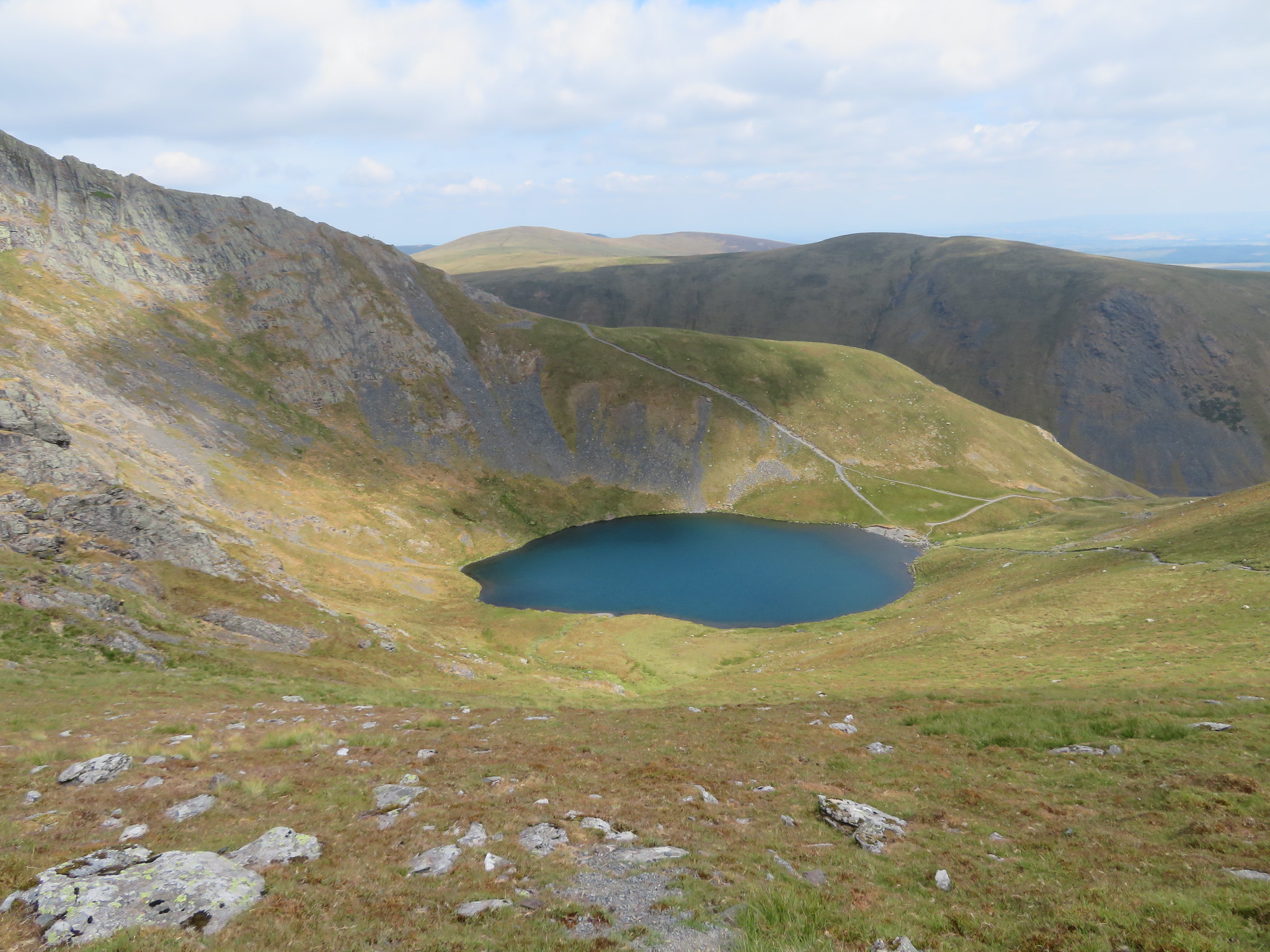 North towards Bannerdale Crags and Bowscale Fell
 As we turned north at this point the path gets decidedly rougher.
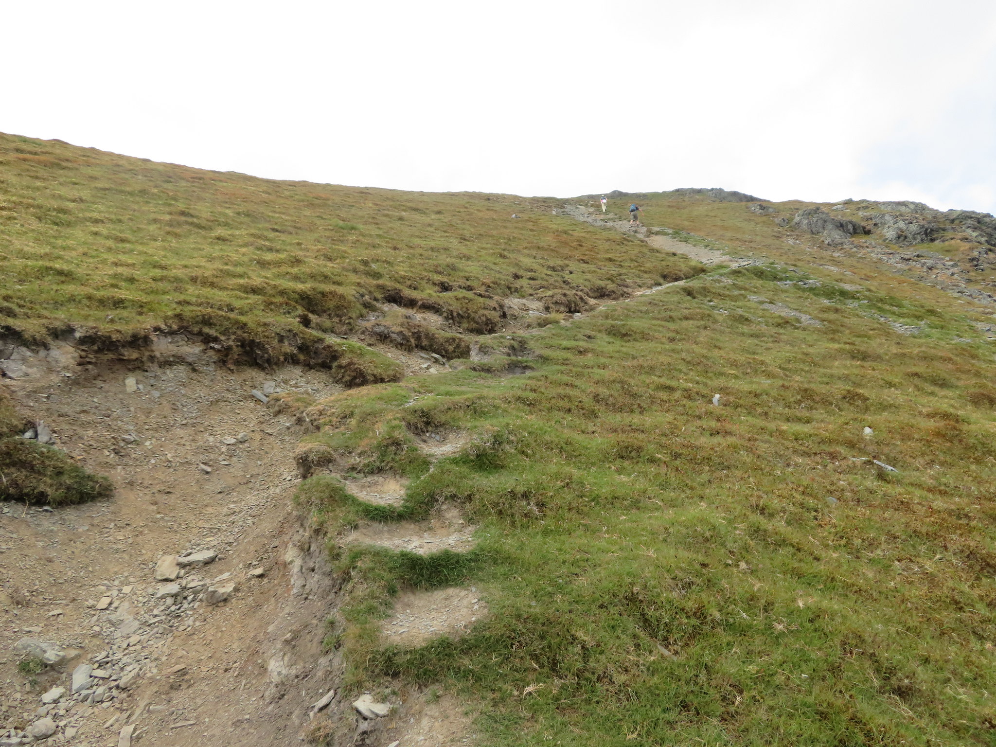 The final stretch is somewhat eroded
 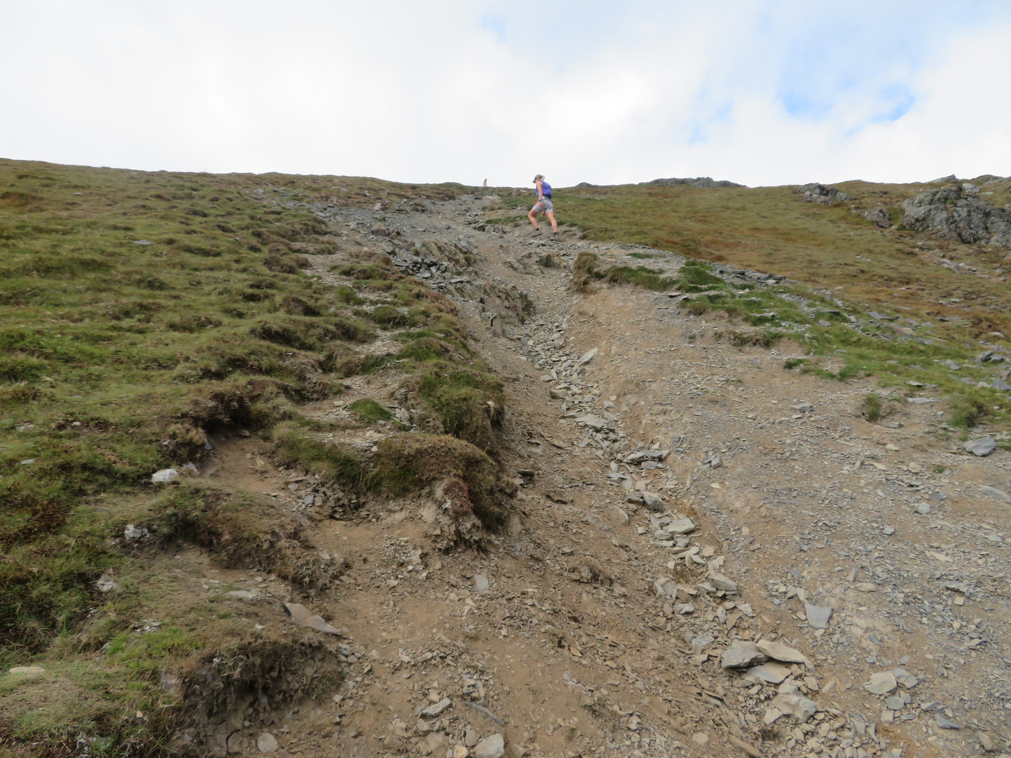 Maybe a little reconstruction required at this point
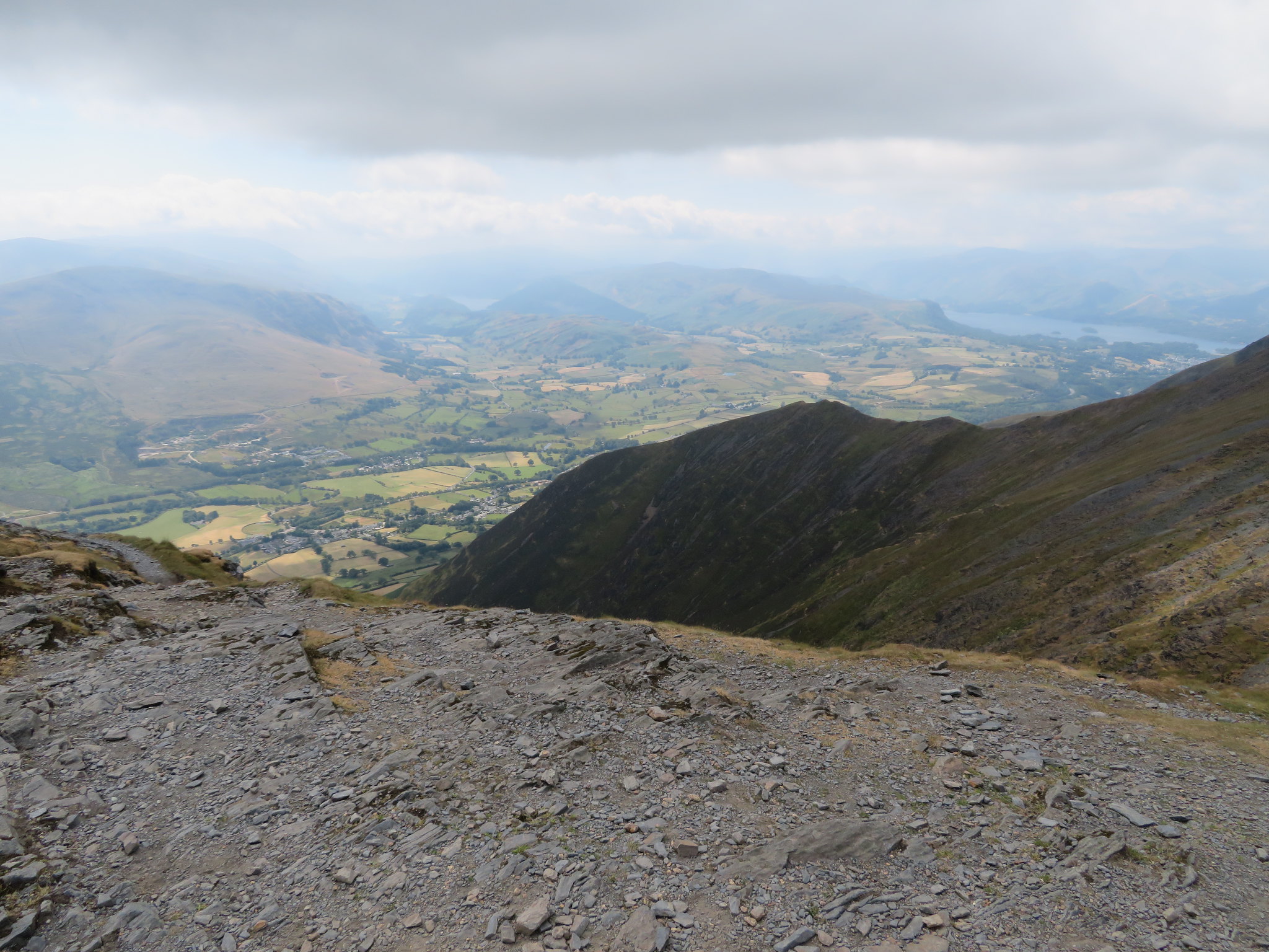
 From where the worst of the erosion starts there is a good view to the east but it was just a pity about the hazy conditions.
 Looking east
 Once that we had reached the end of the climb out we decided to make our way north towards the top of Sharp Edge and Atkinson Pike, just to lengthen the walk a bit really and as it's an easy walk along a good and more or less level path we made short work of reaching our turn around point apart from stopping and making conversation with a few walkers en route…
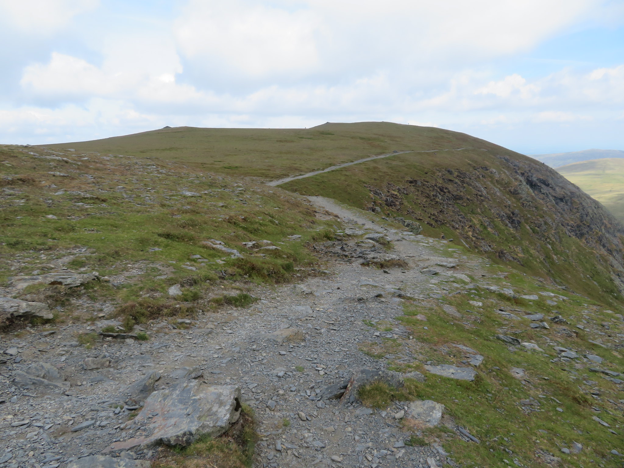 The way to Atkinson Pike and the top of Sharp Edge
 from where a decent view of the tarn is to be had.
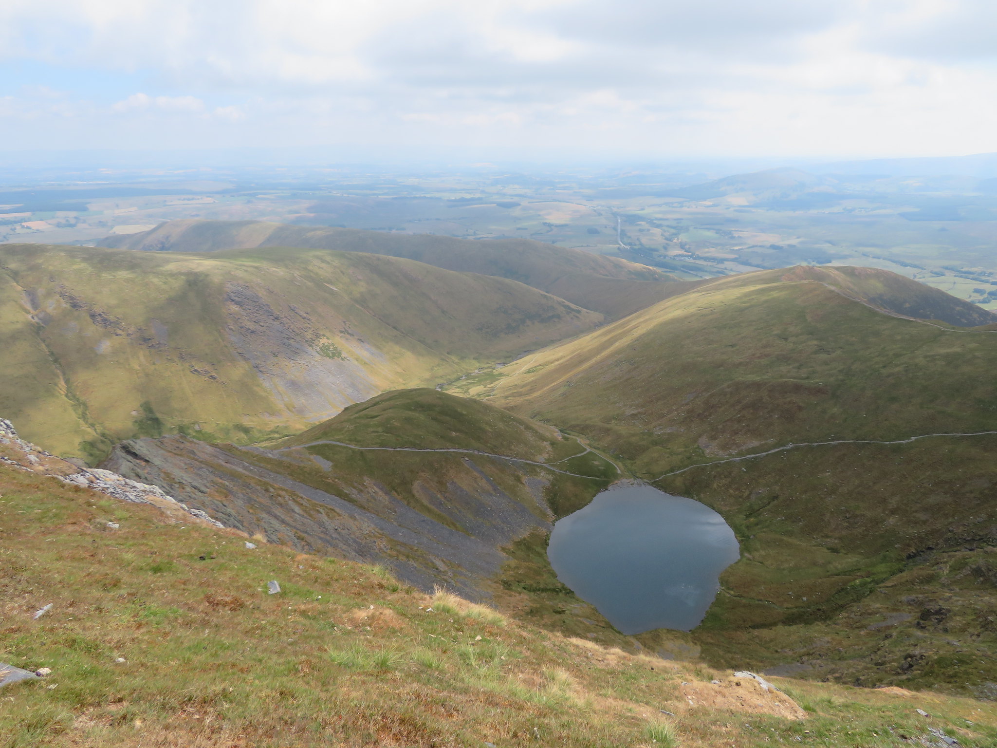 Scales Tarn from above Sharp Edge on Blencathra
 A short walk over the grass to Atkinson Pike gave us a view across the top of Blencathra's saddle…
 From Atkinson Pike to Blencathra summit
whilst over to the west across Mungrisdale Common there is a magnificent view of the Skiddaw Range.
 Roughton Gill and Skiddaw
 We then turned to the south towards the summit where we could see hordes of walkers either sat around in the sun or strolling about and today Sharp Edge was as busy as Striding Edge gets on a good day with people strung out from the tarn all the way up the start of the ridge where a queue was forming as people were negotiating the infamous 'step' before reaching the climb out.
Just short of halfway across the broad back of Blencathra there is a large cross formed by laying lumps of white quartz down on the ground. The history of the cross can be found in Wainwright's Northern Fells Book 5 page 33 in the Blencathra section.
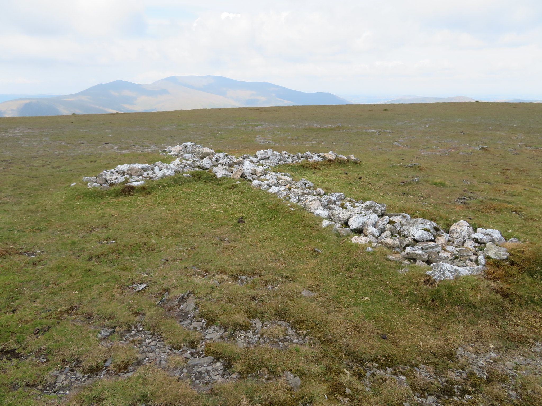 Large cross monument made from white quartz rocks between Atkinson Pike and Blencathra summit
 We passed the spot where the unnamed tarn lies and today the cairn that sits in it is easily reached as the tarn has dried up and looking back to Atkinson Pike one could nearly assume that it and Blencathra summit are one and the same height and with AP only 23 metres lower one could be excused for thinking so.
 Back to Atkinson Pike
 The summit was busy, very busy and too much so for us as after grabbing a couple of shots…
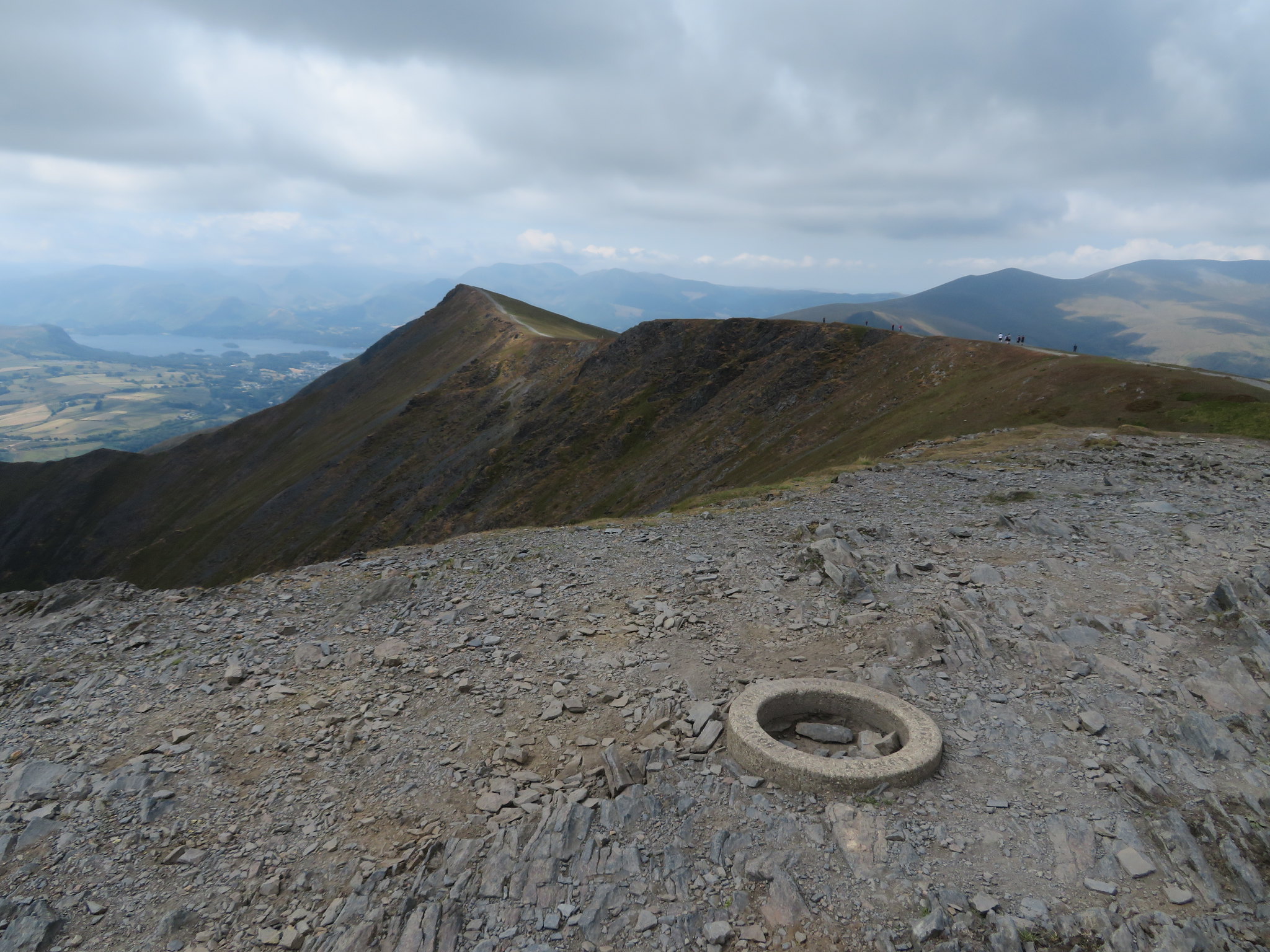 The southwest ridge from the summit
 With Halls Fell being the highest point of this mountain and nothing else near enough to hem the views in it is a tremendous panorama in all directions and it was just a shame that the haze made the furthest fells a bit fuzzy.
 The top of Halls Fell
 There is also a fair view of Gategill Fell with the rocky knoll of Knott Halloo sat about halfway along its steep ridge.
 Knott Haloo on Gategill Fell
 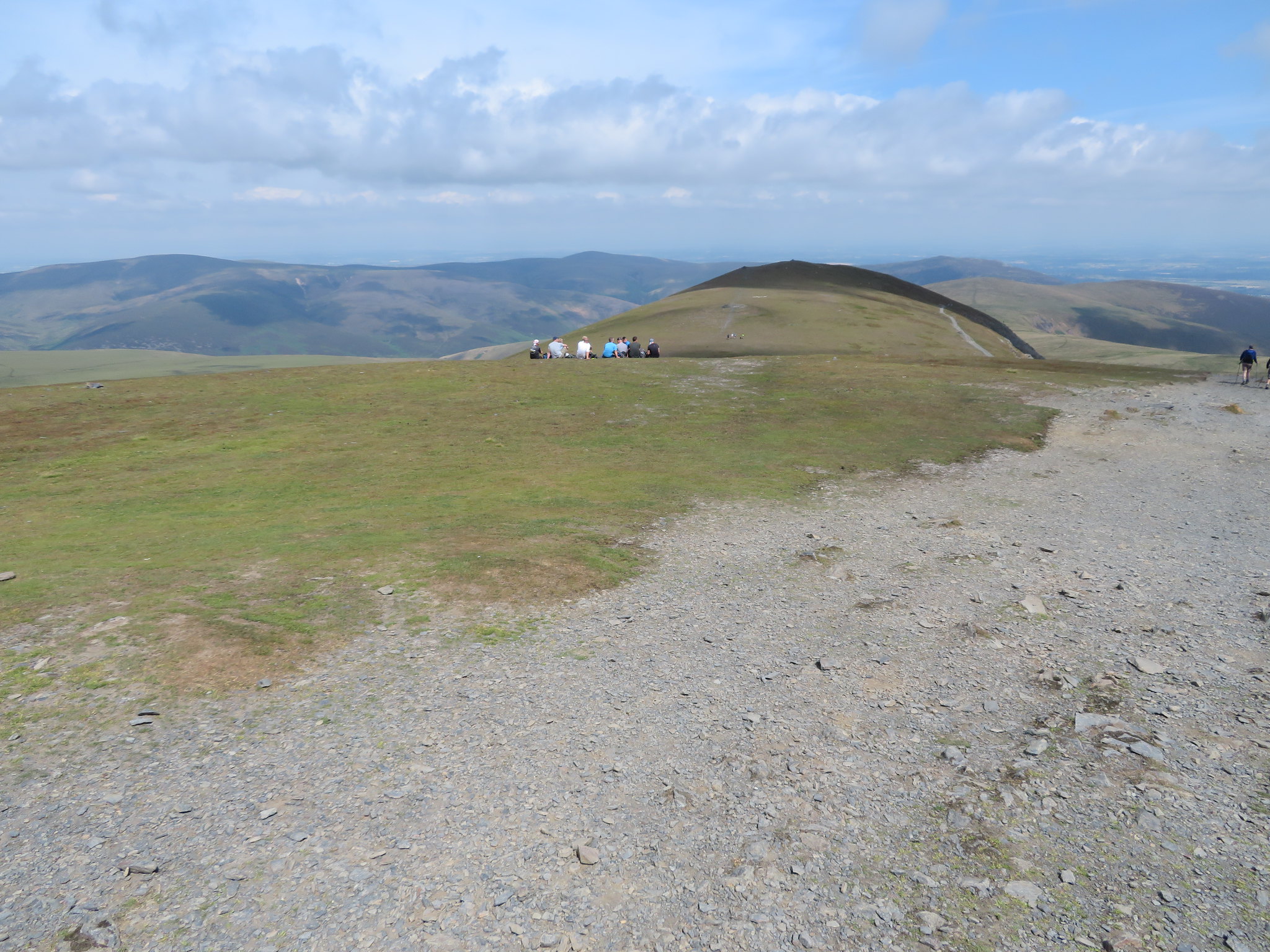 A northern view from the summit
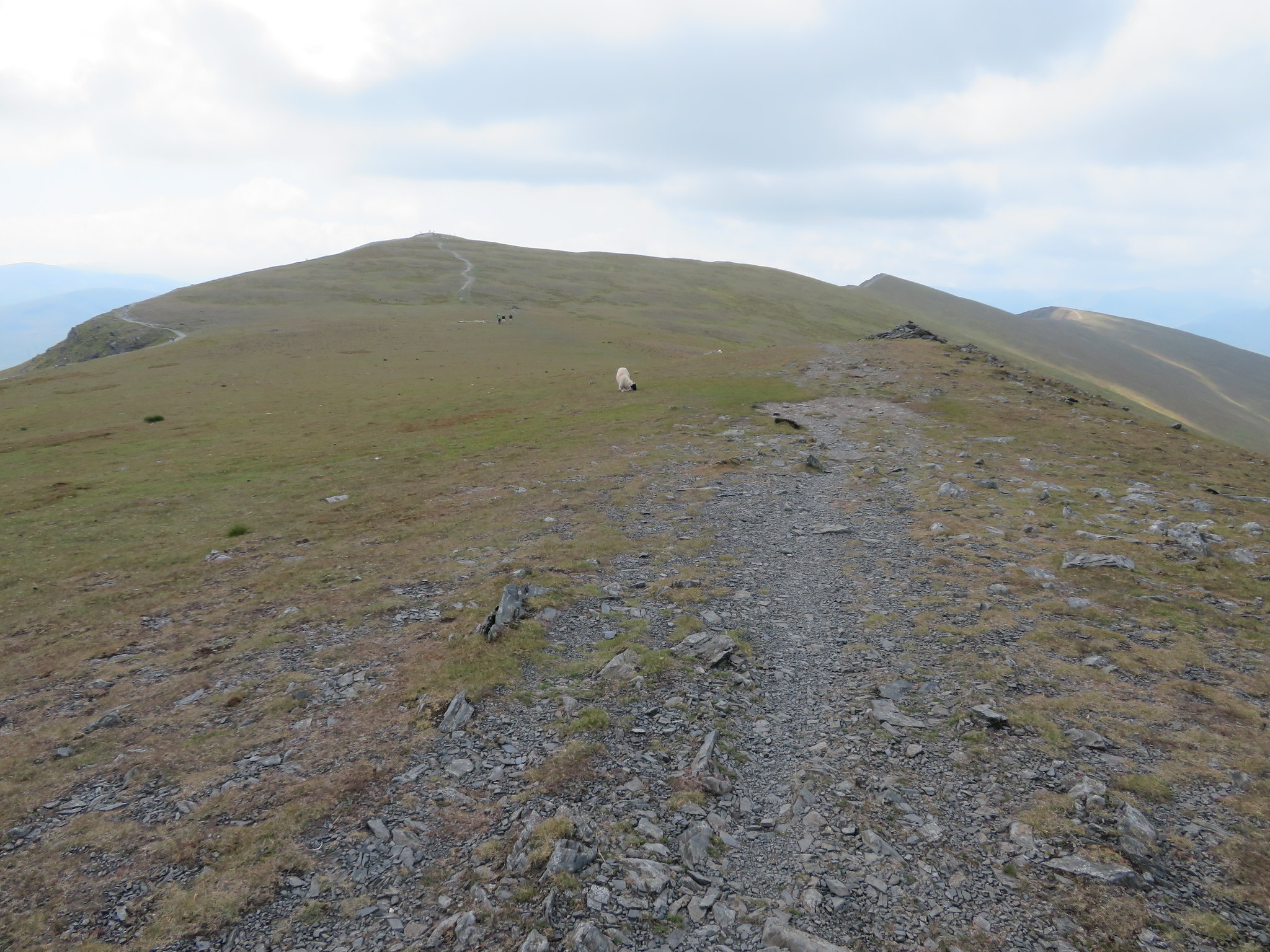
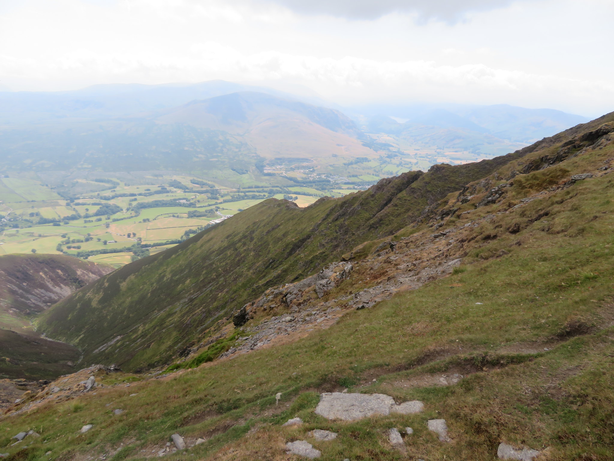
 We didn't linger and left the summit fairly sharpish looking for a relatively quiet spot to have a short break, one we found just at the start of the zigzags on the east ridge path.
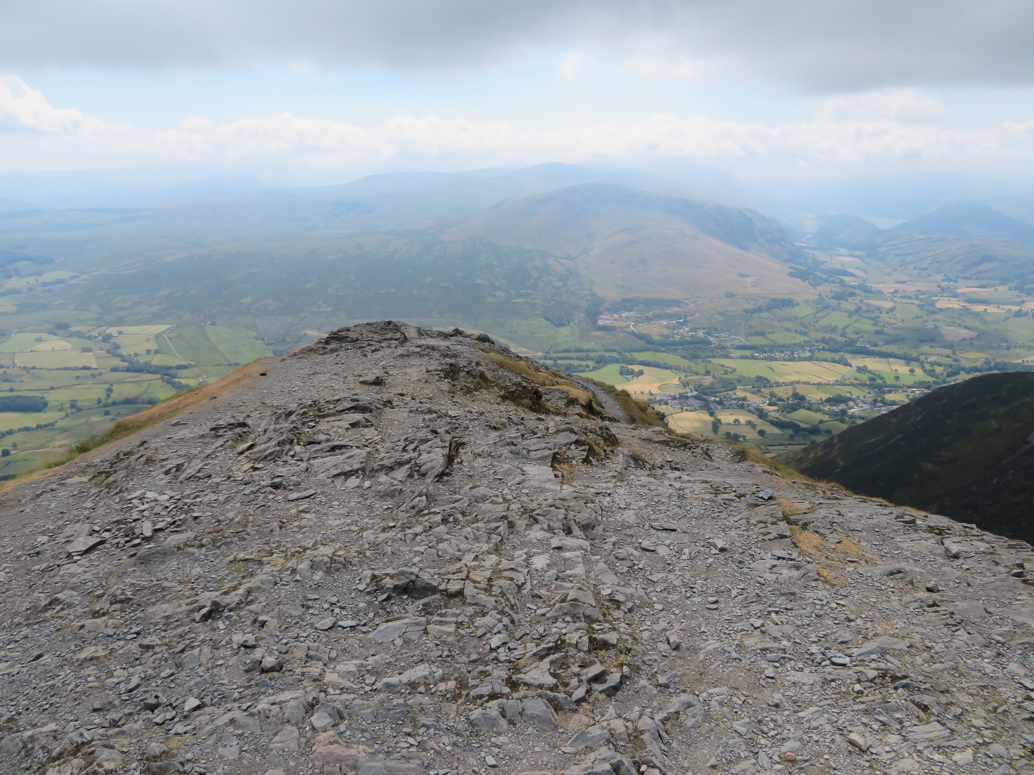
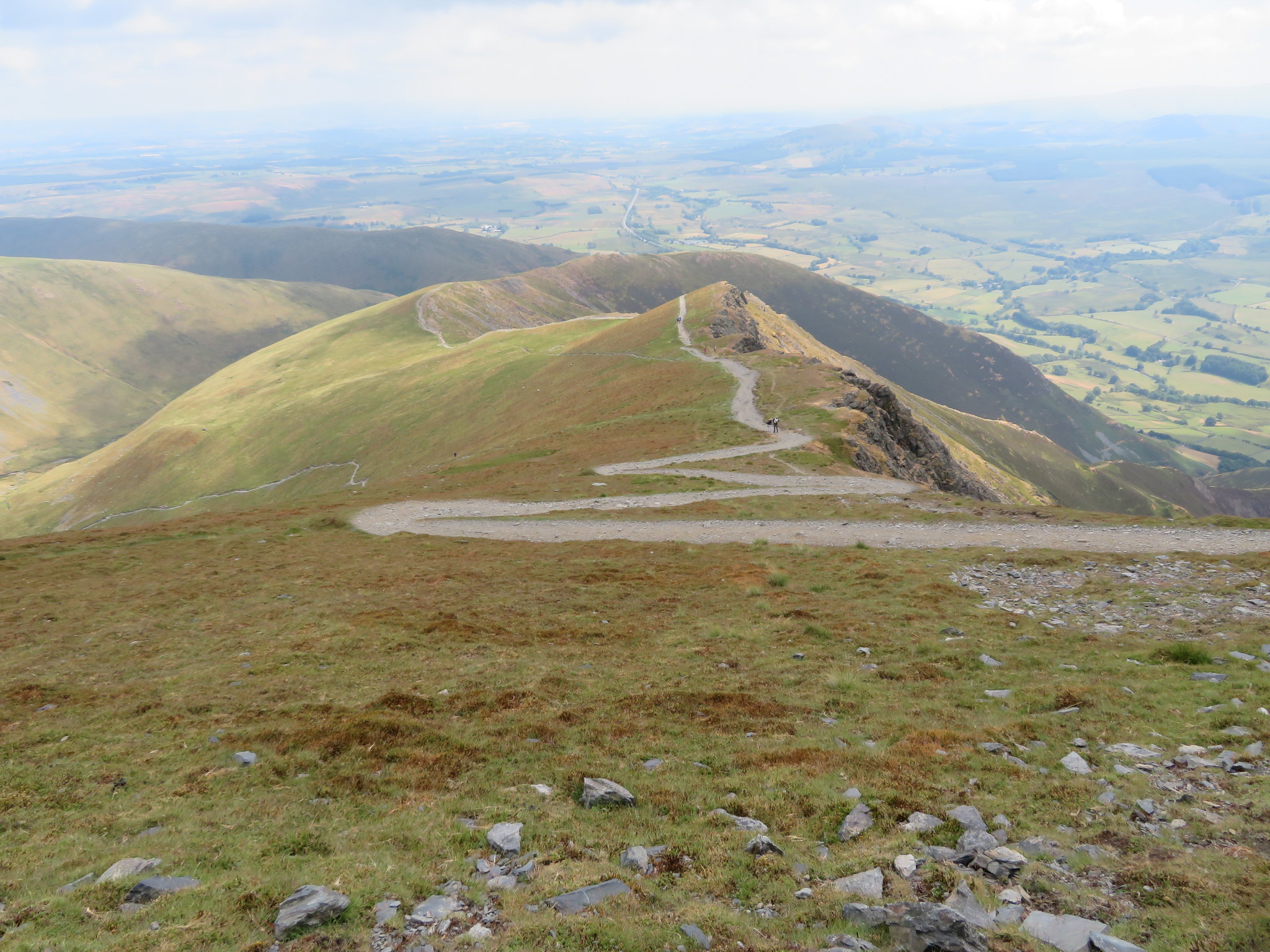 Blencathra - east ridge
 A quiet spot was found just below the ridge giving us excellent views across the valley but soon after refuelling we didn't linger and set off once more on our return journey to the car. On our way down we took a picture of Blencathra's third ridge, Doddick Fell, another great way to climb this mountain.
 The Doddick Fell ridge
 Another view of Halls Fell ridge.
 Halls Fell ridge
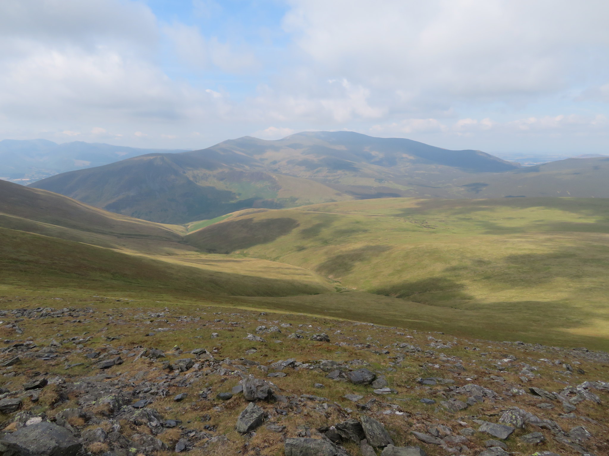
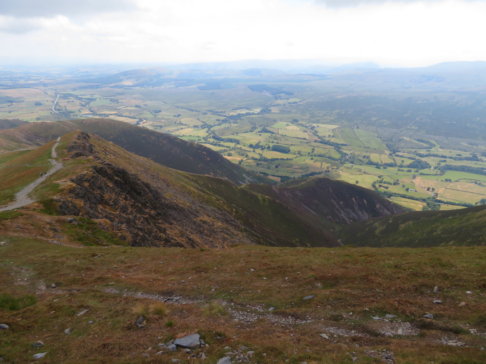
 The path along the east ridge is fine although on a day as warm as today it gets a little tedious especially with the whole ridge in view before you but this can be alleviated by regular looks back to take in the views to the south…
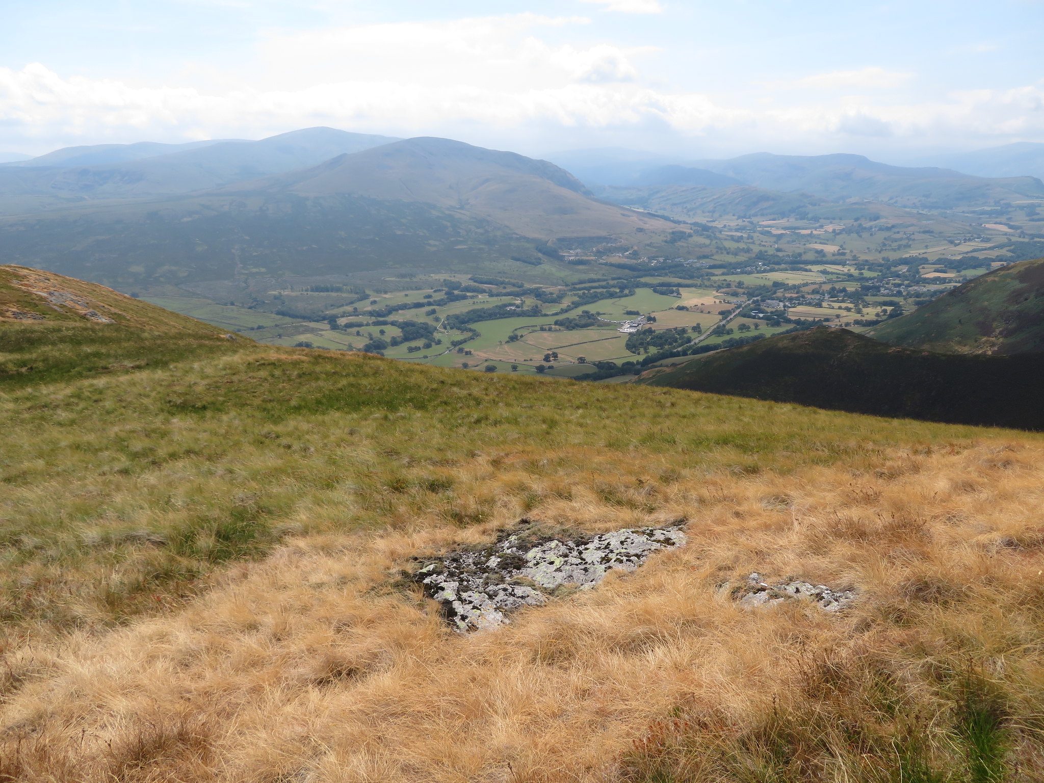 South towards Clough Head - Helvellyn - High Rigg etc
 and east towards Souther Fell and the distant skyline of the Pennine.
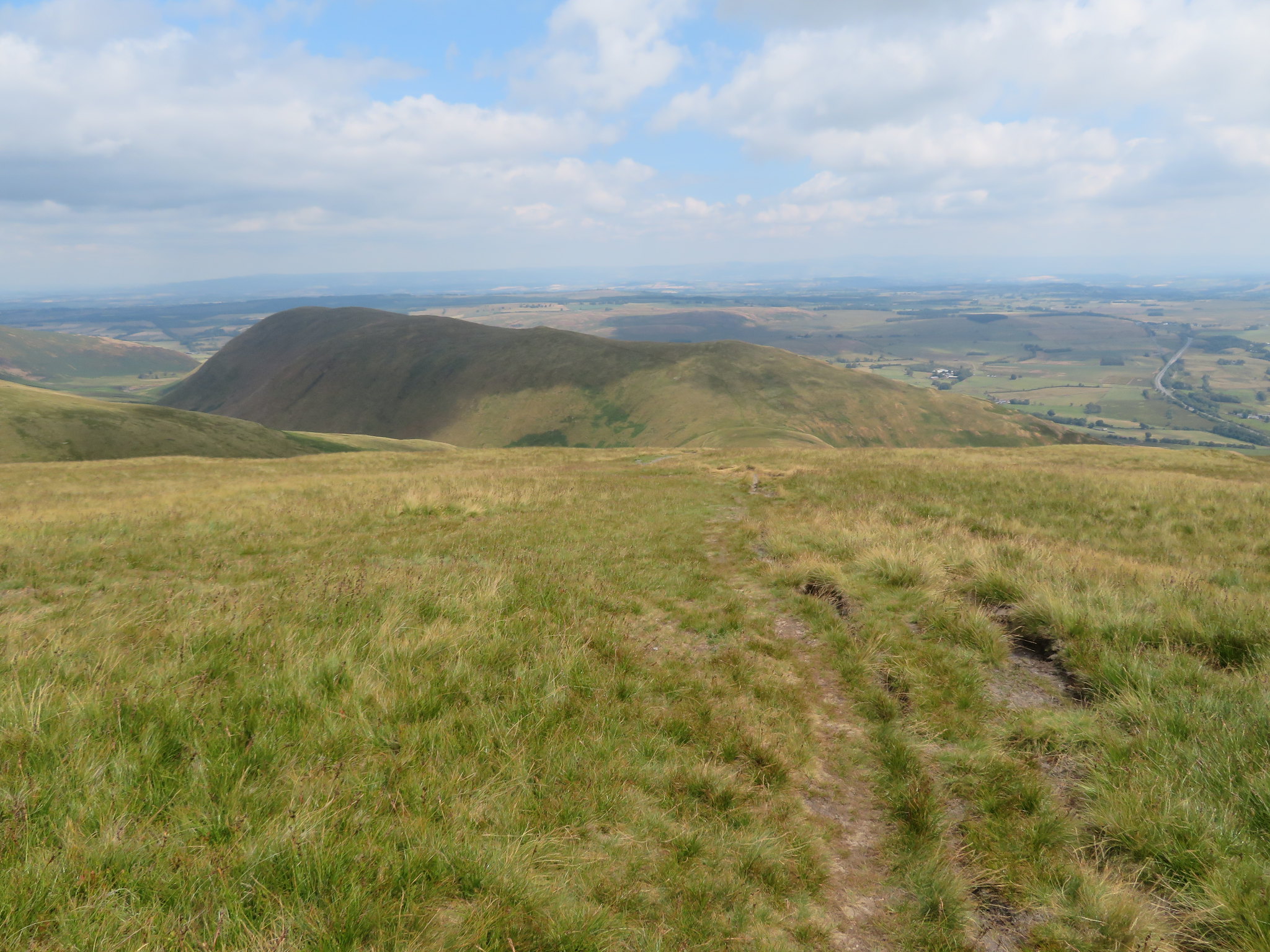 Souther Fell
 We continued on down the path until we reached the col above Mousthwaite Comb from where we just retraced our outward route back to the car. On our way through the Comb we met a small group of walkers with an elderly lady who was supporting herself on two sticks, was recovering from a broken femur and was determined to reach Scales Tarn no matter how long it took her and the people with her to get there. I can only give admiration and respect to someone who has such determination and will power to get back on the hills that they love so much.
This was a short but satisfying walk over easy ground with good paths all the way round despite the erosion in one or two places. It was a busy day on this fell today and just by noting the number of walkers/scramblers making their way to Sharp Edge it looks like it has now got the same magnetic draw of thrill seekers as Striding Edge and its near neighbour Swirral Edge, and of course it also has the dangers of both of the aforementioned ridge walks. It was a hot day despite the cloud coming in later in the morning, a cloud cover that didn't completely block out the sun but neither did it make the day any cooler.