free to be able to rate and comment on reports (as well as access 1:25000 mapping).
Chris is on a mission. He wanted to do another walk soon after we had walked Outerside and Barrow but weather and circumstances prevented us meeting up for 6 days which is maybe as well as he has pushed himself the last few days of the previous 2 weeks. A break would do him good.
Arrangements were made and we met up at the usual coffee shop - my house - before setting off on a gloriously sunny, but a really cold and frosty day, a day that started off with a minus 6°c and was destined to get much colder as the day wore on. Chris, having already driven over to Cumbria from somewhere near Middlesbrough now had another longish drive west along the A66 to the large roundabout north of Keswick where we would then turn off onto the A591 and after a few miles take the right hand turn onto the minor metalled road at Kennedy Plantation. As this road is very narrow with quite a few sharp bends in it the journey along it proves to be quite a slow affair as we passed Mellbecks, Orthwaite then Over Water to our left followed by Chapelhouse Reservoir and finally Longlands where there is a spot for parking a few cars right by the bridge over Longlands Beck - NY265358 - a place that can also be identified by the small electricity sub-station that is now defended by a post and wire fence somewhat reducing the parking space from what it once was.
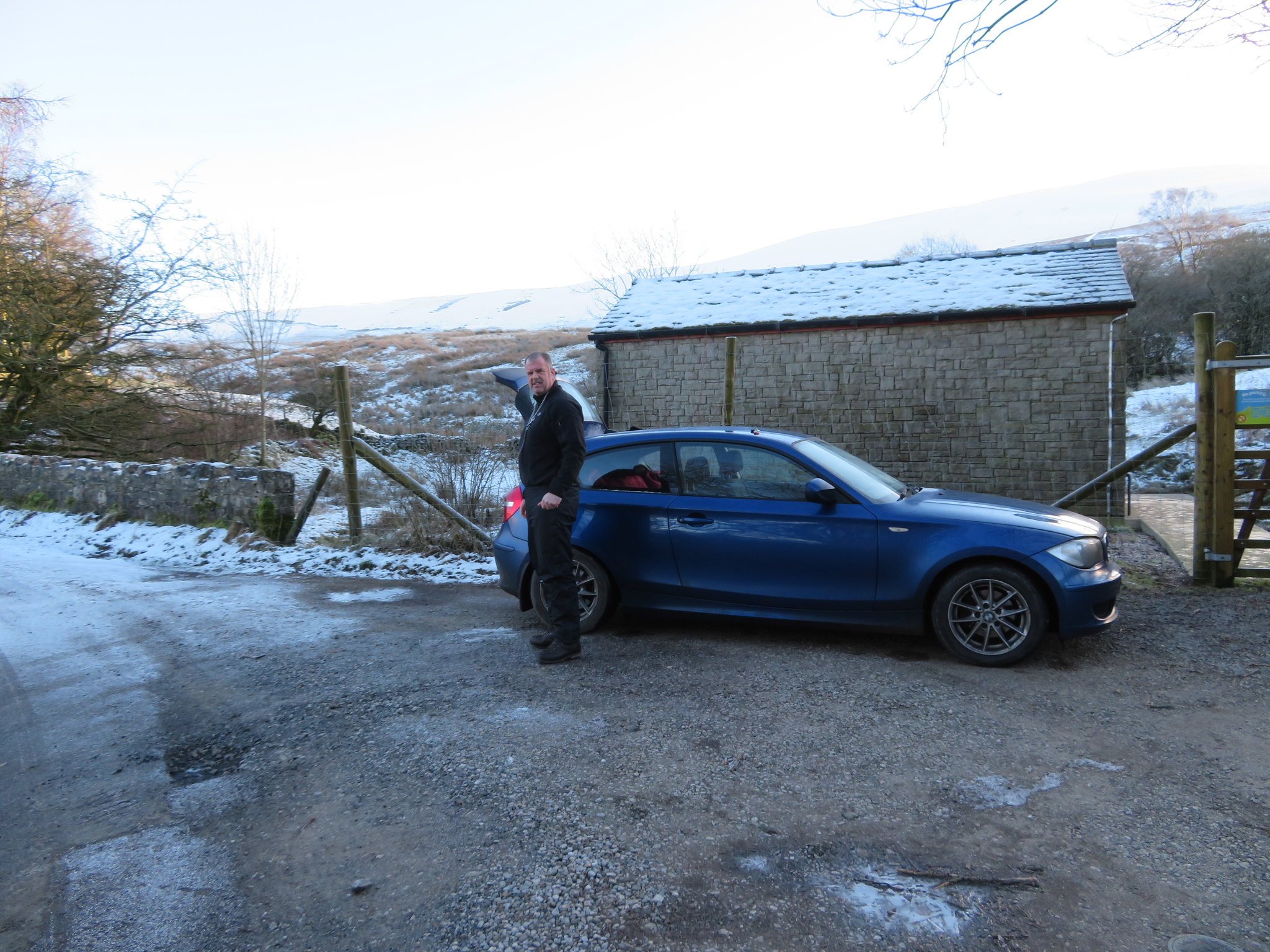 Car parking at Longlands Beck bridge
 Despite this there is room to park a few cars either side of the bridge and just off the tarmac.
It was too cold to hang about so we were quickly donned up and ready to go, leaving the car to walk up the road - northeast - for a few short metres and pass through the gateway to the fells. A gate that hosts a couple of weather worn painted notice boards stating that we were now entering Ulldale Common and the other and nearly illegible one pointing out that access through the gate was required at all times. In other words, don't block it.
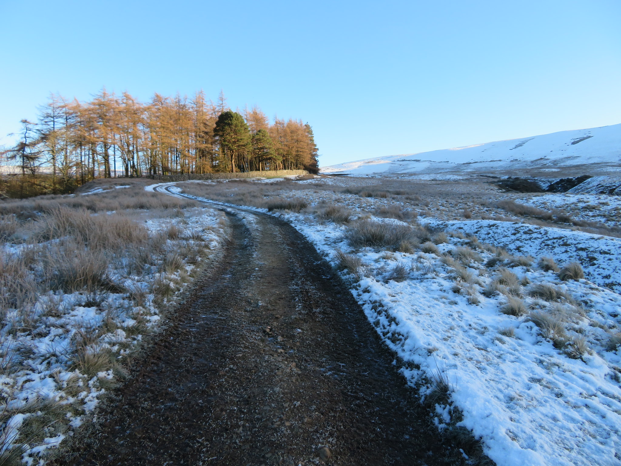
Behind the gate there lay before us a long and winding well made up track that in another time would have been used to transport material from the old and now disused pits that sat at the northern foot of Longlands Fell, although it is now part of the Cumbria Way long distance walk.
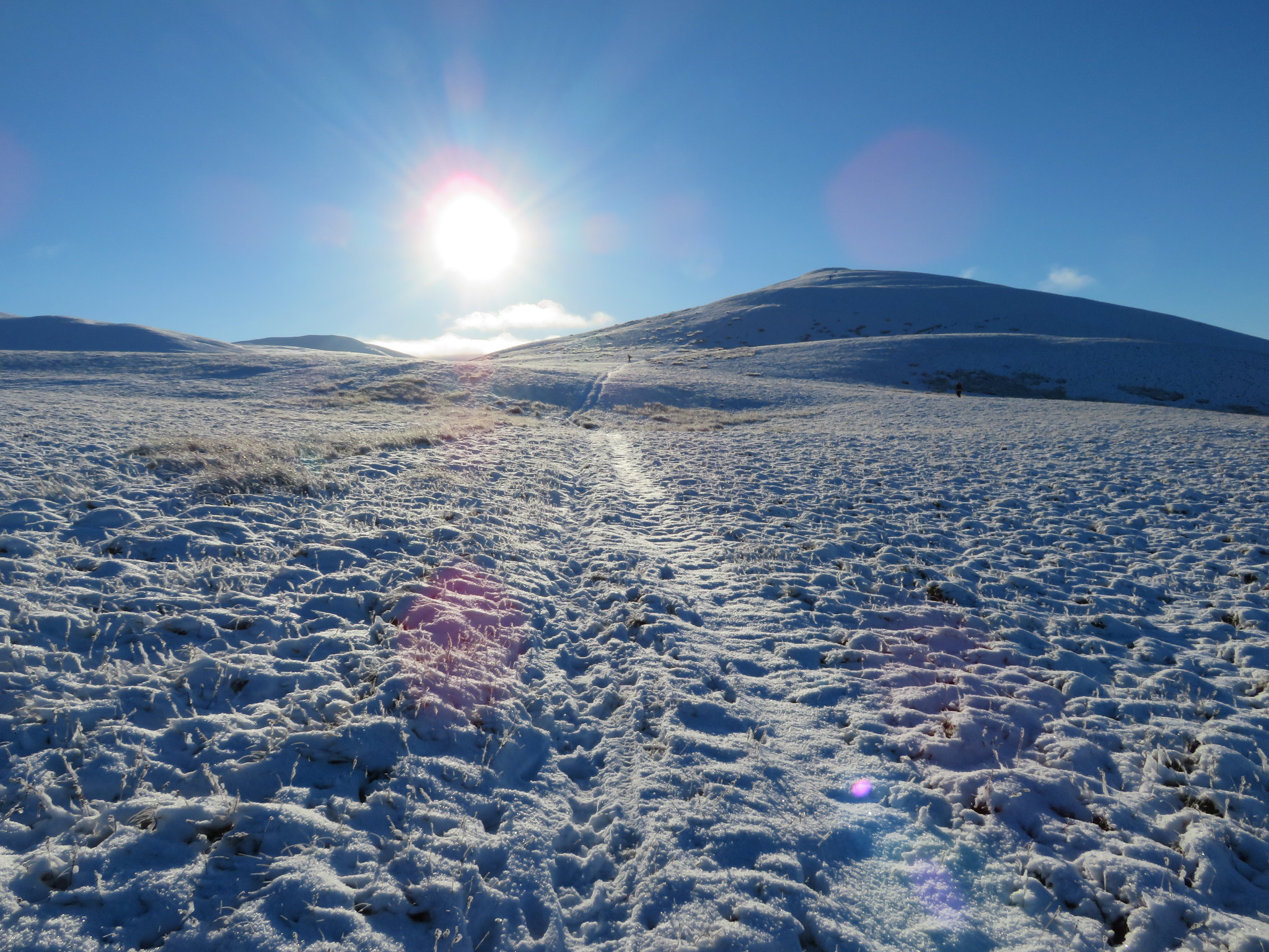
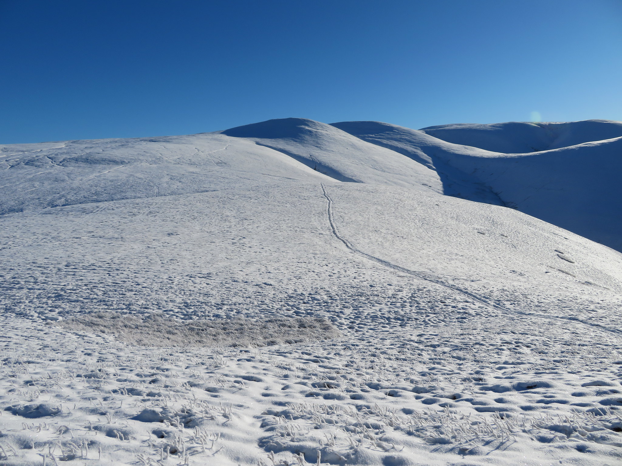
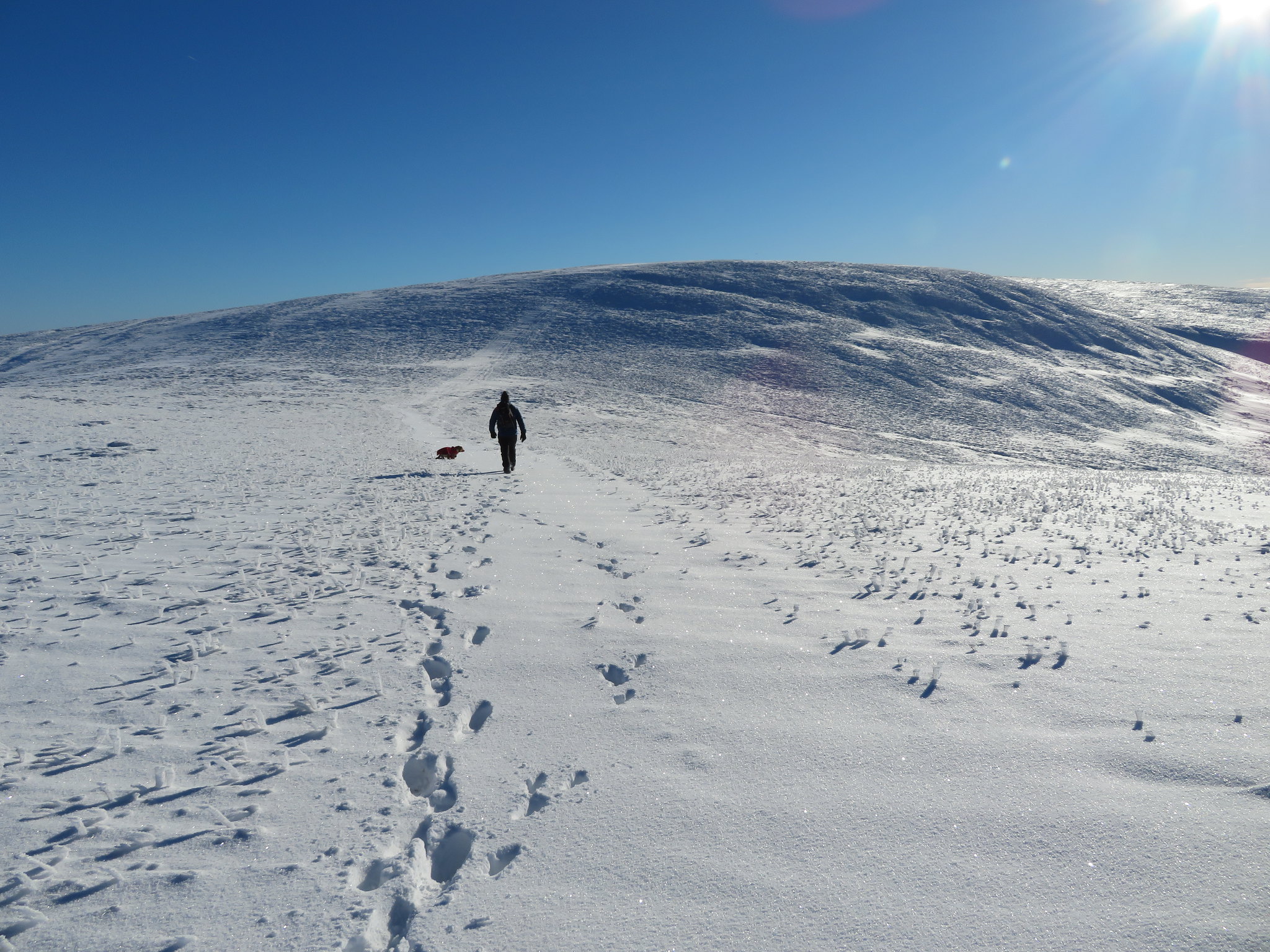
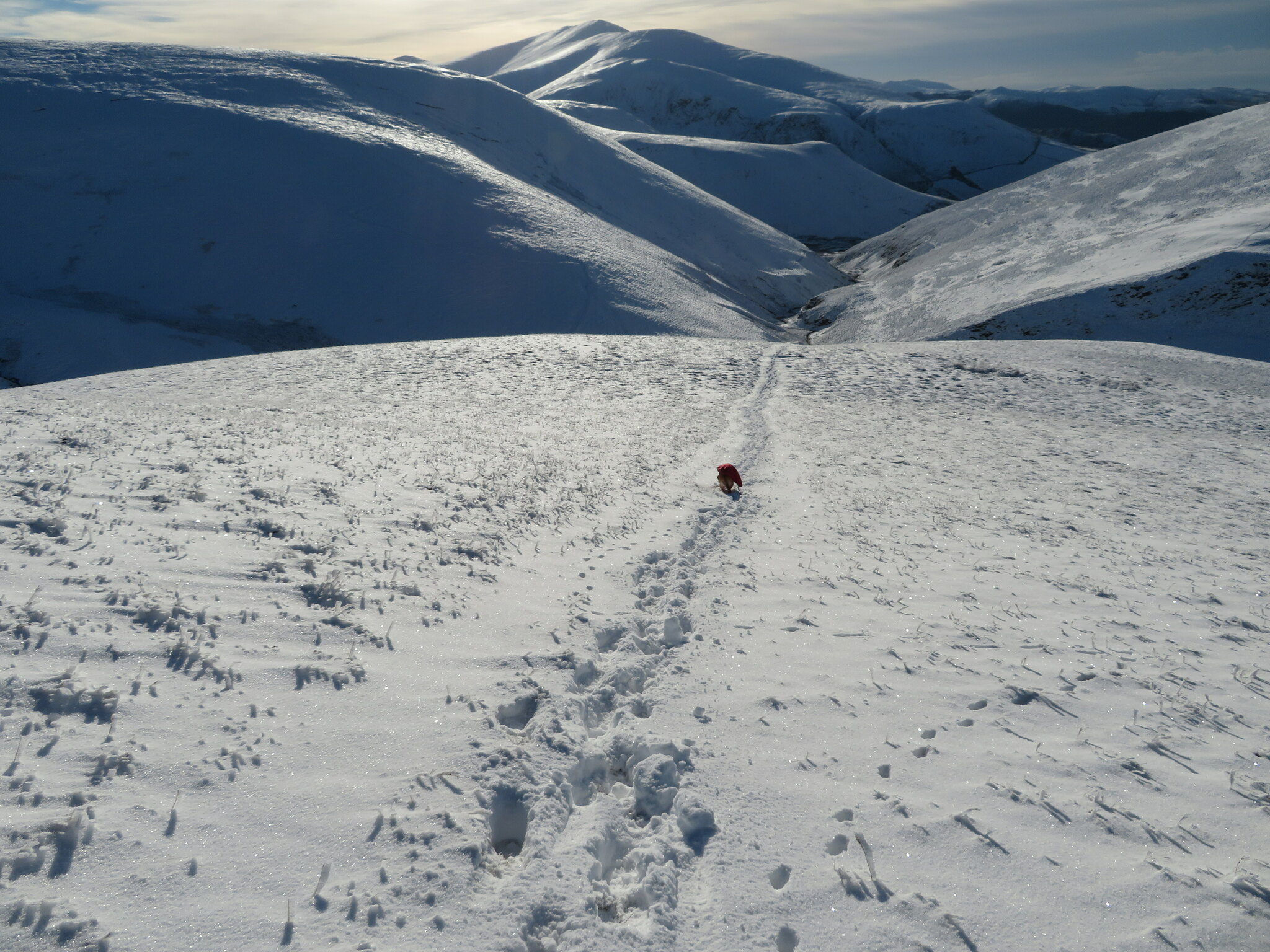
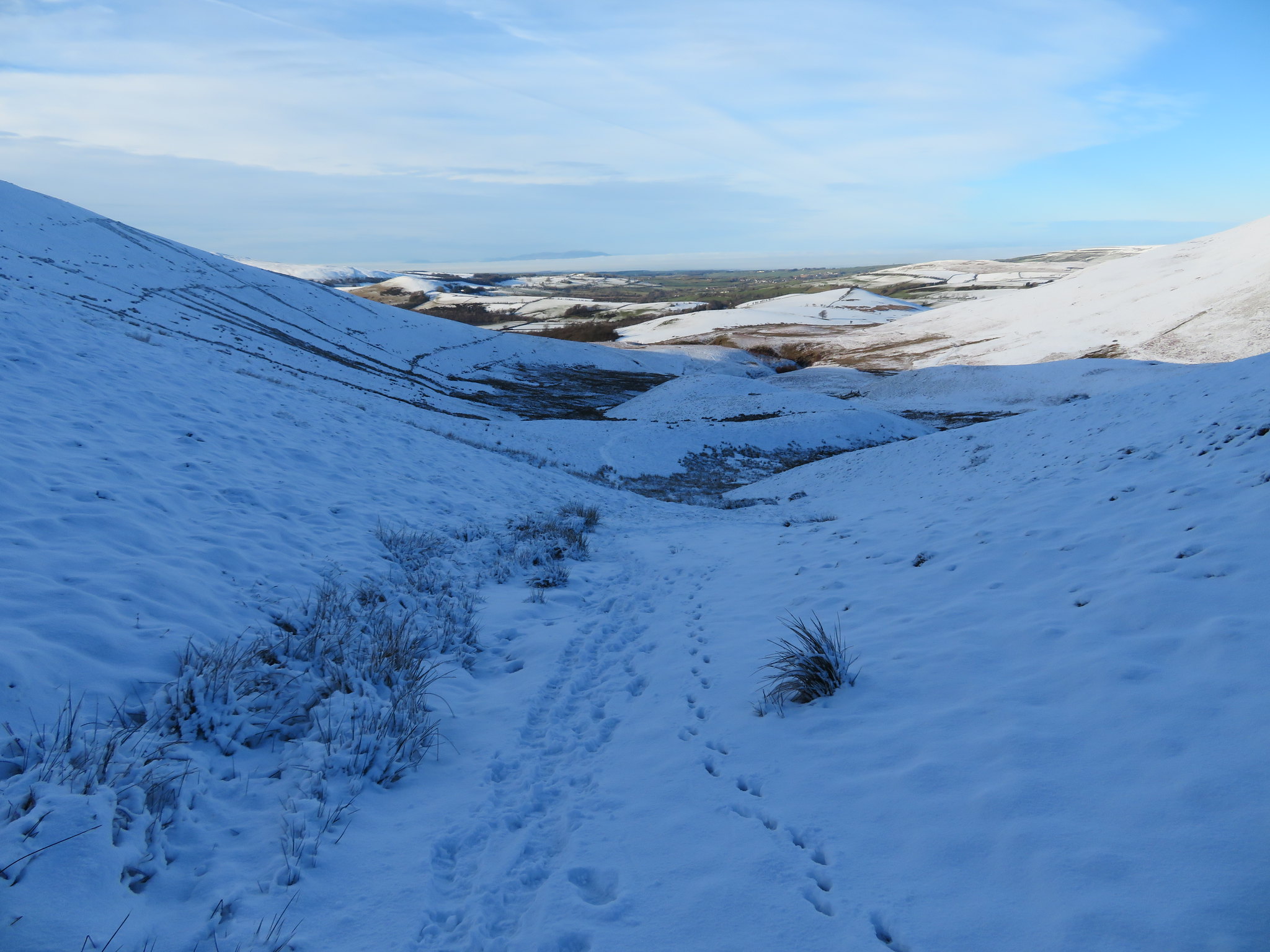
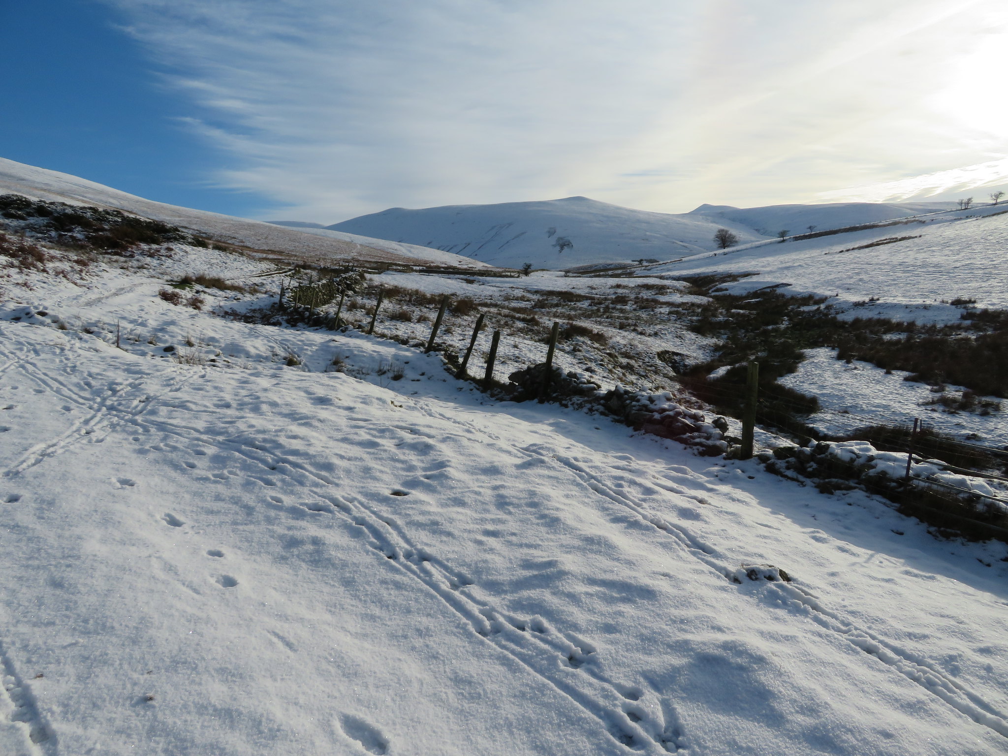
 The lower slopes of Longlands Fell ahead
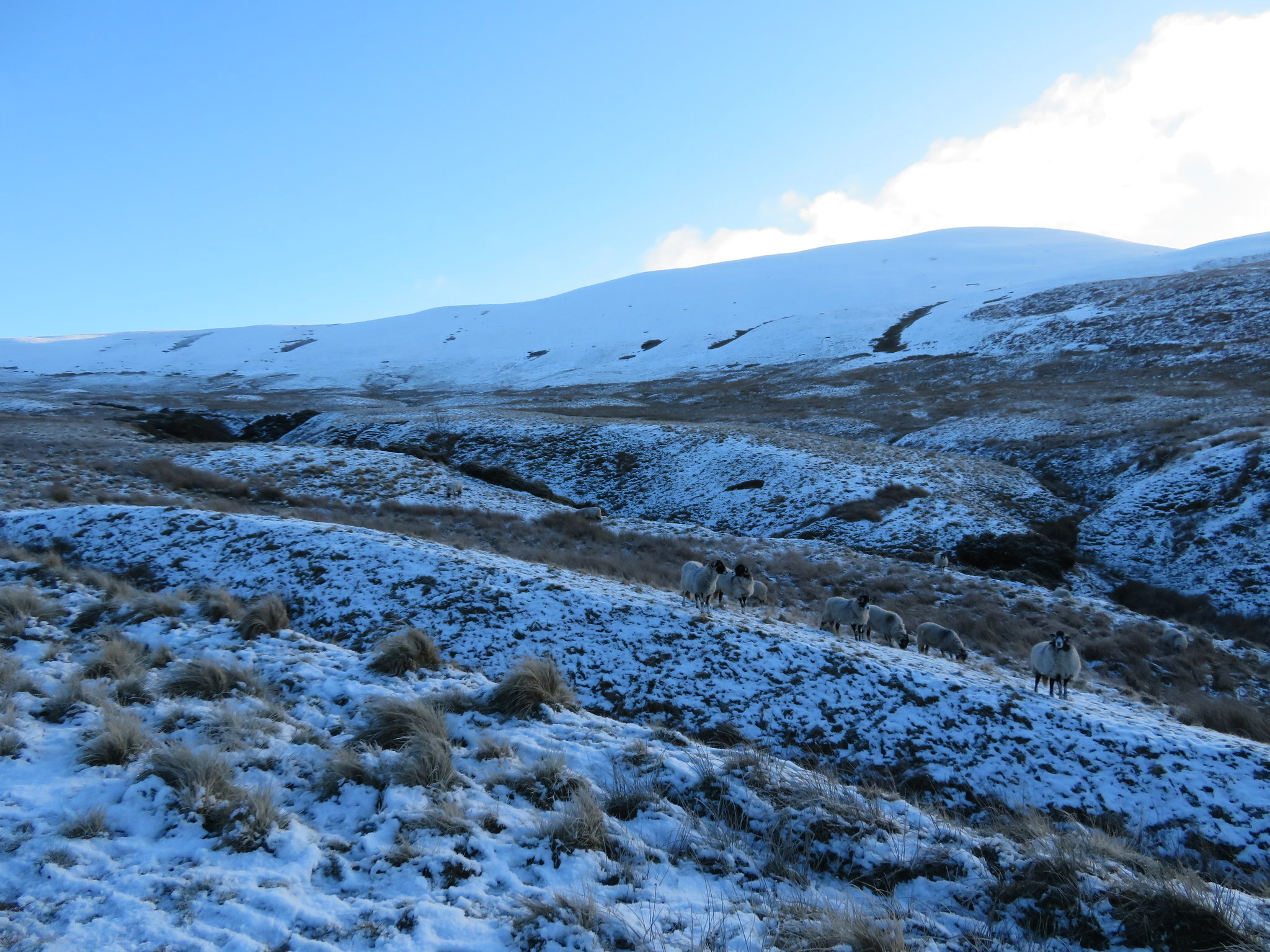
 The hills are covered in snow, glistening in the bright sunshine and there were small groups/flocks of sheep grazing what they could find beneath the snow. From where we were just then Longlands Fell looked a daunting prospect in its length and overcoat of white snow.
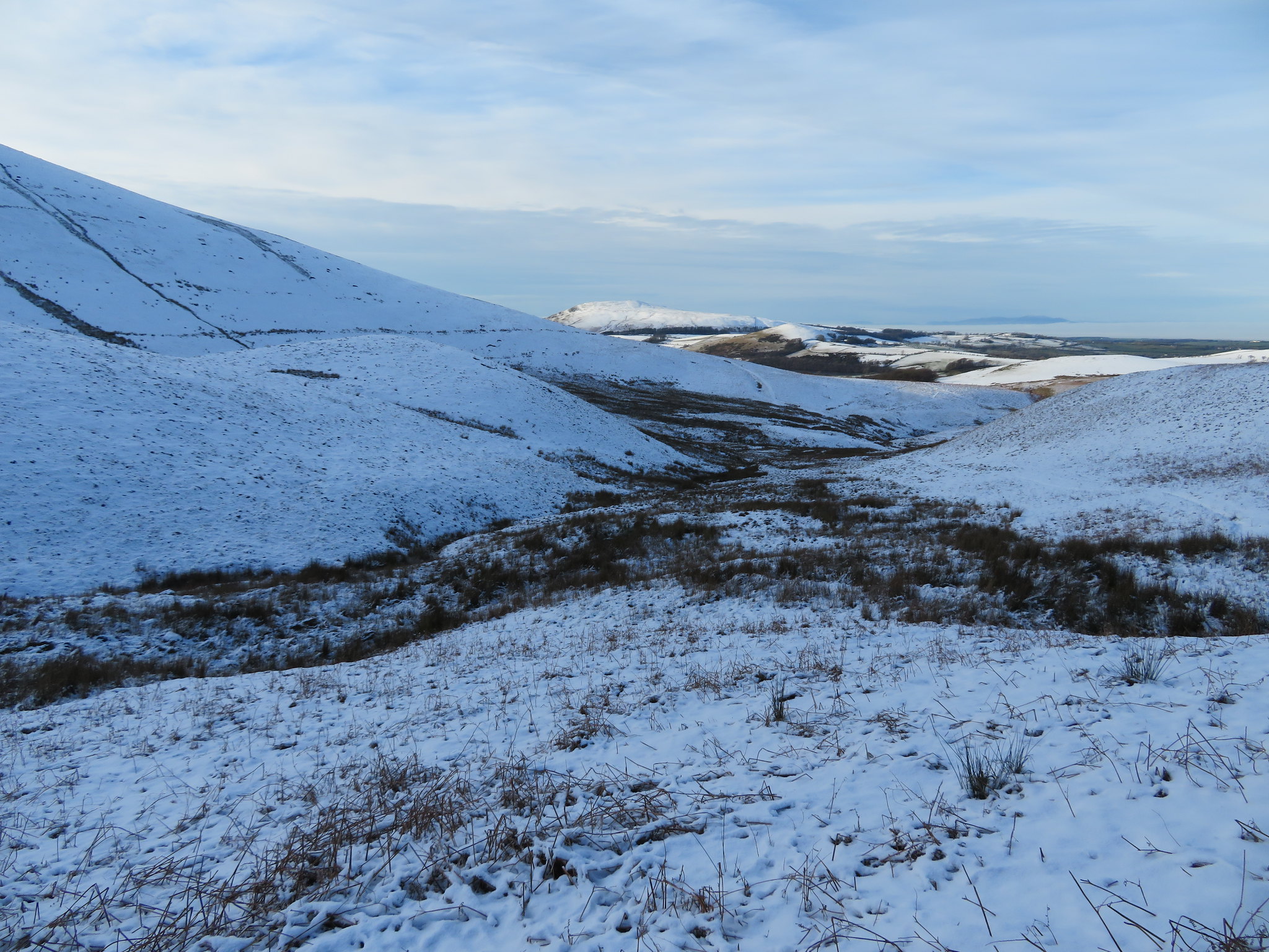
 Longlands Fell is well named
 Walking along the track was easy enough as its well graded and firm, especially today with the ground as hard as iron, as it wends its way steadily northeast and a look back over the shoulder gave us a glimpse of Skiddaw just poking over Thwaite, the west flank of Longlands Fell. This is a cold day, the coldest that we've had for a while but it was absolutely glorious and despite the sun being out noses and ears was feeling the bite of the cold such was the nip in the air. We were now not far away from where we were to start the climb up the long but easy slopes of Longlands Fell where the path begins at the site of the old pits, a path that is a bit meagre to start with but gets ever more prominent as height is gained with the shallow depression of it noticeable beneath the snow.
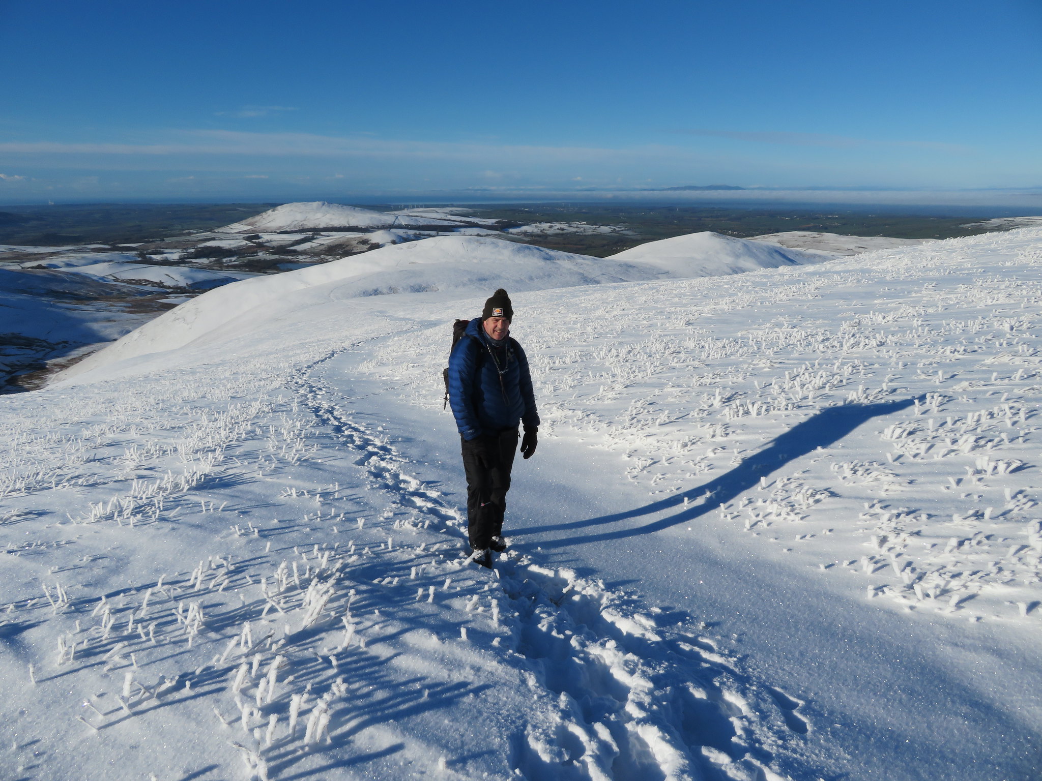
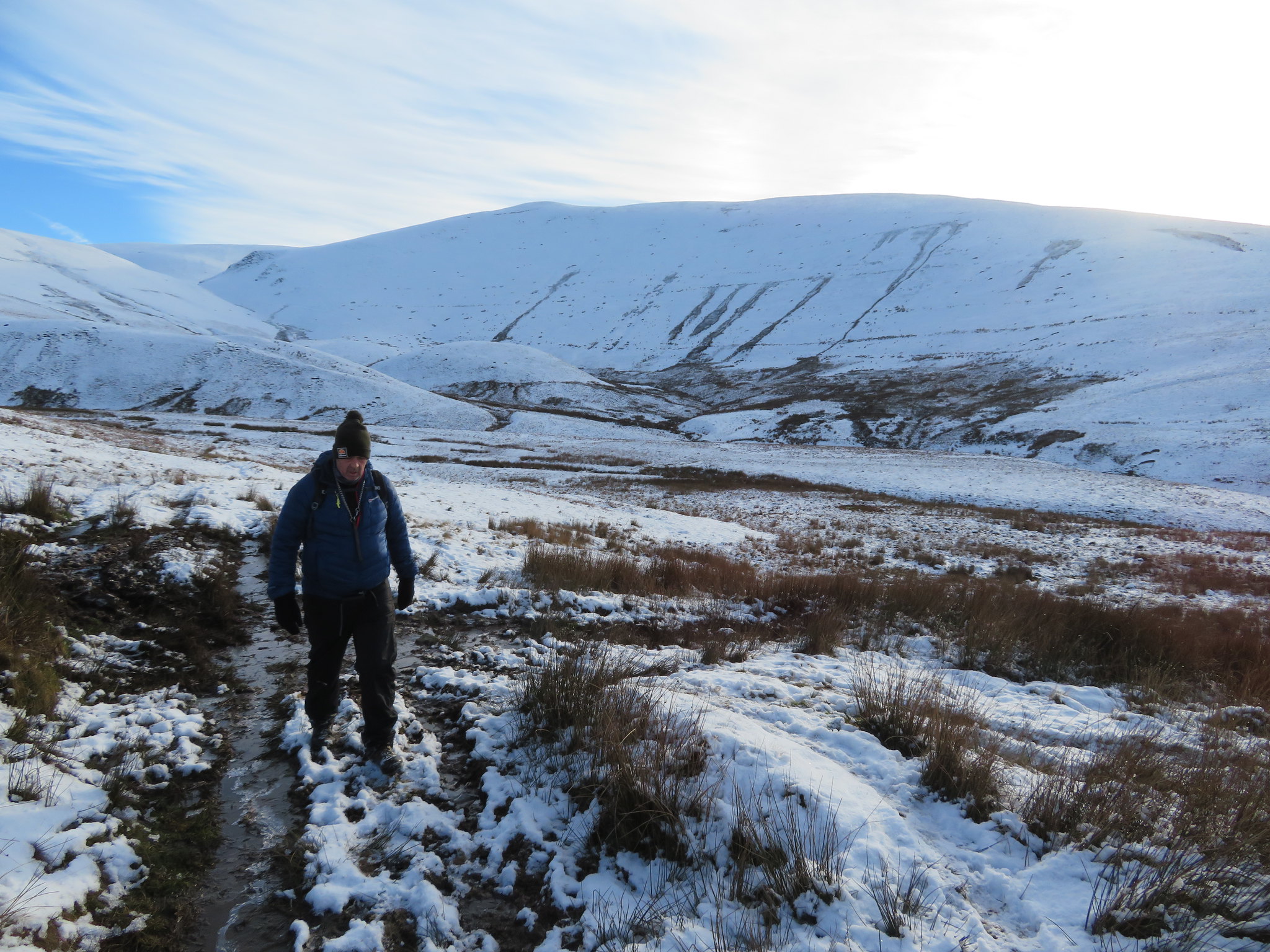
The first third of the climb up to Lodness would be the easiest of the slopes on our way up that can be seen as Chris makes his way through the snow.
 Easy going just here
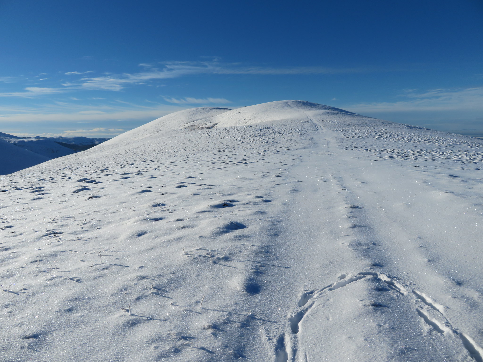
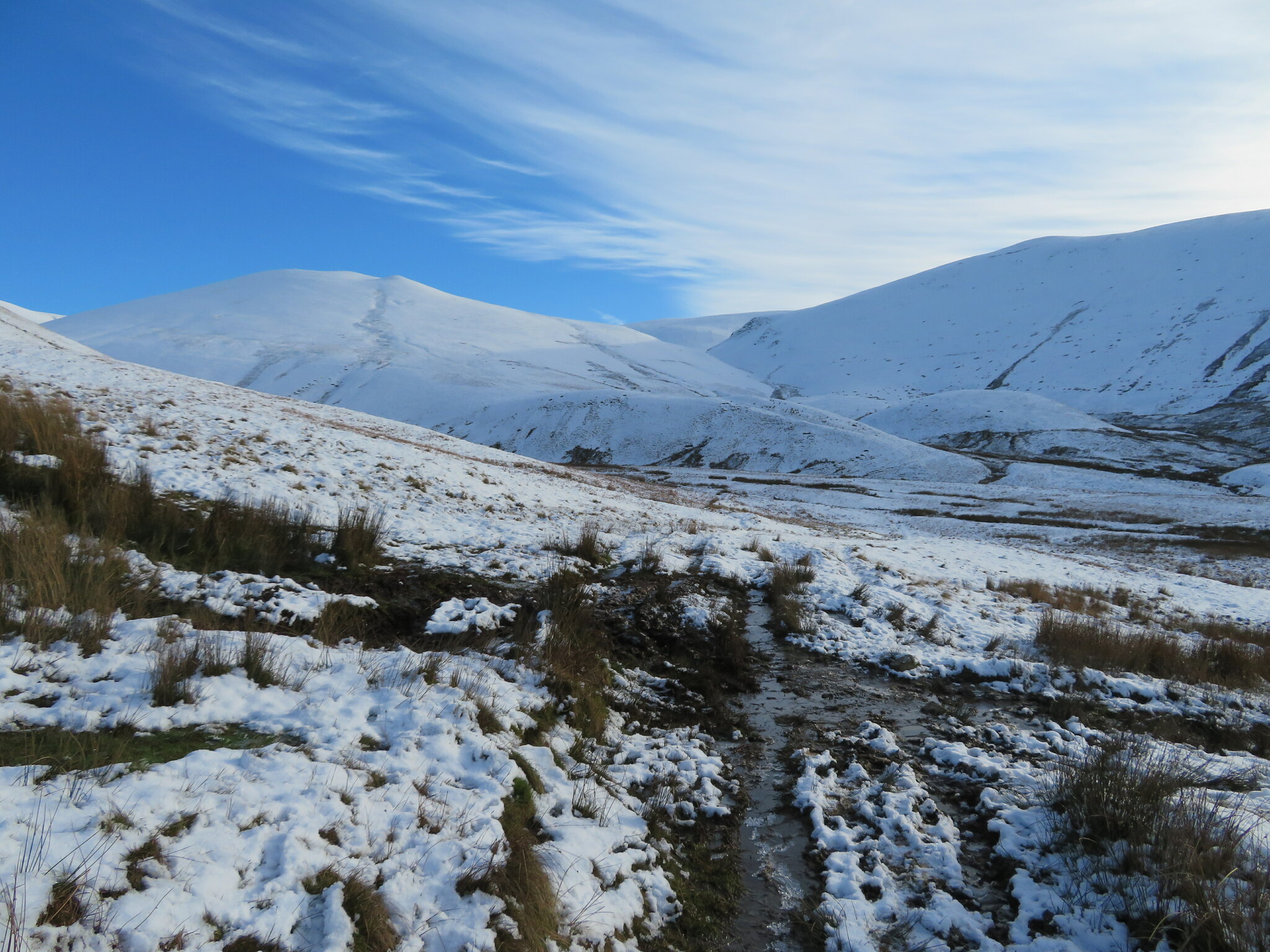
 Then above Lodness the slopes get progressively steeper but not overmuch as the summit can be seen for most of the journey upwards.
 Not far to the summit now
 There were a few other walkers about, two of whom had set out before us and soon turned off to make their way onto Brae Fell that lies to the east of our path. Two more soon came in from the west side struggling up western slopes to meet the ridge path well above us. Well the young bloke did whilst his female partner floundered on well behind in his wake.
The snow that started thin on the ground was getting deeper as we ascended; it was also getting colder though our efforts with tramping through the snow kept us warm enough. The snow was glistening white with thousands of blades of grass standing vertical, frozen solid and looking like vertical icicles, elongated diamonds glinting in bright sunlight. We tramped on, the summit getting ever nearer, the snow deeper, Chris pauses now and again, Sonny the four legged fiend charges up and down like something demented but he's still young, like we used to be, full of energy, and again like us, will also get older and slower, the tosspot.
Despite our slow progress we were actually gaining on the ones in front of us but, they were breaking snow and making it a little easier for us to follow behind them and as we arrived at the summit they were just crossing the saddle between Longlands and Lowthwaite Fells. We arrived at the summit to be met with amazing views all around us; even the partly inhibited view across to Brae Fell, Little Sca and Great Sca Fells was breathtaking in its raw winter wildness. Skiddaw and beyond to the south, west to Binsey, even the snow capped mountains of Scotland could be clearly seen.
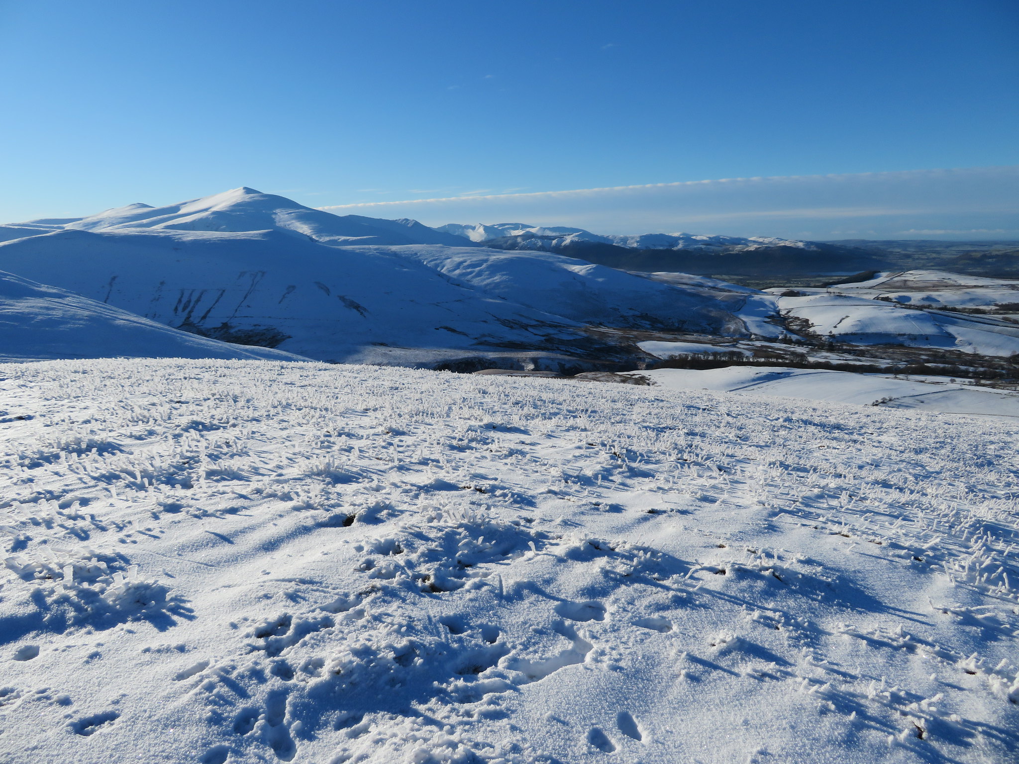 South to Skiddaw
 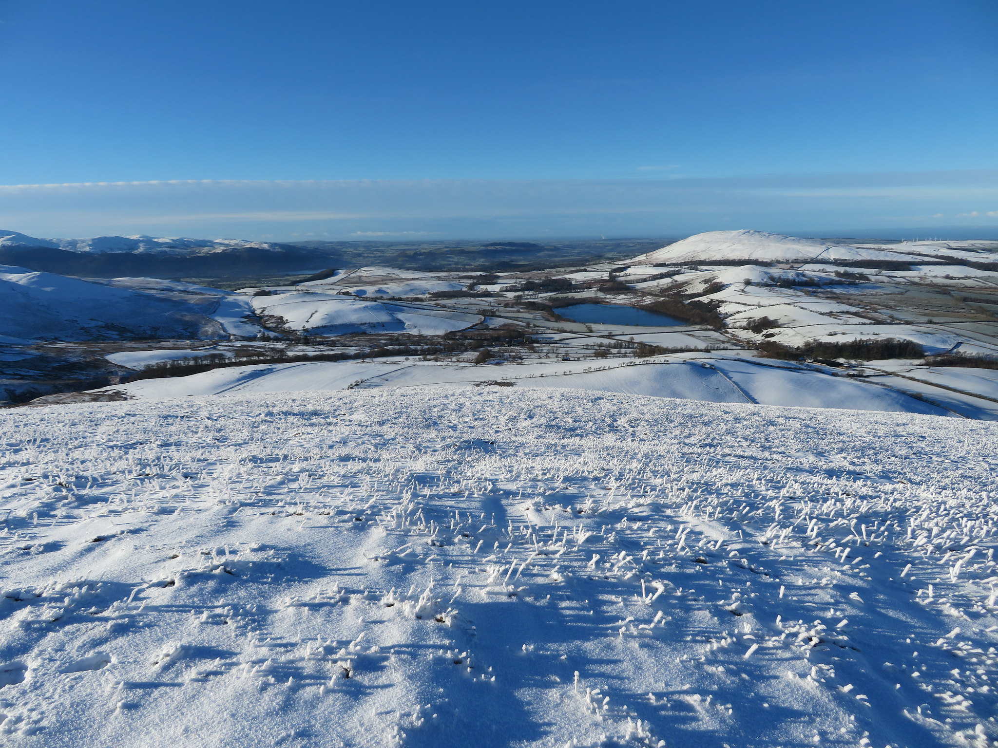 West towards Over Water and Binsey
 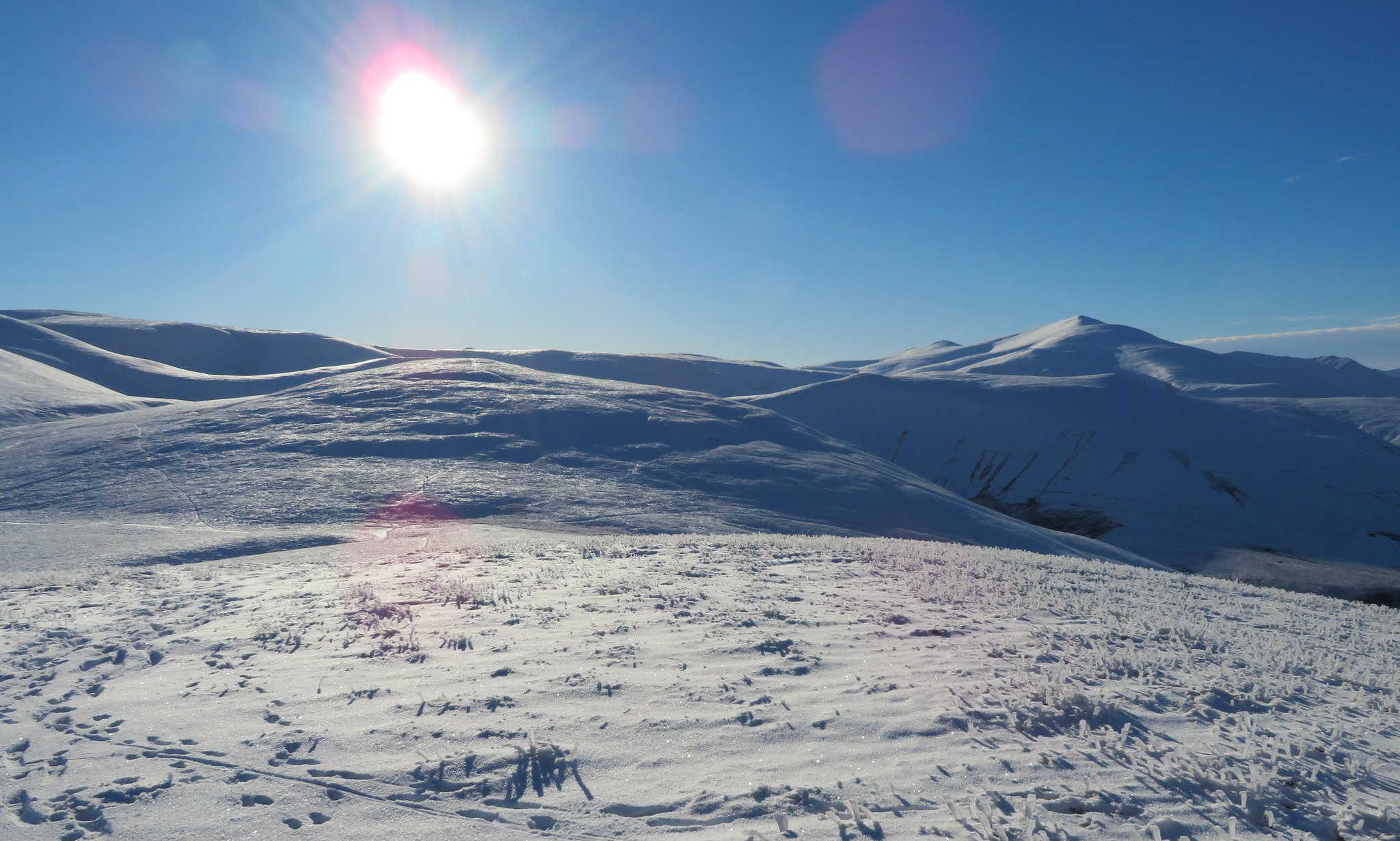 Lowthwaite Fell and Skiddaw
 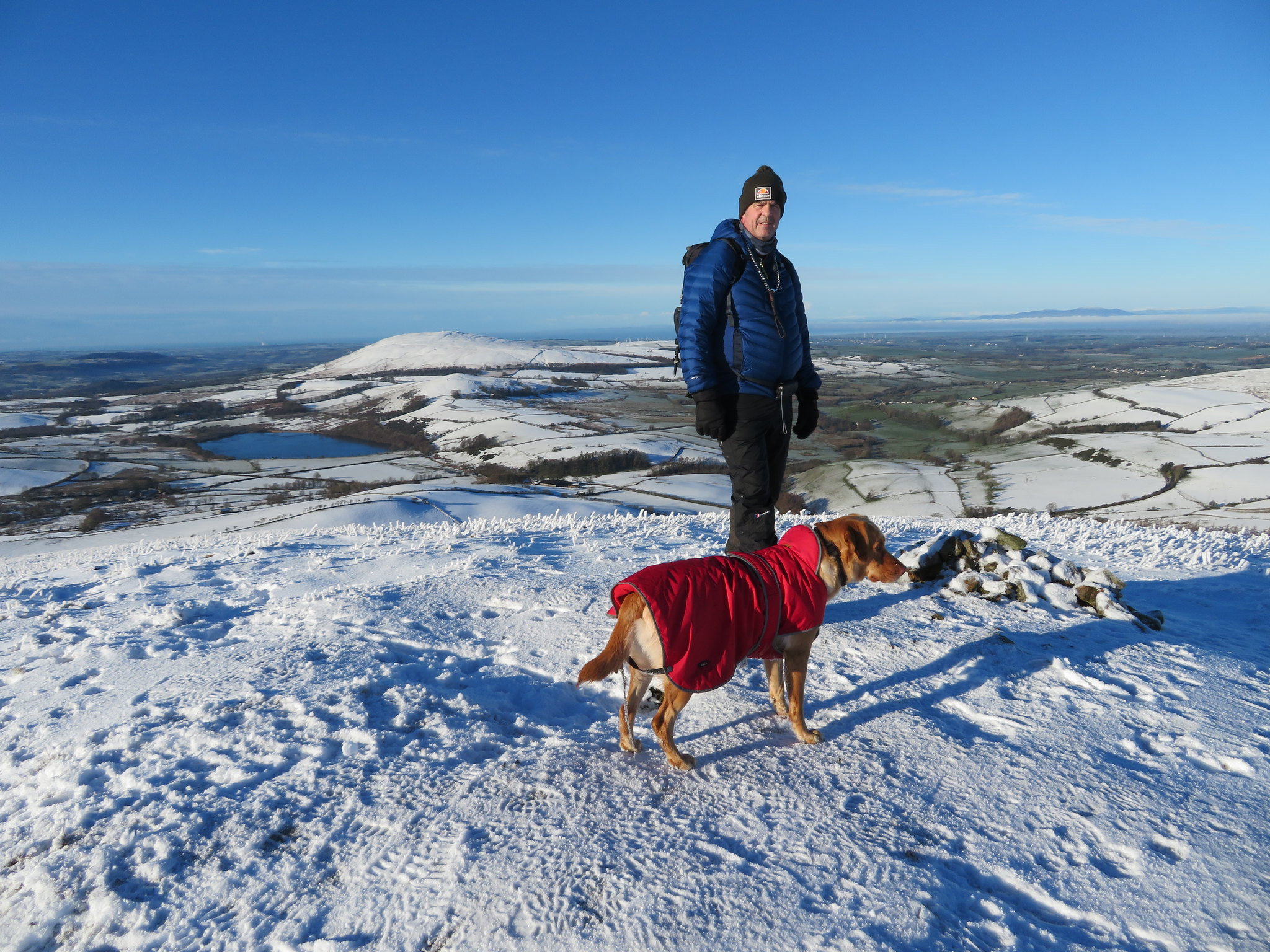 Longlands Fell summit
 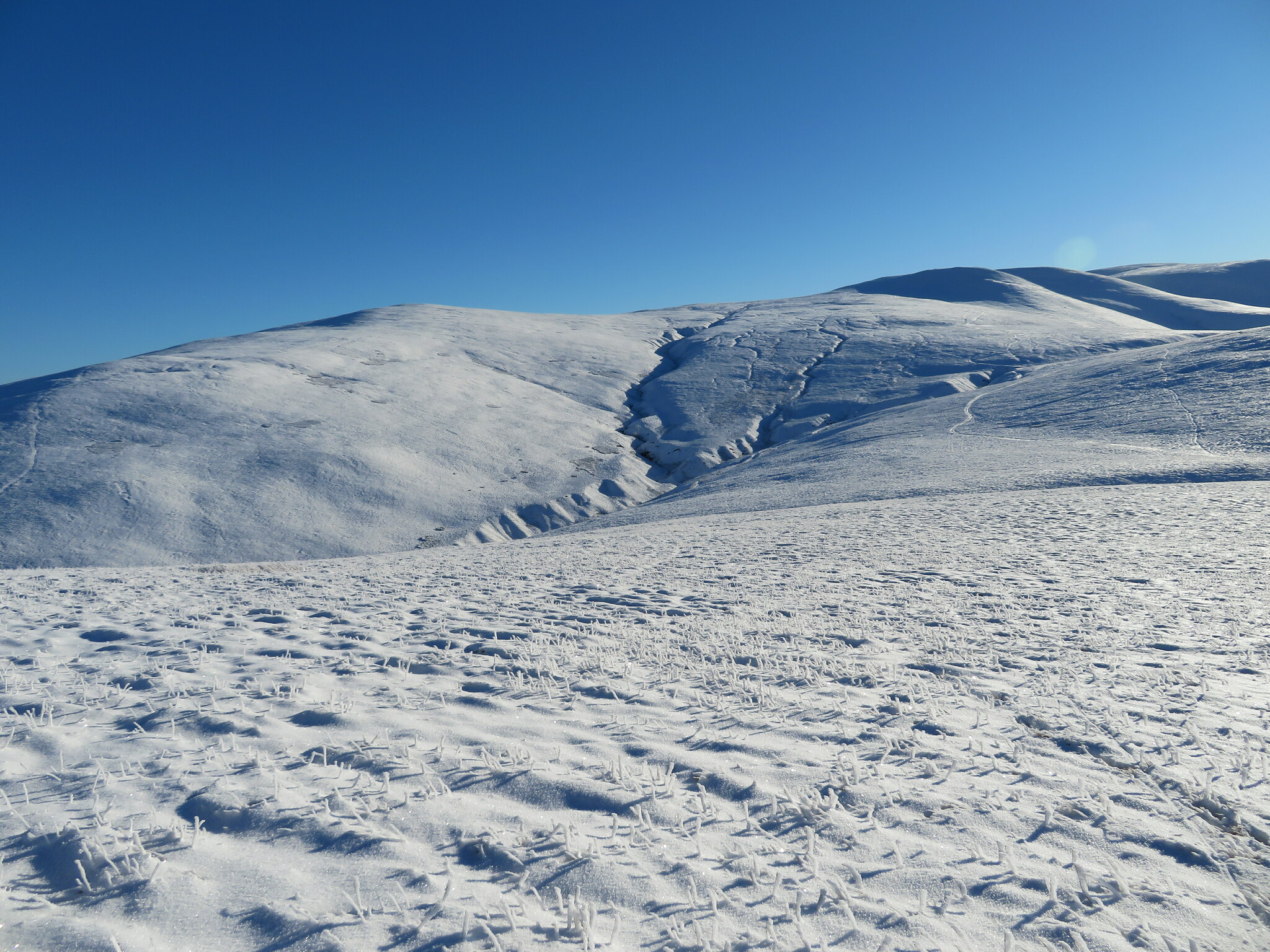 Brae Fell - Little Sca Fell - Great Sca Fell
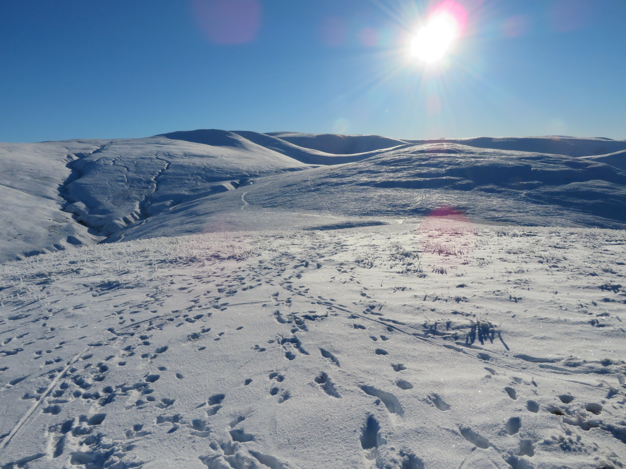 Southeast landscape in snow-sun and shadow
 It was time for a rest and a chat. Did Chris want to turn around or continue on with the snow getting deeper and a fair bit of climbing still to do? In front of us there are still four hills and after leaving Lowthwaite Fell a fairly relentless climb up to the top of Great Sca Fell especially over the snow covered ground. Some 170 metres - 560 feet - and then a bit more to gain the summit of Meal Fell that under normal circumstances and snow free ground is not a big deal but the snow was getting deeper on these northwest facing slopes. It was also by now turning to the soft powdery type of snow that carries no weight upon with boots and legs sinking in up to the knees in places, halfway up the calf at its best.
We decided to carry on and if things got too difficult for Chris we could drop off from Little Sca Fell on to the path that passes below the west side of Great Sca Fell and then take the path that runs above Frozenfell Gill down to Trusmadoor therefore missing out two of the climbs. Or turn back.
Leaving Longlands Fell behind we continued in the southerly direction that had brought us here and descended to the saddle before climbing the short slopes of Lowthwaite Fell.
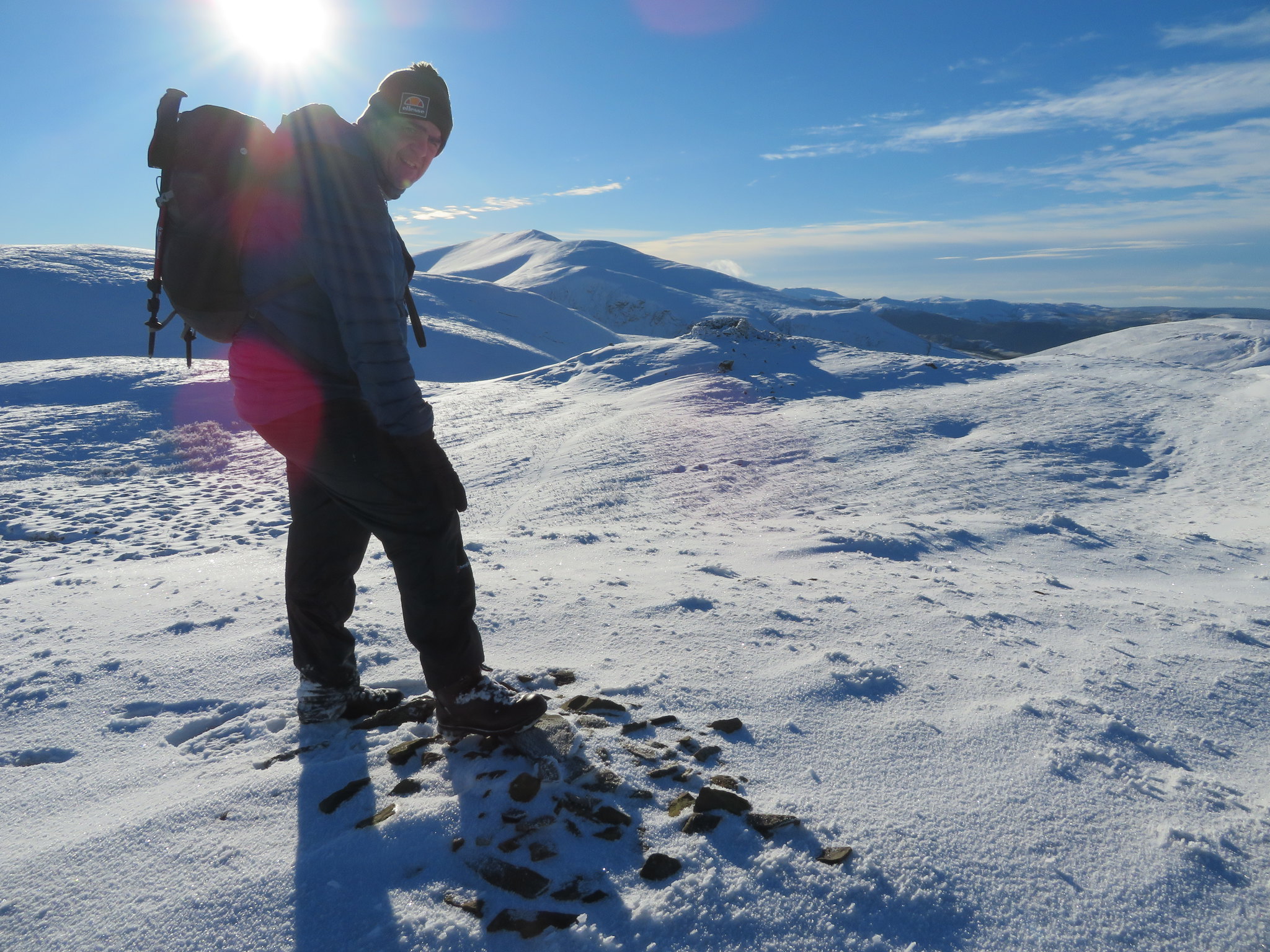
 Chris resting after leaving Longlands Fell
 Another short break on Lowthwaite Fell top whilst a few photos were taken and our way to Great Sca Fell was plain to see. The couple who was in front of us - whom we met as they made their way back down - were making slow progress but at least we had the 'comfort' of using their deeply formed boot marks wherever possible.
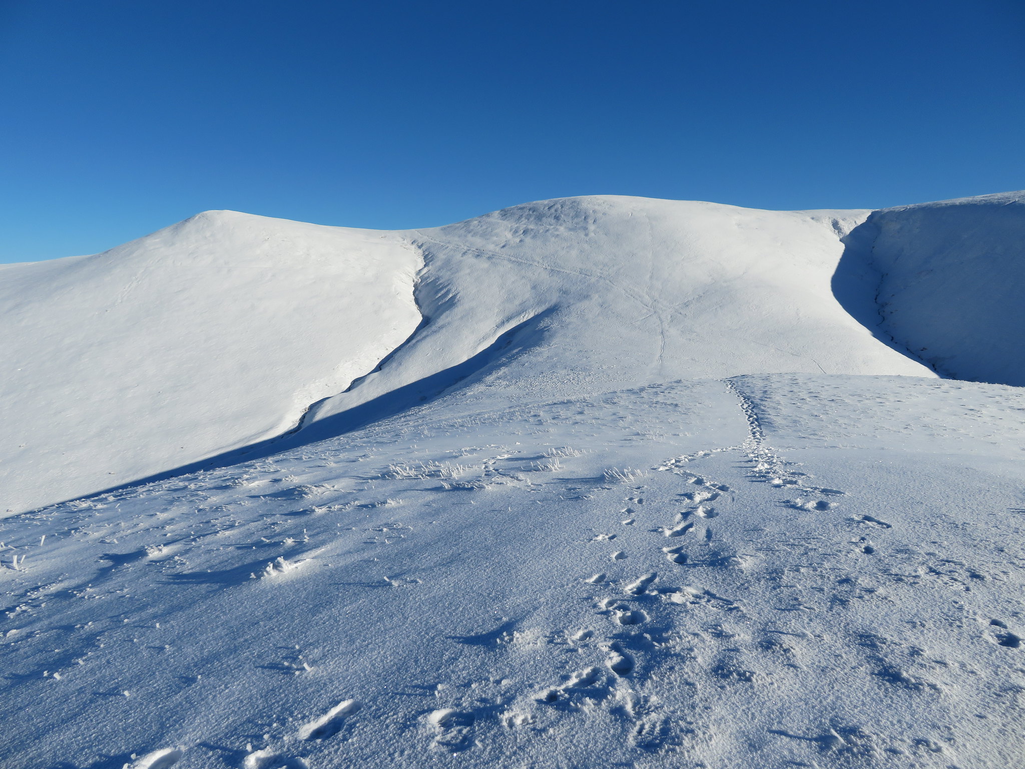
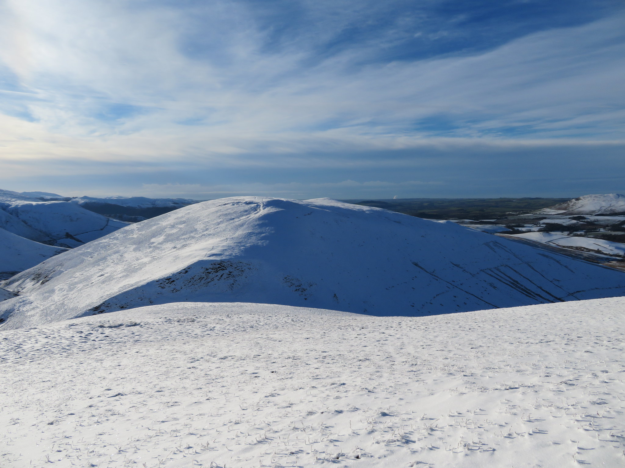
 Little Sca Fell - Great Sca Fell - Knott
 At around the 580 metre contour we stopped for a rest and saw that the couple were now making their way back down towards us, the bloke in front again holding a dog, a spaniel, on an expanding dog lead whereupon Sonny put himself into top gear and had a good romp around with it whilst we rested and chatted to the young fellow. His partner caught up with us and we established that they were both burnt out with the rigours of today's landscape and make no wonder, well for him anyway. He was a fell runner from Wigton out with his partner and because it wasn't suitable for running the fells he had decided to load his bag up with 40 kilos of weights to compensate for the short distance that he would do today instead of having a long run. One fit lad indeed.
A quick drink whilst we were talking and when we parted company we set off once again with about 40 metres of climbing to get us to the summit from where the fantastic views got no worse but even better. But from just below the summit there was a good view towards Scotland.
 A view back over to Lowthwaite and Longlands Fells-Binsey and the Scottish skyline
 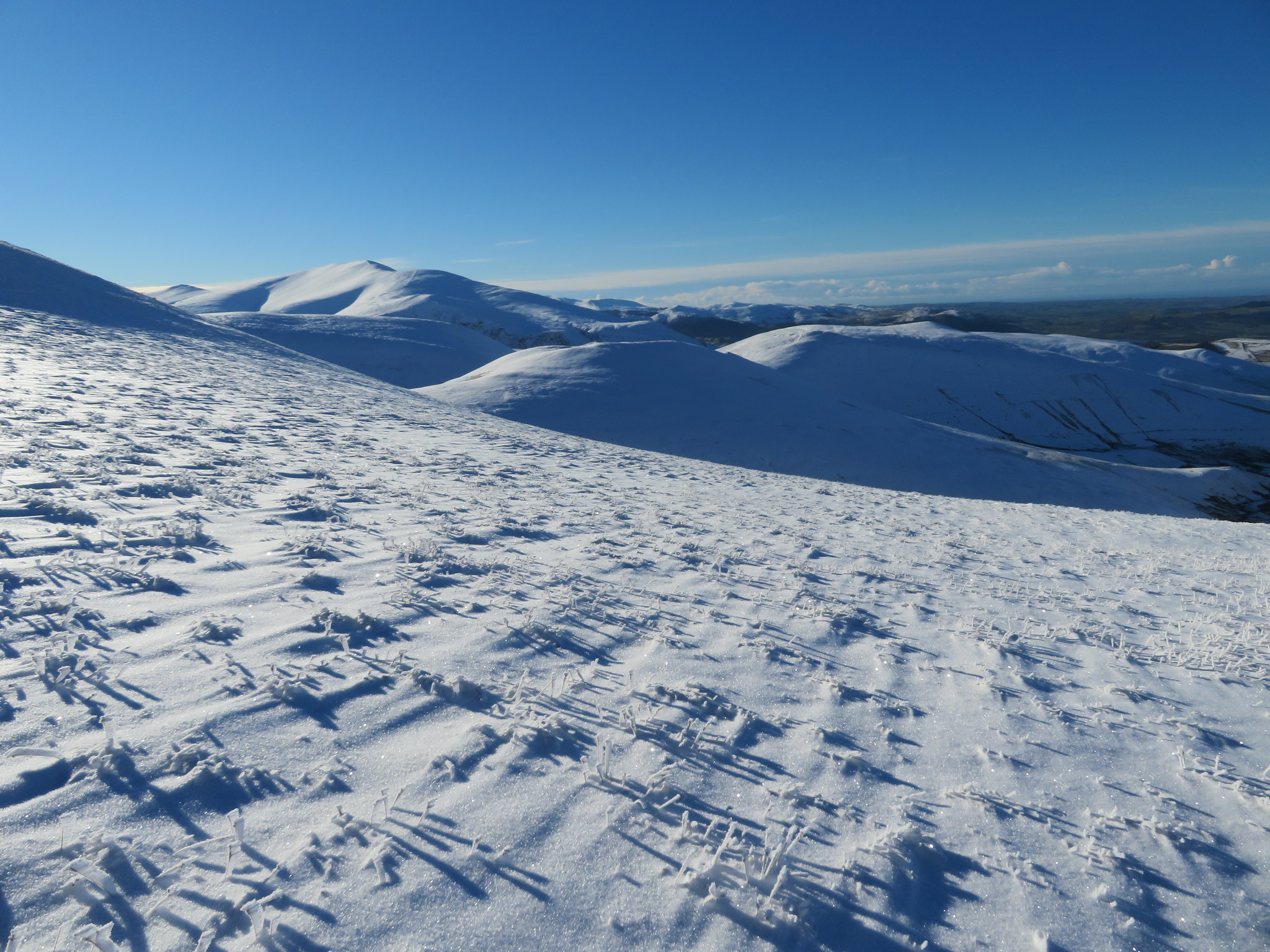 Meal Fell-Great Cockup and Skiddaw
 Shortly after that we were all but arriving on to the summit with its two cairns.
 Little Sca Fell summit
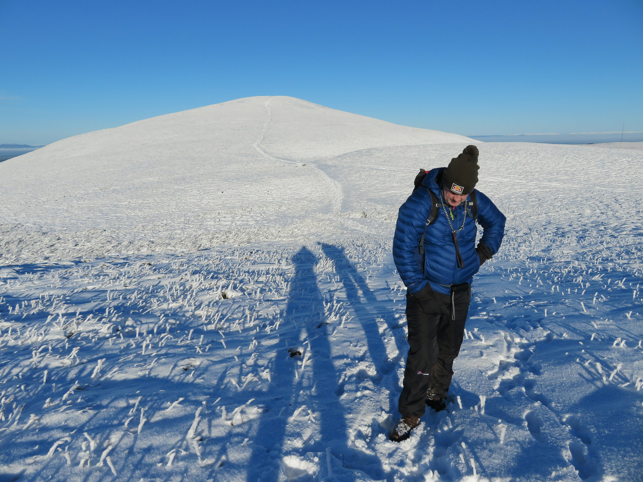
 The snow was a bit thinner on the summit but as we left to go for Great Sca Fell the now virgin snow got deeper again with Chris cursing and wishing that he was as light as I was so that he wouldn't sink in as far as he was doing.
 Great Sca Fell
 The short cut can clearly be seen going off to the right on the above photo of Great Sca Fell but Chris kept walking straight on to the next hill and although its only about 26 metres or so of climb and not at all steep my man was tiring but determined to get round so it was steady as she goes.
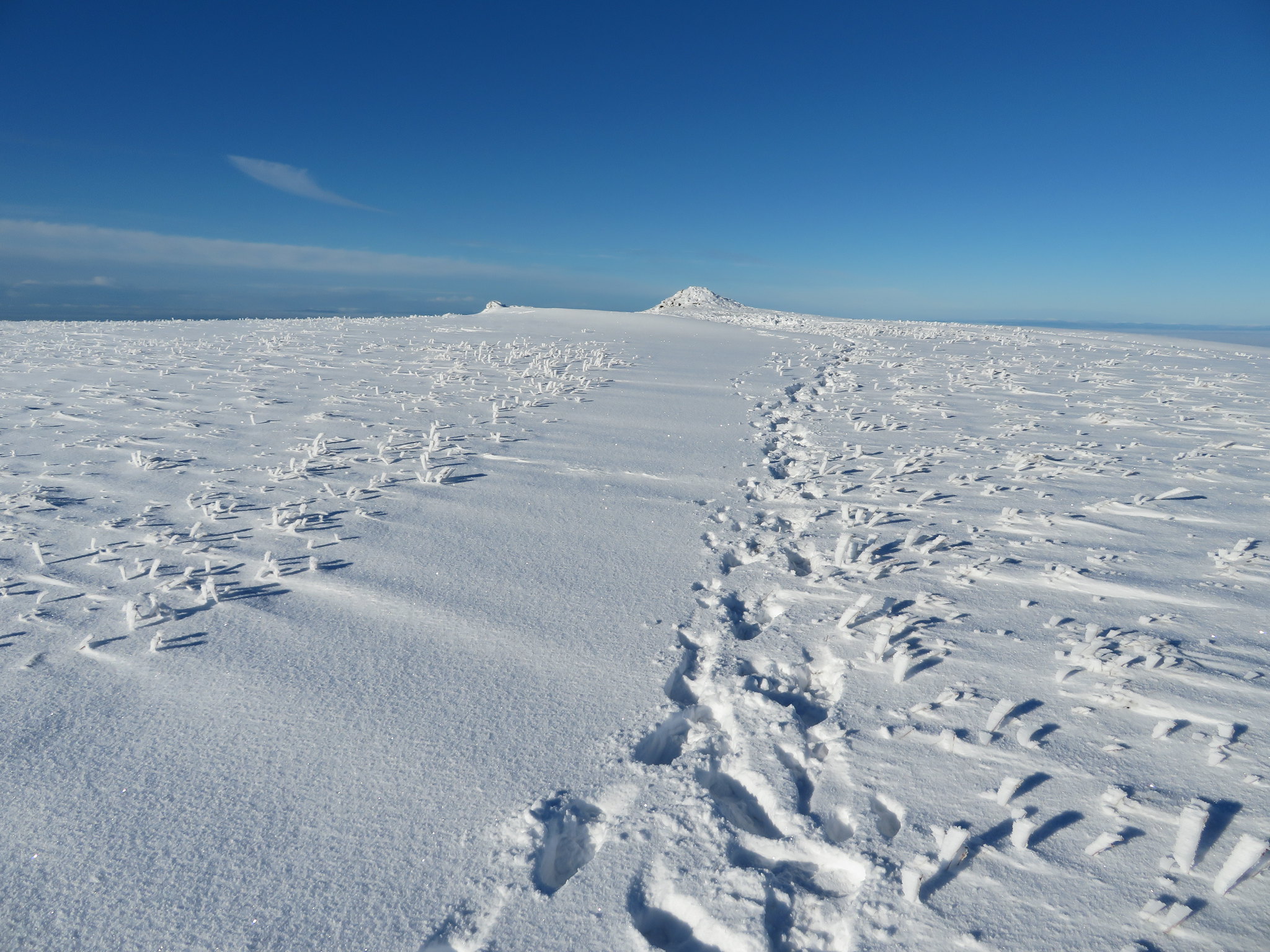
Surprisingly it took only ten minutes to gain this summit so all seemed well as we arrived at the small cairn.
 Great Sca Fell summit with Knott behind
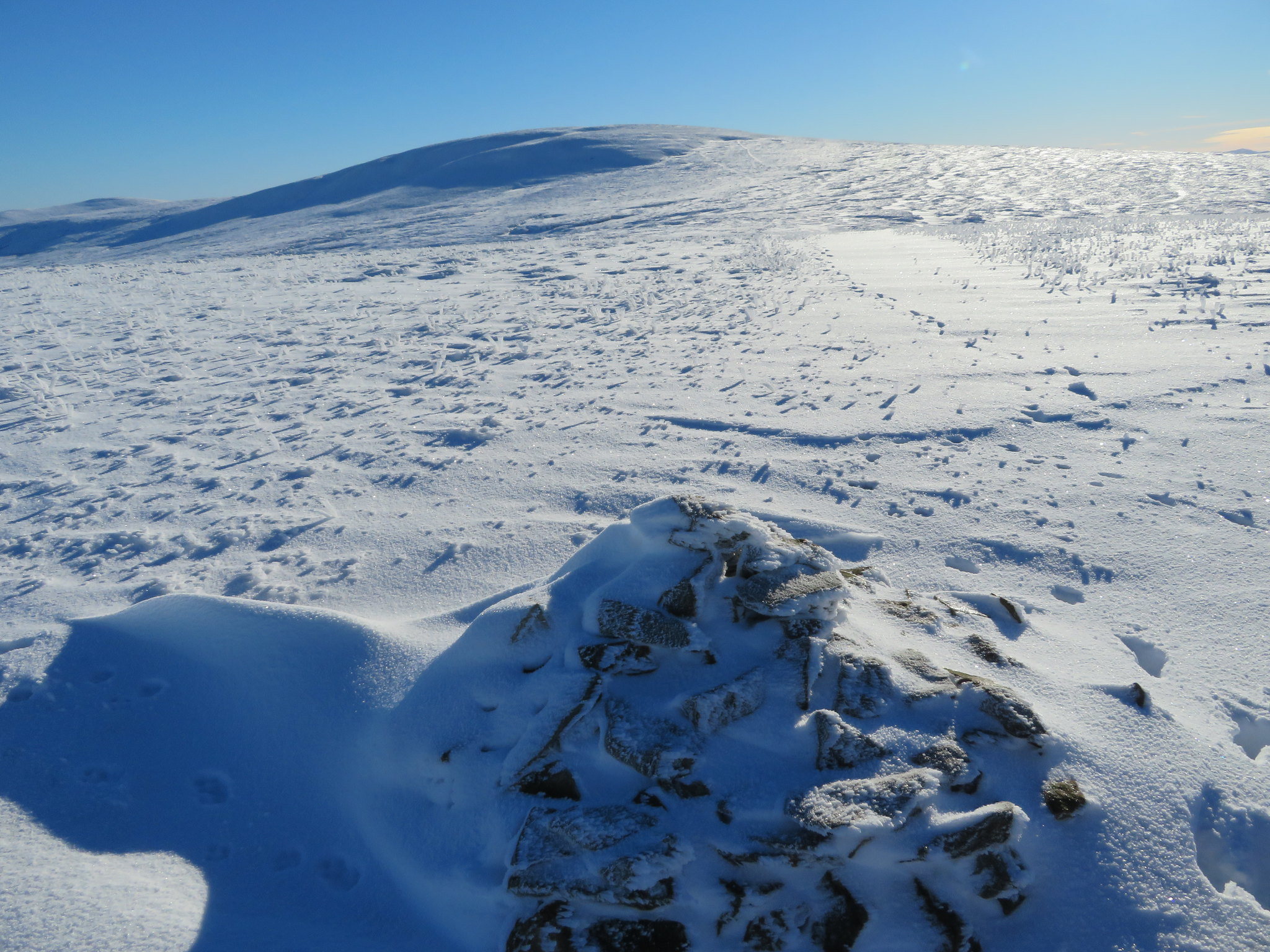
 The highest point of the day and it's great to be out in the hills. In fact it's a pleasure and a blessing to stand in this wide open wilderness of snow and ice under beautiful and nearly clear blue skies with the chill of winter upon our faces. The snow was glaring back at us and I wished that I had the shades that I had forgotten to bring with me, but if a bit of discomfort from the reflection of the sun bouncing off the snow has to be endured then this day out is well worth it. Behind Knott the top of High Pike can be seen just to the left of the photo.
 From Great Sca Fell south towards Great Calva and LD skyline
 From Little Sca Fell onwards we were breaking virgin snow and it turned us to times gone by when you were a young 'un and got a great feeling when you were the first to tread on unbroken snow, no sense of fear, broken bones, or getting stuck, the cold didn't matter nor it seemed getting wet, and of course back in the day there was a lot more snow about that used to linger for months. Ah! salad days.
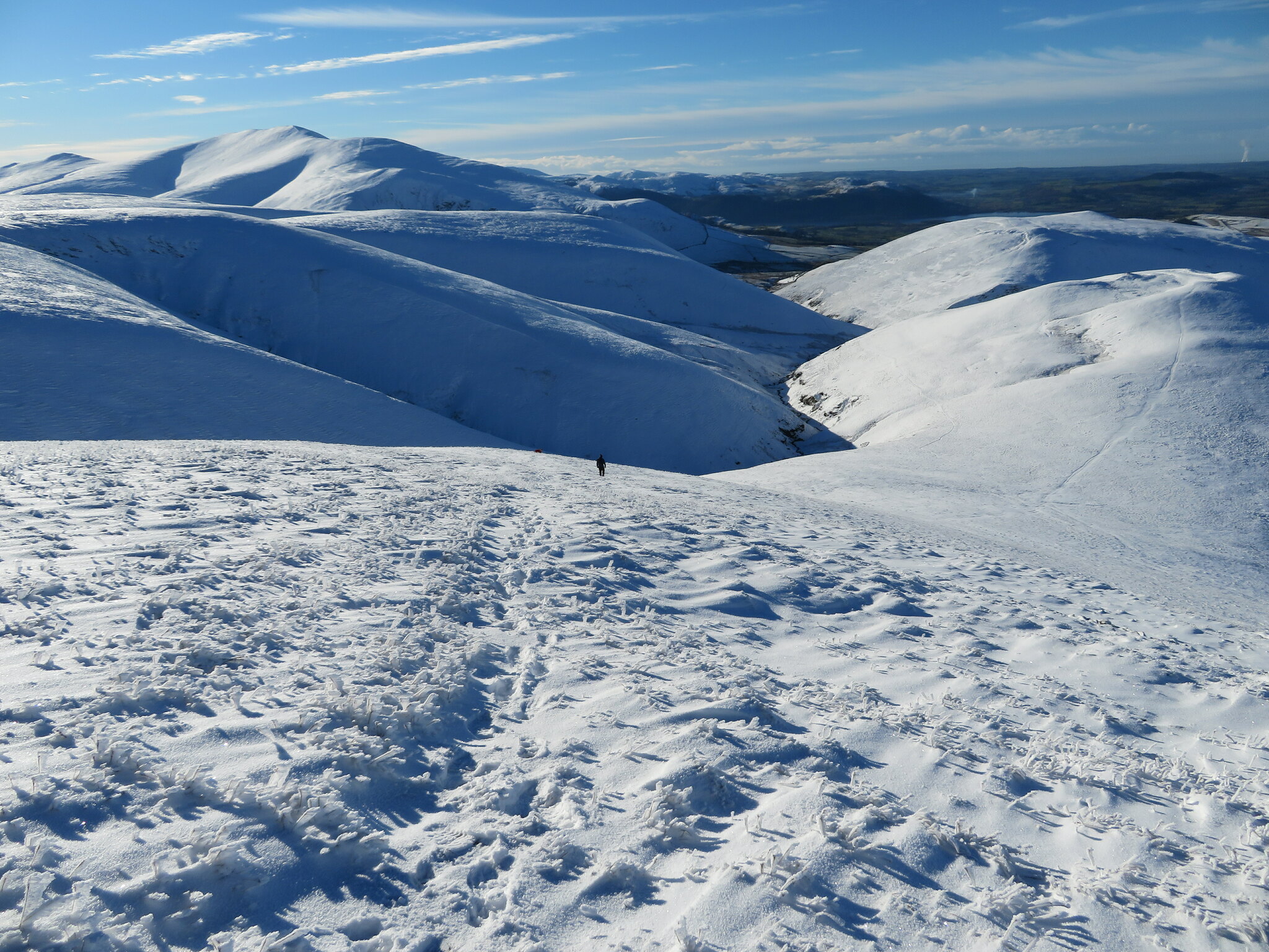
 Looking back on our route to here
 We were now going for the last hill of the day and there is a steep drop off down to the saddle that lies between us and Meal Fell that normally is an alright descent but today we have the snow on the steep slopes to contend with as well as looking at the panorama that was laid out before us.
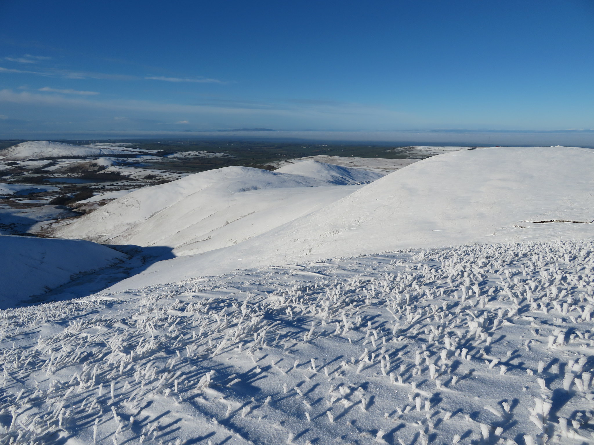
 Winter fells either side of Frozenfell Gill
 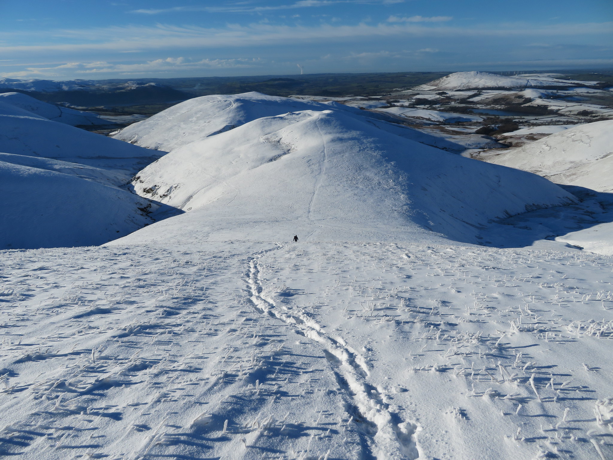 Great Cockup and Binsey behind Meal Fell
 The descent though slow and steady went without incident and we arrived at the east slopes of Meal Fell unscathed after a slip or two on the way down.
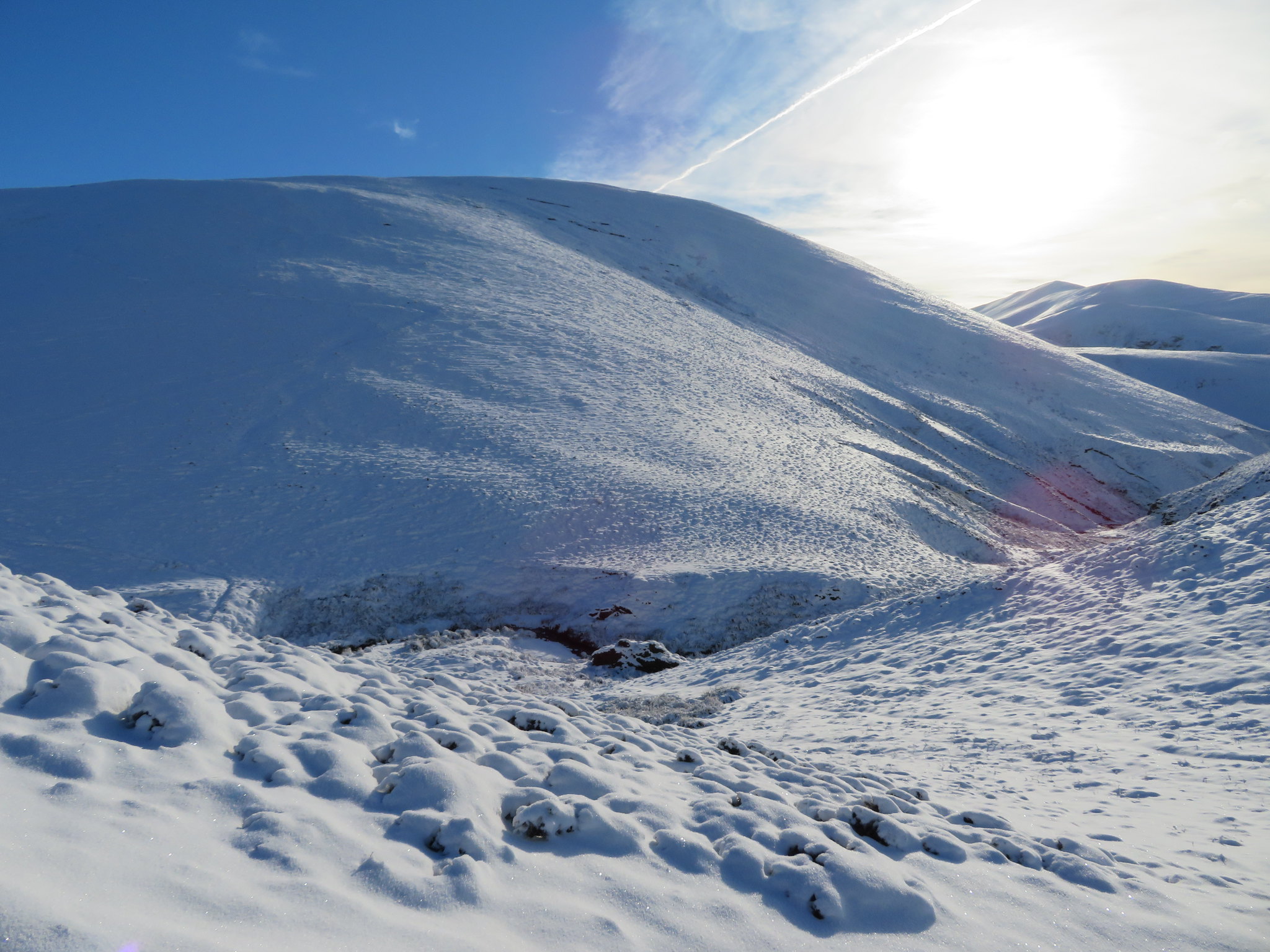
 Looking up the east slopes of Meal Fell
 Roughly 35 metres - 100 feet or so - and it's all but over, the last hill, the final hurdle. We rested awhile before starting the climb up and we could see the faint line of the alternative path under the snow above Frozenfell Gill to our left. The path was mentioned but we went straight on, steadily upwards to finally reach the small and insignificant cairn of small stones where Chris posed in such a way that he looked like the Quasimodo of the fells with the red coloured backside of an in season female baboon caused by the sun reflecting off some aberration on the camera lens.
 Cairn on Meal Fell with stone shelter and Skiddaw behind
 We needed a proper break as we hadn't eaten since setting out so we headed over to the large stone shelter that is perched more to the south of the cairn and despite it being full of snow after brushing off a couple of large rocks we had a comfortable 20 minutes or so of fuelling up and resting. We had seen a couple leaving Little Sca Fell by way of the short cut therefore missing out the higher Great Sca Fell and had followed us up onto Meal Fell but passed us by without acknowledging us. Maybe they couldn't see our dark shapes and Sonny the dog in his red coat against the background of brilliant white snow as they traipsed on behind and then passed us as we lingered on the summit awhile.
Once again the views were snow filled and stunning but we'll soon have to leave this delightful spot and make our way down to Trusmadoor and the walk back to the car.
 View back to Little and Great Sca Fells from Meal Fell
 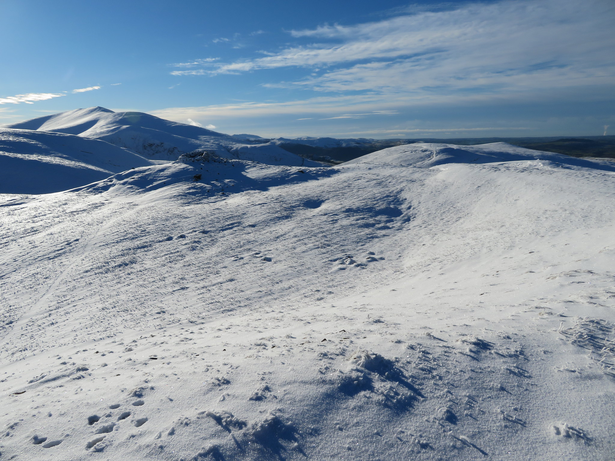 View across the summit of Meal Fell
 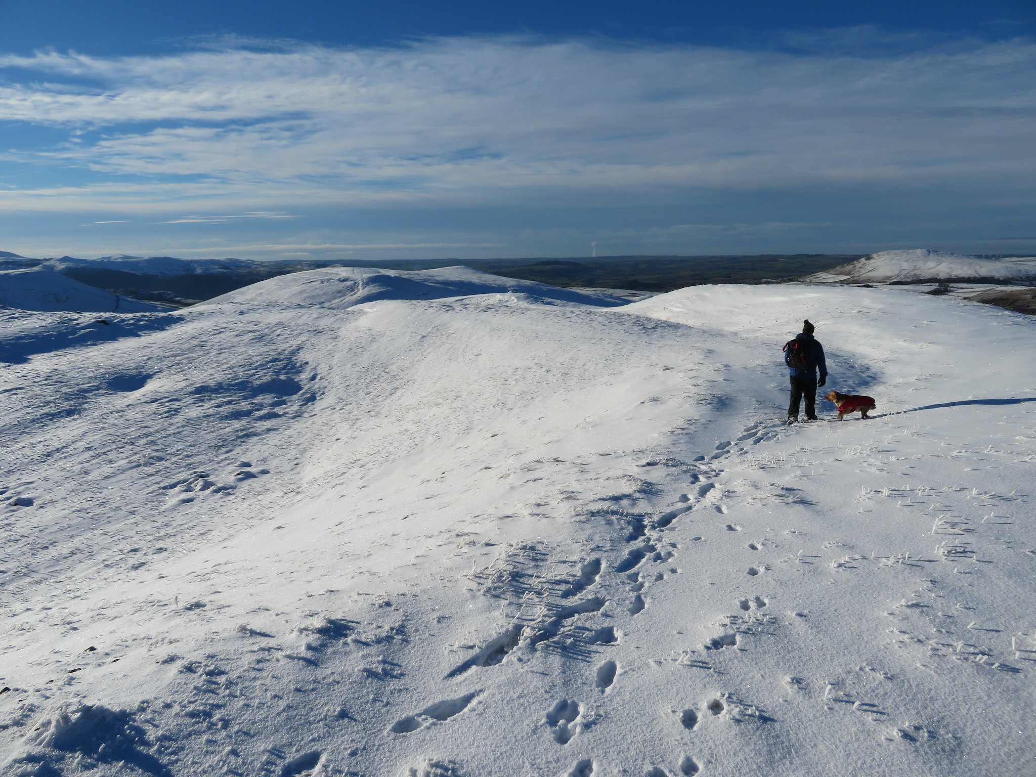 Going for the stone shelter
 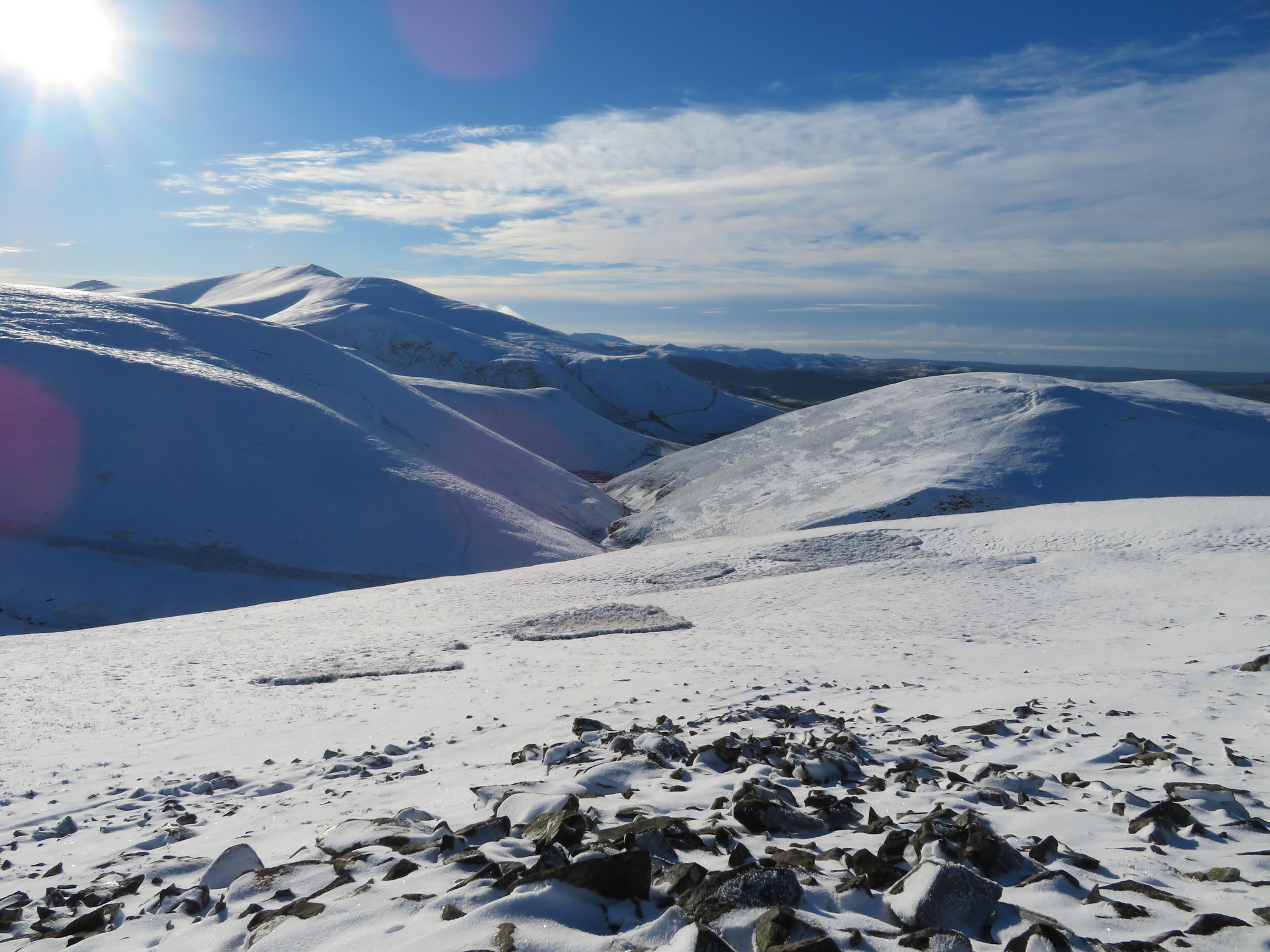 Trusmadoor and Great Cockup
 There is a good steady path descending down the southwest ridge of Meal Fell that leads directly to Trusmadoor, a place where local waters meet and then quickly leave each other again as they mix and match and go their separate ways. Frozenfell Gill sharing its waters between Burntod Gill and the River Ellen with the unnamed watercourse that runs down between Burn Tod and Frozen Fell contributing to the volume of both.
 Little Sca Fell-Great Sca Fell-Knott behind Meal Fell summit
 The voiceless couple had gone before us and broken the snow making it a little easier to make our way down, although in any event the path was to be seen under its covering of snow.
 Southwest ridge from Meal Fell summit
The top half of the mass of Great Cockup could be seen and Chris in a moment of madness enquired about the possibility of 'squeezing' it in as we were so near to it. Due to the current situation I had to give him a refusal and even then I got the 'but, but' from him, one that I quickly dismissed saying that it would wait until another day and reminding him of his tiredness, although 10 out of 10 for trying Chris.
 Great Cockup
 A good walk down the ridge soon had us at Trusmadoor, that in better weather is a fine place to linger and rest amongst the old walls of the tumbledown sheepfold or shelter as it may be. In Wainwright's Northern Fells Book he describes Trusmadoor as
'The neat little pass of Trusmadoor is the Piccadilly Circus of sheep in that locality, a busy thoroughfare in popular use when changing pastures'.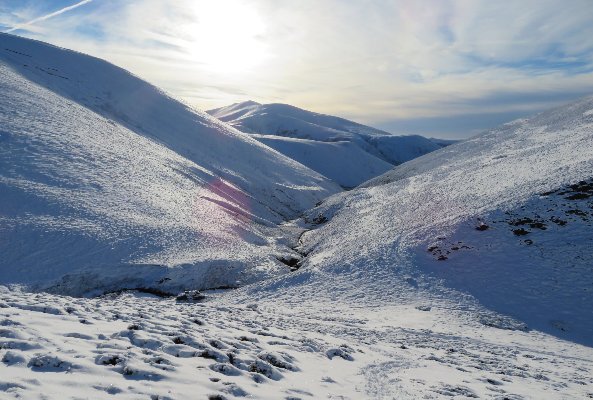 Arriving at Trusmadoor
 We had arrived at this place of small ravines that sits below the high slopes of Burn Tod, Great Cockup and Meal Fell but despite this close proximity of these fells it is a wonderful sun trap from where on a hot day a drink of ice cold water can be taken from any of the watercourses running through here.
 Burn Tod from Trusmadoor
 From here all that we have to do is follow the path that initially follows the course of the River Ellen as it passes between Great Cockup and the lower slopes of Meal Fell then Lowthwaite Fell.
 Walking northwest through Trusmadoor
 The snow was a lot lighter on the ground at this low level and good progress was made as the path meandered around the lower contours of both fells and once away from the confines of the fells the view in front of us opened somewhat.
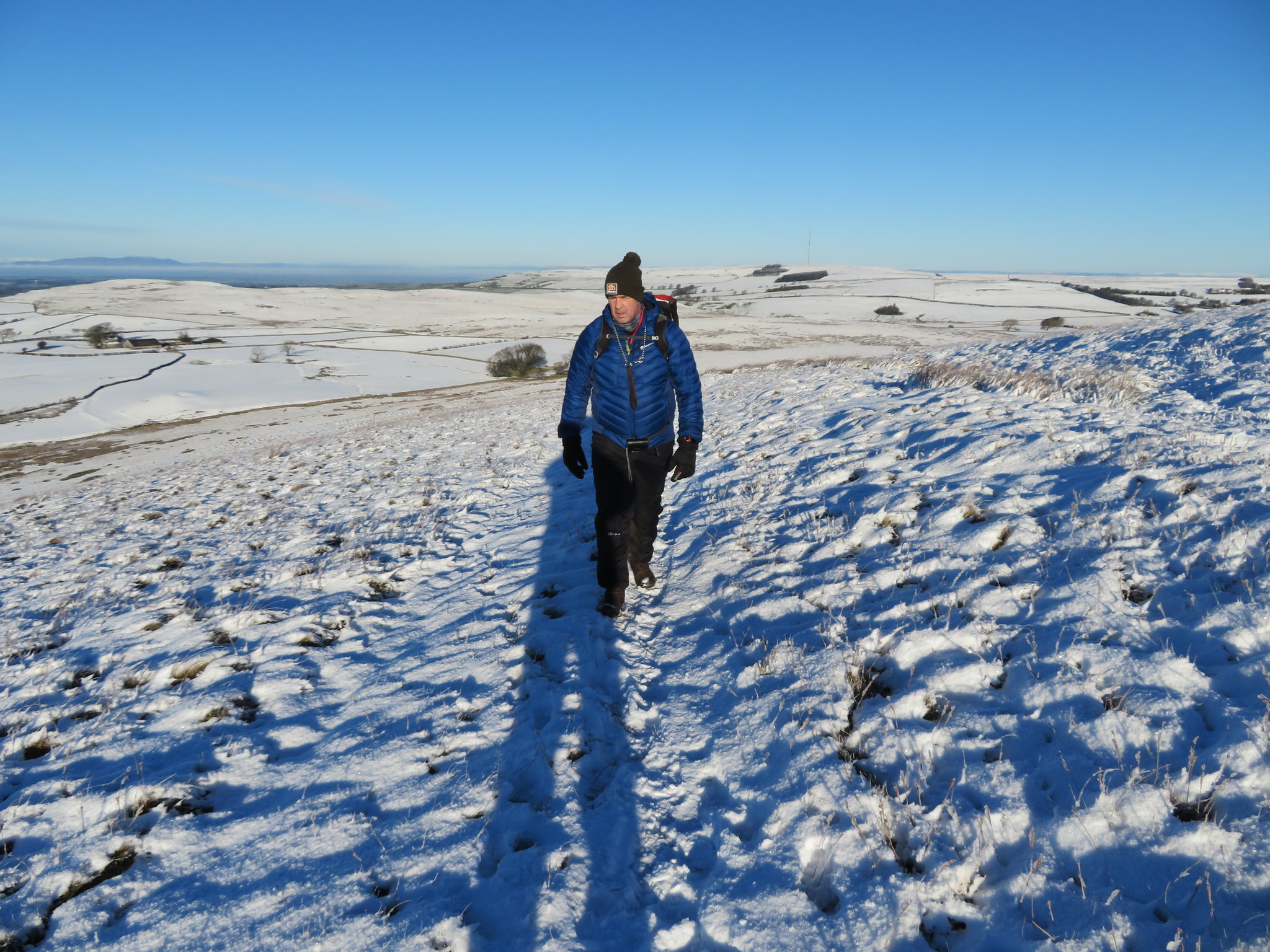
 The view across to Longlands where we started out
After crossing one of the feeders of the River Ellen we picked up a track that runs all the way to an old building before sinking to the lowly status of path again. It was on this track just after crossing the unnamed feeder that Chris felt very low on energy but wouldn't stop for a rest, determined to carry on, albeit slowly but making progress nevertheless.
 Great Cockup and a tired Chris
 In favour of our slowing progress was the fact that the churned up track was frozen into ice covered and rough rock hard ground and even when we reached the path after leaving the track behind the ground was still rough with the passage of many cattle.
 Meal Fell and Great Cockup
 We had left the track and also the River Ellen behind both now to be replaced, one by a path and the other by Longlands Beck that we would follow all the way back to the waiting car at Longlands.
 A view along Longlands Beck towards Great Cockup
 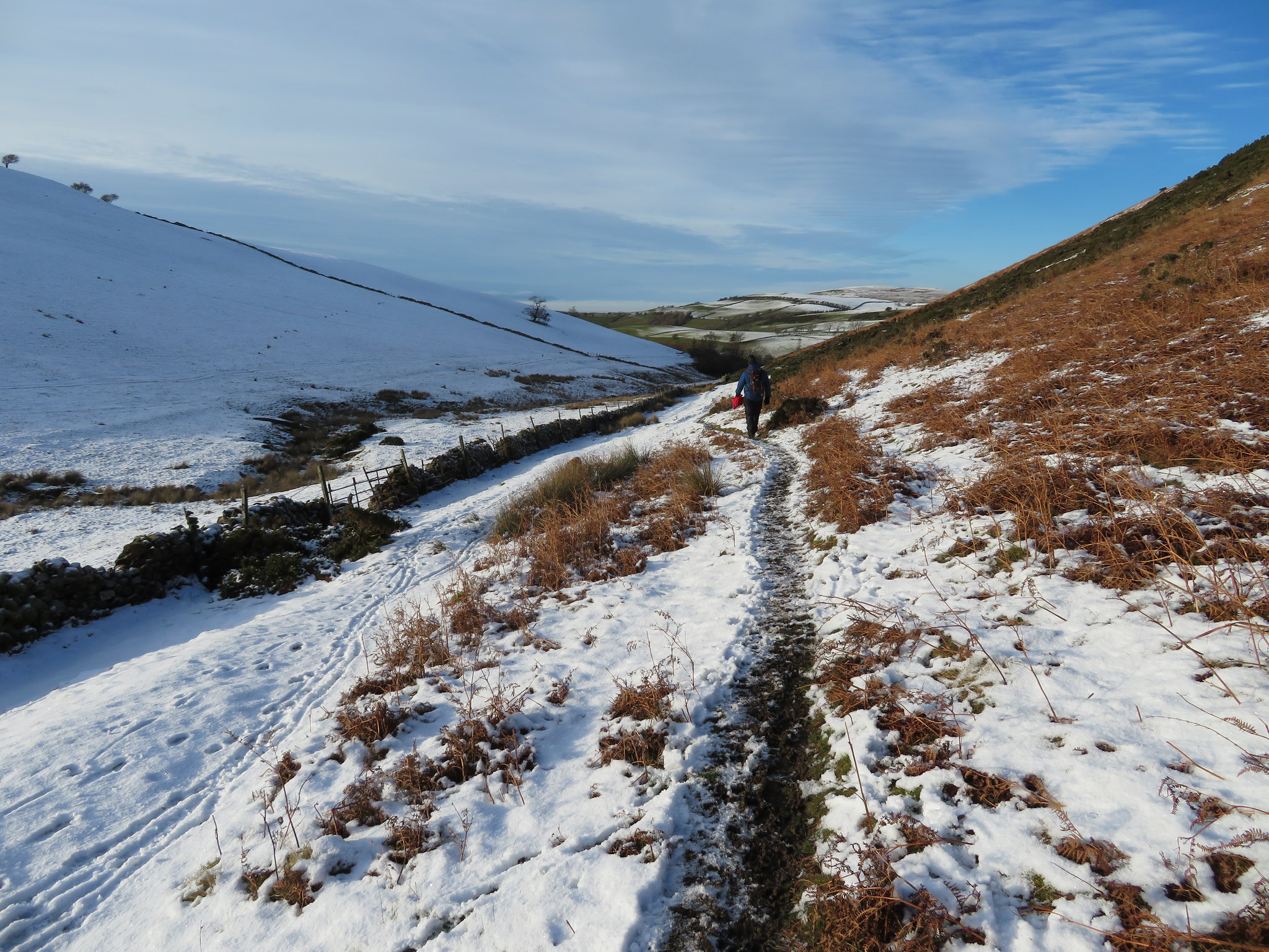 Nearly back at base now
 It has been a good day out once again although a tiring one for Chris who, fair play to him stuck it out without complaining, but he has pushed himself today. He's tired, aching and got sore feet. Sore feet that he's now complaining about. The sore feet a bit of an unusual malady for Chris as he hasn't complained about that before, maybe a bit harder training required next time out.
Winter walking is always - or usually - good and today has been no exception, it's been superb walking weather and conditions despite the deep snow in places and yet again we caught the weather on a good day as the ones before and after this one were abysmal. It was now time to get to one of our favourite watering holes where Chris may stick to his temporary and unwanted diet of a soft drink or coffee whilst I shall taunt him with an alcoholic one or two of my choice.
