
The Höhenweg 3. Jungen to Topali
I have already written up the first part of the Höhenweg as my Favourite walk:-
https://www.walkhighlands.co.uk/Forum/viewtopic.php?f=16&t=67414
This section leads one South to the remote Topali hut: Sections 3 and 4 continue the walk further South to Randa and to Täsch. Heading straight up out of Jungen It takes around 5-6 hours, but longer if you follow the Jungen Rundweg anticlockwise first - though I have done that
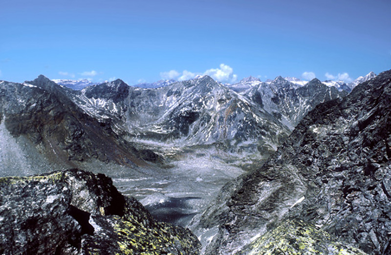
At the highest point in the Jungtal in part I, I reached this round-topped lateral moraine dating from an ancient ice-age:-
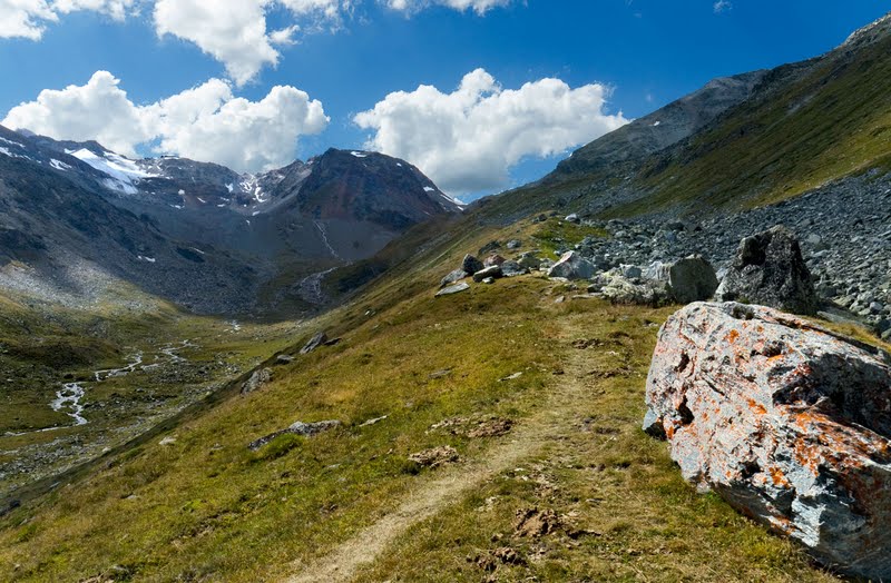
The route to Topali follows this moraine to the head of the Jungtal, turns sharp left across its head, and climbs to a 3114m pass - the Wasulicke from which the hut can be seen. This route was only made possible about 15 years ago by the melting of the steep Jung glacier on the north side of the pass
I have done this route many times: photographs are from different years and may not be in precise order
climbing the lateral moraine - photos taken looking up and down


At one point the moraine merges into the hillside - but reappears sometime later


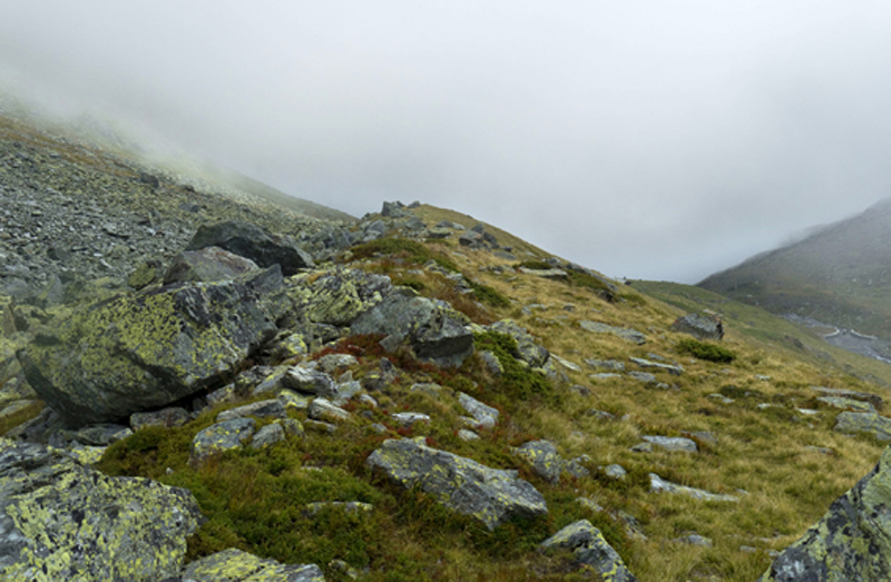
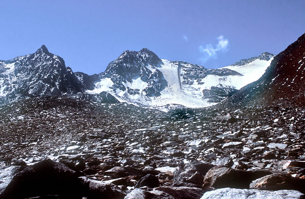
Nearing the top - the grassy valley has given way to rocks and the way to the pass can be seen
The traverse

Views in 2004

In 2011

and In 2017 - the glacier below the pass has almost disappeared

Two views looking back among the boulders on the traverse: it is also possible to exit the far side of the Jungtal over the 2990m Jung pass, but it is not yet a waymarked route

At the end of the traverse the official ("red") route cuts up and back left

And then traverses these slopes between the remains of the glacier and the steep terrain above: there is danger of stonefall here in the early season when snow above is melting - and it is much safer and quicker to follow the Left hand edge of the ice and rejoin the route beyond

This photo shows where the two ways merge

Looking back along the official route in 2004

and a wider view from higher up. There was quite a substantial amount of ice at that time and a "blue" route went up the glacier and climbed a few ladders to join the "red" route near the top. As the remains of the glacier were completely crevasse-free it was probably easier


Similar views in later years
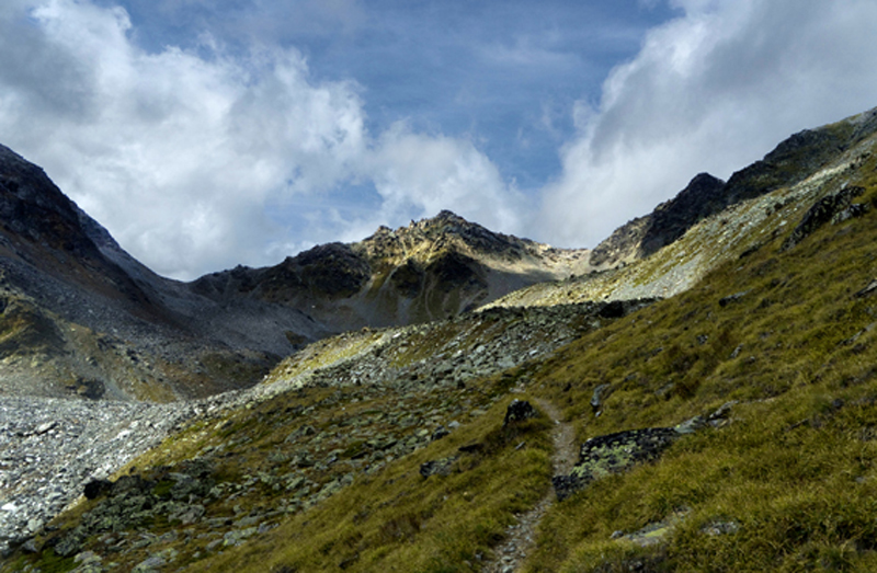
Climb to the pass
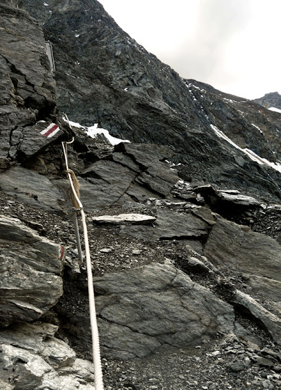
When a glacier melts it invariably leaves behind a horrendous mess of mud and shale and this one is no exception . There is no great difficulty since there is a rope handrail most of the way, but it's certainly not for the faint hearted I think it's best to stow the Left pole, pull up on the rope with the left hand and push with the Right, but heaving oneself on a rope at just below 3000m is hard work - especially if your acclimatisation is imperfect, and I normally arrive at the top knackered Fortunately the rest of the route is easy


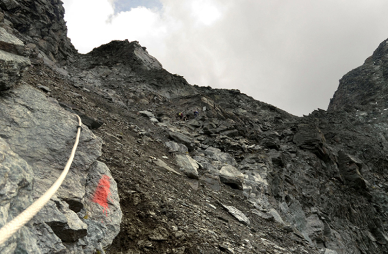
Thrutching up to the Wasulicke
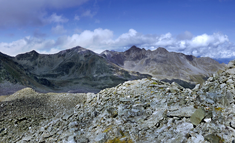
Views from the top

North East to the Oberland - Aletsch glacier centre R
2004 North - back the way we have come

Zoomed - Doldenhorn on the L - Bietschhorn on the R

A similar view in 2017

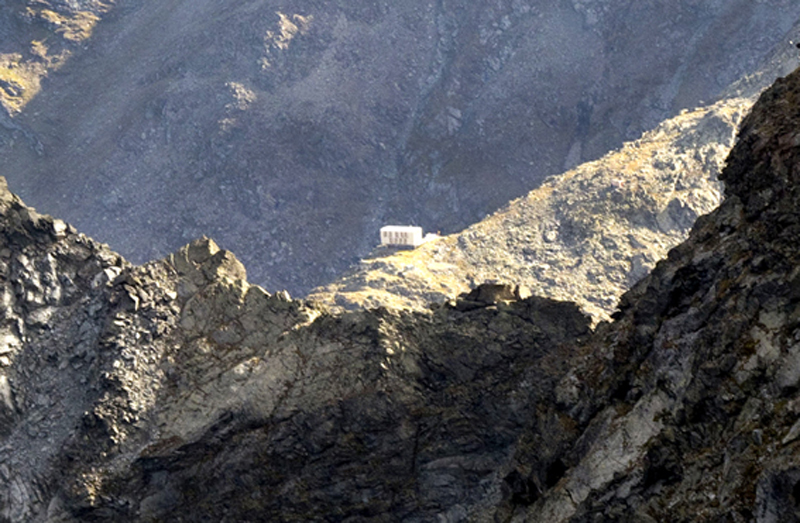
The Topali hut - but it's still over 2 hours away
Zoomed

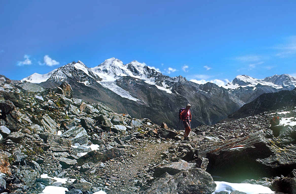
Up the Mattertal towards Monte Rosa and The Liskamm

a wider view across the Mattertal - the big peaks are all in cloud

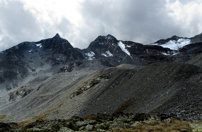
The Brunegghorn and the Weisshorn
The permanent snow on the South side of the pass disappeared decades ago and there remains a field of large boulders. An easy path threads its way through them, heading steeply down iat first, but soon contouring round to the North crossing a another col and then descending across several scree filled valleys.

Brunegghorn from the next col

Zoomed evening shot of the Brunegghorn Weisshorn and Bishorn

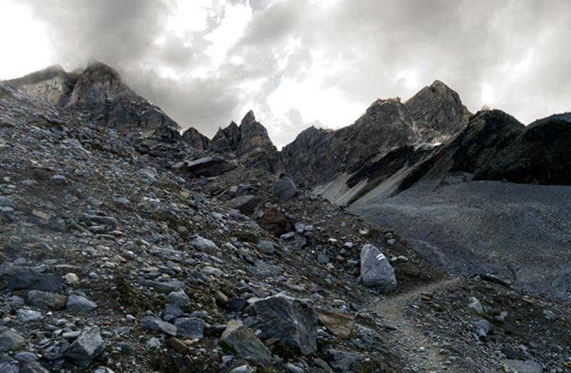
A broad scree-filled valley

The path traverses down and across the valley: above on the R are the Barrhorner - amongst the highest walking peaks in the Valais


A large goat blocked our path: this was the first time we had encountered one. How should we treat this shaggy denizen of the hills? Push on boldly towards it or make a slight detour. As we were pondering, it gave out such a plaintiff bleat that our mind was instantly made up and it trotted off
A flat section where the path crosses a moraine: Behind are the the peaks of the Mischabel

The hut stands on a ridge - well out of the way of avalanches
Looking back on the final slight ascent to the hut

Approaching the hut
The Topali hut dating from 1949 but rebuilt in 2003 was a gift from Dr. Topali of Geneva in memory of his son who died in the mountains, and belongs to the Geneva section of the SAC. It may not be pretty - I guess it was preconstructed in sections - but it is extremely practical - warm, friendly, comfortable with small bedrooms and with a view to die for - which can be seen through the huge communal room window. It is one of my favourites and because the only mountain it serves is the Brunegghorn it is seldom crowded. Without it however, the Höhenweg would not really be a practical propostion
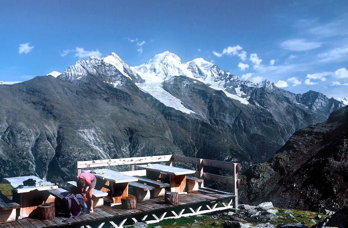
Outside on the terrace

A selfie in 2004

View from the window - Nadelhorn, Dom and Taschhorn - the Lenspitze is hidden behind the Nadelhorn

The evening sun lights up the mountains

and slowly fades
In 2004 a family emergency meant that we could not continue as planned to Randa and we descended directly to St. Niklaus

Looking back up the Stellital to the Barrhorner

Last view of the hut

A little shepherds hut: - beyond, the path entered the woods and descended precipitously to St. Niklaus
https://www.walkhighlands.co.uk/Forum/viewtopic.php?f=16&t=67414
This section leads one South to the remote Topali hut: Sections 3 and 4 continue the walk further South to Randa and to Täsch. Heading straight up out of Jungen It takes around 5-6 hours, but longer if you follow the Jungen Rundweg anticlockwise first - though I have done that
At the highest point in the Jungtal in part I, I reached this round-topped lateral moraine dating from an ancient ice-age:-
The route to Topali follows this moraine to the head of the Jungtal, turns sharp left across its head, and climbs to a 3114m pass - the Wasulicke from which the hut can be seen. This route was only made possible about 15 years ago by the melting of the steep Jung glacier on the north side of the pass
I have done this route many times: photographs are from different years and may not be in precise order
climbing the lateral moraine - photos taken looking up and down
At one point the moraine merges into the hillside - but reappears sometime later
Nearing the top - the grassy valley has given way to rocks and the way to the pass can be seen
The traverse
Views in 2004
In 2011
and In 2017 - the glacier below the pass has almost disappeared
Two views looking back among the boulders on the traverse: it is also possible to exit the far side of the Jungtal over the 2990m Jung pass, but it is not yet a waymarked route
At the end of the traverse the official ("red") route cuts up and back left
And then traverses these slopes between the remains of the glacier and the steep terrain above: there is danger of stonefall here in the early season when snow above is melting - and it is much safer and quicker to follow the Left hand edge of the ice and rejoin the route beyond
This photo shows where the two ways merge
Looking back along the official route in 2004
and a wider view from higher up. There was quite a substantial amount of ice at that time and a "blue" route went up the glacier and climbed a few ladders to join the "red" route near the top. As the remains of the glacier were completely crevasse-free it was probably easier
Similar views in later years
Climb to the pass
When a glacier melts it invariably leaves behind a horrendous mess of mud and shale and this one is no exception
Thrutching up to the Wasulicke
Views from the top
North East to the Oberland - Aletsch glacier centre R
2004 North - back the way we have come
Zoomed - Doldenhorn on the L - Bietschhorn on the R
A similar view in 2017
The Topali hut - but it's still over 2 hours away
Zoomed
Up the Mattertal towards Monte Rosa and The Liskamm
a wider view across the Mattertal - the big peaks are all in cloud
The Brunegghorn and the Weisshorn
The permanent snow on the South side of the pass disappeared decades ago and there remains a field of large boulders. An easy path threads its way through them, heading steeply down iat first, but soon contouring round to the North crossing a another col and then descending across several scree filled valleys.
Brunegghorn from the next col
Zoomed evening shot of the Brunegghorn Weisshorn and Bishorn
A broad scree-filled valley
The path traverses down and across the valley: above on the R are the Barrhorner - amongst the highest walking peaks in the Valais
A large goat blocked our path: this was the first time we had encountered one. How should we treat this shaggy denizen of the hills? Push on boldly towards it or make a slight detour. As we were pondering, it gave out such a plaintiff bleat that our mind was instantly made up
A flat section where the path crosses a moraine: Behind are the the peaks of the Mischabel
The hut stands on a ridge - well out of the way of avalanches
Looking back on the final slight ascent to the hut
Approaching the hut
The Topali hut dating from 1949 but rebuilt in 2003 was a gift from Dr. Topali of Geneva in memory of his son who died in the mountains, and belongs to the Geneva section of the SAC. It may not be pretty - I guess it was preconstructed in sections - but it is extremely practical - warm, friendly, comfortable with small bedrooms and with a view to die for - which can be seen through the huge communal room window. It is one of my favourites and because the only mountain it serves is the Brunegghorn it is seldom crowded. Without it however, the Höhenweg would not really be a practical propostion
Outside on the terrace
A selfie in 2004
View from the window - Nadelhorn, Dom and Taschhorn - the Lenspitze is hidden behind the Nadelhorn
The evening sun lights up the mountains
and slowly fades
In 2004 a family emergency meant that we could not continue as planned to Randa and we descended directly to St. Niklaus
Looking back up the Stellital to the Barrhorner
Last view of the hut
A little shepherds hut: - beyond, the path entered the woods and descended precipitously to St. Niklaus