
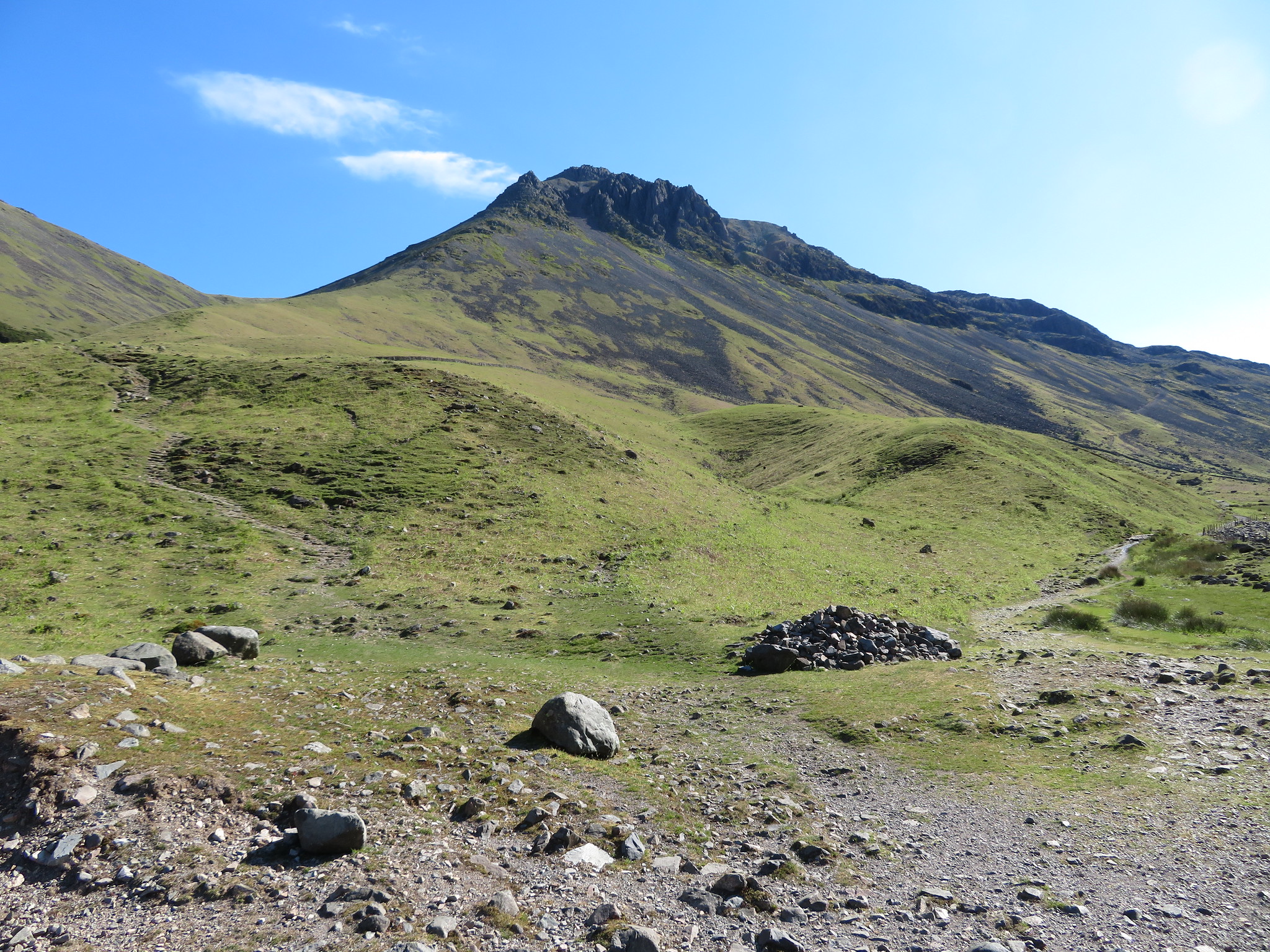
Great End via Piers Gill and Greta Gill gully.
It's Wasdale and day 2 of our 4 days away skiving around the high fells and after a meal and a couple of drinks at the Wasdale Head Inn last night before an early night in bed Chris is perky whilst I am okay and ready for a walk after a good breakfast that I didn't really enjoy. Nothing to do with the food as the breakfasts at the farm are absolutely fine or we wouldn't keep going back there, it's the fault of the tablets and what they are doing to my digestive system, any more than that you don't want to know.
Today's walk was to take on a climb alongside Piers Gill and then on to Great End by one of the two gully's that lie either side of Long Pike picking up a couple of Nuttall's along the way. We were meant to do this walk on last year's visit but the weather was really rough, wet and windy, so on the pretence of giving the start of the Piers Gill route a course of looking at I more or less dragged Chris kicking and screaming along the climb up the Moses Trod Path to the stretcher box at Sty Head so that the day wouldn't have been wasted, as we would have been if entering the WHI at 11am and doing a shift in there.
Our walk started in glorious sunshine at the farm from where we walked roughly east, first off through the fields following the course of Moses' Trod to soon leave those behind and get on to the rough side of things with a good view from the Gable Beck footbridge along the valley and Lingmell Beck towards Spout Head with its many feeder watercourse that make up Spouthead Gill and onwards to Lingmell Beck.
 Looking along Lingmell Beck towards Spout Head
 We're fortunate today that there is very little water in the becks as further along the valley we
would have to cross Lingmell Beck and it would have proved a tad difficult had it been in full flow. Some things never change and as ever we were overlooked by Great Gable and Kirk Fell on our left with the steep slopes of Lingmell rearing up to the right with GG's crags looking particularly handsome in today's sunshine and even though it's there, big as it is, Napes Needle is difficult to pick out from the others around it.
 White Napes - Great Napes - Napes Needle on Great Gable
 We walked on and I took a photo of Lingmell Beck which in reality looks much better in the flesh than the photo depicts.
 Lingmell Beck in Wasdale
 A few minutes later we were at the crossing point of Spouthead Gill that is marked by a big arrow chalked on a large flat rock and where the water was but a mere trickle. Just before we crossed a look back gave us a view of Yewbarrow and a hint of what is left of its screes showing as a pale streak below Stirrup Crag and the backdrop of Wasdale's Red Pike.
 Yewbarrow and Red Pike beyond the south ridge of Kirk Fell
 Once across Lingmell Beck we more or less followed the course of Piers Gill to the start of the lower slopes where the path was a bit difficult to define but as we ascended the steady slope it gradually became more apparent.
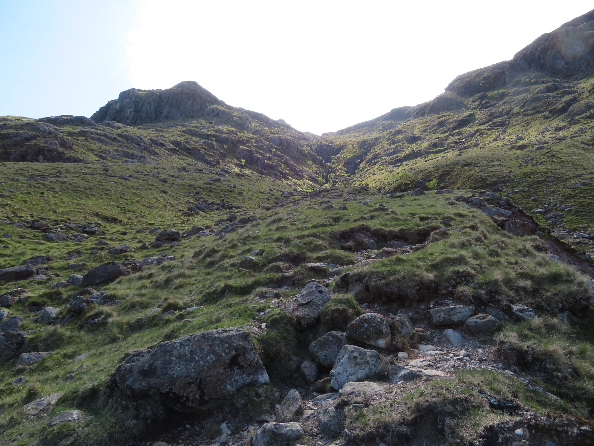
The bottom of Piers Gill spreads out in a wide swath of stones made rounded by the incessant pounding together as the water swirls them around but today there is no water to be seen.
 The path follows the course of Piers Gill
Climbing alongside the gill was easier than we thought it would be, not as steep as it appears when scanned from a distance. The lower slopes are easy over grass with the path turning a bit rougher and more prominent as height is gained.
I'm not going to relate the climb up chapter and verse as some photos will give an indication of conditions so an odd aside will be sufficient as required. This is at the 350 metre contour.
 A dry Piers Gill below Flass Knotts
 Looking upwards towards Criscliffe Knotts from the same contour.
 Criscliffe Knotts
 At around 400 metres we crossed Greta Gill where the path is a bit sketchy but soon becomes more obvious again.
 Continuing on along Piers Gill
 Just a little higher at 415 metres saw the start of the narrow confines of Piers Gill with a good view of Lingmell towering above us. Still no signs of water running in the gill.
 Lingmell Crag overlooks Piers Gill
 We were moving steadily upwards, breaking no records and stopping now and again to take photos and enjoy the superb views that kept unfolding as we climb ever higher. Someone who was moving rather quicker than us was the young runner who was legging it up the fell below us, stripped to the waste and brown as a berry this was one fit lad who disappeared from view as I took this shot of Great Gable and Kirk Fell.
 Great Gable and Kirk Fell
 Now we're at 480 metres and the path is clear to see as it wends its way around the humps and bumps of this rocky fell side.
 The path wriggles its way ever upwards
 The path so far has been very fair to us and presents no problems until we reached the lower crags of Middleboot Knotts at the 565 metre contour where there is a wall of rock to ascend. A rough rock and grass scattered face around 8 metres high - maybe a bit more, it was hard to gauge - an easy scramble for us but we had Sonny with us.
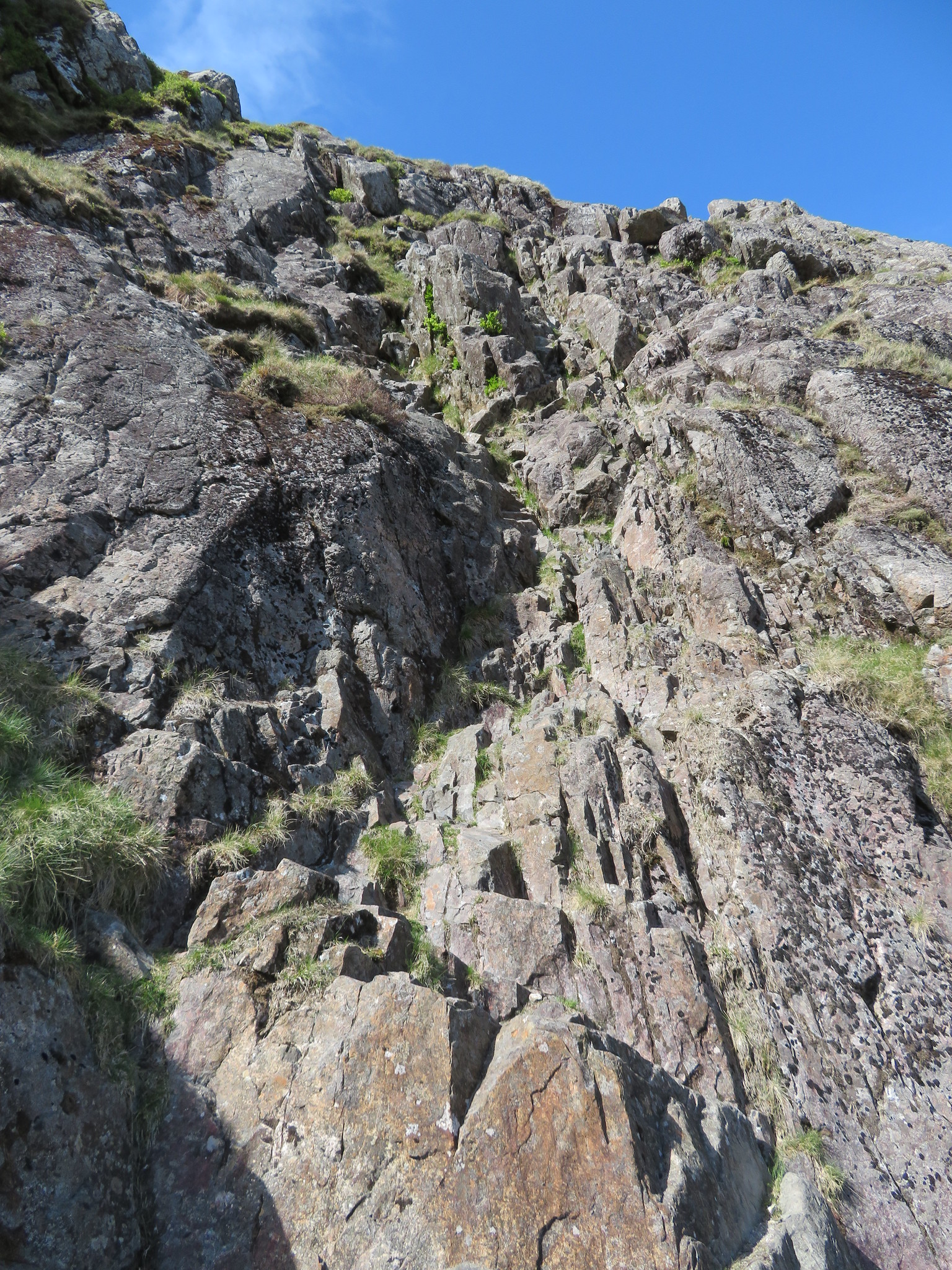 Get ready to scramble
 Chris set off first with Sonny in tow…
 Scramble below Middleboot Knotts
 both climbing well with the ever impatient Sonny passing Chris to reach the top and then turn around and come back down to escort me up the face. Then a calamity. Instead of Sonny re-tracing his paws back up he moved over to the left before starting to climb again and got himself crag fast. No amount of coaxing could entice him back to the proper line so I continued up whilst Chris dropped his bag and went back down for him from where he tried to get him off. The poor pup wasn't about to move from where he was so the only way was for me to drop my bag and descend to a spot above Sonny from where I could reach his collar as Chris, who was hanging on with one hand, managed to push him up far enough for me to grab his collar and between us gently ease him over the rim of the near vertical slab of rock. Once back on safe ground there was nary a thank you or kiss my elbow off him as he promptly proceeded to do what dogs do, wander off sniffing about at what knows what.
After this little bit of excitement we had a minute before continuing on with the ascent and a photo from above the step that shows the path below as well as the surrounding fells.
 Great Gable - Base Brown with Blencathra far distance centre
Taking photos of GG can't be avoided from around here as it's always there along with a few more but as we get higher there are more opportunities for a wider range of views.
Great End is getting larger.
 Great End peeping over the shoulder of Criscliffe Knotts
 At 600 metres this is what Lingmell looks like.
 Lingmell east face
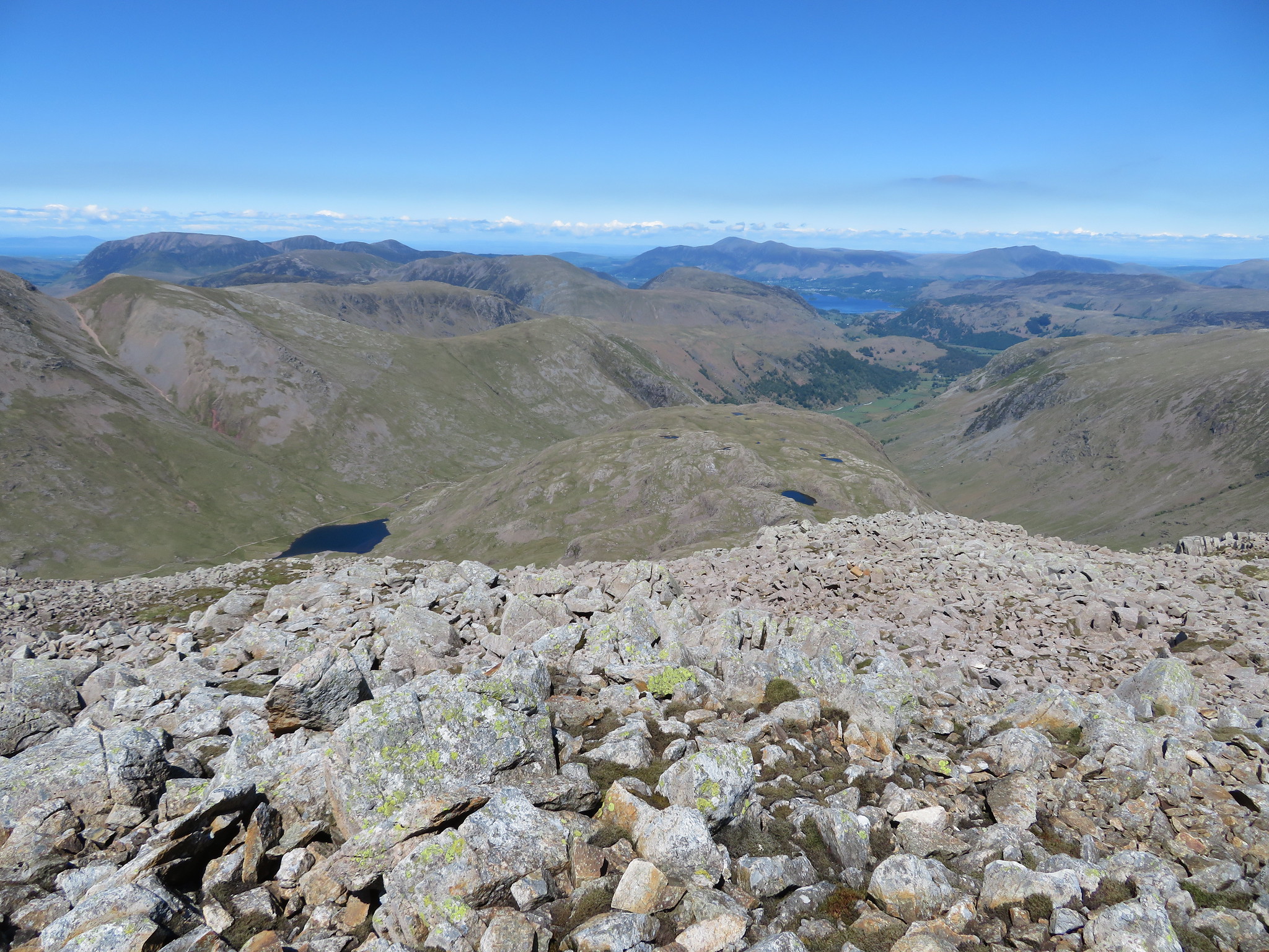
 Above the rock face the path eases off considerably and it's easy going as we reached the upper grassy slopes of Middleboot Knotts where we left the path and now had an easy stroll over grass to reach the summit of Middleboot Knotts, a Nuttall of some 703 metres in height where, from the unremarkable top of grass and grey rock we now had an exquisite and far reaching panorama of fells before us. We could see north as far as Skiddaw and Blencathra, the High Stile range, and behind Kirk Fell there was Pillar and its neighbours.
 The view north from Middleboot Knotts
 It may have been a sunny day but now out of the confines of the Piers Gill route we met up with the cold wind but decided to hunker down behind an up thrust of rock and take a break whilst taking in the views behind the Corridor Route…
 Round How and Great End from Middleboot Knotts
 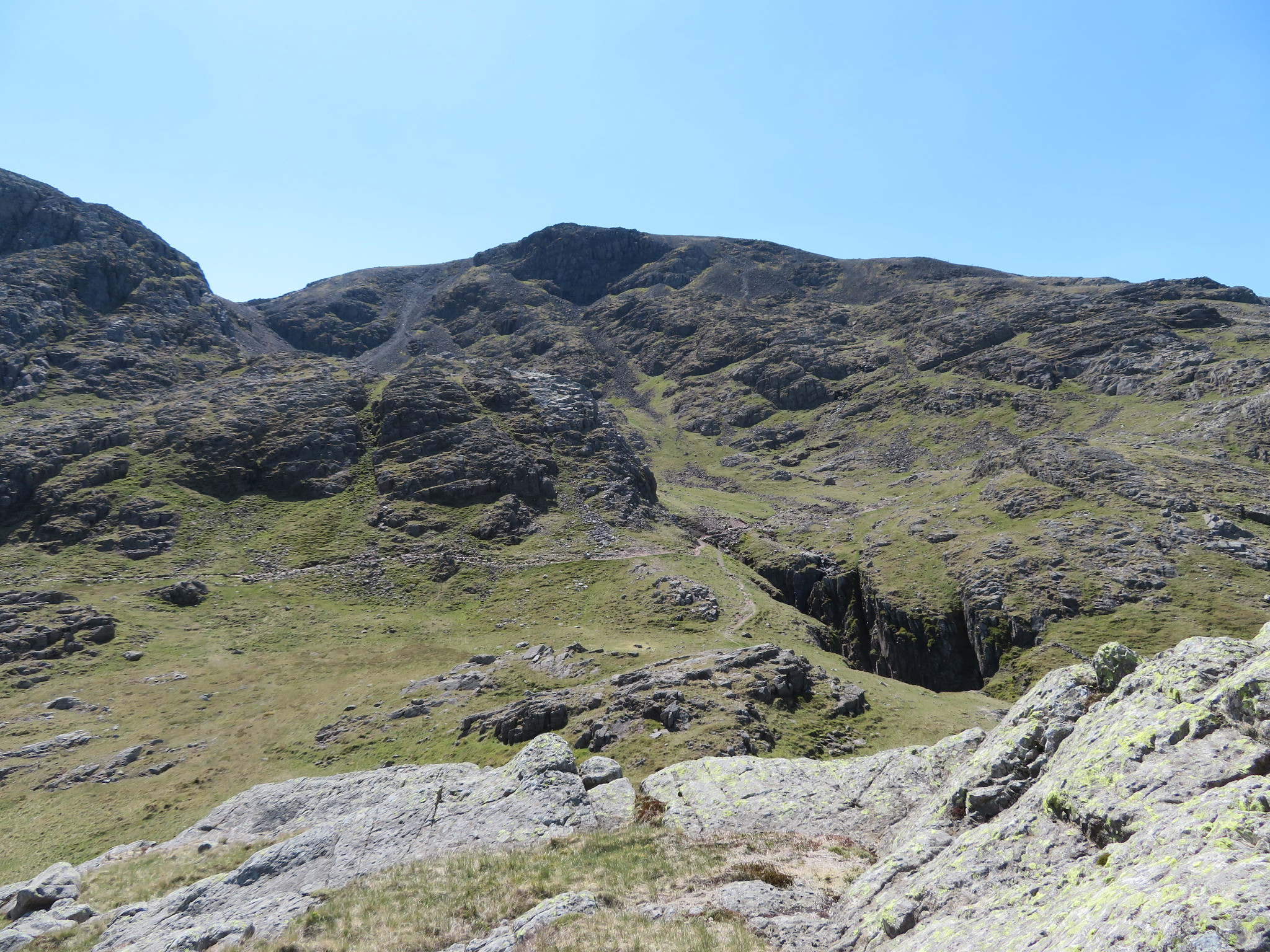 Scafell Pike from Middleboot Knotts
  Broad Crag from Middleboot Knotts
 and of course Lingmell is not to be missed as it was hanging right over us.
I'm not eating much, just a few nuts and an energy bar whilst Chris has one of his tins of steak with even Sonny eating better fare than I am just now.
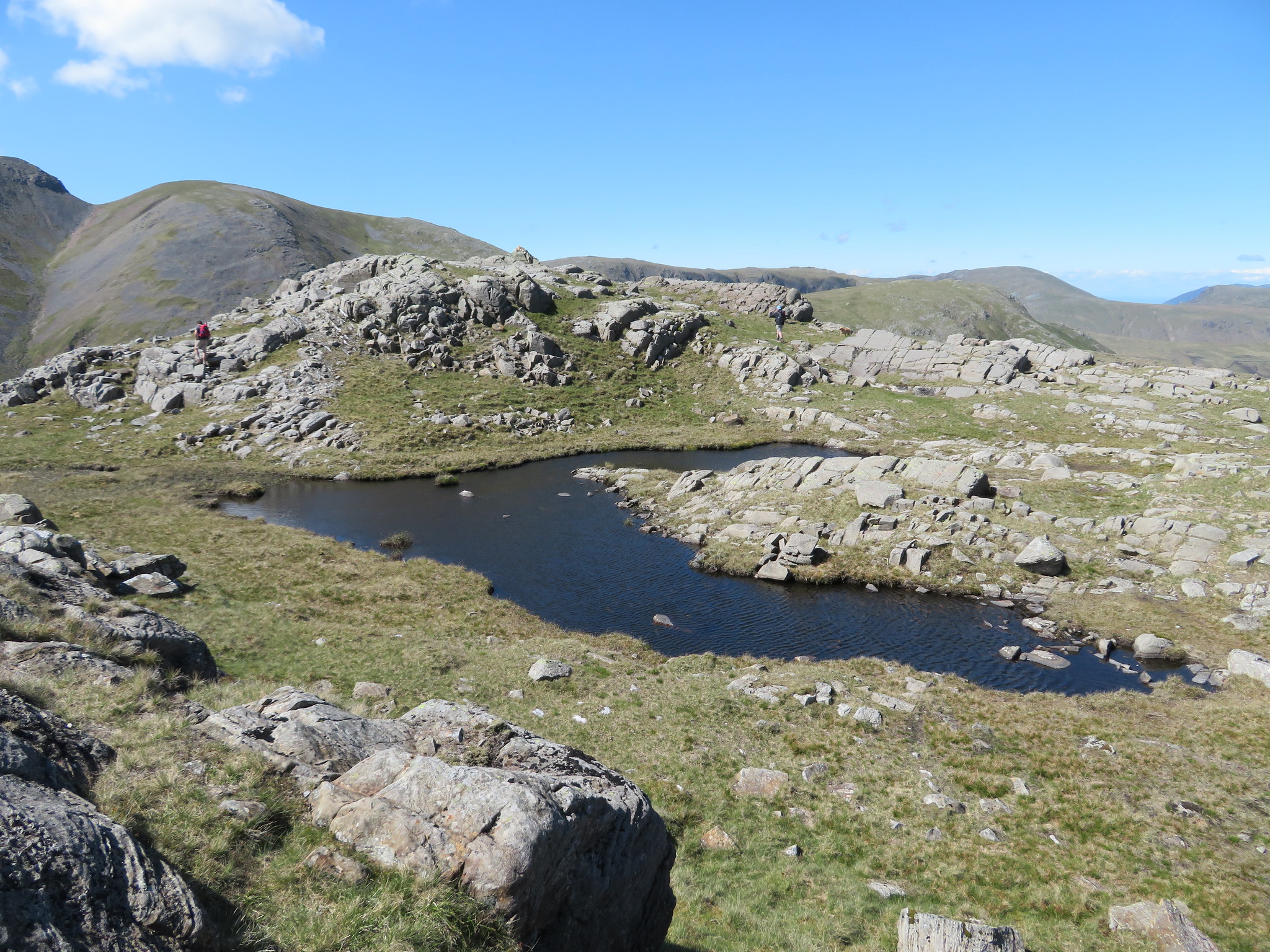
After the break and feeling colder for stopping we left this fell to make our way across the rough passing a couple of unnamed tarns as we made our way to the Corridor Route and our next hill that was Round How, another Nuttall, this being slightly higher than the last one at 741 metres. Reaching the Corridor Route we followed it for just a short distance before picking up a thin path that would lead us towards Greta Gill and then a pathless climb onto the summit that is of a similar nature to the one that we had just left behind.
An easy stride across the gill and a short sharp climb up the west side soon had us at the summit from where the familiar landscape was still in view.
 Lingmell
 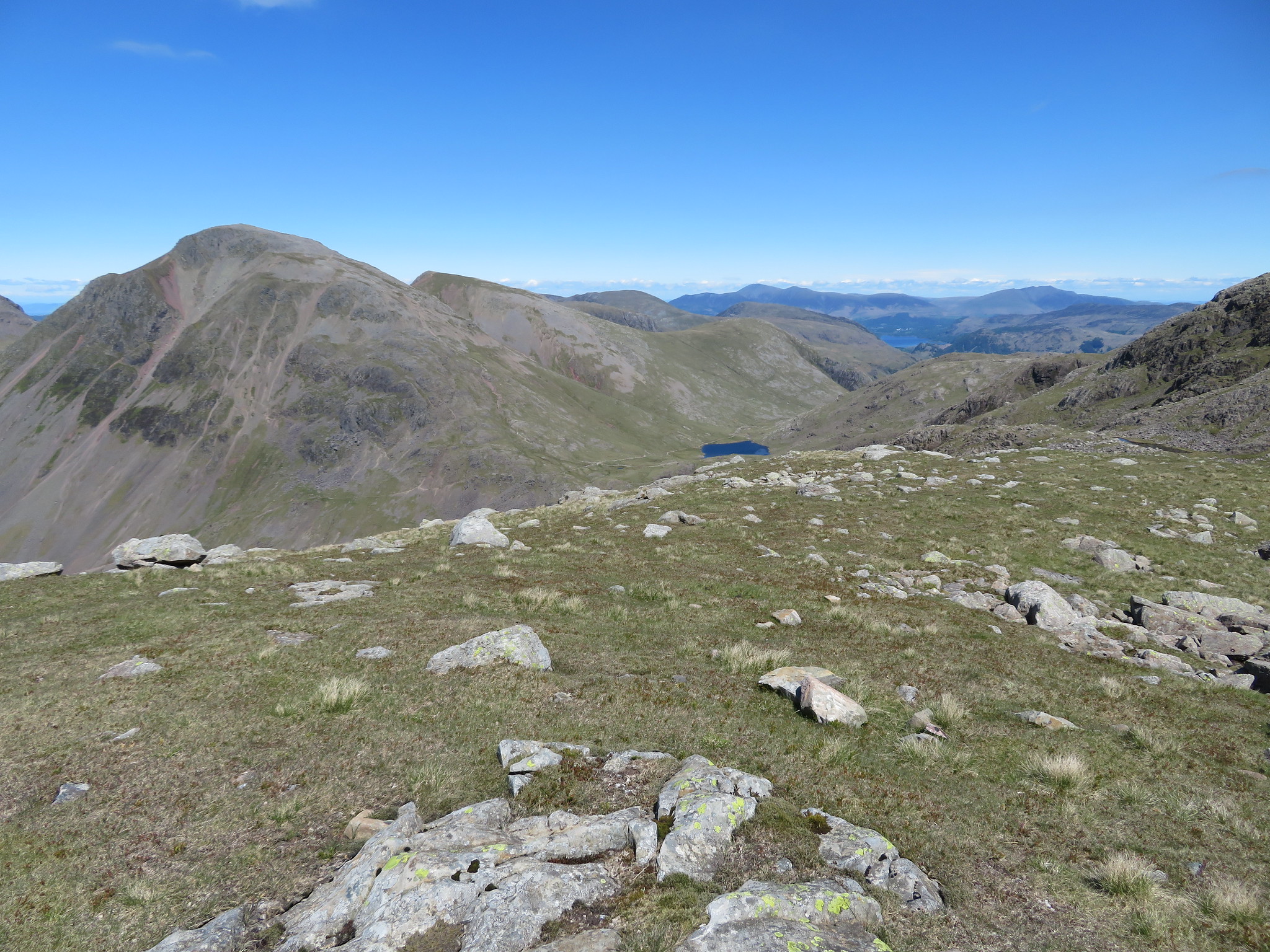 View towards the Northern Fells from Round How
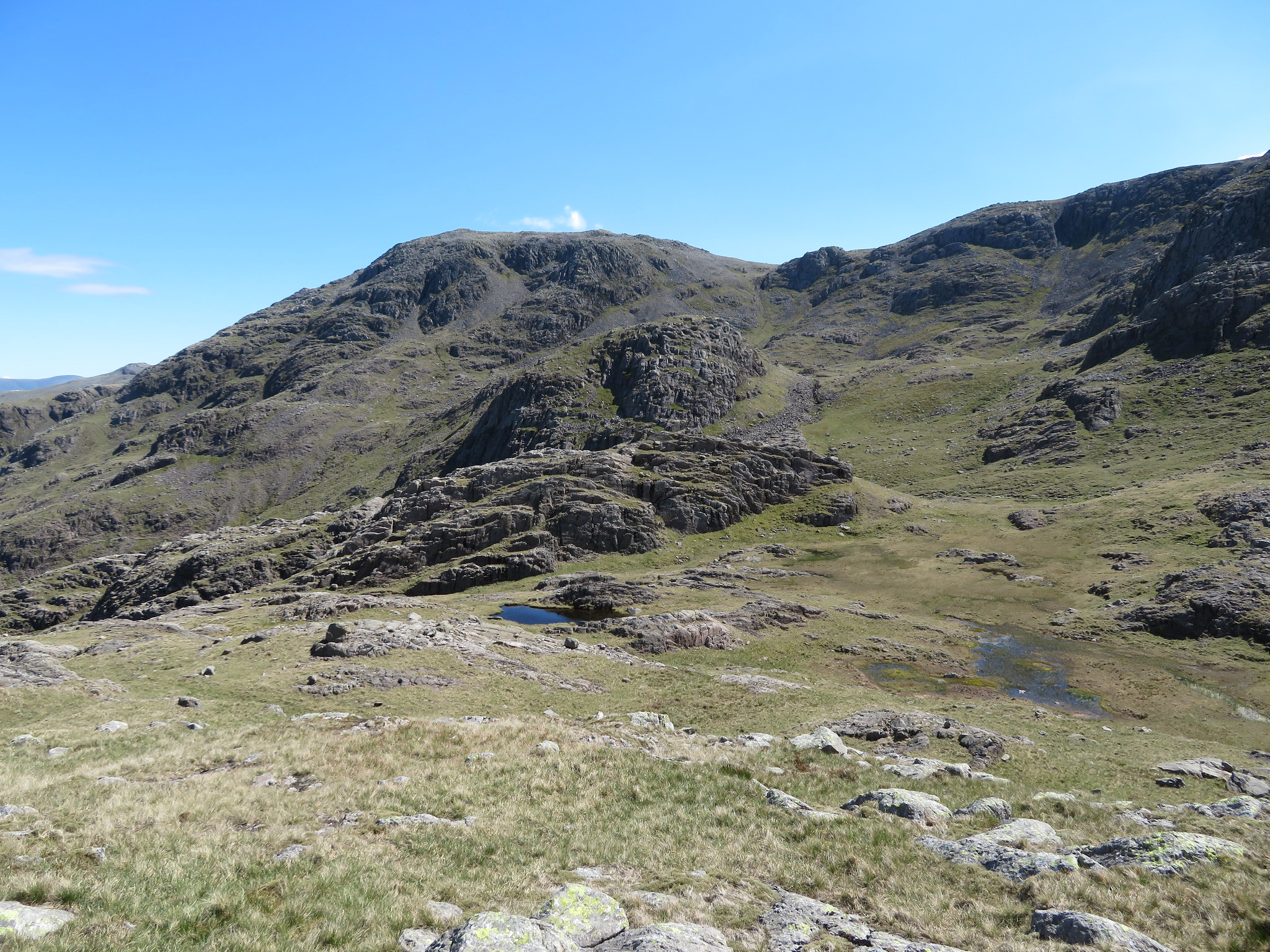
 From this top we could now see Great End and Long Pike that is separating the two access gully's, one of which we would take to the top of Great End and upon leaving this top in a north easterly direction towards the delightful tarn of Lambfoot Dub a couple or three factors came into the equation in deciding which route to take. First off I wasn't at my best with stomach problems and my right knee was acting up again despite the strapping, Chris not being 100% hill fit just yet had aching thighs and didn't fancy the drop off just to climb back up again from the tarn and an admittedly harder climb than Greta Gill, I've been there before and most importantly JKLL aka Anthony had done that route only a few weeks before so a replication of his way up the gully to the left of Long Pike seemed a pointless exercise this time around so, Greta Gill it was.
 Great End and our ascent route at the head of Greta Gill
 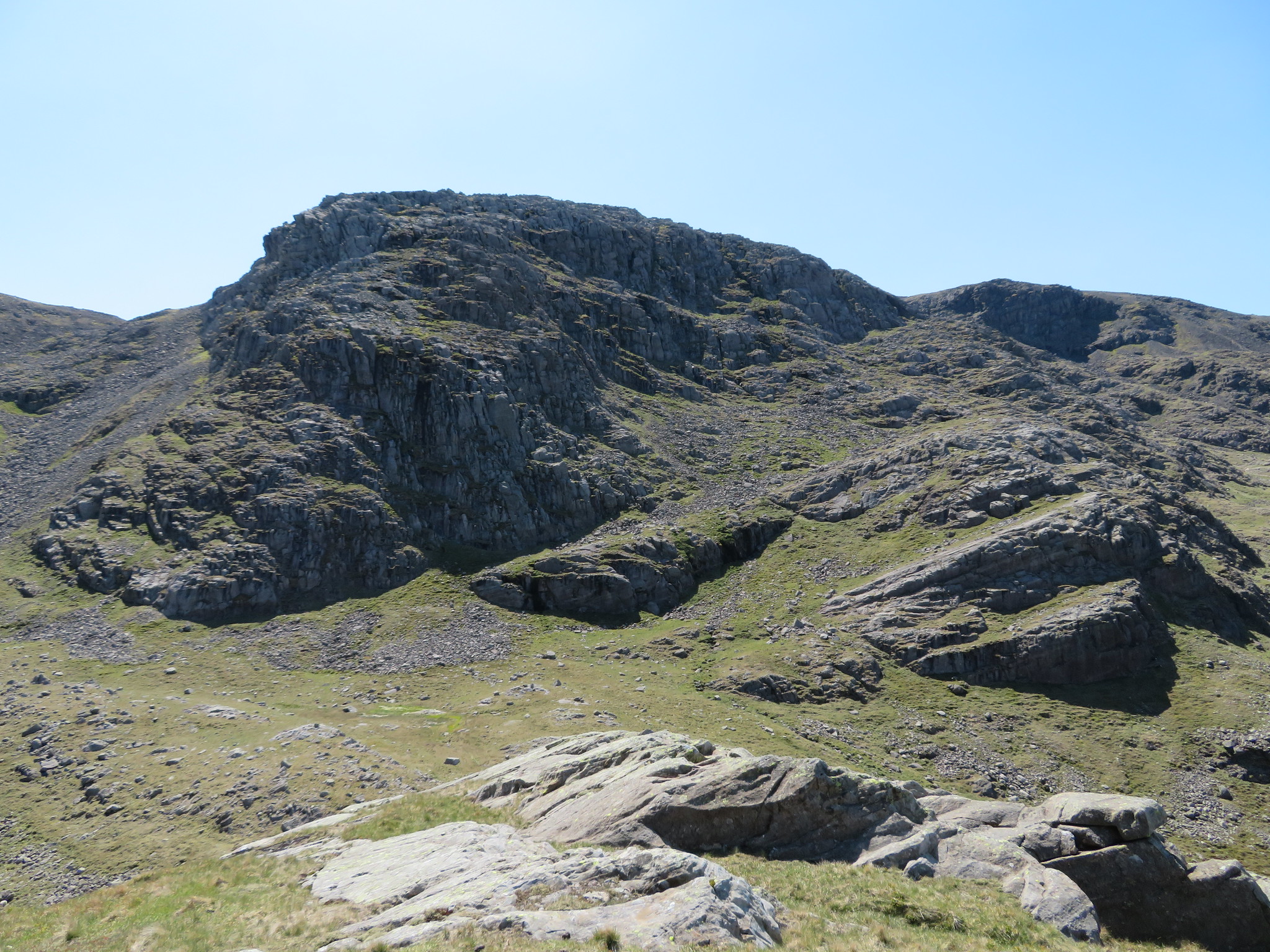 An alternative view of Broad Crag
On leaving Round How we got a glimpse of the tarn and a closer look at Long Pike.
 Great End with Long Pike
 We did a short loop as we left Round How first walking northeast and then southeast following the easiest ground before striking off and approaching the gully from the west.
 Today's route onto Great End from Round How
 The gully of Greta Gill is an easy way to gain the ridge of Great End being on grass for most of the way with just a short stretch of rough path towards the top of the gully. A couple of stops on the way up to take in the views and a picture or two didn't really delay our climb to the top and we were soon at the small stone built shelter where we stopped for a drink and a look around.
 Lingmell - Kirk Fell with Red Pike - Pillar and Scoat Fell behind
 Another short walk had us at the cairn atop Long Pike from where the Isle of Man was plain to see although it is a bit hazy on the photo…
 The Isle of Man on the horizon from the top of Long Pike
 and a less alluring look across the stony top of Great End.
 The stony top of Great End
 From the various tops of Great End there is an almost all round panorama with views over the fells around Langdale.
 An eastern view
  A Great End virgin
 From one top to another.
 Mind you don't trip over
 There are fantastic views to the north over Borrowdale and a hint of Derwent Water showing.
 North over Borrowdale
 And northeast.
 Glaramara
 It has been a well earned climb up to here with the prize being these stupendous views on a day that is clearer than any we've seen for quite some time. Although it is sunny and warm where it's sheltered the wind is fairly strong and cold and maybe that's what is making for long clear views today. Whatever the reason, we could do with a lot more of it. There are quite a few people about, more than we've seen on our way up to here, and quite a queue making their way to Scafell Pike and Broad Crag. We had a chat to a couple who was walking the Bob Graham Round over 6 days and was actually staying at the same place as us tonight.
We saw a lovely looking bird walking about the top of Great End, one with a light coloured ring above its orange breast. A bird that I had never seen before, it was walking quite quickly and keeping its eye on us but staying quite close. I didn't get a photo of it but on getting back home I identified it in my bird book as a Dotterel.
 Dotterel
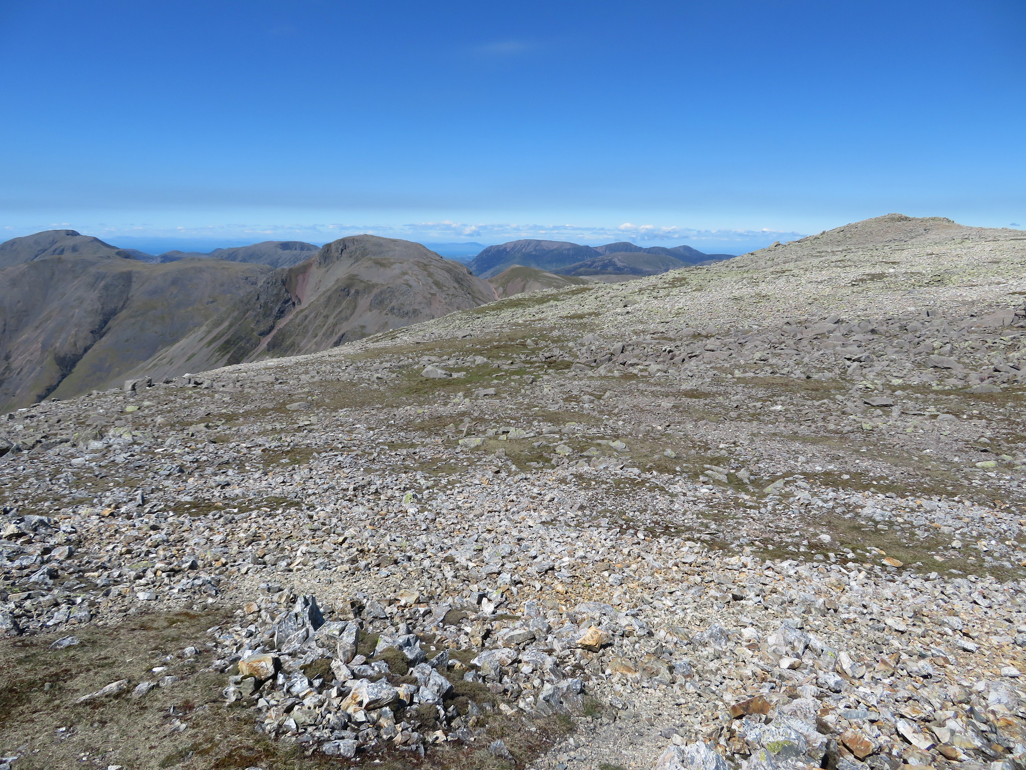
 Our original intention was to exit Great End by its north ridge before walking onto the last fell of the day, Seathwaite Fell, and although the souls were willing the bodies weren't, it's just one of those days. It's been a good walk so far in brilliant weather, a day when one would normally feel exhilarated, and we do, but when tired legs - Chris - and a knackered knee - me - start grumbling it's hard to whistle a happy tune sometimes. We looked over the edge from the cairn and then decided to take the easy option and follow the 'tourist route'…
 A view across Esk Hause to Esk Pike-Bow Fell and the Langdales
 down to Sprinkling Tarn and Seathwaite Fell.
 Northwest towards the Gables - Base Brown
 It's an easy stroll down the good path and we were soon at the tarn where we stopped for another refuel before taking the walk across to Seathwaite Fell summit. We turned off and walked along the northwest side of the tarn where we had that break and then continued north diverting off to take in the Birkett of Great Slack at 632 metres in height passing an unnamed tarn that made a view of Great Ends craggy face all the more picturesque.
 Great End and tarn
 Seathwaite Fell is full of humps and bumps of all shapes and sizes and Great Slack to my mind is one of the best. It sports a Y shaped tarn at its base and has nice looking shape to it, rocky and rounded with a decent cairn astride its top.
 Great Slack
 The views from this Birkett are very fair with a look into Wasdale now possible. On its western corner there is a great lump of rock inlaid with a large amount of white quartz - in fact very similar to the one that is to be seen at the south summit of Mellbreak - from where the view into Wasdale and Sty Head can be seen.
 Yewbarrow behind and quartz from Great Slack
  Great Slack summit
 Leaving this behind we set off across the top of the main fell that is littered with a variety of paths leading in a variety of directions to reach the official summit as designated by the man himself A. Wainwright. This summit is 31 metres - 101 feet - lower than Great Slack but admittedly has the better views, hence Wainwright's selection as to which should be the summit of this fell.
There are two unnamed tarns on the approach to this top…
 Seathwaite Fell
 and due to the surrounding wet nature of the ground a swerve to the left is made to keep boots on dry ground but after an easy walk and climb we were soon on the summit from where AW's choice was undeniably the right one.
 Borrowdale from Seathwaite Fell
 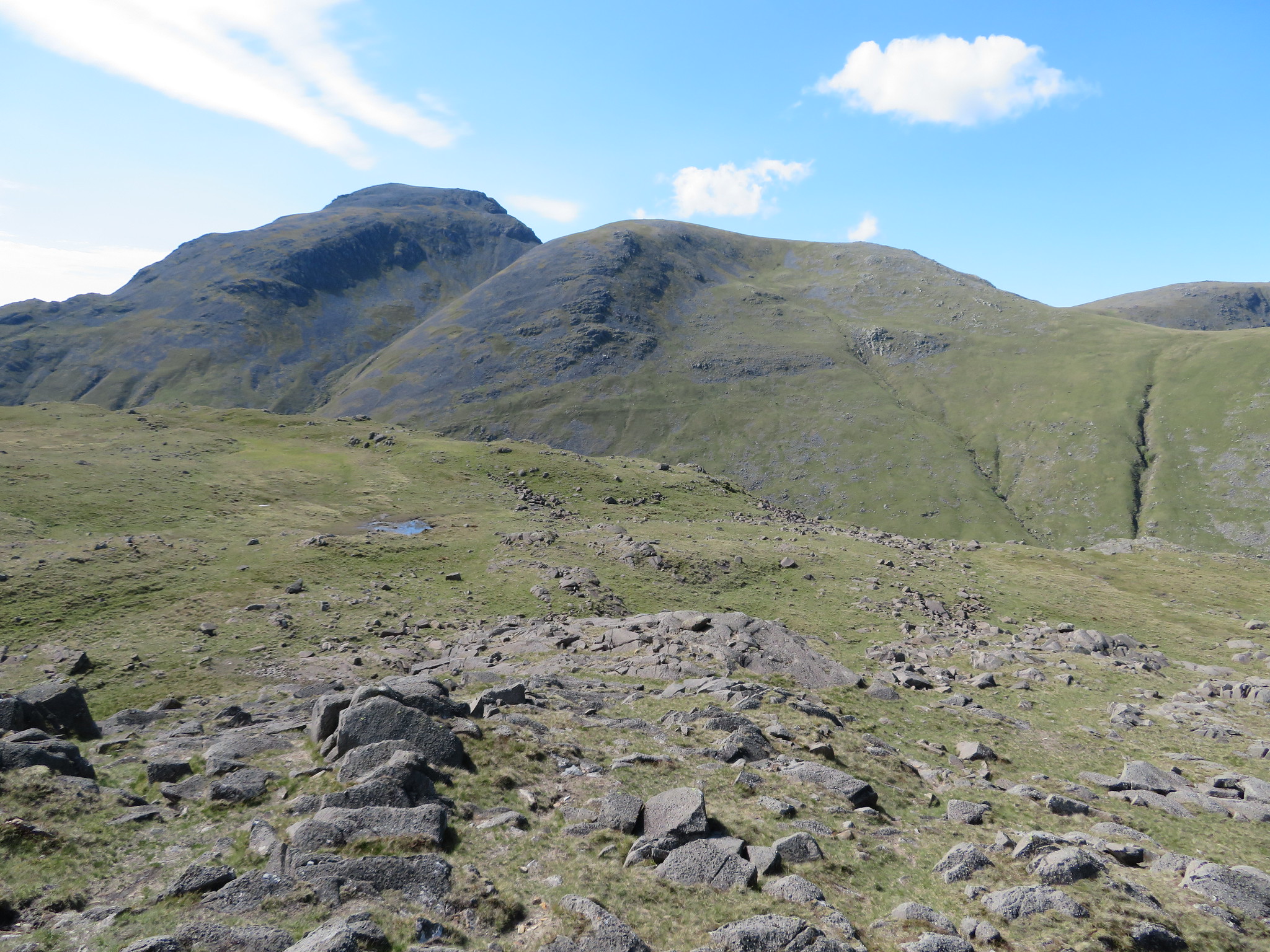 Great Gable and Green Gable from Seathwaite Fell
 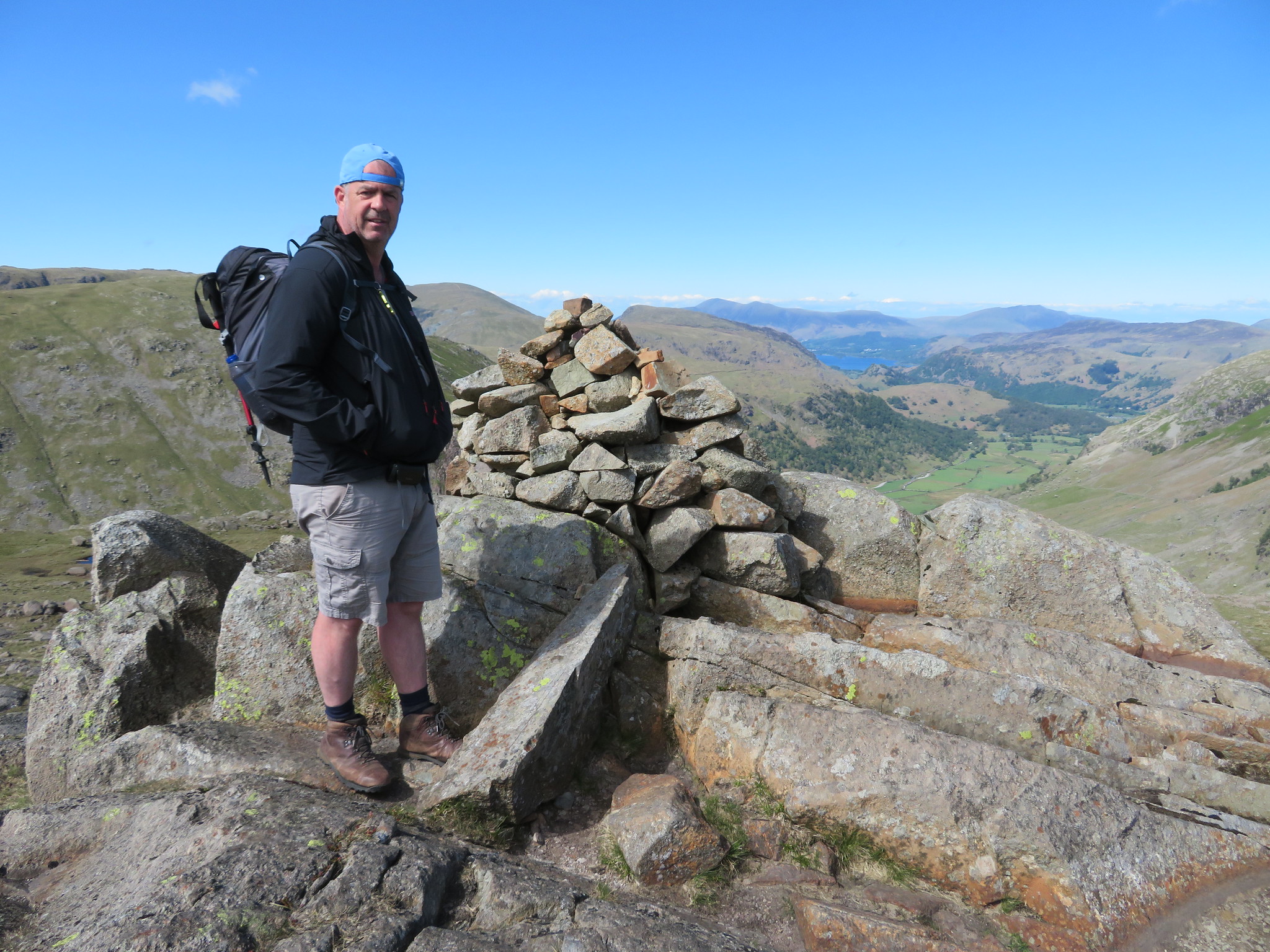 Chris on Seathwaite Fell
 I've looked down on this view on many occasions and never tire of it but it was time to turn around and retrace our way to here and it didn't take too long to arrive back at Sprinkling Tarn and the mass of Great End.
 Great End and Esk Pike behind Sprinkling Tarn
 We made our way to Sty Head from where we took the Moses' Trod Path back down into Wasdale and it was whilst walking down this rough old track that I slipped on a wet stone and aggravated my knee even more. As we made our way down into Wasdale there were quite a few walkers heading up into the hills some were obviously wild camping whilst the others…
On our way down we got a good view of the lower part of Piers Gill…
 Lingmell and Piers Gill
 and looking at it from afar it's hard to believe that there is a route up there as nothing could be seen on the ground from where we were. A few minutes later I took this photo of the upper reaches of Wasdale.
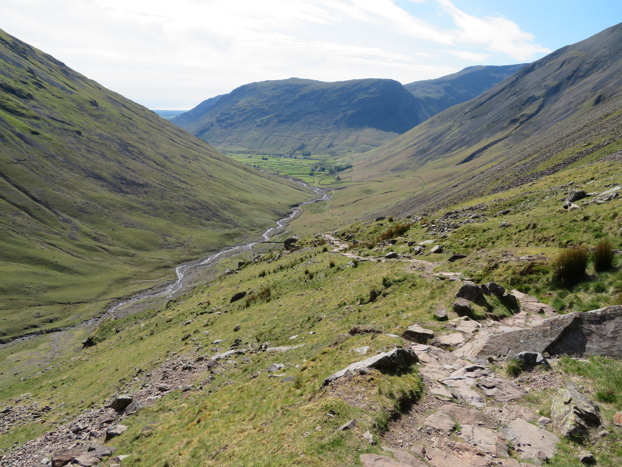 Wasdale view from Lower Kern Knotts
 The worst of this path was over so we made better time down to the farm where a welcome shower and a beckoning from the Wasdale Head Inn were awaiting us.
This has been a great walk despite the fact that it was curtailed somewhat by groaning body parts, and the little bit of excitement on the rocky wall below Middleboot Knotts added some flavour to the day. Five new hills for Chris and a Piers Gill first for both of us have made for a good day out in the Southern Fells.